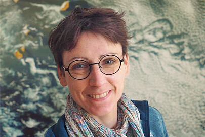
Prof. Dr. Thomas Brinkhoff is Chair of the Institute Board and Chair of Geoinformatics at Oldenburg University of Applied Sciences. He leads the Institute for Applied Photogrammetry and Geoinformatics (IAPG) and contributes to institutions like the Association for the Promotion of Geoinformatics in Northern Germany (GiN e.V.) and the Oldenburg Research and Development Institute for Computer Science (OFFIS e.V.). Education: Diploma in Computer Science (Informatik), Universität Bremen (1990) Doctorate in Computer Science (Dr. rer. nat.), Ludwig Maximilian University of Munich (1994) Brinkhoff's research spans geodatabase systems, spatiotemporal data processing, geosensor analytics, and location-based services. His work addresses Volunteered Geographic Information (VGI), web-based geospatial visualization, and mobile data integration, with applications in traffic management and forensic science. Recent projects include ProSaDi (Digital Provenance and Collection Research) and contributions to the Laboratory for optical 3D metrology . He has served on program committees for ACM SIGSPATIAL (2002-2019), AGILE conferences (2010-2025), and editorial boards of journals like GeoInformatica and TGIS. Notable Lectures: 2024: Forensic applications of tachograph data 2023: Geoinformatics in homicide investigations 2022: Spatiotemporal analysis for sustainability projects 2015: Open geodata standards at FOSSGIS 2014: Mobile sensor data processing
Dr Dominic McCafferty is a Senior Lecturer in Physiology, Ageing & Welfare at the University of Glasgow, based at the Scottish Centre for Ecology and the Natural Environment. He holds academic roles including Editor-in-Chief of the Journal of Thermal Biology and previously Ibis . His research focuses on thermal adaptation, behavioral thermoregulation, and urban wildlife ecology, particularly using thermal imaging techniques. He has a Ph.D. and BSc in Ecological Science from the University of Edinburgh (1989–1993 and 1985–1989). His work spans physiological studies in mammals, birds, and marine species, emphasizing conservation applications. Notable projects include habitat suitability modeling for urban water voles and thermal physiology studies in elephant seals. His educational background includes advanced studies in ecological science, complemented by post-doctoral research at institutions like the British Antarctic Survey (1993–1998). He has contributed to over 99 publications, advancing methodologies in non-invasive wildlife monitoring and ecological field studies. His editorial roles reflect expertise in thermal biology and avian science. McCafferty has led projects on carrion dynamics, stress physiology, and behavioral adaptations in diverse species, with a focus on applying findings to conservation challenges. Labs/Teams: Scottish Centre for Ecology and the Natural Environment (SCENE), part of the broader University of Glasgow's ecological research network. Collaborations include the Muséum National d’Histoire Naturelle in France and the National Trust for Scotland.
Fabio Miranda is an Assistant Professor at the Department of Computer Science, University of Illinois at Chicago (UIC) . His research bridges visualization , machine learning , data management , and computer graphics to enable interactive visual analysis of large-scale urban datasets . He has developed systems like UrbanRama (for VR navigation) and The Urban Toolkit (a grammar-based framework), which have been deployed in academia, industry, and government agencies. Education: Ph.D., Computer Science , New York University (2018) M.S., Computer Science , Pontifical Catholic University of Rio de Janeiro (2011) B.S., Computer Science , Federal University of Minas Gerais (2009) Research Interests center on urban visual analytics , 3D analytics , and machine learning for accessibility . His work addresses challenges like sunlight access , sidewalk quality assessment , and commuting flow modeling , often collaborating with urban planners, climate scientists, and occupational therapists. Scientific Recognition includes awards at IEEE VIS , SIBGRAPI , and SIGMOD . His research is funded by NSF , NIH , DOT , and DPI , with media coverage in The New York Times , The Economist , and Architectural Digest . Teaching includes courses like CS 524: Big Data Visualization and Analytics and CS 424: Visualization and Visual Analytics . He emphasizes web-based systems, dataflow frameworks, and interdisciplinary collaboration, with open positions for PhD , MSc , and undergraduate researchers .
Prof. Dr. Mona Hess is a Full Professor and Chairholder of the Chair of Digital Heritage Technologies at Otto-Friedrich-Universität Bamberg , Germany. She directs the M.Sc. Digital Technologies in Heritage Conservation program and serves as Vice-Speaker at the Centre for Heritage Conservation Studies and Technologies (KDWT) . Her work bridges digital documentation, 3D imaging, and heritage conservation, with a focus on cultural landscapes, historic timber, and artifact preservation. Education : Dipl.-Ing. in Architecture (TUM), M.A. in Heritage Conservation (University of Bamberg), Ph.D. in 3D Imaging Metrology for Cultural Heritage (University College London, 2015) Her research spans 3D laser scanning, photogrammetry, SLAM-based recording , and digital twin environments , particularly for structural monitoring, museum artifacts, and historic gardens. She leads projects like VirScan3D (virtual laser scanner simulator) and 3DPetrie (UCL Petrie Museum 3D models) and collaborates on international initiatives such as the British Museum War Canoe digital repatriation. Recent publications emphasize automated defect analysis in timber, multi-modal imaging for ceiling art, and linked open data in heritage. She has contributed to CIPA ICOMOS as an expert member and will chair their Education and Dissemination Commission (2024). Scientific Awards : Fellow of the UK Higher Education Academy (2016), Associate Fellow of the Higher Education Academy (2014) She teaches courses in Digital Object Recording , 3D Spatial Data Modeling , and Science Communication , and organizes international summer schools on heritage monitoring. Her lab, the Chair of Digital Heritage Technologies , collaborates with institutions in Italy, Spain, and the UK, focusing on interdisciplinary innovation in heritage conservation.
Michela Bertolotto is a Professor in the School of Computer Science at University College Dublin (UCD). Her research focuses on spatio-temporal data modeling, GIScience, and applications of geospatial technologies in fields like urban planning and health informatics. She leads a research group and has supervised 19 PhD and 8 MSc students. Her work includes innovations in LiDAR-based flood risk visualization, semantic web quality assurance, and open-source spatial data analysis. Bertolotto has held roles including College Lecturer at UCD (2000–2006) and postdoctoral research positions at the University of Maine and University of Genoa. Education: BSc and PhD in Computer Science from the University of Genoa (1993, 1998). Professional achievements include over 100 publications, 24 grants (e.g., Science Foundation Ireland-funded Urban ARK project), and editorial roles at journals like the International Journal of Geographical Information Science. Awards include the UCD President's Research Award (2001) and NATO Postdoc Fellowship (1998–1999). Research interests span map personalization, volunteered geographic information (VGI), and geospatial data quality. Her lab develops tools like the LAMSkyCam (low-cost sky imaging system) and dynamic flood risk viewers. She chairs international conferences and serves on program committees for GIScience events.
Jan Borchers is a full professor of computer science and head of the Media Computing Group, an endowed Chair in the Computer Science Department at RWTH Aachen University. He serves as deputy member of the Faculty Council for Mathematics, Computer Science and Natural Sciences (2024-2026) and previously headed the Computer Science Department's Examination Board from 2015 until February 2025. Borchers established his research group in 2003, pioneering modern HCI academic research and teaching in Germany, and opened Germany's first Fab Lab in 2009. Borchers received his PhD 'summa cum laude' in computer science from Darmstadt University of Technology in 2000. Before joining RWTH Aachen, he held faculty positions at Stanford University and ETH Zurich. His PhD thesis, 'A Pattern Approach to Interaction Design,' became the first book to bring design patterns to HCI. His research focuses on Human-Computer Interaction with particular interest in new user interfaces for soft robotics, textile user interfaces, 3D printing and personal fabrication, augmented reality, wearable and tangible computing, interfaces for software development, deceptive patterns, and interactive guides and exhibits. He is a member of ACM, SIGCHI, SIGCHI Germany, and GI, and introduced the Interactivity format to the CHI conference in 2005. Recent publications reveal a strong emphasis on deceptive patterns/dark patterns in UI design, textile interfaces, and the impact of generative AI on creative teamwork. His work spans from fundamental research in interaction techniques to practical applications in smart homes, accessibility, and children's interfaces, with a consistent focus on usability and user-centered design. IDC 2025 Best Work in Progress: 'If They Have No Choice, They'll Accept!' CHI'25 Student Games Competition Winner: 'The Deceptive Dungeon' RWTH-Wissenschaftsnacht 2024 Best Science Slam: 'Usability: 4 Prinzipien guter User Interfaces' Multiple CHI/UIST Honorable Mentions and Best Paper awards spanning two decades Author of influential books including 'A Pattern Approach to Interaction Design' and 'Arduino In A Nutshell' Borchers has provided extensive consulting, training, and user interface design services to major clients including AirBus, Apple, ARD, Bayer, Children's Museum Boston, Daimler, Handelsblatt, OTIS, Scout24, TEDx, and Deutsche Telekom. He actively organizes the Computer Science Department's weekly Faculty Lunch since 2003 and coordinates the department's public relations and web presence since 2010. He leads the Media Computing Group, which has become a leading German lab in terms of archival publications at CHI, the top international conference in HCI. Since March 2025, he serves as faculty patron for TechLabs Aachen, a student initiative providing practical digital skills training.
Walid G. Aref is a Professor of Computer Science at Purdue University since Fall 1999. His research focuses on database systems, spatial and spatio-temporal data management, query processing, and indexing. He has led projects funded by NSF, NIH, and industry partners. Aref is a Fellow of the IEEE and has received awards including the NSF CAREER Award (2001) and VLDB’s Ten-Year Best Paper Award (2016). He serves as Editor-in-Chief of ACM Transactions on Spatial Algorithms and Systems and has authored numerous influential papers. Education: BSc/MSc from Alexandria University (Egypt), PhD from University of Maryland (1993). Research Interests: Extending database functionality for emerging applications like spatial, graph, and sensor databases. Notable contributions include the Chameleon project, AQWA system for big spatial data, and privacy-preserving Casper framework. Selected Projects: NSF-funded work on multi-predicate spatial queries, in-memory graph relational systems, and adaptive spatio-textual processing. Systems like Tornado (spatio-textual streams) and LocationSpark (distributed spatial data) exemplify his contributions. Awards: Multiple best paper awards, IEEE Fellow, and leadership roles in ACM SIGSPATIAL.
Yu Lan is a Research Fellow at the Yale School of Public Health , specializing in spatial epidemiology and health geography . Her work integrates genomic data (e.g., WGS) with geographic information systems (GIS) to analyze transmission patterns of infectious diseases like COVID-19 and tuberculosis . Education: PhD in Geography, University of North Carolina at Charlotte MA in Geography, University of North Carolina at Charlotte Research Interests focus on space-time disease modeling , infectious disease transmission , and data-driven public health tools . She develops web-based systems for real-time disease surveillance and environmental risk assessment, including tools for private well contamination and urban neighborhood dynamics . Scientific Awards include the SISMID Scholarship (2024) , Student Honors Paper Competition Finalist (2023) , and David Woodward Digital Map Award (2021) . Collaborations include work with the Ted Cohen Lab and researchers like Joshua Warren and Eric Delmelle . Her publications emphasize genomic-spatial integration and cluster detection algorithms for diseases such as tuberculosis and SARS-CoV-2.
Professor Jason Dykes is a leading figure in the field of information and geovisualization at City, University of London, where he holds the position of Professor in the Department of Computer Science and co-directs the giCentre , a renowned research centre in visualization. He is affiliated with the School of Mathematics, Computer Science and Engineering and maintains an active research and teaching profile. His academic journey includes a PhD in Geography from the University of Leicester and extensive leadership in both research and education. Education: PhD in Geography, University of Leicester, 2000 MSc in Geographic Information Systems, University of Leicester, 1991 BA/MA in Geography, University of Oxford, 1989 Jason Dykes' research is centered on designing visual methods and tools for exploring, analyzing, and presenting information, with a strong emphasis on geographic data. His work integrates cartography, information visualization, GIScience, and human-computer interaction , leading to the development of innovative techniques such as geowigs, ODmaps, BallotMaps, and AttributeSignatures. He has published extensively in top-tier journals like IEEE Transactions on Visualization & Computer Graphics, with over 20 papers in the last decade, and co-authored the seminal book Exploring Geovisualization (2005). His research is supported by major funders including EPSRC and the EU, with projects like RAMP VIS (Covid-19 response) and VALCRI (criminal intelligence). The most recent articles highlight a consistent trend in applied and human-centered visualization , focusing on responsive design, education, pandemic modeling, and novel visual metaphors for complex data. His work increasingly emphasizes methodological rigor, design exposition, and the role of visualization in interdisciplinary and emergency contexts. Scientific Awards and Recognition: National Teaching Fellow, Higher Education Academy (2005) Best Paper Awards at GIS Research UK (consecutive years) Honorable Mentions, IEEE InfoVis (2009, 2010, 2016, 2018) Security Innovation Commercialisation Award (EU, 2022) Research Supervisor of the Year, City Student Union (2020) Innovations in Teaching Award and multiple teaching grants at City Jason Dykes has supervised eight PhD students to completion and advised many others, including notable researchers like Roger Beecham, Sarah Goodwin, and Susanne Bleisch. His teaching includes modules such as Visualizing Society and Data Presentation. He has received significant grant funding from UK research councils and the EU for projects like DIVA, VALCRI, and RAMP VIS. His service to the community includes leadership roles in IEEE VIS, ICA Commission on GeoVisualization, and editorial positions at IEEE TVCG and the Journal of Visualization and Interaction. He leads the giCentre , a dynamic research group that fosters innovation in visualization, and has been instrumental in establishing the field’s educational and methodological foundations through participation in Dagstuhl seminars and publications on visualization pedagogy.
Jennifer Mason is an Associate Professor of Practice and Associate Director of the Geographic Information Science & Technology (GIST) Program at the University of Arizona. She holds a Ph.D. in Geography (GIScience) from Penn State University, an M.S. in GIScience from San Diego State University, and a B.A. in Geography from UCLA with a GIS&T minor. Her research focuses on GIScience, cartography, and geovisual analytics, particularly exploring uncertainty visualization in maps and spatial decision-making. She teaches courses such as Web GIS, Geovisualization, and Raster/Vector Spatial Analysis, emphasizing practical applications of geographic information systems. Jennifer's work bridges theoretical research and pedagogy, with a strong emphasis on improving cartographic design and usability for diverse audiences. Her publications consistently address spatial uncertainty representation, cognitive aspects of geographic visualization, and open-source tools for education. She has contributed to advancing methodologies for visualizing spatial data uncertainty through noise annotation lines and thematic mapping techniques.
Thierry Badard is an Associate Professor at the Department of Geomatics Sciences , Université Laval, where he also serves as Director of the Center for Research in Geospatial Data and Intelligence (CRDIG) . With over 28 years of experience in geospatial science, he leads research initiatives at the intersection of GeoAI , LiDAR processing , and smart city technologies . Director, CRDIG (2016-2022) Steering Committee Member, Big Data Research Centre (CRDM) Researcher, Institute for Intelligence and Data (IID) Research Expertise spans geospatial big data, GeoNLP, and IoT applications for digital twins. His work addresses flood risk modeling , 3D urban analytics , and environmental monitoring through AI-driven solutions. Recent publications focus on contrastive learning for LiDAR segmentation and geospatial ontologies for early warning systems. Grant Leadership includes collaborative projects on smart insurance analytics (2018-2025), Arctic bioaerosol research (2019-2025), and Quebec-Morocco digital twin partnerships (2022-2023). He has advised 15+ graduate students in geomatics and related fields.
Rainer Gemulla is a Professor of Practical Computer Science I: Data Analytics at the University of Mannheim, heading the Data and Web Science Group within the School of Business Informatics and Mathematics. He has been a W3-Professor at the University since 2014, following positions as a senior researcher at Max-Planck-Institut für Informatik (2010-2014) and postdoctoral researcher at IBM Almaden Research Center (2008-2010). His research focuses on machine learning with structured and semi-structured data, particularly knowledge graphs, and developing efficient systems for data-intensive processing. Professor Gemulla's research spans multiple areas including machine learning with structured data (relational data), machine learning with semi-structured data (multi-relational graphs), combining these approaches with unstructured knowledge (text), and developing efficient, scalable methods for data-intensive processing. His work bridges theoretical foundations with practical implementations, as evidenced by numerous open-source software projects including LibKGE, DistKGE, and AdaPM. His recent publications show a strong trend toward knowledge graph embeddings, parameter server architectures, and efficient training methods. The research demonstrates increasing focus on scalability challenges in graph learning, with particular attention to hyperparameter optimization, dynamic resource allocation, and benchmarking methodologies. His work consistently addresses the practical challenges of implementing machine learning systems at scale. Distinguished Reviewer Award at SIGMOD, 2025 Distinguished PC Member Award at EDBT, 2023 Outstanding Reviewer Award at NeurIPS, 2021 Junior-Fellow of the Gesellschaft für Informatik (GI), 2013 IBM's 2011 Pat Goldberg Memorial best paper award Best paper of NIPS 2011 Biglearn workshop Professor Gemulla actively mentors PhD students and has supervised numerous successful doctoral candidates. His leadership extends to administrative roles including Head of examination board for MSc Business Informatics since 2017, and previously serving as Study dean of the WIM faculty (2016-2019) and CIO of University of Mannheim (2022-2024). His research is supported by grants including AWS in Education Research Grant Award (2013) and Google Focused Research Award (2011). The Data and Web Science Group develops multiple open-source software projects including LibKGE (knowledge graph embedding library), DistKGE (multi-GPU training), AdaPM (adaptive parameter manager), Lapse (parameter server), and various tools for information extraction and sequence mining. The group maintains active collaborations with industry partners and academic institutions worldwide, particularly in the areas of knowledge graph research and scalable machine learning systems.
Dr. Gaël Kermarrec is a researcher at the Boundary Layer Meteorology Group , part of the Institute of Meteorology and Climatology within the Faculty of Mathematics and Physics at Leibniz University Hannover . His work focuses on atmospheric turbulence, GNSS applications, and remote sensing for environmental monitoring. Boundary layer meteorology Turbulence theory GNSS signal processing Terrestrial laser scanning Climate change impacts Geodetic time series analysis His research integrates advanced mathematical models like LR B-splines and Matérn covariance with large eddy simulations to study: Atmospheric turbulence effects on optical/GNSS signals Hydrospheric mass loading Deformation analysis of terrain/port infrastructure Climatic sea-level changes Machine learning for remote sensing The 15 most recent articles (2025-2023) demonstrate his focus on: GNSS-based turbulence detection AI-enhanced climate mapping Advanced surface approximation techniques Multi-sensor data fusion Stochastic modeling of geodetic observations Environmental impacts on optical measurements He has developed tools like the Klimascanner QGIS plugin for urban climate resilience and contributes to: Understanding atmospheric scale lengths Improving TLS/GNSS deformation monitoring Analyzing hydrospheric changes Wavefront modeling Ionospheric corrections
Ngoc Thanh Nguyen is a Full Professor at Wroclaw University of Science and Technology where he serves as Head of the Department of Applied Informatics. He holds the prestigious title of Professor granted by the President of Poland and has been recognized as a Distinguished Scientist of ACM since 2009. He serves as Editor-in-Chief of both the Journal of Information and Telecommunication (JIT) and the Vietnam Journal of Computer Science (VJCS), and chairs the IEEE SMC Technical Committee on Computational Collective Intelligence. His research spans computational collective intelligence, knowledge integration, data mining, social media analysis, and sentiment analysis. Professor Nguyen has pioneered significant methodologies in spatial data clustering within network space, inter-sequence pattern mining, and graph neural network applications. His work bridges theoretical computer science with practical applications in intelligent information systems, demonstrating particular expertise in handling complex spatial and sequential data structures. His research has evolved from foundational pattern mining techniques to sophisticated neural network approaches for geospatial and social data analysis. The analysis of his recent publications reveals a strong focus on spatial data analysis in network environments, with significant contributions to clustering algorithms, graph neural networks, and pattern mining. His work consistently addresses efficiency challenges in data processing while expanding into emerging areas like Vietnamese language processing and topological data analysis. The research demonstrates a clear trajectory from traditional data mining techniques toward more sophisticated AI-driven approaches that incorporate spatial relationships and network topologies. Distinguished Scientist of ACM (2009) ACM Distinguished Speaker (2009-2013) IEEE Distinguished Visitor (2009-2013) Title of Professor granted by the President of Poland Professor Nguyen has supervised over 20 PhD students to completion and currently mentors several ongoing doctoral candidates. His academic leadership extends to founding two major conference series: the Asian Conference on Intelligent Information and Database Systems (ACIIDS) and the International Conference on Computational Collective Intelligence (ICCCI), which have become significant venues in their respective fields. His collaborative network spans multiple institutions, particularly with Yeungnam University as evidenced by several co-supervised PhD projects. As founder and chair of the IEEE SMC Technical Committee on Computational Collective Intelligence, he leads an international community of researchers advancing this specialized field. His departmental leadership at Wroclaw University of Science and Technology positions him at the center of applied informatics research and education in Poland, with particular emphasis on computational intelligence applications.
Mila N. Koeva is a Vice Dean Research and senior Associate Professor at the University of Twente's Faculty of Geo-Information Science and Earth Observation (ITC), Department of Urban and Regional Planning and Geo-Information Management. Her research focuses on 3D modeling and Digital Twins for land management and urban planning, integrating geospatial technologies, UAV data, and AI/ML methods. PhD in architectural photogrammetry MSc in Engineering (Geodesy) Research Themes: Digital Twinning for urban ecosystems AI-driven cadastral boundary extraction 3D modeling with LiDAR and satellite data Global partnerships in Rwanda, Kenya, and Ethiopia Interoperability standards for local digital twins Scientific Contributions: Geospatial World Innovation Award 2021 Copernicus Masters Competition (3rd place 2016) Editorial roles in Photogrammetric Records and MDPI journals Keynote speaker at 3D GeoInfo, GI Forum, and FIG events Her educational impact includes developing courses, lecturing, and supervising students whose work has received top awards in The Netherlands and international competitions.