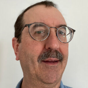
Peter Shearer is a Professor of Geophysics at the Institute of Geophysics and Planetary Physics , affiliated with the Scripps Institution of Oceanography at the University of California, San Diego. His research focuses on observational seismology, mantle discontinuities, earthquake location methods, source properties, and seismicity patterns. Education: B.S. in Geology and Geophysics, Yale University (1978) Ph.D. in Geophysics, UCSD Scripps Institution (1986) Research Interests Shearer's work uses large seismic datasets to study Earth's interior structure, particularly mantle transition zones, lithospheric discontinuities, and earthquake triggering mechanisms. His methods include waveform cross-correlation relocation, SS precursor analysis, and seismic wave scattering studies. Scientific Contributions His publications span 40+ years, with recent works analyzing aftershock migration, mantle discontinuities, and fault weakening. Key themes include Global mantle imaging using teleseismic data High-resolution fault zone seismicity Deep Earth structure from scattered waves Scientific Awards AGU Fellow (1999) SIO Outstanding Teaching Award (2003) Lehmann Medal (AGU, 2020) National Academy of Sciences member (2009)
Dr. Derek Keir is an Associate Professor in Earth Science within the Ocean and Earth Science department at the University of Southampton. He specializes in passive seismology, remote sensing, geochemistry, and field geology to study earthquakes and volcanoes in Africa, Arabia, the Caribbean, and Italy. He leads the Geology and Geophysics research group and serves as Chief Editor of the Structural Geology and Tectonics section in Frontiers in Earth Science , and holds editorial roles in Volcanology and Structural Geology. Education: MSci Geology and Geophysics (Imperial College London, 1998-2002), PhD in Tectonics and Seismology (Royal Holloway University of London, 2002-2006). Previous roles include NERC Research Fellow (University of Leeds, 2007-2011) and Lecturer (University of Southampton, 2011-2015). Research focuses on continental rifting, magmatic systems, and geothermal resources. Notable projects include the South Tanganyika Active Rift Seismicity study (sponsored by Beach Energy) and investigations into the lithospheric structure of the Ontong Java Plateau (NERC-funded). His work combines seismology, InSAR, and geochemical analyses to understand tectonic processes. Publications highlight contributions to understanding volcanic subsidence (Dallol), rift-scale magmatic inflation in Afar, and seismic hazard in the Apennines. Awards include the 2024 Nature Paper (Coevolution of craton margins), Jason Morgan Early Career Award (2011), and Bullerwell Award (2013). Supervises PhD students in INSPIRE programs and collaborates on international projects like the Afar Dallol Drilling initiative. His research bridges field observations with advanced geophysical modeling to advance continental dynamics understanding.
California Institute of Technology (Caltech)United States
Xiaozhuo Wei is a Postdoctoral Scholar Research Associate in Geophysics at the California Institute of Technology (Caltech), affiliated with the Division of Geological and Planetary Sciences and the Department of Geophysics. His research focuses on geophysical monitoring of volcanic and tectonic processes, employing advanced techniques like fiber-optic geodesy, seismic tomography, and machine learning. He specializes in studying seismicity associated with volcanic eruptions, magma dynamics, and slow slip events in subduction zones, with significant contributions to understanding the 2018 Kīlauea eruption and Iceland's Reykjanes Peninsula eruptions. Key affiliations: Caltech’s Geophysics Department, Division of Geological and Planetary Sciences Research tools: Distributed Acoustic Sensing (DAS), ambient noise tomography, and offshore seismic arrays Field areas: Kīlauea Volcano (Hawaii), Iceland’s Reykjanes Peninsula, and Alaska’s subduction zones Wei’s work integrates multidisciplinary approaches to investigate crustal deformation, magma storage, and seismic hazard assessment. He has contributed to improving earthquake catalogs using offshore data and analyzing post-eruption seismicity patterns. His recent studies explore the spatial-temporal evolution of volcanic systems and the mechanics of dike intrusions using high-resolution geophysical methods. His research emphasizes real-time monitoring of volcanic processes and has advanced understanding of how seismic velocity changes reflect magma movement. Collaborations involve deploying ocean-bottom seismometers and machine learning algorithms to detect slow slip events in subduction zones, enhancing earthquake prediction capabilities. Notable projects include the 2023–2024 Reykjanes eruptions study and the analysis of the 2018 Kīlauea eruption’s seismic aftermath. His work bridges observational seismology with theoretical models of volcanic and tectonic systems, contributing to both fundamental science and practical hazard mitigation strategies.
Dr. Zhigang Peng is a Professor in the School of Earth & Atmospheric Sciences at Georgia Institute of Technology, part of the College of Sciences. His research focuses on seismicity dynamics, fault zone imaging, and data science applications in geophysics. He holds a Ph.D. in Geological Sciences from the University of Southern California (2004), an M.S. in Electrical Engineering (2002), and a B.S. in Geophysics from the University of Science and Technology of China (1998). Dr. Peng’s work spans seismological studies of earthquake triggering mechanisms, fault zone structures, and deep-focus earthquakes. He has pioneered dense seismic array techniques to image fault systems and employs machine learning for event detection and phase picking. His recent projects include analyzing the 2023 Kahramanmaraş earthquake sequence in Türkiye and the 2024 Noto earthquake in Japan. He leads initiatives like the Center for Collective Impact in Earthquake Science (C-CIES), promoting inclusive scientific collaboration. Research Highlights: Fault zone imaging, dynamic triggering, AI-driven seismology Labs: ES&T 2235 (Seismology Lab), ES&T 2256 (Office) His awards include the 2002 AGU Outstanding Student Paper Award. He actively contributes to earthquake hazard assessment, nuclear explosion monitoring, and volcano-seismic interactions, with over 150 peer-reviewed publications.
Prof. Dr. Frederik Tilmann is a leading seismologist at the GFZ German Research Centre for Geosciences (Section 2.4 Seismology) and a professor at the Freie Universität Berlin . His work focuses on seismic waveform analysis to understand geodynamic processes in subduction zones and continental collisions. Current affiliations: Head of Seismology Section, GFZ Potsdam University Professor, Freie Universität Berlin Research interests include: Earthquake source characterization Seismic tomography methods Mantle dynamics and lithospheric deformation Machine learning applications in seismic data analysis Volcano-seismic monitoring Ocean bottom seismology techniques Recent publications highlight advancements in: Full waveform inversion for mantle dynamics Machine learning for seismic phase picking Anisotropy studies in Alpine and Himalayan regions Subduction zone microseismicity analysis Volcano-induced landslide detection Scientific awards include: Feodor-Lynen Fellowship (Humboldt Foundation) Trinity Hall College Staff Fellowship Multiple citations in high-impact journals Collaborative work spans global seismic infrastructure projects like SMART cables, the Collaborative Seismic Earth Model, and the AlpArray network. His methodology innovations in shear wave splitting and depth phase picking have become standards in computational seismology.
Cynthia Ebinger is a Professor in the Department of Earth and Environmental Sciences at Tulane University, affiliated with the School of Science & Engineering. She holds the Marshall-Heape Chair and previously served at the University of Rochester and as an Adjunct Professor at Royal Holloway, University of London. Her research focuses on geophysics, rift systems, seismic monitoring, volcanoes, and plate tectonics in West Africa and East Africa, particularly the Turkana Depression and East African Rift. She has conducted fieldwork in Ecuador, Peru, Kenya, Uganda, Ethiopia, and Australia. Education : Ph.D., MIT/WHOI, Joint Program in Oceanography, Marine Geology & Geophysics (1988) M.A., MIT, Geophysics (1986) B.S., Duke University, Geology (1982) Research Interests : Dr. Ebinger investigates continental rifting mechanisms, magmatic processes, seismic anisotropy, and volcanic systems. Her work integrates geophysical methods (e.g., InSAR, receiver functions) to study deformation in regions like the East African Rift and Gulf of Mexico passive margin. She emphasizes understanding crustal dynamics, lithosphere modification, and the interplay between tectonics and surface processes. Publications : Her recent work addresses rift linkage mechanics, crustal anisotropy variations, and volcanic deformation (e.g., Nyiragongo eruption). Key themes include seismic imaging of rift zones, subsidence patterns in coastal Louisiana, and mantle lithosphere interactions. Awards : American Geophysical Union Distinguished Lecturer (2023-2024) NASEM Jefferson Science Fellow (2022-2023) Woollard Award (2021) Tulane Honors Professor of the Year (2021) Grants & Collaborations : Leads projects funded by NSF and international collaborations, focusing on Turkana Depression geodynamics, Gulf of Mexico subsidence, and volcanic monitoring in East Africa. Active in education initiatives to strengthen quantitative geophysics training. Labs/Teams : Core member of the Tulane Earth Sciences group and collaborates with global networks (e.g., Project TRAILS in East Africa). Engages in field-based research and satellite geodesy applications.
Ben Mather is a Research Fellow in the School of Geosciences at The University of Sydney, specializing in geodynamic modeling and Earth system processes. He leads the EarthByte Group's efforts to integrate numerical models with geophysical data, focusing on volcanic systems, groundwater dynamics, and critical mineral exploration. His work bridges geoscience and climate change mitigation strategies, influencing national and international policy discussions. Education: PhD in Earth Science, The University of Melbourne (2016) Bachelor of Science (Hons), Monash University (2011) Diploma of Film and Television, Monash University (2010) Research Interests: Enigmatic volcanic activity patterns and their tectonic drivers Groundwater flow pathways under climate extremes Carbon sequestration via tectonic processes Development of open-source geodynamic tools like Stripy and PyCurious Notable Projects: Project Volcanoes Downunder: Investigating volcanic chains in the Tasman Sea Groundwater modeling for southeastern Australia's aquifers Thermal structure studies in Ireland and Australia using Bayesian inversion His computational frameworks, built on PETSc and Python, enable large-scale simulations of Earth's thermal and hydrological systems. Mather actively engages in public science communication through media interviews and educational workshops.
Keith D. Koper is a Professor in the Department of Geology & Geophysics at the University of Utah and serves as Director of the University of Utah Seismograph Stations (UUSS). He is also the editor-in-chief of The Seismic Record . His work integrates academic research with operational seismic monitoring and public safety initiatives across Utah and the Intermountain West. Education: PhD in Geophysics, Washington University, 1998 BA in Math, Geology, and ISP, Northwestern University, 1993 Dr. Koper's research focuses on array seismology, forensic seismology, deep Earth structure (especially the inner core), earthquake rupture imaging, ambient seismic noise, and seismic hazards in the Intermountain West, including mining-induced and urban earthquakes. His work combines observational seismology with advanced signal processing and machine learning techniques to improve detection, discrimination, and imaging capabilities. He has led or contributed to major projects involving the Wasatch Front, Yellowstone, and regional seismic networks. His recent research emphasizes machine learning for earthquake detection, high-resolution relocation of aftershock sequences (e.g., Magna 2020, Bluffdale 2019), microseism generation in lakes, and fine-scale imaging of the Earth's inner core using seismic reflections. His studies often involve interdisciplinary collaboration, particularly with mining engineering and geodesy. Dr. Koper's research has been consistently funded by federal and state agencies, including the National Science Foundation (NSF), U.S. Geological Survey (USGS), Department of Energy (DOE), Air Force Research Laboratory (AFRL), and the Utah Department of Public Safety. His publications reflect a strong trend toward integrating computational methods with traditional seismological analysis to tackle complex problems in both natural and induced seismicity. Scientific Service and Leadership: Editor-in-Chief, The Seismic Record Director, University of Utah Seismograph Stations Secretary, U.S. Air Force Seismic Review Panel Former Chair and Vice-Chair, Utah Seismic Safety Commission Dr. Koper mentors graduate students in seismology and geophysics, including recent advisees Sean Hutchings and Alysha Armstrong. His research group actively engages in both fundamental and applied seismological research, with strong ties to national labs such as Sandia. The group is involved in deploying portable seismic arrays, analyzing large datasets, and developing new algorithms for event detection and classification. The University of Utah Seismograph Stations, under his leadership, plays a critical role in monitoring seismicity in Utah and Yellowstone, producing real-time earthquake information, ShakeMaps, and public outreach materials. The station also contributes to national and international efforts in nuclear test monitoring and volcanic hazard assessment.
Rex N Taylor is a Professor in the School of Ocean and Earth Science at the University of Southampton. With over 20 years of academic experience, he has developed both undergraduate and postgraduate courses in geology and environmental geoscience, specializing in volcanology, igneous systems, and analytical geochemistry. His research takes him on fieldwork and research cruises across the globe, including a notable 2019 submersible dive to 5700m in the Philippine Sea to explore the earliest volcanoes of the Western Pacific. Taylor's research focuses on volcanic geochemistry, particularly using high-resolution Pb isotope studies to investigate magma evolution and catastrophic volcanic eruptions across diverse tectonic settings including mantle plumes, island arcs, and mid-ocean ridges. His work spans multiple continents and ocean basins, with significant contributions to understanding the geochemical processes in the Afar triple junction, Ethiopian Rift, Tenerife volcanic system, and Western Pacific subduction zones. Analysis of Taylor's recent publications (2022-2025) reveals a strong focus on mantle dynamics, magma evolution processes, and the geochemical signatures of different tectonic settings. His research combines field observations with advanced geochemical techniques, particularly isotope studies, to unravel complex volcanic systems. A recurring theme is the investigation of how deep Earth processes manifest in surface volcanic activity across various geological timescales. Taylor actively supervises PhD students including Morgan George Alun Bugler and Daniel Christopher Howcroft through the INSPIRE program. He has developed a Virtual Fieldwork portal that provides multi-scale visualization of geological field localities, from satellite imagery down to microscopic views, demonstrating his commitment to innovative teaching methods in earth sciences.
Sandro Conticelli is a Full Professor of Igneous and Metamorphic Petrology at the University of Florence, Italy, and Director of the Institute of Environmental Geology and Geoengineering (CNR-IGAG) in Rome. He has held leadership roles, including President of the Geological Society of Italy since 2018 and Editor-in-Chief of the Italian Journal of Geosciences since 2010. His academic career spans over three decades, with previous positions at the University of Basilicata and international postdoctoral fellowships in Canada, Germany, and the U.S. He earned a Laurea in Geology (cum laude) from the University of Florence in 1983 and a Ph.D. in Mineralogy and Petrology from Florence and Perugia Universities in 1988. His research focuses on volcanic and magmatic systems, isotope geochemistry, and the application of analytical techniques to study geological and agricultural matrices. Key research interests include: volcanic processes in Italy, Spain, Greece, and other regions; mantle geochemistry; analytical methods (XRF, ICP-MS, TIMS); and isotope geochemistry for tracing agricultural products like wine. He has authored/co-authored over 120 peer-reviewed articles, with a h-index of 49. Conticelli has received prestigious awards, including the 2016 Luigi Tartufari Prize for Geosciences and the 1991 Angelo Bianchi Prize for Young Petrologists. He serves on editorial boards of major journals and international scientific societies, contributing to advancing volcanology, geochemistry, and petrology. His work bridges fundamental geoscience with applied research, such as geochemical tracing of terroir in wines and olive oils, and investigating CO 2 emissions from active volcanoes like Etna. He leads interdisciplinary projects involving international collaborations, emphasizing both field-based and laboratory analytical approaches.
Joachim Ritter is apl. Professor of Geophysics at the Karlsruhe Institute of Technology (KIT) , Geophysical Institute (GPI). He has been with KIT since 2002, after completing his habilitation at the University of Göttingen. His research integrates experimental seismology with field experiments across Europe and Africa. Education Diplom in Geophysics, University of Karlsruhe (TH), 1985–1991 Doctorate (Dr. rer. nat.), Faculty of Physics, University of Karlsruhe, 1996 Habilitation, Faculty of Physics, University of Göttingen, 2002 Research Interests Ritter’s work spans experimental seismology , seismic tomography , seismic anisotropy , and induced seismicity . He operates mobile broadband arrays to image Earth’s interior, studies deformation in the mantle and lithosphere, and monitors volcanic regions such as the Eifel volcanic field and the East African Rift. Additional foci include wind-turbine-induced ground motion and urban seismology . Publication Trends Recent publications (2022–2025) concentrate on volcano-seismic monitoring in Germany and Greece, wind-energy seismic emissions , shear-wave splitting beneath Central Europe, and fault imaging of active tectonic zones. The breadth reflects both methodological advances and targeted regional studies. Scientific Awards 2017 Faculty Teaching Award, KIT Advising & Committees Ritter has supervised numerous master theses and PhD projects, and he leads the KArlsruhe BroadBand Array (KABBA). He has served on national and international committees including the European Seismological Commission, AlpArray Science Council, and the German Geophysical Society Board. Labs & Teams He heads the Working Group on Analysis of Wind Turbines and previously acted as Spokesperson for the KIT Competence Field "Geosphere and Risk Management". His team operates dense seismological networks across Germany and Europe.
Kyle Bradley is a research-focused academic affiliated with the College of Engineering at Cornell University, specifically within the Department of Earth and Atmospheric Sciences. His work centers on active tectonics, earthquake geology, and geodetic modeling, with extensive fieldwork and satellite-based analysis in Southeast Asia, particularly Indonesia and Myanmar. University: Cornell University School: College of Engineering Department: Department of Earth and Atmospheric Sciences Academic Rank: Research Professor His research interests lie primarily in understanding the mechanics of active fault systems, subduction zones, and their associated hazards. He investigates how tectonic and volcanic processes interact, particularly in regions like the Flores Thrust and Sumatran Fault Zone. His methodologies include GPS and InSAR geodesy, photogrammetry, drone-based mapping, and seismic source modeling to constrain fault geometries, slip rates, and rupture behaviors. The trends in his recent publications indicate a strong emphasis on interdisciplinary geophysics, combining structural geology, seismology, and geochemistry to assess seismic and tsunami hazards. His work often integrates high-resolution geospatial data with field observations to develop models of crustal deformation and earthquake cycles. Although no formal scientific awards are listed in the provided content, his consistent publication record in high-impact journals reflects significant scholarly contributions. There is no mention of formal grant funding, but his research scope suggests involvement in federally or institutionally supported projects. Kyle Bradley has not listed any students in the provided information, but his role as a research professor implies potential mentorship of graduate students and postdoctoral researchers. His work contributes to understanding earthquake triggering mechanisms, such as the role of wet rice cultivation in landslides during the 2018 Palu earthquake, demonstrating applied relevance to disaster risk reduction. He is actively involved in developing regional tectonic models using dense GNSS networks, focal mechanism catalogs, and bathymetric data. His research teams likely include collaborators from international institutions, particularly in Indonesia and Southeast Asia, given the geographic focus of his studies. Labs or research groups associated with his work may utilize geospatial analysis, satellite remote sensing, and computational modeling of tectonic processes.
Professor Nick Schofield is a leading academic in Igneous and Petroleum Geology at the University of Aberdeen's School of Geosciences . His research focuses on seismic and field interpretation of volcanic terranes, with particular emphasis on igneous-hydrocarbon system interactions. He serves on the UK-IODP program advisory group and is currently on 80% secondment to Pulsar Helium as Chief Geologist. Research Themes : Igneous Systems in Sedimentary Basins, Volcanic-Hydrocarbon Interaction, Sub-Basalt Exploration, Seismic Stratigraphy, Sill Complex Analysis Geographic Scope : North Atlantic Margin, Australian North West Shelf, East African Rift, Norwegian Atlantic Margin Recent publications demonstrate his expertise in: Quantifying volcanic-sedimentary interactions through 3D seismic analysis Advancing sub-basalt imaging techniques for hydrocarbon exploration Characterizing alkaline sill emplacement in sedimentary basins Understanding magma plumbing systems' impact on petroleum geology His work bridges academic research with industry applications, particularly in volcanic terrane characterization for energy resource exploration.
Bradley S. Singer is a Vilas Distinguished Professor in the Department of Geoscience at the University of Wisconsin-Madison. His research focuses on geochronology to address volcanic evolution, geomagnetic field history, and sedimentary basin chronostratigraphy. He leads the WiscAr Geochronology Laboratory and an international project investigating ice-magma interactions in the Southern Andes. His work integrates field studies, lab-based geochronology, and numerical modeling to understand magmatic processes and their environmental influences. Research interests include volcanic hazards, magma storage dynamics, and the interplay between glacial cycles and volcanic activity. Recent projects explore the Patagonian Ice Sheet's impact on Andean volcanism and the geochemical evolution of igneous systems. Singer teaches courses on petrology, geochronology, and natural disasters. Scientific awards include the Vilas Distinguished Professorship. Current graduate students include Pablo Moreno-Yaeger and Jack Stalla. Collaborative grants focus on ice-forcing mechanisms in magma systems and Cretaceous chronostratigraphy. The WiscAr Lab is a hub for interdisciplinary geochronology research, supporting both internal and external projects.
Teresa TRUA is an Associate Professor at the Department of Earth Sciences, University of Parma, where she has been employed since 1998. She teaches Petrography (12 ECTS) for the Geological Sciences (L-34) program and holds additional teaching appointments in Geothermal Energy and Active Magmatic Systems. Her academic career includes a Ph.D. in Earth Sciences (University of Pisa, 1997) and a geological sciences degree from the University of Calabria (1990). 1967: Born in Genova, Italy 1990: Degree in Geological Sciences, University of Calabria 1997: Ph.D. in Earth Sciences, University of Pisa Her research focuses on petrology and geochemistry of magmas in back-arc basins (Southern Tyrrhenian), rift areas (Ethiopian Rift; Hyblean Plateau), and post-collisional settings (Carpathian Arc), aiming to decipher magma petrogenesis and geodynamic relationships. She specializes in melt inclusions in olivine phenocrysts and crystal textural/chemical analysis as petrogenetic tools for plumbing system reconstruction. Recent publications (2024) analyze back-arc plumbing systems, carbonatite signatures in Southern Italy, and time scales of mush-dominated magmatic processes, building on 34+ international journal publications with 753 citations (h-index: 14, i10-index: 17 as of 2018). Collaborations include ISMAR-CNR (Bologna), IGG-CNR (Pisa, Padova, Pavia), DiBEST (University of Calabria), and CNRS-IRD (France). Teaching spans Petrography (I & II) at both first and second cycle degrees in Earth Sciences and Geological Sciences Applied to Environmental Sustainability (2013-2025). Her work integrates field-based volcanic rock studies, geochemical data, and experimental petrology to unravel mantle dynamics and crustal magma evolution.