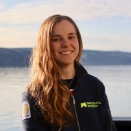
Felicity Alice Holmes is a Research Fellow at the Department of Geological Sciences , Stockholm University , specializing in glacier-ocean interactions in Arctic regions. Her work integrates field data , remote sensing , and numerical modelling to understand frontal ablation processes affecting marine-terminating glaciers. Education : BA Geography, University of Cambridge (2016) MSc Glaciology and Polar Environments, Stockholm University (2018) PhD in Glaciology, Stockholm University (2023) Research focuses on Arctic climate systems , particularly Kronebreen and Ryder Glacier . She investigates how submarine melt and calving respond to ocean temperature variations and tidal fluctuations . Her 2024 ongoing project examines Northern Greenland glacier behavior until 2300 . Recent publications analyze Arctic boundary redefinition (2024), Kronebreen dynamics (2023), coupled lake drainage (2022), and submarine melt protection at Ryder Glacier (2020). She teaches glaciology , paleoglaciology , and GIS courses. Holmes actively participated in the Ryder Glacier Expedition 2019 , using Elmer/Ice and ISSM models. Her work emphasizes site-specific factors like bathymetry and fjord geometry in glacier response to climate change.
Professor Richard Porter (B.Sc., Ph.D. Bristol) is affiliated with the School of Mathematics at the University of Bristol , contributing to the Cabot Institute for the Environment. His research focuses on wave phenomena across fluids, elasticity, electromagnetics, and acoustics, with applications in ocean wave energy converters, metamaterials, ice wave interactions, and variable bathymetry studies. Education: B.Sc. and Ph.D. from University of Bristol Research Themes: Wave Energy, Metamaterials, Fluid-Structure Interaction, Environmental Fluid Dynamics Projects: Principal Investigator for "Water wave metamaterials in the design of ocean wave energy converters" (2021-2023) and "WITT Wave Energy Converter" (2015-2016) His work involves mathematical modeling of wave interactions with complex structures, including theoretical frameworks for wave energy extraction and ice sheet dynamics. Recent publications examine wave scattering, resonant absorption, and metamaterial applications in fluid environments. Research outputs include 98 publications with significant contributions to understanding wave propagation in structured media, as evidenced by his Scopus profile and personal webpage at University of Bristol .
Mischa Schönke is a researcher at the Leibniz Institute for Baltic Sea Research, specializing in marine geophysics and geology. His work focuses on seabed classification, acoustic scattering analysis, and marine habitat mapping through advanced hydroacoustic techniques and signal processing. Institution: Leibniz Institute for Baltic Sea Research Department: Marine Geophysics Group His research explores seabed roughness at millimeter scales, improves calibration methods for acoustic systems, and investigates anthropogenic impacts on coastal sediments through high-resolution bathymetric data. He has contributed to studies on trawling effects on benthic biogeochemistry and sediment dynamics. Key publication trends include submarine gravity flows, sediment wave analysis, and multifrequency backscatter applications for marine habitat monitoring. His work combines field measurements, laboratory experiments, and modeling to advance understanding of seafloor processes. Technical Expertise: Hydroacoustics, Remote Sensing, Signal Analysis, Data Processing Research Themes: Marine Geophysics, Benthic Ecosystems, Sediment Dynamics
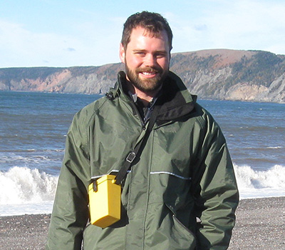
Larry Mayer is a distinguished Professor and founding Director of the Center for Coastal and Ocean Mapping at the University of New Hampshire, with a career spanning over four decades in marine geophysics and ocean mapping. He holds a Ph.D. in Marine Geophysics from Scripps Institution of Oceanography and has held academic positions at Dalhousie University and the University of New Brunswick as the NSERC Industrial Research Chair in Ocean Mapping. Ph.D., Marine Geophysics, Scripps Institution of Oceanography (1979) B.S., Geology (Magna Cum Laude), University of Rhode Island (1973) Mayer's research focuses on seafloor mapping and remote characterization , particularly through autonomous vehicle applications and 3D visualization techniques . His work addresses Arctic Law of the Sea issues and polar bathymetric challenges , contributing to global initiatives like Seabed 2030 and IBCAO. Recent publications emphasize cold-water coral mounds , methane seep detection , and ice-covered oceanography . His career includes over 90 oceanographic cruises with leadership in Arctic expeditions and deep-sea mapping . Notable awards include the Walter Munk Medal , National Academy of Engineering membership , and International Hydrographic Hall of Fame induction. He chairs the National Academies' Oceans Studies Board and advises on NOAA and Arctic Research Commission initiatives. Over 70 months at sea in 35 years Developed 3D visualization frameworks for ocean mapping Co-chair of NOAA Ocean Exploration Advisory Group
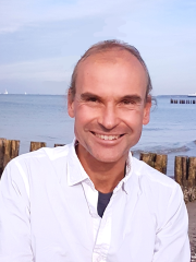
Lars Umlauf is a Senior Researcher at the Leibniz-Institute for Baltic Sea Research (IOW) in Warnemünde, Germany, and a Privatdozent (Lecturer) at Rostock University. He leads the "Turbulence and Small-Scale Processes" research group at IOW and serves as an editor for the Journal of Geophysical Research. His work focuses on physical oceanography with emphasis on turbulence, mixing processes, and small- to meso-scale dynamics in marine environments, particularly in the Baltic Sea. Dr. Umlauf's educational background includes: 1991-1997: Department of Mechanics / Mechanical Engineering at TU Darmstadt (Germany) and UC Berkeley (USA) 1997-2001: PhD at TU Darmstadt (Germany) 2001-2003: Post-Doc at Ecole Polytechnique Fédéral de Lausanne (EPFL, Switzerland) 2013: Habilitation at Rostock University His research interests center on turbulence, mixing, and small- to meso-scale processes in the ocean. Dr. Umlauf investigates small-scale processes near surface-layer fronts, atmosphere-ocean feedbacks induced by diurnal warm layers and rain layers, the dynamics of rotating bottom gravity currents, internal-wave mixing, and boundary mixing processes in stratified basins. He also collaborates with colleagues from other disciplines to understand how small-scale physical processes affect biogeochemical interactions, particularly in regions with large redox gradients. A special interest of his is the development of marine turbulence models, including contributions to the public domain turbulence toolbox GOTM (www.gotm.net). Dr. Umlauf's recent publications reveal a consistent focus on turbulence and mixing processes in stratified marine environments, particularly in the Baltic Sea. His work spans observational, theoretical, and numerical approaches to understanding small-scale ocean dynamics. A significant portion of his recent research examines diurnal warm layers, boundary mixing, and the role of turbulence in biogeochemical processes. His collaborative work extends across multiple institutions and countries, reflecting the international nature of oceanographic research. Among his recognitions: Young Scientist Outstanding Poster Award at EGU General Assembly 2010 Dr. Umlauf actively contributes to the scientific community through editorial work, conference organization, and collaborative research projects. He has been involved in numerous international research collaborations and has served as a guest scientist at institutions including Oregon State University and the University of Victoria. His work often bridges the gap between physical oceanography and other marine science disciplines, particularly in understanding how physical processes influence biogeochemical cycles. At the Leibniz-Institute for Baltic Sea Research, Dr. Umlauf leads the "Turbulence and Small-Scale Processes" research group, which focuses on understanding the fundamental mechanisms of ocean mixing and their implications for larger-scale ocean dynamics and biogeochemical processes. The group employs a combination of observational, theoretical, and numerical approaches to tackle questions related to turbulence and mixing in marine environments.
Jeffrey Beeson is an Assistant Professor at Oregon State University's College of Earth, Ocean, and Atmospheric Sciences. His research focuses on seafloor and subseafloor imaging to explore plate boundary tectonics, methane seepage, and submarine volcanism. He is actively involved in deep-sea exploration using advanced geophysical techniques, including multibeam sonar, AUV surveys, and seismic imaging. Beeson's work emphasizes understanding the dynamic processes at mid-ocean ridges, subduction zones, and hydrothermal systems. He has led and contributed to numerous expeditions, including studies of the Mid-Atlantic Ridge and Cascadia Margin. His recent projects investigate Axial Seamount's eruptive cycles, methane seep distributions, and the structural evolution of active margins. Beeson collaborates with international teams to integrate geodetic, geochemical, and geophysical data for comprehensive Earth system analysis. Research interests include: Volcanism and magma dynamics at mid-ocean ridges Fluid flow and methane seepage in subduction zones Seafloor geodetic monitoring and deformation analysis Hydrothermal vent geochemistry and mineralization His articles highlight advancements in seafloor mapping, eruption forecasting, and tectonic process modeling. Beeson's contributions to the CASIE21 seismic imaging project have improved understanding of Cascadia subduction zone structure. He is also involved in public outreach through ocean exploration initiatives like the R/V Elakha.
Greg Wilson is an Associate Professor in the College of Earth, Ocean, and Atmospheric Sciences (CEOAS) at Oregon State University, where he leads the Wilson Nearshore Research Group within the Coastal Imaging Laboratory (CIL). His research centers on the physics of nearshore coastal processes, including wave dynamics, sediment transport, and current systems, utilizing observational tools and probabilistic modeling approaches. Wilson specializes in acoustic remote sensing, data assimilation for bathymetry inversion, and rip current forecasting, with applications extending from beaches to rivers and inlets. His work emphasizes field measurements using Argus beach cameras, UAVs, and novel instrumentation to address coastal hazards and morphological changes through statistical and numerical frameworks. Analysis of his 2024-2025 publications reveals a pronounced focus on rocky shore dynamics, wave runup prediction on composite beaches, and innovative marine-bird-based environmental monitoring. These studies integrate multiscale remote sensing, field experiments, and modeling to tackle challenges in nearshore circulation, sediment transport, and wave energy dissipation. No scientific awards were mentioned in the provided text. Wilson actively recruits graduate and undergraduate researchers for projects involving surf zone modeling, data assimilation, and coastal hazard prediction. His collaborations with coastal engineers indicate applied research translating into practical coastal management solutions, though specific grant details were not provided. As part of the CIL, he utilizes advanced technologies including Argus imagery, marine radar, and biologging to study nearshore processes, with recent work emphasizing rocky shore environments and infragravity wave interactions.
Dr. Christopher K. Zahm is a Research Scientist at the Bureau of Economic Geology, The University of Texas at Austin. He holds a Ph.D. in Geology from Colorado School of Mines (2002), an M.S. in Geology from UT Austin (1998), and a B.S. in Geology from University of Wisconsin-Madison (1993). His professional experience includes roles as a Structural Geologist at ConocoPhillips (2002–2006), Geologic Consultant at iReservoir (2000–2002), and Adjunct Professor at Colorado School of Mines (2001). Zahm specializes in reservoir characterization, flow modeling in fractured systems, and porosity-permeability evolution. His research integrates field observations, geomechanical modeling, and advanced analytical techniques to address challenges in carbonate reservoirs, fault zone dynamics, and unconventional resource recovery. Key research focuses include: Stratal architecture and deformation in carbonate platforms Fracture network characterization using outcrop analogs and geophysical data Geomechanical properties of reservoir rocks (e.g., Austin Chalk Group) Impact of structural heterogeneity on reservoir compartmentalization Zahm is actively involved in consortia such as the Advanced Energy Consortium (AEC) and Fracture Research and Application Consortium (FRAC). His work has contributed to understanding basement-rooted faults in the Permian Basin, mechanical stratigraphy of anticlines, and the application of machine learning in carbonate reservoir classification. He has authored/co-authored over 50 peer-reviewed publications, emphasizing integration of field, lab, and subsurface data for reservoir optimization. Notable contributions include pioneering studies on fracture prediction using sequence stratigraphy in fault damage zones and quantitative analysis of rock strength in Gulf Coast carbonates. Zahm's expertise bridges academia and industry, with direct applications to oil and gas exploration, CO2 sequestration, and groundwater flow modeling.
Daniel Calvete Manrique is an Associate Professor at the School of Telecommunications and Aerospace Engineering (EETAC) of the Polytechnic University of Catalonia (UPC), where he holds a position in the Department of Physics. His academic journey includes a Degree in Physics from the University of Barcelona (1995) and a PhD in Physics from UPC (1999), focusing on morphological stability models. He conducted postdoctoral research at Utrecht University’s Institute for Marine and Atmospheric Research (1999–2002) and joined UPC’s Ramón y Cajal Program (2003–2008) before becoming an Associate Professor in 2008. His research interests center on coastal morphodynamics, including sedimentary patterns on continental shelves, linear stability analysis, and dynamics of shoreface-connected ridges, crescentic bars, and beach cusps. He leads the DF-GeoTech group, which explores fluid dynamics and geophysical applications. Key contributions include numerical models for coastal evolution, bathymetric inversion techniques (e.g., UBathy), and studies on sediment transport mechanisms under wave and tidal influences. His work integrates field data and numerical simulations to address coastal resilience, climate adaptation, and anthropogenic impacts. Collaborations span institutions like Utrecht University and the Catalan Institute of Water Research. He has authored over 200 publications, focusing on coastal processes, sediment dynamics, and geophysical fluid modeling.
Xingong Li is a Professor and Director of Undergraduate Studies in the Department of Geography at the University of Kansas. His research focuses on geospatial technologies for analyzing surface water dynamics, terrain analysis, and spatiotemporal data frameworks. He teaches courses in spatial analysis, geospatial programming, and water resources applications. His work integrates remote sensing, GIS, and computational models to address environmental challenges such as lake dynamics, solar radiation modeling, and climate impacts on hydrology. Key research interests include: surface water mapping, terrain shading algorithms, and spatiotemporal data frameworks. He has published extensively in journals like Remote Sensing of Environment, Transactions in GIS, and Water Resources Research. Recent studies investigate Tibetan Plateau lake changes, solar radiation modeling in mountainous regions, and GIS applications for cultural heritage mapping. Publications span 1995–2022 with over 50 peer-reviewed articles. His work bridges computational methods with environmental science, emphasizing interdisciplinary GIS applications.
Roger Flood is a Research Professor at the School of Marine and Atmospheric Sciences (SoMAS) at Stony Brook University. His work focuses on marine geology and sediment dynamics, particularly in continental margin systems and coastal environments. He employs advanced geophysical techniques (e.g., multibeam sonar, seismic profiling) to study sediment transport, submarine fan architectures, and environmental impacts of storms like Hurricane Sandy. Education: Ph.D. in Marine Geology from Massachusetts Institute of Technology and Woods Hole Oceanographic Institution (1978). Research emphasizes high-resolution methods to understand sedimentation processes in marine and freshwater systems. Key areas include: continental margin sedimentation (e.g., Amazon Fan studies), environmental applications (e.g., PCB contamination in the Hudson River), and post-storm coastal recovery. Collaborations with international programs like the Ocean Drilling Program (ODP Legs 155, 172, 339) highlight his global fieldwork. His recent studies investigate Mediterranean Outflow dynamics and long-term seabed morphology changes off New York using multidecadal datasets. Contributions include advancing seafloor mapping techniques for habitat classification and infrastructure planning.
Rajashree Datta is an Assistant Professor of Digital Twins at the Faculty of Civil Engineering and Geosciences , Delft University of Technology. She studies cryospheric processes with a focus on climate-ice sheet interactions, utilizing variable-resolution Earth system models (VR-ESMs) and satellite remote sensing. Previous affiliations include the University of Colorado, ESSIC/UMD/NASA, Lamont-Doherty Labs, and City University of New York. Current research connects global climate drivers (ocean warming, sea ice loss) to Antarctic ice sheet surface impacts Specializes in high-resolution earth modeling and multi-source satellite analysis Her recent work examines atmospheric rivers, foehn wind effects, and firn evolution dynamics. She has developed novel methods for satellite-based lake bathymetry analysis and served as a PI in NASA's Small Satellite Databuy Program.
Serge Suanez is a Professor of Physical Geography specializing in coastal geomorphology at the University of Western Brittany, affiliated with both the Department of Geography within the Faculty of Letters & Human Sciences and the LETG UMR 6554 CNRS research unit at the European University Institute of the Sea. His primary research focuses on coastal sediment dynamics, morphological responses to extreme events, and coastal management strategies at the nature-society interface. His research interests encompass coastal geomorphology with emphasis on sediment budgets, soft and rocky coastline responses to climatic and anthropogenic forcing, storm impacts on coastal systems, and gravel spit dynamics. Notable research programs include ANR GEOPRAS (2022-2025), SEA-EU-search (2021-2022), SeaLex (2020-2023), and long-term monitoring of the Sillon de Talbert and Vougot Beach sites. Analysis of his recent publications reveals strong focus on extreme storm impacts on high-energy coastlines, long-term morphological monitoring of gravel barriers, and coastal flooding risk assessment. His work spans both field measurements and modeling approaches, with particular emphasis on Brittany's coastline and Icelandic volcanic coasts. He has served in significant administrative roles including co-coordinator of the EUR ISblue research theme 'Coastal System Sustainability' since 2023, member of the Scientific Council of the European University Institute of the Sea since 2021, and former deputy director of the LETG research unit (2017-2020). His expertise extends to coastal management applications through numerous monitoring programs including annual morphosedimentary surveys of the Talbert channel (since 2007), Natura 2000 dune monitoring at Vougot Beach (2004-2023), and coastal rehabilitation projects across Brittany.
Dr. Michel Tsamados is an Associate Professor in Polar Observation & Modelling at the Department of Earth Sciences, University College London (UCL). He specializes in integrating remote sensing and numerical modeling to study polar climate systems, with a focus on sea ice dynamics, snow cover, and ocean-atmosphere interactions. His work bridges fundamental material science principles with applied climate research, leveraging satellite data (e.g., CryoSat-2, ICESat-2) and advanced machine learning techniques to improve model parameterizations and observational products. Key affiliations include UCL's Centre for Polar Observation and Modelling (CPOM) and collaborations with the Alan Turing Institute and Met Office Academic Partnership (MOAP). His research explores AI applications in polar climate analysis, geoengineering feasibility studies, and historical climatic data recovery (e.g., Ottoman-era rainfall records). Research interests encompass sea ice thickness estimation, snow depth retrieval via dual-frequency radar, and understanding drivers of Arctic amplification. He teaches courses on ocean physics, climate change, and climate principles. Current projects include advancing Southern Ocean tide models (ALBATROSS), optimizing sea ice thickness algorithms, and analyzing extreme cyclone impacts on sea ice. His contributions include developing satellite-derived products like the first summer Arctic sea ice thickness record and pan-Arctic drag coefficient datasets. He actively participates in multidisciplinary initiatives like the MOSAiC Distributed Network and CRISTAL mission preparations.
Scott White is a Professor in the Department of Earth Ocean and Environment at the University of South Carolina's College of Arts and Sciences, specializing in marine geology and geophysics. His research focuses on revealing patterns and processes in underwater environments from deep seafloors to wetlands. Research interests span coastal processes, geophysics, seismology, volcanology, oceanography, tectonics, and marine geology, with particular emphasis on submarine volcanic processes, coastal geomorphology, and groundwater interactions. Recent publications demonstrate strong focus on machine learning applications in seafloor mapping and advanced geomorphological analysis techniques. Award recognition is currently not detailed in available records. Laboratory resources include marine geology equipment and computational modeling capabilities within the School of Earth, Ocean and Environment.