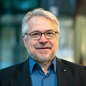
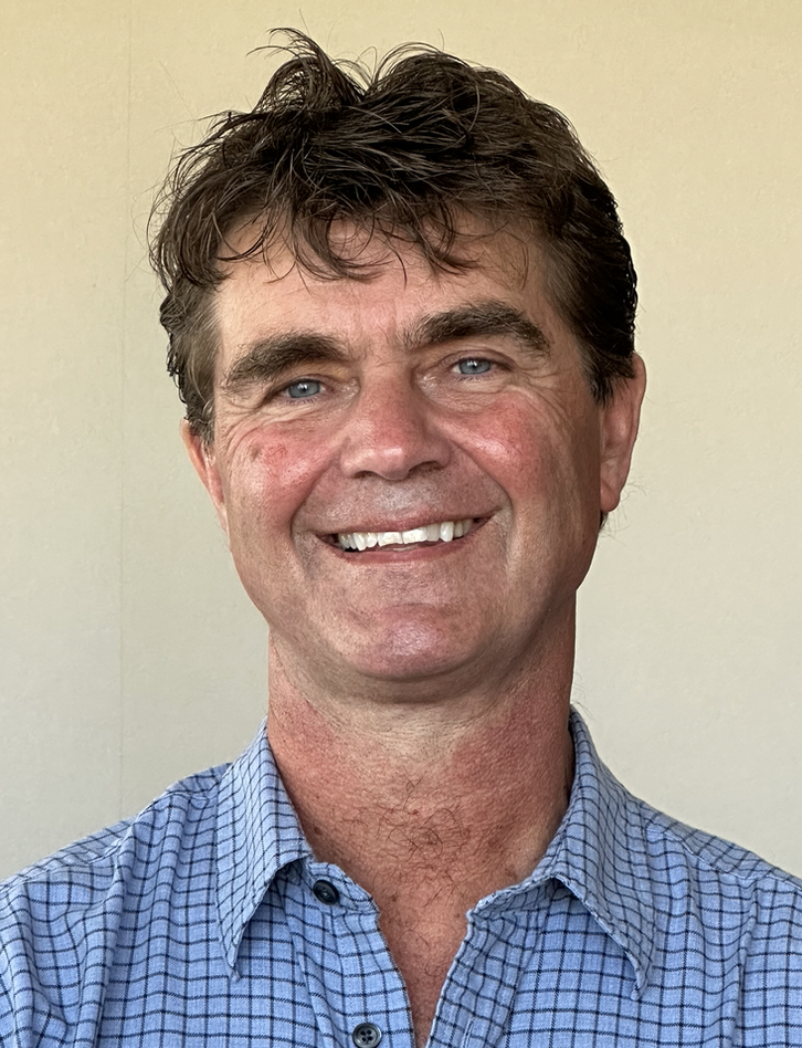
Professor Jan Vanderborght serves as Director of the Agrosphere Institute (IBG-3) at Forschungszentrum Jülich, Germany, while maintaining a professorship in Soil Physics at KU Leuven, Belgium. His research focuses on fundamental soil physical processes with direct applications in agricultural and environmental management. His educational background includes an MSc (1993) and PhD (1997) in Bio-engineering from KU Leuven, followed by post-doctoral research at ETH Zurich (1998-1999). Vanderborght's research centers on solute transport in soils, pesticide fate modeling, hydrogeophysics, soil evaporation processes, and plant water/nutrient uptake mechanisms. His work bridges fundamental soil physics with practical agricultural applications, particularly in irrigation management and contaminant transport. His recent publications reveal strong focus on advanced soil moisture monitoring techniques, root water uptake modeling, and the application of digital twin technology (SWIM²) for precision agriculture. The research spans multiple scales from pore-level processes to field-scale hydrological modeling. As an editorial leader in the field, Vanderborght serves as Co-Editor of Vadose Zone Journal and Associate Editor for both Journal of Hydrology and SOIL, reflecting his significant contributions to soil and water science literature. His research group develops innovative approaches combining field measurements, advanced imaging techniques (like MRI and GPR), and sophisticated modeling frameworks to address critical challenges in soil-water-plant systems, particularly under changing climate conditions.
Prof. Dr. Peter Dietrich is a University Professor of Environmental and Engineering Geophysics at the Eberhard Karls University of Tübingen and Head of the Department of Monitoring and Exploration Technologies at the Helmholtz Centre for Environmental Research (UFZ) in Leipzig, Germany. He holds a joint appointment between the university and UFZ, reflecting his dual role in academic teaching and applied environmental research. Institution: Helmholtz Centre for Environmental Research - UFZ Department: Monitoring and Exploration Technologies Academic Affiliation: University of Tübingen Email: peter.dietrich@ufz.de His research spans environmental and engineering geophysics , with a focus on hydrogeophysics, geophysical monitoring, and exploration technologies for soil and groundwater systems. He applies methods such as electrical resistivity tomography, seismic techniques, and direct push sensing to study subsurface processes in ecological, archaeological, and environmental contexts. His work supports sustainable water management, pollution monitoring, and landscape preservation. The 15 most recent publications highlight a consistent trend in applied geophysics , particularly in non-invasive subsurface characterization , groundwater dynamics , and interdisciplinary environmental monitoring . These studies integrate field experiments, sensor networks, and modeling to address challenges in hydrology, geoarchaeology, and contaminant transport. Keywords across these works include geophysics, hydrogeology, remote sensing, and environmental monitoring, with subfields such as GPR imaging, nitrate plume analysis, peatland carbon storage, and 3D subsurface modeling. No specific scientific awards are listed in the provided text. Prof. Dietrich leads a research team and collaborates extensively with scientists across disciplines, including environmental engineers, hydrologists, and archaeologists. His leadership in the UFZ’s Department of Monitoring and Exploration Technologies underscores his role in advancing smart models and monitoring systems within the broader Helmholtz Research Program 'Changing Earth – Sustaining our Future'.
Lionel Pichon is a leading researcher at the Laboratory of Electrical and Electronic Engineering of the University of Paris. His primary affiliations include the Department of Electrical and Electronic Engineering of Paris, where he specializes in advanced electromagnetic research. His work focuses on Electromagnetics , Electromagnetic Compatibility (EMC) , and Wireless Power Transfer , with particular emphasis on composite materials, biomedical applications, and automotive systems. Expertise in numerical methods (FDTD, FIT, DGTD) for electromagnetic simulations Pioneer in shielding effectiveness analysis for composite materials Developer of AI-driven approaches for dielectric property characterization Over 70 publications since 2017 highlight his contributions to fields like inductive power transfer systems, medical device EMC, and GPR imaging techniques. Collaborates extensively with institutions globally, including research on antenna design for implantable medical devices and electromagnetic compatibility in healthcare facilities. Current research trends emphasize machine learning integration with traditional electromagnetic analysis to optimize system performance and safety standards.
Özgür Aktürk is an Assistant Professor in the Department of Geological Engineering at Akdeniz University, Faculty of Engineering, where he has been serving since 2011. His academic journey began at Ankara University, continued with a master's and doctorate at Middle East Technical University, and includes research experience at the University of Tennessee. He is actively involved in teaching and research in geotechnical and geophysical engineering, with strong industry collaboration through his R&D company. Doctorate: Middle East Technical University, 2010 Undergraduate: Ankara University, 2001 His research interests span Applied Geophysics , Engineering Geology , Electrical Resistivity Imaging , Soil and Rock Mechanics , Seismic Hazard Assessment , and Numerical Modeling . He applies these to practical problems such as tunnel stability, dam safety, karst investigations, and urban infrastructure. His work integrates field geophysics with computational models to assess geotechnical risks. The recent articles reflect a consistent focus on geophysical subsurface characterization, particularly using electrical resistivity methods, and geotechnical stability analysis. Key themes include urban geophysics for subway systems , karst cavity detection , soil liquefaction , and statistical analysis of geological materials . His collaborations with researchers like V. Doyuran, K. Kayabalı, and F. Uçar highlight interdisciplinary and applied research trends. He has supervised multiple master's students on topics related to tunnel deformation, landslide hazards, and geophysical site assessment. Although no formal scientific awards are listed, his extensive publication record and participation in funded projects indicate active research engagement. He is a member of the Engineering Geology Association and the Chamber of Geological Engineers, and has served on thesis juries. Özgür Aktürk has founded JeoTasarım Proje ve Mühendislik under Akdeniz University TEKNOKENT, demonstrating a commitment to applied research and technology transfer. His work bridges academic research and practical engineering solutions, particularly in water resources and geohazard mitigation projects.
Mark Everett is a Professor of Geophysics at Texas A&M University, holding the Howard Karren Professorship. His primary research focuses on near-surface applied geophysics, with expertise in ground-penetrating radar (GPR), electrical resistivity tomography, and controlled-source electromagnetics. He explores applications in environmental monitoring, geotechnical engineering, archaeology, and agricultural sciences. Research interests include karst aquifer dynamics, coastal transition zones, and subsurface imaging for infrastructure assessment. Teaches courses like GEOP 313 (Geophysical Field Methods) and GEOP 413 (Near-Surface Applied Geophysics). Education background: BSc and MSc in Physics from York University (Canada), followed by a PhD in Geophysics from the University of Toronto. Research highlights: Developed the SWAN CSEM system for offshore groundwater mapping. Advanced GPR techniques for unmarked grave detection and crop biomass estimation. Led studies on sinkhole formation mechanisms and coastal aquifer connectivity. Publications emphasize hydrogeological processes, geophysical instrumentation, and interdisciplinary applications in agriculture and archaeology. Collaborates globally on projects like the Texas Water Observatory, focusing on climate-land use interactions in water cycle dynamics.
Associate Professor Gang Ren is affiliated with the School of Engineering at RMIT University, where he specializes in Civil Engineering and Resources Engineering. His research focuses on geotechnical engineering, mining subsidence, sustainable materials, and climate change impacts on infrastructure. His research interests include Civil Engineering, Resources Engineering and Extractive Metallurgy, Environmental Engineering, Geochemistry, and Interdisciplinary Engineering. He has supervised projects on topics such as viscoelastic deformation in mine shafts, clay stabilization using recycled materials, and ground movement monitoring during deep excavations. Teaching interests span Slope Stability Analysis, Retaining Structure Design, Soil Nailing, Ground Movements, Fibre Reinforced Concrete, Finite Element Methods, Site Investigation, Rock Mechanics, and Subsidence Prediction. Notable contributions include studies on climate change effects on residential footings, recycled material applications in pavements, and subsidence mechanisms in multi-seam mining. His work emphasizes sustainable practices and innovative material utilization.
Fauzia Ahmad is an Associate Professor in the Department of Electrical and Computer Engineering at the College of Engineering, Temple University. She has previously held the position of Research Professor and Director of the Radar Imaging Lab at Villanova University. Her research is supported by major U.S. federal agencies, with over $7M in awarded research funding as Principal or Co-Principal Investigator. Ph.D. in Electrical Engineering, University of Pennsylvania, 1997 Dr. Ahmad's research focuses on statistical signal and array processing , computational imaging , and multi-modal sensing . Her work spans applications in through-the-wall radar , ground-penetrating radar , remote patient monitoring , and structural health monitoring . She employs advanced techniques in compressive sensing , sparse reconstruction , and machine learning to solve real-world sensing challenges. The recent publications highlight a strong trend in radar micro-Doppler signature analysis for human activity recognition, coprime array signal processing for super-resolution, and tensor decompositions in MIMO radar and communications. Her work increasingly integrates machine learning with traditional signal processing for robust detection and classification in noisy, real-world environments. Dr. Ahmad has received several prestigious honors: Fellow of the IEEE Fellow of the SPIE Chair of the IEEE Dennis J. Picard Medal Committee (2018-2020) She has served as an Associate Editor for multiple top-tier journals including IEEE Transactions on Signal Processing , IEEE Transactions on Aerospace and Electronic Systems , and IEEE Transactions on Computational Imaging , where she is currently a Senior Area Editor. She has led major conference series such as the SPIE Compressive Sensing and SPIE Big Data conferences. Her research is conducted through the Multi-modal Sensing and Imaging Lab , where she mentors students and collaborates on interdisciplinary projects involving radar, communications, and biomedical applications.
Chiara Colombero is an Associate Professor at Politecnico di Torino, affiliated with the Department of Environment, Land and Infrastructure Engineering (DIATI) and the Interdepartmental Center Photonext. Her work bridges applied geophysics, natural hazard monitoring, and environmental characterization. Research Interests: Passive seismic monitoring of natural hazards Geophysical characterization of glacial/periglacial environments Integration of seismic, electrical, and EM methods Geoengineering applications for infrastructure and cultural heritage Recent Article Trends: Focus on seismic monitoring of rock glaciers, hydrodynamic modeling using radon tracers, and machine learning applications for landslide early warning systems. Methods include ambient noise tomography, surface wave analysis, and multi-sensor integration. Scientific Awards: Premio AGLC "Licio Cernobori" (2016) Teaching Roles: She teaches courses on Applied Geophysics , Remote Sensing , and Innovation Lab for Climate Change , while supervising Ph.D. candidates Lorena Di Toro and Valeria Strallo in projects related to cryospheric and landslide monitoring.
Takumi Ueda is a Professor at Waseda University 's School of Creative Science and Engineering , affiliated with the Waseda Research Institute for Science and Engineering (2024-2026). He holds a Ph.D. in Geophysics (2007) from the University of Utah and an M.Eng. in Electrical Exploration (2002) from Waseda University. Education: Ph.D. (Geophysics) - University of Utah (2007) M.Eng. (Engineering) - Waseda University (2002) B.Eng. (Science and Engineering) - Waseda University (2000) His research focuses on Exploration Geophysics and Electromagnetic (EM) Methods , particularly for marine and UAV-based geophysical surveys . Key contributions include: Developing drone-borne EM systems for buried object detection Advancing 3D holographic imaging techniques in marine CSEM Optimizing continuous wavelet transforms for MT data processing Innovating vertical electrode configurations for sub-seafloor resistivity sensing His 15 most recent publications (2006-2023) demonstrate expertise in electromagnetic exploration , inverse problem solving , and UAV applications for geophysical monitoring. Collaborative work spans institutions including the National Institute of Advanced Industrial Science and Technology (2002-2017) and the University of Utah . Professional engagements include: Leadership roles in the Physical Exploration Society (2010-present) Membership in the Society of Exploration Geophysicists and Japan Society of Computational Methods in Engineering Participation in technical committees for CCS monitoring and geophysical software development
Carles Roque Pau is an Associate Professor in the Department of Environmental Sciences at the University of Girona, Spain, where he specializes in geomorphology and environmental geology. His research focuses on karst systems, sinkholes, groundwater dynamics, and geophysical methods for hazard assessment. He is a key member of the Research Group on Environmental Geology and Cartography. Institution: University of Girona Department: Department of Environmental Sciences Research Group: Research Group on Environmental Geology and Cartography Email: carles.roque@udg.edu His educational background, though not explicitly detailed, is inferred from his long-standing research and publication record in geomorphology and Quaternary geology. He has contributed extensively to geological mapping in Catalonia and has collaborated on interdisciplinary projects involving archaeology and paleoenvironmental reconstruction. Roque’s research interests span geomorphology, hydrogeology, karst systems, and geological hazards. He employs geophysical techniques such as Electrical Resistivity Tomography (ERT), Ground Penetrating Radar (GPR), and trenching to study sinkhole formation, tufa mounds, and evaporite dissolution. His work integrates field observations with stratigraphic and paleoclimatic analysis, particularly in the Pyrenees and Ebro Basin. He also investigates the impact of climate change on geomorphological processes, including drought effects on sinkhole development and natural acid rock drainage. The recent publications reflect a strong trend in applying integrated geophysical and stratigraphic methods to understand subsurface processes in karst and evaporite terrains. The research spans from pure geomorphology to applied environmental geology, with increasing emphasis on hazard assessment, urban risk, and climate change impacts. Topics include hypogenic karst, salt diapirism, radon in groundwater, and prehistoric flint exploitation, demonstrating both depth and breadth in geological inquiry. While no formal scientific awards are listed in the provided text, his sustained publication record in high-impact journals and leadership in multiple research projects indicate significant recognition within the academic community. Roque has supervised or co-supervised several research projects, particularly in the areas of Neanderthal resource use and sinkhole characterization. He has collaborated extensively with researchers such as Francisco Gutiérrez and Anna Menció on hydrogeological and geomorphological projects. His involvement in EU and national grants highlights his role in advancing environmental research in Spain. He is actively involved in geological mapping through the Institut Cartogràfic i Geològic de Catalunya, contributing to official 1:25,000 scale maps. He also participates in interdisciplinary teams focused on prehistoric archaeology, particularly in the study of Neanderthal behavior and lithic resource exploitation in northeastern Iberia.
Amir Alani is a Professor at the University of West London with extensive expertise in Ground Penetrating Radar (GPR) applications for infrastructure and environmental monitoring. His research spans civil engineering, geophysics, and remote sensing, with particular focus on non-destructive testing methodologies for structural health assessment. His research interests center on Ground Penetrating Radar applications across multiple domains including structural health monitoring of bridges and tunnels, tree root mapping and assessment, airport pavement inspection, and flood forecasting systems. Dr. Alani has pioneered innovative approaches using polarimetric GPR systems for tree trunk inspection and developed enhanced data processing frameworks for mapping tree root systems in urban environments. His work integrates GPR with other technologies like InSAR (Interferometric Synthetic Aperture Radar) for comprehensive infrastructure monitoring. Analysis of Dr. Alani's recent publications reveals a strong trend toward integrating multiple sensing technologies for infrastructure monitoring, with significant work on applying GPR to environmental challenges like tree health assessment and urban flood management. His research demonstrates a consistent focus on practical applications of geophysical methods to solve real-world engineering problems, particularly in urban infrastructure contexts. Dr. Alani has been actively involved in advising PhD students and securing research grants, though specific details of these activities are not fully documented in the available publications. His research group appears to collaborate extensively with international partners across Europe. His laboratory work focuses on GPR technology development and application, with particular emphasis on tree root mapping systems and infrastructure health monitoring. The research team has developed specialized processing frameworks for GPR data analysis, including geostatistical approaches and deep learning techniques for root detection.
Professor Ian Haynes is a leading academic at Newcastle University , specializing in Roman archaeology with a focus on urban transformation , military communities , and frontier economies . He co-leads major interdisciplinary projects such as Rome Transformed and The Lateran Project , which employ advanced geophysical and digital methodologies to study Roman sites in Italy, Britain, and beyond. Academic Rank : Professor Institution : Newcastle University Research Themes : Roman military, urban archaeology, geospatial analysis, cultural heritage His work spans from 2001 to 2025 , with recent publications exploring the evolution of the Eastern Caelian in Rome, digital imaging of Gandhāran art, and geophysical prospection techniques. Collaborations with scholars like Professor Paolo Liverani and Dr Thea Ravasi highlight his team-based approach to large-scale urban research. Selected Article Trends : Urban transformation from Castra to Cathedral (2025) Geophysical survey in southeast Rome (2023) Frontier economies in Roman Britain (2020) Digital reconstruction of cultural heritage (2017)
Fronefield Crawford is the Charles A. Dana Professor of Physics and Astronomy at Franklin and Marshall College (F&M), serving as Director of Grundy Observatory since 2017. He holds a Ph.D. from MIT (2000) and B.A. from Williams College (1994). His research focuses on pulsar astronomy, gravitational wave detection via the NANOGrav consortium, and landmine detection technology. He leads the NANOStars program, enabling undergraduate research in pulsar timing arrays. Previously, he chaired F&M's Department of Physics and Astronomy (2020–2022) and served as a technical consultant for Raytheon and an investment firm. Research Highlights: - Pulsar surveys (e.g., PALFA, Parkes 70cm re-analysis) - Detection of fast radio bursts (FRBs) including four historic discoveries from archival data - Gravitational wave studies using millisecond pulsars as cosmic clocks He has co-authored over 50 publications and received prestigious awards including the 2025 Bruno Rossi Prize. His work bridges astrophysics and applied science, including NATO-sponsored landmine detection projects in collaboration with international teams.
Dr. Livia Lantini is a Senior Lecturer in Civil Engineering at the School of Computing and Engineering, University of West London. She holds a BSc (Hons) in Civil Engineering and an MSc in Infrastructure and Transportation Engineering from Rome Tre University, Italy, and a PhD in Civil Engineering from the University of West London. Her research focuses on non-destructive testing (NDT) methods, particularly Ground Penetrating Radar (GPR), for civil engineering infrastructure assessment and tree health monitoring. She has been recognized with the 'Best Paper' award at the 2020 IEEE International Conference on Telecommunications and Signal Processing. Education: BSc (Hons) in Civil Engineering, Rome Tre University, Italy MSc in Infrastructure and Transportation Engineering, Rome Tre University, Italy PhD in Civil Engineering, University of West London, UK Research Interests: Lantini’s work emphasizes innovative applications of GPR and other NDT techniques to evaluate infrastructure integrity and tree health. Her research includes GPR-based tree root mapping, decay detection in tree trunks, and the use of radar for bridge monitoring. She explores integration of GPR with technologies like LiDAR and deep learning for enhanced accuracy and cost-effectiveness. Her studies contribute to sustainable urban planning and infrastructure resilience. Grants & Collaborations: She actively collaborates on projects involving tree-root interactions with infrastructure, bridge health monitoring, and geostatistical analysis of urban tree systems. Her work bridges civil engineering and environmental science to address challenges in urban ecosystems and infrastructure longevity. Labs/Teams: Coordinates the Early Career Researcher (ECR) Network at her university, fostering interdisciplinary research collaborations. Engages in international forums, including presentations at the House of Lords and EGU General Assemblies, promoting applied NDT innovations.
Prof. AYSEL ŞEREN is a distinguished Professor in the Department of Geophysical Engineering at the Faculty of Engineering, Karadeniz Technical University. With over 98 publications in Web of Science and an impressive H-index of 182, she has established herself as a leading expert in applied geophysics, particularly in ground-penetrating radar applications, karst studies, and archaeological geophysics. Her research spans diverse areas including engineering geophysics, hydrogeology, and mineral exploration. Her educational background includes a Doctorate from Istanbul University (1994-1998), Postgraduate studies at Karadeniz Technical University (1990-1993), and Undergraduate studies at the same institution (1985-1989). Her academic journey reflects a deep commitment to geophysical sciences and engineering applications. Prof. Şeren's research interests primarily focus on Geophysical Engineering , Applied Geophysics , Archeo-geophysical studies, and Gravity applications. Her work demonstrates exceptional integration of multiple geophysical methods for solving complex geological and engineering problems. She has made significant contributions to understanding karst systems, slope stability, archaeological site investigations, and infrastructure assessment. Her approach consistently combines theoretical foundations with practical field applications, advancing both scientific knowledge and engineering solutions. Analysis of her recent publications reveals a strong trend toward integrated geophysical approaches, particularly using Ground-Penetrating Radar (GPR) in combination with other methods. Her research has evolved from fundamental geophysical studies to practical applications addressing real-world challenges in engineering, archaeology, and environmental science. The interdisciplinary nature of her work connects geophysics with civil engineering, hydrology, archaeology, and geological hazards assessment, demonstrating her ability to bridge theoretical concepts with practical implementation. Prof. Şeren has supervised 14 theses and secured numerous research grants, demonstrating her leadership in the field. Her funded projects span archaeological investigations, landslide risk assessment, karst studies, and infrastructure evaluation. She has led significant projects including 'Deprem Tetikli Kütle Hareketlerinin Yer Bilimsel Jeoloji-Jeofizik-Jeomorfoloji Yaklaşımlarla Modellenmesi' (2023-Present) and 'Hidrojeofizik Çalışmalarla Dolinlerin, Karstik Boşlukların ve Yeraltı Su Akış Sisteminin Araştırılması' (2022-2024). These projects highlight her ongoing commitment to addressing contemporary challenges through innovative geophysical approaches. Her research group focuses on advanced geophysical techniques, particularly GPR applications, for solving engineering and archaeological challenges. The team conducts comprehensive field investigations, sophisticated data processing, and detailed interpretation for various geological and engineering problems, with strong connections to cultural heritage preservation and infrastructure safety. Their work consistently demonstrates methodological rigor while maintaining practical relevance to real-world applications.