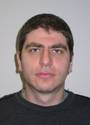
Dr. Mitko Aleksandrov serves as a Casual Academic and Research Associate at the University of New South Wales (UNSW), working with Geospatial Research Innovations and Development (GRID) within the School of Built Environment under the Faculty of Arts, Design & Architecture. With specialized expertise in geospatial information systems and three-dimensional modeling, Dr. Aleksandrov contributes to cutting-edge research in indoor navigation, spatial analysis, and building information modeling applications for urban planning and safety. Dr. Aleksandrov holds a Master's degree in GIS (Geographic Information Systems), though specific details about his educational institutions and timeline are not provided in the available information. His academic background has positioned him at the forefront of geospatial research with practical applications in built environments. Specializing in three-dimensional modeling and navigation systems for indoor environments, Dr. Aleksandrov's research spans geospatial analysis, building information modeling, and spatial data structures. His work focuses on evacuation planning, crowd simulation, and hazard detection through voxel-based representations of 3D spaces, visibility analysis, and the integration of BIM with geospatial data. His research bridges computer science, civil engineering, and urban design to create innovative solutions for complex spatial problems in built environments, particularly addressing safety and navigation challenges in complex buildings. Dr. Aleksandrov's publication record demonstrates a clear progression from foundational research on voxelization algorithms toward practical applications in evacuation planning and pedestrian safety. His recent work shows increasing interdisciplinary collaboration, integrating computer vision techniques with geospatial analysis to address urban challenges. He has made significant contributions to indoor navigation systems, 3D modeling for evacuation scenarios, and the application of voxel-based representations in building information modeling, with publications appearing in high-impact journals across geospatial science, computer science, and civil engineering domains. While specific awards are not mentioned in the available information, Dr. Aleksandrov's research impact is evidenced by his consistent publication record in reputable journals including Transactions in GIS, Journal of Spatial Science, and ISPRS Annals. His work has contributed to advancing methodologies in 3D geoinformation and spatial analysis for practical urban applications. Dr. Aleksandrov actively collaborates with researchers across UNSW and internationally, particularly with Sisi Zlatanova, Jennifer Barton, and other members of the geospatial research community. His publications indicate involvement in significant research projects, potentially including the CRC-LCL project referenced in his 2020 work. While specific student supervision details aren't provided, his research program suggests engagement with graduate students in the geospatial and built environment fields. Working with Geospatial Research Innovations and Development (GRID) at UNSW, Dr. Aleksandrov is part of a dynamic research team focused on advancing geospatial technologies for urban applications. His involvement in organizing academic conferences such as the 3D Geoinfo Conference and GEOINFORMATION for DISASTER MANAGEMENT demonstrates his leadership within the research community. His work with voxel-based modeling in UNITY3D suggests engagement with visualization technologies that bridge academic research and practical applications in urban planning and emergency response.