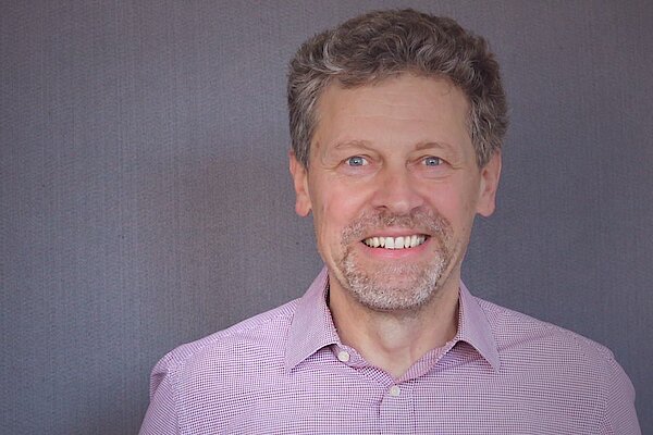
Prof. Dr. Thomas Brinkhoff is Chair of the Institute Board and Chair of Geoinformatics at Oldenburg University of Applied Sciences. He leads the Institute for Applied Photogrammetry and Geoinformatics (IAPG) and contributes to institutions like the Association for the Promotion of Geoinformatics in Northern Germany (GiN e.V.) and the Oldenburg Research and Development Institute for Computer Science (OFFIS e.V.). Education: Diploma in Computer Science (Informatik), Universität Bremen (1990) Doctorate in Computer Science (Dr. rer. nat.), Ludwig Maximilian University of Munich (1994) Brinkhoff's research spans geodatabase systems, spatiotemporal data processing, geosensor analytics, and location-based services. His work addresses Volunteered Geographic Information (VGI), web-based geospatial visualization, and mobile data integration, with applications in traffic management and forensic science. Recent projects include ProSaDi (Digital Provenance and Collection Research) and contributions to the Laboratory for optical 3D metrology . He has served on program committees for ACM SIGSPATIAL (2002-2019), AGILE conferences (2010-2025), and editorial boards of journals like GeoInformatica and TGIS. Notable Lectures: 2024: Forensic applications of tachograph data 2023: Geoinformatics in homicide investigations 2022: Spatiotemporal analysis for sustainability projects 2015: Open geodata standards at FOSSGIS 2014: Mobile sensor data processing
Saurabh Bagchi is a Professor at Purdue University, West Lafayette, USA. He holds a PhD in Computer Science from the University of Illinois Urbana-Champaign (2001). His research focuses on distributed systems security, networking, and embedded systems. Key areas include IoT security, cyber-physical systems resilience, and machine learning applications in edge computing. Bagchi's work spans theoretical and applied domains, addressing challenges in distributed algorithms, fault tolerance, and secure communication protocols. His contributions to firmware analysis, serverless computing optimization, and anomaly detection in industrial IoT systems have been widely recognized. He has published over 300 papers in top-tier conferences and journals such as IEEE Transactions on Dependable and Secure Computing, ACM Transactions on Sensor Networks, and CVPR. He collaborates with researchers in academia and industry to advance resilient networked systems, including projects funded by NSF and industrial partnerships. His lab explores cutting-edge topics like federated learning security, edge computing architectures, and game-theoretic approaches to cyber defense.
Miguel Mahecha is Professor of Environmental Data Science and Remote Sensing at the University of Leipzig, where he serves as Institute Head of the Institute for Earth System Science and Remote Sensing. He is also affiliated with the Remote Sensing Centre for Earth System Research, a collaboration between Leipzig University and the Helmholtz Centre for Environmental Research (UFZ). Mahecha is a member of the German Centre for Integrative Biodiversity Research (iDiv) and serves as Principal Investigator in the Centre for Scalable Data Analytics and Artificial Intelligence. Additionally, he is a Fellow of the European Laboratory for Learning and Intelligent Systems and co-spokesperson for the National Research Data Infrastructure for Earth System Sciences (NFDI4Earth). Full Professor for Modelling Approaches in Remote Sensing, University of Leipzig (since 03/2020) Research Group Leader: Empirical Inference in the Earth System, Max Planck Institute for Biogeochemistry, Jena (12/2012 - 03/2020) PostDoc, Max Planck Institute for Biogeochemistry, Jena (10/2009 - 11/2012) PhD in Environmental Sciences, ETH Zürich (06/2006 - 09/2009) Diploma in Geoecology, Bayreuth University (10/2000 - 04/2006) Mahecha's research focuses on understanding ecosystem responses to climate extremes and human-environment relationships during these events. He investigates macro-ecological dynamics and ecosystem functioning using data-driven methods and high-dimensional Earth observations. A key contribution is his co-development of the Earth System Data Cube concept, which integrates empirical methods with theoretical understanding to analyze complex Earth system interactions. His work spans biogeography, ecosystem functioning, and advanced data science methodologies for environmental monitoring. His recent publications demonstrate a strong emphasis on analyzing compound climate extremes, particularly heatwaves and droughts, and their impacts on ecosystems. Mahecha has pioneered methods using Earth System Data Cubes to integrate diverse environmental datasets, enabling novel insights into biosphere-atmosphere interactions. His research increasingly incorporates artificial intelligence and machine learning approaches to understand spatiotemporal patterns in ecological systems, with applications in real-time forest monitoring and biodiversity assessment. Fellow of the European Laboratory for Learning and Intelligent Systems Co-spokesperson for NFDI4Earth (National Research Data Infrastructure for Earth System Sciences) Mahecha leads multiple significant research projects including Digital Forest (real-time forest monitoring), NFDI4BioDiversity, and XAIDA (extreme events: AI for Detection and Attribution). His work receives funding from diverse sources including EU, DFG, and Stiftungen Inland. He collaborates extensively with the German Centre for Integrative Biodiversity Research (iDiv) and the Centre for Scalable Data Analytics and Artificial Intelligence. His research group, Earth System Data Science (ESDS), focuses on developing methods to extract valuable information from long-term environmental observations to understand coupled Earth system dynamics. At the Remote Sensing Centre for Earth System Research, Mahecha's ESDS group investigates how ecosystem functions respond to climate extremes, societal vulnerability to environmental hazards, and nonlinear interactions in coupled Earth systems. The group leverages citizen science data, remote sensing observations, and advanced computational methods to address pressing environmental questions.
Dr. Adrian Fazekas is a Lecturer at the Institute of Highway Engineering, RWTH Aachen University, and collaborates with the Federal Highway Research Institute (BASt). He holds a Dr.-Ing. in Computer Science from RWTH Aachen (2005–2011), specializing in Media Engineering. His professional trajectory includes roles as a Research Assistant at RWTH Aachen and industry experience as a Software Developer at Continental AG. Research interests focus on traffic data acquisition , microscopic traffic flow simulation , and intelligent transportation systems . Key projects include: DROVA: Drone-based traffic analysis for infrastructure optimization ESIMAS: Real-time tunnel safety management Digital Twin Road: Physical-informational mapping of future highways AUTUKAR: Automated tunnel monitoring systems His publications emphasize real-time traffic detection , safety analytics , and data-driven modeling , with recent work exploring thermal-camera nudging systems and weigh-in-motion accuracy. He actively contributes to the Research Association for Roads, Earth and Tunneling (SETAC). No awards or student advising roles are documented.
Prof. Norbert Ritter is the Dean of the Faculty of Mathematics, Computer Science and Natural Sciences (MIN) at the University of Hamburg since August 2022. He holds a full professorship in the Department of Informatics, leading the Databases and Information Systems group. Previously, he served as an associate professor (2002–2005) and assistant professor (1998–2002) at the Technical University of Kaiserslautern and the University of Hamburg. His research focuses on advanced database technologies, including NoSQL systems, scalable cloud data management, big data analytics, and information integration. Key areas include service-oriented computing, federated database systems, and transaction management. He has authored over 149 publications, with recent work emphasizing polyglot data stores, spatio-temporal data processing, and web performance optimization. Education: M.Sc. (1991), Ph.D. (1997) in Computer Science from the University of Kaiserslautern Professional Activities: Dean of MIN Faculty (since 2022), former head of DBIS group Labs/Teams: Leads the Databases and Information Systems research group His advising record includes over 274 student theses, spanning PhD and master's projects in database design, data integration, and web performance engineering. Collaborative projects include Beaconnect (continuous web A/B testing) and Compaz (shared dictionary compression).
Dr. Helena Herr is a Postdoctoral Researcher and Marine Mammal Ecologist at the University of Hamburg, working within the Faculty of Mathematics, Computer Science and Natural Sciences, Department of Biology, specifically at the Institute of Marine Ecosystem and Fisheries Sciences. Her office is located at Große Elbstraße 133 in Hamburg, where she conducts critical research on marine mammal populations and their conservation. Her research interests focus on marine mammal ecology and conservation, with particular emphasis on population surveys to investigate abundance, distribution, and habitat use of whales. Dr. Herr specializes in large whales in the Antarctic, examining their population status and recovery from commercial whaling. Her work integrates field studies with advanced analytical methods to develop scientific foundations for marine conservation and management policies. She actively uses aerial surveys, satellite tagging, and ecological modeling in her research approach. Analysis of Dr. Herr's recent publications reveals a strong focus on fin whale ecology in the Antarctic region, with particular attention to population dynamics, feeding behavior, and recovery from historical whaling impacts. Her research employs innovative methods including drone imagery, machine learning for photo identification, and multi-source data integration for habitat modeling. A significant portion of her work examines anthropogenic impacts on whale populations while documenting natural ecological patterns and recovery trends. Member of the Scientific Committee of the International Whaling Commission Chair of the Southern Hemisphere Baleen Whales subcommittee German representative in the Southern Ocean Research Partnership (IWC-SORP) Leader of the 'Southern Hemisphere fin whales' focus area Guest scientist at Alfred-Wegener-Institut Helmholtz-Zentrum für Polar- und Meeresforschung Dr. Herr leads a DFG-funded project on fin whale population status along the Antarctic Peninsula (SPP 1158), collaborating with the Alfred Wegener Institute. Her research has been supported by multiple third-party funding sources including the German Federal Ministry of Education and Research, the Federal Agency for Agriculture and Food, and the Federal Agency for Nature Conservation. She has participated in numerous Antarctic research expeditions aboard vessels including RV Polarstern and RV Maria S. Merian. She is part of the Marine Ecosystem Dynamics and Management research team at the University of Hamburg, collaborating with international researchers across multiple institutions. Her work contributes to global efforts in cetacean conservation and Antarctic ecosystem management through participation in international frameworks including the International Whaling Commission and CCAMLR.
Benjamin Bach is a Lecturer (Assistant Professor) in Design Informatics and Visualization at the University of Edinburgh , affiliated with the School of Informatics and the Centre for Design Informatics . Education : PhD in Computer Science from Université Paris Sud (2014), MSc in Computer Science (Diplom Medieninformatik) from University of Technology Dresden (2010). Research Interests focus on designing interactive visualization interfaces to explore, communicate, and understand complex data. Key areas include: Network Visualization Immersive Analytics (Augmented/Virtual Reality) Data-driven Storytelling Collaborative and Non-digital Visualization Visualization of Spatio-temporal Data Graph Databases and Dynamic Networks His work integrates these themes into tools like networkcube and Vistorian , emphasizing interdisciplinary applications in biology, neuroscience, and history. Current projects explore annotation systems, dynamic network analysis, and geographic network visualization. Scientific Awards : Honorable mention for Best PhD Thesis by IEEE Visualization Committee (2014). Supervision : Mentored 14 graduate students (MSc, MA, B.Hons) and actively seeks PhD/MSc candidates in network visualization, data storytelling, and immersive analytics. Collaboration : Works within the interdisciplinary Centre for Design Informatics , which bridges data science, design, and digital humanities.
Prof. Petra Sauer is a Professor of Computer Science and currently serves as Dean of the Department of Computer Science and Media at BHT Berlin. She leads research in database systems, geospatial technologies, and educational data analytics. Her work bridges academic research with practical applications in facility management, urban logistics, and e-learning platforms. Key projects include DiSEA (education analytics), ExCELL (mobility data integration), and BIM-FM (building lifecycle management). Research interests focus on: Database design & schema evolution Semantic web applications Geodatabase implementations Learning analytics in MOODLE environments Notable awards include the Tiburtius Prize (Gold 2008 for Marc-Florian Wendland's thesis, Bronze 2009 for Marco Blankenburg's thesis). Active supervision spans over 15 advisees across data science, database security, and semantic integration topics. Current courses include 'Database Systems' for Media Informatics students. Key projects: DiSEA: Moodle-based learning analytics framework ExCELL: Real-time traffic forecasting platform mVIZ: Open data visualization guidelines BIM-FM: Semantic integration of building models
Dr. Fabian Panse is a Researcher at the Database and Information Systems (DBIS) group within the Department of Informatics at the University of Hamburg. His work focuses on database systems, data quality, and probabilistic data management, with significant contributions to polyglot persistence, duplicate detection, and data simulation frameworks like SmartOpenHamburg and HADeS. Research Assistant since 2009 PhD in Computer Science Research interests center on polyglot persistence , probabilistic databases , duplicate detection , and data pollution techniques . His publications span conferences like VLDB, ICDE, and workshops on database fundamentals. He has supervised over 20 theses including Master's and Bachelor's projects on topics ranging from data synthesis to smart city applications . Key collaborations include Prof. Norbert Ritter and Dr. Wolfram Wingerath.
Mitra Baratchi is an Associate Professor at the Leiden Institute of Advanced Computer Science (LIACS) , Leiden University. She leads the Spatio-temporal data Analysis and Reasoning (STAR) research group, co-leads the Automated Design of Algorithms (ADA) group, and founded the Special Interest Group on Spatio-Temporal Data Mining (SIG-SDTM) . PhD from University of Twente (Mobility Data) Master’s/Bachelor’s in Computer Engineering, Iran Research Interests focus on automated pattern extraction from spatio-temporal data across urban, environmental, and industrial domains. Key applications include: Automated Machine Learning (AutoML) for Earth Observations Time-Series Forecasting for public health (e.g., pandemic modeling) Urban Mobility Optimization with ESA, Honda, and municipalities Reliable Vehicular Communication Systems Smart Garments for Health Risk Detection Geocast Protocols for Internet-wide Communication Grant Highlights include €120K NWO-Aspasia, €2.9M Marie Skłodowska-Curie, €350K NWO-KLEIN, and €135K Center for BOLD Cities funding. She has supervised 12 PhD students and 4 current Master’s students since 2011, with notable best paper award at WWIC'16. Teaching includes Machine Learning (2020-present) and Urban Computing (2018-present) at Leiden, plus past courses in Data Visualization, Software Engineering, and Research Methods.
Prof. Dr. Göran Kauermann is a Full Professor of Statistics at the Ludwig-Maximilians-University Munich , holding the Chair of Applied Statistics in Social Sciences, Economics and Business . His research spans nonparametric models, generalized linear models, and network data analysis, with applications in economics, epidemiology, and data science. Education: Diplom in Economic Mathematics (1991, TU Berlin), PhD in Statistics (1994), Habilitation (Venia Legendi) in Statistics (2000) Kauermann’s research interests focus on penalized regression , network analysis , and statistical modeling in economics, social sciences, and public health. Recent work explores label uncertainty in machine learning , spatio-temporal conflict diffusion , and dynamic network models for economic and social data. Scientific trends in his publications include penalized splines for nonlinear modeling, network flow estimation in social and economic contexts, and label variation analysis in machine learning. His collaborations span climate zone classification , Covid-19 mortality modeling , and smart city parking analytics . Scientific Awards: Bruce Russett Award (2020) for political network research Leadership Roles: He served as Dean of the Faculty of Mathematics, Informatics and Statistics (2019–2021), Speaker of the Elite Master Program in Data Science (2016–2026), and Chair of the German Statistical Society (2005–2013). He also held editorial roles in journals like AStA Advances in Statistical Analysis and Statistical Modelling .
Dr. Tomislav Hengl is a leading researcher and Technical Director at OpenGeoHub Foundation and Envirometrix BV, specializing in spatial statistics, machine learning, and environmental data science. With over 20 years of experience in predictive soil mapping and geostatistics, he has pioneered open source frameworks for automated global environmental mapping. Co-founder of OpenGeoHub Foundation Initiator of OpenGeoHub Summer Schools (running since 2007) Project leader of OpenLandMap system Recipient of Clarivate Highly Cited Researcher (2021) His research focuses on: Machine learning for spatial/spatiotemporal data Environmental data cube systems Global soil and vegetation mapping Open source geospatial software development Spatio-temporal predictive modeling Cloud computing for Earth observation data Recent research trends include: Development of high-resolution global terrain models Analysis of vegetation productivity using satellite time-series Ensemble machine learning for environmental mapping Integration of multi-source geospatial datasets Applications in climate change impact assessment Advancing open data infrastructures Scientific contributions include: Clarivate Highly Cited Researcher (2021) Over 60 journal publications Founding Vice-Chair of the International Society for Geomorphometry (2011-2015) Development of open source R packages for geospatial analysis
Prof. Dr. Jukka Matthias Krisp is a Professor of Applied Geoinformatics at the Institute of Geography, Faculty of Applied Computer Science, University of Augsburg. He leads the Applied Geoinformatics research team focusing on Location Based Services, Geographic Visualization, Spatial Modeling, and GIS applications in ecological network planning. His research interests span multiple domains within geoinformatics: Location Based Services (LBS) including context modeling, navigation systems, and mobile applications Geographic Visualization and Visual Analytics for complex spatial data representation Spatial Modeling techniques for urban environments and transportation systems Geographic Information Systems applications in ecological network planning and environmental monitoring Indoor navigation systems and 3D spatial representation Prof. Krisp's recent publications demonstrate a strong focus on bicycle routing optimization, spatial analysis of social networks, and the integration of AI technologies like ChatGPT for geospatial data generation. His work often combines traditional GIS methodologies with emerging technologies to address urban mobility challenges, traffic congestion analysis, and sustainable transportation planning. He has made significant contributions to the field of Location Based Services, particularly in context-aware computing and spatial data processing. Among his notable scientific contributions: Development of surface roughness-centric approaches to bicycle routing Innovative methods for estimating night populations using mobile network data Integration of big data and cartographic techniques for understanding urban mobility patterns Application of fuzzy inference systems for traffic congestion analysis Narrative approaches to indoor navigation using 360-degree camera documentation Prof. Krisp actively supervises students and collaborates with researchers internationally. His team includes Pablo Löw, Zulfa Nur'aini Afifah, and former members like Lika Zhvania. He teaches courses such as Advanced Spatial Analysis, Geoinformation Systems and Cartography, and Visual Geodata Mining at the University of Augsburg.
Gotthard Meinel is a Senior Fellow at the Leibniz Institute of Ecological Urban and Regional Development (IOER) since 2023, with a distinguished career spanning over three decades in geoinformatics and spatial analysis. Previously, he served as Head of the Research Department for Spatial Information and Modeling (2009-2022) and held various leadership positions within the institute since joining in 1992. Meinel received his education at the Technical University of Dresden, graduating in Information Technology in 1981. He pursued postgraduate studies in biomathematics and earned a specialist mathematician degree between 1981-1992, culminating in his promotion (PhD equivalent) in 1987. His research focuses on geoinformatics, particularly remote sensing image processing and the automated analysis of large geospatial datasets. Meinel specializes in monitoring land-use developments and building stock through advanced spatial analysis methods. His work encompasses the development of indicators and visualization technologies for understanding settlement patterns and open space dynamics. With expertise spanning computer science, mathematics, and spatial analysis, Meinel has made significant contributions to the field of land use monitoring in Germany. Analysis of Meinel's recent publications reveals a strong focus on land use monitoring systems, spatial data infrastructure, and the integration of survey and geospatial data. His research increasingly emphasizes interdisciplinary approaches, combining urban planning, environmental science, and data science to address complex spatial challenges. Key trends include the development of comprehensive monitoring frameworks, analysis of building stock characteristics, and exploration of sustainable land use practices across Germany. Meinel has led or participated in numerous significant research projects including the Social-Spatial Research Data Infrastructure (SORA), the Research Database for Non-Residential Buildings (ENOB:DataNWG), OpenGeoEdu, and the Competence Center for Scalable Data Services and Solutions (ScaDS). These projects demonstrate his leadership in developing innovative spatial data infrastructures and analytical approaches. As project leader and principal investigator, Meinel has supervised numerous research initiatives and likely mentored students and junior researchers, though specific advisees are not documented in the provided materials. His work has significantly influenced spatial planning practices and land use monitoring methodologies in Germany. Meinel's research is closely associated with the IOER Monitor, a comprehensive spatio-temporal research data infrastructure for settlement and open space development in Germany. His team has developed sophisticated methodologies for analyzing land use change, building stock dynamics, and urban structure through the integration of topographic data, remote sensing, and statistical approaches.
Lena Cibulski is a Postdoctoral Researcher at the Institute for Visual and Analytic Computing , University of Rostock , Germany. Her work focuses on the design of visualization tools that empower experts to make data-informed decisions, particularly in engineering and life-science contexts where human expertise must be synthesized with large, complex data. Education PhD in Visualization, 2024 – Technical University of Darmstadt, Germany MSc in Computer Science, 2017 – Otto-von-Guericke University Magdeburg, Germany BSc in Visual Computing, 2016 – Otto-von-Guericke University Magdeburg, Germany Research Interests Lena’s research blends computer science, design, and decision theory . She investigates how interactive visualizations can amplify experiential knowledge, support preference construction, and facilitate multi-attribute choices under conflicting objectives. Key themes include: Multivariate and temporal data visualization Human factors and cognition in visual analytics Real-world, application-driven design studies in engineering and life sciences Parameter-space exploration, feature engineering, and causal analysis Publication Trends Across 2020-2025 her articles cluster around three thrusts: (1) foundational work on Pareto-based decision interfaces (PAVED, COMPO*SED), (2) empirical studies of visualization adoption and usability in manufacturing and engineering, and (3) methodological contributions toward understanding decision problems as a primary goal of visualization design. Recent papers extend these ideas to cell-signaling simulations and sustainable-development education. Scientific Awards 2024 – Best Dissertation in Computer Science, TU Darmstadt 2025 – Honorable Mention, VRVis Visual Computing Award Teaching, Outreach & Collaboration Lena currently teaches master-level courses on visualization, visual analytics, and interactive data analysis at the University of Rostock. She is open to multidisciplinary collaborations involving human factors, methodological aspects of visualization research, and real-world applications. Interested students or partners are encouraged to contact her directly.