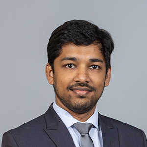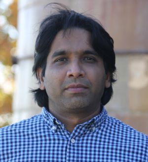
Chandi Witharanaمشاهده پروفایل
استادیار
Dr. Chandi Witharana is an Assistant Professor in the Department of Natural Resources and the Environment at the University of Connecticut's College of Agriculture, Health, and Natural Resources. Previously, they served as Assistant Professor in Residence (2020-2023), Assistant Research Professor (2018-2020), and Visiting Assistant Professor (2016-2018) at UConn. Their academic journey includes a Postdoctoral Research Fellowship at SUNY Stony Brook (2014-2016) and graduate work at UConn where they earned their PhD in Remote Sensing in 2014. Dr. Witharana teaches courses in high-resolution remote sensing, geospatial analysis, and introductory geomatics. Dr. Witharana's educational background includes: PhD in Remote Sensing, University of Connecticut (2014) MS in GIScience, University of Connecticut (2009) BS in Geology, University of Peradeniya, Sri Lanka (2005) Dr. Witharana's research focuses on methodological developments for analyzing large volumes of multi-modal remote sensing data for environmental, industrial, and agricultural applications, with special emphasis on Arctic Permafrost remote sensing. They harness sub-meter resolution satellite imagery, AI, and high-performance computing resources to map permafrost landforms, monitor thaw disturbances, and assess risks to human-built infrastructure in the Arctic. Their work extends beyond research to include innovative applications of remote sensing in K-12 STEM education through imagery-enabled lesson plans. Dr. Witharana aims to use cutting-edge geospatial technologies as transformative learning instruments to help students understand complex human-environment interactions. The recent publications of Dr. Witharana demonstrate a strong focus on applying advanced AI and remote sensing techniques to Arctic permafrost monitoring and infrastructure risk assessment. Their work increasingly incorporates vision transformers and deep learning models for more accurate detection of permafrost features and unhealthy tree crowns. There's a clear trend toward developing scalable geospatial datasets with standardized approaches, particularly for retrogressive thaw slumps. Many publications address practical applications including power outage risk modeling, forest management for storm resistance, and infrastructure monitoring in changing Arctic landscapes. The research shows growing interdisciplinary collaboration across environmental science, computer science, and engineering domains. Dr. Witharana has secured significant research funding as PI or Co-PI on numerous grants totaling over $14 million, including: NSF's Permafrost Discovery Gateway project ($3,000,000) Google-funded research on tracking Arctic permafrost thaw ($5,000,000) NSF's role of capillaries in the Arctic hydrologic system ($2,000,000) USDA projects on drone imaging for nutrient deficiency detection ($200,000) Eversource Energy projects on tree risk modeling ($275,000) As an educator, Dr. Witharana mentors students through research projects funded by these grants and teaches specialized courses in remote sensing and geospatial analysis. They serve as Director of the Remote Sensing & Geospatial Data Analytics Graduate Program and as a Steering Committee Member for UConn's Data Science Masters Program. Dr. Witharana is also an Editorial Advisory Board Member for the ISPRS Journal of Photogrammetry and Remote Sensing and regularly reviews proposals for NSF and other agencies. Their research group leverages high-performance computing resources including Frontera/NSF and XSEDE allocations for large-scale geospatial analysis. Dr. Witharana leads research teams focused on Arctic permafrost monitoring and geospatial AI applications, collaborating with institutions including University of Alaska-Fairbanks, Woodwell Climate Research Center, and UC Santa Barbara. Their work involves developing advanced workflows for processing satellite imagery and implementing machine learning models for environmental monitoring. The research group actively engages in developing educational applications of remote sensing technology, particularly for K-12 STEM education.