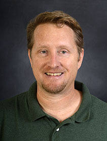
John Derek Morgan is an Associate Professor in the Department of Earth and Environmental Sciences at the University of West Florida, within the Hal Marcus College of Science and Engineering. He serves as the primary faculty for the online Master of Science in GIS Administration program, contributing significantly to geospatial education and research. His work bridges urban environmental geography, GIS, cartography, and public policy. PhD in Geography, Florida State University MS in Management Information Systems, University of Central Florida BA in Economics (with Computer Science minor), University of Central Florida Dr. Morgan's research centers on the application of advanced geospatial methodologies to urban and environmental challenges. His work spans participatory mapping, crime mapping using time-geographic models, hazard modeling, land use planning, and cartographic visualization. He emphasizes user-centered design in Web GIS and explores how spatial tools can promote safer communities and equitable decision-making. His projects often integrate satellite imagery, social vulnerability indices, and community input to inform resilience and policy. The recent publications reflect a strong trend in applying GIS to social and environmental issues, including disaster response, urban park safety, illegal logging detection using GeoAI, and wildfire monitoring. His work combines technical innovation in geovisualization with real-world applications in public safety, environmental justice, and urban sustainability. Scientific Awards: NSF Doctoral Dissertation Research Grant #0927850 Dr. Morgan advises graduate students in the MS GIS program and has been involved in significant research grants, including the Florida Sea Grant 2024 project focused on training GIS graduates for coastal resilience. His collaborations span interdisciplinary teams, including environmental scientists, urban planners, and computer scientists. He has also contributed foundational content to the UCGIS Geographic Information Science & Technology Body of Knowledge. He leads research initiatives involving Web GIS development, hazard modeling post-hurricanes, and participatory mapping for community engagement. His lab work includes the use of satellite imagery, Bayesian networks for infrastructure failure, and deep learning for environmental monitoring. Future work continues to focus on transboundary viewshed changes, GeoAI applications, and improving spatial tools for public decision-making.