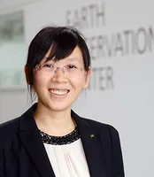
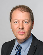
Zahra Gharineiat is an Associate Professor at the University of Southern Queensland , affiliated with the School of Surveying and Built Environment . She has over 8 years of tertiary teaching experience and 11 years of administrative responsibilities. Bachelor of Surveying (BSurv), University of Tabriz Master of Engineering Management (MEngMgt), University of Melbourne PhD, University of Newcastle Research Interests : Zahra specializes in Geomatic Engineering and Machine Learning , with a focus on applications like Unmanned Aerial Vehicles (UAVs) , LiDAR , Digital Twins , and Remote Sensing . Her work spans Earth Science Observations , Satellite altimetry , and Geodetic data capturing , integrating Computational Modelling and Geoinformatics for innovative solutions. Professional Affiliations : She is a member of the Surveying and Spatial Sciences Institute (SSSI) and the International Union of Geodesy and Geophysics (IUGG) . Her research affiliations include the Centre for Future Materials (CFM) , Institute for Advanced Engineering and Space Sciences (IAESS) , and Centre for Astrophysics (CA) .
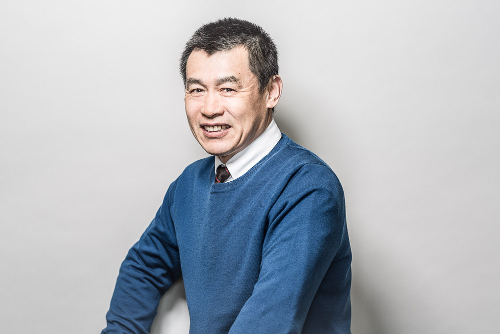
Xiaoxiang Zhu is a Professor for Data Science in Earth Observation at the Technical University of Munich (TUM) and serves as the Director of the International AI Future Lab - AI4EO. She is also on the Board of Directors of the Munich Data Science Institute (MDSI) and has held various leadership positions in research institutions including as Spokesperson for Helmholtz AI Research Field "Aeronautics, Space and Transport" (MASTr). Her educational background includes a doctorate (Dr.-Ing.) and habilitation from TUM. She has held positions as Private Dozent at TUM (2013-2015), TUM Junior Fellow (2013-2015), and Research Group Leader for "SparsEO" at Munich Aerospace (2011-2016). Professor Zhu's research focuses on the intersection of remote sensing, artificial intelligence, and data science. Her work primarily addresses global urban mapping, sustainable development goals, and climate change monitoring through Earth observation technologies. She develops advanced signal processing techniques and machine learning algorithms specifically tailored for satellite imagery and geospatial data analysis. Her research has significant applications in urban planning, environmental monitoring, and disaster management. Her team has pioneered approaches that combine synthetic aperture radar (SAR) with deep learning for improved Earth observation capabilities. Professor Zhu has received numerous prestigious awards including being named an IEEE Fellow (2021), receiving the Geodesy Award of the Nico Rüpke Foundation (2020), and being awarded an ERC Proof of Concept Grant (2020, 2022). She is also a Fellow of the Academia Europaea (2024) and AAIA Fellow (2024). Her publication record includes highly cited works such as "Deep Learning in Remote Sensing: A Comprehensive Review and List of Resources" (2017). She leads a substantial research team comprising numerous PhD students and postdoctoral researchers working on various projects including Horizon Europe - ThinkingEarth, EarthCare, and AI4TWINNING. Her research group, the Chair of Data Science in Earth Observation, is actively involved in multiple large-scale European and German research initiatives focused on Earth observation and AI applications.
Dr. Jianguo Wang is a Professor in the Department of Earth and Space Science Engineering at York University's Lassonde School of Engineering. He has been a faculty member since 2006 and is a founding member of the Lassonde School. With over 35 years of academic and industrial experience, he specializes in multisensor integration, GNSS technology, and precision engineering surveying. He holds a Dr.-Ing. in Geomatics Engineering from Universität der Bundeswehr München, Germany, alongside Bachelor’s and Master’s degrees from Wuhan Technical University of Surveying and Mapping (WTUSM). His research focuses on advanced data processing methodologies, including Kalman filtering, error analysis, and LiDAR systems. He has authored/co-authored over 60 publications, including textbooks like Error Theory and Foundation of Surveying Adjustment and Foundation of Geodesy . He is a Fellow of Engineers Canada and licensed as a Professional Engineer in Ontario. Education: Dr.-Ing., Geomatics Engineering, Universität der Bundeswehr München (Germany) M.Sc., Surveying Engineering, Wuhan Technical University of Surveying and Mapping B.Sc., Surveying Engineering, Wuhan Technical University of Surveying and Mapping Dr. Wang teaches courses such as Advanced Optimization and Applications , GNSS , and Global Geophysics and Geodesy . He leads the Earth Observation Laboratory (PSE 432), focusing on multisensor integration for navigation and positioning. His work explores innovative solutions for sensor calibration, data fusion, and geospatial applications. Grants & Labs: Active in lab-based research with collaborators like Baoxin Hu, his laboratory integrates GNSS, IMUs, LiDAR, and cameras for precision navigation. His recent work addresses challenges in sensor error calibration, LiDAR point cloud accuracy, and Kalman filter enhancements.
Prof. Matt Pritchard is a Professor in Earth & Atmospheric Sciences at Cornell University, based at Snee Hall. His research focuses on volcanology, geodesy, and remote sensing, with a particular emphasis on using satellite data to monitor volcanic activity, deformation, and glacial interactions. He leads studies on global volcanic systems, including Indonesia's Semeru and Raung volcanoes, Chile's Cordón Caulle, and Bolivia's Uturuncu, applying techniques like InSAR, SAR, and thermal imaging. Key research interests include volcanic eruption dynamics, magma-hydrothermal systems, and the integration of multi-sensor datasets. He has contributed to developing tools like Hotspotter for automated volcanic thermal feature detection and has explored planetary volcanism (e.g., Venus). His work bridges geophysics, glaciology, and computational methods, addressing both Earth and extraterrestrial systems. Prof. Pritchard has received recognition such as the William Bowie Lecture (2022, 2023). His projects often involve international collaborations, including the CEOS Volcano Demonstrator initiative and the EarthDEM/ArcitcDEM projects. He also engages in geothermal energy research and seismic monitoring in Ithaca, NY.
Filip Biljecki is an Assistant Professor jointly appointed at the Department of Architecture within the College of Design and Engineering and the Department of Real Estate at the NUS Business School, National University of Singapore. He is the founder and principal investigator of the NUS Urban Analytics Lab and was awarded the prestigious NUS Presidential Young Professorship in 2020. With over 150 peer-reviewed publications, his research bridges geomatic engineering, geospatial technologies, and urban data science to advance digital twins and data-driven urban planning. Dr. Biljecki's educational background includes: PhD in 3D GIS (cum laude), Delft University of Technology, Netherlands (2017) MSc in Geomatics, Delft University of Technology, Netherlands (2010) BSc in Geodesy and Geoinformatics, University of Zagreb, Croatia (2008) His research interests focus on emerging urban data sources, particularly urban imagery, and their application in 3D city modeling, digital twins, and GeoAI. He explores how crowdsourcing and open science can inform cutting-edge techniques for urban sensing and analytics at city-scale. His work significantly contributes to establishing smart cities through innovative methods that integrate recent advancements in computer science, geomatics, and urban data science. Analysis of his recent publications reveals a strong focus on street view imagery applications for urban analytics, digital twin development, and geospatial AI. His research spans multiple domains including urban morphology, environmental assessment, public health applications, and urban comfort analysis. The interdisciplinary nature of his work is evident in collaborations with researchers from diverse fields, producing impactful studies that address complex urban challenges through innovative methodological approaches. His notable scientific achievements include: Annual Teaching Excellence Award (ATEA), 2025 College Educator Award AY2023/2024, 2025 Urban Informatics Paper of the Year Award, 2023 Top 2% scientists worldwide (Stanford University), 2021 Presidential Young Professorship (NUS), 2020 As an educator, Dr. Biljecki has supervised dozens of students leading to publications in leading journals and placements at top universities and organizations. He has delivered talks at over 120 universities and organizations worldwide including MIT, Stanford, Harvard, and ETH Zurich. His research is supported through various grants and affiliations including his role as Principal Investigator at the Future Cities Lab Global at the Singapore-ETH Centre. The NUS Urban Analytics Lab, which he established, brings together scholars from diverse disciplines to drive research on making cities smarter and more data-driven. The lab has developed innovative tools like ZenSVI for street view imagery analysis and has produced influential research on urban digital twins, urban morphology, and GeoAI applications. Through his leadership, the lab continues to pioneer methods that advance data-driven urban planning and smart city development.
David Al-Attar is a Professor at the University of Cambridge's Department of Earth Sciences, actively involved in theoretical and computational geophysics research. He serves as a supervisor within the Cambridge NERC Doctoral Landscape Awards (Training Partnerships) program, particularly in the CREATES initiative focusing on climate and environmental science. Education: While specific educational details aren't provided in the text, his extensive publication record and professorial position at Cambridge indicate advanced training in geophysics and applied mathematics. Research Interests: Professor Al-Attar's work spans several interconnected areas within geophysics. His primary focus includes theoretical and computational problems in geophysics, with particular emphasis on continuum mechanics as applied to Earth systems. He develops new physical and mathematical theories for understanding Earth processes, including rigorous function space methods for inverse problems and uncertainty quantification. His sea level change research aims to constrain ice sheet evolution during the last glacial period to better understand modern contributions to sea level rise. Additionally, he investigates solid Earth dynamics including seismic free oscillations, body tides, and Earth rotation, contributing to our understanding of deep Earth structure and mantle dynamics. Research Themes: His publications demonstrate expertise in adjoint methods, glacial isostatic adjustment, mantle viscosity, planetary seismology, and computational methods for geophysical problems. Recent work emphasizes 3-D Earth modeling, sensitivity analysis, and the integration of satellite observations with theoretical models. Current Projects: Potential projects for students include inverse problems related to deglacial sea level change with focus on uncertainty quantification, modern sea level monitoring using satellite data, and solid Earth dynamics particularly regarding outer core viscosity in tidal and rotational dynamics. Contact: He can be reached at da380@cam.ac.uk for research inquiries and collaboration opportunities.
Karl Ulrich Schreiber is an Adjunct Professor at the Department of Physics and Astronomy, University of Canterbury, New Zealand, and an apl. Professor at the Institute for Astronomical and Physical Geodesy at the Technical University of Munich (TUM). He is a scientist at the Geodetic Observatory Wettzell, jointly operated by TUM and the Bundesamt für Kartographie und Geodäsie (BKG). His work bridges fundamental physics and geodetic applications, with leadership roles in major international projects including ESA’s MAGIC/Science, QSG4EMT, and Baltic+ Theme 5, as well as DFG Research Units NEROGRAV and UPLIFT. His research focuses on Space Geodesy , Satellite and Lunar Laser Ranging , and Ring Laser Technology . He has pioneered the use of large ring laser gyroscopes for measuring Earth's rotation, polar motion, and seismic rotations. His work enables high-precision monitoring of geophysical phenomena such as Earth tides, Chandler wobble, and rotational ground motions from earthquakes. He is a key contributor to multi-technique co-location studies (VLBI, SLR, GNSS) and time transfer experiments, advancing the Global Geodetic Observing System (GGOS). His recent publications show a strong trend in developing and applying large-scale ring laser arrays (e.g., ROMY) for geophysical sensing, photon-counting laser ranging for space debris and satellite tracking, and optical timing systems for synchronization across geodetic networks. These efforts span disciplines including geodesy, seismology, quantum optics, and fundamental physics. Scientific contributions include: Development of the Wettzell Large Ring Laser (G-ring) for continuous Earth rotation monitoring. First direct measurements of Earth's diurnal polar motion and Chandler wobble using ring lasers. Pioneering work in rotational seismology, validating ring laser data against seismic arrays. Contributions to lunar laser ranging and its role in reference frame realization. Leadership in ESA and DFG projects advancing space geodesy and inertial sensing. He advises doctoral and master’s students within the DFG Research Training Group UPLIFT and collaborates with international institutions on instrumentation and data analysis. His lab at Wettzell hosts advanced laser ranging and ring laser systems, serving as a fundamental geodetic observatory. Future work includes enhancing clock ties for global geodesy, expanding multi-component rotation sensing, and advancing space-based geodetic technologies.
Prof. Roland Pail is a full Professor of Astronomical and Physical Geodesy at the Technical University of Munich (TUM). He leads the Chair of Astronomical and Physical Geodesy, part of the TUM School of Engineering and Design. His research focuses on physical and numerical geodesy, global/regional gravity field modeling, and satellite gravity missions like GOCE, GRACE, and future initiatives like MAGIC. He has held leadership roles, including President of IAG Commission 2 (2015–2019) and Vice Dean of TUM's Department of Aerospace and Geodesy. Pail earned his doctorate (sub auspiciis praesidentis) from TU Graz (1999) and habilitation in 2002. He is a Fellow of the International Association of Geodesy and has received numerous awards for his contributions to geodesy. His work integrates satellite data with geophysical modeling to monitor mass transport processes (e.g., ocean circulation, ice melt) and Earth's interior dynamics. He collaborates internationally on missions such as the DFG Research Training Group UPLIFT and the MAGIC constellation. Key publications include gravity field models (e.g., XGM2016, GOCO06s) and studies on future mission design, stochastic modeling, and climate monitoring. Pail’s scientific awards include the IAG Fellowship (2011), Young Authors Award (2006), and the Allmer-Löschner Prize (2000). His research also addresses quantum sensor applications in satellite gravimetry and the development of next-generation gravity field retrieval techniques.
Dr. Penina Axelrad is a University of Colorado Distinguished Professor and Joseph T. Negler Professor of Aerospace Engineering Sciences at the University of Colorado Boulder. She has held academic roles since 1992, serving as Department Chair from 2012–2017. A member of the National Academy of Engineering since 2019, her research focuses on GNSS technology, satellite navigation, and remote sensing applications. She has authored over 223 publications and secured $17.5M in research grants. Education: Ph.D., Aeronautics and Astronautics, Stanford University, 1991 S.M., Aeronautical and Astronautical Engineering, MIT, 1986 S.B., Aeronautical Engineering (Avionics Option), MIT, 1985 Research Interests: Global Navigation Satellite Systems (GNSS), multipath mitigation, GNSS reflectometry, orbital dynamics, and quantum sensing for Earth science. Her work bridges astrodynamics, satellite navigation, and environmental monitoring. Awards: Member, National Academy of Engineering (2019) Women In Aerospace Educator Award (2016) Institute of Navigation Samuel Burka Award (2012) AIAA Summerfield Book Award (2011) Advising & Grants: Advised numerous students (no names listed) and led major grants including NASA Quantum Pathways Institute and Sentinel-6 orbit determination projects. Active in Institute of Navigation leadership roles. Labs/Teams: Colorado Center for Astrodynamics Research (CCAR), Quantum Pathways Institute, and collaborative efforts on CubeSat atomic clock experiments.
Patrick Henkel is a Professor at the Technical University of Munich (TUM) affiliated with the TUM School of Engineering and Design and the Chair of Communication and Navigation. He holds a professorship in Satellite Geodesy under Prof. Hugentobler. His research focuses on advanced positioning technologies, including Global Navigation Satellite Systems (GNSS), autonomous systems, and sensor fusion. He develops algorithms for precise positioning in challenging environments such as urban areas, alpine regions, and indoor spaces. His work also extends to environmental applications, such as snow hydrology and climate monitoring using GNSS signals. Henkel’s contributions include innovations in real-time kinematic (RTK) positioning, UAV navigation, and multi-sensor integration for robotics and autonomous vehicles. His research is supported by collaborations with industry and academic partners, addressing both theoretical and applied challenges in geodesy and navigation. Henkel leads projects on GNSS signal processing, satellite-based environmental monitoring, and autonomous driving technologies. He has contributed to the Galileo HAS service and developed methodologies for snow water equivalent estimation using multi-frequency GNSS signals. His expertise spans hardware-software co-design for navigation systems and algorithm optimization for high-precision positioning in dynamic environments. He actively publishes in top-tier journals and conferences, with a focus on advancing the reliability and accuracy of navigation systems across various domains. His advising and grants include funding for projects on sensor fusion, UAV-based measurements, and satellite receiver development. He collaborates with teams at TUM’s Navigation Lab and the Professur für Satellitengeodäsie, contributing to both academic and industrial applications. His work on low-bandwidth RTK dissemination and laser-tracker verified UAV positioning highlights his commitment to bridging theoretical advancements with real-world implementation.
State University of New York at BuffaloUnited States
Sophie Nowicki is an Empire Innovation Professor at the University at Buffalo's RENEW Institute, Department of Earth Sciences within the College of Arts and Sciences. She serves as Director of the Center for Geological and Climate Hazards. Her research focuses on ice sheet and sea level dynamics, using a combination of applied mathematics, remote sensing observations, and numerical modeling to understand how ice sheets interact with the global climate system. Empire Innovation Professor, University at Buffalo Director, Center for Geological and Climate Hazards Member of UB RENEW Institute Department of Earth Sciences, College of Arts and Sciences Dr. Nowicki's research interests center on glaciology, ice-sheet modeling, climate modeling, and sea level change. She studies how ice sheets interact with the global climate system and affect sea level change using a spectrum of models from idealized to large-scale continental ice sheet models. Her work is integral to climate models that provide forcing for ice sheet models, particularly through the Ice Sheet Model Intercomparison Project for CMIP6 (ISMIP6). She teaches courses including Introduction to Computational Earth Science, Environmental Remote Sensing, and various graduate research courses. Her recent publications reveal a strong focus on Antarctic and Greenland ice sheet modeling, sea level rise projections, and the development of advanced modeling frameworks. The research spans from fundamental glaciological processes to large-scale climate impacts, with a particular emphasis on quantifying uncertainties in ice sheet contributions to sea level rise. Her work frequently appears in top journals including Nature, The Cryosphere, and Geophysical Research Letters, and she has made significant contributions to the IPCC Sixth Assessment Report. Empire Innovation Professor recognition Lead contributor to IPCC AR6 Working Group I Principal Investigator for ISMIP6 (Ice Sheet Model Intercomparison Project) Dr. Nowicki actively mentors graduate students and postdoctoral researchers, with current advisees working on various aspects of ice sheet dynamics and sea level change. Her research is supported by multiple grants from NASA, NSF, and other agencies focused on improving our understanding and projections of ice sheet behavior in a warming climate. She leads the development of critical tools like the Cryosphere Model Comparison Tool (CmCt) and has been instrumental in establishing community standards for ice sheet modeling. She is involved with several research groups and initiatives including the Ice Sheet & Sea Level Lab at UB, which focuses on understanding how ice sheets will evolve in a warming world and what this means for future sea levels. Her team combines observational data with sophisticated modeling approaches to address key questions about ice-ocean and ice-atmosphere interactions that drive ice sheet changes.
Dr. Gaël Kermarrec is a researcher at the Boundary Layer Meteorology Group , part of the Institute of Meteorology and Climatology within the Faculty of Mathematics and Physics at Leibniz University Hannover . His work focuses on atmospheric turbulence, GNSS applications, and remote sensing for environmental monitoring. Boundary layer meteorology Turbulence theory GNSS signal processing Terrestrial laser scanning Climate change impacts Geodetic time series analysis His research integrates advanced mathematical models like LR B-splines and Matérn covariance with large eddy simulations to study: Atmospheric turbulence effects on optical/GNSS signals Hydrospheric mass loading Deformation analysis of terrain/port infrastructure Climatic sea-level changes Machine learning for remote sensing The 15 most recent articles (2025-2023) demonstrate his focus on: GNSS-based turbulence detection AI-enhanced climate mapping Advanced surface approximation techniques Multi-sensor data fusion Stochastic modeling of geodetic observations Environmental impacts on optical measurements He has developed tools like the Klimascanner QGIS plugin for urban climate resilience and contributes to: Understanding atmospheric scale lengths Improving TLS/GNSS deformation monitoring Analyzing hydrospheric changes Wavefront modeling Ionospheric corrections
Professor Walter Timo de Vries is a faculty member at the Technical University of Munich (TUM) , holding the Chair of Land Management and Land Development within the Department of Aerospace and Geodesy, TUM School of Engineering and Design . His research focuses on intelligent and responsible land management , urban and rural development , spatial justice , and the development of a Human Geodesy framework. A graduate of TU Delft (1988) and Rotterdam (PhD), he has led international projects across Asia, Africa, and South America. At TUM, he directs the Master's and PhD Programs in Land Management , serves as Dean of Geodesy , and leads TUM.Africa . Member of the German Geodetic Commission Member of the Bavarian Academy for Rural Development Academic Coordinator of TUM SEED Center Research Interests span responsible land governance , land tenure security , land consolidation , and geospatial methods for sustainable development. His recent work examines the Water-Energy-Food Nexus and digital twins in collaborative planning. He has supervised over 20 PhD and Master’s students on topics like spatial justice , nomic pastoral tenure , and smart land use . Publications address blockchain in land administration , spatial inequalities , and land policy reforms across global contexts.
Byungwoon Park is a Professor in the Department of Aerospace Engineering at Sejong University, specializing in Global Navigation Satellite Systems (GNSS) and precision positioning technologies. His research focuses on advancing navigation systems through innovations in Real Time Kinematics (RTK), smartphone sensor integration, and aviation applications. Professor Park's primary research interests include Global Navigation Satellite System (GNSS), Real Time Kinematics (RTK), smartphone sensor integration, aviation navigation, and urban positioning systems. His work has significantly contributed to improving positioning accuracy in challenging environments such as urban canyons and deep urban areas. He has developed techniques for achieving sub-meter accuracy in smartphone positioning and has made substantial contributions to international GNSS standardization efforts. His recent research has focused on multi-constellation GNSS integration, lunar navigation systems, tropospheric error modeling using LEO satellites, and advanced smartphone positioning techniques. Professor Park has successfully implemented methods to achieve 1m horizontal accuracy in Android smartphone positioning using SFMC SBAS and has developed Compact Network RTK technology that reduces bandwidth requirements for GPS correction in 100x100 km areas to 700bps. 'Google Smartphone Decimeter Challenge 2022' Gold Medal Third Place Winner of the Smartphone Decimeter Challenge (2024) Professor Park leads the Navigation Systems Laboratory at Sejong University, which conducts research on various navigation systems including GNSS. His work spans theoretical research, practical implementation, and industry collaboration, with numerous publications in prestigious journals and conference proceedings. He has advised multiple graduate students and has been actively involved in both domestic and international research collaborations focused on advancing navigation technologies.
Prof. Jürgen Müller is a Full Professor at the Institute of Geodesy, Leibniz University Hannover, leading research in physical geodesy, satellite gravimetry, and relativistic geodesy. He holds positions as Executive Director of the Institute and contributes to global geodetic initiatives like the Global Geodetic Observing System (GGOS). His work focuses on advancing quantum technologies for Earth observation, including cold atom interferometry and optical clocks, to enhance gravity field measurements and test fundamental physics principles. Research Interests: Müller's expertise spans gravimetric Earth observation, lunar laser ranging (LLR), relativistic geodesy, and the application of quantum sensors in space missions. His team explores novel sensor concepts for future satellite gravimetry, such as hybrid accelerometers and gravity gradiometry systems, addressing challenges in climate monitoring and Earth system dynamics. Publications Overview: His recent work emphasizes quantum accelerometers for satellite missions, deployable solar panels for GRACE-like satellites, and LLR-based tests of general relativity. Key contributions include improving Earth rotation parameter estimation and exploring optical clock networks for height system unification. Grants & Collaborations: Müller collaborates on international projects like the CARIOQA quantum pathfinder mission and the GENESIS space observatory. He leads teams in simulating quantum sensor performance and analyzing LLR data for lunar and Earth dynamics studies. Labs/Teams: As head of the Institute of Geodesy, he oversees research groups working on quantum gravimetry, space geodesy, and geodetic reference systems, leveraging facilities like the 10-meter atom interferometer at Hannover.