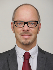
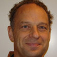
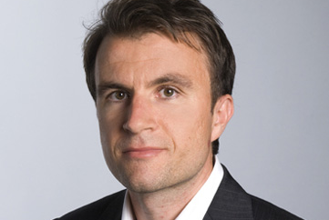
Roman Schnabel is a Professor of Experimental Physics at the University of Hamburg , affiliated with the Institute for Laser Physics under the Faculty of Mathematics, Informatics and Natural Sciences. He leads cutting-edge research in quantum optics, gravitational wave detection, and quantum technologies. Education : PhD in Physics (1999, Leibniz Universität Hannover); Physics degree (1988–1994, Leibniz Universität Hannover) Awards : QCMC 2018 Award, Gruber Cosmology Prize 2016 (LIGO team), Special Breakthrough Prize in Fundamental Physics 2016 (LIGO team), Joseph F. Keithley Award 2012 His recent work explores high-frequency gravitational wave observatories , entanglement generation , and quantum-enhanced sensing . He holds patents for gas sensors and optical surface imaging technologies. Schnabel co-founded the start-up Noisy Labs in 2023 and served as Director of Outreach & Transfer for the Cluster of Excellence 'Quantum Universe' (2019–2022).
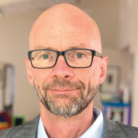
Peter Shearer is a Professor of Geophysics at the Institute of Geophysics and Planetary Physics , affiliated with the Scripps Institution of Oceanography at the University of California, San Diego. His research focuses on observational seismology, mantle discontinuities, earthquake location methods, source properties, and seismicity patterns. Education: B.S. in Geology and Geophysics, Yale University (1978) Ph.D. in Geophysics, UCSD Scripps Institution (1986) Research Interests Shearer's work uses large seismic datasets to study Earth's interior structure, particularly mantle transition zones, lithospheric discontinuities, and earthquake triggering mechanisms. His methods include waveform cross-correlation relocation, SS precursor analysis, and seismic wave scattering studies. Scientific Contributions His publications span 40+ years, with recent works analyzing aftershock migration, mantle discontinuities, and fault weakening. Key themes include Global mantle imaging using teleseismic data High-resolution fault zone seismicity Deep Earth structure from scattered waves Scientific Awards AGU Fellow (1999) SIO Outstanding Teaching Award (2003) Lehmann Medal (AGU, 2020) National Academy of Sciences member (2009)
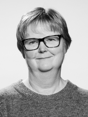
Anne H Schistad Solberg is a Professor in the Department of Informatics at the University of Oslo's Faculty of Mathematics and Natural Sciences. She leads research in digital signal processing and image analysis, with a focus on machine learning applications across multiple domains. As co-director of SFI Visual Intelligence, she oversees research on interpretable deep learning models, uncertainty quantification, contextual learning, and self-supervised learning approaches. Her research spans medical imaging (particularly cardiovascular ultrasound), environmental monitoring using satellite imagery, and seabed mapping with sonar technology. Professor Solberg's work demonstrates a consistent trajectory from foundational signal processing techniques to cutting-edge deep learning applications. Her recent publications show increasing specialization in medical image analysis, particularly in echocardiography enhancement and cardiac structure segmentation, while maintaining strong contributions to remote sensing and geophysical applications. She teaches several popular courses including IN2070, IN3310, and IN5400 (Machine Learning for Image Analysis), which is noted as the most popular master's/PhD course on deep learning at the University of Oslo. Professor Solberg serves as principal investigator for the Intelligent Cardiovascular Ultrasound Scanner (INCUS) project, collaborating with GE Vingmed Ultrasound to develop AI-enhanced cardiac imaging systems that improve diagnostic accuracy and productivity in echocardiography. Co-director of SFI Visual Intelligence research center Principal Investigator for the INCUS project (Intelligent Cardiovascular Ultrasound Scanner) Member of the Digital Signal Processing and Image Analysis (DSB) research group Member of the Strategic Research Initiative: Multimodal Medical Imaging and Image Analysis (MEDIMA) Her research group develops algorithms that address real-world challenges in medical diagnostics and environmental monitoring, with a particular emphasis on making deep learning models more interpretable and reliable for critical applications. The INCUS project, funded through User-driven Research-based Innovation (BIA), aims to reduce the time wasted during cardiac ultrasound examinations by implementing intelligent algorithms that learn from expert users and historical data.
Xiaozhuo Wei is a Postdoctoral Scholar Research Associate in Geophysics at the California Institute of Technology (Caltech), affiliated with the Division of Geological and Planetary Sciences and the Department of Geophysics. His research focuses on geophysical monitoring of volcanic and tectonic processes, employing advanced techniques like fiber-optic geodesy, seismic tomography, and machine learning. He specializes in studying seismicity associated with volcanic eruptions, magma dynamics, and slow slip events in subduction zones, with significant contributions to understanding the 2018 Kīlauea eruption and Iceland's Reykjanes Peninsula eruptions. Key affiliations: Caltech’s Geophysics Department, Division of Geological and Planetary Sciences Research tools: Distributed Acoustic Sensing (DAS), ambient noise tomography, and offshore seismic arrays Field areas: Kīlauea Volcano (Hawaii), Iceland’s Reykjanes Peninsula, and Alaska’s subduction zones Wei’s work integrates multidisciplinary approaches to investigate crustal deformation, magma storage, and seismic hazard assessment. He has contributed to improving earthquake catalogs using offshore data and analyzing post-eruption seismicity patterns. His recent studies explore the spatial-temporal evolution of volcanic systems and the mechanics of dike intrusions using high-resolution geophysical methods. His research emphasizes real-time monitoring of volcanic processes and has advanced understanding of how seismic velocity changes reflect magma movement. Collaborations involve deploying ocean-bottom seismometers and machine learning algorithms to detect slow slip events in subduction zones, enhancing earthquake prediction capabilities. Notable projects include the 2023–2024 Reykjanes eruptions study and the analysis of the 2018 Kīlauea eruption’s seismic aftermath. His work bridges observational seismology with theoretical models of volcanic and tectonic systems, contributing to both fundamental science and practical hazard mitigation strategies.
Biondo Biondi is the Barney and Estelle Morris Professor of Geophysics at Stanford University, affiliated with the School of Earth Sciences. He leads the Stanford Exploration Project and holds roles such as Chair of the Geophysics Department (2019–2022) and Director of the Stanford Earth Imaging Project (1998–Present). His research focuses on seismic imaging algorithms, computational geophysics, and fiber-optic sensing technologies. He earned his Ph.D. (1990), M.S. (1987) in Geophysics from Stanford, and M.Sc. in Electrical Engineering from Politecnico di Milano (1984). Dr. Biondi's research emphasizes improving seismic data imaging through advanced computational methods. He pioneered urban seismic monitoring using preexisting telecommunication fibers, enabling cost-effective subsurface analysis. His work integrates machine learning and high-performance computing to address challenges in reservoir imaging, CO2 monitoring, and infrastructure health. Key research areas include distributed acoustic sensing (DAS), ambient noise tomography, and inverse theory applications. He has authored over 180 publications and received awards like the SEG Honorable Mention (2019, 2016, 2009) and the Distinguished Instructor Short Course (2007). His teaching includes courses like 3-D Seismic Imaging and Reflection Seismology, and he advises graduate students in geophysics and computational science. Collaborations span industry (e.g., Schlumberger, Saudi Aramco) and global institutions. Biondi’s administrative contributions include co-directing the Stanford Earth Sciences Algorithms and Architectures Initiative and serving on editorial boards like the SIAM Journal on Imaging Sciences. His lab’s innovations bridge geophysics with emerging technologies, advancing both academia and industry applications in energy, environment, and urban infrastructure.
Prof. Dr. Johan Robertsson is a Full Professor of Applied Geophysics and Head of the Exploration and Environmental Geophysics (EEG) Group at ETH Zürich's Department of Earth and Planetary Sciences. He holds a MSc from Uppsala University (1991) and a PhD in Geophysics from Rice University (1994). Before joining ETH in 2012, he spent 15 years at Schlumberger in R&D roles, leading projects that revolutionized marine seismic data acquisition. His research focuses on wave propagation physics, seismic data inversion, and applications in exploration and environmental geophysics. He pioneered the use of Distributed Acoustic Sensing (DAS) for landslide monitoring and contributed to Mars seismology via the InSight mission. Education: MSc in Engineering Physics, Uppsala University (1991) PhD in Geophysics, Rice University (1994) Research Interests: Seismic wavefield modeling and inversion Planetary seismology (Mars, Moon) Acoustic metamaterials and wave control Environmental geohazard monitoring Marine seismic acquisition techniques His work on the Martian soil properties using InSight data and lunar exploration instrumentation (ALGEP) reflects his cross-disciplinary approach. He holds 90+ patents and has secured prestigious grants like the ERC Advanced Grant. Awards: EAGE Guido Bonarelli Award (2020) ERC Advanced Grant MATRIX (2017) EAGE Conrad Schlumberger Award (2018) Grants & Advising: Led the MATRIX ERC project advancing seismic imaging algorithms Advised over 20 PhD/MS students (names not listed) Secured Schlumberger's largest R&D project in marine seismic sampling His EEG Group operates cutting-edge labs for immersive wave experimentation and planetary geophysical instrumentation. Current initiatives include lunar subsurface exploration and acoustic invisibility experiments.
Professor Asterios Bakolas is affiliated with the Department of Materials Science and Engineering at the School of Chemical Engineering, National Technical University of Athens (NTUA). His research focuses on materials science, cultural heritage conservation, and sustainable construction technologies. Key areas include the development of compatible restoration mortars for historic structures, analysis of traditional building materials, and application of non-destructive testing (NDT) techniques for heritage assessment. He has contributed to projects involving Hagia Sophia, the Parthenon, and Cretan architectural heritage. Research interests span materials characterization, composite materials, and environmental impact assessment of construction materials. Notable work includes studies on polychromy in ancient art, weathering phenomena in historic buildings, and integration of AI for material property prediction. His interdisciplinary approach combines chemistry, civil engineering, and digital humanities to address challenges in conservation and sustainable building practices. No scientific awards are explicitly listed, but his extensive publications reflect recognition in academic circles. Advising and grants are not detailed here, though his involvement in restoration projects implies active collaboration with funding bodies. He is part of the School’s research groups focused on materials science and heritage preservation.
Suzanne M. Carbotte is a Bruce Heezen Lamont Research Professor at the Lamont-Doherty Earth Observatory (LDEO) and affiliated with the Columbia Climate School . She holds a PhD in Marine Geophysics from the University of California, Santa Barbara (1992), an M.Sc. in Geophysics from Queen's University (1986), and an H.B.Sc. in Geology and Physics from the University of Toronto (1982). Marine and Polar Geophysics Department, LDEO Key focus areas: Mid-ocean ridges, subduction zones, seismic imaging, geoinformatics Research Interests : Carbotte specializes in marine geophysical studies of oceanic crust formation, subduction zone dynamics, and cyberinfrastructure development for geoscience data. Her work integrates seismic reflection, sonar mapping, and geoinformatics tools to analyze crustal evolution, magma chamber processes, and sediment dynamics in regions like the East Pacific Rise, Juan de Fuca Ridge, and Hudson Estuary. Scientific Trends : Recent publications highlight 3D/4D seismic imaging of magmatic-hydrothermal systems, sediment consolidation in subduction zones, and data infrastructure innovations. Key subfields include melt sill dynamics, fault distribution in oceanic plates, and mantle temperature gradients. Scientific Awards 2015 AGU Fellow 2010 Ridge2000 Distinguished Lecturer 2008 Birch Lectureship & UCSB Distinguished Alumni Award 2007 Bruce C. Heezen Research Chair 1982 Governor General's Silver Medal Grants & Projects : Her career spans funding for initiatives like the Rolling Deck to Repository (R2R) program, EarthCube Building Blocks , and Integrated Earth Data Applications (IEDA) . She has led 16 marine expeditions, emphasizing seismic studies from ridge to trench.
Gabi Laske is a Professor at the Institute of Geophysics and Planetary Physics (IGPP), Scripps Institution of Oceanography (SIO), University of California, San Diego (UCSD). She is a leading researcher in seismology and geophysics, with a focus on Earth's internal structure, crustal and mantle modeling, and ocean-bottom seismology. Her work has significantly advanced global crustal models, including CRUST5.1, CRUST2.0, and CRUST1.0. Her research interests include seismology, geophysics, Earth's internal structure, surface wave tomography, normal mode analysis, crustal and lithospheric modeling, ocean bottom seismology, mantle plumes, inner core rotation, ambient noise seismology, and earthquake signal processing. She has led major projects such as the Hawaiian PLUME and SWELL experiments, utilizing ocean-bottom seismometers to study mantle dynamics and lithospheric rejuvenation. Her work on inner core differential rotation, particularly with Guy Masters, has been published in top journals like Nature and Science . The 15 most recent publications reflect a strong trend in ocean-bottom seismology, ambient noise analysis, instrument calibration, seismic signal quality, and imaging of crustal and mantle structure. Her work combines observational seismology with advanced signal processing and modeling techniques, often in collaboration with students and international teams. She has made significant contributions to understanding seismic anisotropy, normal modes, and the structure of volcanic and tectonic regions. Funded by NSF (OCE, EAR, CSEDI, MG&G) Collaborative projects with USGS, international institutions Advisor to PhD students, including Adrian Doran Lead developer of DLOPy for OBS orientation Contributor to global reference models (CRUST1.0, LITHO1.0) Gabi Laske has made enduring contributions to geophysics through her development of global crustal models, leadership in major seismic experiments, and mentorship of the next generation of seismologists. Her work continues to shape our understanding of Earth's deep interior and surface processes.
Keith D. Koper is a Professor in the Department of Geology & Geophysics at the University of Utah and serves as Director of the University of Utah Seismograph Stations (UUSS). He is also the editor-in-chief of The Seismic Record . His work integrates academic research with operational seismic monitoring and public safety initiatives across Utah and the Intermountain West. Education: PhD in Geophysics, Washington University, 1998 BA in Math, Geology, and ISP, Northwestern University, 1993 Dr. Koper's research focuses on array seismology, forensic seismology, deep Earth structure (especially the inner core), earthquake rupture imaging, ambient seismic noise, and seismic hazards in the Intermountain West, including mining-induced and urban earthquakes. His work combines observational seismology with advanced signal processing and machine learning techniques to improve detection, discrimination, and imaging capabilities. He has led or contributed to major projects involving the Wasatch Front, Yellowstone, and regional seismic networks. His recent research emphasizes machine learning for earthquake detection, high-resolution relocation of aftershock sequences (e.g., Magna 2020, Bluffdale 2019), microseism generation in lakes, and fine-scale imaging of the Earth's inner core using seismic reflections. His studies often involve interdisciplinary collaboration, particularly with mining engineering and geodesy. Dr. Koper's research has been consistently funded by federal and state agencies, including the National Science Foundation (NSF), U.S. Geological Survey (USGS), Department of Energy (DOE), Air Force Research Laboratory (AFRL), and the Utah Department of Public Safety. His publications reflect a strong trend toward integrating computational methods with traditional seismological analysis to tackle complex problems in both natural and induced seismicity. Scientific Service and Leadership: Editor-in-Chief, The Seismic Record Director, University of Utah Seismograph Stations Secretary, U.S. Air Force Seismic Review Panel Former Chair and Vice-Chair, Utah Seismic Safety Commission Dr. Koper mentors graduate students in seismology and geophysics, including recent advisees Sean Hutchings and Alysha Armstrong. His research group actively engages in both fundamental and applied seismological research, with strong ties to national labs such as Sandia. The group is involved in deploying portable seismic arrays, analyzing large datasets, and developing new algorithms for event detection and classification. The University of Utah Seismograph Stations, under his leadership, plays a critical role in monitoring seismicity in Utah and Yellowstone, producing real-time earthquake information, ShakeMaps, and public outreach materials. The station also contributes to national and international efforts in nuclear test monitoring and volcanic hazard assessment.
William Harbert is a Professor in the Department of Geology and Environmental Science at the University of Pittsburgh, where he leads research in geophysics and subsurface characterization. His work bridges fundamental geophysical principles with practical applications in energy and environmental systems. Education: MS in Exploration Geophysics from Stanford University PhD in Geophysics from Stanford University Research focuses on seismic analysis across multiple scales, from micro-CT to surface seismic. His group specializes in advanced processing of microseismic, reflection seismic, and VSP data to image subsurface structures and understand pore-scale dynamics. Current work integrates deep learning for geophysical object detection and classification, with emphasis on organic shale systems and CO 2 storage monitoring. Key areas include rock physics, microseismicity analysis, and environmental geophysics for water quality assessment. Publication trends show strong emphasis on energy-related geophysics, particularly hydraulic fracturing monitoring, CO 2 sequestration verification, and unconventional reservoir characterization. Recent work increasingly incorporates machine learning techniques and addresses environmental monitoring challenges in subsurface operations. Scientific recognition: DOE ORISE Research Associate Resident Institute Fellow of the NETL-Institute for Advanced Energy Solution Professional engagements include membership on the Altarock Review Board for DOE-funded geothermal projects and prior service on the Scientific Advisory Board for the In Salah CO 2 Injection Project. His research involves extensive collaboration with national laboratories and industry partners on subsurface monitoring technologies. His laboratory group develops advanced geophysical processing techniques for subsurface imaging across multiple scales, with current projects focusing on microseismic monitoring of shale reservoirs and CO 2 storage sites.
Guy G. Drijkoningen is an Associate Professor in Applied Geophysics at Delft University of Technology (TU Delft), Faculty of Civil Engineering and Geosciences. He is actively involved in teaching and research within the Department of Applied Geophysics & Petrophysics. Education: MSc, Delft University of Technology, The Netherlands PhD, Cambridge University, UK Research Focus: His work centers on Seismic Experiments & Modelling , particularly in exploration and shallow-subsurface contexts. Key areas include: Seismic data acquisition on land Continuous seismic monitoring Shallow shear-wave imaging (land and marine) Seismic wave propagation in porous media Current projects leverage advanced sensor networks (e.g., LOFAR), full-waveform inversion for tunnel-boring machines, and novel vibrator technologies. Publications Trend: Recent works (2011–2016) emphasize seismic modeling, inversion techniques, and experimental validation across marine and terrestrial environments. Topics span poroelastic wave theory, ambient-noise interferometry, and innovative seismic source design, reflecting a blend of theoretical and applied geophysics. Scientific Awards: Best-paper award Geophysics 2015 for "A seismic vertical vibrator driven by linear synchronous motors" Professional Memberships & Editorial Roles: Member: Society of Exploration Geophysicists (SEG) Member: European Association of Geoscientists and Engineers (EAGE) Associate Editor: Geophysics Teaching: He teaches undergraduate and graduate courses including Introduction to Geophysics, Reflection Seismology, and specialized PhD-level modules on seismic data analysis.
Niklas Linde is a full professor at the University of Lausanne's Faculty of Geosciences and Environment, leading the Department of Earth Sciences. He holds a PhD in Geophysics from Uppsala University (2005) and has held roles including Assistant Professor (2008), Associate Professor (2013), and Full Professor (2019). His research focuses on transforming geophysical signals into realistic hydrogeological models with rigorous uncertainty quantification. Key areas include probabilistic inversion, Bayesian methods, and geostatistical modeling applied to environmental and subsurface processes. Education: PhD in Geophysics (Uppsala University, 2005), postdoctoral positions at Lawrence Berkeley National Lab (USA), CNRS-CEREGE (France), and ETH Zurich (Switzerland). He joined UNIL in 2008 as an Assistant Professor in Environmental Geophysics. Research interests span geophysical inversion techniques, subsurface heterogeneity characterization, and the integration of geophysical and hydrological data. Current projects emphasize Bayesian approaches for model selection and rare event estimation, supported by grants from the European Commission and Swiss National Science Foundation. Collaborations involve international teams addressing challenges in hydrogeology, rock fracture dynamics, and 4D hydrogeology. Publications reflect advancements in inverse problem solving, stochastic simulation, and machine learning applications. His work bridges theory and practice, with field studies in alpine environments, fractured media, and environmental monitoring. Students under his supervision have explored topics like deep generative networks and Bayesian hydrogeological inversion. Advising: Supervised over a dozen PhD students, including recent works on variational Bayesian methods and geophysical data fusion. Grants include projects on uncertainty quantification and experimental design. Active in scientific societies and editorial roles, contributing to methodological advancements in Earth sciences.
Annakaisa Korja serves as Head of Department and Research Director at the Department of Geosciences and Geography, Faculty of Science, University of Helsinki, while also holding a Docent title in Tectonics. She is affiliated with the Helsinki Institute of Sustainability Science (HELSUS) and supervises the Doctoral Programme in Geosciences. Her leadership extends to multiple major research initiatives including EPOS Finland, where she serves as Principal Investigator. Her educational background includes a Docent qualification in Tectonics from the University of Helsinki (2003) and a Specialist qualification in Management from Liikemiesten kauppaopisto (2010). Prior to her current position, she held research roles at the Geological Survey of Finland, Geological Survey of Canada, and Geological Survey of Sweden. Korja's research centers on geophysics and seismology, with particular expertise in seismic hazard analysis, induced seismicity related to geothermal energy, tectonic evolution of the Fennoscandian Shield, and deep crustal structures. Her work bridges fundamental Earth science with practical applications in energy development and risk management, especially regarding nuclear power plant safety and urban geothermal projects. Her recent publications reveal strong trends in seismic hazard modeling for Northern Europe, moment tensor analysis of induced earthquakes, and the tectonic evolution of Precambrian terrains. She has led significant updates to the Fennoscandian earthquake catalogue and developed 3D velocity models for the Helsinki region. Suomen Leijonan 1. luokan Ritarimerkki SL R1 (Order of the Lion of Finland, First Class) - 2021 As supervisor for the Doctoral Programme in Geosciences and direct thesis advisor (including Tino Mellin's 2022 Bachelor's thesis), Korja mentors the next generation of Earth scientists. Her extensive grant portfolio includes EPOS Finland (Research Council of Finland infrastructure project), ELY-keskuksen tuki (Ministry funding until 2030), and multiple international collaborations. She actively serves on the Research Council of Finland Scientific Council for Natural Sciences and Engineering (2025-2027). Korja manages the Institute of Seismology's EPOS Finland coordination office and leads the OBF seismic network. Her research group collaborates extensively across Nordic countries and Europe, particularly on seismic hazard assessment projects involving nuclear facilities and urban geothermal development.
Brandon Shuck is an Assistant Professor in the Department of Geology & Geophysics at Louisiana State University (LSU), part of the College of Science. His research focuses on solid-earth geophysics, particularly tectonic processes within plate boundaries and mature tectonic settings. He uses active-source seismic reflection and wide-angle ocean-bottom seismometer data to image subsurface lithospheric architecture and integrate interdisciplinary datasets including bathymetry, borehole logs, and geodynamic models. Education: Ph.D. in Geological Sciences (2021) from the University of Texas at Austin; B.S. in Geology (Petroleum Emphasis) and Mathematics (2015) from Western Colorado University. Previously served as a Postdoctoral Fellow at Lamont-Doherty Earth Observatory, Columbia University (2021–2024). Research Interests: Tectonic evolution of the lithosphere at plate boundaries, feedbacks between lithospheric stress and fluid-rock interactions, geologic hazards related to subduction zones, and mantle dynamics during continental breakup. Active projects include studies of subduction initiation in the Tyrrhenian Sea, megathrust fault segmentation in Cascadia, and water content in the Cocos Plate offshore Mexico. Current opportunities include an NSF-funded PhD position (starting Fall 2025) investigating mantle dynamics during early Atlantic seafloor spreading, involving seismic data acquisition on the R/V Langseth. His group emphasizes collaborative, interdisciplinary approaches combining seismic imaging, field geology, and modeling. Awards: None explicitly listed, though his work has been supported through NSF funding and institutional grants. Lab/Team: Directs the LSU Solid-Earth Geophysics Research Group, which integrates geophysical data analysis with field observations to address tectonic questions at multiple scales.