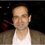
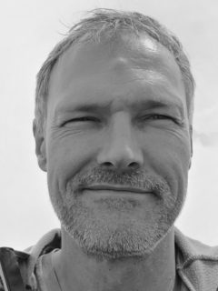
Di Zhang is affiliated with Guangdong Medical College's School of Information Engineering and holds a PhD in Synthetic Aperture Radar Image Interpretation from the University of Hamburg (2022). Their research focuses on interdisciplinary fields such as deep learning, remote sensing, optimization algorithms, and their applications in medical imaging, environmental science, and education technology. They have published extensively in top-tier journals like IEEE Access, IEEE Transactions on Pattern Analysis and Machine Intelligence, and Remote Sensing. Key affiliations: University of Hamburg (PhD), Guangdong Medical College, and others listed in disambiguation entries. Research interests include AI-driven medical diagnostics, SAR image analysis, IoT data management, and educational assessment systems. Recent work emphasizes deep learning frameworks for image processing, algorithm optimization, and multimodal data fusion. Publications span diverse topics such as migraine diagnosis via radiomics, social support in online learning, and robust visual SLAM systems. Their work bridges theoretical advancements with practical applications in healthcare, robotics, and environmental monitoring.
Xiaoxiang Zhu is a Full Professor for Data Science in Earth Observation at Technical University of Munich (TUM) and Director of the International AI Future Lab (AI4EO). She leads interdisciplinary research on signal processing and machine learning applied to Earth observation (EO) data, addressing global challenges like urbanization and climate change. Her work focuses on extracting geoinformation from big EO datasets using innovative AI techniques. Education & Positions: Professor (W3) since 2019, TUM Former Head of EO Data Science Department at German Aerospace Center (DLR) Adjunct Teaching Professor (2013–2015) Research Interests: Deep learning in SAR and multispectral imagery Global urban morphology mapping Uncertainty quantification in AI models EO data fusion and big data analytics Climate change monitoring via satellite data Articles Trends: Her publications emphasize AI-driven solutions for EO challenges, including SAR tomography, benchmark datasets (e.g., So2Sat LCZ42), and uncertainty estimation in neural networks. Over 220 journal papers and 173 conference papers highlight her contributions to geosciences and remote sensing. Awards: IEEE Fellow (2021) ERC Grants (Starting & Proof of Concept) Heinz Maier-Leibnitz-Preis (2015) Member of German and Bavarian Academies of Sciences Advising & Grants: Supervised PhD students (e.g., Mou) Secured €10M+ in research funding Co-led Helmholtz AI Research Field MASTr (2019–2022) Labs & Teams: Founder of AI4EO Lab Co-leader of Munich Data Science Research School (MUDS) Member of ELLIS Society and IEEE committees
David Clausi is a Professor in the Department of Systems Design Engineering at the University of Waterloo. His research focuses on computer vision, image processing, and pattern recognition, with applications in SAR imagery and biomedical imaging. He leads the Vision and Image Processing (VIP) Lab, which explores AI, transparent AI systems, and scalable solutions. He has supervised numerous graduate and undergraduate students, contributing to advancements in medical imaging, SAR sea ice classification, and sports analytics. Awards include Teaching Excellence recognitions and a Research Excellence Award. His work spans publications in remote sensing, medical imaging, and computer vision, with a focus on real-world applications like environmental monitoring and healthcare. Education: Ph.D., P.Eng. (details not explicitly provided, inferred from titles). Research Interests include automated image interpretation, SAR and biomedical imagery analysis, and AI ethics. His lab emphasizes scalable AI and transparent AI explanations. Recent articles address sea ice mapping, hockey analytics, and wildlife detection using advanced machine learning techniques. Awards highlight contributions to research and teaching excellence. Advising spans over 30 students, with notable theses in SAR segmentation, medical image analysis, and computer vision. The VIP Lab collaborates on projects like the AI4Arctic initiative and hockey analytics tools like PuckNet and GoalieNet.
Morteza Karimzadeh is an Assistant Professor of Geography at the University of Colorado Boulder, with courtesy appointments in Computer Science and Information Science. He directs the Geospatial Human-Centered Artificial Intelligence Lab (GeoHAI) and serves as Faculty Fellow at the Institute of Behavioral Science and CU Population Center. His research interests span geospatial data science, machine learning, human-centered visual analytics, and remote sensing applications in public health and environmental science. Key domains include sea ice mapping, chronic disease epidemiology, renewable energy systems, and digital humanities. Publication trends reveal 15 recent works (2023-2025) focused on: Sea ice segmentation & cryospheric monitoring PM2.5 pollution and respiratory health Spatiotemporal disease forecasting Geovisualization tools for dengue and zika Human mobility analysis via wearable devices Energy grid data visualization He actively supervises graduate students including Sepideh Jalayer and Zhongying Wang, and has received research funding from National Science Foundation , NASA , NREL , NIH , and Population Council .
Jia Liang is a researcher at Henan Polytechnic University's School of Electrical Engineering and Automation, with a focus on Machine Learning , Compressed Sensing , and Privacy-Preserving Techniques . His work bridges Computer Science and Signal Processing , particularly in Radar Imaging and Medical Image Analysis . Key Collaborations: Di Xiao, Ying Luo, Qun Zhang, Hui Huang Technical Expertise: Federated Learning, SAR Imaging, Compressive Sensing, Adversarial Learning His research emphasizes secure data processing in IoT and cloud environments, with recent innovations in cross-disciplinary applications like biosignal analysis for cysticercosis diagnosis . Publications span top venues including IEEE Transactions on Aerospace Systems and Remote Sensing . Notable trends include privacy-preserving machine learning for federated systems and 3D radar imaging of rotating targets, alongside medical imaging solutions for chest radiographs and optical coherence tomography .
Konrad Tiefenbacher is a dual tenure-track Assistant Professor at the University of Basel and ETH Zürich, holding positions in the Department of Chemistry (Basel) and the Department of Biosystems Science and Engineering (ETH Zürich). He specializes in applying artificial intelligence and remote sensing to study glaciology, climate science, and environmental systems. His research bridges molecular synthesis (from his PhD in natural product chemistry) with cutting-edge AI-driven Earth observation. Education: Chemical studies at the Technical University of Vienna and University of Texas at Austin, followed by a PhD under Prof. Mulzer (University of Vienna) focusing on total synthesis of bioactive natural products. Postdoctoral research in molecular recognition at The Scripps Research Institute (Prof. Rebek). Became an independent researcher at TU Munich in 2012 before his current dual appointment since 2016. Research interests include deep learning for glacier calving front detection, retrogressive thaw slump mapping, GNSS reflectometry, and self-supervised environmental monitoring. His work integrates multi-sensor data and transformer networks for climate foundation models, with projects like AI-CORE addressing Arctic and Antarctic cryosphere challenges. Publications emphasize AI applications in polar regions, such as calving front dynamics in Greenland/Svalbard, permafrost disturbances, and methane detection. His methods combine semantic segmentation (e.g., PixelDINO) and transformer architectures (DDM-Former) for high-resolution Earth surface analysis. Labs/Teams: Leads the Synthesis of Functional Modules group, collaborating on AI-driven environmental monitoring tools and large-scale datasets like DARTS and IceLines.
Müjdat Çetin is a Professor of Electrical and Computer Engineering and serves as the Robin and Tim Wentworth Director of the Goergen Institute for Data Science and Director of the New York State Center of Excellence in Data Science at the University of Rochester. He previously held faculty positions at Sabancı University and was a Research Scientist at MIT, with visiting roles at Boston University, Northeastern University, and MIT. Education: PhD in Electrical Engineering, Boston University, 2001 MS in Electrical Engineering, University of Salford, 1995 BS in Electrical Engineering, Boğaziçi University, 1993 His research lies at the intersection of signal processing, machine learning, and data science, with applications in biomedical imaging, radar, and brain-computer interfaces. He develops probabilistic and deep learning models for robust information extraction from noisy and complex data. His work emphasizes computational imaging, sparse representations, and multimodal data fusion. The recent publications reflect a strong trend toward integrating Bayesian methods and deep learning in imaging sciences, particularly in medical image reconstruction, neuroimaging analysis, and radar systems. His group actively explores transformer architectures, federated learning, and model-based deep learning for solving inverse problems in imaging. Scientific Awards and Honors: IEEE Fellow IEEE Signal Processing Society Best Paper Award IET Radar, Sonar and Navigation Premium Award Elsevier Signal Processing Best Paper Award Turkish Academy of Sciences Distinguished Young Scientist Award (GEBİP) ODTÜ Mustafa Parlar Foundation Research Incentive Award TÜBİTAK Career Award Boston University Best Engineering Research Award Professor Cetin has advised numerous PhD and Master’s students and led significant research grants in data science and imaging. He has served as a Senior Area Editor for IEEE Transactions on Image Processing and IEEE Transactions on Computational Imaging, and held editorial roles in several top journals. He has chaired major conferences including ICASSP, ICIP, and IVMSP workshops. He leads a multidisciplinary research group focused on data science and imaging, collaborating with neuroscientists and medical researchers. The team develops novel algorithms for brain-computer interfaces, medical image analysis, and remote sensing systems, often integrating machine learning with physical models of data acquisition.
Professor Matthias Braun is a distinguished academic in the field of physical geography, specializing in remote sensing and GIS applications for glaciology and polar research. He holds a professorship at the Institute of Geography at Friedrich-Alexander University Erlangen-Nuremberg (FAU), where he leads the Chair of Geography (Remote Sensing and GIS) and serves as Chairman of the Examination Board for B.Sc./M.Sc. Physical Geography and BA/MA Cultural Geography since 2022. His research focuses on monitoring glacier dynamics, ice sheet changes, and climate impacts in polar and mountainous regions using advanced remote sensing techniques. Professor Braun has held several significant leadership positions including Chairman of the International Doctoral Program 'Measuring and Modelling Mountain Glaciers in a Changing Climate' in the Bavarian Elite Network funded by the Bavarian Ministry of Science & Art since 2022, and Coordinator of the DFG SPP Antarctic Research since 2017. His academic journey includes an Associate Professor position at the University of Alaska Fairbanks (2010-2011) and extensive field experience leading multiple Arctic and Antarctic expeditions since 1994/95, with research stays in Alaska, South America, West & East Africa, Himalaya & Karakorum. His research interests span glaciology, remote sensing, geographic information systems, climate change impacts, land use change, polar regions, and high mountain environments. Professor Braun's work integrates microwave and optical remote sensing data from satellite and airborne platforms to derive geobiophysical parameters and their spatiotemporal variations. He employs advanced digital image processing, pattern recognition, SAR interferometry, and polarimetry techniques in his research. His laboratory maintains active participation in major research initiatives including the TanDEM-X and TanDEM-L Science Teams since 2010. Professor Braun's extensive publication record demonstrates a clear progression from foundational work on glacier monitoring to sophisticated applications of machine learning and deep learning for glacier feature extraction. His recent work focuses on calving front detection using SAR imagery, glacier velocity mapping, and integration of multi-sensor data for comprehensive glaciological analysis. Key research themes include glacier mass balance, ice sheet dynamics, supraglacial hydrology, and climate change impacts on cryospheric systems across diverse regions including Antarctica, Patagonia, the Himalayas, and the European Alps. Among his notable recognitions is the 2009 Science Award for Physical Geography from the Prof. Dr. Frithjof Voss Foundation for Geography and his Habilitation at the Mathematical-Natural Science Faculty of the University of Bonn in 2009. He serves as an Associate Editor for Frontiers in Earth Sciences – Cryospheric Sciences and reviews for numerous peer-reviewed journals. Professor Braun has mentored numerous doctoral students to completion, with recent graduates including Dr. Christian Sommer (2022), Dr. David Farias Barahona (2021), Dr. Stefan Lippl-Seifert (2020), and Dr. Peter Friedl (2019). Several students are currently completing their dissertations under his supervision. His research is supported by various funding mechanisms including the Bavarian Elite Network, DFG research programs, and international collaborations. He maintains strong connections with national and international research institutions including membership in the International Glaciological Society (IGS), German Society for Photogrammetry, Remote Sensing and Geoinformation (DGPF), German Society for Polar Research (DGP), and German Society for Geography (DGfG).
Christian Germain is a Professor of Computer Science at Bordeaux Sciences Agro, an engineering school specializing in agronomy. He focuses on information technologies and their applications to agriculture and environmental science, conducting research in image analysis at the IMS laboratory. His work spans remote sensing, embedded agricultural imaging, and digital tool development for vineyards. Key Roles: Co-holder of the AgroTIC business chair (29 corporate sponsors), Scientific Director of DigiLab (open platform for wine-growing experiments). Research Themes: Remote sensing, agricultural imaging systems, covariance pooling in machine learning, and texture analysis for material science. His recent publications highlight collaborations with industry and academic partners, emphasizing applications in vineyard health monitoring, carbon composite modeling, and vine disease detection. Germain’s team utilizes CNNs, Gaussian mixture models, and SAR imaging techniques to advance agricultural and materials engineering. He has contributed to international conferences and journals, integrating computational methods with real-world agricultural challenges, including proximal sensing for crop management and 3D microstructure simulation.
Dr. hab. Marcin Ciecholewski serves as an Associate Professor in the Department of Geoinformation Systems at the Faculty of Electronics, Telecommunications and Informatics, Gdańsk University of Technology. His academic work bridges geospatial analysis, computer vision, and deep learning applications across multiple domains. His research interests span Remote Sensing , Computer Vision , and Image Segmentation , with particular focus on neural network applications. His work demonstrates strong interdisciplinary connections between geoinformatics and medical imaging, showing how similar computational techniques can be applied to diverse domains from satellite imagery to biomedical diagnostics. Analysis of his recent publications reveals a consistent trajectory in object detection and segmentation methodologies, evolving from medical applications to remote sensing contexts. His work shows increasing sophistication in handling multi-category detection challenges in optical remote sensing imagery, with recent publications focusing on universal models capable of identifying diverse object categories in satellite imagery. While no specific awards are mentioned in the available information, his publications in high-impact journals like IEEE Journal of Selected Topics in Applied Earth Observations and Remote Sensing and Sensors demonstrate scholarly recognition. His research appears to involve both theoretical development and practical applications of image analysis techniques across multiple domains.
Michael Bachmann Nielsen, DMSc, PhD, serves as a Clinical Professor in the Department of Clinical Medicine at the University of Copenhagen's Faculty of Health and Medical Sciences, maintaining dual affiliations with the Radiology department and Capital Region of Denmark (Region Hovedstaden) at Blegdamsvej addresses in Copenhagen. His active clinical-academic role bridges medical practice and research innovation. His research program focuses on: AI-driven optimization of medical imaging workflows Advanced ultrasound techniques including super-resolution vascular imaging Clinical applications in neuroimaging, oncology, and pediatric diagnostics Machine learning for radiology report analysis and protocol adaptation Recent publications demonstrate significant contributions to MRI protocol refinement, tumor volume delineation, and contrast-free microvascular imaging. His work consistently appears in high-impact journals like European Journal of Radiology and Scientific Reports, emphasizing practical clinical translation of imaging technologies through cross-disciplinary collaboration. Nielsen's extensive publication record (291 outputs) reflects leadership in adapting artificial intelligence to radiology practice, with particular emphasis on workflow efficiency and diagnostic accuracy across diverse clinical scenarios.