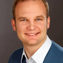
Prof. Jaume Sanz Subirana is a Tenure Full Professor of Mathematics at the Universitat Politècnica de Catalunya (UPC), BarcelonaTECH, and a Senior GNSS Scientific Researcher. He has been affiliated with the Department of Mathematics since 1983. His primary research focuses on GNSS data processing algorithms, ionospheric sounding, and high-accuracy navigation systems like WARTK and Fast-PPP. He co-founded the spin-off company gAGE-NAV S.L. in 2009 and served on the European Space Agency's GNSS Scientific Advisory Group (2018-2022). Prof. Sanz Subirana holds a Physics degree (1982) and a PhD in Galactic Dynamics (1987) from the Universitat de Barcelona. He has authored over 100 peer-reviewed papers (50+ in top JCR journals), 200 conference works, five books (including ESA-commissioned volumes), and holds four patents. His work has earned four best paper awards and UPC's Merit Recognition for teaching excellence. His research group, gAGE/UPC, specializes in GNSS navigation algorithms, ionospheric monitoring, and SBAS/GBAS systems. Key contributions include ionospheric gradient monitoring, real-time kinematic positioning, and mitigation of space weather effects on navigation signals.
Byungwoon Park is a Professor in the Department of Aerospace Engineering at Sejong University, specializing in Global Navigation Satellite Systems (GNSS) and precision positioning technologies. His research focuses on advancing navigation systems through innovations in Real Time Kinematics (RTK), smartphone sensor integration, and aviation applications. Professor Park's primary research interests include Global Navigation Satellite System (GNSS), Real Time Kinematics (RTK), smartphone sensor integration, aviation navigation, and urban positioning systems. His work has significantly contributed to improving positioning accuracy in challenging environments such as urban canyons and deep urban areas. He has developed techniques for achieving sub-meter accuracy in smartphone positioning and has made substantial contributions to international GNSS standardization efforts. His recent research has focused on multi-constellation GNSS integration, lunar navigation systems, tropospheric error modeling using LEO satellites, and advanced smartphone positioning techniques. Professor Park has successfully implemented methods to achieve 1m horizontal accuracy in Android smartphone positioning using SFMC SBAS and has developed Compact Network RTK technology that reduces bandwidth requirements for GPS correction in 100x100 km areas to 700bps. 'Google Smartphone Decimeter Challenge 2022' Gold Medal Third Place Winner of the Smartphone Decimeter Challenge (2024) Professor Park leads the Navigation Systems Laboratory at Sejong University, which conducts research on various navigation systems including GNSS. His work spans theoretical research, practical implementation, and industry collaboration, with numerous publications in prestigious journals and conference proceedings. He has advised multiple graduate students and has been actively involved in both domestic and international research collaborations focused on advancing navigation technologies.
Chris Bartone is a Professor at Ohio University's Russ College of Engineering and Technology, specializing in Electrical Engineering and Computer Science. Prior to his academic role, he spent over 15 years at the Naval Air Warfare Center, focusing on communication, navigation, and surveillance systems. He holds a Ph.D. in Electrical Engineering from Ohio University (1998) and degrees from Penn State (B.S.) and the Naval Postgraduate School (M.S.). His research interests include GNSS systems, electronic navigation, antenna design, and multipath mitigation. He has authored multiple patents and books, including co-authoring the textbook GNSS, Inertial Navigation, and Integration , now in its fourth edition. Notable achievements include the Captain P.V.H. Weems Award (2019) and Fellow status from the Institute of Navigation. Recent work emphasizes advanced antenna configurations, collision-avoidance systems for UAVs, and robust GNSS performance in interference-prone environments. He leads projects on terrestrial positioning systems and collaborates with industry on aviation safety technologies. His lab focuses on integrating sensors and antennas for precision navigation in aerospace applications.
Professor Ahmed El-Mowafy is a faculty member at Curtin University's School of Earth and Planetary Sciences (EPS), part of the Faculty of Science and Engineering. He leads the GNSS satellite positioning and navigation group, focusing on developing methods for high-accuracy geospatial applications in climate change, atmospheric monitoring, and infrastructure. His interdisciplinary research spans geodesy, aerospace engineering, and education. He holds a PhD from the University of Calgary and has over 30 years of expertise in GNSS and engineering surveying. Education: Doctor of Philosophy (University of Calgary, Canada) Bachelor of Civil Engineering (1st Honours, Ain Shams University, Egypt) Master of Science (Ain Shams University, Egypt) Research Interests: His work emphasizes precise positioning techniques like PPP, integrity monitoring, LEO satellite systems, and their applications in climate science, transport, and mining. He has published over 240 peer-reviewed papers and authored a book. His research also addresses educational innovations, including peer assessment and blended learning in engineering education. Awards: OLT Citation for Teaching Excellence (2013) Curtin Excellence in Teaching Award (2017) Asia-Pacific Spatial Excellence Award (2018) Grants & Leadership: Secured 20+ research grants, including ARC Discovery Projects and industry partnerships. Editorial roles in 5 journals, including Journal of Navigation and Frontiers in Environmental Science . International roles in IAG working groups on GNSS integrity and crustal motion monitoring. Lab & Collaborations: His lab collaborates globally, hosting scholars from Canada, Japan, Turkey, and China. Research focuses on LEO-PNT systems, GNSS augmentation, and real-time positioning solutions for autonomous systems.
Prof. Urs Hugentobler is a full professor at the Institute for Astronomical and Physical Geodesy at Technische Universität München (TUM), leading the Satellite Geodesy Department and the Forschungseinrichtung Satellitengeodäsie (FESG). His work focuses on precise geodetic applications of GNSS systems, satellite orbit determination, and Earth rotation studies. He holds a doctorate in astronomy from the University of Bern (1997) and has extensive experience with the ESA and international geodetic networks. Education: Master’s in theoretical physics (University of Bern, 1989), PhD in astronomy (University of Bern, 1997). Professional roles include leadership at the Bernese GPS Software group and the Wettzell Geodetic Observatory collaboration. His research emphasizes satellite gravimetry, solar radiation pressure modeling, and multi-technique geodetic observations. Research interests span satellite geodesy, GNSS applications, time/frequency transfer, and Earth system monitoring. Key contributions include advancements in Galileo and BeiDou satellite modeling, and the development of the Bernese GNSS Software. His work bridges geodesy with space science, addressing challenges in precision positioning and global reference frames. Publications highlight innovations in multi-GNSS analysis, satellite orbit determination, and Earth rotation parameters. His lab, FESG, supports TUM’s geodetic research and operational activities at Wettzell. Ongoing projects include the ESA Baltic+ and NEROGRAV initiatives, focusing on gravimetry and Earth dynamics.
Dr. Amir Allahvirdizadeh is a Lecturer at the School of Earth and Planetary Sciences (EPS) at Curtin University, part of the Faculty of Science and Engineering. He holds a portfolio in the Office of the Provost and is based at Curtin Perth. His research focuses on next-generation Positioning, Navigation, and Timing (PNT) systems leveraging Low Earth Orbiting (LEO) satellites, precise orbit determination, physics-based machine learning, and lunar PNT. He is affiliated with the Institute for Geoscience Research (TIGeR) and the GNSS Research Center. Dr. Allahvirdizadeh's academic career includes roles as a Research Associate (2022–2024), Casual Academic (2013–2022), and industry experience as a Geodetic Surveyor and Project Manager. He has received awards such as the DB Johnston Award (2023) and the Curtin International Postgraduate Research Scholarship (2019). His research activities include optimizing CubeSat orbit determination, developing the Shadow Toolbox software, and analyzing GNSS signal effects in Earth's shadow. He serves as a Guest Editor for Remote Sensing, reviews for journals like GPS Solutions and IEEE Transactions, and chairs sessions at international conferences (e.g., ISPRS Technical Commission IV Symposium). As a network administrator, he manages Curtin's GNSS receiver network, contributing data to global agencies like the International GNSS Service (IGS-MGEX). Education: PhD in Spatial Sciences (funded by ARC Discovery Project DP 190102444), MSc in Geodesy. Grants: Curtin Faculty of Science and Engineering Research Grant (2025), TIGeR Small Grant (2022). Labs/Teams: GNSS Research Center, TIGeR, and the Innovation Central Perth - Binar Space Program.
Prof. Dr. Michael Felux is full Professor and team leader of the Aviation Infrastructure group at the ZHAW School of Engineering , Zurich University of Applied Sciences. He also co-founded and co-owns the Estonian consultancy Navaid OÜ , providing GNSS/CNS expertise while ensuring non-conflict with his academic role. Education Dr.-Ing. in Mechanical Engineering, TU München (2012 – 2018) Dipl.-Tech. Math. in Mathematics, TU München (2003 – 2009) CAS Hochschuldidaktik (Higher-Education Didactics), PHZH (2021) Research Focus Michael Felux’s research centres on safe, secure and efficient aviation communication, navigation and surveillance (CNS) . He investigates GNSS-based augmentation systems (GBAS, SBAS) for precision approach and landing, develops real-time interference detection & localization techniques to counteract jamming and spoofing, and explores high-integrity navigation solutions for unmanned aerial vehicles (UAVs). Additional interests include environmental optimisation of flight procedures and multi-constellation, multi-frequency signal processing . Across more than 50 peer-reviewed publications since 2015, his work consistently targets the intersection of technical robustness and operational feasibility . Recent papers map GNSS disruption events across European airspace, quantify fuel-burn reductions enabled by GBAS-guided continuous-descent approaches, and introduce cost-efficient machine-learning frameworks for real-time localisation of malicious radio-frequency interference. Scientific Awards & Recognition (no specific awards listed in supplied material) Research Funding & Projects Spoofer Localization – Swiss project leader, ongoing EGNSS DFMC for GBAS based operations – EU project leader, ongoing Making I-CNS A Reality – integrated CNS technology, project leader, ongoing High Integrity Satellite Navigation for UAV using Galileo HAS – project leader, ongoing LINA – Shared large-scale infrastructure for safe testing of autonomous systems, team member, ongoing Collision avoidance system for manned & unmanned aircraft via SDR – completed Emission Reduction using Satellite Navigation for Approach Guidance – completed Laboratory & Team As head of the Aviation Infrastructure team at ZHAW, Prof. Felux directs a multidisciplinary group developing next-generation CNS technologies. The team operates dedicated GNSS/GBAS testbeds, flight-trial aircraft, and spectrum-monitoring networks to validate concepts from simulation through to real-world deployment.
Dr. Takács Bence Géza serves as an Associate Professor at the Department of Geodesy and Surveying within the Faculty of Civil Engineering at Budapest University of Technology and Economics (BME). With over two decades of academic engagement, he maintains active roles in teaching core surveying courses, supervising student research projects (TDK), and leading departmental field practice programs. His institutional responsibilities include serving as the department's TDK coordinator and field practice course supervisor, while maintaining professional affiliations with the Hungarian Academy of Sciences, Hungarian Chamber of Engineers, and Hungarian Society of Surveying. Education: PhD in Earth Sciences, Budapest University of Technology and Economics (2005) MSc Land Surveyor and Geomatics Engineer, Budapest University of Technology and Economics (1999) Dr. Takács specializes in Global Navigation Satellite Systems (GNSS) and Engineering Geodesy with particular expertise in Safety of Life applications, Performance Based Navigation procedures, and infrastructure monitoring systems. His research bridges theoretical geodesy with practical civil engineering challenges, focusing on bridge load testing, road infrastructure quality control, and modernization of cadastral systems through point cloud technologies. Recent work demonstrates strong emphasis on ionospheric modeling for GNSS integrity, EGNOS network deployment, and open-source solutions for coordinate transformations, reflecting his commitment to advancing both academic knowledge and industry standards in geospatial engineering. Analysis of his publication record (2014-2021) reveals a clear trajectory toward practical implementation of geodetic techniques in critical infrastructure projects. His work consistently addresses safety-critical applications in aviation navigation (PBN4HU, BEYOND projects), structural monitoring of bridges (Rákóczi Bridge, Komárom Bridge), and modernization of land registry systems. The integration of machine learning for ionosphere modeling and open-source GIS development highlights his innovative approach to solving complex geospatial problems across civil engineering and transportation domains. Scientific Awards: Academy of Sciences Youth Award (2004) Award for consultation of student research projects, BME (2007) Rector's Award (2021) Hazay Prize (2021) Dr. Takács actively supervises student research through TDK programs and coordinates comprehensive surveying field practice courses. His research leadership spans major projects including PBN4HU (implementing Performance Based Navigation at Hungarian airports), BEYOND (building EGNSS capacity across multimodal domains), and EDCN (operating EGNOS monitoring stations). These initiatives demonstrate significant grant acquisition capabilities with direct applications to aviation safety, road infrastructure monitoring, and national geodetic infrastructure. His work bridges academic research with practical industry implementations through collaborations with the Paksi Nuclear Power Plant, Budapest Metro, and Hungarian road construction authorities. As a key member of the Committee on Geodesy and Geoinformatics at the Hungarian Academy of Sciences and serving on multiple certification committees for the Hungarian Chamber of Engineers, Dr. Takács shapes national standards for geospatial practice. His departmental leadership in surveying field courses and TDK supervision creates pipelines for next-generation geospatial professionals, while his professional qualifications as a certified designer (GD-T) and expert (GD-Sz) in land surveying ensure industry relevance of academic training.
Javier Ventura-Traveset is a leading researcher in GNSS (Global Navigation Satellite Systems) Science, serving as coordinator of ESA's GNSS Science activities and Head of the Galileo Navigation Science office (SCI-N). His roles include Executive Secretary of ESA’s GNSS Science Advisory Committee and Chair of the International Colloquium on Scientific and Fundamental Aspects of GNSS/Galileo. He has been instrumental in developing the European Geostationary Navigation Overlay Service (EGNOS) and advancing SBAS (Satellite-Based Augmentation Systems). His research spans fundamental physics tests using GNSS, Earth sciences applications (geodesy, ionosphere monitoring), and metrology (precise timing and atomic clocks). Key collaborations include SYRTE (Paris), ZARM (Bremen), TU München, and UPC. He authored/co-authored over 150 publications, including the seminal The EGNOS Book and chapters in Galileo Positioning Technology Book . Notable awards include ION’s Best Presentation Awards (2001, 2005, 2006). His work on the GREAT experiment (Galileo gravitational Redshift test) and the ESA ALIVE concept (emergency communication via SBAS) highlights his contributions to both fundamental science and practical applications. He leads educational initiatives like the ESA/UPC GNSS-Lab tool (gLAB) and promotes global collaborations through ESA’s NAVISP program. His research emphasizes GNSS Big Data, advanced signal processing, and transdisciplinary science education.
Prof. José Miguel Juan Zornoza is a Tenure Full Professor of Physics and Senior GNSS Scientific Researcher at the Universitat Politècnica de Catalunya (UPC), BarcelonaTECH. He leads research in the gAGE group, focusing on GNSS data processing, high-accuracy navigation, and ionospheric studies. His work includes developing Wide Area RTK (WARTK) and Fast-PPP techniques, supported by 100+ peer-reviewed papers (50+ Q1 JCR) and 200+ publications. He co-authored 5 patents and three books on GNSS, including ESA-commissioned volumes. Education: Physics (Earth and Cosmos) degree from Universitat de Barcelona (1982); PhD in Galactic Dynamics (1993) His research emphasizes GNSS algorithms for multi-frequency systems (GPS, Galileo) and augmentation systems. He has led over 100 R&D projects as PI and co-founded spin-off gAGE-NAV S.L. (2009). Notable contributions include 12 patent entries linked to WARTK/F-PPP, and recognition through best paper awards. His work bridges academic research with industry applications in precision navigation and geomatics.