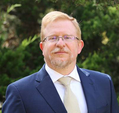
Dr. Patrick S. Market is a Professor of Atmospheric Science and currently serves as the Director of the School of Natural Resources at the University of Missouri. He also acts as Interim Co-Director of the Missouri Water Center. His research focuses on synoptic and mesoscale dynamics, particularly winter weather, heavy rainfall, flash flooding, and severe local storms. He has contributed to advancements in precipitation efficiency studies and operational forecasting techniques. His work explores the role of artificial intelligence in weather prediction and communication, emphasizing the continued importance of human expertise in an automated forecast process. Dr. Market has secured grants for data stream maintenance and digital equity planning, and he has led educational initiatives integrating research into synoptic meteorology classrooms. Notable collaborations include projects with the National Weather Service and studies on the Ozark Plateau's topographical influence on weather systems.
Gregory J. Carbone is a Professor in the Department of Geography at the University of South Carolina. His research investigates climate variability and change impacts on water resources and agriculture, with emphasis on drought monitoring systems and climate scenario development. He earned his Ph.D. from the University of Wisconsin-Madison (1990), M.A. from University of Kansas (1984), and B.A. from Clark University (1982). His research develops tools for drought assessment in data-scarce regions and examines how spatial scale affects climate impact assessments. Research focuses on drought monitoring techniques, climate extremes, and the application of climate information in water resource management. Recent work explores uncertainty in precipitation indices, agricultural sensitivity to drought, and regional climate projections. He co-developed the Carolinas Dynamic Drought Index tool used by water managers. His publications demonstrate consistent innovation in drought monitoring methodologies, with recent advancements in spatial visualization of climate impacts and statistical downscaling techniques. Research integrates geospatial analysis, remote sensing, and statistical modeling. Teaching excellence recognized through multiple awards: Michael J. Mungo Distinguished Professor of the Year (2025) Mortar Board Excellence in Teaching Award (2012) Mungo Undergraduate Teaching Award (2005) He has supervised 6 MS students and served on 50+ thesis committees. Major grants include $3.75 million from NOAA for the Carolinas Integrated Sciences & Assessments program. Professional service includes editorial roles for Physical Geography and leadership in the American Association of Geographers.
Dr Ting Sun is an Associate Professor in Climate & Meteorological Hazard Risks at University College London , Department of Risk and Disaster Reduction. He earned his BEng (2009) and PhD in Hydrology (2013) from Tsinghua University , followed by a visiting period at Princeton University (2011–2012). After postdoctoral appointments at Tsinghua and the University of Reading , he held a NERC Independent Research Fellowship at Reading (2017–2022) before joining UCL in May 2022. Education PhD in Hydrology, Tsinghua University, 2013 BEng in Hydraulic Engineering, Tsinghua University, 2009 Visiting PhD Student, Princeton University, 2011–2012 Research Interests Dr Sun’s work converges on urban climate modelling across scales —from neighbourhood blocks to global grids—focusing on the impacts of weather and climate extremes such as heat waves and extreme rainfall in cities. He is the lead developer of the Surface Urban Energy and Water balance Scheme (SUEWS) and its Python wrapper SuPy , developed in collaboration with Prof Sue Grimmond’s micromet group. He also contributes as a core member of the Urban Multi-scale Environmental Predictor (UMEP) development team. His multidisciplinary expertise integrates hydro-climate dynamics, computational modelling, machine learning, built-environment processes, and public-health linkages . Research Trends from Recent Publications Across the 15 most recent articles, a clear trajectory emerges from high-resolution urban-process modelling toward integrated socio-environmental assessments . Studies published in 2024–2025 couple atmospheric models (WRF-SUEWS) with global building-morphology datasets (GLAMOUR) to quantify how cities alter rainfall patterns, temperature sensitivity, and heat-related mortality. Earlier works progressively refined SUEWS’s physical parameterisations and Python accessibility, while recent outputs leverage deep-learning remote-sensing tools (SHAFTS) and hybrid hydrological-neural architectures to deliver actionable insights for urban planning and climate adaptation. Scientific Awards & Fellowships NERC Independent Research Fellowship , University of Reading, 2017–2022 HEA Fellowship , University College London, 2023 Professional Service & Editorial Roles Topic Editor , Geoscientific Model Development (from 2025) Editorial Board Member , Scientific Data (from 2024) Peer review and consultancy for journals, conferences, and policy bodies Supervision of taught-course projects and research degrees External examining and mentoring Labs, Teams & Collaborations Dr Sun leads and collaborates within the UCL Department of Risk and Disaster Reduction , working closely with the micromet group at the University of Reading (Prof Sue Grimmond) on SUEWS/SuPy development. He is an active member of the UMEP consortium and maintains extensive international collaborations spanning Tsinghua University, Princeton, and numerous European research centres, underpinning a vibrant, interdisciplinary research network focused on urban climate resilience.
Alessandro Battaglia is an Associate Professor at the Department of Environmental, Land and Infrastructure Engineering (DIATI) at the Polytechnic University of Turin. He specializes in microwave remote sensing of clouds and precipitation, with expertise in Doppler radar, cloud and snow microphysics, and microwave radiometer technology. His research spans atmospheric physics, meteorology, and climate science with applications in Earth observation from space. Dr. Battaglia's research interests focus on remote sensing of atmospheric phenomena, particularly using advanced radar technologies. His work encompasses cloud microphysics, precipitation measurement, and wind observation from space. He is particularly known for his contributions to the development of spaceborne Doppler radar systems for measuring in-cloud winds, which represents a significant advancement in atmospheric observation capabilities. His research bridges engineering, physics, and meteorology to improve our understanding of Earth's atmospheric processes and climate systems. His recent publications demonstrate a strong focus on the WIVERN (Wind Velocity Radar Nephoscope) mission, with research spanning cloud microphysics, snowfall measurement, wind field reconstruction, and innovative radar signal processing techniques. These works highlight the interdisciplinary nature of his research, connecting atmospheric science, engineering, and computational methods to advance space-based Earth observation capabilities. NASA Group Achievement Award (2015) Fellow of the National Center for Earth Observation, UK (2014-present) Dr. Battaglia actively mentors several PhD students including Marco Coppola, Francesco Manconi, Riccardo Rabino, Susmitha Sasikumar, Aida Galfione, and Paolo Martire across Civil and Environmental Engineering and Aerospace Engineering programs. He serves as Principal Investigator for multiple research projects funded by ESA (3 projects), UK-NERC (1 project), UK-NCEO (1 project), and the US Department of Energy (1 project). His current research focuses on the WIVERN mission, EarthCARE mission, and NASA's INCUS mission, with particular emphasis on developing algorithms for spaceborne Doppler radar systems. He leads research teams working on cutting-edge remote sensing technologies for atmospheric observation, with particular focus on developing the next generation of spaceborne instruments capable of measuring in-cloud winds—a capability that has been missing from Earth observation systems until now.
Soroosh Sorooshian is a Professor at the Samueli School of Engineering , University of California, Irvine, with joint appointments in Civil and Environmental Engineering and Earth System Science . He serves as Founding Director of the Center for Hydrometeorology and Remote Sensing (CHRS) and holds the Samueli Endowed Chair in Engineering . His expertise spans hydrometeorology, climate-water interactions, remote sensing applications, and water resource management in arid regions. Education : Ph.D. in Engineering (1978), Engineer Degree in Systems Engineering (1977), M.S. in Operations Research (1973), B.S. in Mechanical Engineering (1971). Leadership & Affiliations : Member of US National Academy of Engineering , International Academy of Astronautics , and multiple scientific bodies (AAAS, AGU, AMS, IWRA). Former advisor to NASA, NOAA, and UNESCO initiatives. Recent research focuses on machine learning integration for hydrological modeling , satellite precipitation product development , and climate change impact assessments . Key trends include deep learning for bias correction , multi-sensor precipitation fusion , and atmospheric river hydrology in California. Awards include the AGU Horton Medal , NASA Distinguished Public Service Medal , and Prince Sultan Bin Abdulaziz International Water Prize . He consults on urban flooding and surface hydrology challenges. Scientific Honors : Chinese Academy of Sciences Einstein Professorship (2014) UNESCO Great Man-Made River Water Prize (2007) AMS Walter Orr Roberts Lecturer (2009) Multiple Distinguished Educator Awards Advisory Roles : Served on committees for NASA, DOE, and World Climate Research Programme's Hydrology Commission.
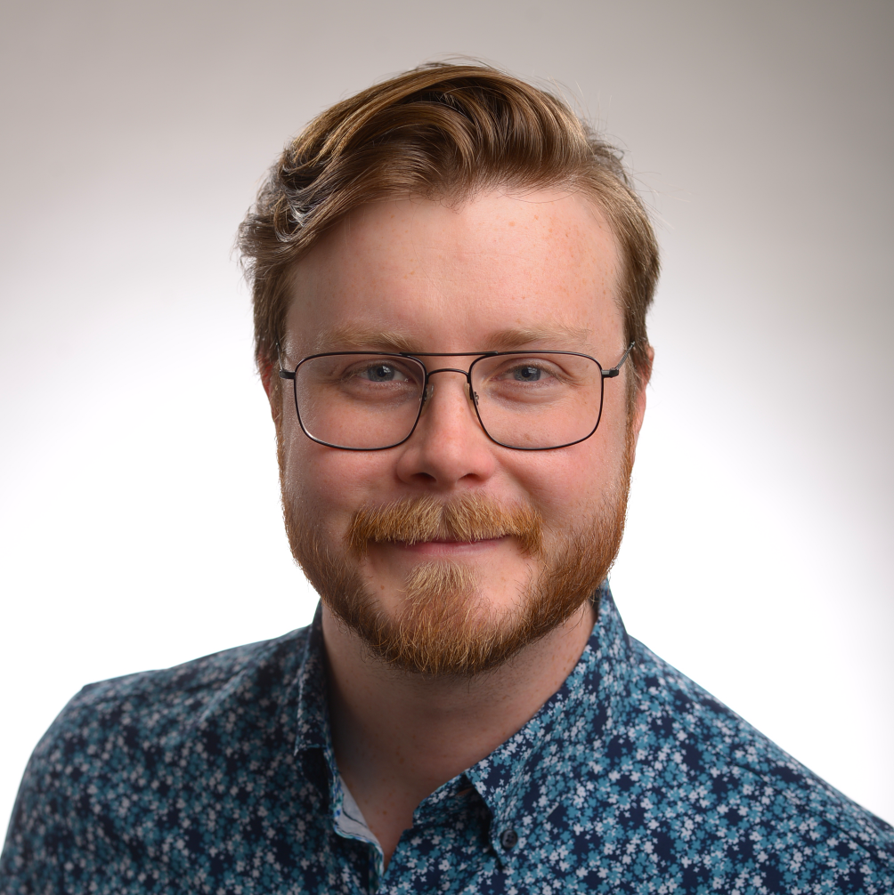
Fraser King is an incoming Assistant Professor in the Department of Atmospheric and Oceanic Sciences (AOS) at the University of Wisconsin–Madison, starting in Winter 2026. He holds a PhD in Machine Learning and Remote Sensing of Precipitation from the University of Waterloo (2022) and is currently a postdoctoral research associate at NASA Goddard Space Flight Center. His research integrates machine learning with atmospheric physics to advance precipitation and snowfall retrieval, cloud microphysics, and climate modeling. He has held research positions at the University of Michigan and NASA Jet Propulsion Laboratory. His research interests include: Climate and Climate Change Radiation and Remote Sensing Synoptic Meteorology Atmospheric and Cloud Physics Large Scale Dynamics Machine Learning and Model Interpretability Arctic Snowfall Prediction His recent publications reflect a strong trend in applying deep learning (e.g., U-Net, CNNs) and unsupervised methods (PCA, t-SNE, UMAP) to radar and satellite data for precipitation and snow microphysics. Key themes include radar gap inpainting, melting layer detection, and dimensionality reduction for physical interpretation. His work bridges geoscience and AI, aiming for interpretable models that enhance physical understanding. Scientific awards and professional service include: Finalist for the 2023 Governor General's Gold Medal, University of Waterloo Associate Editor, Journal of Atmospheric and Oceanic Technology (AMS) Member, AMS Committee on Artificial Intelligence Applications to Environmental Science Executive Council Member, AGU Precipitation Technical Committee Executive Member, Eastern Snow Conference Research Board Fraser King has mentored students through research projects and led educational initiatives such as a 12-week course on machine learning for land cover classification. He has secured research experience through internships at Aquanty Inc. and multiple NASA-affiliated institutions. He founded MapsByFraser, a company combining cartography and satellite data, and has collaborated with Google's Quantum AI team. His technical skills span Python, deep learning frameworks, and high-performance computing platforms. He leads several major research projects: Towards Interpretable Physical Models : Using sparse autoencoders and nonlinear dimensionality reduction to interpret geoscience models. Microphysical Dimensionality Reduction : Applying PCA, t-SNE, and UMAP to identify physical modes in precipitation data. BlindPaint : A U-Net for radar gap inpainting in spaceborne systems. DeepPrecip : A deep learning model for surface precipitation retrieval. iPhone LiDAR : Using consumer smartphones for snow depth measurement via drones. NRCan Machine Learning Land Cover Classifier : Training ML models on Sentinel-2 data. Climate Model Calibration : Using ML to correct biases in snow-related climate variables. CloudSat Snowfall Validation : Validating high-latitude snowfall estimates. Snow Modelling : A Rust-based physical/temperature-index snow model.
Dr. Armando Marino is a Senior Lecturer in Earth Observation at the University of Stirling’s Department of Biological and Environmental Sciences since 2018. He holds an MSc in Telecommunication Engineering (2006, Universita’ di Napoli) and a PhD in Polarimetric SAR Interferometry (2011, University of Edinburgh). His research focuses on synthetic aperture radar (SAR) for environmental monitoring, including maritime pollution, forest degradation, agricultural productivity, and coastal erosion. Education: MSc Telecommunication Engineering, Universita’ di Napoli ‘Federico II’ (2006) PhD in Remote Sensing, University of Edinburgh (2011) Marino develops machine learning algorithms for SAR data analysis and conducts fieldwork with custom-built radar systems. He collaborates with institutions like ESA, JAXA, and NASA, leading projects such as PlasticSurf (microplastic detection) and MoLaDy (ALOS-4 land monitoring). His work integrates optical and SAR satellite data for flood mapping and vegetation analysis. He has received accolades including the RSPSoc Best PhD Thesis (2011) and University of Stirling’s Outstanding Collaborator award (2022). Current projects involve £180,000+ in funding for radar-based environmental solutions. Scientific Awards: Best PhD Thesis 2011 (RSPSoc) Outstanding PhD Thesis (Springer Verlag) Outstanding Collaborator 2022 (University of Stirling) Marino’s methodologies combine SAR polarimetry, computer vision, and environmental field measurements. He actively mentors interdisciplinary teams and contributes to global initiatives on climate hazard mitigation.
Dawei Han serves as Professor of Hydroinformatics at the University of Bristol's School of Civil, Aerospace and Design Engineering, leveraging advanced computational techniques to address hydrological challenges. Holding a B.Eng. and M.Sc. from Huabei alongside a Ph.D. from Salford, he is recognized as a Chartered Engineer (C.Eng.) and Fellow of the Chartered Institution of Water and Environmental Management (FCIWEM). His academic credentials include: Bachelor of Engineering (B.Eng.) from Huabei Master of Science (M.Sc.) from Huabei Doctor of Philosophy (Ph.D.) from University of Salford Professor Han's research focuses on integrating hydroinformatics with practical water management solutions, particularly in urban environments. His work pioneers applications of machine learning for rainfall nowcasting, radar-based hydrological monitoring, and climate change impact assessment. Key innovations include DREE-RF for rainfall energy estimation and frameworks for urban flood resilience, emphasizing data-driven approaches to enhance prediction accuracy and risk mitigation strategies. Analysis of his 2024-2025 publications reveals dominant themes in urban hydrology (40%), flood risk management (30%), and climate-remote sensing integration (30%). His research spans global contexts from UK catchments to Iraqi rainfall systems, consistently employing computational methods like neural networks and WRF modeling to address data-scarce environments and extreme weather events. Professional recognition includes: Fellow of the Chartered Institution of Water and Environmental Management (FCIWEM) While specific student supervision details are unavailable, his extensive publication record indicates active mentorship in hydroinformatics. Research grants likely support his work on radar remote sensing and urban climate adaptation, though explicit funding sources aren't documented in the source material. His affiliation with Bristol's engineering school positions him within interdisciplinary teams addressing infrastructure resilience, though laboratory-specific information remains unreported.
Christopher Williams is a Research Professor at the University of Colorado Boulder's Department of Aerospace Engineering Sciences, affiliated with the Colorado Center for Astrodynamics Research (CCAR). He holds a PhD in Electrical Engineering from the University of Colorado (1994), an MS from Purdue University (1986), and a BS from California Polytechnic State University (1984). His research focuses on radar remote sensing of precipitation, tropospheric microphysics, and cloud dynamics, with emphasis on satellite, airborne, and ground-based systems. He has contributed to projects like the Global Precipitation Measurement (GPM) mission and led validation efforts using disdrometers and profilers. Key awards include the NASA Goddard Robert H. Goddard Award (2015) and CIRES Outstanding Scientist (2006). Research interests include calibrating cloud radars, analyzing raindrop size distributions, and understanding precipitation processes in diverse environments. His work bridges observational techniques (e.g., Doppler radar, microwave radiometry) with theoretical modeling to improve satellite rainfall algorithms. Recent studies address attenuation effects in radar signals, vertical air motion estimation, and the impact of anthropogenic pollution on Arctic cloud properties. Educations : PhD, Electrical Engineering, University of Colorado, 1994 MS, Electrical Engineering, Purdue University, 1986 BS, Electronic Engineering, California Polytechnic State University, 1984 Key Projects : ARM Climate Research Facility NOAA Earth System Research Laboratory GPM Ground Validation campaigns Publications emphasize radar-based precipitation analysis, with recent trends in airborne W-band applications, PIA modeling, and parameterization of rain variability for large-scale models. His lab collaborations include CIRES and NASA, advancing technologies for climate monitoring and disaster response.
Anthony Illingworth is a Professor in the Department of Meteorology at the University of Reading, UK, where he leads research in atmospheric remote sensing, radar and lidar technologies, and weather forecasting. His work is central to major satellite missions such as EarthCARE and WIVERN, and he collaborates extensively with European and international meteorological agencies. Education and Background: While specific degrees are not listed in the provided text, his long-standing academic career and leadership in advanced meteorological research suggest a PhD in atmospheric physics or a related field, likely from a UK institution. His research interests span radar meteorology , cloud physics , satellite remote sensing , precipitation measurement , boundary layer dynamics , and numerical weather prediction . He focuses on improving observational techniques using ground- and space-based sensors to enhance forecast accuracy. His work integrates physics-based models with real-world data from instruments such as Doppler radars, lidars, and polarimetric sensors. The publication trends from 2015 to 2025 reveal a consistent focus on satellite-based wind and cloud observations (e.g., WIVERN and EarthCARE), calibration of remote sensing instruments, and data assimilation for weather models. His articles frequently address technical challenges in radar signal interpretation, wind profiling in extreme weather, and the use of ground networks to validate and improve forecasts. A recurring theme is the development and validation of new methodologies for extracting atmospheric parameters from remote sensing data. Scientific Awards: Advising and Grants: While no students or grants are explicitly listed, his frequent senior authorship and leadership in large collaborative projects (e.g., FRANC, EarthCARE) suggest active supervision of PhD students and postdoctoral researchers, as well as success in securing major research funding from agencies such as the UK Met Office, ESA, and NERC. Labs and Teams: Illingworth is closely associated with the atmospheric remote sensing group at the University of Reading, which operates advanced radar and lidar systems. He collaborates with the European Centre for Medium-Range Weather Forecasts (ECMWF), CNRS in France, and the CloudSat science team, indicating strong institutional partnerships and team-based research in operational and satellite meteorology.
Prof. Dr. Corinna Hoose leads the Cloud Physics research group at the Institute of Meteorology and Climate Research - Tropospheric Research (IMKTRO) within Karlsruhe Institute of Technology (KIT) . She has held this W3 Professorship since 2013 and previously led a Helmholtz Young Investigators Group (2010-2016). Her work focuses on aerosol-cloud interactions , mixed-phase cloud processes , and numerical modeling of atmospheric systems . Professor of Theoretical Meteorology at KIT (2013-present) Former Helmholtz Group Leader (2010-2016) University of Oslo & ETH Zurich Postdoc experience Co-Editor of Atmospheric Chemistry and Physics Research Interests center on ice nucleation mechanisms , cloud dynamics , and climate sensitivity studies . Her group develops parameterizations for heterogeneous ice nucleation and investigates precipitation formation across different cloud types. Notable methodological contributions include SEVIRI satellite data analysis and ICON model modifications for microphysical-dynamic coupling. Publication Trends show consistent leadership in mixed-phase cloud modeling (2013-2025), with particular emphasis on Arctic cloud systems , heterogeneous ice formation , and aerosol impacts on precipitation . Her work bridges laboratory ice nucleation studies (e.g., dust-ash parameterizations) and regional climate modeling at various spatial resolutions. Teaching includes core courses in Theoretical Meteorology , Numerical Methods , and Cloud Physics at KIT. She has mentored multiple early-career researchers as evidenced by co-authorships with advisees like A. Oertel and L. Ickes. Collaborations span institutions including ETH Zurich, University of Oslo, and EU projects like EUCAARI. Her research group interacts with observational teams through field campaigns like Swabian MOSES and utilizes both in situ and remote sensing data for model validation.
Dr. Zhaoxia Pu is a Professor in the Department of Atmospheric Sciences at the University of Utah and an Adjunct Professor at the School of Computing . Recognized as a Fellow of both the American Meteorological Society and the Royal Meteorological Society, she serves on the NOAA Science Advisory Board and has led 38 federally funded projects from agencies including NOAA, NASA, NSF, DOE, and ONR. Specializes in numerical weather prediction , data assimilation , and AI/machine learning for high-impact weather systems Developed advanced methods integrating satellite/radar data (GOES-R, CYGNSS, TROPICS) with Earth system models (UFS, E3SM, WRF) Recipient of the 2024 Excellence in Research Award and 2023 Provost's Banner Project recognition Research Trends : Her recent publications focus on: Machine learning approaches for precipitation retrieval using GOES-R data Cold fog microphysics and visibility parameterization in complex terrain Tropical cyclone dynamics through radar and lidar data assimilation Boundary layer turbulence in landfalling storms Drought mechanisms linked to synoptic-scale circulation New particle formation in mountainous regions Scientific Leadership : Lead scientist for CFACT NSF field campaign (2021–2025) Editorial board member of leading journals Active reviewer for NSF, DOE, NOAA, and NASA Teaching & Mentorship : Teaches Numerical Weather Prediction , Atmospheric Dynamics , and Introduction to Atmospheric Sciences courses. Has supervised 28 graduate students to completion.
Stephen Saleeby is a Senior Research Associate at Colorado State University, working in the field of atmospheric science since July 2000. His research focuses on cloud microphysics, aerosol-cloud interactions, and numerical modeling using the RAMS mesoscale model. Education: B.S. in Physics (1997), M.S. in Atmospheric Science (2000) Affiliation: Colorado State University Research Interests: Cloud microphysics, aerosol effects on precipitation, numerical modeling His recent publications analyze aerosol impacts on deep convection, ice nucleation processes, and convective storm initiation mechanisms. He has contributed to model development (e.g., tobac v1.5) and validation studies using satellite and radar observations. Field experience includes the ISPA-2 and ISPA-3 projects at Storm Peak Lab, where he conducted aerosol and snowfall measurements. He also coaches the Kinard Middle School Science Olympiad Meteorology Team.
Steven Siems is a Professor at Monash University's School of Earth Atmosphere and Environment. He leads research on clouds, precipitation, and boundary layer meteorology, focusing on the Southern Ocean, Australia, and SE Asia. As a Chief Investigator in the ARC Securing Antarctica's Environmental Future (SAEF) center, he studies precipitation processes and co-chairs the World Weather Research Program's Weather Modification Expert Team. He also edits the Journal of Southern Hemisphere Earth System Science. Education: PhD in Applied Mathematics from the University of Washington (Seattle), followed by post-doctoral research at NCAR and UMIST. His work contributes to UN Sustainable Development Goals related to climate action and life below water. Projects: CAPE-k (Southern Ocean Clouds), CCI GBR (Great Barrier Reef Climate), POSOSI (Antarctic Sea Ice), and PSCSO (Southern Ocean Convection) Research Themes: Cloud microphysics, orographic precipitation, trade wind cumulus dynamics Recent publications focus on satellite cloud retrievals, coral bleaching drivers, and precipitation biases in high-latitude observations. Supervised PhD students engage in fieldwork across the Snowy Mountains, King Island, and Great Barrier Reef aboard research vessels like the R/V Investigator.
Prof. Dr. Dirk Notz is a Professor and Head of the Sea Ice research group at the Institute of Oceanography, University of Hamburg, where he also serves as Deputy Managing Director. He is affiliated with the Centrum für Erdsystemforschung und Nachhaltigkeit (CEN) and the Cluster of Excellence Climate, Climatic Change, and Society (CLICCS), focusing on Arctic and Antarctic climate dynamics. His research centers on sea ice physics, Arctic amplification, climate modeling, and the impacts of global warming on polar regions. He investigates sea ice decline, Antarctic precipitation sensitivity, light transmission in sea ice (notably through the MOSAiC expedition), and uncertainty in climate data and sea-level projections. His work integrates observational data, satellite retrievals, and climate model simulations to understand and project changes in the cryosphere. His recent publications reveal strong trends in Arctic warming, under-ice photosynthesis at extremely low light levels, observational constraints on ice-free Arctic projections, and the communication of sea-level rise uncertainty. His articles appear in leading journals such as Science , Nature Communications , Nature Climate Change , and The Cryosphere . He leads and participates in multiple research projects, including those related to sea ice modeling, polar tipping points, and laboratory ice applications. His work contributes to international climate assessments and supports the UN Sustainable Development Goals, particularly SDG 13 (Climate Action), SDG 14 (Life Below Water), and SDG 15 (Life on Land). Prof. Notz mentors students and early-career researchers within his group and through his leadership roles. He has secured funding for projects analyzing sea ice light and biology, climate sensitivity, and future Arctic scenarios. His research infrastructure includes data from major field campaigns and collaborations with international polar science teams.