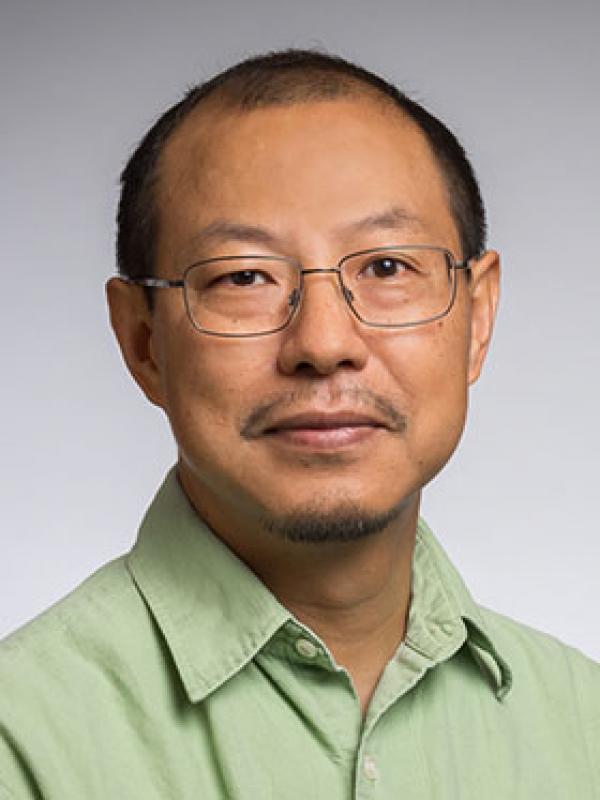
Ryan Engstrom is a Professor and Director of Data Science in the Department of Geography at George Washington University (GW). He is affiliated with the Columbian College of Arts and Sciences and holds a Ph.D. from the joint program at San Diego State University and UC Santa Barbara. His research focuses on Remote Sensing, GIS applications, Climate Change impacts, Arctic environments, and Population Estimation, with an emphasis on poverty mapping and urban deprivation analysis. Engstrom has led major initiatives such as YouthMappers and IDEAMAPS, leveraging geospatial data and satellite imagery to address global development challenges. His work includes developing methodologies for georeferencing historical imagery, estimating non-monetary poverty, and mapping population density in regions like Sri Lanka and Ghana. He has published extensively in Remote Sensing , World Bank Economic Review , and Global Change Biology , among others. Key research trends in his publications involve integrating satellite-derived features with machine learning to model urban poverty, climate-driven land-use changes in Arctic regions, and applications of open-source geospatial tools for international development. Engstrom collaborates globally, contributing to projects like the World Bank’s welfare tracking in disaster-affected regions.
Dr. Alastair Key serves as Director of Studies in Archaeology and Official Fellow in Archaeology at Queens' College, University of Cambridge. His research bridges Paleolithic archaeology, stone tool technology, and hominin behavioral evolution through experimental and computational approaches. Director of Studies and Official Fellow at Queens' College, Cambridge Specializes in Paleolithic stone tool analysis, Acheulean technology, and hominin adaptation Conducts experimental archaeology and computational modelling to assess tool functionality Key's research focuses on Acheulean handaxe production , lithic microwear patterns , and ergonomic constraints in prehistoric tool use . He has extensively published on topics including glacial-stage hominin occupations , Oldowan toolmakers , and machine learning applications to archaeological analysis . His recent publications (2025-2023) span diverse subfields: Acheulean chronology , hominin tool use biomechanics , experimental projectile testing , and computational morphometric methods . The work often integrates multidisciplinary datasets and open-source analytical tools to address fundamental questions about human technological evolution. Current research directions include stone tool sharpness quantification , handaxe social signaling potential , and cross-species tool use comparisons through primate studies.
Michela Bertolotto is a Professor in the School of Computer Science at University College Dublin (UCD). Her research focuses on spatio-temporal data modeling, GIScience, and applications of geospatial technologies in fields like urban planning and health informatics. She leads a research group and has supervised 19 PhD and 8 MSc students. Her work includes innovations in LiDAR-based flood risk visualization, semantic web quality assurance, and open-source spatial data analysis. Bertolotto has held roles including College Lecturer at UCD (2000–2006) and postdoctoral research positions at the University of Maine and University of Genoa. Education: BSc and PhD in Computer Science from the University of Genoa (1993, 1998). Professional achievements include over 100 publications, 24 grants (e.g., Science Foundation Ireland-funded Urban ARK project), and editorial roles at journals like the International Journal of Geographical Information Science. Awards include the UCD President's Research Award (2001) and NATO Postdoc Fellowship (1998–1999). Research interests span map personalization, volunteered geographic information (VGI), and geospatial data quality. Her lab develops tools like the LAMSkyCam (low-cost sky imaging system) and dynamic flood risk viewers. She chairs international conferences and serves on program committees for GIScience events.
Oisin Mac Aodha is a Reader (Associate Professor) in Machine Learning at the School of Informatics, University of Edinburgh. He is also an ELLIS Scholar and founder of the Turing interest group on biodiversity monitoring and forecasting, having previously served as a Turing Fellow from 2021-2025. Mac Aodha completed his undergraduate degree in electronic engineering from the University of Galway in Ireland, followed by his MSc and PhD at University College London (UCL). His academic journey includes postdoctoral positions at UCL (2013-2016) working with Prof. Gabriel Brostow and Prof. Kate Jones, and at Caltech (2016-2019) in Prof. Pietro Perona's Computational Vision Lab as part of the Visipedia team. His research centers on computer vision and machine learning with emphasis on 3D understanding, human-in-the-loop methods, and AI for conservation and biodiversity monitoring. He has made significant contributions to monocular depth estimation (including the influential Monodepth2 paper), fine-grained visual categorization, and biodiversity monitoring systems. His work bridges theoretical machine learning with practical ecological applications, developing tools for species identification, range estimation, and conservation efforts. Recent publications reveal a strong trend toward ecological applications while maintaining fundamental contributions to 3D vision and representation learning. His major scientific achievements include: Turing Fellow (2021-2025) ELLIS Scholar Founder of the Turing interest group on biodiversity monitoring and forecasting Co-organizer of the Fine-Grained Visual Categorization (FGVC) workshop series at major vision conferences Mac Aodha advises multiple PhD students and postdocs working on computer vision for biodiversity monitoring, 3D understanding, and human-in-the-loop learning. His team has developed practical tools like Whombat (an open-source annotation tool for bioacoustics) and contributed to field-deployed biodiversity monitoring systems. He has served as Area Chair for top conferences including NeurIPS, CVPR, ICCV, and ICML, demonstrating his standing in the computer vision community. His research group collaborates extensively with ecologists at University College London, particularly with Prof. Kate Jones' team, bridging machine learning expertise with ecological domain knowledge. The Vision at Edinburgh group he contributes to focuses on developing practical AI tools that address real-world conservation challenges while advancing fundamental computer vision research.
Ross Meentemeyer is a Professor and Director of the Center for Geospatial Analytics at North Carolina State University, affiliated with the Department of Forestry and Environmental Resources in the College of Natural Resources. He holds a Ph.D. in Geography from the University of North Carolina, Chapel Hill (2000) and a B.S. in Geography from the University of Georgia (1993). His research focuses on geospatial analytics, ecological forecasting, biological invasions, and forest health, with a strong emphasis on integrating geospatial data and modeling to address environmental challenges. Dr. Meentemeyer's work includes developing decision-support tools for pest management, climate adaptation, and land-use planning. Notable projects involve forecasting invasive species spread via international trade, creating open-source geospatial platforms, and modeling floodplain development risks. He collaborates extensively with federal agencies like USDA, DOI, and NPS to translate research into practical solutions. His grants include multi-million dollar NSF and USDA-funded initiatives addressing plant disease pandemics, agricultural pest threats, and geospatial infrastructure development. Key outcomes include the PAdb system for pandemic prediction and the FUTURES model for urbanization forecasting. He also leads efforts to enhance stakeholder engagement through participatory modeling tools like Tangible Landscape. Research contributions span 20+ years, with over 100 peer-reviewed articles on topics like viewscape modeling, river water dynamics, and wildfire-epidemic interactions. His work bridges ecological and social sciences, emphasizing actionable solutions for sustainable land management and climate resilience.
Ben Mather is a Research Fellow in the School of Geosciences at The University of Sydney, specializing in geodynamic modeling and Earth system processes. He leads the EarthByte Group's efforts to integrate numerical models with geophysical data, focusing on volcanic systems, groundwater dynamics, and critical mineral exploration. His work bridges geoscience and climate change mitigation strategies, influencing national and international policy discussions. Education: PhD in Earth Science, The University of Melbourne (2016) Bachelor of Science (Hons), Monash University (2011) Diploma of Film and Television, Monash University (2010) Research Interests: Enigmatic volcanic activity patterns and their tectonic drivers Groundwater flow pathways under climate extremes Carbon sequestration via tectonic processes Development of open-source geodynamic tools like Stripy and PyCurious Notable Projects: Project Volcanoes Downunder: Investigating volcanic chains in the Tasman Sea Groundwater modeling for southeastern Australia's aquifers Thermal structure studies in Ireland and Australia using Bayesian inversion His computational frameworks, built on PETSc and Python, enable large-scale simulations of Earth's thermal and hydrological systems. Mather actively engages in public science communication through media interviews and educational workshops.
Christian Igel is a Professor at the Department of Computer Science, University of Copenhagen, and serves as director of the SCIENCE AI Centre . He is also a co-lead of the Pioneer Centre for Artificial Intelligence in Denmark. His academic journey includes a Doctoral degree from Bielefeld University (2002) and a Habilitation degree from Ruhr-University Bochum (2010). Igel is a Juniorprofessor (2002–2010) and has held editorial roles at journals like KI - Künstliche Intelligenz and Artificial Intelligence Journal . Doctoral degree: Faculty of Technology, Bielefeld University, Germany (2002) Habilitation degree: Department of Electrical Engineering and Information Sciences, Ruhr-University Bochum, Germany (2010) His research spans Machine Learning , focusing on Support Vector Machines , Evolution Strategies , Reinforcement Learning , Deep Neural Networks , and PAC-Bayesian Analysis . He applies these methods to Environmental Monitoring , Medical Diagnostics , and Climate Research . Recent publications highlight work on adversarial machine learning , environmentally sustainable AI , and tree resource mapping using deep learning. His scientific awards include being a ELLIS Fellow . Igel’s software tools like Shark , woody , and Multi-Planar UNet are widely used in research and industry. Notable grants and collaborations involve projects with European Lab for Learning and Intelligent Systems (ELLIS) , SCIENCE AI Centre , and international teams in Denmark , Germany , and France . His lab leadership emphasizes open-source frameworks and reproducible research. Editorial Roles: German Journal on Artificial Intelligence , Evolutionary Computation Journal , Artificial Intelligence Journal Software Projects: Shark , woody , Multi-Planar UNet , U-Time Collaborations: SCIENCE AI Centre , Pioneer Centre for Artificial Intelligence , European Lab for Learning and Intelligent Systems
Laura K. Nelson is an Associate Professor of Sociology at the University of British Columbia , where she also directs the Centre for Computational Social Science . Her work bridges computational methods with sociological inquiry, focusing on gender inequality, social movements, and organizational dynamics. She previously held faculty roles at Northeastern University and affiliated with institutions like the NULab for Texts, Maps, and Networks and the Network Science Institute . Education: PhD in Sociology (2014), University of California, Berkeley MA in Sociology (2009), University of California, Berkeley BA in Sociology (2006), University of Wisconsin-Madison (Phi Beta Kappa) Research Interests span computational sociology, social movement strategy, intersectionality, and STEM equity. She pioneered frameworks like computational grounded theory and radical objectivity , integrating machine learning with qualitative paradigms. Recent publications analyze gender dynamics in emergency medicine, feminist movement histories, and the NSF ADVANCE program’s impact on equity. Her 2024 Social Science Quarterly paper quantifies ADVANCE’s interdisciplinary reach. Awards include the 2020 Best Meta-Reviewer at SocInfo20 and Outstanding Faculty of the Year at Northeastern University. She serves on editorial boards for American Journal of Sociology , Poetics , and Acta Sociologica . She co-PIs a National Science Foundation grant studying gender-equity dissemination in higher education networks and supervises graduate student Jinyang Yu . Her lab, Centre for Computational Social Science , drives open-source methodological innovation.
Julian Adamek is a computational cosmologist and lead developer of gevolution , a general-relativistic N-body code for cosmological simulations. His work focuses on modeling relativistic effects in cosmic structure formation to better understand gravity’s role on large scales and dark energy. Research Interests: Computational Cosmology, Theoretical Cosmology, Large-scale structure of the Universe, Relativistic N-body simulations. Technical Leadership: Lead developer of gevolution , a public cosmological simulation code available via GitHub. Recent publications span diverse applications of deep learning in geospatial analytics, environmental monitoring, and computer vision, including phenology modeling, biomass mapping, conflict assessment, and 3D reconstruction from point clouds. Key Trends: Integration of AI/ML for environmental tasks, cross-domain applications (cosmology, ecology, forestry), and satellite data processing. Technical Focus: Transformer networks, diffusion models, super-resolution imaging, and ensemble learning for uncertainty quantification. Julian collaborates with researchers in cosmology and geospatial science, though specific students or awards are not mentioned in the provided texts.
Jennifer Mason is an Associate Professor of Practice and Associate Director of the Geographic Information Science & Technology (GIST) Program at the University of Arizona. She holds a Ph.D. in Geography (GIScience) from Penn State University, an M.S. in GIScience from San Diego State University, and a B.A. in Geography from UCLA with a GIS&T minor. Her research focuses on GIScience, cartography, and geovisual analytics, particularly exploring uncertainty visualization in maps and spatial decision-making. She teaches courses such as Web GIS, Geovisualization, and Raster/Vector Spatial Analysis, emphasizing practical applications of geographic information systems. Jennifer's work bridges theoretical research and pedagogy, with a strong emphasis on improving cartographic design and usability for diverse audiences. Her publications consistently address spatial uncertainty representation, cognitive aspects of geographic visualization, and open-source tools for education. She has contributed to advancing methodologies for visualizing spatial data uncertainty through noise annotation lines and thematic mapping techniques.
Robert P. Anderson is a Professor of Biology in the Division of Science at City College of New York (CCNY), part of the City University of New York (CUNY) system. His research laboratory is located in Marshak Science Building (Room 810), with additional affiliation as a Research Associate at the American Museum of Natural History (AMNH) Mammalogy Department. As a Highly Cited Researcher (2019-2023) and AAAS Fellow (2023), he leads an interdisciplinary biogeography research program focused on modeling species niches and distributions. Dr. Anderson's research spans biodiversity modeling, biogeography, and ecology with specialization in mammals. His lab develops ecological modeling software widely applied in conservation biology, invasive species management, zoonotic disease studies, and climate change impact assessments. Key research themes include: Characterizing spatial configuration of environmental suitability for species Developing machine learning approaches (particularly Maxent) for species distribution modeling Studying climate change effects on biodiversity Conservation applications of biogeographic models Neotropical mammal systematics and ecology His work has resulted in significant software contributions including Wallace, ENMeval, and spThin, with recent publications emphasizing methodological improvements in species distribution modeling and conservation applications. The lab maintains active projects funded by NASA and the National Science Foundation, focusing on small mammals of North and South America. Scientific recognition includes: AAAS Fellow (2023) Web of Science Highly Cited Researcher (2019-2023) Blavatnik Science Scholar (New York Academy of Sciences) Most Downloaded Paper in Ecography (2023-2024) Most Cited Paper in Ecography (2023) Dr. Anderson mentors graduate students through the CUNY Graduate Center and CCNY Master's programs, with recent advisees receiving prestigious awards including the ASM Horner Award and NASA FINESST Fellowship. His lab trains students in environmental biology through interdisciplinary research combining fieldwork, morphology, climatology, remote sensing, physiology, and genetics. Current lab members include Andrew Gaier (NASA Fellow), Mariano Soley-Guardia, and Kass (lead author on highly cited Wallace v2 paper). The Anderson Lab operates from CCNY's Marshak Science Building as part of the university's biodiversity group studying ecology, evolution, and geography of life on Earth. The lab emphasizes software co-design between end-users and developers to enhance conservation utility, with recent work focusing on neighborhood approaches for range estimation and operationalizing expert knowledge in species assessments.
Prof. Dr. Heiko Paulheim is a Professor of Data Science and currently serves as University Vice President at the University of Mannheim. He leads the Data and Web Science Group (DWS), which focuses on Web Data Mining, Knowledge Graphs, and Semantic Web technologies. His research group contributes to open source knowledge graphs like DBpedia and develops new knowledge graphs such as WebIsALOD and DBkWik. As of October 1, 2024, he has limited teaching capacity due to his vice presidential duties. Prof. Paulheim's research interests span Knowledge Graphs, Semantic Web, Web Data Mining, Machine Learning, and Natural Language Processing. His work particularly focuses on knowledge graph refinement, embedding techniques (notably RDF2vec), and applications in various domains including news recommendation, biomedical informatics, and environmental monitoring. His group develops practical tools like the RapidMiner Linked Open Data Extension and RDF2vec for knowledge graph applications. His recent publications demonstrate a strong focus on knowledge graph embeddings, with particular attention to RDF2vec variants, applications in news recommendation systems, biomedical data integration, and spatio-temporal knowledge graphs for environmental monitoring. His work bridges theoretical advances in knowledge representation with practical applications across multiple domains. Among his notable achievements are a nomination for the Best Paper Award at CAiSE 2025 and securing an Open Science Grant for the SpatialBenchRAG project. His research has significant impact in both academic and industrial contexts, with multiple papers accepted at top conferences like ISWC and ESWC. Prof. Paulheim has supervised numerous PhD students including Alexander Brinkmann and Michael Schlechtinger, and has led several research projects including the DFG Project Mine@LOD, State of BW Project SyKoW², and BMBF Project DS4DM. His group maintains strong industry connections with partners like SAP AG, Daimler AG, and IDS.
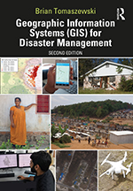
Brian Tomaszewski is a Professor at the Rochester Institute of Technology (RIT) within the School of Interactive Games and Media , Golisano College of Computing and Information Sciences. He also holds an Adjunct Professor position at the Centre for Disaster Management and Mitigation, Vellore Institute of Technology, India. Education : BA (University at Albany), MA (University at Buffalo), PhD (Pennsylvania State University) Research Interests focus on Geographic Information Science applications for Disaster Management , Forced Displacement , and Geovisual Analytics . His work bridges Spatial Thinking with Serious Games for crisis response and mitigation. Recent Publications (2023-2014) emphasize LLM-driven refugee camp analysis , geospatial resilience modeling , and serious games for disaster education , with fieldwork spanning Rwanda, Jordan, and Poland. Scientific Awards : Fulbright Scholar (2018) Grants & Collaborations include US National Science Foundation (NSF) funding for international projects and partnerships with UNHCR and IEEE . He leads the RefuGIS project and the Center for Geographic Information Science and Technology at RIT.
Dr. Chiara Bertelli is a Lecturer in Biosciences at Swansea University within the Faculty of Science and Engineering, School of Biosciences, Geography and Physics. With over 15 years of experience in coastal and marine ecological surveys, she specializes in seagrass ecology and restoration, marine conservation, and habitat suitability modeling. Dr. Bertelli has extensive field experience including boat-based surveys, SCUBA diving, and snorkeling in both temperate and tropical environments. She is currently completing her PhD part-time focusing on environmental drivers of change in seagrass meadows in the UK and Brazil. Her educational background includes advanced training in marine biology with specialization in ecological survey techniques and data analysis using R and Primer. Her primary research focuses on seagrass ecology as nature-based solutions for climate change. She develops habitat suitability models to inform optimal locations for seagrass restoration, with applications in carbon sequestration (blue carbon) and marine biodiversity enhancement. Her work aligns with UN Sustainable Development Goals 13 (Climate Action) and 14 (Life Below Water). Analysis of Dr. Bertelli's recent publications (2020-2025) reveals a strong emphasis on practical applications of seagrass research to inform restoration efforts. Her work spans habitat suitability modeling, environmental stress responses, nutrient dynamics, and decision-support tool development. A significant portion addresses seed-based restoration techniques, ecosystem services, and the socio-ecological dimensions of marine conservation. Dr. Bertelli actively collaborates with external organizations including Project Seagrass, Sky Ocean Rescue, WWF, Natural England, and the National Oceanographic Centre. Her current ReSOW project aims to develop the CEEDS (Coastal Ecosystem Enhancement Decision Support) tool, an open-source platform to guide seagrass restoration practitioners. As an educator, Dr. Bertelli teaches several field-based marine biology courses including BIO260 Marine Biology Field Course, BIO327 Tropical Marine Ecology Field Course, and BIO346 Professional Skills in Marine Biology. Her teaching emphasizes practical, field-based learning and professional skill development for marine biologists, with a focus on survey techniques, data analysis, and environmental impact assessment. Dr. Bertelli is actively involved in research teams focused on marine ecosystem restoration and coastal management. Her work bridges academic research with practical conservation applications, working closely with government agencies, NGOs, and international research partners to translate scientific findings into actionable conservation strategies.
Ningchuan Xiao is a Professor of Geography at The Ohio State University's Department of Geography. His work bridges Geographic Information Science (GIScience) with computational methods, emphasizing spatial optimization, cartography, and machine learning integration. Education: Ph.D. in Geography from The University of Iowa (2003). Courses taught include GIS fundamentals, cartography, and Python-based spatial analysis. Research Interests: Spatial Optimization: Developing algorithms for land acquisition, redistricting, and resource allocation. Machine Learning & Cartography: Exploring AI-driven map interpretation and ethical visualization of complex data. Census Data: Innovating privacy-preserving techniques while maintaining data utility, including temporal/spatial modeling. Open Source Tools: Authored GIS Algorithms (2016) and maintains GitHub repository 'gisalgs' for accessible code. Publications: Recent work (2023-2025) highlights advancements in synthetic microdata generation, privacy-utility tradeoffs in census aggregation, and AI-driven cartographic recognition. His 2022 studies include traffic camera analytics and choropleth map QA systems. Awards: Not explicitly listed in the provided texts. Advising & Grants: Collaborated with researchers like Y. Lin, J. Li, and S. Bao. Projects include the Sustainable Columbus Observatory (SCO) for urban sustainability metrics. Research is supported through academic partnerships and computational initiatives.