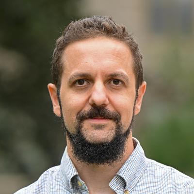
Timothy Becker serves as the John D. MacArthur Assistant Professor of Computer Science at Connecticut College, where he joined in 2023. His research focuses on transforming complex datasets into functional instruments through advanced computational techniques. His academic background includes: B.M. in Music Production from The Hartt School of Music B.S. in Computer Science from the University of Hartford Ph.D. in Computer Science and Engineering from the University of Connecticut Becker specializes in genomics applications but maintains active interdisciplinary collaborations in ecology and transportation. His core methodology integrates deep learning, generative modeling, and data visualization to develop open-source software tools. He emphasizes practical implementations for real-world data analysis and creates interactive tutorials to foster persistent student learning. His publication record from 2018-2025 reveals consistent contributions to bioinformatics and environmental data science, particularly in structural variation analysis and river connectivity modeling. Key trends include developing neural network frameworks for genomic data integration and creating visualization methods for multi-omic datasets. Becker actively seeks undergraduate research collaborators, encouraging students with domain-specific data or research questions to initiate projects. His interdisciplinary approach connects computer science with life sciences and environmental studies through numerous cross-institutional partnerships.
Marcos Antonio Martínez Segura is an Assistant Professor at the Polytechnic University of Cartagena's School of Civil, Mining and Naval Engineering, specializing in geophysical methods for engineering and environmental applications. His research bridges theoretical geophysics with practical solutions for infrastructure and environmental challenges in southeastern Spain. His primary research interests include Geophysics, Engineering Geology, and Geotechnical Engineering, with specific expertise in Electrical Resistivity Tomography (ERT), Multichannel Analysis of Surface Waves (MASW), Ground-Penetrating Radar (GPR), and UAV photogrammetry. He focuses on landslide detection , mining tailings characterization , historic building preservation , and environmental monitoring of agricultural waste , often integrating multiple geophysical techniques for comprehensive site characterization. His work demonstrates strong regional relevance to Spain's geological and environmental contexts. Analysis of his recent publications (2023-2025) reveals a dominant trend toward Python-based software development for geophysical data processing, particularly for ERT applications in hazard detection. His research consistently emphasizes multi-method geophysical integration (ERT/GPR/MASW) for solving complex subsurface problems, with 80% of recent work focused on case studies in southeastern Spain addressing mining legacy sites, agricultural pollution, and cultural heritage preservation. Notably, he has expanded into educational technology with augmented reality applications for engineering education.
Prof. Dr. Burak Beyhan is a Professor at the Faculty of Architecture, Department of Urban and Regional Planning, Muğla Sıtkı Koçman University. His academic journey includes: Education : Bachelor's in Urban and Regional Planning (Middle East Technical University, 1990–1996), MSc in Regional Planning (METU, 1996–1999), and PhD in Urban and Regional Planning (METU, 2000–2006). His research focuses on urban planning, GIS, regional development, and spatial analysis , with emphasis on historical cartography, socio-ecological resilience, and computational geospatial methods. He integrates open-source tools for spatial problem-solving. Publications (2011–2025) reveal trends in: Historical GIS and cultural memory revitalization. Urban morphology algorithms and open-source GIS tool development. Regional planning policy and sports-driven urban transformation in Turkey. Awards & Honors : ODTÜ Geliştirme Vakfı Book Award (2003) Young Social Scientists Award (Mansiyon, 2002) MFAY Incentive Award (2001) Prof. Dr. İlhan Tekeli MSc Thesis Award (1999) Supervision & Projects : Advised MSc theses on rural-industrial spatial organization and cultural planning. Led projects including: Development of campus spatial information systems (WEB-GIS). EU COST-A17 on SME regional development (2001–2005). TÜBİTAK-funded socio-economic change studies (2014–2016).
Assoc. Prof. Dr. Eng. Gergana Antova is a faculty member at the University of Architecture, Civil Engineering and Geodesy (UACEG) in Sofia, Bulgaria, serving in the Faculty of Geodesy, Department of Geodesy and Geoinformatics as Associate Professor since 2022. Her academic career spans over two decades, progressing from Assistant (2001-2004) to Senior Assistant (2004-2007), Chief Assistant (2008-2022), and finally to Associate Professor. Dr. Antova's educational background includes: Doctor of Science in General, Higher and Applied Geodesy/Geodesy and Geoinformatics (2014-2019, UACEG Sofia) Specialist in the Department of Higher Geodesy (2000-2001, UACEG Sofia) Master of Engineering in Geodesy (1995-2000, UACEG Sofia) Her primary research focuses on terrestrial laser scanning technologies and applications, specializing in point cloud modeling, Building Information Modeling (BIM), and laser scanning deformation investigation. Dr. Antova's work bridges theoretical geodesy with practical engineering applications, particularly in construction and cultural heritage preservation. She teaches courses including 'Geodesy' for Architecture students, 'CAD Systems' for Geodesy students, and 'Terrestrial Laser Scanning in Geodesy.' Her recent publications demonstrate significant advancement in laser scanning technologies, showing progression from fundamental techniques to sophisticated BIM integration and practical deformation monitoring solutions. The research reveals increasing sophistication in point cloud data handling, with emphasis on accuracy assessment, software comparison, and integration with UAV technology for diverse applications. Dr. Antova actively leads research projects related to digitalization in construction, including 'Use of ground-based laser scanners for deformation applications' and 'Terrestrial laser scanning of immovable cultural heritage objects.' She has practical experience with over 100 projects across Bulgaria, including significant work on the 'Studena' dam following the 2012 earthquake. She serves in leadership roles including Chairman of the General Assembly of the Faculty of Geodesy (2024-2027) and is a member of professional organizations such as the Union of Surveyors and Land Planners in Bulgaria and the Chamber of Engineers in Investment Design. Her professional qualifications include legal capacity according to cadastre and full design qualification KIIP, with proficiency in English and Russian.
Tamara Ilieva-Tsvetkova is a Senior Assistant Professor at the Department of Geodesy and Geoinformatics within the Faculty of Geodesy at the University of Architecture, Civil Engineering and Geodesy (UACEG) in Sofia, Bulgaria. She also serves as a Technical Associate at the Center for Quality and Accreditation and maintains her office in Cabinet 411P, with reception hours on Mondays from 11:30-12:30 during the winter semester of the 2025-26 academic year. Her educational background includes: Master's degree in Geodesy from UACEG, Sofia (2007) Master's degree in Marketing with specialization in "Advertising Management" from UNWE, Sofia (2015) Doctorate in "General, Higher and Applied Geodesy" from UACEG, Sofia (2019) Tamara Ilieva-Tsvetkova's research focuses on geospatial technologies and methodologies, with particular expertise in geodetic measurements, spatial databases, CAD and GIS systems development, engineering project management, and coordinate systems. She is proficient in English (excellent level) and Russian (basic level), and possesses extensive technical skills in AutoCAD, ArcGIS, QGIS, PostgreSQL with PostGIS, and web mapping libraries like Leaflet and OpenLayers. Her recent publications (2021-2024) show a strong trend toward web-based GIS applications, indoor positioning systems, climate change monitoring using geospatial data, and the integration of artificial intelligence with geospatial technologies. Her work spans practical applications in urban planning, transport infrastructure risk assessment, real estate management, and environmental monitoring, with a particular focus on Bulgarian territories. She is an active member of professional organizations: Chamber of Engineers in Investment Design Chamber of Engineers in Geodesy European Geosciences Union (EGU) Tamara Ilieva-Tsvetkova has participated in numerous research and construction projects: Upgrading information systems for AGKK (2013-2014) Information platform for environmental research and modeling at UACEG (2018-2019) Center of Excellence "Heritage BG" (2018-2023) Geodetic surveying for the South Stream gas pipeline Cadastral mapping for multiple Bulgarian villages and regions Geodetic survey for Sofia Metro expansion Geodetic survey for Sofia Airport infrastructure Her technical expertise spans multiple domains including geodetic measurement processing, GIS system development, spatial database management, and programming for geospatial applications using C#, SQL, JavaScript, and various GIS APIs.
Keith Spangler serves as Clinical Assistant Professor in Health Sciences Education at Boston University, leveraging interdisciplinary expertise to investigate climate-health relationships through spatial epidemiology. His research bridges geoscience data systems and public health analysis to address environmental health disparities. Education: PhD in Earth, Environmental, and Planetary Sciences, Brown University MS in Earth, Environmental and Planetary Sciences, Brown University MS in Epidemiology, Brown University Research focuses on spatial analysis of climate change health impacts , with emphasis on developing county-level heat metrics, open-source geospatial tools for social determinants assessment, and community-based hazard mapping. His methodology integrates big-data analytics from epidemiology and geoscience to model hospitalization risks and environmental exposures. Publication trends (2019-2023) reveal consistent output in environmental epidemiology journals, with growing emphasis on open-source methodological development and spatial resolution refinement . Recent work shifts from basic heat metric validation toward practical applications for community health planning and equity-focused interventions. As Clinical Assistant Professor, Dr. Spangler likely advises graduate students in health sciences programs. His active research portfolio—including community participatory projects and methodological innovations—indicates ongoing grant support for environmental health studies, though specific funding sources aren't detailed. Current work emphasizes translating geospatial research into public health practice through tools like the county-level heat metric dataset.
Kijung Shin is an Associate Professor at KAIST (Korea Advanced Institute of Science and Technology), holding dual appointments in the Kim Jaechul Graduate School of AI and the School of Electrical Engineering (Computer Division). He leads the Data Mining Lab and teaches multiple courses including Graph Mining and Social Network Analysis, Data Mining and Search, and other foundational courses in electrical engineering and AI. Education Ph.D. in Computer Science, Carnegie Mellon University (February 2019) M.S. in Computer Science, Carnegie Mellon University (December 2017) B.S. in Computer Science and Engineering, Seoul National University (August 2015) B.A. in Economics (Double Major), Seoul National University (August 2015) Research Interests Professor Shin's research primarily focuses on data mining, graph algorithms, and network science, with particular expertise in hypergraph analysis, tensor decomposition, and graph neural networks. His work bridges theoretical foundations with practical applications, developing algorithms that can efficiently analyze complex real-world networks. His recent research has expanded into multimodal learning, integration of large language models with graph neural networks, and applications in recommendation systems, satellite imagery analysis, and biological data analysis. His approach combines rigorous mathematical analysis with practical implementation, resulting in numerous open-source software tools that have been widely adopted in both academia and industry. His research has significant implications for social network analysis, fraud detection, recommendation systems, and scientific discovery in various domains. Research Trends Professor Shin's recent publications show a clear trajectory toward more complex network structures, particularly hypergraphs that capture higher-order interactions beyond simple pairwise relationships. His work increasingly integrates traditional graph algorithms with deep learning approaches, especially focusing on how graph neural networks can be improved and made more interpretable. There's also a growing emphasis on practical applications in areas like satellite imagery analysis, medical data, and recommendation systems that address real-world challenges. Scientific Awards Received the PAKDD Best Survey Paper Award for 'Multi-Behavior Recommender Systems: A Survey' (2025) Selected as one of the best short paper candidates of ACM RecSys 2024 (top 7) for 'Revisiting LightGCN' (2024) Selected for oral presentation (2.6% of accepted papers) at AAAI 2024 for 'VITA: 'Carefully Chosen and Weighted Less' Is Better in Medication Recommendation' (2024) Received the IEEE ICDM Best Student Paper Runner-up Award for 'TensorCodec: Compact Lossy Compression of Tensors without Strong Data Assumptions' (2023) Received the SIGKDD Best Research Paper Award and CogX Award for Best Student Paper in AI for 'FRAUDAR: Bounding Graph Fraud in the Face of Camouflage' (2016) Received the Best Senior Thesis Award from Seoul National University (2015) Received the Samsung Humantech Paper Award (1st in Computer Science) (2015) Teaching and Mentoring Professor Shin has taught multiple graduate and undergraduate courses at KAIST since 2019, including Graph Mining and Social Network Analysis, Data Mining and Search, and foundational courses in electrical engineering. He has also co-organized tutorials at major conferences including AAAI, KDD, ICDM, and CIKM on advanced topics in hypergraph neural networks and real-world hypergraph analysis. As the leader of the Data Mining Lab, he mentors numerous graduate students and postdoctoral researchers, fostering a collaborative research environment that has produced significant contributions to the field of data mining and network analysis. Research Leadership Professor Shin leads the Data Mining Lab at KAIST, which focuses on developing novel algorithms for analyzing complex networks and high-dimensional data. The lab has produced numerous influential software tools including D-Cube, M-Zoom, CoreScope, and DenseAlert, which are widely used in both academic research and industry applications. His research group maintains active collaborations with institutions worldwide and has received funding from various sources to support their innovative work in data mining and network analysis.