Ahmed Elbeltagi is an Assistant Professor in the Agricultural Engineering Department at Mansoura University's Faculty of Agriculture. His work focuses on hydrology, agricultural water management, and climate change adaptation. Specializes in data-driven modeling for water resource optimization Integrates machine learning with traditional hydrological models Active in climate change impact assessments on agricultural systems Recent research trends include: Developing open-source tools like Aqua-MC for irrigation simulation Applying hybrid deep learning models for evaporation prediction Advancing water quality assessment through multivariate analysis Exploring economic applications of wetlands in arid regions He collaborates with institutions across Egypt, India, China, and Saudi Arabia, with a focus on sustainable water management solutions.
Dr. Jann Michael Weinand is the head of the Integrated Scenarios department at the Institute of Climate and Energy Systems (ICE-2) within Forschungszentrum Jülich GmbH. He leads a team of 30 scientists, PhD students, and master students focusing on energy system analysis, complexity management, and AI integration. His work addresses regional and international energy systems, emphasizing renewable energy resource assessment and techno-economic feasibility. Dr. Weinand holds a Dr.-Ing. from the Karlsruhe Institute of Technology (2020) and a Mechanical Engineering and Business Administration degree from RWTH Aachen University (2016). His research spans energy autonomy, renewable resource optimization, and the socio-technical challenges of energy transitions. Key research areas include energy system modeling, geothermal and wind energy potential, and data-driven methodologies. He coordinates interdisciplinary projects with academic and industrial partners, contributing to high-impact journals like Nature Energy and Joule. His team develops open-source tools (e.g., ETHOS workflows) for reproducible energy assessments and advocates for spatially disaggregated energy planning. Publications highlight trade-offs in energy system design, AI risks, and land-use conflicts for renewables. He emphasizes integrating social, technical, and environmental factors into energy policy frameworks.
Katharina Eggensperger is an Early Career Research Group Leader at the University of Tübingen , leading the AutoML for Science group within the Cluster of Excellence Machine Learning for Science . She previously completed her Ph.D. at the University of Freiburg under Frank Hutter and Marius Lindauer (2022), and actively contributes to the AutoML community through open-source tool development and competition leadership. Co-developer of AutoML.org tools Faculty member of IMPRS-IS Chair for multiple AutoML workshops/conferences (2019-2025) Her research focuses on automated machine learning (AutoML) with specific attention to: AutoML Systems Hyperparameter Optimization Tabular Machine Learning Scientific Applications of ML She has organized multiple AutoML schools and conferences, including serving as Program Chair for AutoML 2024 and Non-archival Track Chair for AutoML 2025. Her work emphasizes making machine learning accessible through automation while maintaining scientific rigor and interpretability, particularly for tabular data applications. Katharina actively recruits PhD students through IMPRS-IS and collaborates with institutions like the University of Freiburg and Cyber Valley .
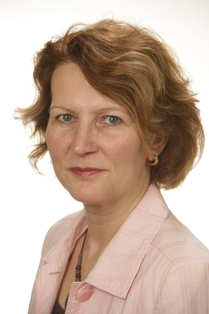
Laura Becker is an Assistant Professor at the Department of General Linguistics, University of Freiburg. Her research focuses on linguistic typology, quantitative methodology, and the role of coding efficiency in grammatical structures. She holds a PhD exploring article systems across languages and has contributed to cross-linguistic studies on syntax, morphology, and sociolinguistics. Her work emphasizes statistical rigor and computational tools, such as the glottospace R package for geospatial linguistic analysis. Recent projects include investigating phoneme inventories in Polynesian languages and socio-linguistic influences on conditional constructions. Publications highlight her expertise in morphosyntax, language contact, and corpus-based approaches. No scientific awards are explicitly mentioned in the provided materials. Dr. Becker has advised no recorded students in the available data and has not listed specific grants or labs. Her current research trends prioritize quantitative frameworks to address typological and evolutionary questions in linguistics.
Prof. Dr. Hanna Meyer is a Professor of Remote Sensing and Spatial Modeling at the Institute of Landscape Ecology, University of Münster (WWU). She leads the Remote Sensing and Spatial Modeling Group and is actively involved in teaching and research in geospatial data science, machine learning, and environmental monitoring. Her work is supported by multiple national and international funding bodies including the DFG, EU Horizon Europe, and internal university grants. B.Sc. Geography, Philipps University Marburg (2007–2010) M.Sc. Environmental Geography, Philipps University Marburg (2010–2013) Ph.D., Philipps University Marburg (2014–2018) Her research focuses on machine learning methods for spatial data, optical remote sensing, environmental monitoring, and spatio-temporal modeling. She develops and applies advanced statistical and machine learning techniques to satellite and drone-based data for mapping ecological variables, land cover, and environmental change. Her work emphasizes methodological rigor, model transferability, and uncertainty quantification in spatial predictions. The recent publications reflect a strong trend in developing and validating machine learning models for environmental mapping, with applications in soil science, peatland hydrology, forest ecology, and polar climatology. She contributes both to theoretical advancements in spatial model validation and to practical software tools in R for geospatial analysis. She has secured competitive research funding for projects such as PRISM, Carbon4D, Uebersat, and BEyond, focusing on spatial pattern recognition, carbon modeling, AI model transferability, and biodiversity prediction. She teaches courses on remote sensing, spatial data analysis with R, and environmental modeling, and supervises students and early-career researchers. She collaborates widely with researchers across institutions and leads a dynamic research group including postdoctoral researchers and students. Her open-source contributions, particularly R packages like CAST and uavRst, support reproducible research in geospatial machine learning.
Prof. Petra Sauer is a Professor of Computer Science and currently serves as Dean of the Department of Computer Science and Media at BHT Berlin. She leads research in database systems, geospatial technologies, and educational data analytics. Her work bridges academic research with practical applications in facility management, urban logistics, and e-learning platforms. Key projects include DiSEA (education analytics), ExCELL (mobility data integration), and BIM-FM (building lifecycle management). Research interests focus on: Database design & schema evolution Semantic web applications Geodatabase implementations Learning analytics in MOODLE environments Notable awards include the Tiburtius Prize (Gold 2008 for Marc-Florian Wendland's thesis, Bronze 2009 for Marco Blankenburg's thesis). Active supervision spans over 15 advisees across data science, database security, and semantic integration topics. Current courses include 'Database Systems' for Media Informatics students. Key projects: DiSEA: Moodle-based learning analytics framework ExCELL: Real-time traffic forecasting platform mVIZ: Open data visualization guidelines BIM-FM: Semantic integration of building models
Dr. Thomas Kalbacher serves as Deputy Head of Department and Workgroup Leader of Hydroinformatics at the Department of Environmental Informatics, Helmholtz Centre for Environmental Research - UFZ in Leipzig, Germany. With extensive experience in environmental modeling and software development, he leads critical research initiatives focused on groundwater systems and environmental informatics. His research spans Earth Science - Hydrogeology and Computer Science - Simulator & Workflows, with particular emphasis on the development of OpenGeoSys (OGS) software and related analysis tools. Kalbacher's work addresses sustainable use and protection of natural groundwater systems, examining their quantitative and qualitative impact on surface waters. He investigates how digital twins and near real-world models can help tackle water management challenges in the face of climate change, with a focus on creating robust future projections to preserve landscape multifunctionality. Analysis of his recent publications reveals strong trends in hydrogeological modeling, spectral analysis of groundwater level fluctuations, and development of digital tools for environmental monitoring. His work increasingly focuses on large-scale modeling of groundwater systems, particularly in the Danube catchment area, while also advancing data infrastructure through projects like Digital Earth. A significant portion of his recent research examines methodological approaches to hydrologic modeling, particularly comparative assessments of Richards equation versus infiltration capacity approaches. As leader of the Hydroinformatics workgroup, Kalbacher plays a pivotal role in the OpenGeoSys open-source project, which has become a significant platform for computational hydrology and environmental modeling. His team develops software solutions for regional groundwater quantity modeling (LandTrans) in cooperation with the Research Software Engineering and Visualization group. The Hydroinformatics group under his leadership contributes to advancing environmental modeling capabilities through robust software development practices and integration of high-resolution observation data from modern monitoring stations and satellite observations.
Dr. Guy C. Hembroff is an Associate Professor in the College of Computing at Michigan Technological University, serving as the founding director of the MS in Health Informatics Program and director of the Computational Science & Engineering PhD Program. He leads the Biomedical Data Science (BDS) Lab, focusing on healthcare innovation through AI, cybersecurity, and data science. His expertise spans machine learning, medical image analysis, and healthcare interoperability. Education: PhD in Computational Science & Engineering (Michigan Tech), MPA in Public Administration (Northern Michigan University), BS in Finance and Economics (Michigan Tech). Research interests include human health-focused AI/ML models, cybersecurity in healthcare, medical image segmentation, and public health surveillance. His work emphasizes collaboration with medical institutions like Henry Ford Hospital to develop clinical decision support systems and improve disease surveillance. Recent projects include AI-driven fracture risk prediction from knee radiographs and enhancing mental health intervention efficacy through multi-source data integration. Advising includes four doctoral students in areas like medical image analysis, blockchain for patient data security, and cost-effective mental health modeling. His software projects include FHIR-enabled health information exchange systems and Tick-Talk, a crowdsourced tick disease monitoring platform. Labs/Teams: The BDS Lab integrates expertise in medicine, AI, and cybersecurity to tackle healthcare challenges, emphasizing real-world impact through industry and academic partnerships.
Dr. Tomislav Hengl is a leading researcher and Technical Director at OpenGeoHub Foundation and Envirometrix BV, specializing in spatial statistics, machine learning, and environmental data science. With over 20 years of experience in predictive soil mapping and geostatistics, he has pioneered open source frameworks for automated global environmental mapping. Co-founder of OpenGeoHub Foundation Initiator of OpenGeoHub Summer Schools (running since 2007) Project leader of OpenLandMap system Recipient of Clarivate Highly Cited Researcher (2021) His research focuses on: Machine learning for spatial/spatiotemporal data Environmental data cube systems Global soil and vegetation mapping Open source geospatial software development Spatio-temporal predictive modeling Cloud computing for Earth observation data Recent research trends include: Development of high-resolution global terrain models Analysis of vegetation productivity using satellite time-series Ensemble machine learning for environmental mapping Integration of multi-source geospatial datasets Applications in climate change impact assessment Advancing open data infrastructures Scientific contributions include: Clarivate Highly Cited Researcher (2021) Over 60 journal publications Founding Vice-Chair of the International Society for Geomorphometry (2011-2015) Development of open source R packages for geospatial analysis
D. Frantz is an Assistant Professor at Trier University , leading the Geoinformatics - Spatial Data Science lab. Their research focuses on transforming Earth Observation (EO) data into actionable environmental insights through preprocessing, data cubes, and machine learning. Current Position : Assistant Professor for Geoinformatics - Spatial Data Science, Trier University (2021–today) Former Role : PostDoctoral Researcher at Earth Observation Lab, Humboldt-Universität zu Berlin (2017–2021) Education : PhD in Environmental Remote Sensing and Geoinformatics, Trier University (2013–2017) Frantz's research emphasizes open science , with all software and methods published as open source ( FORCE ). Key research areas include: EO data preprocessing to analysis-ready data Multi-sensor data integration (Sentinel, Landsat) Land cover fraction mapping and time series analysis Material stock quantification in buildings/infrastructure Climate change mitigation through urban-rural gradient analysis Recent publications highlight work on global material stock mapping , tree species classification in temperate forests, and temporally transferable crop mapping using deep learning. While no explicit awards are listed, their open-source contributions and leadership in the Geoinformatics lab underscore significant academic impact.
Pengfei Li is a prolific researcher affiliated with multiple academic institutions, including Harbin Medical University, Yale University, Beihang University, Zhejiang University, and others. His work spans interdisciplinary domains such as machine learning, robotics, remote sensing, and biomedical engineering. Research interests focus on Machine learning and deep learning for industrial and medical applications Signal processing and sensor technologies Remote sensing and geospatial data analysis Robotic control systems and exoskeleton design Code search and software engineering optimization His recent publications highlight trends in FPGA-based real-time systems, multimodal machine learning, and AI-driven diagnostics. While awards and student advising details are absent in the provided data, his contributions to IEEE journals and conferences underscore his expertise in algorithm design and applied informatics.
L. Oostwegel is a Researcher at GFZ German Research Centre for Geosciences, working within the Seismic Hazard and Risk Dynamics department. The researcher specializes in earthquake exposure modeling, building stock characterization, and multi-hazard risk assessment using geospatial data and open-source information. Oostwegel's research focuses on seismic hazard and risk assessment, with particular emphasis on building exposure modeling using OpenStreetMap and remote sensing data. Key research areas include earthquake risk modeling, flood risk assessment, landslide risk management, and the development of tools for multi-hazard risk assessment. The researcher has made significant contributions to understanding building stock characteristics at various scales, from individual buildings to global assessments. Analysis of recent publications reveals a strong focus on utilizing volunteered geographic information and Earth observation datasets for risk assessment. Oostwegel has developed methods for assessing the completeness of OpenStreetMap building data globally and has created tools like 'risk-calculator' for multi-hazard risk assessments. The research shows an interdisciplinary approach combining geophysics, geospatial analysis, and disaster risk reduction. Top-down or bottom-up in earthquake exposure modeling (2025) Safe Haven – Landslides: A Serious Game for Enhancing Risk Awareness (2025) A model of European buildings (2024) From Shelters to Skyscrapers: Worldwide Building Exploration (2024) Seismic loss assessment sensitivity study (2023) Oostwegel has collaborated extensively with researchers including Evaz Zadeh, T., Schorlemmer, D., and others across multiple projects focused on natural disaster risk assessment. The research has practical applications in urban planning, disaster risk reduction, and climate adaptation strategies, particularly for coastal megacities and areas prone to seismic activity.
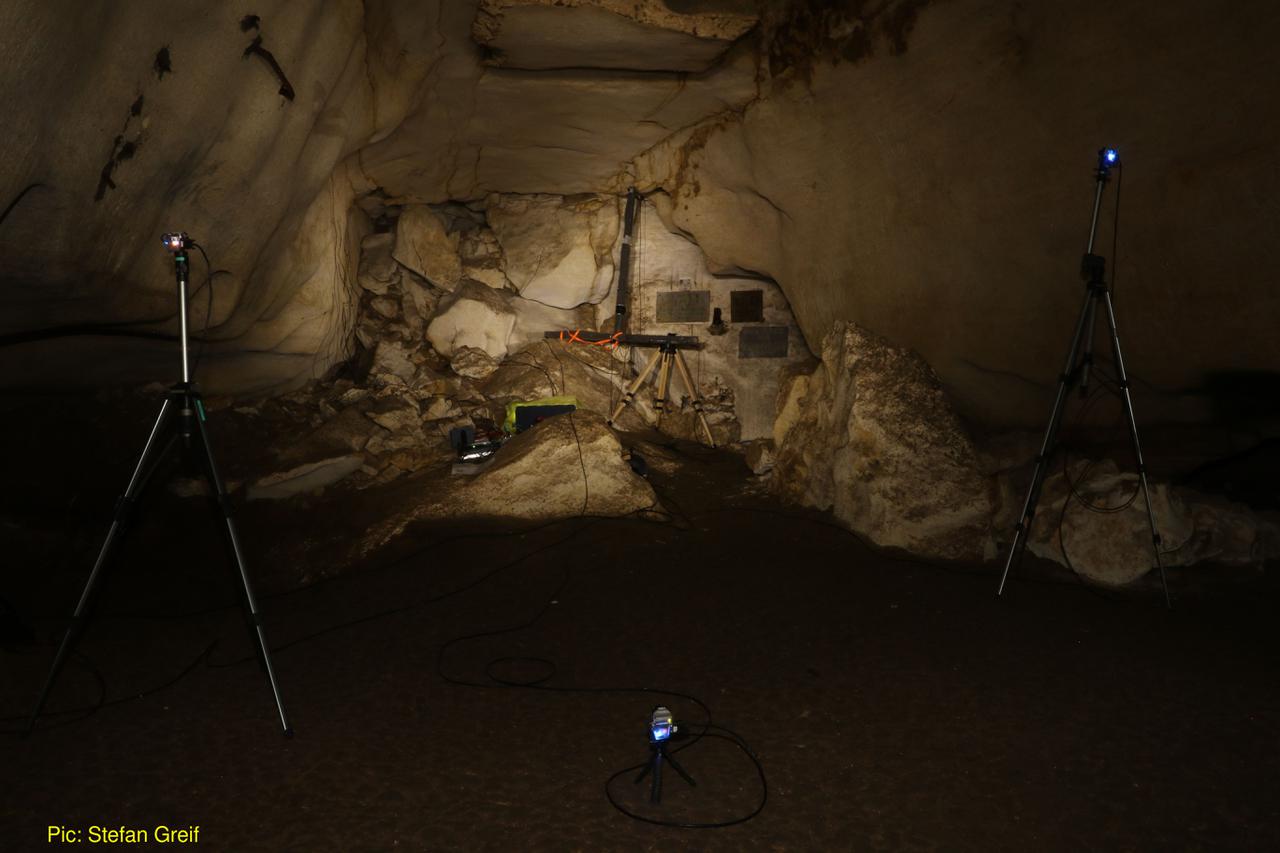
Dr. Thejasvi Beleyur is a Group Leader of the Active Sensing Collectives Lab at the Centre for the Advanced Study of Collective Behaviour, University of Konstanz, and holds an affiliated position at the Max Planck Institute of Animal Behavior. She also serves as IMPRS Faculty, contributing to interdisciplinary research at the intersection of animal behavior, sensory biology, and collective systems. Current: Group Leader, Active Sensing Collectives Lab (2025-present) Previous: Postdoc at Centre for the Advanced Study of Collective Behaviour (2021-2025) PhD: Max Planck Institute for Ornithology (2015-2021) Education: BS-MS in Biological Sciences, IISER-TVM (2008-2013) Dr. Beleyur's research program investigates how active-sensing agents like echolocating bats navigate complex sensory environments when operating in groups. Her work combines field observations, computational modeling, and swarm robotics to understand the sensorimotor strategies animals employ in information-limited settings. She has pioneered the development of the Ushichka dataset—a multichannel audio-video system for recording echolocating bats in natural habitats—which provides unprecedented insights into how bats modify flight and echolocation behaviors as group sizes change. Her publication record reveals a consistent trajectory examining sensory challenges in collective animal systems, with emphasis on echolocating bats. The research spans experimental field work, computational modeling, and methodological innovations in acoustic and video tracking. Recent work has expanded into developing computational tools like the beamshapes Python package for sound source modeling and exploring robot platforms to simulate bat collective behavior. Carl-Zeiss Nexus grant for inter-disciplinary research (2025) DFG Walter Benjamin postdoc grant (2021-2023) Early Career Researcher Award at International Bioacoustics Congress Google Cloud Platform Research Credits award ($1000) DAAD-GSSP Stipend for doctoral studies (2015-2020) Dr. Beleyur actively mentors students in her lab, currently supervising PhD student Frithjof and Master's student Aditya, following the completion of Gabriele's Master's thesis on the active-sensing Ro-BAT platform. Her research program is supported by competitive grants including the Carl-Zeiss Nexus grant and previously the DFG Walter Benjamin fellowship, which funded her work on 'The How and What of Active Sensing Collectives.' The Active Sensing Collectives Lab brings together an interdisciplinary team working at the interface of sensory biology, robotics, and collective behavior. The lab develops novel computational methods for analyzing complex datasets from multi-sensor field recordings, with emphasis on creating tools for long-term community use. Current projects include characterizing echolocating groups in the field and studying sensorimotor strategies using computational modeling.
Pavol Hnila is a Researcher at the Institute of Ancient Near Eastern Studies within the Department of History and Cultural Studies at Free University of Berlin. He serves as Project Director for the DFG-funded project 'High Mountains as Cultural Landscapes: Studies on the Interconnection of Pastoralism, Cult, and Climate Change in Prehistoric Armenia', conducting fieldwork in the Armenian Highlands with a focus on Mount Aragats. Hnila specializes in high-altitude archaeology of the South Caucasus, with particular expertise in vishap stelae (dragon stones) and ritual landscapes. His research integrates traditional field archaeology with archaeometric methods including machine learning for obsidian sourcing, geochemical analysis of stone monuments, and digital elevation model assessment. He examines prehistoric adaptation to mountainous environments through studies of pastoralism, settlement patterns, and cultural responses to climate change. His publication trends reveal deep engagement with Armenian prehistory, particularly ritual practices surrounding vishap monuments and high-altitude burial sites. Recent work demonstrates increasing methodological sophistication through computational approaches to material culture analysis while maintaining strong field-based documentation of endangered cultural heritage sites across the Armenian Plateau. Dr. Hnila leads the DFG project team conducting interdisciplinary research in Armenia, supported by student assistant Nikolai Techow. His work involves collaboration with international specialists in archaeometry, geology, and remote sensing to document and interpret high-mountain cultural landscapes. The research team operates in challenging high-altitude environments of Armenia, focusing on the cultural significance of vishap stelae within ritual landscapes. Fieldwork combines systematic survey, targeted excavation, and scientific analysis to understand prehistoric adaptation strategies, monument construction techniques, and ritual practices in mountainous terrain, with particular attention to preservation challenges facing these unique heritage sites.
Maria Antonia Brovelli is a Professor of GIS at Politecnico di Milano (PoliMI) in the Department of Civil and Environmental Engineering and a member of the School of Doctoral Studies in Data Science at Roma La Sapienza University. Formerly Vice-Rector of PoliMI for the Como Campus (2011-2016), she currently leads the GEOLab (Geomatics and Earth Observation Lab) and holds influential roles including Deputy Chair of the ISPRS TC on Spatial Information Science, co-chair of the United Nations Open GIS Initiative, and Chair of the UN-GGIM Academic Network. Her research spans geomatics with evolving expertise from geodesy and radar-altimetry to GIS, webGIS, geospatial web platforms, Volunteered Geographic Information (VGI), Citizen Science, Big Geo Data, and geospatial AI. A global leader in Open-Source GIS advocacy, her work emphasizes open data ecosystems, collaborative mapping, and AI-driven geospatial solutions for environmental challenges. Key methodologies include open-source software frameworks and citizen science integration. Recent publications (2025) demonstrate convergence of AI and geospatial analysis, featuring satellite-ground sensor fusion for urban air quality, high-resolution land cover mapping, zero-shot learning for remote sensing imagery, landslide prediction models, and climate-agriculture impact studies. Dominant themes include open geospatial platforms, transferable AI architectures, and multi-scale environmental monitoring using open data principles. Honors include: Sol Katz Award for Geospatial Free and Open Source Software (OSGeo) As mentor of PoliMI's YouthMappers chapter (PoliMappers), she guides student-led open mapping initiatives. Her editorial leadership as Associate Editor of ISPRS International Journal of Geo-Information shapes discourse in geospatial AI and open science. Research grants span ESA Earth Observation programs, UN initiatives, and international collaborative projects focused on open geospatial infrastructure. Brovelli directs GEOLab at Politecnico di Milano, a hub for geospatial innovation developing open-source tools for earth observation, citizen science platforms, and AI-driven spatial analytics. The lab collaborates with UN-GGIM, ISPRS networks, and ESA projects, driving open standards adoption globally while advancing geospatial AI applications in climate resilience and urban sustainability.