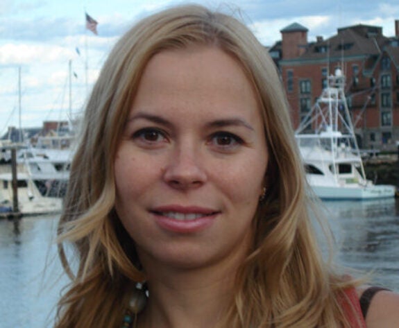
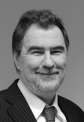
Irina Marinov is an Associate Professor in the Department of Earth and Environmental Sciences at the University of Pennsylvania. She specializes in climate science, focusing on the critical role of oceans in global climate dynamics and carbon cycling. Her research integrates Earth system models and satellite data to study phenomena such as Southern Ocean convection, phytoplankton ecology, and the impact of climate change on oceanic processes. Marinov’s research spans biogeochemical cycles, marine ecology, and climate modeling, with a particular emphasis on Southern Ocean dynamics. She explores teleconnections between tropical atmospheric systems and Southern Ocean processes, polynya variability, and the use of satellite data to understand phytoplankton biomass and carbon distribution. Her recent publications (2024-2025) highlight the Southern Ocean’s influence on multidecadal climate variability, nonlinear CO2 dynamics, and the development of the GLOBAL CLIMATE SECURITY ATLAS. These works bridge climate modeling, satellite remote sensing, and policy applications. Scientific Awards: Undergraduate Research Mentorship award First woman to be tenured in the Earth and Environmental Sciences Department at Penn
Peter Huybers is a Professor of Earth and Planetary Sciences and Environmental Science and Engineering at Harvard University , where he investigates the climate system and its societal implications, including interactions between volcanism and glaciation , extreme temperature predictability , and climate change impacts on food production . Research interests span climate change attribution , paleoclimate reconstruction , drought dynamics , crop yield modeling , and earth system feedbacks . His work often integrates art-historical analysis with climate science, as seen in studies of 19th-century air pollution through Turner and Monet paintings . Scientific awards include funding from Harvard Data Science Initiative (2023) for projects on climate change and food supply volatility Amazon Web Services (2023) grant His 20+ peer-reviewed articles since 2020 focus on climate proxies , hydrological modeling , solar forcing , and agricultural-climate interactions , with recent work in Nature , PNAS , and Science Advances . Advising : Mentored 10+ PhD students including Parker Liautaud , Duo Chan , and Marena Lin , while leading research teams with current members like Greta Berendes and Caro Park . Former staff include Jon Proctor and Lucas Vargas Zeppetello , the latter now at UC Berkeley (2024).
Zackary Johnson , the Juli Plant Grainger Associate Professor of Biological Oceanography and Marine Biotechnology at Duke University, leads interdisciplinary research at the intersection of marine microbiology and biogeochemical innovation. Affiliated with the Nicholas School of the Environment and based at the Duke Marine Laboratory , his work spans microbial ecology, algal biotechnology, and climate mitigation strategies. Education: Ph.D. in Marine Science (Duke University, 2004), B.S. in Biology (MIT, 1994) Research Interests focus on marine microbial communities, particularly the model phytoplankton Prochlorococcus , algal cultivation for sustainable bioproducts, and the ecological impacts of ocean acidification. His lab investigates microbial interactions across diverse environments—from coastal estuaries to open-ocean gyres—and develops technologies for carbon-negative aquaculture systems. Publications highlight expertise in microbial biogeography, algal biofuels, and climate-resilient marine food webs. Recent work explores drone-based ocean color sensing, Gulf Stream eddy microbiomes, and the role of Labyrinthulomycetes protists in carbon export. Scientific Awards: Juli Plant Grainger Associate Professorship DOE and NSF-funded projects Grants include high-profile initiatives like the Marine Algae Industrialization Consortium (MAGIC) and REU Site program for coastal research training. His lab maintains a dedicated research site for studying microbial dynamics and sustainable algal cultivation.
Dr. John Lehrter is a Professor of Marine Sciences and Associate Director of the Stokes School of Marine & Environmental Sciences at the University of South Alabama, as well as a Senior Marine Scientist at the Dauphin Island Sea Lab. He holds a Ph.D. in Marine Sciences from the University of Alabama (2003). His research focuses on coastal biogeochemistry, ecosystem modeling, and satellite ocean color remote sensing, with an emphasis on understanding eutrophication, hypoxia, and multiple stressor impacts on coastal ecosystems. Dr. Lehrter has advised numerous graduate and undergraduate students and leads a lab engaged in field studies, numerical modeling, and satellite data analysis. His work addresses societal challenges in coastal management and climate change adaptation. Research Interests: Multiple Stressor Impacts to Coastal Ecosystems, Marine Biogeochemistry, Ecosystem Modeling, Satellite Remote Sensing, and Hypoxia Dynamics. His lab develops tools to quantify nutrient pollution effects and predict ecosystem responses to management actions. Advising and Grants: Dr. Lehrter oversees a dynamic lab with graduate students, postdocs, and technicians. Current projects include modeling nutrient dynamics, satellite data applications for water quality, and experimental studies on multiple stressors (e.g., temperature, pH) impacting marine organisms. His lab collaborates with agencies like the EPA and NOAA, contributing to coastal policy and restoration efforts. Labs/Teams: Dauphin Island Sea Lab (DISL) and the University of South Alabama’s Stokes School of Marine & Environmental Sciences. The lab recently established a state-of-the-art facility for multiple stressor experiments on marine species.
B. B. Cael is an interdisciplinary climate and ocean scientist affiliated with the Department of the Geophysical Sciences at the University of Chicago and the Climate Systems Engineering Initiative . His work integrates data analysis and theoretical models to investigate global-scale questions about Earth's carbon cycle and climate system. Cael's research interests span climate mitigation , climate sensitivity , climatic extremes , ocean biogeochemistry , plankton ecology , remote sensing , and paleoclimate . His publications focus on ocean carbon fluxes, climate feedbacks, and marine ecosystem dynamics, with recent work applying machine learning to oceanographic data. His academic journey includes a PhD from the MIT-WHOI Joint Program , a Simons Foundation Postdoctoral Fellowship at the University of Hawai’i at Manoa, and a Principal Scientist role at the UK's National Oceanography Centre. Current research at UChicago addresses both carbon dioxide removal and solar geoengineering strategies. Scientific Awards Simons Foundation Postdoctoral Research Fellow
Ralf Jaumann is a Professor at the Free University of Berlin within the Institute of Geological Sciences, Department of Planetary Sciences and Remote Sensing . He serves as Deputy Director of the Institute of Planetary Research and previously led the Planetary Geology Department at the German Aerospace Center (DLR) in Berlin-Adlershof until January 2020. As Principal Investigator of the High Resolution Stereo Camera (HRSC) on ESA's Mars Express mission (2013-2021), he has significantly contributed to Mars geology studies. Co-PI of Mastcam-Z on NASA's Mars 2020 mission Co-I on instruments for Rosetta , Cassini , Dawn , and ExoMars missions Coordinated global Mars color mosaics and long-term surface change detection using HRSC data His research focuses on planetary geology , remote sensing , and space mission instrumentation , particularly analyzing geological processes on Mars, asteroids, and icy satellites. Recent publications examine spectral properties of asteroid regolith, Martian aeolian processes, and hydration dynamics on the Moon. Despite his extensive involvement in mission operations, no specific student advisement records or scientific awards are mentioned in the provided data. Jaumann teaches Planetary Exploration: Space Missions and Planetologie Literaturseminar at the graduate level.
Bita Sabbaghzadeh is a Marine Biogeochemist affiliated with the Leibniz Institute for Baltic Sea Research (IOW), Germany. Her work focuses on trace gas dynamics, surface microlayer chemistry, and biogeochemical processes in marine systems. She holds a PhD in Marine Biogeochemistry from Newcastle University (2017) and has taught at Newcastle and the University of Glasgow. Her research explores surfactants, chromophoric dissolved organic matter (CDOM), and their impacts on air-sea gas exchange, with implications for climate science and ocean acidification. Education: PhD in Marine Biogeochemistry, Newcastle University (2017) MRes in Marine and Freshwater Ecology, University of Glasgow (2011) MSc in Marine Biology, Azad University (Tehran, Iran) BSc in Natural and Environmental Sciences, Azad University (Tehran, Iran) Research Interests: Her work integrates physical, chemical, and biological oceanography to study trace gases (N₂O, CH₄), surfactant dynamics, CDOM, and their roles in climate systems. Recent projects include the Benguela Upwelling System (EVAR project) and the RAGNARoCC initiative on North Atlantic radiatively active gases. Publications Overview: Her articles highlight surfactant impacts on CO₂ exchange, nitrous oxide biogeochemistry in upwelling systems, and CDOM dynamics across ocean provinces. These studies bridge laboratory and field observations, emphasizing interdisciplinary approaches. Awards: Best Published Paper Prize (Geophysical Research Letters), 2017 NERC PhD Scholarship, Newcastle University Best Presentation Awards (2016–2017) Grants & Projects: EVAR: Benguela Upwelling System under Climate Change RAGNARoCC: North Atlantic Trace Gases Atlantic Meridional Transect (AMT) Labs/Teams: She is part of IOW's Trace Gas Biogeochemistry group, collaborating with institutions like the University of Hamburg and the Natural Environment Research Council (NERC).
Sabrina Speich serves as Full Professor of Oceanography and Climate Sciences at École Normale Supérieure (ENS), a constituent institution of Paris Sciences and Letters University (PSL). She conducts research within the Laboratoire de Météorologie Dynamique (LMD) at the Institut Pierre Simon Laplace (IPSL), France's premier climate research consortium. Her work bridges observational oceanography with climate modeling to address fundamental questions in earth system dynamics. Her research program investigates scale-interaction phenomena in ocean-atmosphere systems, with specialized focus on mesoscale eddy dynamics, tropical Atlantic circulation patterns, and remote sensing applications. Key interests include the three-dimensional structure of anticyclonic eddies, material coherence in oceanic features, and the interplay between river plumes (notably the Amazon) and ocean currents. She employs integrated methodologies combining in-situ measurements, satellite remote sensing, and theoretical frameworks to unravel complex fluid dynamics processes. Analysis of her 2023-2024 publications reveals consistent emphasis on eddy boundary detection techniques, vertical eddy structure characterization, and air-sea interaction mechanisms in tropical regions. Her work demonstrates methodological innovation in applying theoretical frameworks to observational data, particularly regarding North Brazil Current ring dynamics and latent heat flux variations. Collaborative international research features prominently across these studies. Professor Speich actively contributes to the Laboratoire de Météorologie Dynamique's research ecosystem at IPSL, participating in France's national climate science infrastructure. Her editorial role as Associate Editor for Ocean Observation at Frontiers in Marine Science further demonstrates engagement with the broader oceanographic community, alongside 35 documented editorial contributions including edited research topics and publications.
Dr. Hesham El-Askary is a Professor of Computational and Data Science at Schmid College of Science and Technology, Chapman University . With expertise in Global Climate Change, Remote Sensing, and Natural Disasters , his research spans atmospheric aerosols, marine ecosystems, and sustainable resource management. He holds a Ph.D. in Computational Sciences from George Mason University. B.Sc. Alexandria University M.Sc. George Mason University (×2) Ph.D. George Mason University His research interests focus on: Dust storm monitoring via remote sensing Climate change impacts on sea-level rise and coral reefs Renewable energy for sustainability Hydrological extremes and drought analysis AI/ML applications in environmental science Marine habitat and coastal zone management Recent publications highlight his work in: Machine learning for groundwater vulnerability Land surface temperature trends Coral reef monitoring in the Red Sea Solar energy optimization in Egypt/UAE Drought prediction in Mediterranean regions Awards & Grants : Chapman University Senior Wang-Fradkin Professorship (2015) Regional Coordinator for EU Horizon 2020 GEO-CRADLE Project ($3M, 2016) Saudi Environmental Management Award (2006) Funding from NSF, NASA, USDA, and EU As a IEEE and AGU member , he bridges environmental science with advanced computational methods.
Claire Dune is an Assistant Professor at the University of Toulon, affiliated with the COSMER Laboratory (Mechanical and Robotic Systems Design Laboratory). Her research focuses on robotics, computer vision, and underwater systems, with applications in environmental monitoring and human-robot interaction. She teaches computer science, numerical methods, image processing, and visual servoing. Institution: University of Toulon Laboratory: COSMER (Mechanical and Robotic Systems Design Laboratory) Academic Rank: Assistant Professor Email: claire.dune@univ-tln.fr Her research centers on perception for robot control, particularly in underwater robotics and computer vision. Key interests include visual servoing, SLAM, gesture recognition for diver-robot interaction, and autonomous capabilities in real-world marine environments. She applies deep learning and sensor fusion techniques to enhance underwater visual perception and navigation. The recent publications demonstrate a strong trend in underwater robotics, with focus areas including tether dynamics (catenary modeling), ROV localization using umbilicals and IMUs, long-term visual localization in deep-sea environments, and color restoration in underwater imagery. Her work bridges theory and real-world application, contributing datasets like 'Eiffel Tower' for benchmarking and advancing multi-agent SLAM systems. Claire Dune has contributed to leading journals such as IEEE Robotics and Automation Letters, Ocean Engineering, and The International Journal of Robotics Research. Her editorial and survey work highlights her leadership in the domain of deformable object manipulation. Retrieval of benthic habitat abundance and bathymetry from hyperspectral data (DESIS) in shallow waters ROV localization using ballasted umbilical equipped with IMUs MAM3SLAM: Towards underwater robust multi-agent visual SLAM Eiffel Tower: A Deep-Sea Underwater Dataset for Long-Term Visual Localization Challenges and Outlook in Robotic Manipulation of Deformable Objects Claire Dune actively collaborates with researchers such as Vincent Hugel, Juliette Drupt, and Andrew Comport. She has supervised or co-supervised numerous research projects and publications, particularly in underwater robotics and assistive technologies. Her work involves experimental robotics and system integration, often validated in real marine environments. She leads research in the COSMER laboratory focused on underwater robotics, including projects on tethered ROVs, diver-robot communication via gesture recognition, and environmental monitoring using visual and hyperspectral data. Her team develops practical solutions for marine science and offshore operations, emphasizing robustness and autonomy.
Prof. Kazimierz Bęcek is affiliated with the Wrocław University of Science and Technology as a faculty member in the Faculty of Geoengineering, Mining and Geology , specifically within the Department of Geodesy and Geoinformatics . His research spans multiple domains including geodesy, remote sensing, and geomatics, with a strong focus on elevation data analysis and environmental monitoring. Ecology Photogrammetry Remote Sensing Geodesy Geomatics Prof. Bęcek's work primarily investigates geospatial data accuracy, environmental dynamics, and geodetic methodologies. He has contributed significantly to elevation model validation, land subsidence detection, and vegetation collapse analysis through advanced remote sensing techniques. Recent publications highlight his expertise in Digital Elevation Model evaluation , LiDAR data processing , and environmental monitoring using satellite observations. His research extends to climate-ocean interactions and real-time geospatial mapping challenges. Contact: kazimierz.becek@pwr.edu.pl Physical address: ul. Na Grobli 15, 50-421 Wrocław, building L-1 (Geocentrum), room 366
Ahed Alboody is a Professor and Researcher at HESAM University Group, specifically affiliated with CESI and the Digital Innovation Laboratory for Businesses and Learning to Support Territorial Competitiveness (LINEACT) in Nice, France. He holds a specialized doctorate in computer science from the University of Toulouse 3 Paul Sabatier and has extensive experience in deep learning, computer vision, and remote sensing applications. His work bridges academic research with practical applications in environmental monitoring, human-computer interaction, and spatial reasoning systems. Education: Specialized Doctorate in Computer Science, University of Toulouse 3 Paul Sabatier (IRIT), 2011 Master 2 Research in Electronics, Automation and Systems Engineering, National Polytechnic Institute of Toulouse (INPT-ENSEEIHT), National School of Civil Aviation (ENAC), ISAE-SUPAERO, and University of Toulouse III, 2006 Engineering Diploma in Electronics and Telecommunications, University of Tishreen (Techrine), Lattakia, Syria, 2002-2003 Undergraduate studies in Electronics and Telecommunications, University of Tishreen (Techrine), Lattakia, Syria, 2002 Alboody's research focuses on advanced applications of deep learning and computer vision, particularly in the areas of 3D hand gesture recognition, hyperspectral and multispectral image processing, and semantic segmentation. His work combines theoretical advancements in mixture-of-experts architectures with practical applications in remote sensing and environmental monitoring. He has pioneered approaches in frugal learning and zero-shot learning for image segmentation tasks, with applications in digital twins and collaborative robot environments. His publication record demonstrates a clear evolution from foundational work in spatial reasoning systems (2008-2012) to current cutting-edge research in deep learning architectures for 3D gesture recognition and hyperspectral image analysis. Recent publications (2022-2024) show a strong focus on mixture-of-experts transformers, parallel architectures for efficient computation, and applications in environmental monitoring with drones and satellite imagery. Alboody actively supervises Master's level research projects (two M2 level projects mentioned) and serves as a reviewer for prestigious journals including IEEE Transactions on Neural Networks and Learning Systems and IEEE Transactions on Geoscience and Remote Sensing. He has also been a member of the Technical Program Committee for international conferences on databases and knowledge applications. His laboratory work centers around the Digital Innovation Laboratory for Businesses and Learning to Support Territorial Competitiveness (LINEACT), where he leads research in engineering and digital tools. Current projects include developing graph neural networks for 3D hand gesture recognition using depth and skeleton data, and implementing frugal learning approaches for semantic image segmentation in collaborative robot environments.
Dr. Gabriel A. Vargo is affiliated with the College of Marine Science at the University of South Florida. His primary research focuses on phytoplankton ecology, harmful algal blooms (HABs), and benthic microbial processes . He investigates dinoflagellate dynamics, in situ phytoplankton growth rates, and interactions between phytoplankton and zooplankton. Recent projects examine phycotoxin impacts on coastal wildlife and the ecological consequences of events like the Deepwater Horizon oil spill. His work integrates field observations, isotopic analysis, and satellite remote sensing (e.g., SeaWiFS data) to understand marine ecosystems. Key contributions include studies on Florida red tides, Gulf of Mexico environmental changes post-oil spill, and benthic foraminifera symbiosis. Dr. Vargo collaborates widely, publishing in journals like Journal of Geophysical Research and Progress in Oceanography . No scientific awards are explicitly listed, but his research aligns with grants in marine ecology and environmental monitoring. Lab affiliations are inferred through his College of Marine Science affiliation, though specific lab names are not mentioned.
Atsushi Hamada is an Associate Professor at the Faculty of Sustainable Design, University of Toyama, where he is affiliated with the Department of Earth System Science. He concurrently serves as a Visiting Associate Professor at the Center for Environmental Remote Sensing (CEReS) at Chiba University. His academic career spans multiple institutions and research collaborations focused on atmospheric science and remote sensing. Dr. Hamada's research focuses on several interconnected areas within atmospheric science: Precipitation systems and cloud physics analysis Satellite meteorology and remote sensing techniques Tropical meteorology and extreme rainfall events Global precipitation measurement using spaceborne instruments Climate change impacts on precipitation patterns His publication record demonstrates extensive work with satellite missions including the Global Precipitation Measurement (GPM) and Tropical Rainfall Measuring Mission (TRMM). Recent research emphasizes spectral latent heating retrieval algorithms, drop size distribution analysis, and precipitation mechanisms across diverse geographical regions. His work consistently involves international collaborations with researchers from multiple institutions across Japan and globally. Dr. Hamada has developed significant tools for the meteorological community, including the Equidistant color scale generator (with Inatsu, 2016) and the CTOP (Cloud-Top Height Product) estimated by geostationary satellites. His research bridges theoretical meteorology with practical applications for weather prediction, climate monitoring, and environmental studies. His work on precipitation systems has particular relevance for understanding regional weather patterns around Japan and in tropical regions.
Andrea Ajmar is an Associate Professor at the Politecnico di Torino, affiliated with the Interuniversity Department of Territorial Sciences, Planning and Policies (DIST). He serves as the contact person for the University Language Centre (CLA) and leads research in geomatics, spatial data science, and emergency management. His work is aligned with UN SDG 11: Sustainable Cities and Communities, and he contributes to major EU-funded projects such as LEXIS (H2020). Scientific Disciplinary Sector: CEAR-04/A - Geomatics (Area 0008 - Civil Engineering and Architecture) Research Laboratory: SDG11Lab (DIST) ERC Sectors: PE10_14, SH2_10, PE10_4, SH2_9 Andrea Ajmar's research focuses on applying Spatial Data Science techniques to transportation, urban planning, and disaster response. His work leverages GIS, remote sensing, and spatial data infrastructures to analyze urban resilience, environmental change, and emergency workflows. He has published extensively on topics including climate adaptation in cities, glacier monitoring, flood modeling, and post-disaster assessment tools. The recent publications of Andrea Ajmar demonstrate a strong trend in integrating high-performance computing, AI, and big data with geospatial technologies for urban and environmental applications. His work spans climate resilience, disaster impact modeling, and satellite-based environmental monitoring, reflecting a multidisciplinary approach to sustainable development. Scientific Awards and Recognitions: BEST POSTER PAPER AWARD, ISPRS (2008) Teaching and Advising: Andrea Ajmar is actively involved in teaching and mentoring. He supervises multiple PhD students in the Urban and Regional Development and Architectural and Landscape Heritage programs. He teaches advanced courses such as "Advanced Geospatial Data Management" and "Geomatics for Urban and Regional Planning." He has also earned teaching certifications including Learning to Teach (L2T), Mentoring Polito Project (M2P), and Learning to Teach with Innovative Teaching Project (L2T_ITP). Research Projects: He served as the Scientific Manager for the EU H2020 LEXIS project, focusing on HPC and Big Data enabled large-scale test-beds and applications in disaster management and urban planning. Professional Service: Ajmar has held leadership roles in international organizations, including Vice-President of the International Working Group on Satellite Emergency Mapping (2013–2014), Secretary of ISPRS ICWG IV/VIII (2008–2012), and member of the ASITA Scientific Committee (2008–2012). He also served as Guest Editor for the journal Remote Sensing (2019–2021) and participated in conference program committees such as GISTAM 2019 and 2020.