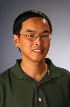
Peng Gao is a Professor in the Department of Geography and the Environment at Syracuse University, affiliated with the Maxwell School of Citizenship and Public Affairs. His work bridges river geomorphology and urban geospatial analysis, leveraging GIS, remote sensing, and UAV technologies to address environmental and social challenges. Education: Ph.D., Physical Geography, State University of New York at Buffalo (2003) M.S., Physical Geography, Lanzhou University (1993) B.S., Solid Mechanics, Lanzhou University (1990) Professor Gao specializes in river morphodynamics—particularly in the Qinghai-Tibet Plateau—and geospatial applications for urban planning. His research examines braided/meandering river systems, peatland hydrology, and how urban built environments influence social inequities and public health outcomes through spatial analysis. His 2020-2024 publications reveal a dual focus: (1) fluvial processes in high-altitude regions (e.g., neck cutoff dynamics, braided river discharge estimation using Landsat), and (2) urban applications (e.g., green building design, lead poisoning exposure mapping). This reflects a strategic integration of field geomorphology with computational geospatial modeling. Professor Gao actively mentors through SOURCE undergraduate research grants and PhD committees. Current funded projects include peatland mapping in the Andean Altiplano, I-81 Viaduct impact analysis in Syracuse, and studies on urban built environments affecting childhood lead poisoning. His work utilizes UAVs for BVLOS operations and collaborates with Syracuse CoE on urban environmental simulations, emphasizing technical innovation in geospatial data acquisition and analysis.