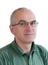
Dr. Kevin Pearson is a Senior Research Officer in the Department of Geography at Swansea University, part of the Faculty of Science and Engineering. His research focuses on atmospheric science, remote sensing, and climate applications using satellite data. He specializes in aerosol optical depth measurements, sea surface temperature analysis, and convective systems modeling. Key research areas include: Aerosol measurements from satellite instruments (ATSR-SLSTR series) Global climate data products (EOCIS project) Sea surface temperature analysis using microwave radiometers Recent contributions include high-impact publications on atmospheric aerosol datasets and satellite-based climate time-series analysis. His work bridges geophysics, remote sensing technology, and climate modeling to address environmental challenges.
Ralf Bennartz is a Full Professor in the Department of Earth and Environmental Sciences at Vanderbilt University. He holds affiliate appointments at the University of Wisconsin–Madison’s Department of Atmospheric and Oceanic Sciences and the Space Science and Engineering Center. His research is centered on atmospheric and climate physics, with a strong focus on high-latitude and Arctic regions. Ph.D., Free University of Berlin, 1997 Diploma (M.S.), University of Hamburg / Max-Planck-Institute für Meteorologie, 1994 Undergraduate Studies, University of Cologne, 1988–1990 His research interests include the role of water vapor, clouds, and precipitation in the climate system, leveraging both satellite and ground-based remote sensing. He leads the NSF-funded ICECAPS project in Greenland and contributes to NASA missions such as OCO-2 and TROPICS. His work emphasizes cloud-radiation interactions, Arctic climate change, and aerosol-cloud interactions. He has published extensively in high-impact journals such as Nature , Geophysical Research Letters , and Journal of Climate . His recent publications show a strong trend in using satellite data (especially MODIS, CloudSat, and GPM) to analyze cloud microphysics, precipitation, and water vapor. Topics include cloud droplet number concentration, snowfall retrieval, and radiative transfer modeling. These studies span diverse regions including Greenland, the East China Sea, the Atlantic, and the Pacific. Scientific awards and recognitions include: Member, NASA TROPICS Science Team (2016–ongoing) Member, NASA OCO-2 Science Team (2010–ongoing) Expert Reviewer, IPCC Working Group I, 5th Assessment Report Chair, JCSDA Working Group on Cloud and Precipitation Data Assimilation (2011–2015) Editor, Journal of Applied Meteorology and Climatology (2006–2010) He mentors graduate students and has advised researchers like Amato Evan and Claire Pettersen. He has secured major grants from the National Science Foundation and NASA. He is actively involved in international scientific working groups including the International Precipitation Working Group (IPWG) and GEWEX Water Vapor Assessment (G-VAP). His research integrates field observations, satellite data, and modeling to understand climate processes, with future work likely to expand on Arctic amplification and cloud feedbacks. He leads the ICECAPS observatory at Summit Station, Greenland, and participates in NASA field campaigns. His team uses advanced instrumentation to study cloud and radiation processes in extreme environments.
Alexandre Langlois is a Professor at the University of Sherbrooke specializing in Arctic cryospheric research. His work bridges geomatics, hydrology, and climate science with a focus on winter extreme events and remote sensing applications. His research interests center on Arctic snow and ice processes, particularly rain-on-snow events, extreme precipitation, and the development of remote sensing methods for quantifying surface changes in snow, sea ice, and glacier mass balance. Key areas include passive microwave radiometry, radar applications, UAV-based snow monitoring, and avalanche risk assessment. Langlois' recent publications demonstrate strong trends in Arctic climate monitoring, with emphasis on microwave remote sensing techniques for snow water equivalent retrieval, freeze-thaw cycle detection, and climate change impacts on northern ecosystems. His work frequently integrates field measurements with satellite observations and numerical modeling. Bronze Medal from Canadian Remote Sensing Society 2017 Langlois has secured substantial funding as Principal Applicant for projects including NSERC Discovery grants on Arctic winter extreme events ($225,000), CFI Innovation Fund for Arctic climate monitoring ($4.26M), and multiple FRQNT and NSS contracts for avalanche hazard assessment. His research directly supports Indigenous knowledge integration for caribou habitat conservation and operational avalanche forecasting systems. He leads the MOACC (Multidisciplinary Observatory for Arctic Climate Change) initiative and collaborates internationally with UK, Sweden, USA, and France on polar research. His lab develops specialized instrumentation including portable FMCW radars for snow stratigraphy analysis and UAV-based snow depth mapping systems.
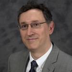
Professor Marios Nestoros is an academic at the University of Nicosia, where he serves as an Associate Dean of the School of Sciences and Engineering and holds a Professor position in the Department of Engineering. He earned his BSc in Physics from the National and Kapodestrian University of Athens (1994) and his PhD in Physics from the University of Cyprus (2000). Education: BSc (Athens), PhD (Cyprus) Research Interests: Photothermal physics, semiconductor diagnostics, RFID antenna design, and biomedical applications Teaching: General Physics, Biophysics, Semiconductor Devices, Renewable Energy His recent research explores machine learning applications for skin cancer detection and photothermal analysis of semiconductors. He has published 27 peer-reviewed works and maintains professional affiliations with the American Institute of Physics (AIP) and European Physical Society (EPS).
Professor Anthony Paul Doulgeris at the UiT The Arctic University of Norway leads research in Earth Observation within the Department of Physics and Technology . His work focuses on Interpreting satellite radar images for Arctic sea ice studies Developing automated algorithms for large-scale environmental data Advancing SAR (Synthetic Aperture Radar) methodologies His research interests span Remote Sensing , Sea Ice Dynamics , Machine Learning Applications , and Algorithm Optimization for polar environments. Current projects include Boosting Space Business and membership in the Earth Observation research group. Recent publications analyze High-resolution sea ice concentration using Sentinel-1 deep learning models Icberg detection via multiscale CFAR algorithms in L-band SAR Multidecadal SAR sea ice type analysis in the Atlantic Arctic Incidence angle compensation techniques for cross-platform consistency with keywords spanning Arctic Climate , Microwave Remote Sensing , Operational Ice Monitoring , and Data Processing Frameworks . Collaborations include international teams from Norway, China, and Canada, with fieldwork integration in expeditions like MOSAiC and N-ICE2015. His work bridges Satellite Data and Environmental Modeling to improve Arctic navigation and climate predictions.
Joel Johnson is a Professor at The Ohio State University and a key member of the MOSAiC (Multidisciplinary drifting Observatory for the Study of Arctic Climate) expedition's remote sensing team. He leads the deployment of a 4-channel microwave radiometer operating at 0.5-2 GHz frequencies to advance sea ice observation methodologies from space. His research centers on improving remote sensing techniques for Arctic sea ice properties, with specific focus on Ultra-wideband microwave radiometry applications. This work addresses critical gaps in satellite-based monitoring of polar environments, directly contributing to climate change research and operational ice forecasting systems. Johnson emphasizes the interdisciplinary nature of sea ice studies, integrating electromagnetic theory with environmental science to enhance data interpretation. Professor Johnson actively collaborates within the MOSAiC framework, leveraging cross-disciplinary ice data from expedition partners to validate remote sensing models. He expresses particular enthusiasm for the expedition's comprehensive dataset, which enables unprecedented analysis of sea ice thermodynamics and surface characteristics. His work demonstrates strong alignment with NSF-funded polar research initiatives focused on Arctic system science.