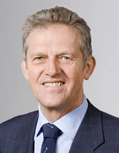
Joannes Westerink is the Joseph and Nona Ahearn Professor in Computational Science and Engineering at the University of Notre Dame's College of Engineering. He holds concurrent faculty titles in the Departments of Aerospace and Mechanical Engineering, Earth Sciences, Computer Science and Engineering, and other disciplines. His research focuses on computational fluid dynamics, tidal hydrodynamics, and hurricane storm surge prediction. He earned his Ph.D. from MIT in 1984, followed by M.S. and B.S. degrees in Civil Engineering from SUNY Buffalo. Key research interests include finite element methods, coastal circulation modeling, and geophysical turbulence. In 2025, he was awarded the International Coastal Engineering Award for his contributions to storm surge forecasting and coastal hazard mitigation. Westerink leads the Computational Hydraulics Laboratory, advancing numerical models like STOFS (Surge and Tide Operational Forecast System) for global water level predictions. His recent work integrates AI-driven nudging techniques and machine learning to enhance model accuracy, with applications in disaster risk assessment and climate adaptation.
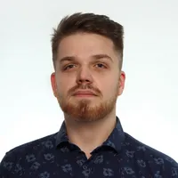
Dr. David Belton is a Senior Lecturer in the School of Earth and Planetary Sciences at Curtin University, within the Faculty of Science and Engineering. He also holds a portfolio role in the Office of the Provost. His expertise lies in laser scanning (both terrestrial and mobile) and photogrammetry, with a focus on automated processing, feature extraction, and applications in mining, heritage conservation, and structural monitoring. Dr. Belton holds a BCSc, BSc (First Class Honours), and a PhD from Curtin University. His teaching responsibilities include coordinating and lecturing in Cartographical Statistics and Integrated Surveying, alongside previous roles in Mine Surveying and Mine Survey Project courses. He actively supervises PhD, MPhil, and Honours students, fostering research excellence in spatial sciences. His research emphasizes practical applications of geospatial technologies, including underwater photogrammetry, pipeline monitoring, and coral reef analysis. Key areas include robust statistical methods for point cloud processing, sensor calibration, and open-source device development for marine surveys. His work bridges theoretical advancements with real-world challenges in environmental monitoring, infrastructure assessment, and cultural heritage preservation. Publications span high-impact journals like Corall Reefs , ISPRS Journal of Photogrammetry , and IEEE Transactions , reflecting contributions to geomatics, remote sensing, and computer vision. His research often addresses interdisciplinary challenges, such as UAV-based ecological monitoring and automated 3D model reconstruction from laser scanning data. Dr. Belton collaborates widely, contributing to projects like the Sydney-Kormoran wreck analysis and heritage documentation of Pilbara rock art. His work underscores innovative solutions for spatial data challenges across environmental, engineering, and archaeological domains.
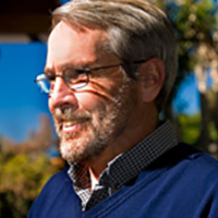
Reiner Rummel is a Carl von Linde Senior Fellow at Technische Universität München (TUM), holding a professorial academic rank within the Department of Astronomical and Physical Geodesy. His career includes leadership roles such as former head of TUM’s Institute for Astronomical and Physical Geodesy, and professorships at Delft University of Technology. He has contributed significantly to satellite gravimetry, Earth’s gravitational field analysis, and geodetic observing systems. Education: Engineering diploma from TU München (1970), PhD from Technical University of Darmstadt (1974, dissertation on stochastic methods in geodesy). Postdoctoral research at Ohio State University (1974–76) and German Geodetic Research Institute (1976–78). Professional roles include membership in international academies (e.g., German Academy of Sciences Leopoldina, Royal Netherlands Academy) and leadership in ESA’s GOCE mission advisory group. Research focuses on physical geodesy, satellite-based gravitational field determination, and spectral methods. Notable achievements include advancing the GOCE mission’s scientific outcomes and developing methodologies for Earth’s gravity field analysis. Awards include the Bavarian Order of Merit (2008), Vening Meinesz Medal (1998), and honorary doctoral degrees from multiple universities. Publications span over four decades, emphasizing satellite gravimetry applications, dynamic ocean topography, and geodetic system unification. His work bridges geodesy with climate science, oceanography, and solid Earth dynamics. Current affiliations include TUM’s Institute for Advanced Study and leadership in global geodetic networks. Awards: Over 10 major honors, including medals from geophysical societies and academy memberships. Key Projects: GOCE mission science, Integrated Global Geodetic Observing System (IGGOS), and height system unification initiatives.
Dick G. Simons is a Professor in the Faculty of Aerospace Engineering at Delft University of Technology, specializing in aircraft noise modeling and acoustic measurement systems. His research spans aerospace acoustics and geodetic monitoring of environmental phenomena, with significant contributions to aircraft noise prediction models like sonAIR and calibration methodologies using acoustic measurements at Schiphol Airport. His research interests focus on aircraft noise propagation , acoustic measurement techniques , and geodetic monitoring of seismic and coastal processes . Recent work integrates satellite subsidence data with sea-level measurements for coastal risk assessment in Southeast Asia, while maintaining active research in aeroacoustics through collaborations with Schiphol Airport authorities and the Commissie Deskundigen Vliegtuiggeluid. His 190+ publications reveal a dual research trajectory: post-2020 publications increasingly emphasize geodetic studies of earthquake cycles and sea-level changes in Thailand/Malaysia, while continuing aircraft noise research through TU Delft's aerospace division. Key trends include the application of GNSS and InSAR for monitoring postseismic deformation and the development of psycho-acoustic listening facilities for noise assessment. Leif Bjorno Award (2017) for contributions to acoustics research Simons actively supervises research (19 supervised works documented) and serves on editorial boards including the IEEE Journal of Oceanic Engineering. His work receives significant media attention in the Netherlands, particularly regarding Schiphol Airport noise policies, with 6 media engagements in 2023-2024 covering aircraft noise reduction strategies and climate impacts. He leads multiple research datasets on marine benthic habitats and acoustic source localization, and directs laboratory facilities for psycho-acoustic testing. Current activities include participation in the Commissie Deskundigen Vliegtuiggeluid and organizing workshops on aircraft noise modeling capabilities.
Sander Varbla is a Postdoctoral Researcher at the Department of Civil Engineering and Architecture, School of Engineering, Tallinn University of Technology, and concurrently holds a postdoctoral fellowship at the Chair of Astronomical and Physical Geodesy, Technical University of Munich (2025–2027). His research spans geodesy, remote sensing, and civil engineering, with a focus on marine geoid modeling, satellite altimetry, and construction surveying technologies. His research interests include marine geoid refinement, satellite gravimetry, terrestrial and drone-based surveying, GNSS-UWB positioning, and the application of machine learning in geodetic data processing. He actively contributes to international geodetic standardization through memberships in EUREF, NKG, and the Baltic Sea Hydrographic Commission. His recent publications show a strong trend in integrating satellite data (e.g., SWOT mission) with in-situ measurements to improve marine geoid models, assess vertical land motion, and develop dynamic height references. He also investigates the quality of industrial-scale laser scanning for BIM applications and advances in underground utility mapping using low-cost sensors. Researcher of the Year, Department of Civil Engineering and Architecture, TalTech (2024) Best Research Article 2022, TalTech (2023) First Prize, National Contest for University Students (2023) ESRI Young Scholar Award (2017) CLGE Students' Contest Winner (2017) Varbla has supervised multiple Master’s theses at TalTech, focusing on drone photogrammetry, point cloud analysis, and construction surveying. He has been a lecturer in courses such as Construction Surveying and Theory of Processing Geodetic Measurements, and has led continuing education courses on UAV photogrammetry and terrestrial laser scanning. He is the principal investigator of the MarGeoid project and has participated in numerous national and EU-funded projects, including DYNAREF, BalMarGrav, and ESA initiatives. He has also contributed to major collaborative efforts such as the Baltic Sea Chart Datum 2000 and FAMOS Odin.
Robert Kingdon is an Associate Teaching Professor and Chair in the Department of Geodesy and Geomatics Engineering at the University of New Brunswick (UNB) in Fredericton. He holds a PhD and is a Professional Engineer (P.Eng.). His research focuses on advanced geodetic techniques including geoid modeling, gravity field analysis, orthometric height systems, and satellite gravimetry. Key areas of expertise include rigorous geoid computation using the Stokes-Helmert method, topographical density modeling, and precision geodetic positioning in marine environments. Professor Kingdon has contributed to global and regional geoid models such as the UNB_TopoDens series and the GCR-RSH-2020 for Costa Rica. His work emphasizes the physical rigor of height systems, advocating for orthometric heights compatible with geoid models. He has developed the GEOWAPP geospatial web application for surveying education and explored innovative PPK techniques in challenging environments. No scientific awards are explicitly mentioned in the provided materials. His research spans over two decades, with publications addressing theoretical geodetic principles alongside practical applications in terrestrial and airborne gravity data processing.
Donald L. Forbes is a Senior Research Scientist at the Geological Survey of Canada (Natural Resources Canada) and Adjunct Professor in Geography at Memorial University. His research examines coastal hazards, climate change impacts, and adaptation strategies, with field studies spanning the Canadian Arctic, Atlantic Canada, and Pacific Islands. With a B.A. from Carleton University, M.A. from University of Toronto, and Ph.D. from UBC, he focuses on sea-level rise, coastal erosion, and geomorphic processes. He has contributed to IPCC assessments and UNESCO tsunami response initiatives. Publications address marine habitat mapping, Arctic coastal biodiversity, and LiDAR applications for flood-risk modeling. Research employs interdisciplinary approaches with funding from ArcticNet, GEOIDE, and international agencies. He serves on editorial boards for 'Marine Geology' and 'Journal of Coastal Research', and leads projects on climate adaptation in vulnerable communities.
David T. Sandwell is a Professor of Geophysics at the Institute of Geophysics and Planetary Physics within Scripps Institution of Oceanography, University of California, San Diego. His research integrates satellite remote sensing, geodesy, and marine geophysics to study Earth's dynamic processes. Research Interests: Sandwell specializes in marine gravity anomaly mapping from satellite altimetry, predicted and measured seafloor topography, synthetic aperture radar interferometry (InSAR), thermal and mechanical structure of the oceanic lithosphere, geodynamic applications of satellite altimetry, and tectonics on Venus. His work bridges planetary science with terrestrial geophysics, focusing on crustal deformation, earthquake mechanics, and ocean basin evolution. He teaches courses including Introduction to Geodynamics, Satellite Remote Sensing, and Physics of Surfing. His recent publications demonstrate a strong trend toward high-resolution seafloor mapping, interseismic deformation analysis, and advanced InSAR techniques for earthquake cycle studies. Key themes include satellite-derived bathymetry, fault creep monitoring along major plate boundaries like the San Andreas Fault, and tectonic applications of gravity field recovery. His research increasingly incorporates multi-satellite data fusion and computational geophysics for modeling lithospheric behavior. Scientific Awards: While specific awards aren't detailed in the source material, Sandwell's extensive publication record (over 200 papers) and leadership in major projects like the SRTM15+ global bathymetry model reflect significant recognition in geophysics. Advising and Grants: Sandwell has advised 17 Ph.D. students since 1988, with recent graduates (2016-2023) focusing on seafloor geodesy, InSAR applications, and lithospheric mechanics. His research is supported by NASA, NSF, and USGS grants targeting satellite geodesy, earthquake cycle modeling, and marine gravity field recovery. Current projects include meter-scale seafloor deformation monitoring and absolute phase recovery in InSAR processing. Labs and Teams: He leads research within Scripps' Institute of Geophysics and Planetary Physics, collaborating with the GPlates development team for 3D tectonic visualization and contributing to NASA's Earth Surface and Interior focus area. His group develops open-source radar interferometry software (GMTSAR) and maintains global gravity and bathymetry databases used worldwide.
Ole Baltazar Andersen is a Professor in the Department of Space Research and Technology, Geodesy and Earth Observation section at the Technical University of Denmark (DTU). His research focuses on satellite altimetry and remote sensing for geodetic, oceanographic, hydrological, and climatological applications. He is actively involved in major international satellite missions including TOPEX/POSEIDON, JASON-1, and GRACE, serving on their science working teams. He also holds leadership roles in national and international research projects such as the Danish HYDROGRAV project, which applies gravimetric methods to hydrology. His research interests center on satellite-derived geodetic measurements, particularly in sea level monitoring, marine geoid modeling, and climate change impacts. He utilizes data from missions like SWOT, ICESat-2, and GRACE to study ocean dynamics, terrestrial water storage, and Arctic sea ice. His work contributes to UN Sustainable Development Goals related to climate action (SDG 13), clean water (SDG 6), and life below water (SDG 14). The recent publications highlight a strong trend in advancing satellite altimetry techniques—particularly through SWOT and SAR altimetry—for high-resolution marine geoid and sea surface height estimation. Research areas include bathymetry mapping in complex coastal zones, interference correction in island regions, and validating next-generation satellite performance for ocean topography. These efforts represent cutting-edge developments in geodetic remote sensing and climate monitoring. Andersen has supervised multiple PhD students on topics including maritime surveillance using AI, sea level fingerprints, and geodetic climate change measurements in Greenland. He has participated in numerous national and international collaborative projects, often integrating satellite gravimetry, altimetry, and in-situ data for hydrological and oceanographic modeling. His work is supported by EU and national Danish funding sources. He is an active contributor to the scientific community, presenting at major conferences such as EGU and IUGG. He is also the creator of the DTU21 Mean Sea Surface dataset, a key resource in geodetic research. His laboratory and research environment at DTU are deeply integrated into global Earth observation networks, collaborating with institutions like NASA, CSIRO, and the International Association of Geodesy.
Valérie Ballu is a CNRS Research Director at the University of La Rochelle, affiliated with the DPL team. Her research focuses on underwater and coastal geodesy, utilizing GNSS, altimetry, and tide gauge data to study crustal movements, subduction zones, and sea-level changes. She contributes to interdisciplinary projects addressing coastal hazards and volcanic activity, particularly in Vanuatu, Mayotte, and the Indian Ocean. Research Themes : Vertical and horizontal geodetic positioning, subduction dynamics, and coastal vulnerability. Technologies : PAMELi autonomous drone development for coastal exploration. Her recent work includes monitoring the Mayotte volcanic crisis (2024) and analyzing the Ganges-Brahmaputra-Meghna delta subsidence (2021). She collaborates with geographers, oceanographers, and seismologists, emphasizing interdisciplinary data integration for hazard assessment. Scientific contributions span seafloor deformation studies (2024), calibration of altimetry missions (2023), and modeling of seafloor geodetic positioning (2021). She holds a HDR (Habilitation à Diriger des Recherches) and actively participates in international conferences like EGU and OSTST.
Johnson O. Oguntuase is an Assistant Professor of Hydrographic Science at the University of Southern Mississippi, specializing in advanced sensor technologies for seafloor mapping. His research integrates machine learning and artificial intelligence to enhance positioning accuracy using cost-effective solutions like GNSS receivers, INS, and bathymetric SONARs. He teaches courses including Kinematic Positioning, Applied Acoustics, and Applied Bathymetry in the Master of Science in Hydrography program. His research interests span hydrographic science, geospatial AI, sensor fusion for marine applications, and the development of efficient seafloor mapping methodologies. Current investigations focus on optimizing multibeam bathymetry and improving shallow-water survey techniques. Publications demonstrate consistent focus on GNSS-INS integration, bathymetric accuracy improvement, and practical survey solutions, with recent emphasis on drone/sonar-based environmental monitoring and tactical-grade navigation systems for marine surveys.
Dr. Philipp Zingerle is a researcher at the Chair of Astronomical & Physical Geodesy, Technical University of Munich, where he conducts advanced research in satellite gravimetry, global gravity field modeling, and future quantum-based gravity missions. He plays a key role in ESA projects such as MAGIC and QSG4EMT, as well as DFG-funded initiatives NEROGRAV and UPLIFT, contributing to next-generation Earth observation systems. Research Interests: His work focuses on high-resolution gravity field modeling (e.g., XGM series), time-variable gravity, quantum satellite missions, and integration of terrestrial and airborne data. He applies these to improve geoid determination, height systems, and monitoring of mass transport in the Earth system. The recent publications highlight a strong trend toward future quantum gravimetry missions, especially through the MAGIC and NGGM studies, emphasizing constellation design, error modeling, and hydrological applications. There is also sustained work on extending global models to higher spatial resolution (up to d/o 1440 and beyond) and improving regional solutions such as for Antarctica and North America via GRAV-D integration. Scientific Contributions: Lead and co-author of multiple high-impact journal papers on XGM models and satellite gravimetry. Active participant in international symposia including EGU, IUGG, and ESA Living Planet. Contributor to the realization of the International Height Reference System (IHRS). Advising and Research Leadership: He has supervised several bachelor’s and master’s theses, indicating an active role in student mentorship. He collaborates extensively with leading institutions and researchers across Europe and globally. While no formal awards are listed, his involvement in flagship projects underscores recognition in the geodetic community. Labs and Teams: He is embedded in the Satellite Geodesy Research Facility at TUM and contributes to multiple interdisciplinary teams including ESA MAGIC, DFG NEROGRAV, and UPLIFT, working closely with Prof. Roland Pail and other experts in geodesy and Earth observation.
Per Knudsen is a Professor at the Department of Space Research and Technology within the Technical University of Denmark (DTU) . His work focuses on geodesy, Earth observation, and satellite altimetry, addressing critical climate science challenges such as sea-level rise, ice sheet dynamics, and ocean mass budget analysis. Research Interests Earth’s Gravity Field and Geoid Modeling Climate Change Impacts on Greenland and Antarctic Ice Sheets Integration of GNSS, Satellite Altimetry, and Tide Gauge Data Advanced Data Products for Ocean and Climate Monitoring Computational Methods in Geodetic Network Optimization Future Satellite Missions (SWOT, GOCE, CryoSat) Scientific Leadership includes supervising PhD projects on 3D Surface Displacements in Greenland Marine Geodesy using SWOT satellite data UAV-based Positioning Algorithms His publications (185) span oceanography, climate modeling, and geodetic measurement techniques, with recent emphasis on SWOT mission performance and GRACE-derived sea-level budgets.