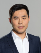
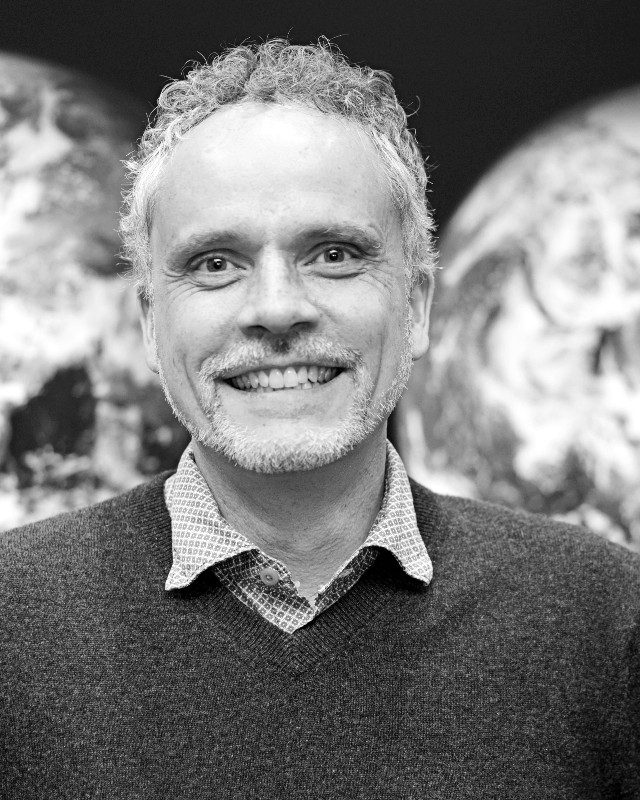
Ashley D'Antonio is an Associate Professor and Associate Department Head in the Forest Ecosystems & Society department at Oregon State University's College of Forestry. Her research integrates recreation ecology, visitor behavior analysis, and protected area management using spatial methods like GPS tracking and social science approaches. Education includes a Ph.D. and M.S. in Human Dimensions of Ecosystem Science from Utah State University and a B.S. in Biology from Pennsylvania State University. Research focuses on sustainable recreation, human-environment interactions in parks, and visitor impact mitigation. Recent work examines weather impacts on visitation, trail degradation prediction, and pandemic effects on outdoor recreation behavior. Publications consistently address visitor movement modeling, recreation ecology, and protected area management using geospatial technologies. Trends show growing emphasis on machine learning applications, pandemic-related behavioral shifts, and interdisciplinary approaches combining ecological and social science methods. Advises graduate student Danielle Berger and teaches courses including Outdoor Recreation Management, Parks and Protected Area Management, and Sustainable Recreation Planning.
Professor Fabio Tosti is a Professor of Civil Engineering and Director of the Faringdon Research Centre at the University of West London , School of Computing and Engineering. He holds a PhD and MSc from Roma Tre University, Italy, and has been a key figure in advancing Ground Penetrating Radar (GPR) and non-destructive testing (NDT) in civil and environmental engineering. PhD in Civil Engineering, Roma Tre University (2014) MSc in Road Transportation and Infrastructures, Roma Tre University (2010) His research centers on non-destructive evaluation of civil infrastructure using GPR, microwave tomography, and remote sensing (e.g., InSAR). He has led projects within the COST Action TU1208 and co-convener of GPR sessions at the EGU General Assembly . He teaches across BEng, MEng, and MSc programs in civil and environmental engineering. The articles listed span from 2020 to 2025, showcasing a consistent focus on infrastructure and environmental monitoring. Key research trends include bridge and runway deformation monitoring using satellite radar (InSAR), tree root and trunk assessment via GPR, data fusion of multi-sensor systems, and advanced signal processing techniques like reverse-time migration and joint inversion. His work bridges geophysics, civil engineering, and environmental science, with applications in transportation, urban forestry, and heritage conservation. Notable scientific recognition includes the GI Division Outstanding ECS Award Lecture at EGU 2017. Prof. Tosti actively supervises research, collaborates internationally, and contributes to editorial boards, including as Assistant to Editors for Advances in Transportation Studies . He has led and participated in numerous European and Italian research projects, demonstrating sustained funding and leadership. His work often involves interdisciplinary teams, including researchers from Italy, the UK, and the Netherlands. He is a recognized expert in transport infrastructure health monitoring , with a strong emphasis on smart, non-invasive methods for roads, railways, bridges, and airport runways. His lab and research group focus on developing integrated sensing systems combining GPR, InSAR, LiDAR, and machine learning for real-world engineering challenges.
Martin Servin is an Associate Professor at the Department of Physics, Umeå University, and leads the Digital Physics research group within the UMIT Research Lab. His work focuses on computational modeling and simulation of granular materials, robots, and vehicles, with applications in AI-based control and perception. He holds a doctoral degree from Umeå University (2003) and has pioneered research in real-time physics simulation, particularly in the context of autonomous machinery and off-road robotics. Research Interests : Digital physics, granular materials simulation, autonomous systems, reinforcement learning, and simulation-to-reality transfer. His group develops advanced simulation tools for industries like forestry, mining, and construction. Key Projects : Mistra Digital Forest (2019–2026) AILUR (Digital Twin for AI-controlled Lunar Robotics) XSCAVE (Explainable, Safe Control for Heavy Machinery) Publications emphasize simulation methodologies, AI integration, and real-world validation across robotics, vehicle dynamics, and granular mechanics. Notable contributions include work on wheel loader dynamics, deep reinforcement learning for control systems, and terrain modeling. Awards include the Spin-off award for industry-grade physics in Unreal Engine (2018) , recognizing his role in Algoryx Simulations, a spin-off company commercializing his research. Labs/Teams : UMIT Research Lab, Digital Physics Group, and collaborations with Algoryx Simulations.
Prof. Dr. Hanna Meyer is a Professor of Remote Sensing and Spatial Modeling at the Institute of Landscape Ecology, University of Münster (WWU). She leads the Remote Sensing and Spatial Modeling Group and is actively involved in teaching and research in geospatial data science, machine learning, and environmental monitoring. Her work is supported by multiple national and international funding bodies including the DFG, EU Horizon Europe, and internal university grants. B.Sc. Geography, Philipps University Marburg (2007–2010) M.Sc. Environmental Geography, Philipps University Marburg (2010–2013) Ph.D., Philipps University Marburg (2014–2018) Her research focuses on machine learning methods for spatial data, optical remote sensing, environmental monitoring, and spatio-temporal modeling. She develops and applies advanced statistical and machine learning techniques to satellite and drone-based data for mapping ecological variables, land cover, and environmental change. Her work emphasizes methodological rigor, model transferability, and uncertainty quantification in spatial predictions. The recent publications reflect a strong trend in developing and validating machine learning models for environmental mapping, with applications in soil science, peatland hydrology, forest ecology, and polar climatology. She contributes both to theoretical advancements in spatial model validation and to practical software tools in R for geospatial analysis. She has secured competitive research funding for projects such as PRISM, Carbon4D, Uebersat, and BEyond, focusing on spatial pattern recognition, carbon modeling, AI model transferability, and biodiversity prediction. She teaches courses on remote sensing, spatial data analysis with R, and environmental modeling, and supervises students and early-career researchers. She collaborates widely with researchers across institutions and leads a dynamic research group including postdoctoral researchers and students. Her open-source contributions, particularly R packages like CAST and uavRst, support reproducible research in geospatial machine learning.
Terézia Beck is a university teacher at the Department of Biology and Environmental Studies, Faculty of Natural Sciences, Matej Bel University in Banská Bystrica, Slovakia. She teaches courses in Microbiology, Molecular Biology, Diversity and Phylogenesis of Protists, Algae and Fungi, Plant Cytology, Anatomy and Morphology, Plant Physiology, and Molecular Ecology, with consultation hours held Monday-Tuesday 09:00-11:00. Her educational background includes: PhD in Evolution of Ecosystems and their Protection (2015-2019), Matej Bel University, Faculty of Natural Sciences RNDr. in Ecology and Protection of Ecosystems (2016-2018), Matej Bel University, Faculty of Natural Sciences Mgr. in Nature and Landscape Conservation and Use (2013-2015), Comenius University in Bratislava, Faculty of Natural Sciences Dr. Beck's research focuses on mycology , particularly the molecular diversity and phylogenesis of wood-decay fungi including Ganoderma and Fomes fomentarius . She employs advanced techniques such as ITS sequencing, MALDI-TOF mass spectrometry, and fuzzy logic systems to study fungal identification, host-pathogen interactions, and ecological adaptations in urban and natural ecosystems across Central Europe. Her recent publications (2017-2022) demonstrate consistent contributions to fungal systematics, revealing cryptic diversity in Ganoderma species and pioneering identification methods for wood-decay macrofungi. Key thematic areas include molecular ecology of euglenoid flagellates, synanthropic processes in fungal communities, and host-specific adaptations of wood-decaying fungi in Mediterranean and Central European habitats. Dr. Beck serves as co-worker on two VEGA research projects: VEGA 1/0694/21 ( The influence of intra-and extracellular factors on the metabolism and motility of euglenoid flagellates ) and VEGA 1/0564/21 ( Interactions of wood-decay macromycetes and woody plants in habitats with different levels of preservation ). No graduate students are documented in available records. She actively collaborates within the Department of Biology and Environmental Studies and maintains professional memberships in the Slovak Mycological Society and the Slovak Society for Agricultural, Forestry, Food and Veterinary Sciences under the Slovak Academy of Sciences.
Kirsikka Riekkinen is an Assistant Professor at Aalto University in the Built Environment domain, specializing in land administration , cadastral systems , and property rights . Her research bridges technological innovation with policy analysis, focusing on digitalization , security implications , and climate impacts of land governance frameworks. Research Focus Development of holistic cadastral frameworks for mature systems Land consolidation in Finland and Africa, including climate effects Security-based property restrictions in Northern Europe Integration of blockchain , text mining , and 3D modeling into land administration Comparative analysis of Nordic and African land policies Scientific Trends in Publications Her article corpus (2012-2025) reveals a sustained focus on land consolidation (with climate implications), cadastral modernization (digitalization, blockchain), and cross-national policy analysis (Finland, Nigeria, Rwanda). Recent works emphasize public value perspectives and security challenges in cadastral systems. Teaching & Professional Role As an Assistant Professor, she contributes to academic discourse in land governance. Contact: kirsikka.riekkinen@aalto.fi
Aimad el Issaoui is a Doctoral Researcher at Aalto University's T213 Built Environment unit, specializing in geoinformatics and laser scanning technologies. His work focuses on integrating advanced sensing systems with deep learning applications for infrastructure and environmental monitoring. His research spans multiple domains: Infrastructure Analysis : Pavement distress detection, road rut measurement using mobile/terrestrial laser scanning Environmental Monitoring : Forest health assessment, UAV-based canopy mapping, tree water stress analysis 3D Mapping : Semantic point cloud segmentation, ALS/MLS integration, indoor scanning methodologies The publications reveal a consistent focus on improving accuracy and efficiency in spatial data processing across civil engineering and ecological contexts. He has contributed to advancements in: Real-time localization systems Deep learning approaches for point cloud analysis Multiscale forest observation techniques 3D indoor/outdoor environment modeling
Colin John McClean is a Senior Lecturer in the Department of Environment and Geography at the University of York , with over 25 years of experience in spatial analysis and GIS applications for environmental management. His career spans post-doctoral research at Cardiff and Newcastle, followed by academic roles at York since 1996. Education: BSc in Geography from the University of Edinburgh (1986); PhD in Geography from Durham University (1991). McClean’s research focuses on leveraging spatial datasets to address conservation ecology, climate change impacts on biodiversity, and land use modeling. He has pioneered work using machine learning methods like genetic algorithms and simulated annealing for reserve selection, with applications in the Sahel region (e.g., Shea Tree climate modeling) and marine conservation. Recent publications highlight interdisciplinary themes, including urban green-blue spaces and health , tropical peatland restoration , and oil palm sustainability . His work has been funded by NERC, Defra, EU, and the Darwin Initiative, often involving cross-institutional collaborations. He supervises PhD students in topics such as water chemistry prediction , soil nitrogen dynamics , and protected area effectiveness under climate change . No scientific awards are documented, but his research on climate change impacts has influenced major reports like the Stern Review and the 2007 IPCC assessment.
Victoria Hemming is an Adjunct Professor in the Department of Forest and Conservation Sciences at the University of British Columbia. She is also a Decision Analyst at Compass Resource Management and an Honorary Research Associate at the Martin Conservation Decisions Lab, UBC. Her work bridges decision science, risk analysis, and behavioral sciences to address natural resource management challenges. Education: PhD in Environmental Science and Ecology, University of Melbourne (2019); BSc (Hons) in Botany, University of Melbourne (2009); BASc in Environmental Science, Geography, and Ecology, University of Melbourne (2008) Research Interests: Victoria focuses on improving decision quality under uncertainty, overcoming data deficiencies through structured expert elicitation, and addressing the decision-implementation gap in conservation. Her work integrates Indigenous knowledge, climate change impacts, and co-benefits frameworks to enhance biodiversity outcomes. Article Trends: Recent publications emphasize expert elicitation protocols (IDEA and Classical Model), decision-making under uncertainty, ecosystem-based climate solutions, and interdisciplinary applications of decision science in conservation and urban planning. Scientific Awards 2022 Top Downloaded Article: An Introduction to Decision Science for Conservation 2020 Chancellor’s Prize for Excellence in PhD thesis 2018 Editor Recommendation: A Practical Guide to Structured Expert Elicitation Teaching & Mentorship: She co-developed UBC’s CONS440 course and led workshops on expert elicitation and decision science. Her mentorship includes PhD and Masters students working on urban forestry, marine conservation, and threat management.
Dr. Erika Gobet is a Lecturer in Paleoecology at the University of Bern's Institute of Plant Sciences. Her work focuses on reconstructing long-term environmental changes through multi-proxy analyses of lake sediments, ice cores, and macrofossil records. She specializes in understanding interactions between climate, vegetation dynamics, and human activities, particularly during the Holocene and Late Glacial periods. Her research spans multiple regions including Switzerland, Greece, Ukraine, the Mediterranean, and Central Asia. Key themes include the impact of Neolithic land use on ecosystems, climate-driven vegetation shifts, and teleconnections between distant ecosystems via monsoon patterns. She employs cutting-edge methods like high-resolution chronologies, machine learning for pollen sequence analysis, and genetic studies of plant species adaptation. Dr. Gobet collaborates across disciplines, integrating archaeology, climatology, and ecology to address questions about human-environmental interactions. Her work highlights biodiversity conservation challenges posed by historical and modern environmental changes, especially in mountainous and mediterranean ecosystems. Recent studies emphasize methodological advancements in paleoenvironmental reconstruction (e.g., ice-core microfossil extraction) and interdisciplinary projects like Burgäschisee archaeological excavations. Though no awards are explicitly mentioned, her prolific publication record and methodological innovations indicate significant contributions to the field.
Dr. Fang Qiu is a Professor of Geospatial Information Sciences at the University of Texas at Dallas (UTD), serving in the School of Economic, Political and Policy Sciences. He holds a Ph.D. in Geographic Information Sciences from the University of South Carolina (2000), an M.S. in Geographical Information Systems from the Chinese Academy of Sciences (1993), and a B.S. in Geography with GIS emphasis from China Normal University (1990). His research focuses on remote sensing technologies, including LiDAR and hyperspectral imaging, spatial analysis, and GIS software development. Notable work includes urban forest inventory using LiDAR and hyperspectral data, and the development of web-based GIS tools such as GWASS. He has received the 2012 AAG Remote Sensing Specialty Group Early Career Paper Award for his contributions. Dr. Qiu has secured significant grants, including a $3 million NASA-funded project for Earth science data integration (2004–2009) and a Dallas Urban Forest Advisory Committee grant for tree inventory (2008–2009). He serves on editorial boards, including as Vice Chair of the AAG Spatial Analysis and Modeling Group, and has reviewed for journals like Geographical Analysis and ISPRS Journal of Photogrammetry and Remote Sensing . His professional roles include Department Head of the School of Economic, Political and Policy Sciences at UTD since 2013 and Associate Professor (with tenure) from 2006–2014. He has also held leadership positions in organizations such as the International Association of Chinese Professionals in GIS.
Susan L. Ustin is a Professor in the Department of Land, Air, and Water Resources at the University of California Davis, where she has been a faculty member since 1999. She is also the Associate Director of the John Muir Institute of the Environment and Head of the Center for Spatial Technologies and Remote Sensing (CSTARS). Her academic journey began with a Ph.D. in Botany from UC Davis in 1983, followed by a postdoctoral fellowship working with NASA's Jet Propulsion Laboratory on imaging spectroscopy. Ph.D. in Botany, University of California Davis, 1983 M.A. in Biology, California State University, Hayward, 1978 B.S. in Biology, California State University, Hayward, 1974 Dr. Ustin is a leading expert in remote sensing, with over 30 years of experience applying imaging spectroscopy, LiDAR, thermal, and multispectral data to ecological and environmental problems. Her research spans landscape and ecosystem ecology, focusing on vegetation mapping, invasive species detection, canopy water content estimation, wildfire risk modeling, and climate change impacts. She has developed novel methods for quantifying biophysical and biochemical properties of vegetation using remote sensing technologies. Her recent publications demonstrate a strong trend in integrating multiple remote sensing platforms (LiDAR, hyperspectral, thermal, satellite) to study complex ecological systems. Key research areas include fuel type and canopy structure mapping for wildfire risk, biochemical analysis of plant species, and monitoring environmental disturbances such as oil spills and hurricanes. She has been a key member of NASA's MODIS Science Team and the HyspIRI Preparatory Science Team, contributing to major Earth observation missions. Elected Fellow, American Geophysical Union (AGU), 2017 Honorary Doctorate, University of Zurich, Switzerland, 2010 Outstanding Service Award, American Society of Photogrammetry and Remote Sensing, 2004 Elected Senior Member, IEEE, 2004 SERDP Conservation Project of the Year Award, 2004 Elected Fellow, The Remote Sensing and Photogrammetry Society, 2002 Dr. Ustin has advised numerous graduate students and postdoctoral scholars and has led major research initiatives including the Center for Spatial Technologies and Remote Sensing. She has secured significant research funding from NASA, DOE, and other agencies to support her work on global environmental change and remote sensing applications. Her collaborations span across institutions and disciplines, including work with the National Research Council and Battelle on NEON. She leads the Center for Spatial Technologies and Remote Sensing (CSTARS), which focuses on developing and applying advanced remote sensing technologies for environmental monitoring. The center works on projects ranging from agricultural productivity to wildfire risk assessment and ecosystem health monitoring using airborne and satellite platforms.
Prof. Yu Kang is a Professor of Precision Agriculture at the TUM School of Life Sciences, Technische Universität München (TUM). His research focuses on integrating imaging, sensing, and computational methods to study plant-environment interactions. He aims to enhance resource efficiency and reduce environmental impact through precision crop management. Prior to TUM, he held positions at China Agricultural University (CAU) and conducted postdoctoral research at ETH Zurich and KU Leuven. Prof. Yu's career includes roles such as Associate Professor of Crop Science at CAU and postdoctoral fellowships in physical geography. His educational background includes a doctoral degree from the University of Cologne (2014) and undergraduate studies at China Agricultural University. Key research areas include remote sensing for crop health monitoring, hyperspectral imaging for disease detection, and machine learning applications in agriculture. His work has led to innovations in crop nitrogen management and precision phenotyping. Awards include the Innovation Team Award (2019) from the Crop Science Society of China and the GSGS Fellowship (2014) from the University of Cologne.
Mathias Kneubühler is a Senior Lecturer and Scientific Section Head of Remote Sensing Spectroscopy at the Department of Geography, Faculty of Science, University of Zurich. He leads the Spectroscopy Lab and has been a key figure in advancing imaging spectroscopy and Earth observation research. He is actively involved in international remote sensing initiatives, including serving as the Swiss ESA-DOSTAG Delegate and Co-Chair of the EARSeL Special Interest Group on Imaging Spectroscopy. PhD in Remote Sensing, University of Zurich (1997–2002) MSc in Geography, University of Zurich (1992–1996) His research focuses on imaging spectroscopy , spectro-directional measurements , and ecosystem monitoring , with applications in plant phenology , biodiversity assessment , and land surface dynamics . He investigates how multi-angular and hyperspectral data can improve the understanding of vegetation structure, function, and environmental responses. His work integrates field spectroscopy, airborne and satellite remote sensing, and advanced data processing techniques. The recent publications highlight a strong trend in imaging spectroscopy for ecological applications, including plant trait mapping , camouflage detection , tree species identification , and phenology modeling . These studies often involve UAV and satellite data fusion, BRDF correction, and machine learning, demonstrating interdisciplinary innovation in remote sensing science. Co-Chair, EARSeL Special Interest Group on Imaging Spectroscopy (2016–present) President, Swiss Commission for Remote Sensing (2015–2020) Swiss ESA-DOSTAG Delegate (2004–2024) He has supervised several PhD and Master’s students, including Marius Vögtli, Christian Rossi, and Mojdeh Miraki, contributing to the next generation of remote sensing scientists. His leadership in organizing scientific workshops and campaigns underscores his role in fostering collaborative research. He is associated with the Spectroscopy Lab at the University of Zurich, which conducts cutting-edge research in spectro-directional measurements and environmental monitoring.
Artemio Cerda Bolinches is a Professor in the Department of Geography at the Faculty of Geography and History, University of Valencia, Spain. His academic work centers on Physical Geography, with a strong emphasis on soil erosion, hydrological processes, land degradation, and wildfire impacts. He leads the SEDER (Soil Erosion Rates and Runoff Generation) research group, reflecting his leadership in environmental process studies. His educational background includes a PhD from the Universitat de València in 1993, with a thesis on soil infiltration in the Valencian region, supervised by Dr. Adolfo Calvo Cases. This foundational research has evolved into a prolific career in geomorphology and environmental change. Cerda Bolinches’ research interests span soil erosion dynamics , wildfire-soil interactions , sustainable land management , and Mediterranean environmental systems . His work integrates field experiments, modeling, and global meta-analyses, often using GIS and machine learning to analyze spatial patterns of erosion and degradation. He explores biological influences on hydrology, post-fire recovery, and nature-based solutions for flood and erosion control. His recent publications (2022–2025) reveal a strong trend in interdisciplinary environmental science, with frequent studies on machine learning applications in soil mapping, fire impacts on hydrology, and sustainability in agricultural systems. His work spans regions including Spain, Iran, China, Ethiopia, and Bangladesh, indicating broad international collaboration and relevance. While no specific scientific awards are listed in the provided text, his leadership in special issues and editorial contributions (e.g., introducing FIRElinks and fire-hydrology special issues) highlights recognition in the academic community. He is actively involved in advising and research supervision, implied by his PhD and research group leadership. His projects often address applied environmental problems, including soil conservation in vineyards, wildfire management, and climate change adaptation. He has contributed to policy-relevant studies, such as the EU Soil Observatory’s role in erosion monitoring. Cerda Bolinches is affiliated with the SEDER research group, which conducts long-term experimental studies on soil erosion, such as at the El Teularet-Sierra de Enguera experimental station in Valencia. This lab supports field-based research on erosion processes, land management, and sustainable viticulture.