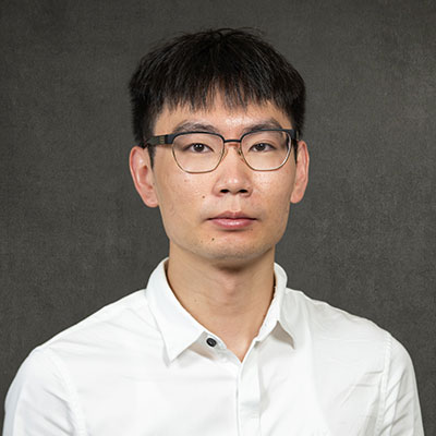
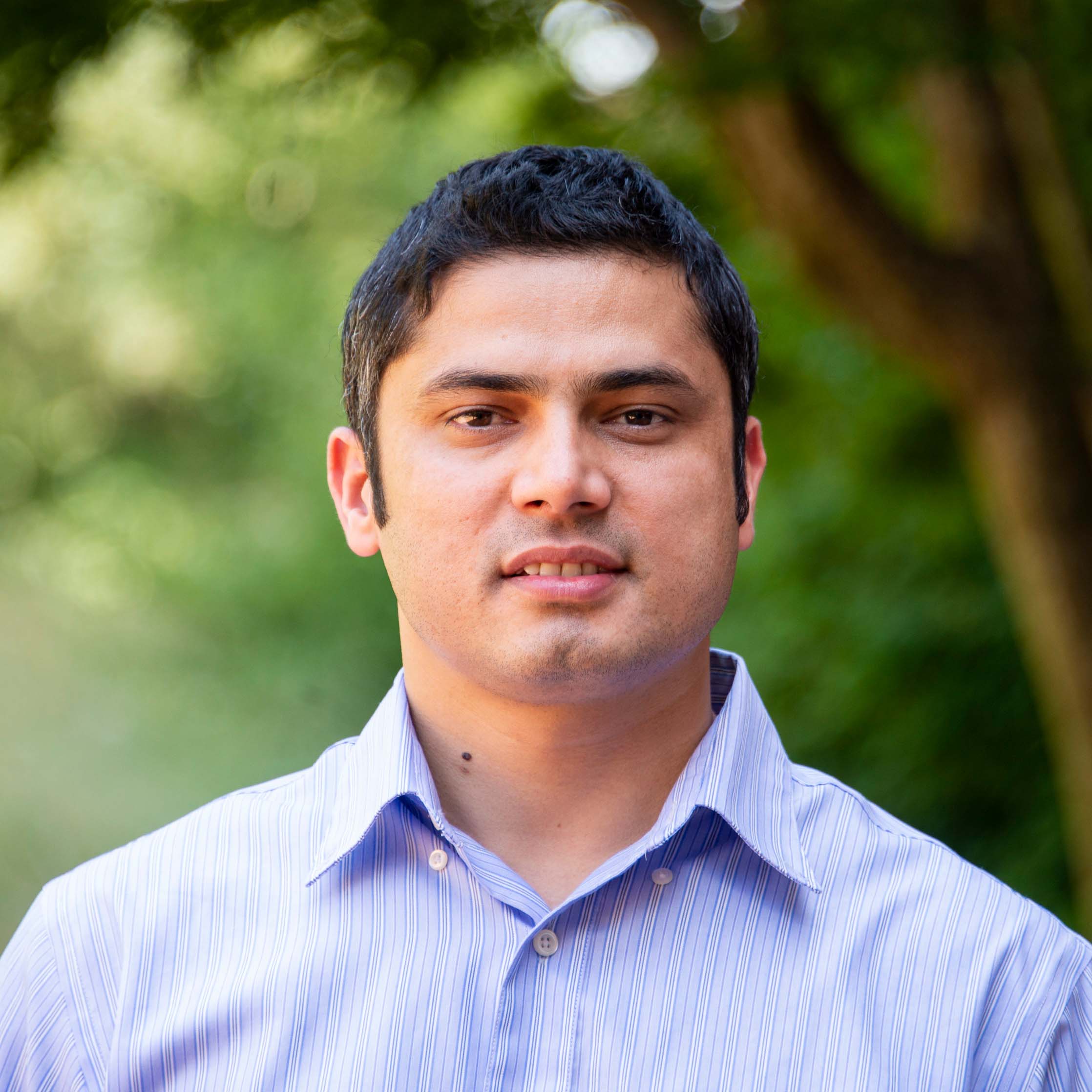
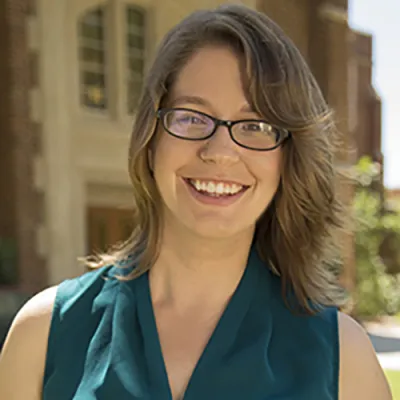
Dr. Ninghao Liu is an Assistant Professor of Computer Science in the School of Computing at the University of Georgia, part of the Franklin College of Arts & Sciences - Division of Physical & Mathematical Sciences. He holds a Ph.D. in Computer Science from Texas A&M University (2021) and an M.S. in Electrical and Computer Engineering from Georgia Institute of Technology (2015). His research focuses on Explainable AI (XAI), Graph Mining, Model Fairness, Recommender Systems, and Outlier Detection, with notable contributions to foundational AI techniques and their applications in education, healthcare, and environmental sciences. Dr. Liu has secured significant funding, including a three-year NSF grant (2022–2025) for 'Graph-Oriented Usable Interpretation' and a five-year $10 million grant from the U.S. Department of Education (2024–2029) for the GenAI Empowered National Initiative for STEM+C Education. He has also been honored with the Outstanding Paper Award at ICML 2022, Best Paper Award Shortlist at WWW 2019, and other distinctions. His work emphasizes interpretable machine learning, graph neural networks, and addressing algorithmic bias. He collaborates across disciplines, contributing to radiology AI, climate-smart forestry, and pandemic prediction through knowledge-enhanced deep learning. His lab is based at the Boyd Research and Education Center, where he advances research in trustworthy AI systems and data-centric solutions.
Matthew Fagan is an Associate Professor in the Department of Geography & Environmental Systems at the University of Maryland, Baltimore County (UMBC), holding a Ph.D. from Columbia University (2014). His research integrates remote sensing, landscape ecology, and conservation biology to study forest dynamics across tropical and temperate ecosystems. His primary research interests focus on: Landscape-scale habitat degradation and restoration Remote sensing applications for forest monitoring Policy effectiveness in tropical conservation corridors Socio-ecological drivers of agricultural expansion Connectivity and reforestation processes Recent publication trends reveal increasing emphasis on machine learning integration with high-resolution satellite imagery for tropical forest monitoring, particularly in assessing degradation patterns, carbon sequestration potential, and the distinction between natural regeneration versus plantation forestry. His work increasingly addresses the intersection of climate change mitigation, biodiversity conservation, and poverty reduction through land use studies in Africa and Latin America. Dr. Fagan leads the "Earth from Above" research laboratory, which conducts field and remote sensing work in Costa Rica, Maryland, and the Caribbean, with specific projects examining timber plantation impacts, riparian forest connectivity using LiDAR, and conservation of endangered species like the Bahama Oriole.
Yeyin Shi is an Associate Professor and Agricultural Intelligence Engineer at the University of Nebraska-Lincoln, Department of Biological Systems Engineering. His research focuses on applying artificial intelligence and remote sensing technologies to enhance agricultural productivity and sustainability. He teaches courses such as AGST 316: Technologies and Techniques for Digital Agriculture and AGEN/AGRO/AGST 431/892: Site-Specific Crop Management. He holds a Ph.D. in Biosystems and Agricultural Engineering from Oklahoma State University (2014), an M.S. (2010), and a B.S. in Mechanical Engineering from Nanjing Forestry University (2007). Research Interests: Agricultural data generation/analysis, remote sensing systems (satellite/UAV-based), crop stress sensing, precision crop management, and high-throughput phenotyping. His work bridges machine learning, robotics, and agronomy to address challenges in sustainable farming practices. Recent projects include maize tassel detection via deep learning, UAV-based weed detection, and nitrogen stress indices for maize using hyperspectral imagery. Awards: ASABE Outstanding Manuscript Reviewer (2015), 1st Place Postdoc Research Poster (2015), 2nd Place Student Robotic Competition (2012) Grants: Active collaborations on USDA-funded projects for precision agriculture and phenotyping Labs/Teams: Leads the Agricultural Intelligence Research Group at UNL, focusing on AI-driven agricultural solutions His research emphasizes scalable solutions through edge computing and cloud-based frameworks for irrigation scheduling and crop monitoring, aiming to optimize resource use in both row crops and livestock systems.
Dr. Bon Woo Koo is an Assistant Professor at the School of Urban and Regional Planning , Toronto Metropolitan University. His expertise lies in geospatial urban analytics, walkability, and GIS applications, focusing on urban design for public health equity and innovative data science tools. He holds a PhD in City & Regional Planning from Georgia Institute of Technology, a Master’s in Landscape Architecture from Seoul National University, and a Bachelor’s in Interior Design from Kookmin University. Education: PhD in City and Regional Planning, Georgia Institute of Technology Master of Landscape Architecture, Seoul National University Bachelor of Interior Design, Kookmin University Research Interests: Dr. Koo investigates urban environments’ impact on health and well-being, equity in environmental amenities (e.g., tree canopies), and advanced GIS techniques. He develops automated audit methods for walkability and explores spatial modeling for urban sustainability. His work bridges data science with policy, contributing to CDC health surveillance and smart city initiatives. Publications: His research appears in journals like Landscape and Urban Planning , Environment and Behavior , and Health and Place , with a focus on walkability audits, urban tree equity, and audio-based pedestrian sensing. Recent work addresses post-pandemic mental health and broadband equity strategies. Professional Engagement: He has advised the CDC’s technical panel on leveraging big data for health policy, presented at conferences like the Association of Collegiate Schools of Planning, and collaborated with institutions like Universitas Gadjah Mada and the Atlanta Regional Commission.
Dr. Chao Fan is an Assistant Professor in Civil Engineering and Environmental Engineering and Earth Sciences at Clemson University, affiliated with the Glenn Department of Civil Engineering. His research focuses on climate change adaptation, socio-environmental systems dynamics, and urban resilience, leveraging AI and data science. He holds a Ph.D. from Texas A&M University (2020), an M.S. from UC Davis (2017), and a B.S. from China University of Mining and Technology (2016). Dr. Fan's work integrates interdisciplinary approaches to address challenges in disaster management, smart cities, and environmental justice. Key interests include social sensing for infrastructure disruptions, equity in urban mobility networks, and leveraging digital twins for resilience planning. His recent publications explore topics like wildfire impacts, PM2.5 exposure inequity, and carbon market mechanisms for infrastructure adaptation. Professional memberships include ASCE, ACM SIGKDD, AGU, and AAAS. His lab (fanchaolab.com) develops innovative solutions for climate adaptation and equitable urban systems, emphasizing fairness in AI-driven models and network analysis.
Maha Ben Ali is an Associate Professor at the Department of Mathematical and Industrial Engineering at Polytechnique Montréal. She is also an Adjunct Professor at Université Laval and a member of the Interuniversity Research Centre on Enterprise Networks, Logistics and Transportation (CIRRELT) and the Laboratoire Poly-Industries 4.0 . Education: Bachelor’s in Industrial Engineering, École Nationale des Ingénieurs de Tunis M.Sc. in Industrial Systems Engineering, École Nationale des Ingénieurs de Tunis M.Sc./Ph.D. in Mechanical Engineering (Industrial concentration), Université Laval Research Interests focus on Industrial Engineering , with emphasis on Demand Management , Supply Chain Optimization , Simulation Modeling , Industry 4.0 , and Data Valorization . Her work combines Operations Research with Machine Learning to solve complex production and logistics challenges, particularly in softwood lumber and bioethanol supply chains . Publications (34 total) include studies on reinforcement learning for demand-driven systems, hybrid recommendation systems in B2B contexts, and symbiotic bioethanol network design . She has presented at conferences like the Winter Simulation Conference and IISE Annual Conference . Scientific Awards: Best paper – CIGI-QUALITA-MOSIM 2023 David Martell Student Paper Prize in Forestry – CORS 2018 NSERC Alexander Graham Bell Canada Graduate Scholarship FRQNT Doctoral scholarship Fast-tracking scholarship Teaching includes courses like Production and Inventory Planning , Simulation of Production Systems , and Logistic Networks . She has supervised 9 completed Master’s theses on topics ranging from multi-project scheduling to CO₂ emission reduction in freight transportation .
Brian M Deal serves as a Professor of Landscape Architecture within the School of Architecture at the University of Illinois at Urbana-Champaign, holding additional appointments in Urban and Regional Planning, the European Union Center, the Center for Latin American and Caribbean Studies, and the National Center for Supercomputing Applications (NCSA). His expertise bridges sustainable planning theory, energy systems, and spatial modeling to develop practical decision-support tools for community development and climate resilience. His educational foundation includes a PhD in Regional Planning (2002), Master of Architecture (1997), and BS in Architectural Studies (1983), all earned at the University of Illinois at Urbana-Champaign. Prior academic experience encompasses a decade of professional architecture practice and senior research at the Army Construction Engineering Research Laboratory (CERL), where he specialized in sustainable military facility design using spatial simulation. Deal's research centers on sustainable planning systems and climate adaptation, with current projects examining urbanization impacts on Korean rural amenities, advancing the University of Illinois' climate action plan (iCAP), and developing next-generation 'sentient' planning support systems. His work integrates land-use modeling, energy systems analysis, and decision-support technologies to address complex urban environmental challenges through interdisciplinary collaboration. Recent publications reveal a pronounced shift toward data-driven sustainability solutions, featuring AI applications for carbon-neutral planning, multi-scaled green infrastructure optimization, and socio-ecological modeling. Key themes include urban carbon sequestration, post-pandemic park dynamics, and climate-resilient coastal design, demonstrating consistent innovation in translating theoretical frameworks into actionable planning tools for real-world implementation. Professor Deal's scientific awards and honors were not detailed in the provided text. As faculty mentor to the Student Sustainability Committee and chair of campus sustainability planning efforts, Deal actively guides student development and institutional policy. His leadership of the LEAM Laboratory and SEDAC involves managing research grants focused on urban resilience, energy systems, and climate adaptation, fostering partnerships with government agencies and community organizations to deploy planning tools that directly impact community decision-making processes. Deal directs the Land Use Evolution and Impact Assessment Modeling (LEAM) Laboratory and Smart Energy Design Assistance Center (SEDAC), leading interdisciplinary teams in developing spatial simulation models and decision-support systems. His operational leadership extends to authoring the university's climate action plan and chairing campus sustainability committees, positioning him at the nexus of academic research, institutional policy, and community engagement for sustainable urban futures.
Introduction Dr. Shelley Xuelian Meng is an Associate Professor in the Department of Geography and Anthropology at Louisiana State University (LSU), part of the College of Humanities & Social Sciences. Her research focuses on leveraging remote sensing technologies (e.g., UAVs, LiDAR, multispectral imaging) to study coastal dynamics, wetland restoration, vegetation health, and precision agriculture. Education Ph.D. in Geography and GIScience, Texas State University (2010) M.S. in GIS and Cartography, Chinese Academy of Sciences (2003) B.E. in Information Engineering, Wuhan University (2000) Research Interests Meng’s work emphasizes the application of advanced geospatial technologies to address environmental challenges. Key areas include: Coastal wetland die-off and restoration using multi-scale remote sensing LIDAR and UAV-based terrain and vegetation mapping Object-oriented classification algorithms for environmental monitoring GIS integration for precision agriculture and disaster management Awards & Recognition 2023 Tipton Team Award (for Roseau cane die-off research) 2014 Best Paper Award in Remote Sensing CPGIS Young Scholar (2012) Grants & Projects Notable funded projects include: USDA-funded Roseau cane die-off studies ($1.6M+ across multiple years) Development of LiDAR and thermal sensing tools for coastal research Acquisition of terrestrial LiDAR equipment for multidisciplinary studies Labs & Affiliations Meng directs the Technology Intensive Geospatial and Remote Sensing (TIGeRS) Lab , which houses advanced equipment including drones, LiDAR scanners, and multispectral sensors. The lab collaborates with the LSU Coastal Studies Institute and other institutions.
Dr. Krishna P. Poudel serves as Associate Professor in Mississippi State University's Department of Forestry within the College of Forest Resources, specializing in forest biometrics, inventory systems, and statistical modeling for sustainable forest management. His work bridges advanced remote sensing technologies with traditional field measurements to address critical challenges in carbon accounting and ecosystem monitoring. His educational foundation includes: Ph.D. in Forestry, Oregon State University M.S. in Statistics, Oregon State University M.S. in Forestry, Louisiana State University B.S. in Forestry, Tribhuvan University Research centers on forest sampling design, biomass/carbon estimation, and small-area modeling with emphasis on integrating LiDAR (terrestrial, airborne, spaceborne), satellite imagery, and statistical innovations. Current projects span temperate forests in the Lower Mississippi Alluvial Valley and tropical ecosystems in Southeast Asia, focusing on species-specific allometry, short-rotation woody crops, and uncertainty quantification in forest attribute prediction. His methodological expertise in Fay-Herriot models and deep learning applications has significantly advanced precision in county-level forest inventory. Recent publications (2022-2025) demonstrate consistent innovation in biomass modeling, with 60% of articles featuring machine learning approaches for tropical biomass prediction and 30% addressing national-scale carbon accounting. Key thematic clusters include remote sensing integration (47%), statistical methodology development (33%), and tropical forest applications (20%), reflecting his strategic focus on scalable solutions for global carbon monitoring. Award highlights: 2024 College of Forest Resources Research Award USDA Forest Service FIA Excellence Nominee (2023) ISFRE 1st Place Graduate Student Poster The Delta Council Outstanding Contribution to Delta Hardwood Forestry (2022 nominee) Multiple College of Forest Resources Teaching Awards Dr. Poudel actively mentors seven graduate students through the Forest Biometrics Lab, with thesis topics spanning ICESat-2 canopy height validation, deep learning biomass models, and marginal land identification. His lab maintains strong partnerships with USDA Forest Service programs including Forest Inventory and Analysis (FIA) and the Center for Bottomland Hardwoods Research, securing collaborative funding for projects on carbon dynamics in Conservation Reserve Program lands and shortleaf pine restoration. Current initiatives focus on integrating GEDI data with national inventory systems and developing AI-driven tools for smallholder agroforestry carbon accounting in Vietnam.
Prof. Alfred Stein is a Full Professor in Spatial Statistics and Image Analysis at the Department of Earth Observation Science, Faculty ITC, University of Twente. He earned his MSc in Mathematics and Information Science from Eindhoven University of Technology and a PhD in Spatial Statistics from Wageningen University. His career spans roles at Wageningen University (1988–2002), ITC (2002–present), including leadership positions as department head, vice-rector research, and portfolio holder for education. Education: MSc (Eindhoven University of Technology), PhD (Wageningen University) Leadership: Department Head (Earth Observation Science), Vice-Rector Research (2008–2012), Portfolio Holder Education (2012–) His research focuses on Spatial and Spatio-Temporal Statistics , emphasizing Bayesian inference , data quality , image analysis , and fuzzy techniques . Key application domains include agriculture, health, urban land use, coastal systems, hazards, and wildlife. He has mentored over 30 PhD students since 1998, with 11 currently under supervision. Recent research trends highlight AI-driven remote sensing for glacier mapping, urban livability, and disease modeling. Publications span Deep Learning for SAR tomography, Bayesian hierarchical models for health data, and multitemporal SAR analysis for environmental monitoring. Awards include the Best Paper Award (2019) and ISARA Founder's Award (2020) . Scientific Awards Best Paper Award (2019) ISARA Founder's Award (2020) As Editor-in-Chief of Spatial Statistics and associate editor for multiple journals, he leads academic discourse. Collaborations include the University of Cape Town and University of Pretoria as Honorary Professor. His work contributes to UN Sustainable Development Goals, particularly in climate action and sustainable cities.
Meley Mekonen Rannestad is a Researcher at the Norwegian University of Life Sciences specializing in forest and resource economics. She leads the interdisciplinary NFR project ClimateSmartForest with a 15 million NOK budget and received the prestigious Human Frontier Science Program research grant in 2024. Her research examines climate-smart forest management, ecosystem services valuation, and sustainable land use in African dryland ecosystems. Recent publications focus on remote sensing applications for biomass estimation, armed conflict impacts on vegetation, and economic analyses of agroforestry adoption. Rannestad represents NMBU at UN climate conferences (COP25, COP27, COP28) and investigates carbon sequestration potential, forest governance, and climate adaptation strategies in vulnerable ecosystems. Her work integrates natural and social science approaches to address climate change challenges.
Dr. Sophie Wilkinson is an Assistant Professor at the School of Resource & Environmental Management, Simon Fraser University (SFU) since 2023. Her interdisciplinary research focuses on wildfire ecology and ecosystem management, integrating field studies, experimental fires, GIS, and ecological modeling to enhance resilience against wildfires. She holds a PhD in Ecohydrology from McMaster University, with prior degrees from the University of Leeds. Her work emphasizes understanding wildfire severity patterns and ecological tipping points in Canadian boreal forests and peatlands. Collaborating with the Canadian Forestry Service and land managers, she translates research into practical solutions, including a new fuel moisture index for wildfire danger rating systems. Key research themes include peatland ecohydrology, climate change impacts, and fire management strategies. She teaches REM 471 (Forest Ecosystems and Management) and is developing a community science platform (iWetland) for wetland monitoring. Wilkinson’s studies highlight the interconnectedness of human activities, environmental health, and wildfire dynamics. Her publications span over 30 peer-reviewed articles since 2020, addressing topics like peat burn severity thresholds, seismic line impacts on boreal ecosystems, and turtle nesting habitat recovery post-fire. She actively engages with policymakers and communities to bridge academic findings and real-world applications.
Giorgos Mountrakis is a Professor in the Department of Environmental Resources Engineering at SUNY College of Environmental Science and Forestry (ESF). His research focuses on environmental monitoring using remote sensing, environmental modeling through geographic methods, and decision support systems for ecological and urban challenges. He holds a Dipl. Eng. from the National Technical University of Athens (1998), an M.S. (2000), and Ph.D. (2004) from the University of Maine. His work integrates advanced technologies like satellite imagery, LiDAR, and machine learning to address land cover dynamics, climate impacts, and wildlife conservation. Current advisees include Atef Amriche (PhD candidate in Geospatial Information Science), Babak Haji Seyed asadollah (PhD in Environmental Resources Engineering), Ahmadreza Safaeinia (PhD in Environmental Resources Engineering), and Zhixin Wang (PhD in Geospatial Information Science). Key research themes include: land use/cover classification using deep neural networks, climate change impacts on forests and rangelands, and optimizing spatial-temporal models for large-scale environmental analysis. His projects span global datasets (e.g., Landsat, MODIS) and regional case studies in the US, Mongolia, and Algeria. Publications emphasize methodological advancements in remote sensing, such as fusion of multisensor data, accuracy assessment frameworks, and applications in biodiversity conservation. His work bridges technical innovation with practical environmental decision-making, addressing issues like urban growth prediction and wildlife-vehicle collision mitigation.
Katie Marshall is an Assistant Professor in the Department of Zoology at the University of British Columbia’s Faculty of Science. Her research focuses on the physiological and ecological mechanisms underlying species’ survival in cold environments, particularly in intertidal invertebrates and forest pest insects. She explores how low-temperature adaptation affects population growth and geographic range limits, aiming to predict climate change impacts on species distributions. Dr. Marshall is affiliated with the Biodiversity Research Centre and the Comparative Physiology Group, emphasizing interdisciplinary collaboration in ecology and evolutionary biology. Her work integrates biological and environmental disciplines, combining molecular studies with ecological observations. For instance, she investigates ice-binding proteins in marine invertebrates and metabolic adaptations in insects and mussels exposed to freezing conditions. She also utilizes advanced technologies like machine learning and DNA metabarcoding for species classification and ecosystem monitoring. Dr. Marshall’s research addresses key questions about why species have specific geographic ranges and how they might respond to environmental changes. Recent studies highlight themes such as the evolutionary origins of cold tolerance, the effects of temperature fluctuations on insect survival, and the interplay between climate variables and organismal physiology. She emphasizes understanding functional traits and eco-evolutionary dynamics to improve predictive models for species range shifts and ecosystem management. Though no specific scientific awards or grants are listed in the provided texts, her contributions to biodiversity and physiological ecology are evident through her active research and lab leadership. The Marshall Lab collaborates broadly within the Zoology Department and across UBC’s Biodiversity Research Centre to advance knowledge in these critical areas.
Dr Daniel Harris is a Senior Lecturer in the Department of Geography at the School of the Environment, University of Queensland (UQ). His research focuses on coastal and coral reef morphodynamics, integrating physical processes like waves and tides with ecological and geological systems. Prior to UQ, he held positions at the University of Sydney and the Leibniz Center for Tropical Marine Ecology (ZMT). He leads The BeachLab, dedicated to developing tools for coastal resilience in a warming world. Research interests include coral reef structural complexity, coastal protection under climate change, and surf zone processes. His work combines field data, remote sensing (e.g., LiDAR, drones), and numerical modeling to address both fundamental and applied questions. Notable projects involve quantifying coral rubble mobility, analyzing Holocene reef evolution, and assessing shoreline change via satellite imagery. His expertise spans marine geoscience, physical oceanography, and environmental adaptation strategies. Publications emphasize coral reef dynamics, coastal geomorphology, and climate impacts. He collaborates with ecologists, geologists, and coastal engineers to advance interdisciplinary solutions. Teaching focuses on geography and marine science, reflecting his commitment to educating future researchers and practitioners. Key contributions include advancing methods for shoreline monitoring using Bayesian networks and Google Earth Engine. His research highlights the critical role of coral reefs in coastal protection, particularly under rising sea levels and extreme weather events. The BeachLab’s work bridges academic inquiry with practical management strategies for vulnerable coastal ecosystems.