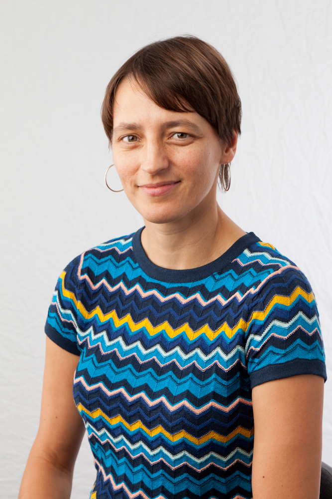
Karianne Bergen is an Assistant Professor at Brown University, affiliated with the Departments of Earth, Environmental and Planetary Sciences and Data Science. She holds a courtesy appointment in Computer Science and is the founder of the Scientific Machine Learning (SciML) Research Group. Her work bridges geosciences and AI, focusing on interpretable machine learning for seismology and climate science. Research interests include earthquake monitoring via AI, climate modeling using neural networks, and explainable AI for geoscience applications. Recent projects involve improving sea level projections and analyzing carbon capture materials using GANs and LSTM emulators. Her talk at the 2024 'Exploring System Dynamics in the Natural World with AI' conference highlighted AI-driven climate science. Key achievements include the 2021 Sleeping Bear Award. She advises PhD students in geosciences and data science, focusing on topics like sea ice dynamics and uncertainty quantification. Labs/Teams: SciML Group at Brown University, collaborating with institutions like the SciAI Center. Current research includes prototype-based explainability and flow-based neural networks for environmental projections.
Ashkan Jahanbani Ghahfarokhi is an Associate Professor at the Norwegian University of Science and Technology (NTNU), Department of Geosciences (IGV), specializing in reservoir engineering. He leads the CEORS Gemini Centre, a strategic collaboration between NTNU and SINTEF on CO2 Enhanced Oil Recovery & Storage. His roles include Head of the Well and Reservoir Group (2021-2022), Project Manager for the NORHED II Program in Mozambique, and Guest Editor for the Energies journal's AI/ML in Oil & Gas Special Issue. Education: PhD (NTNU, 2015), MEng (University of Calgary, 2009), MSc/BSc (Petroleum University of Technology, Iran) Research focuses on subsurface reservoir modeling, CO2 storage, data-driven techniques, and production optimization. Key interests include: CO2-EOR/Storage system design Machine learning integration in reservoir simulation Wellbore-reservoir coupling dynamics Recent articles emphasize advanced numerical modeling of CO2 injection in depleted gas fields, AI-driven proxy models for reservoir optimization, and interfacial tension analysis for hydrogen storage. His work spans 40+ peer-reviewed papers and 20+ conference presentations. Scientific Awards: NTNU's Outstanding Academic Fellows Programme (2022-2026), DNVA Postdoctoral Scholarship (2015-2017) Supervised 20+ master’s students and 4 PhD candidates, including Jinjie Mao (CO2 storage optimization), Cuthbert Ng (data-driven reservoir modeling), and Behnam Tavagh Mohammadi (CO2 field storage modeling). Active in teaching reservoir simulation, CO2 storage engineering, and petroleum geoscience courses at NTNU.
Nikolas Benavides Höglund is a Postdoctoral Researcher at the Department of Geology, Lund University. His work focuses on hydrogeology, groundwater modeling, and environmental remediation, contributing to UN Sustainable Development Goals related to clean water and sustainable development. Research Interests: Groundwater modeling and numerical techniques Contaminated site characterization and remediation Data-driven approaches in hydrology Integration of academic research with industrial and policy applications Key Projects: A decade of applied groundwater modelling in Sweden (PI, 2024–2026) MIRACHL: In-situ remediation of chlorinated hydrocarbon contamination (Researcher, 2016–2024) Collaborations include international teams in hydrology and geophysics, with recent focus on Sweden's groundwater decision-support systems and industry partnerships.
Philippe Poncet is a Professor at the Université de Pau et des Pays de l'Adour (UPPA) and Vice-President for Digital Environment. He leads the Numerical Methods and Complex Fluids team at the Laboratory of Mathematics and their Applications (LMAP). His expertise spans particle/vortex methods, high-performance computing, and applications in geoscience, microfluidics, and biomathematics, with a focus on reactive flows and porous media. Poncet's research integrates numerical analysis with practical challenges in environmental and biomedical engineering. Key interests include Lagrangian methods for fluid dynamics, optimization algorithms, pore-scale modeling, and cystic fibrosis biomechanics. His work bridges theoretical mathematics and industrial-scale simulations. Recent publications demonstrate advances in pore-scale dissolution modeling, Bayesian neural networks for inverse problems, and viscous flow simulations. His articles consistently address multi-scale challenges in geosciences and biomedicine using innovative computational frameworks. He has led significant projects including the ANR-funded MucoReaDy (mucus dynamics in respiratory diseases) and MicroMineral (CO₂ mineral storage). These collaborations involve multidisciplinary teams addressing environmental and health-related fluid dynamics.
Brindha Karthikeyan is an environmental geoscientist affiliated with the IHE Delft Institute for Water Education. She holds a PhD in Environmental Geosciences from Anna University, India, and completed her Habilitation in Hydrogeology at Freie Universität Berlin, Germany. Her research focuses on integrated water resources management, managed aquifer recharge (MAR), and groundwater quality assessment, with a strong emphasis on applied solutions for real-world environmental challenges. Post-doctoral fellowships at IWMI (Lao PDR) and the National University of Singapore. Experience in over 12 countries across Asia, Africa, and the Americas. Recipient of the Linnaeus Palme Fellowship and Associate Editor of the Hydrogeology Journal. Her research interests span hydrogeochemical processes, climate change impacts on water resources, and sustainable groundwater management. She has pioneered novel methods for assessing karst spring dynamics and fluoride contamination mitigation. Over 150+ publications reflect her expertise in interdisciplinary approaches combining GIS, machine learning, and field-based studies. Key contributions include floodwater harvesting strategies in the Ganges Basin and vulnerability assessments in coastal aquifers. Her work integrates socio-technical aspects of water governance, emphasizing capacity-building in Global South nations.
Fernando Barrio Parra is an Assistant Professor at the Department of Energy and Fuels, School of Mining and Energy Engineering, Polytechnic University of Madrid (UPM). He holds a PhD in Natural Resource Conservation and has extensive experience in environmental geochemistry, pollution modeling, and geophysical techniques for contaminant detection. His academic roles include serving as Deputy Director of the Department of Energy and Fuels since 2025. Education: Bachelor's Degree in Environmental Sciences Master's Degree in Environmental Research, Modeling, and Risk Analysis PhD in Natural Resource Conservation Research interests focus on environmental risk assessment, radon deficit technique for contaminant mapping, and innovative educational methodologies. He is a member of the Prospecting and Environment Research Group and has pioneered applications of machine learning and 3D printing in academic settings. Key technical contributions include modeling LNAPL contamination, soil bioaccessibility studies, and coastal dune dynamics using LiDAR/GPR. Teaching innovations include flipped classroom approaches (e.g., QuimeTube for chemistry labs) and gamification strategies to enhance student engagement. He actively promotes scientific literacy through projects like 'Fake Hunters' addressing misinformation in classrooms. His work bridges environmental science and engineering, with emphasis on sustainable mining practices and circular economy models derived from hydrogeochemical data. Recent studies address background/reference values for trace elements in sediments and probabilistic risk assessments in urban gardens.
Gustau Camps-Valls is a Full Professor of Electrical Engineering at the University of Valencia, Spain, where he has been employed since 2002, progressing from Assistant Professor to Associate Professor and finally to Full Professor in 2017. He serves as Head of the Image and Signal Processing (ISP) group (http://isp.uv.es) and coordinates the 'Machine Learning for Earth and Climate Sciences' program within ELLIS.eu, Europe's premier AI network of excellence. Professor Camps-Valls specializes in the intersection of artificial intelligence and Earth sciences, with research spanning remote sensing for terrestrial biosphere monitoring, explainable AI and causal discovery, Earth system modeling through machine learning, and geoscience data analysis. His work bridges theoretical machine learning advances with practical Earth observation applications, creating interpretable models that integrate physical knowledge with data-driven approaches. With over 250+ peer-reviewed journal papers, 300+ conference papers, and an h-index of 78 (29,000+ citations), his publication record demonstrates significant impact across both technical (IEEE, PLOS One) and high-impact scientific journals (Nature, Science Advances, PNAS). His research consistently focuses on developing machine learning methods specifically tailored for Earth observation challenges. 2022 Fellow of the European Academy of Sciences (EurASc) 2022 Fellow of Asia-Pacific Artificial Intelligence Association (AAIA) 2021 Highly Cited Researcher 2020 ERC Synergy Grant recipient 2019 Google Classic Paper Award 2018 IEEE Fellow 2017 IEEE Distinguished Lecturer 2015 ERC Consolidator Grant recipient Professor Camps-Valls has (co)advised over 30 PhD theses and coordinated/participated in more than 60 research projects with industry and academia at national and European levels. He serves on the advisory boards of major space organizations including ESA Phi-Lab and EUMETSAT, demonstrating the practical impact of his research. His substantial grant portfolio includes two prestigious European Research Council grants across different scientific domains. Leading the Image and Signal Processing research group, Professor Camps-Valls maintains strong international collaborations with institutions including Max Planck Institutes in Germany and École Polytechnique Fédérale de Lausanne in Switzerland. He is a vocal advocate for open code/data science in Earth observation and regularly contributes to shaping research policy through his membership in the European Space Sciences Committee.
Christoph W. Borst is a professor at the University of Louisiana at Lafayette, USA, specializing in Virtual Reality (VR) and Human-Computer Interaction (HCI). His research focuses on enhancing educational VR environments through attention guidance, emotion recognition, and multimodal sensing (EEG, eye-tracking). He collaborates with researchers like Jason Woodworth, Adil Khokhar, and Arun Kulshreshth on projects involving spatial interaction, distraction classification, and pedagogical agents. His work includes developing time-continuous emotion rating interfaces, gaze-driven attention restoration systems, and VR tools for teaching molecular reactions and geosciences. Key publications address VR classroom monitoring, collaborative dataset exploration, and haptic feedback optimization for precision tasks. Articles highlight applications in rehabilitation, energy education, and simulated welding training. Research interests span VR attention mechanisms Emotion detection in immersive environments Machine learning for student distraction classification Interactive 3D visualization techniques
Dr. Iuliia Burdun is a Postdoctoral Researcher at the Department of Built Environment and Geoinformatics, focusing on remote sensing applications in peatland ecology and environmental monitoring. Her work contributes to UN Sustainable Development Goals related to climate action and life on land. She holds a PhD in Physical Geography from the University of Tartu (2020) and MSc/BSc in Geography from V. N. Karazin Kharkiv National University. She has held external roles including Research Fellow and Remote Sensing Specialist at University of Tartu, and Adjunct Instructor in 2017. Primary Affiliation: Department of Built Environment Secondary Affiliation: Geoinformatics Her research interests span remote sensing techniques, peatland hydrology, vegetation dynamics, and Earth observation. She has pioneered methods combining optical/thermal satellite data to monitor groundwater tables in Northern Hemisphere peatlands. Notable contributions include developing algorithms for water table estimation using Sentinel and Landsat data, and spectral libraries for peatland vegetation characterization. Recent publications highlight advancements in hyperspectral analysis of Sphagnum moss species, tropical peatland monitoring, and integration of remote sensing with social media data for ecosystem assessment. Her work has been recognized with the Mobilitas Pluss postdoctoral grant (2021) and a National University Student Award. Burdun actively contributes to academic communities through organizing conferences (e.g., European Geosciences Union General Assembly 2022), peer-review for Geomatics, Natural Hazards and Risk , and membership in the Peatland ECR Action Team. She has supervised datasets including CO2/CH4 gas flux measurements and spectral libraries of boreal peatland vegetation.
Courtney Schumacher is the E.D. Brockett Professor of Geosciences at Texas A&M University's College of Geosciences, Department of Atmospheric Sciences. Her research focuses on tropical convective processes, radar meteorology, and mesoscale-climate interactions. She employs radar data and climate models to study precipitation dynamics in the tropics and subtropics. Education: Ph.D. (2003), M.S. (2000) in Atmospheric Sciences from the University of Washington; B.A. (1994) in Environmental Sciences from the University of Virginia. Research emphasizes environmental influences on precipitation, radar climatology, and model-data comparisons. Notable projects include analyses of the Madden-Julian Oscillation (MJO), Amazonian convection, and hurricane activity in historical contexts. She has contributed to major field campaigns like GoAmazon2014/5 and DYNAMO/CINDY2011/AMIE. Recent articles highlight advancements in machine learning for rainfall prediction, lightning modeling in global climate systems, and diurnal circulation patterns over West Africa. Her work bridges observational data with theoretical climate dynamics, emphasizing tropical systems' global impacts. No scientific awards are explicitly listed. Advising and grants remain unspecified, though her extensive publication record suggests active research and mentorship roles. She collaborates on interdisciplinary teams studying cloud systems, climate feedbacks, and remote sensing techniques.
Juan Carlos Laya is an Associate Professor specializing in Carbonate Sedimentology and Diagenesis at Texas A&M University. His research focuses on the interplay between climate, ocean circulation, and carbonate platform evolution, with a strong emphasis on diagenetic processes and dolomitization. He holds a PhD from Durham University (UK), an MSc from Universidad Central de Venezuela, and a BEng in Geological Engineering from Universidad de Los Andes, Venezuela. Education: PhD in Geological Sciences (2012), Durham University MSc in Geological Sciences (2010), Universidad Central de Venezuela BEng in Geological Engineering (2002), Universidad de Los Andes His research interests include Miocene carbonate platform evolution via IODP data, Permian carbonate paleogeography in South America, and multi-scale approaches to carbonate sedimentation in the Middle East and Caribbean. Recent work explores monsoon dynamics and sea-level changes in the Maldives, integrating sedimentological and geochemical analyses. Publications highlight contributions to understanding dolomitization mechanisms, carbonate reservoir quality, and the application of machine learning in sedimentology. Teaching innovations include interactive games and conceptual assessments to enhance undergraduate learning at Texas A&M. No scientific awards are explicitly listed in the provided texts. His research leverages interdisciplinary methods, combining fieldwork, experimental petrology, and computational tools to address fundamental questions in carbonate geology.
Mark Lindsay serves as an Adjunct Senior Research Fellow at the Centre for Exploration Targeting within the School of Earth and Oceans at The University of Western Australia. His academic career focuses on geological interpretation, mineral exploration, and advanced modeling techniques. Lindsay actively contributes to multiple research initiatives, including the ARC Centre for Data Analytics for Resources and Environments (DARE), where he serves on the executive team and education committee. He also co-leads Project 6 (Automated 3D Modelling) within the MinEx Cooperative Research Centre and participates in the Loop Consortium, which connects research organizations, government agencies, and industry partners in mineral exploration. Lindsay's research interests center on the complexities of uncertainty and ambiguity in 3D geological and mineral exploration modeling, with particular emphasis on the process and psychology of data interpretation. His work explores a stochastic approach to modeling that assesses the importance of different data types in answering geoscientific questions. Key research areas include interpretation of geology from geophysics, mineral systems analysis, complex systems, uncertainty analysis, 3D modeling, value-of-information assessment, and applications of machine learning and Bayesian methods to geosciences. His research has significant industrial relevance through collaborations with the DARE ARC Industrial Transformation Training Centre, MRIWA industry/state government projects, and the MinEx Cooperative Research Centre. His recent publications demonstrate a strong focus on integrating advanced computational methods with traditional geological analysis. The research shows increasing application of machine learning techniques to geoscience problems, particularly in the areas of 3D modeling, mineral prospectivity analysis, and geophysical interpretation. His work frequently addresses the challenge of uncertainty quantification in geological models and explores how different data types contribute to more robust interpretations. The research spans multiple geographical contexts including Western Australia, the Capricorn Orogen, Yamarna Region, Paterson Orogen, and international locations such as the West African Craton and Eastern India. Lindsay has received notable recognition for his research contributions: MinEx CRC 2022-2023 publication prize MinEx CRC 2019-2020 publication prize Discovery Early Career Researcher Award (2018) His research is supported through multiple significant grants, including active leadership roles in the ARC Training Centre in Data Analytics for Resources and Environments (DARE) and the Evolution of Proterozoic multistage rift basins project. He also contributes to the MinEx CRC Project OP 6, which focuses on automated 3D geological modeling. While specific student supervision details aren't explicitly listed in the provided information, his involvement in training initiatives through the DARE Centre's education and training committee suggests active participation in academic mentorship. Lindsay maintains strong industry connections through multiple government and industry collaborations, enhancing the practical application of his research findings. Lindsay is actively involved in developing and applying advanced tools for geological modeling and interpretation. His work with the Loop Consortium and MinEx CRC demonstrates commitment to creating practical solutions for mineral exploration challenges. The research environment he operates within emphasizes collaboration between academia, government agencies, and industry partners, ensuring that theoretical advances translate into practical applications for resource exploration. His recent focus on integrating machine learning with traditional geological methods represents a cutting-edge approach to solving complex exploration problems.
Tom Horrocks is a Senior Research Fellow at the School of Earth and Oceans, University of Western Australia (UWA). He holds a dual degree in Engineering (Software) and Science (Physics/Applied Mathematics) from UWA, complemented by a research-focused doctoral program supported by the Robert and Maude Gledden Scholarship. His work bridges machine learning with geoscience challenges, focusing on predictive modeling, data mining, and software engineering solutions for resource exploration. Key research areas include machine learning applications in geophysics (e.g., neural networks for potential field modeling), hyperspectral imaging for mineral identification, and automated geological logging using FTIR spectra. His interdisciplinary approach often results in deployable software tools addressing real-world problems, such as the Rio Tinto Data Fusion project. Education : Bachelor of Engineering (Hons) in Software, UWA Bachelor of Science in Physics & Applied Mathematics, UWA Awards : Nick Rock Memorial Prize (2018) ASEG WA Branch Student Award (2015) UWA Vice Chancellor’s Impact & Innovation Award (2015) Current projects include the ChatGEO initiative for semantic document retrieval and collaboration with the Geodata Algorithms Team on predictive logging techniques. His research outputs span geostatistics, mineral exploration, and AI-driven geoscience solutions. Tom has contributed to major grants totaling over 5 years, including partnerships with industry leaders like Fortescue Metals Group and the Geological Survey of Western Australia. His work is disseminated through high-impact journals like Scientific Reports and Ore Geology Reviews , reflecting a strong focus on both theoretical innovation and practical application.
Professor Eun-Jung Holden is a leading academic in data science applied to geoscience, holding dual roles as Professor at the UWA Data Institute and Adjunct Senior Research Fellow in the School of Earth and Oceans at The University of Western Australia (UWA). She transitioned from computer science to geoscience in 2006, establishing the Centre for Data-driven Geoscience (CDG) to bridge academia and industry through advanced machine learning and visualization tools. Her education includes a computer science background from UWA, with postgraduate and postdoctoral research in computer vision and visualization. Her research focuses on automating geoscientific data analysis, including drill hole data integration, spectral imagery, and geomechanical modeling. She has commercialized three geodata analytics algorithms and led major industry projects with Rio Tinto Iron Ore, resulting in patent applications. Professor Holden’s work emphasizes cross-disciplinary collaboration, fostering innovation in mineral exploration, geophysical surveys, and virtual reality geologic mapping. She has been recognized with awards such as the 2022 Women in AI Award and the UWA Vice Chancellor’s Impact & Innovation Award. Her grants include leadership in the ARC Training Centre for Critical Resources and the ChatGEO project on semantic document retrieval. She has supervised 8 research projects and actively promotes industry-academia partnerships through initiatives like the UWA Data Institute. Labs/Teams: Leads the Centre for Data-driven Geoscience (CDG), specializing in machine learning and geoscientific data integration.
Milan Stanko is a Professor in Production Engineering and Field Development at NTNU's Department of Geoscience. As deputy leader of SUBPRO-Zero and BRU21 research programs, his work focuses on subsea hydrocarbon production systems, CO2 injection, and multiphase flow modeling. Research encompasses production optimization, subsea processing, water management, and renewable-integrated field designs. Current projects investigate bulk separation, cold flow production, and carbon injection systems using computational fluid dynamics and machine learning approaches. Teaches petroleum engineering courses and mentors doctoral researchers in multiphase flow modeling and field development optimization. Education includes PhD from NTNU and engineering degrees from Simón Bolívar University.