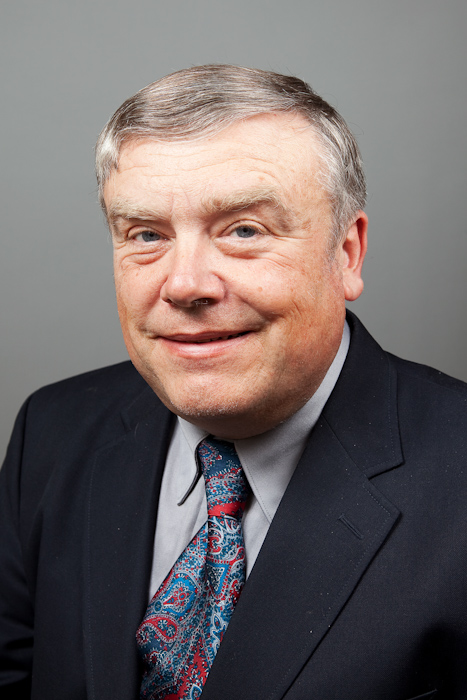
Alva L. Couch is an Associate Professor at Tufts University's School of Engineering, Department of Computer Science, with a career spanning over 30 years. His work bridges network/system administration, autonomic computing, and hydrologic data science, focusing on scalable solutions for data management and automated system administration. Education: Ph.D. in Mathematics (1988), B.S. in Architecture (1978), and B.A. in Bassoon/Contrabassoon Performance (1978). Research Interests His research centers on: Network and System Administration: Tools like SLINK, Maelstrom, and Babble for dependency analysis, cloud migration, and policy enforcement. Geo-informatics: MEDFORD metadata language and HydroShare platform for hydrologic data curation and discovery. Autonomic Computing: Promise theory, convergent operators, and closure models for self-managing systems. Recent Work Trends His 2024-2018 publications emphasize: Cloud-based hydrologic data management (AnVILMEDFORD, HydroShare) Metadata standards for interdisciplinary research Machine learning for system administration Agent-based resource sharing models Scientific Awards Liebner Teaching Award (1996) Seymour Simches Advising Award (2017) Best Paper Awards: LISA 1996, AIMS 2008, LISA 2001 LISA 2000 Best Student Paper (with Michael Gilfix) Contributions He developed key software like Peep (network auralization) and Slink (configuration management), supported by NSF grants and industry partnerships. His work with CUAHSI's Water Data Center shapes national hydrologic data infrastructure. He also advocates for science education and privacy in computing.
Pascal Hitzler is a University Distinguished Professor and holds the endowed Lloyd T. Smith Creativity in Engineering Chair at Kansas State University's Department of Computer Science, Carl R. Ice College of Engineering. He directs the Center for Artificial Intelligence and Data Science (CAIDS) and the Institute for Digital Agriculture and Advanced Analytics (ID3A). Previously, he held roles at Wright State University, Karlsruhe Institute of Technology, and TU Dresden. His research focuses on neuro-symbolic AI, semantic web technologies, knowledge graphs, and ontology engineering. Education: PhD in Mathematics (2001, University College Cork), Diplom in Mathematics (1998, University of Tübingen). Academic achievements include over 400 publications, founding editor roles for journals like Neurosymbolic Artificial Intelligence , and leadership in organizations like the Neural-Symbolic Learning and Reasoning Association. Research interests include AI explainability, knowledge representation, and interdisciplinary applications of semantic technologies. He leads the DaSe Lab for Data Semantics, advancing projects like the KnowWhereGraph and Enslaved.org Hub Knowledge Graph. His work bridges symbolic AI with neural networks, emphasizing practical applications in agriculture, environmental science, and historical data preservation. Grants and collaborations span academic, industrial, and international partners. He has advised numerous students and researchers, contributing to both theoretical advancements and real-world semantic systems deployments.
Dr. Ali Grami is an Associate Professor in the Department of Electrical, Computer and Software Engineering at Ontario Tech University, within the Faculty of Engineering and Applied Science. He holds a PhD in Electrical Engineering from the University of Toronto (1986), an MEng from McGill University (1980), and a BSc from the University of Manitoba (1978). His research focuses on satellite communications, digital transmission systems, and wireless networks. He has extensive industrial experience, including roles at Telesat Canada and Nortel Networks, and has contributed to pioneering projects like Canada's Anik-F2 Ka-Band satellite system. Dr. Grami has authored several textbooks, including Introduction to Digital Communications and Discrete Mathematics: Essentials and Applications . His work spans theoretical advancements (e.g., beamforming algorithms, spectrum access protocols) and practical applications in broadband satellite systems and cognitive radio networks. Awards include the United Nations TOKTEN Award (1995) and Nortel Award of Excellence (1989). He has designed academic programs at Ontario Tech, including the BEng, MASc/MEng, and PhD in ECE, and contributed to IT security programs. His teaching spans undergraduate and graduate courses in digital transmission, communication systems, and signal processing.
Christophe Mues is a Professor of Data Science and Information Systems at the University of Southampton's School of Management, within the Department of Decision Analytics and Risk. His research focuses on credit scoring, consumer credit risk modeling, and applications of predictive analytics, including machine learning techniques for credit risk assessment. He leads the Information Systems & Business Analytics section and supervises multiple PhD students in Business Studies and Management. His work spans advanced statistical methods for predicting Probability of Default (PD), Loss Given Default (LGD), and loan profitability. He is actively involved in the academic community, serving on the organizing committee for the Credit Scoring and Credit Control conference. His teaching includes topics in information systems and business analytics. Contact: C.Mues@soton.ac.uk. Research Interests: Credit Scoring and Consumer Credit Risk Modelling Predictive Analytics in Finance Machine Learning Applications (Deep Learning, Graph Neural Networks) Non-Traditional Data Integration Credit Model Transparency and Fairness Debt Collection Optimization PhD Supervision: Currently guiding four students in Business Studies & Mngt: Kameswara Rao Korangi, Sarthak Gurnani, Pablo Casas, and Nora Agyei-Ababio. Professional Activities: Leads research groups and contributes to international conferences. His work bridges academic research with practical financial risk solutions, emphasizing ethical AI and regulatory compliance in credit modeling. Biography: Holds a PhD in Applied Economics from KU Leuven (Belgium). Joined the University of Southampton in 2004, advancing from researcher to his current leadership role in Decision Analytics and Risk.
Monika Kuffer is a Full Professor at the University of Twente's Faculty of Geo-Information Science and Earth Observation (ITC), holding additional roles as Associate Professor in the Department of Urban and Regional Planning and Geo-Information Management. She leads research in urban remote sensing, deprived area monitoring, and sustainable urban development. Her work integrates spatial statistics, machine learning, and citizen science to inform inclusive city planning. Education: PhD in Human Geography & GIS from the University of Twente MSc in Human Geography (TU Munich) MSc in Geographic Information Science (University of London) Research Interests: Urban Remote Sensing Slum and Deprivation Mapping Climate Adaptation Strategies Citizen Science for Urban Inequalities Earth Observation Policy Support Articles Trends: Recent work emphasizes multi-city climate adaptation analyses, thermal inequality assessments in African slums, and scalable deprivation modelling frameworks like IDEAMAPS. Projects like ONEKANA and NightWatch highlight fusion of EO data with community-driven methods. Awards: 2022 EO4all Prize for innovative Earth Observation applications Advising & Grants: Supervised 3 PhD/MSc projects. Active in global initiatives like the EU's Knowledge Centre on EO and the UN's SDG frameworks. Leads datasets on deprivation (e.g., IDeAMapSudan). Labs/Teams: Core member of ITC's Urban Remote Sensing and GeoAI teams. Collaborates with the Digital Society Institute for interdisciplinary urban research.
Jaap Zevenbergen is a Full Professor at the University of Twente's Faculty of ITC, specializing in Land Administration and Geo-Information Management. He holds a PhD from Delft University of Technology (2002) and degrees in Geodetic Engineering (Delft) and Law (Leiden University). His research focuses on international land governance, digital transformation of property institutions, and pro-poor land tools, with projects in Africa, Southeast Asia, and Eastern Europe. He has contributed to UN Habitat initiatives and World Bank programs, emphasizing sustainable development goals (SDGs 1, 11, 13). Key roles: Theme leader at TU Delft's OTB Institute (2003–2010), Portfolio Manager for MSc Land Administration at ITC. Teaching: MSc programs in Land Administration, GIMA, and International Land Management. Research interests include: Land Administration Domain Model (LADM) implementation, legal-technical integration in geo-ICT systems, and post-disaster/post-conflict land governance. He has authored/co-authored over 340 publications and edited books like Real Property Transactions . Notable achievement: Co-winner of the 2018 FIG-Survey Review Prize for land policy analysis. Current projects explore 3D cadastral systems, UAV applications in land registration, and ethical geospatial practices. He advises on land reforms in Greece and Egypt and collaborates with institutions like UN Habitat and the World Bank.
Professor Ahmed Karmouch is a faculty member at the University of Ottawa's School of Electrical Engineering and Computer Science. He holds a Ph.D. and specializes in advanced networking research, including Network Slicing, Software Defined Networks (SDN), Named Data Networking (NDN), and Cloud Computing. His IMAGINE Lab focuses on developing innovative solutions for autonomic and cognitive networks, emphasizing programmable data planes and in-network computing. Research Interests: Network Slicing Software Defined Networking Named Data Networking Programmable Data Plane Intelligence In-Network Computing Ambient Intelligence & IoT Publications reflect a focus on SDN, NDN, and cloud infrastructure optimization. His work often bridges theory and practical implementation, addressing challenges in network efficiency, reliability, and scalability. Supervised over 30 graduate students, contributing to advancements in edge computing, virtual networks, and autonomic systems. Labs/Teams: Leads the IMAGINE Lab, dedicated to research in mobile autonomic networks, context-aware systems, and future broadband infrastructure. Projects include WiMAX security, policy-based overlay networks, and semantic resource discovery.
Samsung Lim serves as an Associate Professor of geographic information systems (GIS) in the School of Civil and Environmental Engineering at the University of New South Wales (UNSW) Sydney. With expertise spanning data science, artificial intelligence, and machine learning, Lim applies geospatial technologies to critical real-world challenges in natural disaster management and public health research. Lim's interdisciplinary work bridges engineering, computer science, and public health domains to develop practical decision-making tools for emergency response and disease surveillance. Ph.D. in Aerospace Engineering and Engineering Mechanics, University of Texas, Austin, TX, USA M.A. in Mathematics, Seoul National University, Seoul, South Korea B.A. in Mathematics, Seoul National University, Seoul, South Korea Lim's research focuses on applying GIS to natural disaster management and public health challenges. Key areas include machine learning methods for bushfire susceptibility mapping, spatial clustering for landslide susceptibility analysis, city-scale evacuation management in flood scenarios, and social media-based natural disaster assessment. In public health, Lim investigates geo-correlations between environmental factors and asthma occurrence, computational approaches to avian influenza outbreaks, emerging hot spot analysis of COVID-19, and early detection systems for emerging infectious diseases. This work combines advanced spatial analytics with machine learning to address complex environmental and health challenges. The recent publication record demonstrates a clear interdisciplinary trajectory where geospatial science intersects with public health emergency response and natural hazard management. Lim's work consistently applies machine learning techniques to geospatial data, with particular emphasis on disaster susceptibility mapping, disease outbreak detection, and infrastructure monitoring. The research spans multiple continents and addresses both immediate emergency response needs and long-term environmental health challenges, reflecting a commitment to practical applications of geospatial science. Associate Editor of Geospatial Information Science National Delegate of Commission 3 of International Federation of Surveyors (FIG) National Representative of the International Cartographic Association (ICA) Commission on Sensor-driven Mapping Senior Member of Institute of Electrical and Electronics Engineers (IEEE) Lim actively contributes to the development of early warning systems for emerging infectious diseases through collaborations with public health researchers. The work on EPIWATCH demonstrates how AI can enhance surveillance capabilities for outbreak detection. Lim's research on cruise ship transmission of diseases and the spread of avian influenza through bird migration patterns and poultry trade networks shows strong engagement with real-world public health challenges. These projects often involve multidisciplinary teams spanning engineering, computer science, epidemiology, and veterinary medicine. Lim's work integrates multiple geospatial data sources and analytical techniques to address complex environmental and public health challenges. This includes developing frameworks for performance analysis of OpenStreetMap data, creating specialized road datasets for pedestrian navigation, and applying Persistent Scatterer Interferometry for land motion monitoring. The research combines traditional geospatial methods with cutting-edge machine learning approaches to extract meaningful insights from complex spatial datasets.
Ajay B. Limaye is an Assistant Professor in the Department of Environmental Sciences at the University of Virginia. His research spans terrestrial and planetary landscapes, focusing on fluvial geomorphology, quantitative stratigraphy, and planetary surface processes. He employs remote sensing, geospatial analysis, numerical modeling, and laboratory experiments to study river dynamics, sedimentary deposits, and climate records on Earth, Mars, and Titan. His work integrates NSF and NASA-funded projects, including the development of a Landscape Evolution Laboratory with a 7m×3m experimental basin for controlled landscape modeling. His research explores feedbacks between landslides and ecology in central Virginia, Martian deltaic deposits, and submarine channel systems. He teaches courses in geomorphology, planetary geology, and fundamental geosciences. NSF CAREER Award (2023) : "GLOW: Sequencing rivers with machine learning and bioinformatics" Keck Institute Fellowship (2010) : High-resolution stratigraphy of Mars polar deposits Recent publications analyze braided river dynamics (e.g., Brahmaputra-Jamuna River), meander bend geometry, landslide-vegetation interactions, and planetary hydrology. His experimental work on autogenic fluvial terraces and turbidity maximum zones in estuaries demonstrates interdisciplinary methodological rigor.
Piotr Jankowski is a Professor of Geography and Director of the Joint Doctoral Program in Geography between San Diego State University (SDSU) and the University of California, Santa Barbara. He holds a Ph.D. from the University of Washington and has held faculty positions at institutions in the U.S., Germany, and Poland. His research focuses on spatial decision support systems, participatory GIS, and sensitivity analysis in spatial models. He has authored/co-authored over 100 peer-reviewed publications and two books on GIS applications in urban planning and decision-making. Education: Ph.D. (1989, University of Washington), M.S. (1979, Poznań University of Economics and Business). Positions include Professor at SDSU since 2003, Director of the Joint Doctoral Program since 2019, and Coordinator of the GIS Certificate Program. He has led international collaborations in Austria, Brazil, Germany, Ireland, Italy, New Zealand, and Poland. Research interests span spatial decision support systems, participatory GIS methodologies, and sensitivity analysis in spatial models. His work emphasizes bridging GIS technology with urban planning and environmental decision-making. Recent publications explore AI-enabled participatory planning, uncertainty in spatial models, and geodiversity assessment. Awards: 2018/19 SDSU Alumni Distinguished Faculty Award. Grants and advising involve spatial optimization, urban sustainability, and environmental modeling. He leads the Center for Earth Systems Analysis Research and has pioneered tools like the Geo-questionnaire for public participation in planning.
Fei Han is an Assistant Professor in the Department of Civil and Environmental Engineering at the University of New Hampshire, affiliated with the College of Engineering and Physical Sciences. His research focuses on advanced sensing technologies, artificial intelligence, computational mechanics, decision-making systems, deep learning, optimization, plasticity, and soil mechanics & foundations. He teaches courses including Soil Mechanics, Geo-Environmental Engineering, and Foundation Design. His work integrates machine learning with geotechnical engineering to address challenges in infrastructure resilience, sustainable development, and disaster mitigation. Education : Ph.D., Purdue University M.S.C.E., Purdue University B.S., Huazhong University of Science Key Research Trends : Recent publications emphasize data-driven modeling for infrastructure systems (e.g., transfer learning for monopile foundations, deep reinforcement learning for equitable bridge maintenance), optimization algorithms (multi-objective genetic algorithms), and marine geology advancements. His work bridges computational methods with practical geotechnical challenges, addressing scour management, soil-structure interaction, and sustainable engineering solutions. Grants & Advising : No specific grants or student advisees are listed, though his courses suggest involvement in mentoring senior theses (e.g., CEE 799H). His research collaborations involve institutions like INDOT and international co-authors. Labs & Teams : Active in UNH’s geotechnical and environmental engineering research groups, focusing on sensor fusion, deep learning applications, and sustainable infrastructure systems.
Oscar Mendez Maldonado is a Lecturer in Robotics and Artificial Intelligence at the University of Surrey's School of Computer Science and Electronic Engineering, affiliated with the Robotics Department and CVSSP Centre. He holds a PhD (2018) and BEng (2013) from the University of Surrey. His research focuses on Machine Learning, Computer Vision, and Robotics, with emphasis on autonomous systems, localisation, and SLAM applications. Key projects include the Autonomous Valet Parking (AVP) system for indoor navigation and the SMILE project for sign language assessment using AI. He has supervised students like James Ross (Autonomous Vehicles), Xihan Bian (Reinforcement Learning), and Nimet Kaygusuz (Visual Odometry). Notable achievements include the Sullivan Thesis Prize (2018) and impactful publications in IEEE conferences (e.g., ICRA, CVPR, IROS). Research spans topics like 3D hand pose estimation via diffusion models, graph-based visual odometry fusion, and Raman spectroscopy for localisation. He contributes to open-source tools (e.g., RaSpectLoc GitHub) and collaborates with industry partners like Parkopedia. His work bridges theoretical advances with real-world applications in autonomous systems and healthcare.
Cantay Caliskan is an Associate Professor at the Goergen Institute for Data Science, University of Rochester. He teaches Data Mining, Statistical Machine Learning, and the Data Science Capstone courses in the undergraduate and graduate data science curriculum. Bachelor of Arts, Brandeis University Master of Arts, Koç University PhD in Political Science, Computer Science, and Statistics, Boston University (2018) His research focuses on computational social science, computer vision, and generative AI, with applications in deep learning, network analysis, and AI ethics in social contexts. His recent publications span interdisciplinary topics including: Geo-cultural bias in AI-generated urban models (SimCityNet) Comparative religious text analysis using LLMs (HalalLLM vs. KosherLLM) Political polarization metrics through social media interactions Article trends highlight AI's role in addressing social science challenges, from electoral geography to disaster response optimization. His work integrates natural language processing, dynamic network modeling, and cross-cultural analysis. He contributes to advancing accessible AI systems (ACROSS) and understanding misinformation dynamics. No scientific awards listed in available data.
Simon Oya is an Assistant Professor in the Department of Electrical and Computer Engineering at the University of British Columbia (UBC), Faculty of Applied Science. He holds a PhD in Information Technologies and Communications from the University of Vigo (Spain) and was previously a postdoctoral fellow at the Cryptography, Security and Privacy (CrySP) group at the University of Waterloo. His educational background includes: BSc, MSc, PhD from University of Vigo (Spain) Simon Oya's research focuses on designing and evaluating privacy-enhancing technologies with strong privacy and utility guarantees. He approaches privacy problems from a statistical perspective, using theoretical tools from signal processing and information theory to quantify privacy leakage and develop effective defenses. His primary research areas include: Privacy-preserving searchable encryption Machine learning privacy (particularly membership inference attacks) Anonymous communication systems Location privacy Differential privacy His publication record demonstrates a consistent focus on analyzing and improving privacy mechanisms across various domains. His recent work has particularly emphasized the intersection of machine learning and privacy, as well as advancing techniques for searchable encryption. His research methodology typically involves developing statistical models to understand privacy leakage and designing optimization-based approaches to improve privacy-utility tradeoffs. His notable scientific contributions include developing attacks against searchable encryption schemes to better understand their privacy limitations, and designing improved privacy mechanisms for location-based services. His work on statistical disclosure attacks against anonymous communication systems has also been influential in the field. As an educator, he teaches CPEN 442: Introduction to Cybersecurity at UBC. He actively seeks motivated graduate students interested in privacy research, particularly those with strong backgrounds in statistics, machine learning, or optimization.
Dr. Ronald Maria Siebes serves as Assistant Professor at the Faculty of Science, Vrije Universiteit Amsterdam, with affiliations to the Network Institute and Business Web and Media department. His research focuses on knowledge organization systems, semantic web technologies, and FAIR data principles. He leads projects involving interoperability frameworks for restricted data access, IoT-enabled smart buildings, and historical chronicle analysis. Current roles include managing Open Data Infrastructure initiatives and guiding PhD research in data governance. Education details are not explicitly provided in the text. Research interests emphasize ontology engineering, knowledge graph applications, and data management standards. Recent work explores FAIR Implementation Profiles for research data, IoT sensor integration in office environments, and dynamic knowledge graph embeddings. Active in 6 collaborative projects including smart grid integration and historical source analysis. Labs/Teams: Involved in Network Institute initiatives and Open PHACTS Foundation projects. Supervised 2 PhD theses (names not specified in text). Grant activities span €2.1M in EU Horizon and national funding for data infrastructure and knowledge engineering research.