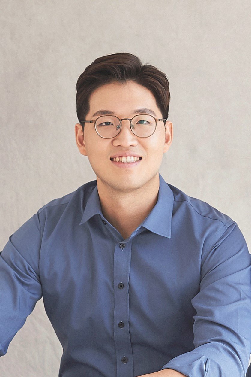
Tom Beucler is a Conditional Pre-Tenure Assistant Professor in Geo-Environmental Data Science at the University of Lausanne’s Institute for Earth Surface Dynamics (IDYST). He holds a Master’s degree in Science and Mechanics from École Polytechnique (2014) and a PhD in Atmospheric Science from MIT (2019). Postdoctoral research at Columbia University and UC Irvine focused on machine learning applications in climate science under Professors Pierre Gentine and Michael Pritchard. Research Interests: Climate informatics, atmospheric physics, fluid dynamics, tropical meteorology, and integrating machine learning into climate models for extreme weather prediction and hydrological cycle modeling. Collaborations: Works with environmental scientists and computer engineers to improve climate models using neural networks and causal discovery methods. Initiatives: Organizes weekly brainstorming sessions to promote machine learning adoption in environmental sciences. Publications span climate-invariant machine learning, data-driven parameterizations, and hybrid AI-climate modeling frameworks like ClimSim. His work emphasizes causal consistency and generalizability across climate conditions.
Kenan Li, Ph.D., is an Associate Professor in the Department of Epidemiology and Biostatistics at Saint Louis University’s College for Public Health and Social Justice. He joined SLU in August 2022 and teaches courses such as Statistical Learning, R for Spatial Analysis, and Environmental Determinants of Health. His research bridges data science, GIS, and public health, focusing on spatial computation, environmental exposures, and community resilience. Ph.D. in Environmental Sciences, Louisiana State University M.S. in Environmental Sciences, Louisiana State University B.S. in Environmental Sciences and Applied Mathematics, Nankai University, China Dr. Li’s research interests lie at the intersection of spatial computation, environmental health, and community resilience . He develops geo-AI frameworks , integrated geo-cyber-infrastructures , and biostatistics algorithms using big data, deep learning, and sensor data. His work emphasizes understanding human-environment interactions, urban sustainability, and health disparities. His recent publications from 2023 to 2015 reveal a strong trend in spatial modeling of population dynamics , machine learning for environmental exposure analysis , and resilience assessment in vulnerable coastal regions. He has pioneered methods like Dynamic Time Warping Self-Organizing Maps and Wavelet-based Shapelet Discovery to extract meaningful patterns from high-frequency sensor data. His scientific awards include the Taylor Geospatial Institute Seed Grant (2023) , the Saint Louis University 2023 Health Research Grant , and selection for the Scholarly Undergraduate Research Grants and Experiences . He has secured funding from NSF, NIH, USC Keck School of Medicine, and the US Army Corps of Engineers. Dr. Li has advised and collaborated on numerous research projects, particularly in interdisciplinary teams studying the Mississippi River Delta and urban health interventions. He has been involved in NIH/NIBIB-funded projects and led research on emergency management of trail systems in Los Angeles County. He is actively involved in building research labs and teams focused on spatial data science and public health analytics , having previously worked at USC’s Spatial Sciences Institute and Population and Public Health Sciences Department.
Hyemi Kim is an Adjunct Professor at the School of Marine and Atmospheric Sciences (SoMAS), Stony Brook University. Her research focuses on climate variability across subseasonal to decadal timescales, including topics like the Madden-Julian Oscillation (MJO), tropical-extratropical interactions, and extreme weather events such as atmospheric rivers and tropical cyclones. Education: Ph.D., 2008, School of Earth and Environmental Sciences, Seoul National University, South Korea Research Interests: Hyemi Kim's work spans four primary areas: (1) Climate prediction from subseasonal to decadal scales, (2) Tropical-extratropical interactions, (3) Extreme events (atmospheric rivers, storm tracks, tropical cyclones), and (4) Machine learning applications for subseasonal-to-seasonal (S2S) prediction. Publication Trends: Her research output emphasizes the MJO, its interactions with other climate modes (QBO, ENSO), and implications for extreme weather. Recent works analyze atmospheric rivers, storm tracks, and tropical cyclone activity, often linking these to large-scale climate variability. Publications frequently employ climate models (e.g., CESM1, SubX, NMME) to assess predictability and improve forecasting frameworks. Labs & Teams: She collaborates with institutions like the National Center for Atmospheric Research (NCAR) and contributes to multi-model experiments such as the Subseasonal Experiment (SubX) and North American Multi-Model Ensemble (NMME).
Dr. Ying He is a Senior Lecturer at the School of Electrical and Data Engineering, University of Technology Sydney (UTS). Her research focuses on wireless communication networks, particularly integrating machine learning with satellite and terrestrial systems. She holds a BEng from Beijing University of Posts and Telecommunications (2009) and a PhD from UTS (2017). Prior to her academic role, she worked on TD-LTE chip design at the Chinese Academy of Sciences. Affiliations : Faculty of Engineering and Information Technology Global Big Data Technologies Centre (GBDTC) Education : BEng in Telecommunications Engineering, Beijing University of Posts and Telecommunications (2009) PhD in Engineering (Telecommunications), UTS (2017) Her research interests include satellite communication (GEO-LEO integration), spectrum sharing, vehicular communication, and applying machine learning to physical layer algorithms. Notable contributions include optimizing beam design in LEO networks and developing secure IoT systems. She supervises PhD/Master’s students and teaches courses like CCNA and capstone projects. Funded projects span satellite networks, IoT security, and supply chain tracking. Recent grants include SmartSat CRC initiatives and collaborations with industry partners like Intel and Ericsson. Her work addresses challenges in 6G, UAV-enabled computing, and resilient quantum algorithms.
Ediz Cetin is an Associate Professor in Digital Electronics Engineering at Macquarie University's School of Engineering and a member of the Astrophysics and Space Technologies Research Centre. He serves as Course Director for the MEng Electronics Engineering program and Chair of the School's Postgraduate Coursework Committee. His research focuses on radio frequency interference mitigation, fault-tolerant reconfigurable circuits for space applications, machine learning in RF signal analysis, and low-power digital circuit design. Education: PhD in Signal Processing (Unsupervised Adaptive Signal Processing Techniques for Wireless Receivers) B.Eng. (Hons.) in Control and Computer Engineering Research Interests: RF interference detection and localization GNSS anti-jamming and spoofing detection FPGA-based reconfigurable systems Space instrumentation and CubeSat technologies Machine learning for signal processing Awards: Excellence in Learning Innovation (FSE Teaching Award, 2022) Highly Commended Finalist – Vice-Chancellor’s Award for Learning Innovation (2022) Innovative Approaches – Highly Commended (FSE Teaching Award, 2020) Key Projects: SmartSat CRC (2020–2026): Smart Satellite Technologies and Analytics Spacecraft Innovation Lab (2021–2022) CubeSat Biological Payload (2019–2022) Teaching Contributions: Led the 'Improving Student Engagement with Anywhere and Any-time Laboratory Access' initiative (2019–2020), enhancing remote lab accessibility for students.
Walter Jetz is a Professor of Ecology and Evolutionary Biology and the School of the Environment at Yale University, where he directs the Center for Biodiversity and Global Change. He chairs the E.O. Wilson Biodiversity Foundation and co-chairs the GEO BON Species Population Working Group. His work focuses on biodiversity science, conservation, and global change ecology. Education: D.Phil. in Zoology (University of Oxford, 2002), M.Sc. in Integrative Bioscience (Oxford, 1997) Research interests include macroecology, species distribution modeling, and conservation science across spatial scales. His group develops tools like Map of Life , Wildlife Insights , and Half-Earth Project to address biodiversity monitoring and area-based conservation. Current projects explore climate change impacts on tropical ecosystems, movement ecology, and machine learning applications in biodiversity science. Recent publications focus on niche scaling, climate change vulnerability, deep learning for species distribution, and mountain biodiversity monitoring. Awards include being an ISI Highly Cited Researcher since 2014. Over 30 former students hold faculty positions globally. The lab promotes diversity, equity, and inclusion in science and collaborates with NASA, Microsoft, and the Gordon and Betty Moore Foundation.
George Vosselman is a Full Professor at the University of Twente, Faculty of Geo-Information Science and Earth Observation (ITC), specializing in Geo-Information Extraction with Sensor Systems. Educated with honours at Delft University of Technology (1986) and PhD in Photogrammetry from Rheinische Friedrich Wilhelms University of Bonn (1991), he has held academic roles at the University of Stuttgart, University of Washington, and Delft University of Technology (1993–2004). Since 2004, he has been a key figure at ITC, serving as department head (2012–2018, 2023–). Education: Delft University of Technology (BSc with honours, 1986), Rheinische Friedrich Wilhelms University of Bonn (PhD with honours, 1991) His research focuses on leveraging sensor technology advancements for large-scale geo-information production. Key expertise includes quality analysis of laser altimetry data, point cloud segmentation/classification, 3D building/road modeling, and model-driven imagery analysis. He has published over 220 papers and co-edited the textbook Airborne and Terrestrial Laser Scanning (2010). Recent work integrates deep learning with geospatial data, addressing semantic segmentation, visual question answering, and drone-based mapping. Recent publications (2025–2023) highlight trends in deep learning for remote sensing , including multimodal question answering benchmarks (HRVQA), vectorized building extraction (RoIPoly), latent diffusion for road modeling (LDPoly), and drone obstacle avoidance systems. His work bridges photogrammetry , computer vision , and robotic mapping , with applications in urban planning, disaster management, and informal settlement monitoring. Scientific Awards : Hansa Luftbild (1993), ISPRS Otto von Gruber (2000), Schwidefsky Medal (2012), Karl Kraus Medal (2012), ASPRS Fairchild Award (2015), ISPRS Fellow (2020) As an educator, Vosselman has taught photogrammetry, remote sensing, and laser scanning at Delft University of Technology and globally. He chaired the ITC Examination Board (2015–2023) and modernized geo-information education in Asia/Africa. His software for point cloud processing is commercialized in Europe, and he currently leads ISPRS working groups on point cloud methodologies. Labs/teams include the Earth Observation Science Chair Group at ITC, collaborating on UAV-based datasets (UAVid, UAVPal) and indoor laser scanning systems. Recent activities (2025) involve invited talks on pulse matching limitations in laser scanning and deep learning for point cloud classification.
Srinivas Narayana is an Assistant Professor in the Department of Computer Science at Rutgers University, specializing in programmable networking, formal verification, and systems research. He holds a PhD from Princeton University and a B.Tech from IIT Madras, with postdoctoral work at MIT. His research focuses on building safe, high-performance networks through optimizing compilers, verified programming, and distributed system monitoring. He has received NSF grants, the CGO 2022 Distinguished Paper Award, and the 2017 SIGCOMM Best Paper Award. Education: PhD and MA in Computer Science, Princeton University (2016) B.Tech in Computer Science, IIT Madras (2010) Postdoctoral Research, MIT (2018) Research Interests: His work bridges networking and systems with a focus on compilers, formal methods, and programmable hardware. Notable projects include K2 compiler for eBPF, the eBPF verifier soundness work, and congestion control mechanisms like CCP. He explores parallel packet processing, privacy-preserving analytics, and load balancing strategies. Grants & Awards: NSF Awards #2422076, #1910796, #2019302 eBPF Foundation Grant Facebook Networking Research Award Network Programming Initiative (NPI) Funding Lab & Teams: Leads the NetSys group at Rutgers, collaborating with teams on projects like the eBPF verifier, verified packet processing, and network monitoring tools like Marple. His lab emphasizes open-source contributions and industry collaboration.
Nica Ross is an Associate Professor of Video & Media Design and Director of The Frank-Ratchye STUDIO for Creative Inquiry at Carnegie Mellon University's School of Drama in Pittsburgh, Pennsylvania. With a background in cinema and advanced photographic studies, Ross brings a unique interdisciplinary approach to their work, blending technology, performance, and critical theory to explore how social constructions are reinforced by technology and performance. Ross holds a B.A. in Cinema from San Francisco State University and an M.F.A. in Advanced Photographic Study from The International Center of Photography-Bard College program. Their educational background has informed their practice as both an artist and educator, with a focus on critical applied learning and transdisciplinary collaboration. Through humor and play, Nica Ross creates participatory video installations and games that challenge social constructions reinforced by technology and performance. Their creative research focuses on “social machines” that reveal and interrogate cultural constructs, with particular attention to queer theory, gender non-conforming experiences, and the politics of visibility. Ross emphasizes liveness, human connection, and critical examination of tools and contexts in their teaching and artistic practice. Ross's recent work shows a trajectory moving from traditional video and media design toward increasingly interactive and participatory forms that engage audiences directly in questioning social constructs. Their projects increasingly incorporate game mechanics, queer theory, and critical examinations of surveillance technologies, often using RGB color systems and immersive environments to challenge perceptions of reality. Ross has received notable recognition including the Frank-Ratchye Fund for Art @ the Frontier, the Lighthouse Fellowship, and residency at Baxter Street CCNY. These awards support their innovative work at the intersection of technology, performance, and social critique. As Director of The Frank-Ratchye STUDIO for Creative Inquiry, Ross connects with researchers and creators across Carnegie Mellon University, fostering transdisciplinary practice and critical engagement with technology. Their leadership in this space has created opportunities for collaborative projects that challenge conventional boundaries between art, technology, and social inquiry. Ross's work often involves collaborative teams and labs, including partnerships with musicians like Geo Wyeth, artists like Ginger Brooks Takahashi, and technical collaborators at Carnegie Mellon's Panoptic Dome. These collaborations result in immersive installations, interactive games, and critical explorations of technology's role in shaping social reality.
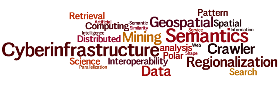
Wenwen Li is a Professor at Arizona State University (ASU), holding roles as Director of the CyberInfrastructure and Computation Intelligence (CICI) Lab and Research Director at the Spatial Analysis Research Center (SPARC). She specializes in geographic information science, cyberinfrastructure, and geospatial big data. Her work focuses on developing intelligent cyberinfrastructure for environmental and urban studies, leveraging AI and semantic technologies. Li's research has been supported by NSF, USGS, and Google.org, among others. Education: Ph.D. in Earth System and Geoinformation Science (George Mason University, 2010), M.S. in Signal and Information Processing (Chinese Academy of Sciences, 2007), and B.S. in Computer Science (Beijing Normal University, 2004). Research Interests : Cyberinfrastructure, spatial-temporal data mining, semantic interoperability, GeoAI applications in climate science, and urban studies. Her lab, CICI, pioneers projects like the Arctic Permafrost Thaw analysis and disaster response systems. Awards : 2023 AAG and UCGIS Fellowships, 2021 NSF Mid-Career Award, 2015 NSF CAREER Award, and the 2024 Greg Leptoukh Lecture Award (AGU). She chairs AAG's Cyberinfrastructure Specialty Group and serves on editorial boards of key journals. Grants & Service : Leads NSF-funded projects on GeoAI, climate modeling, and Arctic science. Active in AAG leadership roles and global initiatives like the Polar Cyberinfrastructure Portal. Recruits Ph.D. students in Geography and Computer Science. Labs & Teams : Directs the CICI Lab, advancing interdisciplinary GeoAI research and training. Collaborates with global partners on environmental and computational geography projects.
Seongjin Choi is an Assistant Professor in the Department of Civil, Environmental, and Geo-Engineering at the University of Minnesota, Twin Cities , where he began his role in January 2024. His research bridges Urban Mobility Data Analytics , Spatiotemporal Modeling , and Deep Learning to advance transportation systems. Affiliated with the Center for Transportation Studies , Minnesota Robotics Institute , and Data Science Initiative , he leads the Choi Research Group . Education: Ph.D., Civil and Environmental Engineering, Korea Advanced Institute of Science and Technology (KAIST), 2021 M.S., Civil and Environmental Engineering, KAIST, 2017 B.S., Civil and Environmental Engineering, KAIST, 2015 His research focuses on Urban Mobility Data Analytics and Deep Learning to optimize transportation systems. Key areas include: Spatiotemporal Data Modeling for forecasting and imputation Generative AI applications in transportation data Reinforcement Learning for Connected Automated Vehicles (CAV) Cooperative Intelligent Transport Systems (C-ITS) Recent publications in Transportation Science and Transportation Research Part C highlight his work on probabilistic traffic forecasting , deep generative models , and vision-language-action frameworks for autonomous systems. His methodologies often combine AI-driven analytics with real-time mobility optimization . Dr. Choi serves as: Associate Editor of The Journal of the Korean Society of Transportation (JKST) , 2023–Present Guest Editor for Journal of Advanced Transportation special issue on "Advanced Data Intelligence Theory and Practice in Transport 2023", 2023–2024 He actively seeks PhD students/postdocs for 2025 cohorts focused on machine learning for transportation challenges. Current projects include AI-enhanced traffic forecasting, CAV control, and urban air mobility (UAM) integration studies.
Hakan Basarir is a Professor in the Department of Mining Engineering at the Norwegian University of Science and Technology (NTNU), Trondheim, Norway. His research and teaching focus on mining rock mechanics, rock mass characterization, underground support systems, and the application of soft computing methods in mining engineering. PhD in Mining Engineering (2002) 20+ years of research and teaching experience 60+ publications in journals and conferences Research Interests include rock mass property prediction using measurement while drilling (MWD) techniques, numerical modeling of mining structures, optimization of mine support systems, and sustainable material development. His work integrates machine learning and computational methods to address challenges in mining geomechanics and backfill design. Recent Publications highlight advancements in AI-driven lithology prediction, eco-concrete formulation, and backfill mixture optimization. He has also contributed to tunnel stability analysis and seismic rock slope modeling. Teaching includes advanced courses in mining engineering, mineral production modeling, and specialization projects in geotechnology.
Craig Knoblock serves as Keston Executive Director of the Information Sciences Institute (ISI) at the University of Southern California (USC), Vice Dean of the USC Viterbi School of Engineering, and Research Professor of Computer Science and Spatial Sciences. He also directs the Data Science Program and the Center on Knowledge Graphs at USC. His educational background includes a Ph.D. and M.S. in Computer Science from Carnegie Mellon University (1991, 1988) and a B.S. with honors in Computer Science from Syracuse University (1984). Knoblock's research focuses on data semantics , specializing in source modeling, schema and ontology alignment, entity and record linkage, data cleaning, Web data extraction, and knowledge graph construction. His work bridges computer science, geospatial analysis, and artificial intelligence to solve complex data integration challenges. Recent projects emphasize historical map digitization, geospatial knowledge graphs, and smart city applications. His 300+ publications demonstrate consistent contributions to knowledge graphs and geospatial data integration, with a growing emphasis on historical map analysis and urban applications. The research trajectory shows increasing interdisciplinary collaboration across computer vision, geoinformatics, and domain-specific applications. IEEE Fellow (2020) ACM Fellow (2017) AAAI Fellow (2004) Robert S. Engelmore Memorial Lecture Award (2014) Donald E. Walker Distinguished Service Award (IJCAI, 2018) Use-Inspired Research Award (USC Viterbi, 2018) As Executive Director of ISI, Knoblock oversees one of USC's premier research centers with significant federal funding. His leadership extends to directing the Center on Knowledge Graphs and the Data Science Program. While specific grant details aren't provided, his extensive publication record and leadership roles indicate substantial research funding across data integration, knowledge representation, and geospatial applications. His work bridges theoretical computer science with practical applications in historical preservation, urban planning, and resource management through collaborative projects with government agencies and industry partners. Knoblock leads the Center on Knowledge Graphs at USC, focusing on developing techniques for building and utilizing knowledge graphs across diverse domains. His team combines expertise in artificial intelligence, geospatial analysis, and data integration to tackle challenges in historical map digitization, urban applications, and resource discovery. The research group maintains strong connections with both academic and government partners through the Information Sciences Institute's extensive network.
Henrikki Tenkanen is an Assistant Professor in the Department of Built Environment at Aalto University, specializing in Geoinformatics. His research focuses on geospatial analysis, urban planning, transportation accessibility, and open data applications for sustainable development. His primary research interests include Geospatial Analysis , Urban Planning , Transportation Accessibility , and Population Dynamics . Tenkanen's work integrates mobile phone data, social media, and open geospatial sources to understand urban environments, accessibility patterns, and carbon emissions. His research contributes significantly to UN Sustainable Development Goals related to sustainable cities and communities. Tenkanen's recent publications demonstrate strong trends in high-resolution spatial analysis of urban environments, with particular emphasis on transport equity , carbon emissions mapping , and rural population representation . His work combines advanced geocomputing techniques with practical urban planning applications, often developing open-source tools to enhance reproducibility and accessibility of geospatial research. As an active member of the academic community, Tenkanen serves as a peer reviewer for journals including Big Data & Society and Environment and Planning B, and participates in conference committees such as the International Conference on Location Based Services. His research has garnered significant attention, with multiple publications featured in news outlets and academic platforms. Tenkanen leads several major research projects including Geo-R2LLM (developing geographic large language models), Geoportti (open geospatial infrastructure), MAPICO (mapping commute-related carbon emissions), and LIH: Location Innovation Hub. His work bridges academic research with practical applications for urban planning and sustainable mobility.
Prof. Hansjörg Kutterer is a Professor and Dean at the KIT-Department of Civil Engineering, Geo and Environmental Sciences at Karlsruhe Institute of Technology (KIT). His primary affiliation is with KIT's Department of Civil Engineering, Geo and Environmental Sciences. He leads geodetic research initiatives focusing on Earth observation systems, atmospheric modeling, and geophysical data analysis. His research emphasizes advanced applications of GNSS, InSAR, and satellite gravimetry for monitoring climate-related phenomena such as water vapor dynamics, terrestrial water storage changes, and ground motion patterns. Key projects include developing machine learning-enhanced models for tropospheric delay corrections and integrated water vapor estimation in the Upper Rhine Graben region. Prof. Kutterer actively contributes to international geodetic frameworks like the Global Geodetic Observing System (GGOS), particularly through DA-CH regional collaborations. His work bridges geodetic methodologies with interdisciplinary challenges in climate science and environmental engineering. He oversees departmental operations as Dean, fostering innovation in geospatial education and infrastructure. His technical expertise spans geodetic deformation analysis, statistical robust estimation, and the integration of geophysical models with observational data.