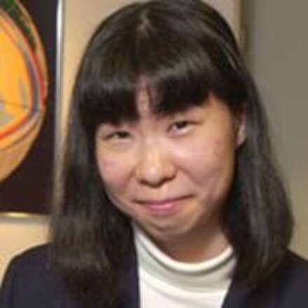
Miaki Ishii is a Professor of Earth and Planetary Sciences at Harvard University, affiliated with the Department of Earth and Planetary Sciences. She leads the Harvard Seismology Group and has held academic roles at Harvard since 2006, progressing from Assistant to Associate Professor and then Full Professor. Education: Ph.D. in Geophysics (2003), Harvard University Hon.B.Sc. in Physics (1998), University of Toronto Research Interests: Ishii specializes in seismic imaging of Earth's internal structure, including the mantle and core. Her work focuses on earthquake mechanisms, signal processing, and theoretical seismology. She uses seismic data to study rupture dynamics, subduction zone processes, and free oscillations of the Earth. Key Contributions: Notable projects include analyzing the 2011 Tohoku-Oki earthquake rupture, developing the DigitSeis software for analog seismogram digitization, and studying inner core anisotropy using normal mode splitting. Her research integrates high-performance computing and waveform inversion techniques. Awards: James B. Macelwane Medal (2009) Kavli Fellow (2012) Charles F. Richter Award (2008) Alice Wilson Award (2004) Labs/Teams: Directs the Harvard Seismology Group, collaborating internationally on seismic networks like Hi-net and USArray. Her work bridges computational seismology with observational geophysics.
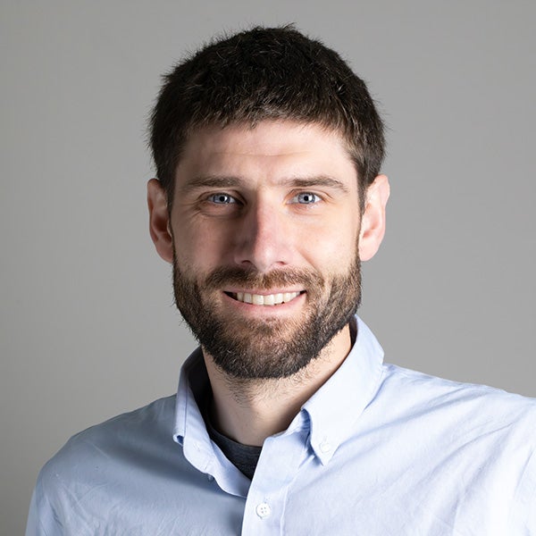
Keith D. Koper is a Professor in the Department of Geology & Geophysics at the University of Utah and serves as Director of the University of Utah Seismograph Stations (UUSS). He is also the editor-in-chief of The Seismic Record . His work integrates academic research with operational seismic monitoring and public safety initiatives across Utah and the Intermountain West. Education: PhD in Geophysics, Washington University, 1998 BA in Math, Geology, and ISP, Northwestern University, 1993 Dr. Koper's research focuses on array seismology, forensic seismology, deep Earth structure (especially the inner core), earthquake rupture imaging, ambient seismic noise, and seismic hazards in the Intermountain West, including mining-induced and urban earthquakes. His work combines observational seismology with advanced signal processing and machine learning techniques to improve detection, discrimination, and imaging capabilities. He has led or contributed to major projects involving the Wasatch Front, Yellowstone, and regional seismic networks. His recent research emphasizes machine learning for earthquake detection, high-resolution relocation of aftershock sequences (e.g., Magna 2020, Bluffdale 2019), microseism generation in lakes, and fine-scale imaging of the Earth's inner core using seismic reflections. His studies often involve interdisciplinary collaboration, particularly with mining engineering and geodesy. Dr. Koper's research has been consistently funded by federal and state agencies, including the National Science Foundation (NSF), U.S. Geological Survey (USGS), Department of Energy (DOE), Air Force Research Laboratory (AFRL), and the Utah Department of Public Safety. His publications reflect a strong trend toward integrating computational methods with traditional seismological analysis to tackle complex problems in both natural and induced seismicity. Scientific Service and Leadership: Editor-in-Chief, The Seismic Record Director, University of Utah Seismograph Stations Secretary, U.S. Air Force Seismic Review Panel Former Chair and Vice-Chair, Utah Seismic Safety Commission Dr. Koper mentors graduate students in seismology and geophysics, including recent advisees Sean Hutchings and Alysha Armstrong. His research group actively engages in both fundamental and applied seismological research, with strong ties to national labs such as Sandia. The group is involved in deploying portable seismic arrays, analyzing large datasets, and developing new algorithms for event detection and classification. The University of Utah Seismograph Stations, under his leadership, plays a critical role in monitoring seismicity in Utah and Yellowstone, producing real-time earthquake information, ShakeMaps, and public outreach materials. The station also contributes to national and international efforts in nuclear test monitoring and volcanic hazard assessment.
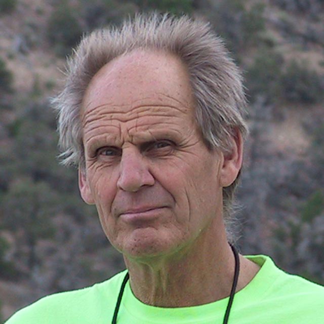
Professor Patrice Rey is a faculty member at the School of Geosciences, The University of Sydney. He holds the rank of Professor and specializes in geodynamics, tectonics, and landscape evolution. With an international career spanning 12 institutions across three continents, his research focuses on continental rifting, mantle dynamics, metamorphic processes, and the interplay between climate and tectonics. Notable projects include studies on Australia’s geological history, the formation of precious opal, and the dynamics of early Earth geodynamics. His work bridges field geology, numerical modeling, and geophysical analysis. Key research themes include gravitational collapse in cratons, the role of isostasy in fold belt evolution, and the impact of dynamic topography on sedimentary systems. He has contributed to interdisciplinary projects such as the Perseverance Mars mission, highlighting connections between Earth’s geology and Martian surface processes. Recent publications emphasize continental crust evolution, landscape dynamics, and the integration of virtual reality tools in geological education. He leads research teams funded by grants like the Australian Research Council (DP22 and LP20 projects), focusing on mineral systems and Proterozoic rift basins. His media presence includes BBC documentaries and NOVA series, showcasing his expertise in continental evolution and planetary geology.
Brandon Schmandt is a Professor in the Department of Earth, Environmental and Planetary Sciences at Rice University, where he leads research using seismology to investigate Earth systems. His work integrates interdisciplinary approaches, data science, and numerical modeling to study tectonic processes, magmatic systems, and environmental interactions. His educational background includes a PhD in Geological Sciences from the University of Oregon (2011) and a BA in Environmental Studies from Warren Wilson College (2006). Dr. Schmandt's research focuses on seismology, tectonics, volcanology, and surface processes , with emphasis on seismic imaging of subsurface structures. His group employs innovative time-series analysis and field projects to resolve geologic history and contemporary Earth dynamics, particularly examining fault zones, magmatic reservoirs, and deep convective processes. Key methodologies include dense seismic arrays and machine learning applications. Analysis of his recent publications (2023-2025) reveals dominant trends in seismic event discrimination (earthquakes vs. explosions), magmatic system imaging (Yellowstone, Cascades), and global mantle structure studies. There is strong emphasis on induced seismicity, machine learning applications, and high-resolution imaging of Earth's discontinuities using dense arrays. His distinguished honors include: Aki Award of the AGU Seismology Section GSA Donath Medal AGU Macelwane Medal Body Dr. Schmandt directs an active research group conducting field projects across diverse settings including the Raton Basin, Yellowstone, Antarctica, and the Caribbean. While specific student advisees and grant details aren't provided in available materials, his group's work involves collaborative data collection, advanced computational modeling, and development of novel seismic analysis techniques applicable to both natural and anthropogenic seismic sources. The research program maintains focus on magmatic systems beneath volcanic regions, induced seismicity mechanisms, and global mantle structure using dense node arrays and interdisciplinary approaches to address fundamental questions in Earth dynamics.
Dr. Steven G. Wesnousky is the Foundation Professor and Director of the Center for Neotectonic Studies at the University of Nevada, Reno (UNR). He holds a Ph.D. in Seismology from Columbia University (1982) and a B.A. in Geology from the University of California, Santa Barbara (1975). His academic career spans over three decades at UNR, where he combines geology and seismology to study earthquake mechanics, seismic hazard quantification, and crustal deformation. Research focuses on neotectonics, active fault systems, and the Himalayan seismic hazard. Key areas include fault slip rates, paleoearthquake reconstruction, and integrating geological data into seismic risk models. He teaches advanced courses on photogeology, neotectonics, and seismic hazard analysis. Publications emphasize Quaternary fault mapping, Himalayan tectonics, and rupture mechanics. Notable works include studies on the Walker Lane deformation zone and the 2015 Gorkha earthquake in Nepal. Awards include the Foundation Professorship (2008), F. Donald Tibbetts Teaching Award (2008), and a Fulbright Scholarship (2005). Professional roles include presidency of the Seismological Society of America (1995–1997), board memberships, and international collaborations at institutions like King Abdul University and the Institute of Nuclear and Geological Sciences, New Zealand. His work bridges field geology, geochronology, and computational modeling to advance understanding of continental deformation and earthquake processes.
Dr. Catherine Rychert is an Associate Professor in the Department of Geology and Geophysics at the University of Southampton, where she conducts cutting-edge research in seismology and marine geophysics. She is a member of both the Geology and Geophysics research group and the Southampton Marine and Maritime Institute, contributing significantly to our understanding of Earth's interior structure and dynamics through advanced seismic imaging techniques. Her research focuses on several key areas: Seismic imaging of lithosphere-asthenosphere boundary Subduction zone dynamics and slab structure Continental rifting processes Seafloor spreading mechanisms Mantle flow patterns and upwellings Development of novel seismic sensing technologies Dr. Rychert's recent publications (2023-2025) demonstrate a strong focus on applying advanced seismic techniques across diverse tectonic settings including subduction zones (Lesser Antilles, Cascadia, Hikurangi), mid-ocean ridges (Mid-Atlantic Ridge), and continental rift systems (East African Rift). A notable trend is her increasing use of distributed acoustic sensing technology for both terrestrial and planetary applications, showing interdisciplinary reach beyond traditional Earth science. Dr. Rychert actively supervises PhD students, including William Arnold Buffett working on the INSPIRE project. She has secured significant research funding from diverse sources including the European Union (EURO-LAB project), National Geographic Society, and Natural Environment Research Council (NERC). Her collaborative network includes Dr. Nicholas Harmon and Professor Derek Keir, with whom she frequently publishes. Her research team conducts fieldwork and data analysis focused on understanding fundamental Earth structure and processes through innovative seismic methodologies, contributing to both theoretical understanding and practical applications in hazard assessment and resource exploration.
Paul A Kapp is a Professor in the Department of Geosciences at the University of Arizona. His expertise spans continental tectonics, regional geology, structural-stratigraphic analysis, and eolian processes, with a focus on Asia and Cordilleran orogenic systems. Fieldwork includes geologic mapping, kinematic analysis of structures, and stratigraphic section measurements across Precambrian to Quaternary rock types. University: University of Arizona Department: Geosciences Email: pkapp@arizona.edu Research interests emphasize quantifying timing and rates of tectonic processes via geochronology and thermochronology. Key themes include Tibetan Plateau uplift, lithospheric dynamics in collisional zones, and eolian-landscape interactions. His work integrates field observations with analytical methods to understand orogenic plateau formation and paleoelevation reconstruction. Recent publications highlight tectonic-climate feedbacks, mantle melting mechanisms in Tibet, and crustal deformation in the North American Cordillera. Articles often address geodynamic modeling, basin evolution, and isotopic dating applications, reflecting a multidisciplinary approach to orogenic and sedimentary systems.
Jian Lin is a Chair Professor in the Department of Ocean Science and Engineering at the Southern University of Science and Technology (SUSTech) , China. He is an internationally renowned geophysicist, member of the European Academy of Sciences , Academia Europaea , and Russian Academy of Natural Sciences . He has held distinguished positions at Woods Hole Oceanographic Institution (WHOI) and MIT/WHOI Joint Program in Oceanography , and is a leading expert in global oceanic plate tectonics, earthquake mechanics, and marine geophysics. Education: Ph.D. in Geophysics (1988), Brown University M.S. in Geophysics (1984), Brown University B.S. in Geophysics (1982), University of Science and Technology of China Research Focus: Prof. Lin's work spans computational geodynamics , marine geophysics , earthquake mechanics , and oceanic lithospheric evolution . His studies include mid-ocean ridges, subduction zones, hydrothermal systems, and tsunami dynamics. He has led over 20 international oceanographic expeditions and contributed to major discoveries such as the first hydrothermal vents on the Southwest Indian Ridge and high-resolution seismic imaging of the Mariana Trench. Scientific Recognition: Fellow, American Geophysical Union (AGU) Fellow, Geological Society of America (GSA) Fellow, American Association for the Advancement of Science (AAAS) Henry Bryant Bigelow Chair for Excellence in Oceanography Charles E. Culpeper Young Scientist Award Member (Academician), European Academy of Sciences Member (Academician), Russian Academy of Natural Sciences Member (Academician), Academia Europaea Advising & Mentorship: Prof. Lin has supervised numerous PhD and Master's students, including Shuqiao Zhong , Guanzhi Wang , and postdocs such as LaiYin Guo , Caicai Zha , and Yiming Luo . He has taught courses like Global Plate Tectonics , Intelligent Ocean Exploration , and Introduction to Oceanography . Laboratory & Leadership Roles: He has served as Chair of the InterRidge Program , an international initiative promoting deep-sea research. He has held editorial roles in top journals and served on advisory boards for major ocean science programs globally.
Peter C. Lippert is an Associate Professor in the Department of Geology & Geophysics at the University of Utah , with research spanning paleomagnetism, tectonics, and environmental magnetism. His work connects geological time scales to climate dynamics, orogenic processes, and urban pollution monitoring. BS (2003) and PhD (2010) in Earth sciences Postdoctoral training at University of Arizona and UC Santa Cruz Research focuses include: Antarctic ice age cyclicity and Earth's orbital influences Hydrothermal alteration effects on paleomagnetic records in Tibet Magmatism during Mongol-Okhotsk Ocean closure Magnetofossils as climate proxies for rapid warming events Evergreen needle magnetization for urban pollution mapping Recent publications highlight collaborations across 50+ international institutions , with methodological innovations in site-level paleomagnetic analysis and FORC-PCA magnetofossil discrimination. His 15 most recent articles (2020–2024) address tectonic reconstructions, geomagnetic field evolution, and climate-ocean interactions. He serves on the Magnetics Information Consortium (MagIC) Steering Committee and has received the Taft-Nicholson Summer Faculty Fellow award. Teaching emphasizes Earth science as a philosophy, with courses on structural geology, dynamic Earth systems, and field research.
Kip Hodges is a Foundation Professor at the School of Earth and Space Exploration, Arizona State University (ASU). He leads the Group 18 Laboratories, focusing on noble gas isotope geochemistry and planetary geology. His work integrates field, laboratory, and theoretical approaches to study mountain formation, planetary processes, and impact events. His research interests span Earth Systems, Planetary Geoscience, Continental Tectonics, Earth Surface Processes, Cosmochemistry, and Planetary Geochemistry. He examines the geodynamic evolution of mountain belts like the Himalaya and Tibetan Plateau, utilizing thermal-kinematic modeling and noble gas isotope data. His planetary research includes lunar and Martian geochronology, impact crater analysis, and strategies for human-robotic collaboration in planetary exploration. Key projects include studies on the thermal evolution of terrestrial/extraterrestrial materials, diffusivity of noble gases, and the dynamics of continental subduction. His work contributes to understanding mountain-building, impact history of the Solar System, and future exploration missions. He directs the Group 18 Laboratories, renowned for innovative noble gas isotope geochemistry techniques to constrain thermal histories of terrestrial and extraterrestrial samples. The lab's work includes studies on noble gas diffusivity in planetary materials.
Professor Meghan S. Miller is an academic at the Australian National University (ANU), serving as a Professor in the Research School of Earth Sciences, specializing in Geophysics. She holds an ARC Future Fellowship, focusing on advancing Distributed Acoustic Sensing (DAS) technology for seismic imaging. Her research emphasizes observational seismology, particularly at critical tectonic plate boundaries such as subduction zones and continental collision zones. Education: Ph.D. in Geophysics from ANU (2006), M.Eng. from Cornell University (2000), M.S. from Columbia University (1999), and B.A. from Whittier College (1997). Research interests include seismic imaging of Earth’s structure, dynamics of subduction zones, and the application of novel techniques like DAS for high-resolution subsurface imaging. She has led projects such as the Southwest Australia Seismic Network (SWAN) and the SISSLE experiment in New Zealand. Key achievements include over 100 peer-reviewed publications, supervising numerous graduate students, and leading international collaborations in Indonesia, Alaska, and Morocco. Awards include the ARC Future Fellowship (2022–2026). Labs/Teams: Active in the AuScope Earth Imaging Program and collaborates with institutions like Geoscience Australia and Macquarie University.
Andrew Goodliffe is an Associate Professor and Associate Dean for Graduate Admissions, Recruitment, and Fellowships at the University of Alabama's Department of Geological Sciences. His primary affiliations include the College of Arts and Sciences and the Department of Geological Sciences. He specializes in tectonics, basin evolution, and geophysics, with a focus on continental rifting, rift basin dynamics, and subduction processes. His research spans regions such as the Woodlark Basin, Gulf of Corinth, and the Black Warrior Basin. Education details are not explicitly provided in the text. However, his career trajectory suggests advanced training in geology and geophysics, likely including a PhD in a related field. His work integrates field data, seismic imaging, and numerical modeling to address questions about tectonic processes and resource management. Research interests prominently feature continental rifting, rift-to-spreading transitions, and the structural evolution of active margins. He has extensively studied the Woodlark Basin (Papua New Guinea) and the Gulf of Corinth (Greece), contributing to understanding mechanisms of lithosphere thinning, fault systems, and seismic hazards. His recent focus includes groundwater vulnerability assessment in coastal Alabama and CO₂ sequestration feasibility. Publications highlight interdisciplinary approaches, combining geophysical data with geological observations. Over 50 articles span topics from subduction zone dynamics to educational initiatives like GeoPRISMS integration in undergraduate curricula. Grants and advising activities are not detailed here, but his role as Associate Dean indicates involvement in graduate education and fellowships. No labs or teams are explicitly mentioned, though collaborations are implied through multi-institutional projects like the MARGINS/GeoPRISMS program.
Craig O'Neill is an Associate Professor in Geophysics/Remote Sensing at the School of Earth & Atmospheric Sciences, Faculty of Science, Queensland University of Technology (QUT). His research spans geodynamics, planetary science, geophysics, and engineering geology, with a strong focus on understanding Earth and planetary evolution through computational modeling and geophysical data analysis. His research interests include Geophysics, Geodynamics, Remote Sensing, Planetary Science, Engineering Geology, Geochemistry, and Geology . He applies advanced numerical methods to model planetary interiors, tectonic processes, and geohazards, with recent work exploring early Earth crust formation, Venusian core dynamics, exoplanet thermal evolution, and applied geophysical techniques for engineering and environmental monitoring. The trend in his recent publications shows a strong interdisciplinary focus, combining computational geophysics with planetary science and Earth systems analysis. His work appears in leading journals such as Nature , Science Advances , and Geophysical Research Letters , covering topics from asteroid impacts and craton formation to ambient noise tomography and groundwater response to climate change. Professional Memberships: Australian Society of Exploration Geophysicists American Geophysical Union Australian Geomechanics Society Craig O'Neill supervises research students in areas such as lunar seismology and planetary geodynamics. While no specific grants are listed in the provided text, his extensive publication record and active research programs suggest ongoing funding support. He has developed open-source tools like Planet_LB for lattice-Boltzmann modeling of planetary systems. He is actively involved in the geophysics community, with scholarly profiles on ORCID, Google Scholar, and Scopus, and shares his research via X (formerly Twitter). His work bridges fundamental planetary science with practical geophysical applications.
Brandon Shuck is an Assistant Professor in the Department of Geology & Geophysics at Louisiana State University (LSU), part of the College of Science. His research focuses on solid-earth geophysics, particularly tectonic processes within plate boundaries and mature tectonic settings. He uses active-source seismic reflection and wide-angle ocean-bottom seismometer data to image subsurface lithospheric architecture and integrate interdisciplinary datasets including bathymetry, borehole logs, and geodynamic models. Education: Ph.D. in Geological Sciences (2021) from the University of Texas at Austin; B.S. in Geology (Petroleum Emphasis) and Mathematics (2015) from Western Colorado University. Previously served as a Postdoctoral Fellow at Lamont-Doherty Earth Observatory, Columbia University (2021–2024). Research Interests: Tectonic evolution of the lithosphere at plate boundaries, feedbacks between lithospheric stress and fluid-rock interactions, geologic hazards related to subduction zones, and mantle dynamics during continental breakup. Active projects include studies of subduction initiation in the Tyrrhenian Sea, megathrust fault segmentation in Cascadia, and water content in the Cocos Plate offshore Mexico. Current opportunities include an NSF-funded PhD position (starting Fall 2025) investigating mantle dynamics during early Atlantic seafloor spreading, involving seismic data acquisition on the R/V Langseth. His group emphasizes collaborative, interdisciplinary approaches combining seismic imaging, field geology, and modeling. Awards: None explicitly listed, though his work has been supported through NSF funding and institutional grants. Lab/Team: Directs the LSU Solid-Earth Geophysics Research Group, which integrates geophysical data analysis with field observations to address tectonic questions at multiple scales.
Frederik J. Simons is a Professor of Geosciences and Associate Chair of the Department of Geosciences at Princeton University. He holds affiliations with the Program in Applied & Computational Mathematics, High Meadows Environmental Institute, and Andlinger Center for Energy and the Environment. His research focuses on global geophysics, seismology, and geodesy, emphasizing the lithosphere's physical properties through seismic tomography and spectral analysis. Simons developed methods for oceanic instrumentation, including the EarthScope-Oceans consortium, and pioneered wavelet-based signal processing for seismology. His work integrates computational inverse methods and statistical techniques, with a commitment to reproducible research. Education: PhD in Geophysics (MIT), M.Sc. in Geology (KU Leuven, Belgium). Previous roles include Lecturer at University College London and Hess Postdoctoral Fellow at Princeton. Research interests span seismic tomography, lithospheric mechanics, and planetary science, with notable contributions to mantle structure imaging and earthquake early warning systems. Awards include the Vladimir Keilis-Borok Medal (2022). Simons advises graduate students and mentors researchers in computational geoscience. His teaching emphasizes clarity and engagement, blending theoretical foundations with hands-on applications.