

Thomas Kjeldsen is a Professor in the Department of Architecture & Civil Engineering at the University of Bath. He leads multiple research projects funded by organizations such as The British Council, Royal Academy of Engineering, and The Leverhulme Trust. His research focuses on extreme events, machine learning, hydrological modeling, and nature-based solutions. He is affiliated with centers including the Water Innovation and Research Centre (WIRC), EPSRC Centre for Doctoral Training in Statistical Applied Mathematics (SAMBa), and the Institute for Mathematical Innovation (IMI). Research Interests: Extreme events, machine learning applications in hydrology, flood risk management, and civil engineering resilience. Key Projects: Development of rainfall frequency models for infrastructure design, flood reconstruction using historical data, and capacity-building for South African flood studies. His work contributes to UN Sustainable Development Goals related to climate action and clean water. Recent studies emphasize non-stationary hydrological analysis, urban flood modeling using machine learning, and interdisciplinary approaches to water resource management. Activities include advising doctoral students, organizing academic events (e.g., British Hydrological Society Symposium), and serving on external committees like Affinity Water. His research has been widely cited and featured in policy discussions and international media.
جستوجوی استاد و پژوهشگر
استاد راهنما، استاد دانشگاه یا پژوهشگر مناسب برای مسیر پژوهشیتان را پیدا کنید و با او ارتباط بگیرید.
نمایش ۴۶-۶۰ از ۶۳۱ استاد راهنما
اطلاعات این پروفایلها از صفحات عمومی دانشگاهها جمعآوری شده و ممکن است بهروز نباشد.
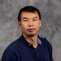
Hankui Zhangمشاهده پروفایل
دانشیار
Hankui Zhang is an Associate Professor in the Department of Geography and Geospatial Sciences at South Dakota State University (SDSU), and a Research Scientist at the Geospatial Sciences Center of Excellence. He holds a Ph.D. from the Chinese University of Hong Kong (2013), specializing in satellite image fusion. His research focuses on developing algorithms for medium-resolution satellite data processing (e.g., Landsat and Sentinel-2), including cloud masking, BRDF correction, and compositing. He also explores AI applications in remote sensing for land cover mapping and environmental monitoring. As a Landsat Science Team member, he contributes to global remote sensing initiatives. Education: B.S. in Geographic Information Systems, Zhejiang University (2007) M.S. in Remote Sensing, Zhejiang University (2010) Ph.D. in Geography and Resource Management, Chinese University of Hong Kong (2013) Research Interests: Deep learning applications in remote sensing, land cover dynamics, analysis-ready data development, and geospatial data harmonization. His work emphasizes operationalizing satellite data for environmental decision-making. Grants & Awards: Over $2.5M in grants as PI/co-PI, including USDA and NASA-funded projects. Notable awards include the SDSU Wadsworth Research Award (2020-2021) and the Global Scholarship for Research Excellence from CUHK (2011-2012). Professional Roles: Editorial board member for Remote Sensing of Environment and Remote Sensing ; guest editor for special issues on deep learning in remote sensing. Top 20 reviewer for Remote Sensing of Environment (2020, 2022-2024). Key Contributions: Published over 70 SCI papers, developed cloud detection algorithms (e.g., LANA), and pioneered analysis-ready data workflows for global monitoring. His work bridges satellite data science with practical environmental applications.

Introduction Dr. Shelley Xuelian Meng is an Associate Professor in the Department of Geography and Anthropology at Louisiana State University (LSU), part of the College of Humanities & Social Sciences. Her research focuses on leveraging remote sensing technologies (e.g., UAVs, LiDAR, multispectral imaging) to study coastal dynamics, wetland restoration, vegetation health, and precision agriculture. Education Ph.D. in Geography and GIScience, Texas State University (2010) M.S. in GIS and Cartography, Chinese Academy of Sciences (2003) B.E. in Information Engineering, Wuhan University (2000) Research Interests Meng’s work emphasizes the application of advanced geospatial technologies to address environmental challenges. Key areas include: Coastal wetland die-off and restoration using multi-scale remote sensing LIDAR and UAV-based terrain and vegetation mapping Object-oriented classification algorithms for environmental monitoring GIS integration for precision agriculture and disaster management Awards & Recognition 2023 Tipton Team Award (for Roseau cane die-off research) 2014 Best Paper Award in Remote Sensing CPGIS Young Scholar (2012) Grants & Projects Notable funded projects include: USDA-funded Roseau cane die-off studies ($1.6M+ across multiple years) Development of LiDAR and thermal sensing tools for coastal research Acquisition of terrestrial LiDAR equipment for multidisciplinary studies Labs & Affiliations Meng directs the Technology Intensive Geospatial and Remote Sensing (TIGeRS) Lab , which houses advanced equipment including drones, LiDAR scanners, and multispectral sensors. The lab collaborates with the LSU Coastal Studies Institute and other institutions.
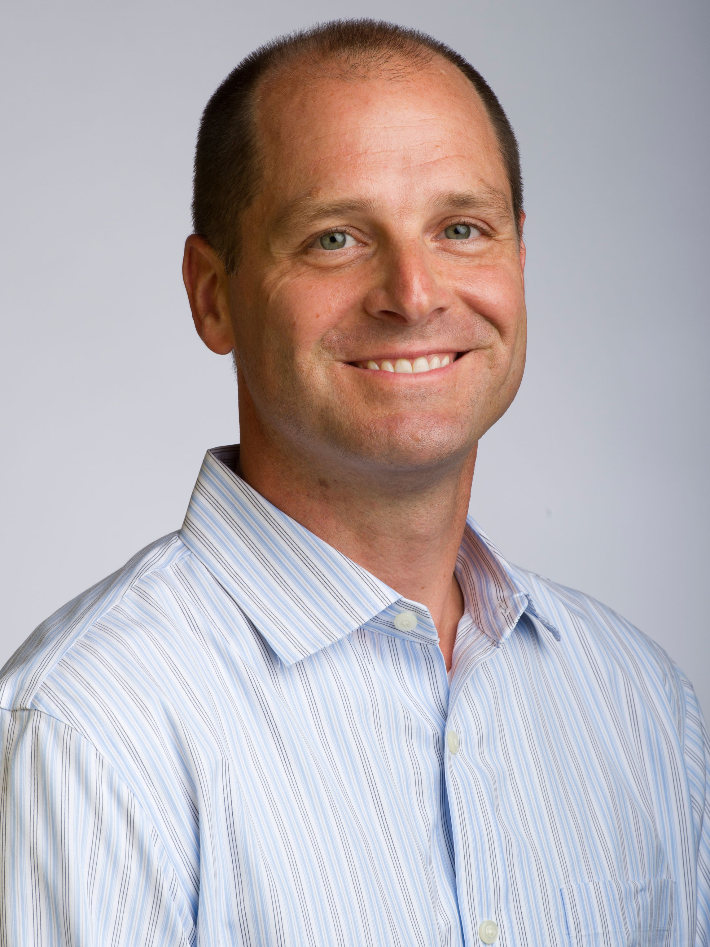
R. Edward Beighley is the COE Distinguished Professor and Interim Chair of Civil and Environmental Engineering at Northeastern University. He is also affiliated with the Marine and Environmental Sciences program. His research focuses on hydrologic and hydraulic modeling, remote sensing of the hydrologic cycle, and flood hazard assessment. He holds a Ph.D. from the University of Maryland (2001), an M.S. from Pennsylvania State University (1996), and a B.S. from the same institution (1995). Key honors include the 2024 Distinguished Faculty Award, 2019 Fostering Engineering Innovation Award, and leadership roles in NASA’s SWOT Satellite Mission. His work emphasizes sustainable water resource management through interdisciplinary approaches combining remote sensing, field data, and hydrologic models. Research projects include evaluating microplastic accumulation in floodplains, global river baseflow analysis via GRACE/GRACE-FO satellites, and improving SWOT discharge estimation algorithms. The Beighley Lab collaborates on flood risk assessment and climate change impacts at local to global scales. Grants: SWOT Science Team (NASA), NSF Microplastics Project, North Carolina Hurricane Relief Research. Students: Advises PhD student Max Rome on floating wetlands and urban water quality. Labs/Teams: Beighley Lab focuses on terrestrial water systems and satellite applications.
Tina Delahuntyمشاهده پروفایل
استادیار
- Geography
- Environmental Change
- Land Cover Change
- +۷ مورد دیگر
Tina Delahunty is an Assistant Professor in the Department of Physical and Environmental Sciences at Bloomsburg University, where she contributes to the academic and research mission in geography and environmental sciences. Her work bridges geospatial technologies with environmental change analysis. Education: Ph.D. in Geography — University of Florida M.A. in Geography — Florida Atlantic University Her research focuses on the spatial and temporal dynamics of Holocene land cover and environmental change. She employs advanced tools such as GIS, remote sensing, and palynology to investigate long-term ecological transformations. Her interdisciplinary approach integrates geospatial data with paleoenvironmental proxies to reconstruct past landscapes and assess modern environmental impacts. The recent publications highlight consistent engagement in remote sensing applications, including agricultural monitoring, urban extent mapping using nighttime lights, and ecological assessment via environmental DNA. These works reflect a strong methodological foundation in multiscale geospatial analysis and environmental monitoring across diverse ecosystems. Scientific Contributions: Co-authored research in high-impact journals such as International Journal of Remote Sensing , Freshwater Biology , and International Journal of Applied Earth Observation and Geoinformation . Active contributor to interdisciplinary environmental research involving geography, ecology, and geospatial science. She is involved in mentoring and research supervision, though specific advisees are not listed. Her work is supported by institutional affiliation and access to geospatial laboratories and field resources. She contributes to advancing methodologies in land cover classification and environmental change detection. Dr. Delahunty leads research in GIS and remote sensing laboratories at Bloomsburg, where she likely supervises student projects and collaborates on regional and global environmental studies.

Stephen J. Leisz is a Professor in the Department of Anthropology and Geography at Colorado State University (CSU). As a leading scholar in land change science and remote sensing, he directs the Land Change Science and Remote Sensing Laboratory and co-directs the Center for Archaeology and Remote Sensing. His research integrates remote sensing, GIS, and participatory methods to study human-environment interactions in Southeast Asia, Melanesia, and West Africa. Key areas include land-use transitions, peri-urbanization, agricultural systems, and climate change impacts. Leisz holds a Ph.D. in Geography from the University of Copenhagen (2007), an M.Sc. in Environmental Monitoring from the University of Wisconsin-Madison, and a B.A. in American Studies from Georgetown University. Leisz’s recent work focuses on agrarian transitions in Vietnam’s Mekong and Red River Deltas, impacts of transportation corridors on rural transformations, and applications of LiDAR in archaeology. He has led projects funded by NASA’s Land Cover/Land Use Change program and co-founded the Earth Archive Initiative to digitally preserve global landscapes. His fieldwork spans over 30 years in Southeast Asia and Melanesia, emphasizing interdisciplinary collaboration and policy-relevant outcomes. Leisz advises graduate students in CSU’s International Development Studies program and the Graduate Degree Program in Ecology (GDPE). He teaches courses on remote sensing, spatial analysis, and land change science. His career includes Peace Corps service in Senegal (1980s) and recognition as a First-Generation College Graduate.
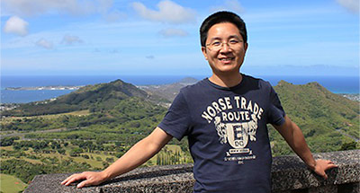
Qi Chen is a Professor in the Department of Geography at the University of Hawaii at Mānoa, specializing in remote sensing and geospatial technologies. His office is located in Saunders Hall, and he teaches undergraduate and graduate courses including GEO 370 (UAV and Aerial Photography), GEO 388 (Introduction to GIS), GEO 470 (Remote Sensing), GEO 489 (Applied GIS), and GEO 762 (Research Seminar: Remote Sensing. His research focuses on transforming earth observation data into actionable knowledge for environmental monitoring. Primary interests include: LiDAR applications for vegetation analysis and biomass estimation Climate change impacts on land cover and coastal systems Machine learning integration with geospatial data High-resolution mapping of agricultural and forest ecosystems Drone and satellite-based environmental assessment Chen's recent publications (2020-2025) demonstrate a strong focus on advancing remote sensing methodologies, particularly through: AI-driven approaches (GANs for vegetation indices, deep learning for marine debris) Multi-sensor fusion (LiDAR with camera systems, hyperspectral-multispectral integration) Novel applications in precision agriculture and infrastructure monitoring Hawaii-specific environmental studies incorporating indigenous knowledge systems He leads the Smart Remote Sensing Lab (smartremotesensing.org) where he mentors graduate students in developing cutting-edge geospatial solutions for ecological and societal challenges.
Keith Morrison is a Professor at the University of Reading, affiliated with the School of Mathematical, Physical and Computational Sciences and the Department of Meteorology. His research focuses on advanced remote sensing techniques, particularly synthetic aperture radar (SAR), for environmental monitoring and subsurface imaging. Institution: University of Reading School: School of Mathematical, Physical and Computational Sciences Department: Department of Meteorology Research Focus: Radar Remote Sensing, Soil Moisture, Peatlands, Subsurface Scattering His research interests lie in the development and application of radar systems for Earth observation. He specializes in SAR-based methods such as tomographic profiling, interferometry, and virtual bandwidth SAR (VB-SAR) to study soil moisture dynamics, peatland hydrology, forest structure, and subsurface features. His work bridges physics, signal processing, and environmental science, enabling improved understanding of ecosystem processes through microwave remote sensing. The analysis of his recent publications reveals a strong focus on C-band and S-band SAR applications, particularly in explaining anomalous backscatter due to subsurface scattering in dry soils and peatlands. He has pioneered techniques like VB-SAR for centimeter-scale vertical profiling from space, contributing significantly to the accuracy of soil moisture and vegetation parameter retrievals. His work increasingly integrates laboratory experiments, field studies, and satellite data for robust validation. Although no formal awards are listed in the provided text, his sustained contributions to high-impact journals such as IEEE TGRS, Remote Sensing of Environment, and International Journal of Remote Sensing suggest recognition within the scientific community. Morrison has supervised and collaborated with numerous researchers, including Edwards-Smith, Zwieback, Andre, and Bennett. While formal student advising is not detailed, his role as a senior author and frequent collaborator indicates mentorship responsibilities. He has been involved in projects related to peatland monitoring, forest biophysical retrieval, and SAR-based change detection, likely supported by research grants from UK and European funding bodies. He contributes to major international conferences such as IGARSS, EUSAR, and IEEE RadarCon, demonstrating active engagement in the global radar and remote sensing community. His work supports future advancements in satellite-based environmental monitoring, particularly in carbon-rich ecosystems like peatlands and forests.
Giorgos Mountrakis is a Professor in the Department of Environmental Resources Engineering at SUNY College of Environmental Science and Forestry (ESF). His research focuses on environmental monitoring using remote sensing, environmental modeling through geographic methods, and decision support systems for ecological and urban challenges. He holds a Dipl. Eng. from the National Technical University of Athens (1998), an M.S. (2000), and Ph.D. (2004) from the University of Maine. His work integrates advanced technologies like satellite imagery, LiDAR, and machine learning to address land cover dynamics, climate impacts, and wildlife conservation. Current advisees include Atef Amriche (PhD candidate in Geospatial Information Science), Babak Haji Seyed asadollah (PhD in Environmental Resources Engineering), Ahmadreza Safaeinia (PhD in Environmental Resources Engineering), and Zhixin Wang (PhD in Geospatial Information Science). Key research themes include: land use/cover classification using deep neural networks, climate change impacts on forests and rangelands, and optimizing spatial-temporal models for large-scale environmental analysis. His projects span global datasets (e.g., Landsat, MODIS) and regional case studies in the US, Mongolia, and Algeria. Publications emphasize methodological advancements in remote sensing, such as fusion of multisensor data, accuracy assessment frameworks, and applications in biodiversity conservation. His work bridges technical innovation with practical environmental decision-making, addressing issues like urban growth prediction and wildlife-vehicle collision mitigation.
- Agronomy
- Agroecology
- Organic Agriculture
- +۵ مورد دیگر
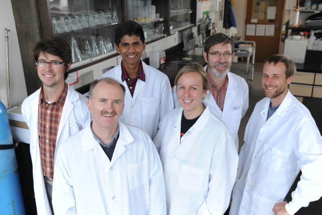
Derek Lynch is a Professor in the Department of Plant, Food, and Environmental Sciences at Dalhousie University's Faculty of Agriculture. He holds a B.Sc. (1989) and M.Sc. (1992) in Plant Science from McGill University and a Ph.D. (2002) in Land Resource Science from the University of Guelph. From 2005–2015, he was Canada Research Chair in Organic Agriculture. His research focuses on agroecological approaches to agronomy and soil science, examining how farming systems influence productivity and ecosystem services. Key areas include soil health, soil carbon dynamics, organic agriculture, and nutrient management. He co-founded the Atlantic Soil Health Lab and is a founding member of the Centre for Sustainable Soil Management. Lynch teaches undergraduate courses like Soil Science, Organic Field Crop Management, and Agroecology, and contributes to the Certificate in Sustainable Soil Management. He is cross-appointed to the Dalhousie College of Sustainability. He serves on committees like the Canadian Society of Agronomy and CIRCASA, focusing on soil carbon research. His work emphasizes bridging science with policy, addressing climate change, biodiversity, and sustainable farming systems. Notable awards include the Canada Research Chair designation. His recent articles explore soil carbon sequestration, farming system impacts, and soil biodiversity. He has authored over 70 peer-reviewed publications and book chapters, with a focus on organic agriculture's environmental and socio-economic dimensions.
Colleen Baileyمشاهده پروفایل
استادیار
Colleen Bailey is an Assistant Professor in the Department of Electrical Engineering at the University of North Texas. Her research focuses on the intersection of machine learning, signal processing, and energy systems, with applications spanning biomedical imaging, environmental monitoring, and edge computing. Research Interests: Machine learning optimization for edge devices Entropy-based image compression techniques Attention mechanisms in vision transformers Urban air pollution prediction models Land surface temperature super-resolution Publication Trends: Recent works emphasize compact AI architectures (e.g., MHATT network, entropy bottleneck models) for efficient processing in resource-constrained scenarios. Applications include medical imaging (Chest X-ray analysis), environmental monitoring (air quality, Martian dust storms), and energy systems (household prediction, power quality classification). Contact: Email: Colleen.Bailey@unt.edu Office: Discovery Park B252 Phone: 940-891-6874
Jan-Henrik Haunert is a Professor at the University of Bonn, affiliated with the Institute of Cartography and Geoinformatics within the Faculty of Civil Engineering and Geodetic Science. His research focuses on map generalization, geographic information systems (GIS), and optimization techniques in cartography. He has contributed to projects funded by the German Research Foundation (DFG), particularly in deriving scale-dependent representations of geographic data. His work emphasizes logical consistency, semantic accuracy, and quality assessment in geospatial data processing. Key research areas include land cover map generalization, spatial data integration (e.g., volunteered geographic information), and rule-based incremental generalization. He has developed methodologies leveraging mixed-integer programming and straight skeleton algorithms for cartographic automation. His publications span peer-reviewed journals like GeoInformatica and Photogrammetrie - Fernerkundung - Geoinformation , as well as conference proceedings such as AGILE and ACM-GIS. Haunert’s contributions address challenges in geospatial data quality, including polygon simplification and river dataset matching. He has also explored applications in vehicle localization and virtual reality systems like the GeoScope for urban planning. His work bridges theoretical GIScience with practical applications in cartography and geoinformatics.
Dr. Kevin A. Adkins is a Professor in the College of Aviation at Embry-Riddle Aeronautical University , where he teaches aerodynamics, aircraft performance, and uncrewed aircraft systems (UAS) courses. He pioneered the first collegiate Advanced Air Mobility (AAM) course in the U.S. in 2023 and directs two labs: the Advanced Air Mobility Research and Innovation Lab (AAMRIL) and the Uncrewed Vehicle and Atmospheric Investigation Lab (UNVAIL) . Education : Ph.D. in Aerospace Engineering (Mississippi State University), M.Eng. and B.S. in Aerospace Engineering (University of Michigan-Ann Arbor) His research focuses on atmospheric boundary layer meteorology using UAS, AAM concepts of operation (ConOps), and flight test engineering. He collaborates extensively on sensor development for environmental monitoring, including low-cost particulate matter sensors and bioaerosol sampling mechanisms. Recent publications emphasize UAS applications in wildfire detection, urban microclimate analysis, and wind farm humidity studies. Dr. Adkins serves on advisory committees for the Florida Department of Transportation's AAM initiative and ASTM International's UAS standards. Awards : Fellow of the Royal Aeronautical Society, ERAU Researcher of the Year (2020), PIEoneer Real Life Learning Award (2019), AUVSI Best Paper Award (2019) He mentors numerous student projects on UAS sensor development and atmospheric research, with teams winning symposium awards. His labs integrate experiential learning with international fieldwork in Puerto Rico, Norway, and Lithuania.
- Regional and global climate modeling
- Aerosol-climate interaction
- Snow and glacier impurities and climatic impact
- +۳ مورد دیگر
Dr. Yun Qian is a distinguished Earth Scientist and Lab Fellow at Pacific Northwest National Laboratory (PNNL), where he leads the Earth System Modeling Group with over 80 scientists and staff within the Atmospheric, Climate, and Earth Sciences (ACES) Division. He joined PNNL in 2000 and has established himself as a renowned expert in climate modeling, particularly in regional climate systems, aerosol-climate interactions, and urban climate effects. Dr. Qian is also an AMS Fellow with significant contributions to understanding human influences on the Earth system. Dr. Qian received his academic training in China: Ph.D. in Atmospheric Science from Nanjing University, Nanjing, China B.S. in Atmospheric Science from Nanjing University, Nanjing, China Dr. Qian's research focuses on advancing our understanding of climate systems through sophisticated modeling approaches. His work spans regional and global climate modeling, aerosol-climate interactions, snow and glacier impurities and their climatic impacts, land-atmosphere-water interactions, urban and coastal environment modeling, and uncertainty quantification in climate modeling. His pioneering work on Asian aerosols revealed their dominant role in shaping climatic trends in East Asia, while his research on snow and ice impurities provided new insights into changes in snowpacks in the western United States and the Himalayas. Dr. Qian has also made significant contributions to understanding how atmosphere-land-water interactions modulate the influence of human activities on the environment. Analysis of Dr. Qian's recent publications shows a strong focus on urban climate effects, regional climate modeling, and the impacts of human activities on climate systems. His work increasingly incorporates advanced computational methods including machine learning for weather pattern identification. There's a clear trend toward studying the interactions between urban environments and climate systems, with particular attention to heat stress, precipitation patterns, and regional warming effects. His research also shows growing interest in extreme weather events and their changing patterns under climate change scenarios. Dr. Qian has received numerous prestigious awards and recognitions: Fellow of American Meteorological Society Chair of AMS Coastal Environment Committee Program Chair for Annual AMS Coastal Environment Symposium Editor of JGR-Atmospheres, Atmospheric Chemistry and Physics, and Advances in Atmospheric Sciences Director of international workshop on Uncertainty Quantification in Climate Modeling and Projection Member of Scientific Steering Committee for IPCC CMIP6 Global Monsoons Modeling Inter-comparison Project NSR 2020 Best Paper AAS Esteemed Review Paper Award PNNL Exceptional Contribution Program Award PNNL EBSD Mentor of the Year Editors' Citation for Excellence in Refereeing at AGU (2015, 2019) Contributing Author of IPCC Assessment Report Fellowship Award of International Council for Science (ICSU), 1997 Xue-Du-Feng-Zheng Award in Chinese Academy of Sciences, 1998 With over 200 peer-reviewed articles and 20,000 citations (h-index of 74), Dr. Qian has made substantial contributions to climate science. His work has garnered significant media attention, with features in top-tier scientific publications like Nature and Science, as well as major news outlets including the Associated Press, New York Times, Washington Post, BBC, NBC, and NPR. He has served as chair of the AMS Coastal Environment Committee, Program Chair for the Annual AMS Coastal Environment Symposium, and as a member of the Scientific Steering Committee for the IPCC CMIP6 Global Monsoons Modeling Inter-comparison Project. Dr. Qian has also directed international workshops on uncertainty quantification in climate modeling and served as an editor for three prestigious journals. Dr. Qian leads the Earth System Modeling Group at PNNL, which comprises over 80 scientists and staff. His team focuses on developing and applying atmospheric and land surface models to advance understanding of human influence on the Earth system. The group's work spans regional climate modeling, aerosol-climate interactions, snow and glacier impurities, land-atmosphere-water interactions, urban and coastal environment modeling, and uncertainty quantification. Their research has significant implications for understanding climate change impacts and developing adaptation strategies.
Paweł Tysiącمشاهده پروفایل
استادیار
- Coastal Engineering
- Remote Sensing
- Geodesy
- +۳ مورد دیگر
Dr. Paweł Tysiąc serves as an Assistant Professor in the Department of Geodesy at the Faculty of Civil and Environmental Engineering, Gdańsk University of Technology, where he conducts research at the intersection of geospatial technologies and environmental engineering. His work focuses on developing innovative measurement methodologies for coastal and structural applications. His primary research interests include coastal engineering, particularly low-energy coast dynamics and beach nourishment; remote sensing using UAV-LiDAR and multispectral systems for environmental monitoring; and applications of 3D printing in civil engineering with fractal-based designs. He specializes in leveraging low-cost LiDAR solutions for deformation analysis, sediment monitoring, and heritage conservation, demonstrating strong interdisciplinary collaboration across environmental science and geodesy. Recent publications reveal a consistent trend toward practical applications of emerging measurement technologies, with significant emphasis on sustainable coastal management and advanced construction techniques. His work bridges theoretical geodesy with real-world environmental challenges, particularly in the Baltic region.