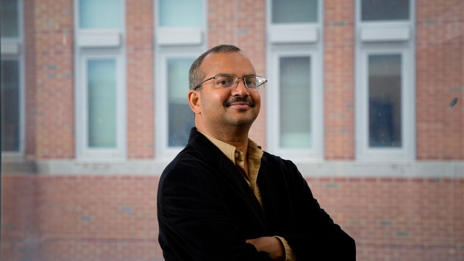
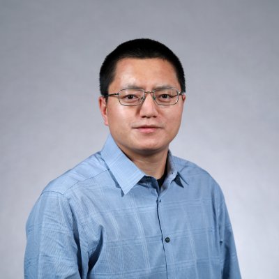
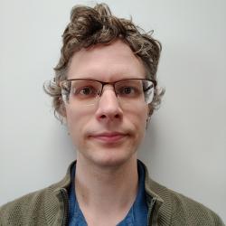
Raju Vatsavai is an Associate Professor in the Department of Computer Science at North Carolina State University, affiliated with the Center for Geospatial Analytics. He joined NC State in 2014 as part of the Chancellor’s Faculty Excellence Program cluster hire in Geospatial Analytics. Education: PhD and MS in Computer Science from University of Minnesota Prior Roles: Lead Data Scientist at Oak Ridge National Lab, roles at University of Minnesota, IBM Research, AT&T Labs, and C-DAC (India) His research in geospatial analytics spans big data management , spatiotemporal data mining , deep learning for remote sensing , and high-performance computing , with applications in national security, climate change, and crop monitoring. Recent work includes deep learning frameworks for cloud imputation , multi-sensor satellite data harmonization , and transfer learning applications in crop classification . He has been a leading investigator on grants from the National Geospatial-Intelligence Agency, Department of Energy, and Department of Homeland Security. Labs: Associate Director of the Center for Geospatial Analytics Expertise: Spatial computing, Earth observation, nuclear proliferation detection via remote sensing
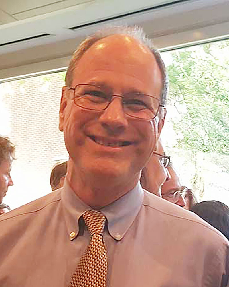
Joseph Alejandro Gallego Mejia is an Assistant Teaching Professor in the Department of Computer Science at Drexel University's College of Computing and Informatics. He holds a PhD with meritorious distinction in Systems and Computing Engineering from the National University of Colombia, along with a Master’s and dual Bachelor’s degrees in Systems and Computing Engineering and Industrial Engineering. PhD in Systems and Computing Engineering, National University of Colombia (Meritorious Distinction) Master of Systems and Computing Engineering, National University of Colombia Bachelor of Engineering in Systems and Computing Engineering, National University of Colombia Bachelor of Engineering in Industrial Engineering, National University of Colombia His research focuses on artificial intelligence, machine learning, computer vision, quantum machine learning, natural language processing, and cybersecurity. He explores robustness estimation, anomaly detection, incremental learning, and scalable software architectures for AI systems. His work bridges theoretical foundations and practical applications in health, remote sensing, and edge computing. The recent publications reflect a strong trend in interdisciplinary AI research, combining machine learning with quantum computing, cybersecurity, and natural language understanding. His work spans domains such as satellite imagery analysis, medical diagnostics, IoT security, and conversational AI, demonstrating a commitment to scalable and robust intelligent systems. Keywords across publications include Computer Science, Machine Learning, Quantum Computing, and Cybersecurity, with subfields ranging from adversarial robustness to hybrid quantum-classical models. Scientific distinctions include: PhD with meritorious distinction, National University of Colombia Postdoctoral fellow, Frontier Development Lab (Trillium), supported by NASA and ESA He has served as a reviewer for top-tier journals and conferences including Neurocomputing, IEEE Access, Radioscience, NeurIPS, and NLDL. Though no formal grants are listed, his postdoc was funded by NASA and ESA, indicating significant external support. He teaches courses in programming, data science, machine learning, deep learning, NLP, and software engineering. He founded the tech company Sammu and mentors students through instruction and research supervision. He is actively involved in research and teaching, contributing to innovative programs in AI and computing education. His lab and team affiliations are not explicitly stated, but his work suggests collaboration with AI, quantum computing, and cybersecurity research groups.
Nina Schwarz is Assistant Professor of human-environment interactions in cities at the Department of Urban and Regional Planning and Geo-Information Management, ITC—University of Twente. Holding a Diploma in Environmental Sciences (University of Lüneburg, 2003) and a PhD in Social and Economic Sciences (University of Kassel, 2007), she spent a decade as senior scientist at the Helmholtz Centre for Environmental Research – UFZ before joining ITC. Her interdisciplinary research integrates urban land-use science, ecosystem-service evaluation and advanced modelling techniques—especially agent-based models—to explore sustainable urban development under global change. Research interests revolve around three interconnected themes: (i) urban land-use change —understanding how residential, commercial and green-space dynamics co-evolve; (ii) urban ecosystem services —quantifying both supply and demand of services such as local climate regulation, recreation and biodiversity; and (iii) behavioural modelling —formalising human decision-making to simulate policy scenarios ranging from slum-upgrading to vineyard management. She actively links these themes to UN Sustainable Development Goals, notably SDG 11 (Sustainable Cities) and SDG 15 (Life on Land). Recent publications (2022-2025) reveal a methodological breadth spanning citizen-science impact assessment in Suriname, cooling effects of urban water bodies in Chinese mega-cities, European wine-growers’ adaptive behaviour, and methodological advances in upscaling and validating agent-based land-use models. Across these studies, Schwarz consistently combines empirical field data, geospatial analytics and participatory approaches to produce policy-relevant insights for cities in both the Global North and South. She has (co-)authored >80 peer-reviewed works, accumulating c. 5 900 citations and an h-index of 28 (Scopus). While specific honours are not itemised in the supplied text, her sustained citation impact and invited contributions to major conferences (e.g., iEMSs 2020, IAHR 2025) underscore scientific recognition. Schwarz frequently engages with societal stakeholders: her projects have generated open datasets on urban green-space monitoring in Paramaribo, e-learning modules for Latin-American universities, and interactive dashboards for sustainable water management. Within ITC she contributes to capacity-building programmes for emerging economies, supervises graduate researchers and maintains active collaborations across Europe, Latin America, Africa and Asia. No explicit lists of PhD students or personal grants are provided in the current corpus, but her leadership of externally funded projects (e.g., citizen-science evaluation, vineyard decision-making database) indicates ongoing acquisition of research funding.
Professor Stuart Phinn is a distinguished academic at the University of Queensland, serving as Professor in the School of the Environment and Centre Director of the Remote Sensing Research Centre (Earth Observation Research Centre). He also maintains affiliations with the Centre for Marine Science. With a career spanning over two decades, Professor Phinn has established himself as a leading expert in earth observation and environmental monitoring, with over 559 publications including 295 journal articles. His educational background includes a Bachelor (Honours) of Science (Advanced) from The University of Queensland and a Doctor of Philosophy from San Diego State University. Professor Phinn's leadership extends to founding directorships of Australia's national earth observation coordination body (www.eoa.org.au) and collaborative research infrastructure (www.tern.org.au), as well as a world-leading research-to-operational program supporting government environmental monitoring (www.jrsrp.org.au). He also leads the Earth Observation for Government Network. Professor Phinn's research focuses on monitoring environmental change using earth observation and field data. His work primarily involves using images collected from satellites and aircraft, combined with field measurements, to map and monitor Earth's environments and how they change over time. This research is conducted in collaboration with environmental scientists, government agencies, NGOs, and private companies. A growing aspect of his work focuses on national coordination of earth observation activities and the collection, publishing, and sharing of ecosystem data. His work provides solutions to support sustainable development and resource use for governments, industries, and communities. His recent publications demonstrate a consistent focus on applying earth observation technologies to solve environmental challenges across multiple domains. The 15 most recent articles reveal strong themes in coral reef mapping and monitoring, land cover change detection, fire resilience analysis, and advanced remote sensing techniques including multi-sensor fusion and machine learning applications. His work spans terrestrial, coastal, and marine environments, with significant contributions to understanding environmental change in Australia and internationally, particularly in Indonesia. Professor Phinn has secured substantial research funding from diverse sources including government agencies (Queensland Government, Great Barrier Reef Marine Park Authority), industry partners (SmartSat CRC, Blue Economy CRC), and international organizations (Google Inc, Vulcan Inc). Current projects include evaluating impacts of threats to endangered reptiles, automating tree-scale vegetation structure monitoring, and continuing the Joint Remote Sensing Research Program. As an academic supervisor, Professor Phinn has mentored numerous PhD and Master's students, with current supervision spanning topics from forest disturbance analysis to kelp forest mapping and fire resilience of mine site rehabilitation. His extensive supervision history demonstrates his commitment to training the next generation of earth observation scientists. The Earth Observation Research Centre he directs fosters a collaborative research environment focused on transforming satellite and airborne images with field survey data into meaningful environmental information for decision-making.
Dr. David S. Kosson is a distinguished faculty member at Vanderbilt University, holding the Gass Family Chair in Energy and the Environment. He serves as Professor of Civil and Environmental Engineering, Chemical and Biomolecular Engineering, and Earth and Environmental Sciences. As Director of the Consortium for Risk Evaluation with Stakeholder Participation (CRESP) and the Environmental Laboratory, he leads multidisciplinary research addressing nuclear waste management, environmental remediation, and policy. His work has established frameworks like the U.S. Leaching Environmental Assessment Framework (LEAF), impacting national waste management policies. Dr. Kosson earned his Ph.D., M.S., and B.S. in Chemical Engineering from Rutgers University. He previously chaired Vanderbilt’s Civil and Environmental Engineering Department (2000–2012). His research focuses on nuclear/chemical waste containment, contaminant mass transfer, and eco-cultural risk assessment. He advises U.S. federal agencies on defense waste remediation and chemical weapons demilitarization. Education: Ph.D., Chemical and Biochemical Engineering, Rutgers University M.S., Chemical and Biochemical Engineering, Rutgers University B.S., Chemical Engineering, Rutgers University Key Roles: CRESP Principal Investigator Environmental Laboratory Director Former Department Chair (Civil & Environmental Engineering) His research integrates laboratory experiments with field data to model long-term behavior of waste forms and geological interfaces. Notable contributions include studies on cement-rock interactions, PFAS leaching, and ecological risk assessment at DOE sites like Hanford and Oak Ridge. He has authored over 200 publications, advancing risk-informed decision-making in waste management. Scientific contributions span nuclear waste durability, eco-cultural justice frameworks, and sustainable materials engineering. He collaborates internationally on deep geological disposal systems and environmental policy.
Dr. Yin-Long Qiu is an Associate Professor in the Department of Ecology and Evolutionary Biology at the University of Michigan, where he also serves as Associate Curator of the U-M Herbarium. His research focuses on understanding the evolution of land plants through molecular approaches. Dr. Qiu received his Ph.D. from the University of North Carolina, Chapel Hill in 1993, followed by an NIH postdoctoral fellowship at Indiana University in 1997. His academic journey has positioned him as a leading researcher in plant evolutionary biology. Dr. Qiu's research spans three primary areas: reconstructing plant phylogeny using molecular approaches, investigating evolution of mitochondrial and nuclear genomes in early land plants, and examining the effects of environmental changes on plant evolution. His work has particularly focused on group II introns in mitochondrial genomes, early land plant diversification patterns, and the genetic basis of plant-environment interactions. His lab continues to advance knowledge in these areas while developing new projects on nuclear genome evolution, particularly the roles of introns and transposons. Analysis of Dr. Qiu's publication record reveals a consistent focus on plant evolutionary genomics, with particular emphasis on mitochondrial genome evolution across land plants. His research spans from molecular dating of plant divergences to detailed genomic structural analyses, with significant contributions to understanding bryophytes, lycophytes, and early vascular plants. NIH postdoctoral fellowship Dr. Qiu teaches Plant Evolution (EEB 420), an advanced course that covers plant phylogeny, evolutionary genomics, evolutionary developmental biology, and evolutionary ecology of plants. His graduate student Alexander Taylor continues his research tradition in plant evolutionary studies. Dr. Qiu's work has been supported by various research grants that have enabled extensive genomic analyses across diverse plant lineages. As Associate Curator of the U-M Herbarium, Dr. Qiu integrates traditional botanical resources with modern genomic approaches to advance plant evolutionary research.
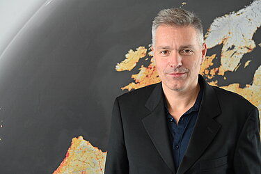
Prof. Dr. Hannes Taubenböck holds the Chair of Global Urbanization and Remote Sensing at the Julius-Maximilians University of Würzburg (Faculty of Philosophy, Institute of Geography and Geology) since 2022 and collaborates with the German Aerospace Center (DLR). His research bridges remote sensing with urban geography, focusing on: Global urbanization patterns and structural analysis Informal settlements (slums/refugee camps) Climate change and natural hazard vulnerability Migration dynamics via remote sensing and social media He obtained his PhD (2008) and habilitation (2019) at JMU Würzburg, preceded by geography studies at LMU Munich (1999-2004). His recent publications analyze: Climate impacts on African agriculture Urban permeability and walkability Border region disparities Heat exposure modeling Methodologically, he specializes in: Deep learning for earth observation Multi-modal data fusion Urban pattern classification Building stock analysis His work informs policy applications in: EU cohesion programs Disaster risk reduction Environmental justice Urban sustainability
Shiguo Jiang is a tenured Associate Professor in the Department of Geography, Planning, and Sustainability at the University at Albany's College of Arts and Sciences. Currently on sabbatical during Fall 2025, he maintains active research leadership through the Spatial Analysis Laboratory. His affiliations extend to the PhD Program in Information Science (College of Emergency Preparedness, Homeland Security and Cybersecurity) and the MS Program in Biodiversity, Conservation, and Policy (Department of Biological Sciences), reflecting his interdisciplinary approach. Dr. Jiang's educational background includes a PhD from Ohio State University (2012), an MS from Peking University (2004), and dual BS/BA degrees from Peking University (2001). His research integrates geospatial technologies with spatial statistics to investigate land use dynamics, forest ecosystems, and human-environment interactions. Key application areas include urban systems analysis, climate change modeling, and crime pattern detection, with notable fieldwork in the Maya Forest of Belize. His publication portfolio reveals an evolution from urban fractal analysis (early Beijing studies) toward integrated socio-ecological research, with recent emphasis on crime geospatial modeling and climate-ecosystem interactions. The 15 most recent articles demonstrate methodological innovation in remote sensing reconstruction and spatial statistics, applied across environmental, criminological, and public health domains. Dr. Jiang actively mentors graduate students across departments including Geography, Sociology, Information Science, and Criminal Justice. While currently unable to fund Graduate Research Assistants, he collaborates with students who secure external funding. His Spatial Analysis Laboratory requires technical proficiency in programming (Python/R/Matlab) and geospatial software, welcoming undergraduates through postdoctoral researchers with relevant skills.
Jun Zhou is Professor and Deputy Head of School (Research) at Griffith University's School of Information and Communication Technology. His research specializes in hyperspectral imaging, computer vision, and pattern recognition with applications in agriculture, environmental monitoring, and remote sensing. Zhou leads significant projects including the ARC Research Hub for Driving Farming Productivity and Disease Prevention. His work develops innovative computer vision systems for agricultural automation, environmental conservation, and industrial quality control. He has received the ARC Discovery Early Career Researcher Award and secured extensive research funding from ARC, CSIRO, and industry partners. Zhou's publications demonstrate consistent contributions to hyperspectral image analysis, object tracking, and deep learning applications. As Deputy Director of the ARC Industrial Transformation Research Hub, he coordinates multi-institutional research teams developing AI-powered solutions for farming productivity and disease prevention.
Dr. Husam Al-Najjar is a Lecturer at the School of Computer Science within the Faculty of Engineering and Information Technology at the University of Technology Sydney (UTS). He serves as the Course Director for the Bachelor of Information Systems (BIS) program. With expertise in geospatial technology and machine learning, Dr. Al-Najjar focuses on predicting and mitigating natural hazards and environmental issues to contribute to a sustainable digital earth. Dr. Al-Najjar earned his PhD from the University of Technology Sydney. Before joining academia, he worked in project management and has received numerous prestigious awards, scholarships, and grants throughout his career. Dr. Al-Najjar's research primarily centers on the application of machine learning techniques to address complex environmental challenges. His work spans geospatial AI, natural hazard prediction (particularly landslides and bushfires), and sustainable development. He has developed innovative approaches that integrate physical models with machine learning algorithms to improve prediction accuracy in data-scarce environments. His research also extends to remote sensing applications, urban planning, and smart city technologies, with a strong emphasis on practical solutions for real-world problems. Analysis of Dr. Al-Najjar's recent publications reveals a strong focus on applying explainable AI techniques to natural hazard prediction, particularly landslides. His work consistently bridges the gap between theoretical machine learning approaches and practical geospatial applications. He has made significant contributions to integrating physical models with AI, developing methods for handling imbalanced data through generative adversarial networks, and improving feature selection for remote sensing applications in environmental monitoring. Best Paper Award at the ISPRS Geospatial Week in Enschede, the Netherlands As an educator, Dr. Al-Najjar is actively involved in mentoring and teaching. He serves as Course Director for the Bachelor of Information Systems program and teaches courses in GIS, Information Systems, IS development methodologies, Design & Innovation, and Project Management. He welcomes prospective PhD candidates interested in his research areas and emphasizes the importance of detailed research proposals that demonstrate novelty and significance. His teaching philosophy focuses on fostering an engaging and inclusive learning environment that promotes student success and well-being. Dr. Al-Najjar is affiliated with 'The Trustworthy Digital Society' concentration at UTS and serves as a referee and holds editorial roles in respected journals. His work contributes to the development of geospatial AI frameworks that support decision-making in environmental management and disaster preparedness.
Lucy Bastin is a Professor in the School of Computer Science and Digital Technologies at Aston University, part of the College of Engineering and Physical Sciences. She holds academic roles since 2003, including leadership in the Digital Observatory for Protected Areas (DOPA) project at the European Commission. Her research focuses on biodiversity informatics, remote sensing, and citizen science, with applications in conservation planning and sustainable development. She advises PhD students on topics like GIS, remote sensing, and citizen observatories. Education: BSc Zoology (University of Nottingham), MSc GIS (University of Leicester), PhD in Spatial Population Ecology (University of Birmingham). She also holds a Postgraduate Certificate in Teaching and Learning in Higher Education. Research Interests: Essential Biodiversity Variables, metadata standards for citizen science, uncertainty in conservation models, disease mapping (e.g., MRSA), and environmental policy support. She developed the DOPA toolkit for protected area monitoring and co-authored the Bari Manifesto for biodiversity variables. Key Projects: DOPA Explorer 2.0, FLIERS EU project, EuroGEOSS initiatives Recent Awards: Midlands Women in Tech Finalist (2021), Best Paper Award (2018) Teaching: Software Engineering, Professional Ethics in Computing, GIS modules Labs/Teams: Part of the Computer Science Research Group and Aston Centre for Artificial Intelligence Research and Application. Collaborates with global partners on initiatives like BIOPAMA and the Green Deal Data Space.
Isabella "Izzi" Hinks serves as a Teaching Assistant Professor in the Computer Science Department at the University of North Carolina at Chapel Hill. She completed her Ph.D. in Geospatial Analytics at NC State University's Center for Geospatial Analytics in 2024, where she was advised by Dr. Josh Gray. Her academic journey began with dual B.Sc. degrees in Computer Science and Environmental Science, along with a minor in Statistics and Analytics, all earned at UNC Chapel Hill. Dr. Hinks' research focuses on developing innovative algorithms to estimate the adaptive potential of small-scale agriculture in poverty-affected regions. Her work combines computer science expertise with environmental applications, particularly in using remote sensing technologies and deep learning techniques to monitor smallholder farming systems. She has made significant contributions to understanding how smallholder farmers can enhance their climate resilience through strategic adaptations, leveraging both satellite data and field observations. Her publication record demonstrates a consistent focus on applying advanced computational methods to agricultural monitoring challenges. The most recent articles show a progression from basic field boundary mapping using deep learning toward more sophisticated analyses of climate adaptation impacts on smallholder resilience. Her work increasingly integrates multiple data sources, including satellite imagery, household surveys, and on-the-ground measurements, to create comprehensive assessment frameworks for agricultural systems in developing regions. Among her notable recognitions is the Gladys West Award from the Center for Geospatial Analytics' fourth annual CGA Awards, received in January 2023. Her research on deep learning-based smallholder field delineation was featured in an NC State University News article in April 2023, highlighting the practical significance of her work. Dr. Hinks has been actively involved in several research initiatives, including work with the RESCuE Consortium in Thailand monitoring coastal ecosystem rehabilitation and supporting underserved communities during the Covid-19 pandemic through Curamericas Global. She was also a founding member of Acta Solutions, a tech start-up focused on helping local governments optimize decisions using constituent data. Her presentations at major conferences like the AGU Fall Meeting demonstrate her growing prominence in the field of geospatial analytics for agricultural applications.
Dr. Tamas Mona is a Postdoctoral Research Associate in the Department of Plant Sciences at the University of Cambridge , affiliated with the Epidemiology and Modelling Group . His work focuses on environmental suitability models for large-scale epidemiological forecasting, particularly in wheat rust outbreaks across Africa, the Middle East, and Asia. Collaborations include the UK Met Office, CIMMYT, and institutions in Ethiopia, Kenya, Bangladesh, and Nepal. PhD in Environmental Sciences (2019), Eötvös Loránd University MSc in Meteorology (2013), Eötvös Loránd University BSc in Physics with Meteorology (2011), Eötvös Loránd University Research interests integrate meteorological applications with epidemiological models to predict crop disease outbreaks. Key projects involve tracking transmission pathways for stem rust pathogens and analyzing how irrigation creates green bridges for intercontinental pathogen spread. Publications emphasize environmental science and computational epidemiology . Current collaborations span Sub-Saharan Africa (EIAR, ATI, KARLO) and South Asia (BWMRI, NARC) through initiatives like the Global Food Security IRC . Modeling frameworks developed by Mona contribute to policy advisory systems for emerging pest threats, aligning with DEFRA and UK government strategies.
Joel Hartter is a Professor in the Department of Environmental Studies at the University of Colorado, where he also served as the founding director of the Masters of the Environment and Outdoor Recreation Economy programs. With dual BS degrees in Mechanical Engineering and German from the University of Michigan, an MS in Forest Engineering from Oregon State University, and a PhD in Geography from the University of Florida, his expertise bridges sustainability science, policy, and practice. His research focuses on private sector engagement in sustainability, ESG frameworks, climate action, and the Sustainable Development Goals (SDGs), with particular attention to net-zero strategies, bioeconomy implementation, and nature-based solutions. Dr. Hartter’s work emphasizes stakeholder engagement, inclusive decision-making, and bridging science with practical applications in conservation, climate resilience, and economic development. He has led projects globally in Africa, South America, and the US, addressing challenges such as wildlife conservation, sustainable supply chains, and community-based natural resource management. As a National Geographic Explorer and advisor to Fortune 500 companies, NGOs, and governments, he integrates sustainability into organizational strategies to drive innovation and competitive advantage. His teaching reaches over 20,000 students annually through courses on sustainability leadership and workforce development. Dr. Hartter’s interdisciplinary approach combines geospatial analysis, participatory methods, and behavioral science to address complex socio-ecological issues. His research spans topics like climate migration, household vulnerability, and the impact of conservation policies on communities. Notable projects include studying land-use changes in Uganda’s Albertine Rift and evaluating the effects of oil exploration on protected areas in Murchison Falls Conservation Area. Dr. Hartter collaborates closely with communities, governments, and international organizations to create equitable, actionable sustainability solutions.
Leszek Ludwik Gawrysiak is a Professor at the Department of Geology, Soil Science, and Geoinformatics , affiliated with the Faculty of Earth Sciences and Spatial Management at Maria Curie-Skłodowska University in Lublin, Poland. His academic career includes habilitation in Earth and Environmental Sciences (2019), a PhD in Geomorphology (2003), and a master’s in Physical Geography (1993), all from UMCS. Education: Master’s in Physical Geography (1993), UMCS PhD in Geomorphology (2003), UMCS Habilitation in Earth and Environmental Sciences (2019), UMCS His research focuses on Geomorphology , Geomorphometry , and Geoinformatics , with applications in Loess Erosion , Gully Dynamics , and Environmental Risk Assessment . He employs GIS, LiDAR, and remote sensing techniques to analyze terrain segmentation, forest cover changes, and geomorphological impacts on land use planning. Projects include studies on extreme meteorological events, geopark development, and Polish-Belarusian-Ukrainian water policy in the Bug River basin. Recent publications emphasize Loess Landscapes , Proglacial Valley Morphology , and Gully Erosion , with methodological advancements in Digital Terrain Modeling and Geomorphon Analysis . His work bridges computational methods (e.g., GPU-accelerated topographic parameter evaluation) with field-based geomorphological studies in Svalbard and Eastern Europe. Scientific Awards: Award from the Polish Geomorphological Society for best PhD thesis (2002) Team Award from the Rector of UMCS (2010) Individual Award from the Rector of UMCS (2013) He has contributed to understanding Loess Area Geomorphodiversity , Forest Cover Dynamics , and Climate Change Impacts on landscapes. His collaborations span interdisciplinary studies in gully erosion, geotourism, and Holocene soil erosion rates. Contact: leszek.gawrysiak@mail.umcs.pl | Phone: +48 81 537 68 71