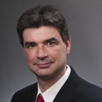
Lars Ulander is a Professor at Chalmers University of Technology specializing in radar remote sensing. His research focuses on synthetic aperture radar (SAR) signal processing, particularly for applications in forest biomass mapping and ground imaging using VHF/UHF-band systems. He is a key proposer for ESA's BIOMASS satellite mission (launching 2025) and leads the BorealScat project, utilizing a 50-meter tower-based tomographic radar to study boreal forest dynamics. His work spans radar system development, SAR tomography techniques, and environmental monitoring of forests and sea surface currents. Current research areas include vegetation water content estimation, bistatic radar configurations, and optimization of SAR data processing algorithms for multi-temporal analysis. Recent publications demonstrate expertise in P-band/L-band SAR for biomass retrieval, passive radar systems, and interferometric techniques. His articles investigate radar backscatter sensitivity to forest structure, moisture parameters, and seasonal changes, while contributing to mission design frameworks like SLAINTE and SESAME.
Tobias Bolch is a full Professor at the Institute of Geodesy, Graz University of Technology (TU Graz), Austria, specializing in cryospheric research with a focus on High Mountain Asia and the Tibetan Plateau. His work integrates advanced geodetic and remote sensing methodologies to address critical climate change impacts on glaciers and related systems. His research spans: Glacier dynamics and mass balance monitoring using InSAR and optical satellite data Rock glacier kinematics and permafrost interactions Glacial lake evolution and outburst flood hazards Climate-glacier-hydrology linkages in Central Asian river basins Long-term cryosphere reconstruction using historical satellite archives Analysis of his 2023-2025 publications reveals dominant trends in quantifying ice loss acceleration, particularly from lake-terminating glaciers, and the application of multi-sensor approaches (Sentinel, ASTER, UAV) for decadal-scale change detection. His work consistently emphasizes the hydrological consequences of glacier retreat for downstream water security across High Mountain Asia. No scientific awards or specific grant programs were documented in the provided materials. While student supervision details are absent, his position at TU Graz's Institute of Geodesy indicates active mentorship within geospatial and cryospheric research programs. His homepage (https://ifg.tugraz.at) serves as the primary hub for research dissemination through the university's PURE portal.
Albert Lau is an Associate Professor of Civil and Environmental Engineering at the Norwegian University of Science and Technology (NTNU), located in Trondheim, Norway. He specializes in railway engineering, structural dynamics, and transportation systems. Lau holds leadership roles as the Study Program Leader for the MSc in Road, Railway, and Transportation Engineering, overseeing curriculum development and program coordination. His research focuses on railway track design, dynamic modeling of train-track interactions, and infrastructure maintenance, with projects such as the MeTinT initiative (Measurement with Train in Regular Traffic). He has extensive experience supervising master’s and PhD students, and his work emphasizes innovation in rail infrastructure and sustainable transportation solutions. Education and Professional Background: Lau earned his PhD from NTNU in 2018, focusing on numerical simulations of railway turnouts. Prior roles include Postdoc (2018–2020) and Assistant Professor (2017–2018) at NTNU, and teaching at Oslo Metropolitan University (2020). His industry experience includes roles as a Design Engineer (2010–2012) and Project Engineer (2013–2014) in Malaysia, where he managed construction projects and structural design. Research Interests: Lau’s work spans railway track dynamics, infrastructure health monitoring, and machine learning applications in transportation. Key projects include developing digital twins for railway test sites and analyzing ground displacement impacts on track anomalies. His contributions to the Road, Railway and Transport Group at NTNU aim to advance rail safety and efficiency through interdisciplinary approaches. Teaching and Outreach: Lau coordinates courses such as TBA4225 (Railway Engineering) and BA6012 (Fundamental Railway Technology). His outreach includes expert commentary on railway incidents, such as an interview on NRK (2024) discussing potential causes of a train accident. Current initiatives focus on revitalizing regional rail services and optimizing train positioning systems.
Leif Eriksson is a Professor at Chalmers University of Technology , specializing in Radar Remote Sensing within the Department of Space, Earth and Environment . His career at Chalmers began in 2004, and he was promoted to Professor in 2022 after serving as Group Leader (2012–2017) and Head of Faculty Assembly (2017–2020). His research focuses on developing advanced methods for environmental monitoring using radar data, particularly synthetic aperture radar (SAR) from satellites and aircraft. Leadership Roles: Group Leader (Radar Remote Sensing), Faculty Assembly Head Key Collaborations: Rymdstyrelsen, EU Horizon, VINNOVA, European Space Agency Research Interests : Dr. Eriksson’s work spans forest biomass estimation , sea ice dynamics , and ocean surface current/wind retrieval . He integrates SAR data with in situ observations and climate models to study: Forest degradation (clear cuts, storm damage) via multi-temporal SAR Sea ice concentration, drift patterns, and thickness in Arctic regions Wind vectors and surface currents using interferometric SAR techniques Applications for maritime navigation safety and polar shipping optimization Article Trends : His recent publications emphasize SAR’s role in transport infrastructure monitoring (e.g., Iron Ore Line degradation), pan-Arctic landfast ice stability , and multi-frequency SAR fusion for enhanced sea ice observations. Collaborative work with teams across Europe and the U.S. highlights interdisciplinary approaches to climate and marine research. Projects & Grants : Dr. Eriksson leads or contributes to projects such as: CAISA (2022–2024): Air-ice-sea data assimilation EONav (2016–2019): Copernicus data for maritime navigation SEDNA (2017–2020): Safe Arctic shipping Forest Biomass Monitoring (2017–2018): Spaceborne SAR applications His work is supported by Rymdstyrelsen, EU Horizon, and industry partners like Trafikverket. Labs & Teams : He is central to the Radar Remote Sensing Group at Chalmers, collaborating with institutions like Lund University and international bodies such as ESA. His research often involves satellite campaigns (e.g., TanDEM-X, Sentinel) and field studies in polar regions.
Joanna Millstein is a Post-doctoral Fellow in Geophysics at the Colorado School of Mines. She earned her Ph.D. in Geophysics from the Massachusetts Institute of Technology in 2023 as part of the MIT-WHOI Joint Program in Oceanography and Engineering, where her dissertation focused on The Flow and Fracture of Antarctic Ice Shelves . She also holds an A.B. in Earth Sciences from Dartmouth College (2017). Her research centers on the deformation and fracture of glacier ice, working at the intersection of fracture mechanics, remote sensing (particularly SAR and InSAR processing), statistical mechanics, and stochastic models. Millstein uses observational data from satellites and field measurements to derive mechanical and statistical models for glacier ice processes, with particular focus on reconciling observations of ice fracture and iceberg calving with theoretical models. Her work aims to resolve the nonlinear physics of glacier ice to better understand future global climate change impacts. Millstein's publication record shows a strong focus on Antarctic ice dynamics, with recent work applying extreme value theory to analyze 47 years of iceberg calving events. Her research demonstrates consistent attention to both theoretical modeling and practical applications for understanding climate change impacts on polar regions. She has developed computational tools including CryoCloud, reflecting her commitment to open science and cloud-based infrastructure for cryosphere research. Her scientific contributions span ice shelf mechanics, fracture prediction, rheology, and statistical modeling of glacial processes. Millstein maintains an active research presence with publications extending to 2025, demonstrating ongoing contributions to the field of glaciology and climate science. She is affiliated with the glaciology research center at Colorado School of Mines and maintains an active GitHub presence with climate-related code repositories. Her work bridges theoretical geophysics with practical climate change impact assessment, particularly regarding ice sheet stability and sea level rise projections.
Mike Willis is an Associate Professor of Cryospheric Science, Geodesy & Remote Sensing at the Department of Geosciences, Virginia Tech's College of Science. His research focuses on advancing remote sensing techniques to study Earth's cryosphere, coastal environments, and natural hazards. He leads projects on glacial dynamics, sea level rise impacts, landslide monitoring, and the application of GNSS and InSAR technologies. His work combines field instrumentation (e.g., OrangePi-GNSS systems) with satellite data analysis to address climate and geohazard challenges in polar regions and coastal communities. Education background: Not explicitly stated in provided text. Research interests include cryospheric science, geodetic monitoring, and environmental remote sensing applications. His lab group maintains a dedicated website at https://sites.google.com/view/4datvt/ . Key research themes include: Glacier and ice shelf mass balance Coastal vulnerability to sea level rise Disaster monitoring using GNSS-IR and InSAR High-resolution digital terrain modeling Recent projects highlight work in Greenland (landslide monitoring, sea level measurements), the Pacific Northwest (subduction zone hazards), and the Dominican Republic (coastal inundation modeling). His interdisciplinary approach bridges geophysical observations with computational geospatial analysis.
Brett Sanders is a Professor in the Department of Civil and Environmental Engineering at the Samueli School of Engineering, University of California, Irvine. His research focuses on developing innovative algorithms for flow and transport in river and coastal systems and integrating information technologies to create more accurate and efficient simulation tools for flood hazard assessment. His primary research interests include: Flooding and erosion hazards, particularly coastal flooding and urban flooding Surface water quality Low impact development impacts on hydrology Dam-break flooding Aerial and terrestrial lidar scanning Geographical information systems High performance computing for simulation tools Social dimensions of flood risk and adaptation behaviors Dr. Sanders' recent publications (2024-2025) reveal a comprehensive research program addressing both technical and social aspects of flood risk. His work spans computational hydrodynamics, flood hazard mapping, infrastructure vulnerability assessment, and the socioeconomic dimensions of flood risk. He has made significant contributions to understanding multi-grid modeling of urban flooding, post-fire flood hazards, satellite-based monitoring of land motion, and social inequalities in flood exposure. His research demonstrates how flood dynamics are more complex than simple bath-tub filling models suggest, with important implications for urban planning and climate adaptation. Dr. Sanders has received recognition as a Chancellor's Professor at UC Irvine, indicating distinguished scholarly achievement. His educational background includes: Ph.D. in Civil Engineering from the University of Michigan (1997) M.S. in Civil Engineering from the University of Michigan (1994) B.S. in Civil Engineering from the University of California, Berkeley (1993)
Prof. Matt Pritchard is a Professor in Earth & Atmospheric Sciences at Cornell University, based at Snee Hall. His research focuses on volcanology, geodesy, and remote sensing, with a particular emphasis on using satellite data to monitor volcanic activity, deformation, and glacial interactions. He leads studies on global volcanic systems, including Indonesia's Semeru and Raung volcanoes, Chile's Cordón Caulle, and Bolivia's Uturuncu, applying techniques like InSAR, SAR, and thermal imaging. Key research interests include volcanic eruption dynamics, magma-hydrothermal systems, and the integration of multi-sensor datasets. He has contributed to developing tools like Hotspotter for automated volcanic thermal feature detection and has explored planetary volcanism (e.g., Venus). His work bridges geophysics, glaciology, and computational methods, addressing both Earth and extraterrestrial systems. Prof. Pritchard has received recognition such as the William Bowie Lecture (2022, 2023). His projects often involve international collaborations, including the CEOS Volcano Demonstrator initiative and the EarthDEM/ArcitcDEM projects. He also engages in geothermal energy research and seismic monitoring in Ithaca, NY.
Matej Varga is a Scientific Assistant and Postdoctoral Researcher at ETH Zurich's Department of Civil, Environmental and Geomatic Engineering, working in the Geosensors and Engineering Geodesy group under Prof. Andreas Wieser since 2021. His research spans geometrical geodesy, physical geodesy, and satellite geodesy, with applications in both theoretical and practical domains. Dr. Varga's research interests focus on spatial, temporal and spectral analysis of geodetic data, with particular expertise in geodetic reference systems and frames, gravity and geomagnetic field modeling at all temporal and spatial scales, and multi-GNSS multi-frequency positioning and monitoring. His work integrates geometrical and physical aspects of geodesy to address complex Earth observation challenges, particularly in infrastructure monitoring and geophysical applications. His recent publications demonstrate a strong trend toward high-precision geodetic applications for major scientific infrastructure, most notably the Future Circular Collider project, alongside important contributions to earthquake impact analysis, geomagnetic network development, and gravity field modeling. His research bridges traditional geodetic methods with modern computational approaches, including machine learning applications for point cloud registration. Dr. Varga is actively involved in the GSEG research group at ETH Zurich, contributing to the development of geodetic infrastructure and reference systems. His work has practical applications in infrastructure monitoring, earthquake analysis, and scientific projects requiring extreme geodetic precision.
Dr. Derek Keir is an Associate Professor in Earth Science within the Ocean and Earth Science department at the University of Southampton. He specializes in passive seismology, remote sensing, geochemistry, and field geology to study earthquakes and volcanoes in Africa, Arabia, the Caribbean, and Italy. He leads the Geology and Geophysics research group and serves as Chief Editor of the Structural Geology and Tectonics section in Frontiers in Earth Science , and holds editorial roles in Volcanology and Structural Geology. Education: MSci Geology and Geophysics (Imperial College London, 1998-2002), PhD in Tectonics and Seismology (Royal Holloway University of London, 2002-2006). Previous roles include NERC Research Fellow (University of Leeds, 2007-2011) and Lecturer (University of Southampton, 2011-2015). Research focuses on continental rifting, magmatic systems, and geothermal resources. Notable projects include the South Tanganyika Active Rift Seismicity study (sponsored by Beach Energy) and investigations into the lithospheric structure of the Ontong Java Plateau (NERC-funded). His work combines seismology, InSAR, and geochemical analyses to understand tectonic processes. Publications highlight contributions to understanding volcanic subsidence (Dallol), rift-scale magmatic inflation in Afar, and seismic hazard in the Apennines. Awards include the 2024 Nature Paper (Coevolution of craton margins), Jason Morgan Early Career Award (2011), and Bullerwell Award (2013). Supervises PhD students in INSPIRE programs and collaborates on international projects like the Afar Dallol Drilling initiative. His research bridges field observations with advanced geophysical modeling to advance continental dynamics understanding.
Dr. Peter Fokker is a Researcher at Utrecht University's Faculty of Geosciences, specifically within the Department of Earth Sciences and the Experimental Rock Deformation/HPT group. He is affiliated with the Research Programme in Earth Sciences Utrecht (DES/IVAU) and has been actively publishing in geomechanics, subsidence modeling, and induced seismicity for over three decades. His work primarily focuses on the application of geomechanical principles to understand and model subsurface processes related to resource extraction and geothermal energy. Dr. Fokker's research interests span several interconnected domains in geomechanics and subsurface engineering. His primary focus is on experimental rock deformation , studying how rocks behave under various stress conditions. He has made significant contributions to subsidence modeling , particularly in the context of gas field depletion in the Netherlands. His work on induced seismicity has helped understand the relationship between subsurface operations and seismic events. Additional interests include geothermal energy systems , reservoir engineering , and the application of data assimilation techniques to improve subsurface characterization. His research often bridges theoretical models with practical applications in energy resource management. An analysis of Dr. Fokker's recent publications (2020-2025) reveals a strong focus on practical applications of geomechanics to real-world challenges. His work increasingly integrates InSAR technology and data assimilation methods to monitor and model subsidence processes. There's a clear emphasis on geothermal energy applications , reflecting growing interest in sustainable energy solutions. His research also demonstrates a sophisticated approach to modeling complex reservoir behaviors across multiple scales, from laboratory experiments to field-scale operations. The interdisciplinary nature of his work is evident in collaborations spanning geology, engineering, and environmental science. Dr. Fokker has supervised multiple research projects and students throughout his career, as indicated by the "Supervised Work (4)" reference in his profile. His research has been supported by various grants focused on subsidence modeling, geomechanics of energy resources, and induced seismicity. He has been involved in significant collaborative efforts, including the Dutch National Scientific Research Program on Land Subsidence. Dr. Fokker is part of the Experimental Rock Deformation/HPT group at Utrecht University, which conducts laboratory experiments and develops theoretical models to understand rock behavior under various conditions. His work contributes to the broader research ecosystem focused on sustainable resource management and understanding subsurface processes, with particular relevance to the Dutch context of gas extraction and land subsidence.
Gabriele Facciolo is a Professor at the Centre Borelli, ENS Paris-Saclay, France. He is a Senior Member of the Institut Universitaire de France (IUF) and holds an Innovation Chair (2025). His research focuses on image and video processing, remote sensing, and super-resolution techniques. Current affiliations: Centre Borelli (ENS Paris-Saclay), Institut Universitaire de France His research explores advanced algorithms for satellite stereo pipelines, real-time deblurring, denoising, and explainable AI systems for legal evidence enhancement. He coordinates projects like ANR SURECAVI (Super-resolution for visible camera systems) and ANR IMPROVED (video enhancement for judicial use), with recent work on Gaussian Splatting for Earth Observation and multi-date satellite super-resolution. Notable scientific achievements include the IGARSS 2025 Top 10 Student Paper Award and leadership in projects funded by ANR (€890k) and Prime Minister's entities (SGDSN/ANSSI). His work bridges computational imaging, defense applications, and digital forensics. Project leadership: SURECAVI, IMPROVED, BOFOR Key technologies: GPU acceleration, real-time processing, optical flow estimation, RPC refinement Gabriele actively contributes to open-source tools like S2P (Satellite Stereo Pipeline), MGM (MultiGlobal Matching), and OMNIflip. He teaches in the Master MVA program and collaborates across institutions (ENPC, UPF).
Russell Tessier is a Professor and Department Head of Electrical and Computer Engineering at the University of Massachusetts Amherst, affiliated with the Manning College of Information and Computer Sciences. His research focuses on reconfigurable computing, FPGA architectures, and hardware security, with notable contributions in CAD algorithms for FPGAs, embedded systems, and multi-tenant FPGA vulnerability analysis. Education: B.S.C.S.E., Rensselaer Polytechnic Institute (1989) M.S. and Ph.D., Massachusetts Institute of Technology (1992 and 1999) Research Interests: Dr. Tessier's work spans FPGA security (e.g., side-channel attacks, power distribution vulnerabilities), reconfigurable cloud computing, and hardware acceleration for applications like SAR imaging and machine learning. His lab, the Reconfigurable Computing Group, develops open-source FPGA cores (e.g., FlexGrip GPGPU, DE4 NetFPGA) and explores cutting-edge security countermeasures. Awards and Honors: Chancellor's Leadership Fellow (2015-2016) NSF Information Technology Research Grant Lilly Teaching Fellow (2002-2003) Multiple College of Engineering Excellence Awards Grants and Projects: Active funding includes NSF SaTC grants on reconfigurable cloud security and NASA support for snowpack measurement systems. His research also addresses FPGA-based solutions for cybersecurity, such as intrusion detection and power-side channel mitigation. Labs and Teams: Leads the UMass Reconfigurable Computing Group, which collaborates on open-source FPGA tools, security frameworks, and embedded system designs. The group maintains platforms like the DE4 NetFPGA and FlexGrip architecture.
Steve Margulis is a Professor in the Department of Civil and Environmental Engineering at the University of California, Los Angeles (UCLA). His research focuses on surface hydrology and hydrometeorology, particularly in snow-dominated mountainous regions. University: University of California, Los Angeles Department: Civil and Environmental Engineering Research Interests: His work aims to improve characterization of hydrologic states and fluxes through remote sensing and modeling, with applications to water resource management and environmental hazard mitigation. Key areas include: Land surface and atmospheric boundary layer modeling Remote sensing of snow and soil moisture Data assimilation techniques Hydroclimatology and climate change impacts Publications Trends show consistent focus on snow hydrology, remote sensing applications, and data assimilation frameworks across diverse mountain regions including the Sierra Nevada, Andes, and High Mountain Asia. Recent work emphasizes model improvements through spatially distributed precipitation bias correction and satellite data integration. Students: Mentoring includes Ph.D. candidates Yiwen Fang, Yufei Liu, Jacob Schaperow, and Manon von Kaenel. Group alumni include notable researchers at institutions like NASA, Ohio State University, and University of Colorado. Research Projects are funded by NSF, NASA, and DOE/CERC-WET. Key initiatives include: Snow reanalysis frameworks for Sierra Nevada and Andes Investigations into land-atmosphere interactions Global frameworks for SWOT data products
Gaetano Miraglia is a Fixed-term Assistant Professor in the Department of Structural, Building and Geotechnical Engineering (DISEG) at Politecnico di Torino, where he conducts research in structural health monitoring, seismic analysis, and computational modeling. He is a member of the Interdepartmental Center R3C – Responsible Risk Resilience Centre, contributing to interdisciplinary efforts in risk mitigation and infrastructure resilience. His work spans both theoretical and applied domains, with strong emphasis on heritage preservation and sustainable urban development. His research interests include Bayesian calibration of nonlinear models, hybrid simulation, peridynamics, masonry structures, and the integration of satellite interferometric (InSAR) data with in-situ measurements for structural monitoring. He applies advanced computational and machine learning techniques to improve the accuracy and reliability of structural assessments, particularly in historical and monumental buildings. His work supports UN Sustainable Development Goals 9, 11, and 13. His recent publications demonstrate a consistent focus on data fusion, digital twinning, domain adaptation, and real-time damage detection. He frequently collaborates with researchers such as Rosario Ceravolo and Erica Lenticchia, publishing in high-impact journals like Computer-Aided Civil and Infrastructure Engineering , Structures , and Scientific Reports , as well as at major conferences including EWSHM, SAHC, and EVACES. His research is applied in projects such as the monitoring of the Vicoforte Sanctuary and the development of the CAMELOT and HY-LEARN toolboxes. Research Projects: MONITORAGGIO VICOFORTE (2024–2026) – Member of Research Group CAMELOT – PoC Transition (2023–2024) – Member of Research Group HY-LEARN – Model Calibration via Hybrid Simulation and ML (2022–2024) – Scientific Manager (PNRR Mission 4) He teaches in various programs, including as a course collaborator in PhD, Master’s, and Bachelor’s level courses such as Earthquake Engineering , Structural Consolidation , and Seismic Risk of Cultural Heritage . He is also an inventor on national and international patents and software related to the CAMELOT toolbox, highlighting the translational impact of his research. He has no listed scientific awards or formal advisees in the provided text.