Jun Tu is a Professor in the Department of Geography and Anthropology at Kennesaw State University (KSU). He specializes in Environmental Geography, Health Geography, and Spatial Analysis, with a focus on integrating GIS, spatial statistics, and modeling to study environmental and health impacts of urbanization and climate change. His research spans water quality in Georgia and Massachusetts, air pollution in China and Iran, and public health issues like preterm birth and lung cancer in Georgia. Education: Ph.D. and M.Phil. in Earth and Environmental Sciences (Geography Specialization) from The City University of New York; M.E. and B.S. in Earth Sciences from Nanjing University, China; Certificate in Urban Environmental Management from the Institute for Housing and Urban Development Studies, The Netherlands. Research interests include GIS applications in environmental health, urbanization effects on natural environments, and climate resilience. Collaborations include projects funded by The Partnership for Inclusive Innovation, focusing on community preparedness in Athens-Clarke County. He has published over 35 peer-reviewed articles and reviewed for 60+ journals. Teaching includes courses on Weather and Climate, Environmental Studies, GIS in Public Health, and Geography of Asia. His work has been cited over 2500 times globally.
Meeyoung Cha is a Professor at KAIST and Scientific Director of the Max Planck Institute for Security and Privacy (MPI-SP) in Bochum, Germany. Her research focuses on Data Science for Humanity, encompassing computational social science, misinformation dynamics, and human-machine interaction. She holds a PhD in Computer Science from KAIST (2008) and previously served as Chief Investigator at the Institute for Basic Science and Visiting Professor at Facebook. Her work addresses societal challenges such as poverty mapping, fraud detection, and AI ethics. Key achievements include best paper awards and recognition like the Hong Jin-Ki Creator Award (2024) and Test-of-Time Awards (ACM IMC 2022, AAAI ICWSM 2020). Research interests span AI ethics, social media analysis, and interdisciplinary applications of machine learning. Notable projects include modeling climate risks via satellite imagery and analyzing chatbot interactions' societal impacts. She leads the MPI-SP's Data Science for Humanity Group, mentoring over 20 students across PhD and postdoc programs. Education: PhD in Computer Science (KAIST, 2008) Affiliations: MPI-SP (Germany), KAIST Key Awards: Hong Jin-Ki Creator Award, Korean Young Information Scientist Award, Test-of-Time Awards Her publications bridge computational methods with societal issues, including climate modeling, protein engineering, and algorithmic fairness. Current projects explore geospatial AI for economic development and ethical AI design frameworks.
Dr. Gaël Kermarrec is a researcher at the Boundary Layer Meteorology Group , part of the Institute of Meteorology and Climatology within the Faculty of Mathematics and Physics at Leibniz University Hannover . His work focuses on atmospheric turbulence, GNSS applications, and remote sensing for environmental monitoring. Boundary layer meteorology Turbulence theory GNSS signal processing Terrestrial laser scanning Climate change impacts Geodetic time series analysis His research integrates advanced mathematical models like LR B-splines and Matérn covariance with large eddy simulations to study: Atmospheric turbulence effects on optical/GNSS signals Hydrospheric mass loading Deformation analysis of terrain/port infrastructure Climatic sea-level changes Machine learning for remote sensing The 15 most recent articles (2025-2023) demonstrate his focus on: GNSS-based turbulence detection AI-enhanced climate mapping Advanced surface approximation techniques Multi-sensor data fusion Stochastic modeling of geodetic observations Environmental impacts on optical measurements He has developed tools like the Klimascanner QGIS plugin for urban climate resilience and contributes to: Understanding atmospheric scale lengths Improving TLS/GNSS deformation monitoring Analyzing hydrospheric changes Wavefront modeling Ionospheric corrections
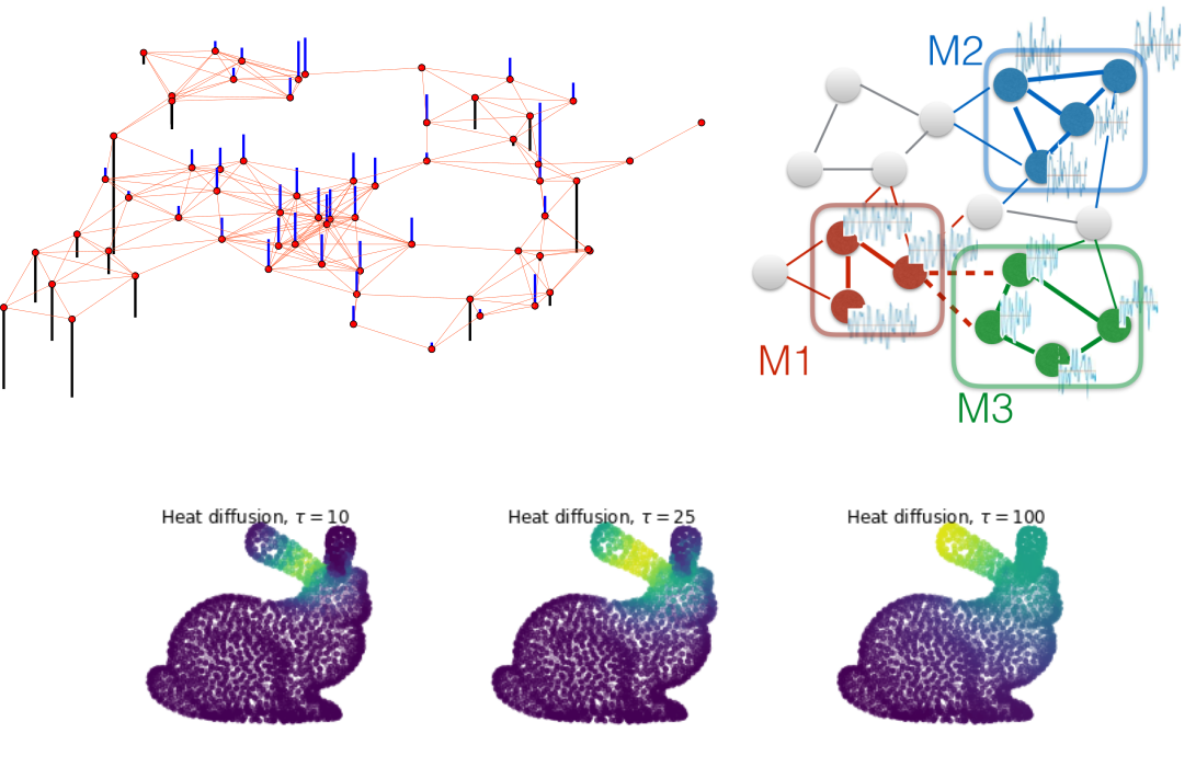
Benjamin Ricaud is an Associate Professor and Group Leader in Machine Learning at UiT The Arctic University of Norway's Department of Physics and Technology. His core affiliations include membership in the Machine Learning Group, Visual Intelligence center, and co-directorship of the Digital Technology Innovation Lab focused on Arctic-region tech startups. He also co-chairs the annual Northern Light Deep Learning conference. Ricaud's research spans: Fundamental ML : Graph signal processing, explainable AI, and generative models Applications : Microfossil classification, medical diagnostics (retinal aging), drug analysis, and climate data interpretation Emerging domains : Self-supervised learning and biological data analysis using Raman spectroscopy His recent publications (2020-2025) cluster in three domains: Graph ML methodologies (35%) Biomedical/biological applications (40%) Geoscience/climate informatics (25%) with consistent focus on interpretability and real-world data challenges. Teaching includes Image Processing (FYS-2010), Pattern Recognition (FYS-3012), and Machine Learning (FYS-2021). He leads outreach initiatives developing AI exhibits for Tromsø Science Centre.
Julian Adamek is a computational cosmologist and lead developer of gevolution , a general-relativistic N-body code for cosmological simulations. His work focuses on modeling relativistic effects in cosmic structure formation to better understand gravity’s role on large scales and dark energy. Research Interests: Computational Cosmology, Theoretical Cosmology, Large-scale structure of the Universe, Relativistic N-body simulations. Technical Leadership: Lead developer of gevolution , a public cosmological simulation code available via GitHub. Recent publications span diverse applications of deep learning in geospatial analytics, environmental monitoring, and computer vision, including phenology modeling, biomass mapping, conflict assessment, and 3D reconstruction from point clouds. Key Trends: Integration of AI/ML for environmental tasks, cross-domain applications (cosmology, ecology, forestry), and satellite data processing. Technical Focus: Transformer networks, diffusion models, super-resolution imaging, and ensemble learning for uncertainty quantification. Julian collaborates with researchers in cosmology and geospatial science, though specific students or awards are not mentioned in the provided texts.
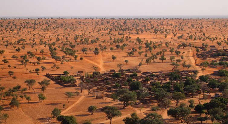
Ankit Kariryaa is a Tenure Track Assistant Professor at the Department of Computer Science and Department of Geosciences and Natural Resource Management , University of Copenhagen. His work bridges Machine Learning and Environmental Informatics , focusing on remote sensing, geospatial analysis, and ecological modeling. University of Copenhagen, Denmark Machine Learning Section, Department of Computer Science Geography, Land, Environment and Society, Department of Geosciences Kariryaa specializes in applying deep learning and computer vision to environmental challenges. His research includes: Automated tree detection and biomass estimation via satellite imagery Multi-modal geospatial representation learning Monitoring farmland tree decline and carbon sequestration potential Agroforestry system mapping using AI Developing AI tools for climate policy and sustainability Recent work trends show a focus on quantum-inspired machine learning , environmental monitoring , and cross-cultural AI applications . His 15 most recent publications span topics in remote sensing , ecological modeling , and AI ethics , with methods ranging from neural networks to tensor-based learning. He collaborates across disciplines, notably with researchers in ecology , climate science , and quantum computing . His outreach includes seminars on AI in agroforestry and ecosystem management , while his team contributes to global tree resource databases like TreeSense.
Anton Rozhkov is an Industry Assistant Professor and Director of the M.S. in Applied Urban Science and Informatics Program at the Center for Urban Science and Progress (CUSP) at New York University (NYU) Tandon School of Engineering. His work focuses on applying geospatial tools, modeling techniques, and data science to address complex challenges in urban environments, with particular emphasis on infrastructure planning and city design. Dr. Rozhkov earned his Ph.D. in Urban Planning and Policy from the University of Illinois Chicago, where his research centered on decentralized and renewable energy systems in urban contexts through a complex systems approach. Prior to his doctoral studies, he received an M.S./B.S. in Engineering in Land Cadaster from the State University of Land Use Planning in Moscow, Russia, and worked as a senior specialist in the Russian power grid sector with "Rosseti" Group of Companies. His research interests span the application of complex systems, data science, and spatial analytics to solve urban challenges, particularly focusing on how data-driven policies and new technologies can transform infrastructure planning and city design. Dr. Rozhkov employs methods including causal loop diagrams, system dynamics, and agent-based modeling to understand how decentralized energy systems interact with existing power grids and contribute to sustainable urban development. He has published extensively on urban transportation, energy systems, and census data analysis, with a notable focus on Chicago's urban landscape and Illinois state initiatives. Dr. Rozhkov has been actively involved in several significant research projects including an empirical investigation into affordable transit-oriented development in California sponsored by the California State University Transportation Consortium, the Sustainable Urban-Regional Modeling Network project funded by the Illinois Innovation Network, and the Census 2020 Map-The-Count project with the Illinois Department of Human Services which developed predictive models for census response rates and a GIS platform for reporting outreach activities. Ph.D. in Urban Planning and Policy, University of Illinois Chicago M.S./B.S. in Engineering in Land Cadaster, State University of Land Use Planning (Moscow, Russia) His teaching portfolio includes courses on geographic information systems (GIS), advanced spatial analysis, decision modeling, and machine learning for cities. Dr. Rozhkov emphasizes not just understanding urban trends but exploring the "why" behind these trends to develop sustainable solutions. His recent publications (2020-2025) demonstrate a consistent research trajectory examining the complex interrelationships between urban infrastructure systems, particularly focusing on energy, transportation, and spatial patterns through sophisticated analytical methods. Outside of his academic work, Dr. Rozhkov is passionate about urban and landscape photography, traveling, running, snowboarding, and playing guitar. He was born and raised in Balashikha, a city in the Moscow suburbs in Russia, and maintains a gallery of his photographic work from various global locations.
Dr. Debraj Roy is a Visiting Professor at the University of Amsterdam (UvA), affiliated with the Faculty of Science, Mathematics and Computer Science and the Informatics Institute. His research focuses on agent-based modeling, socio-economic dynamics, environmental resilience, and blockchain technology. He investigates complex systems such as urban slums, disaster recovery, and climate adaptation using computational methods like remote sensing and machine learning. His work bridges theory and practice, offering insights into policy design for sustainable development and social equity. Key research interests include slum dynamics, poverty traps, and the application of blockchain oracles for decentralized systems. He employs advanced techniques such as global sensitivity analysis and manifold learning to explore multi-scale socio-environmental challenges. His recent articles highlight trends in carbon pricing, flood risk valuation, and multi-agent systems. Earlier work concentrated on urban inequality in cities like Bangalore and Mexico City, leveraging geospatial and statistical tools. No scientific awards or grants are explicitly listed. His advising and team collaborations are unspecified in the provided text.
Dr. Steven Manson is a Professor in the Department of Geography, Environment, and Society at the University of Minnesota's College of Liberal Arts, where he also served as Associate Dean for Research and Graduate Programs. He directs the Human-Environment Geographic Information Science (HEGIS) laboratory and leads major data science initiatives like the National Historical Geographic Information System (NHGIS) and IPUMS Terra. PhD in Geography, Clark University (2002) BA Honours in Geography, University of Victoria (1995) His research focuses on geographic information science and human-environment systems , using agent-based modeling and big data to analyze land use change, urban dynamics, and sustainability challenges. Recent work explores spatiotemporal data harmonization and geospatial cyberinfrastructure . The articles reveal trends in GIScience methodology , urbanization analysis , and data-intensive sustainability research . Key contributions include self-organizing map applications for health data and hybrid statistical-GIS techniques for environmental policy. Scientific accolades include: Ecological Society of America Sustainability Science Award NASA Earth System Science Fellow McKnight Land Grant Professorship As Principal Investigator for NHGIS and IPUMS Terra, he secured over $40M in NSF, NIH, and DOJ grants for spatiotemporal data infrastructure. Outreach initiatives include developing open geospatial textbooks adopted globally and collaborating with Twin Cities K-12 programs.
Dr. Adnan Rajib is an Assistant Professor of Civil Engineering at The University of Texas at Arlington, leading the H2I Lab (Hydrology & Hydroinformatics Innovation Lab). His research focuses on large-scale hydrology, water quality modeling, and integrating artificial intelligence with remote sensing data to address climate change impacts on water resources. He actively advises doctoral, master's, and undergraduate students in projects related to flood resilience, wildfire hydrology, and nature-based solutions. Dr. Rajib has secured significant grants from NASA, NSF, and USDA, totaling over $4 million, including a major NASA initiative to predict wildfire effects on freshwater supplies and a DOE-funded Coastal Bend Climate Resilience Center. His work spans collaborations with international organizations like the United Nations University and The Nature Conservancy. Key contributions include global studies on floodplain alterations, wetland-mediated nitrate reductions, and the development of cyberinfrastructure tools for open science. He serves on the editorial board of environmental journals and professional committees, including the American Society of Civil Engineers' Wetland Hydrology Technical Committee. His teaching emphasizes advanced topics in civil engineering and research mentorship, with courses like 'Topics in Civil Engineering' and dissertation advisement. Dr. Rajib's lab integrates cutting-edge hydroinformatics to advance climate resilience strategies for vulnerable communities.
Thierry Badard is an Associate Professor at the Department of Geomatics Sciences , Université Laval, where he also serves as Director of the Center for Research in Geospatial Data and Intelligence (CRDIG) . With over 28 years of experience in geospatial science, he leads research initiatives at the intersection of GeoAI , LiDAR processing , and smart city technologies . Director, CRDIG (2016-2022) Steering Committee Member, Big Data Research Centre (CRDM) Researcher, Institute for Intelligence and Data (IID) Research Expertise spans geospatial big data, GeoNLP, and IoT applications for digital twins. His work addresses flood risk modeling , 3D urban analytics , and environmental monitoring through AI-driven solutions. Recent publications focus on contrastive learning for LiDAR segmentation and geospatial ontologies for early warning systems. Grant Leadership includes collaborative projects on smart insurance analytics (2018-2025), Arctic bioaerosol research (2019-2025), and Quebec-Morocco digital twin partnerships (2022-2023). He has advised 15+ graduate students in geomatics and related fields.
Jacques Gautier is an Assistant Professor in Geovisualization at LASTIG, part of the French National Geographic Institute (IGN France) since September 2020. He is a member of the GEOVIS research team focusing on advanced geovisualization techniques for spatio-temporal data analysis. Prior to his current position, he served as a Postdoctoral Researcher at LASTIG working on the Urclim European project, developing geovisualization methods for climate data in urban environments. His educational background includes a PhD in Geography from Université Grenoble Alpes (2015-2018), where his dissertation focused on "GrAPHiST: An exploratory analysis approach for identifying the dynamics of spatio-temporal phenomena," and an Engineering degree in Geographical Information Science from ENSG (2009-2012). Dr. Gautier's research focuses on innovative approaches to visualize complex spatio-temporal data across multiple domains. His expertise spans meteorological data visualization, epidemiological data visualization, 2D/3D geovisualization techniques, and exploratory data analysis of spatio-temporal phenomena. He has developed specialized methods for identifying cyclic patterns in time-series data, visualizing uncertainty in ensemble forecasting systems, and creating interactive visualization environments for domain experts in urban planning, public health, and emergency response. Analysis of Dr. Gautier's publication record reveals a consistent focus on developing visualization techniques that bridge theoretical advances with practical applications. His work spans urban climate analysis, pandemic response (particularly during COVID-19), and mountain rescue operations. A distinctive aspect of his research is the integration of harmonic analysis with visual exploration to identify cyclic patterns in spatio-temporal data, as demonstrated in his GrAPHiST framework. Dr. Gautier has been actively involved in several significant research projects including ORACLES (focusing on ensemble forecasts of marine submersion), Urclim (aiming to develop integrated Urban Climate Services), and Choucas (an interdisciplinary project to assist mountain rescue operations). These projects highlight his ability to translate visualization research into practical decision-support tools for critical situations. As a member of the GEOVIS research team, Dr. Gautier contributes to advancing geovisualization methodologies through both theoretical development and practical implementation. His work on mixed temporal diagrams, helical time representations, and uncertainty visualization has provided new approaches for exploring complex spatio-temporal datasets across multiple disciplines.
Veronica J. Berrocal is an Associate Professor in the Department of Biostatistics at the University of Michigan School of Public Health. Her work focuses on developing statistical methods for spatial, spatio-temporal, and longitudinal data with applications in environmental health, atmospheric sciences, and medical fields including rheumatology and reproductive endocrinology, contributing to public health protection through research and EPA advisory roles. Her educational background includes: PhD in Statistics from the University of Washington (2007) MSc in Statistics from Michigan State University (2002) Dr. Berrocal specializes in creating statistical models for dependent data structures, particularly spatial and spatio-temporal frameworks. Her research addresses environmental determinants of health such as air pollution, weather patterns, built environment, and socio-economic factors, with direct applications in atmospheric sciences, environmental epidemiology, and medical domains like rheumatology and reproductive health. She develops hierarchical models for environmental risk prediction, calibrates geophysical models, and leverages complex data sources including social media for exposure assessment. Her recent publications (2016-2019) demonstrate consistent methodological innovation in spatial statistics applied to critical public health challenges. Key themes include nonstationary spatial prediction for environmental resources, distributed lag modeling of pollutant interactions, and advanced spatio-temporal frameworks for fMRI and urban pollution mapping. Her work bridges statistical theory with practical health impact assessments across atmospheric science, environmental epidemiology, and medical imaging domains.
Robert P. Anderson is a Professor of Biology in the Division of Science at City College of New York (CCNY), part of the City University of New York (CUNY) system. His research laboratory is located in Marshak Science Building (Room 810), with additional affiliation as a Research Associate at the American Museum of Natural History (AMNH) Mammalogy Department. As a Highly Cited Researcher (2019-2023) and AAAS Fellow (2023), he leads an interdisciplinary biogeography research program focused on modeling species niches and distributions. Dr. Anderson's research spans biodiversity modeling, biogeography, and ecology with specialization in mammals. His lab develops ecological modeling software widely applied in conservation biology, invasive species management, zoonotic disease studies, and climate change impact assessments. Key research themes include: Characterizing spatial configuration of environmental suitability for species Developing machine learning approaches (particularly Maxent) for species distribution modeling Studying climate change effects on biodiversity Conservation applications of biogeographic models Neotropical mammal systematics and ecology His work has resulted in significant software contributions including Wallace, ENMeval, and spThin, with recent publications emphasizing methodological improvements in species distribution modeling and conservation applications. The lab maintains active projects funded by NASA and the National Science Foundation, focusing on small mammals of North and South America. Scientific recognition includes: AAAS Fellow (2023) Web of Science Highly Cited Researcher (2019-2023) Blavatnik Science Scholar (New York Academy of Sciences) Most Downloaded Paper in Ecography (2023-2024) Most Cited Paper in Ecography (2023) Dr. Anderson mentors graduate students through the CUNY Graduate Center and CCNY Master's programs, with recent advisees receiving prestigious awards including the ASM Horner Award and NASA FINESST Fellowship. His lab trains students in environmental biology through interdisciplinary research combining fieldwork, morphology, climatology, remote sensing, physiology, and genetics. Current lab members include Andrew Gaier (NASA Fellow), Mariano Soley-Guardia, and Kass (lead author on highly cited Wallace v2 paper). The Anderson Lab operates from CCNY's Marshak Science Building as part of the university's biodiversity group studying ecology, evolution, and geography of life on Earth. The lab emphasizes software co-design between end-users and developers to enhance conservation utility, with recent work focusing on neighborhood approaches for range estimation and operationalizing expert knowledge in species assessments.
Dr. Penina Axelrad is a University of Colorado Distinguished Professor and Joseph T. Negler Professor of Aerospace Engineering Sciences at the University of Colorado Boulder. She has held academic roles since 1992, serving as Department Chair from 2012–2017. A member of the National Academy of Engineering since 2019, her research focuses on GNSS technology, satellite navigation, and remote sensing applications. She has authored over 223 publications and secured $17.5M in research grants. Education: Ph.D., Aeronautics and Astronautics, Stanford University, 1991 S.M., Aeronautical and Astronautical Engineering, MIT, 1986 S.B., Aeronautical Engineering (Avionics Option), MIT, 1985 Research Interests: Global Navigation Satellite Systems (GNSS), multipath mitigation, GNSS reflectometry, orbital dynamics, and quantum sensing for Earth science. Her work bridges astrodynamics, satellite navigation, and environmental monitoring. Awards: Member, National Academy of Engineering (2019) Women In Aerospace Educator Award (2016) Institute of Navigation Samuel Burka Award (2012) AIAA Summerfield Book Award (2011) Advising & Grants: Advised numerous students (no names listed) and led major grants including NASA Quantum Pathways Institute and Sentinel-6 orbit determination projects. Active in Institute of Navigation leadership roles. Labs/Teams: Colorado Center for Astrodynamics Research (CCAR), Quantum Pathways Institute, and collaborative efforts on CubeSat atomic clock experiments.