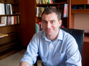
Michael Baldea is an Associate Professor in the Department of Chemical Engineering at the University of Texas at Austin . He holds a Ph.D. in Chemical Engineering from the University of Minnesota (2006), with prior degrees from 'Babeş-Bolyai' University in Romania (M.Sc. 2001, Diploma 2000). His research group develops theoretical and computational methods for Process and Energy Systems Engineering , focusing on integrated decision-making, performance optimization, and process intensification with industrial validation. Education: Ph.D., Chemical Engineering, University of Minnesota (2006) M.Sc., Interface Process Engineering, 'Babeş-Bolyai' University (2001) Diploma, Chemical Engineering, 'Babeş-Bolyai' University (2000) Research Thrusts: Integrated decision-making in chemical/energy supply chains Process performance monitoring and optimization Process integration and intensification Key applications include grid-responsive chemical plants, intensified distillation/column designs, and renewable energy integration for building systems. Scientific Awards: Frank A. Liddell, Jr. Fellowship NSF CAREER Award (2015-2020) Moncrief Grand Challenges Faculty Award (2014) AIChE Outstanding Young Researcher Award (2017) Implementation : His group has translated research into commercial tools through partnerships with industrial test beds and is working to integrate methods into commercial simulators. They explore predictive approaches for building energy management and strategic capital investment analysis in next-generation energy systems.
Professor Andrew Hudson-Smith is the Director of the Bartlett Centre for Advanced Spatial Analysis (CASA) at University College London (UCL), where he holds the title of Professor of Digital Urban Systems. He leads UCL's academic and applied research in smart cities, digital twins, and urban informatics. His roles include Editor-in-Chief of the Future Internet Journal and academic lead for the Smart Queen Elizabeth Park project. He contributes to strategic initiatives such as the Greater London Authority Smart London Board and EPSRC Digital Economy Programme Advisory Board. Education: PhD (2003), MSc (1996) from UCL; BSc in Geography from the University of Plymouth (1992). Research focuses on digital urban systems, IoT applications, sustainable urban planning, and cyberphysical systems. Notable projects include urban heat island monitoring, participatory planning platforms, and metaverse-driven urban design. His work bridges technology, art, and public engagement, exemplified by initiatives like Tales of Things and the Haggle-O-Tron. Recent publications emphasize digital twins, metaverse urbanism, and IoT integration in urban environments. Awards include a Fellowship of the Royal Society of Arts. His work addresses SDGs 3 (Good Health) and 11 (Sustainable Cities), with a focus on equitable smart city development and public space innovation.
Professor Isabella Alexander is a distinguished legal historian and intellectual property scholar at the University of Technology Sydney (UTS), Faculty of Law. She specializes in copyright law with a particular focus on its historical dimensions and application to cartography and visual works. As a leading researcher in her field, she holds significant research grants including ARC Discovery projects on copyright law in the 21st century and copyright in cartography. Her educational background includes: PhD from the University of Cambridge LLB (Hons) from the Australian National University BA (Hons) from the Australian National University Professor Alexander's research explores how laws inform and regulate the creation, circulation and reception of knowledge and culture from a historical perspective. Her work bridges legal history with contemporary intellectual property challenges, particularly in areas of copyright for visual works, cartography, and digital creativity. She has made significant contributions to understanding the historical development of copyright principles and their application to modern technological contexts. An analysis of her recent publications reveals a strong focus on the intersection of copyright law with visual culture, cartography, and emerging digital challenges including AI-generated content and memes. Her work demonstrates a clear trajectory toward interdisciplinary approaches that connect historical legal frameworks with contemporary technological and cultural phenomena, showing increasing engagement with how historical understanding can inform solutions to modern intellectual property challenges. Her notable scientific achievements include: 2023 LSAANZ Award for published scholarly book/monograph for "Copyright and Cartography: History, Law, and the Circulation of Geographical Knowledge" Professor Alexander has secured significant research funding as Lead Chief Investigator on the ARC Discovery grant "Hacking Copyright Law in the 21st Century: Art, Law, History and Technology" and as sole Chief Investigator on "Copyright and Cartography: Understanding the past, shaping the future." She has actively contributed to policy development through submissions to the Australian Productivity Commission's Inquiry into IP Arrangements and on addressing copyright infringement online through secondary liability and website blocking mechanisms. She currently serves as President of the Australian and New Zealand Law and History Society and is a member of the Governing Board of the International Society for the History and Theory of Intellectual Property, demonstrating her leadership and influence in both national and international academic communities.
John Paisley is an Associate Professor of Electrical Engineering at Columbia University's Fu Foundation School of Engineering and Applied Science, and a member of Columbia's Data Science Institute (DSI). He holds a B.S., M.S., and Ph.D. in Electrical and Computer Engineering from Duke University (2004-2010), followed by postdoctoral research in Computer Science at Princeton University and UC Berkeley. His research focuses on Bayesian models, posterior inference techniques for Big Data, and applications in data analysis, recommendation systems, information retrieval, and compressed sensing. He has pioneered methods like Bayesian Gaussian Process ODEs and Double Normalizing Flows, with recent work emphasizing uncertainty quantification in environmental modeling and neuroimaging analysis. His collaborative workflows (e.g., bneR ) address air pollution exposure and PM2.5 concentration uncertainties, combining Bayesian nonparametric ensembles with geospatial data. He has also developed frameworks for neural network interpretability, image denoising, and compressed sensing MRI. Paisley's work bridges statistical theory and applied machine learning, with applications in healthcare, environmental science, and geophysics. His academic contributions include over 50 publications since 2016, spanning topics like deep metric learning, adversarial learning, and variational inference optimization. He maintains an active research group and serves on editorial boards for machine learning and signal processing journals.
Sanjay Purushotham is an Assistant Professor in the Department of Information Systems at the University of Maryland Baltimore County (UMBC), with a PhD in Electrical Engineering from the University of Southern California (USC) and a postdoctoral background in Computer Science at USC's Integrated Media Systems Center (IMSC). His research focuses on machine learning, data mining, and their applications in biomedical informatics, social network analysis, and multimedia data mining. Key contributions include survival analysis models using pseudo values and federated learning frameworks for healthcare data. He has received awards including the Best Paper Award at SIGSPATIAL 2014 and a Best Poster Runnerup at SCMLS 2016. Education: PhD in Electrical Engineering (USC), Postdoc in Computer Science (USC) His work spans interdisciplinary areas such as domain adaptation for remote sensing, thermal face translation, and interpretable neural networks for medical applications. Recent projects include federated survival analysis models and climate-informatics frameworks for cloud property retrieval. He teaches courses in artificial intelligence, healthcare informatics, and statistical learning at UMBC. Research highlights include developing MedFuseNet for multimodal medical question answering and VDAM for multi-sensor cloud data analysis. His work on fair survival analysis models addresses algorithmic bias in healthcare predictions. Current grants include a NSF CAREER award for trustworthy federated learning in computational healthcare.
Yang Zhou is an Associate Professor in the Department of Computer Science and Software Engineering at Auburn University, part of the Samuel Ginn College of Engineering. His research focuses on big data algorithms, machine learning, data mining, and distributed computing. He has contributed to advancements in federated learning frameworks, graph mining tools, and spatial machine learning for environmental applications like flood mapping. Education includes a Ph.D. in Computer Science from Georgia Tech (2021), M.E. in Computer Application Technology from Chongqing University (2016), and B.E. in Engineering from Jiangnan University (2014). His work emphasizes scalable algorithms for large-scale systems, with tools like DirDense for dense subgraph mining and FedASMU for federated learning optimization. Recent publications explore adversarial robustness, blockchain strategies in IoT, and curriculum-based learning for large language models. He advises on interdisciplinary projects at the intersection of AI and environmental science.
Clio Andris is an Associate Professor at Georgia Tech, jointly appointed in the School of City and Regional Planning and the School of Interactive Computing. She directs the Friendly Cities Lab, focusing on mathematical models of social networks applied to urban planning, transportation, and geography. Her work integrates spatial analysis with visualization, emphasizing interdisciplinary collaboration. Education and Career: Andris earned a PhD in Urban Information Systems from MIT (2011), where she was an NDSEG Fellow. She held postdoctoral positions at Singapore-MIT Alliance for Research and Technology and the Santa Fe Institute. Prior to Georgia Tech, she was a faculty member at Penn State’s Department of Geography, affiliated with the GeoVISTA Center. Research Focus: Her research bridges social networks, geovisualization, and urban informatics. Key areas include spatial social network analysis, GIS applications for urban policy, and the impact of digital tools on civic engagement. She has developed innovative visual analytics tools like SNoMaN and ROBIN to democratize spatial data exploration. Awards: She received the NSF CAREER Award (2021) and NDSEG Fellowship (2011). Her lab is affiliated with the Center for Spatial Planning Analytics and Visualization (CSPAV) and the Information Visualization Lab. Labs and Collaborations: The Friendly Cities Lab focuses on socially just urban design through computational methods. Her work addresses issues like food security networks, pandemic impacts on biodiversity, and community mapping for activism. Grants and Outreach: Her NSF-funded projects emphasize public good applications, such as real-time pandemic risk communication and educational tools for migration data. She actively collaborates with non-profits and policymakers to translate research into actionable urban strategies.
Huamin Qu is a Chair Professor in the Department of Computer Science and Engineering at the Hong Kong University of Science and Technology (HKUST). He serves as the Founding Dean of the Academy of Interdisciplinary Studies (AIS), Founding Head of the Division of Emerging Interdisciplinary Areas (EMIA), and was the Founding Acting Head of Computational Media and Arts (CMA) at HKUST(GZ). Qu directs the VisLab and coordinates the Human-Computer Interaction (HCI) group. He obtained his BS in Mathematics from Xi'an Jiaotong University and MS/PhD in Computer Science from Stony Brook University. Qu's research integrates Data Visualization , Human-Computer Interaction , and Human-Centered AI , with applications in urban informatics, social networks, and explainable AI. His work focuses on developing interactive systems for big data analytics, visual storytelling, and AI-driven decision support. Research extends to multimodal communication, fintech, and augmented reality applications. His publications emphasize visual analytics for complex datasets (mobility, social media, financial), interaction techniques for immersive environments, and AI-enhanced visualization tools. Recent works explore explainable AI interfaces and large-scale data communication frameworks. IEEE Visualization Academy (2020) IEEE VGTC Technical Achievement Award AI 2000 Most Influential Scholar (2019, 2023, 2024) 21 Best Paper/Honorable Mention awards IBM Faculty Award (2009) APICTA Merit Award (2015) Yelp Dataset Grand Prize (2018) Qu has advised 48 PhD graduates (21 now faculty at institutions like UC Davis, University of Minnesota, Texas A&M) and 30 MPhil students. He secured major grants including RGC theme-based projects (digital citizenship, air pollution), UGC AoE (slope safety), and China's 973 Program. As VisLab director, he leads 20+ researchers in visualization/HCI projects adopted by Microsoft, IBM, Huawei, and Tencent.
Laura Vaughan is Professor of Urban Form and Society and Director of the Space Syntax Lab at The Bartlett School of Architecture, University College London. Her research examines the relationship between urban form and society using space syntax methodologies, addressing critical urban challenges including spatial inequalities, health disparities, poverty, housing, and socioeconomic vitality. She maintains active policy engagement through memberships in the West Yorkshire Scientific Advisory Group and as Chair of the International Space Syntax Executive Committee. Education includes: Doctor of Philosophy, University of London (1995-1999) Master of Science, University of London (1992-1994) Bachelor of Design, Bezalel Academy of Arts and Design (1985-1989) Her research integrates space syntax methodology with urban geography and architecture to analyze how spatial configurations influence social patterns. Key interests include the historical evolution of urban segregation mechanisms, morphological predictors of community vitality, and geospatial determinants of public health outcomes. She maintains cross-disciplinary collaborations spanning public health, history, anthropology, and urban planning. Publication trends show consistent focus on urban morphology's societal impacts, with recent work emphasizing longitudinal health studies, historical cartography, and high street resilience. Methodological innovations include developing individual-level environmental exposure metrics and integrating geospatial analysis with cohort studies. Research consistently demonstrates how spatial configurations mediate social processes across temporal scales. Scientific recognition includes: Fellow of the Royal Geographical Society (elected 2005) Fellow of the Royal Historical Society (elected 2015) As Director of the Space Syntax Lab, she leads research on socio-spatial systems and advises PhD students. She teaches the 'Urban Form and Society' module in the MSc/MRes Space Syntax program, exploring urban design's relationship with crime, health, and inequality. Her pedagogical approach emphasizes integrating research with design practice and historical analysis.
Xi Gong is an Associate Professor in the Department of Biobehavioral Health and the Institute of Computing and Data Sciences at Pennsylvania State University, where he leads the Gong Lab. His research focuses on Geospatial Data Science, integrating GIScience, computational methods, and statistical analysis to study environmental health and social dynamics. He holds a PhD in Geographic Information Science from Texas State University, an M.Sc. from the University of Chinese Academy of Sciences, and a B.Eng. from Wuhan University. Dr. Gong's research interests include spatio-temporal data mining, environmental exposure modeling, and visual analytics for big data. His work bridges Environmental Health Science (EHS) and Spatially Integrated Social Science (SISS), addressing public health concerns through geospatial modeling and interdisciplinary collaboration. He currently accepts graduate students and postdoctoral scholars for projects in Geospatial Data Science and EHS. Education: PhD (2016, Texas State University), M.Sc. (2011, University of Chinese Academy of Sciences), B.Eng. (2008, Wuhan University) Labs/Teams: Director of Gong Lab, focused on geospatial big data analysis for health and environmental studies Advising: Mentors PhD and MS students in Biobehavioral Health and related fields
Dr. Farha Sattar is a Lecturer in Education (Mathematics) at the Faculty of Arts and Society, Charles Darwin University. With over thirty years of teaching experience in Mathematics, Science education, GIS, Remote Sensing, and e-Learning technologies at undergraduate and postgraduate levels, Dr. Sattar brings extensive expertise to her academic role. She holds a PhD in Geospatial Science from Charles Darwin University, focusing on Spatial Mathematical Modelling for 3D Gully Mapping and Erosion Quantification. Her educational background includes: PhD in Geospatial Science (Three Dimensional Gully Mapping and Erosion Quantification within a Geoinformatics Framework), Charles Darwin University (2012) Prior academic experience at several Asian and European universities Dr. Sattar's research spans multiple interdisciplinary fields with a strong focus on the intersection of education and technology. Her primary research interests include Mathematics Education, STEM Education, Geoscience Education, Spatial Mathematical Modelling, Drone Technology, Remote Sensing, Geographic Information Systems, and Innovative Pedagogies such as experiential learning and inquiry-based approaches. She has developed expertise in cognitive development, particularly in fostering critical and creative thinking skills through iSTEM approaches. An analysis of Dr. Sattar's recent publications reveals a consistent trajectory toward integrating emerging technologies like drones, augmented reality, and geospatial artificial intelligence into educational contexts. Her work demonstrates a progression from foundational geospatial research on erosion mapping to innovative applications in STEM education. Recent publications increasingly focus on drone technology for educational purposes, spatial data infrastructure for policy development, and computational thinking development through technology-enhanced learning. Dr. Sattar has received numerous accolades for her contributions to education and research: NT Science Week Awards – Inspired NT STEM Hero of the Year award (2021) Long Service Recognition Award (2023) Finalist, CDU Alumni Award (2023) Multiple Best Presentation Awards (2008, 2010, 2017) Australian College of Educators - 2021 College Medal Nominee As a supervisor, Dr. Sattar mentors postgraduate research students including Ayesha Farhan, who is working on "A Framework for Cognitive Development: Fostering Critical and Creative Thinking Skills, Using iSTEM Approach." She actively secures research funding through various projects such as "DBELaSTEM: Drone-Based Experiential Learning and STEM Education," "STEM_D & VR: Youth STEM Learning and Empowerment with Drones and VR," and "CodProg Drone Lab." Her research is supported by grants from NT Government projects and other external funding sources. Dr. Sattar leads the CodProg Drone Lab, an innovative research space exploring drone technology applications in education. She is a certified drone pilot and aeronautical radio operator, which enables her to bridge theoretical knowledge with practical applications. Her work with the "Flying Forward: Drones, STEM Equity, and Indigenous Empowerment" initiative demonstrates her commitment to community engagement and addressing educational disparities through technology.
Clark Olson is a Professor in the Division of Computing & Software Systems at the University of Washington Bothell, part of the School of Science, Technology, Engineering & Mathematics. He earned his Ph.D. in Computer Science from UC Berkeley (1994), M.S. in Electrical Engineering (1990), and B.S. in Computer Engineering (1989) from the University of Washington, Seattle. Education: Ph.D. in Computer Science (2017) from University of California, Berkeley M.S. in Electrical Engineering (1990) from University of Washington, Seattle B.S. in Computer Engineering (1989) from University of Washington, Seattle His research focuses on computer vision, robot navigation, and clustering algorithms. He has developed techniques for Mars rover terrain mapping, subspace clustering, and geometric feature matching. His work bridges theory and application in autonomous systems and image analysis. Analysis of his publications reveals expertise in computer vision (8 papers), clustering algorithms (4 papers), and robotics (5 papers). Key subtopics include Mars exploration (3 papers), Hough transforms (3 papers), and probabilistic methods (3 papers). Professor Olson teaches courses ranging from introductory programming (CSS 161-162) to advanced topics in computer vision (CSS 487-587) and algorithm design (CSS 549). He also advises on the CSSE Capstone (CSS 497) projects requiring rigorous prerequisites and structured evaluation criteria.
Ahmed Eldawy is an Associate Professor in the Department of Computer Science at the University of California, Riverside. He leads groundbreaking research in databases, big data management, and spatial data processing, with a focus on scalable exploratory analytics through systems like Beast , UCR-Star , Raptor , and Spider . His work spans geospatial data infrastructure, distributed computing, and computational geometry. Research Interests : Databases, big data management, spatial data processing, geospatial analytics, distributed systems, computational geometry. Awards : NSF CAREER award (2021), 10-year Influential Paper Award (ICDE 2025), Best Demo award (SIGSPATIAL 2020). Grants : NSF (IIS-2046236, IIS-1954644, CNS-1924694), USDA (USDA NIFA 2020-69012-31914), UC Office of the President (M21PL3368). Labs & Centers : RAISE@UCR, Data Science Center, Center for Robotics and Intelligent Systems (CRIS), Affiliate of Center for Geospatial Sciences and Winston Chung Global Energy Center. His recent publications focus on LLM-driven geospatial visualization (LASEK), distributed raster analytics (RDPro), learned spatial query optimization, and scalable spatiotemporal systems. He advises numerous PhD and Master’s students, many of whom now work at top tech companies like Amazon, Microsoft, and Meta.
Prof. Christian Heipke is a distinguished academic serving as Dean of the Faculty of Civil Engineering and Geodetic Science at Leibniz University Hannover, Germany. He also holds the position of Executive Director at the Institute of Photogrammetry and GeoInformation (IPI), one of the leading research institutions in geospatial sciences within the faculty. His leadership extends across multiple committees including the Curriculum and Teaching Committee, Admissions and Examination Boards for Geodetic Science and Geoinformatics, and Navigation and Environmental Robotics. As a Professor at IPI, he maintains active research while overseeing significant academic and administrative responsibilities at the university. Professor Heipke's research spans multiple domains within geospatial sciences, with particular emphasis on: Advanced photogrammetric techniques and algorithms Remote sensing applications for environmental monitoring Computer vision approaches for geospatial data analysis Urban development monitoring using satellite imagery Machine learning applications in geoinformatics Disaster prediction and management systems His recent scholarly output reveals a strong focus on integrating cutting-edge computer vision and deep learning techniques with traditional photogrammetric methods. Analysis of his 15 most recent publications shows a clear trajectory toward more sophisticated AI-driven approaches for processing geospatial data, with particular attention to time-series analysis, uncertainty quantification, and multi-view systems. His work bridges theoretical advancements with practical applications in flood forecasting, deforestation monitoring, urban planning, and construction materials analysis. The geographic scope of his research has expanded significantly, with recent projects focusing on international case studies in the Philippines and tropical regions. Professor Heipke leads the Institute of Photogrammetry and GeoInformation, a major research hub that has celebrated 75 years of contributions to the field. His leadership extends to the Graduiertenkolleg 2159: "Integrity and Collaboration in Dynamic Sensor Networks," where he serves as a professor overseeing doctoral research. The institute maintains state-of-the-art facilities for processing satellite imagery, aerial photography, and developing novel algorithms for geospatial data analysis. Under his direction, the institute has strengthened its international collaborations and interdisciplinary research approaches, particularly in addressing Sustainable Development Goals through geospatial technologies.
Devis Tuia serves as Associate Professor at the Swiss Federal Institute of Technology Lausanne (EPFL), holding appointments in the Institute of Environmental Engineering (IIE) within the School of Architecture, Civil and Environmental Engineering (ENAC). He leads the Environmental Computational Science and Earth Observation Laboratory (ECEO) since 2020 and contributes to EPFL's Doctoral Program in Civil and Environmental Engineering. His academic journey began in Lausanne with studies at UNIL and EPFL, culminating in a PhD in remote sensing from UNIL. Postdoctoral research followed at institutions in Valencia, Boulder, and EPFL, focusing on machine learning model adaptation. He progressed from Research Assistant Professor at University of Zurich to Associate and Full Professor at Wageningen University before joining EPFL. Tuia's research bridges Earth observation with artificial intelligence, specializing in interpretable deep learning for environmental applications. His lab develops algorithms for making remote sensing accessible, with particular emphasis on digital wildlife conservation through automated censuses using drone and satellite imagery. Current projects tackle the 'black box' problem in environmental modeling while advancing spatial intelligence for sustainable urban development. His 2023-2025 publication portfolio reveals three dominant trends: (1) species distribution modeling using incomplete observations, (2) multimodal fusion of satellite/drone data with textual descriptions, and (3) interpretable AI frameworks for environmental decision-making. This work consistently addresses real-world challenges like wildfire forecasting and biodiversity monitoring. As an educator, Tuia supervises 12 current PhD students and has graduated 4 former EPFL doctoral candidates. His teaching portfolio includes Frontiers of Deep Learning for Engineers , Sensing and Spatial Modeling for Earth Observation , and Image Processing for Earth Observation courses. The ECEO laboratory maintains active collaborations with ESA-NASA initiatives and conservation organizations globally.