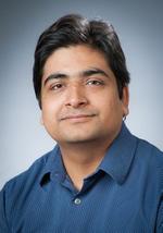
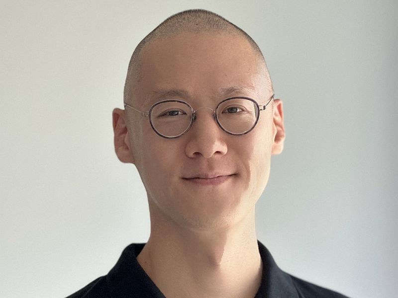
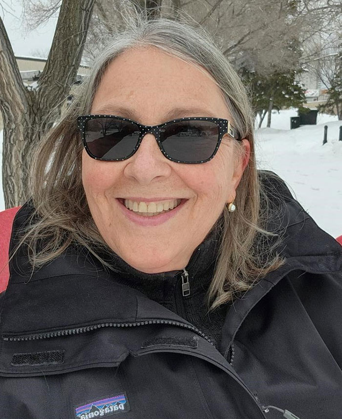
Derek T. Robinson is an Associate Professor at the University of Waterloo's Department of Geography and Environmental Management , specializing in land-use science, agent-based modeling, and geospatial analysis. His work integrates GIS, ecological models, and human decision-making to assess impacts of land policies on ecosystem services and human well-being. Research Interests : Land-use/cover change and carbon cycle dynamics Agent-based modeling of socio-ecological systems Exurban land management and fragmentation Ecosystem service quantification Land policy scenario analysis Teaching : Courses in spatial analysis, advanced GIS, and land-use-carbon interactions. His lab utilizes cutting-edge tools like ArcGIS, NetLogo, and UAV systems (e.g., Aeryon SkyRanger) for fieldwork and modeling.
Stephen Brooks is a Professor in the Faculty of Computer Science at Dalhousie University, actively contributing to research and education in computer graphics, visualization, and human-computer interaction. He is affiliated with the Human-Computer Interaction, Visualization & Graphics research cluster and currently supervises multiple graduate students on diverse projects. PhD in Computer Science, University of Cambridge (2004) MSc in Computer Science, University of British Columbia (2000) BSc, Brock University (1998) His research focuses on computer graphics and visualization, particularly non-photorealistic rendering, image editing, 3D geospatial systems, ocean visualization, and real-time rendering of natural phenomena. He has also worked in sound synthesis and motion editing. His recent publications show a strong emphasis on visual analytics, network flow visualization, and ocean science applications. His work spans interdisciplinary domains including environmental science, genomics, cybersecurity, and digital art. He has developed visualization tools for ocean science under a major CFREF-funded initiative and created novel methods for rendering stained glass, mixed media art, rivers, and ocean surfaces. His research integrates perception, automation, and user interaction to enhance visual analysis. Notable scientific contributions include work on tone mapping optimization, uncertainty visualization using chromatic aberration, semantic object clouds, and hybrid 2D/3D GIS. His publications appear in top venues such as IEEE TVCG, ACM Transactions, and SIGGRAPH. NSERC Discovery Grants Canada First Research Excellence Fund (CFREF) NSERC CREATE Mitacs Accelerate and Globalink CFI New Opportunities Grant Cyber Security Research and Development Grant He has supervised numerous PhD, Master’s, and undergraduate students in areas including ocean visualization, tone mapping, network security, VR, and geospatial analytics. He teaches courses in Game Design, Visualization, Computer Animation, and Network Computing, emphasizing project-based and interdisciplinary learning. He leads research in visual analytics for network data (FloVis), ocean science, and mixed reality collaboration. His lab develops interactive systems for data exploration in domains ranging from marine biology to cybersecurity. Future work includes expanding ocean-first climate visualization and enhancing mixed presence collaboration in immersive environments.
Tae J. Kwon is an Associate Professor in the Department of Civil and Environmental Engineering at the University of Alberta . His research spans Winter Transportation Engineering , Intelligent Transportation Systems (ITS) , Traffic Optimization , and Geospatial Information Science . Developed LoRWIS , a web-based decision support system for road weather sensor optimization Recipient of multiple awards including ITS Canada Excellence in Research and Development Award (2024) , KOFST Scientist of the Year (2024) , and Early Career Research Award (University of Alberta, 3 times) Active in professional committees like the TRB Surface Transportation Weather Research Group (2016–present) Research Highlights : Winter Road Maintenance : Advanced geostatistical and deep learning techniques for road condition monitoring Location Optimization : Pioneered models for RWIS sensor placement using hybrid geostatistical methods Intelligent Transportation Systems : Focused on big data applications for traffic safety and connected vehicles Climate Resilience : Integrated ecological vulnerability into fire hazard modeling Scientific Awards : ITS Canada Excellence in Research (2024) KOFST Scientist of the Year (2024) Donald Stanley Best Paper Award (2023) AKCSE Early Achievement Award (2021) University of Alberta Early Career Research Award (2020) Great Supervisor Award (2019) Teaching & Leadership : Teaches courses like CIV E 419 (Transportation Engineering: Highway Planning and Design) and CIV E 612 (Transportation Planning: Methodology and Techniques) Leads the Geospatial Transportation System & Sensing Solutions Lab (GeoTrans) , mentoring PhD students Juan Cuellar and Jiehao Bi Collaborates with agencies including Alberta Transportation , NSERC , and Iowa DOT
Dr. Indratmo is an Associate Professor and Chair of the Department of Computer Science at MacEwan University. He holds a PhD from the University of Saskatchewan, an M.Sc. from the University of Manitoba, and a B.Eng. from Petra Christian University. His research focuses on information visualization, human-computer interaction, and social computing, with a particular emphasis on developing tools for analyzing social media data. He has contributed to projects like a visual analytical tool for sentiment analysis in Edmonton's traffic-related social media data and studies on multimedia content effectiveness in communication strategies. Indratmo teaches a range of computer science courses, emphasizing student engagement through transparent pedagogical practices. His work bridges technical innovation with social impact, aiming to enhance communication strategies for organizations through data-driven insights. He has published extensively in journals like Big Data Research and Visual Informatics , and his research spans topics from educational visualization tools to smart mirror applications and geospatial heritage systems. Outside academia, he enjoys outdoor activities in the Canadian Rockies. Notable collaborations include work on stacked bar chart efficacy, web-based course registration models, and exploratory browsing frameworks. His research portfolio demonstrates a commitment to both theoretical advancement and practical applications in computing.
Margaret Kalacska is an Associate Professor in the Department of Geography at McGill University, leading the Applied Remote Sensing Lab. Her research focuses on advancing remote sensing technologies like hyperspectral imaging, Remotely Piloted Aircraft Systems (RPAS), LiDAR, and thermal imaging for environmental science and natural hazard monitoring. She has pioneered the use of RPAS-HSI systems, including developing Canada’s first fully operational RPAS-HSI for the Canadian Airborne Biodiversity Observatory (CABO) since 2018. Dr. Kalacska holds a PhD and MSc in Earth and Atmospheric Sciences from the University of Alberta. Her interdisciplinary work spans Canada, Brazil, Tanzania, Ghana, the Peruvian Amazon, Panama, Madagascar, and Costa Rica. Notable achievements include being the first Canadian woman to lead an airborne hyperspectral mission (MAC-13) in Costa Rica (2013) and receiving the Silver Medal from the Canadian Remote Sensing Society (2018). Her lab specializes in integrating cutting-edge remote sensing tools for biodiversity conservation, ecosystem monitoring, and disaster response. Recent projects include the Fish + Forest initiative studying aquatic habitats in Brazil and advancing custom RPAS for hyperspectral imaging. She also collaborates with the National Research Council of Canada and international organizations like NATO. Awards: Fessenden Prize (2014), Silver Medal (2018), Steacie Prize Nomination (2020) Key Projects: CABO, Fish + Forest , RPAS-HSI System Development Technologies: UAV LiDAR, Structure-from-Motion Photogrammetry, Satellite Data Validation Her research bridges environmental science and technology, emphasizing global applications in conservation and climate resilience.
Trevor Barnes is a Professor in the Department of Geography at the University of British Columbia (UBC), with affiliations to the Faculty of Arts and the Science and Technology Studies program. His work bridges historical geography, economic geography, and critical political ecology, focusing on the intersections of capitalism, colonialism, and spatial governance. Education: PhD in Geography, University of Minnesota (1983) MA in Geography, University of Minnesota BSc in Economics, University College London His research spans Cold War geographies, the role of geographers in intelligence work, colonial and capitalist environmental impacts, and the critical analysis of market-driven approaches to biodiversity. Recent publications examine ideological landscapes, pragmatist economic geography, and the legacies of influential geographers like Cole Harris and David Lowenthal. Key trends in his work include: Analysis of capitalist spatial practices in environmental governance Historical connections between academic disciplines and military-industrial complexes Decolonial approaches to knowledge production and land politics Critical engagement with GIS and big data in Cold War contexts Scientific awards include: Distinguished University Scholar Fellow of the Royal Society of Canada Fellow of the British Academy Barnes has supervised numerous doctoral students, including Max Cohen (PhD Geography, 2024, on Marx’s suppressed theory of history). His collaborations with scholars like Eric Sheppard and Brett Christophers have produced foundational texts on radical geography and economic theory. His fieldwork and archival research inform comparative studies of urban governance, including climate policy in Durban and Portland, and the socioecological impacts of infrastructure projects like the Trans Mountain Pipeline.
François Pomerleau is a full-time Professor at the Department of Computer Science and Software Engineering at Université Laval since 2017. His research focuses on 3D environment reconstruction , autonomous navigation , search-and-rescue robotics , and scientific methodology in robotics . He has held postdoctoral fellowships at the University of Toronto and Université Laval, with technology transfer experience at Alstom Inspection Robotics and Robotiq. Ph.D. in Mechanical Engineering (2013) from ETH Zurich M.Sc. in Electrical Engineering (2009) and B.Ing. in Computer Engineering (2006) from Université de Sherbrooke His research integrates robotics , computer science , and environmental monitoring , with a focus on point cloud registration , Lidar-based SLAM , and trajectory planning for unstructured environments. Recent work includes UAV-assisted terrain awareness , exposure time emulation for vision algorithms , and multi-season datasets for autonomous navigation . François’s recent publications emphasize 3D mapping , SLAM robustness , and environmental adaptation across forestry, subarctic, and alpine domains. His team develops tools for autonomous vehicles , search-and-rescue , and industry 4.0 . Scientific awards include Best Robotic Vision Paper Awards at CRV 2016 and 2020, a Best Paper Award at the ICRA 2024 Workshop, and recognition as a Distal Fellow of the NSERC Canadian Robotics Network (NCRN). He collaborates with industry partners like Robotiq and serves as Associate Editor for IEEE Robotics and Automation Letters , Frontiers in Robotics and AI , and IROS , while contributing to international program committees for robotics conferences.
Fedor Dokshin is an Assistant Professor in the Department of Sociology at the University of Toronto, Downtown Toronto (St. George) campus. His research bridges computational social science with environmental and political sociology, focusing on energy transitions, partisan dynamics, and social network structures. Key research areas include racial and income disparities in solar photovoltaic adoption, policy feedback mechanisms in renewable energy programs, and partisan influences on environmental decision-making. Fields of Study: Computational and Quantitative Methods, Environmental Sociology, Political Sociology, Social Networks Areas of Interest: Computational social science, Energy and the environment, Political polarization Research Trends: Dokshin's publications reveal a focus on energy justice, behavioral diffusion models, and political polarization. His work combines computational methods with environmental policy analysis, examining how socioeconomic factors and partisan identities shape renewable energy adoption. Articles demonstrate geographic heterogeneity in opposition to extraction projects, digital discourse analysis techniques, and institutional dynamics affecting scholarly knowledge production. Methodological Emphasis: Utilizes large-scale data analysis, spatial modeling, and automated textual analysis to explore energy-environment-society intersections. Research highlights the tension between technical solutions and social equity in energy transitions, with recurring themes of policy design, public engagement, and networked political behavior.
Dr. Kenneth Kent is a Professor in the Department of Computer Science at the University of New Brunswick (UNB), where he has served for 14 years. He is the Director of the Information Technology Centre (ITC) and heads the Reconfigurable Computing Group. He also serves as Director of the IBM Centre for Advanced Studies - Atlantic and holds an Honorary Professorship at Hochschule Bonn-Rhein-Sieg. His research focuses on hardware/software co-design, reconfigurable computing, virtual machines, and embedded systems. Dr. Kent earned his PhD and Master of Science in Computer Science from the University of Victoria. His work has led to over 100 refereed publications and the supervision of 70+ graduate students. He co-founded WEnTech Solutions Inc., a software firm addressing waste-to-energy optimization. His awards include the IBM Faculty Fellow of the Year and Project of the Year (as Principal Investigator) for contributions to the J9 Java Virtual Machine. His articles span FPGA acceleration, compiler optimization, cloud storage security, and IoT intrusion detection. Recent work emphasizes energy-efficient Node.js systems and advancements in CAD tools like VTR 9 for FPGA architecture. Dr. Kent’s advising and grants include leading the IBM CAS Atlantic and directing industry-academia collaborations. He has pioneered technologies such as the Eclipse OpenJ9 JVM and the CephArmor storage interface, balancing academic research with commercial innovation. He leads the Reconfigurable Computing Group at UNB and collaborates with the Institute for Visual Computing in Germany. His research bridges theoretical computing and practical applications, with a focus on scalable systems and embedded technologies.
Kshirasagar Naik is a Professor in the Department of Electrical and Computer Engineering at the University of Waterloo, Ontario. He is actively involved in graduate research supervision and has been a member of IEEE since 1994. His academic career spans decades, with a focus on wireless communication, energy efficiency, and cybersecurity. 1992, Doctorate in Computer Engineering from Concordia University, Ontario 1988, Master of Mathematics in Computer Science from University of Waterloo, Ontario 1983, MTech in Computer Engineering from Indian Institute of Technology, Kharagpur, India 1981, BScEng in Electronics and Telecommunication from Sambalpur University, India His research interests include Mobile and Ad Hoc Networks , Cybersecurity , Internet of Things (IoT) , and Intelligent Transportation Systems . He has published extensively on energy optimization in wireless devices, delay-tolerant networks, and security protocols for vehicular systems. Recent publications highlight the integration of Machine Learning and IoT in environmental monitoring, particularly forest fire detection and prediction. Other works focus on cybersecurity , vehicular networks , and energy optimization in data centers and handheld devices. Professor Naik is currently accepting graduate students for research in mobile systems, network protocols, and green computing at the University of Waterloo.
Dr. Chantel Chizen is an Assistant Professor in the Department of Soil Science at the University of Saskatchewan. Her research focuses on advancing sustainable land management through digital pedology, remote sensing, and geospatial methods. She investigates soil carbon dynamics, prairie wetland management, soil salinity, and soil data management, collaborating with farmers and institutions to bridge scientific insights with practical agricultural needs. Education : Ph.D. (Soil Science), University of Saskatchewan (2024) M.Sc. (Soil Science), University of British Columbia (2020) B.Sc. (Applied Plant and Soil Science), University of British Columbia (2018) Research emphasizes interdisciplinary approaches to soil stewardship, including fieldwork and technologies like machine learning. Key themes include soil variability in agroecosystems, salinity impacts on Prairie wetlands, and carbon sequestration strategies. Recent work highlights soil-landscape modeling and climate resilience in agricultural systems. Key Awards : Carbon Sequestration Research Fellow (2024) Teacher-Scholar Doctoral Fellow (2023) FFAR Future Leaders in Food & Agriculture (2021) Her publications address soil carbon dynamics, greenhouse gas emissions in potato farming, and labile carbon fractions in grassland restoration. Ongoing projects aim to integrate farmer feedback into soil data frameworks and improve Prairie wetland management practices.
Bishnu Acharya serves as an Associate Professor and Saskatchewan Ministry of Agriculture Chair in Bioprocess Engineering within the Department of Chemical and Biological Engineering at the University of Saskatchewan. His research program focuses on sustainable conversion of agricultural biomass into high-value products through advanced bioprocessing techniques, addressing critical environmental and energy challenges. His primary research domains include: Cellulose-based biomaterials and nanocomposites for biomedical and packaging applications Thermochemical conversion (pyrolysis, gasification) and biochemical processing of agricultural residues Engineered biochar systems for wastewater remediation and soil enhancement Integration of remote sensing and machine learning for precision agriculture optimization Development of biodegradable materials from flax, wheat straw, and camelina meal Analysis of his 2024-2025 publications reveals a strong interdisciplinary trajectory bridging chemical engineering, environmental science, and agricultural technology. Key thematic clusters involve circular economy implementation in biomass valorization, nanocellulose-based advanced material development, and sustainable wastewater treatment solutions. His work consistently emphasizes practical applications for Canadian agricultural systems, particularly in Saskatchewan and Prince Edward Island contexts. Professional Recognition: Saskatchewan Ministry of Agriculture Chair in Bioprocess Engineering While specific grant details are not publicly enumerated in available materials, Dr. Acharya's prolific output across high-impact journals indicates substantial research funding and active supervision of graduate students. His collaborations span environmental remediation, advanced materials development, and sustainable agricultural technologies, reflecting a systems-thinking approach to bioresource management. Laboratory infrastructure likely includes biomass processing units, nanomaterial characterization facilities, and bioreactor systems supporting his diverse research portfolio.
Dr. Bon Woo Koo is an Assistant Professor at the School of Urban and Regional Planning , Toronto Metropolitan University. His expertise lies in geospatial urban analytics, walkability, and GIS applications, focusing on urban design for public health equity and innovative data science tools. He holds a PhD in City & Regional Planning from Georgia Institute of Technology, a Master’s in Landscape Architecture from Seoul National University, and a Bachelor’s in Interior Design from Kookmin University. Education: PhD in City and Regional Planning, Georgia Institute of Technology Master of Landscape Architecture, Seoul National University Bachelor of Interior Design, Kookmin University Research Interests: Dr. Koo investigates urban environments’ impact on health and well-being, equity in environmental amenities (e.g., tree canopies), and advanced GIS techniques. He develops automated audit methods for walkability and explores spatial modeling for urban sustainability. His work bridges data science with policy, contributing to CDC health surveillance and smart city initiatives. Publications: His research appears in journals like Landscape and Urban Planning , Environment and Behavior , and Health and Place , with a focus on walkability audits, urban tree equity, and audio-based pedestrian sensing. Recent work addresses post-pandemic mental health and broadband equity strategies. Professional Engagement: He has advised the CDC’s technical panel on leveraging big data for health policy, presented at conferences like the Association of Collegiate Schools of Planning, and collaborated with institutions like Universitas Gadjah Mada and the Atlanta Regional Commission.
Dr. Hung Cao is an Assistant Professor of Computer Science at the University of New Brunswick, where he directs the Analytics Everywhere Lab. His work focuses on interdisciplinary research in Cyber-Physical Systems (CPS), IoT, Edge/Fog/Cloud Computing, and Explainable AI, addressing societal challenges through data-driven solutions. Prior roles include PostDoc Fellow and Data Scientist at the People in Motion Lab, UNB, and Lecturer/Researcher at Vietnam National University. He holds a Ph.D. in Geomatics Engineering (specializing in Data Science) from UNB (2020), an M.Sc. in Computer Science from University College Dublin (2015), and a B.Eng. from Vietnam National University (2011). Research interests span Smart Cities, Embedded AI, TinyML, Federated Learning, and Real-time Systems. He has led projects with Cisco, NB Power, and other industry partners to develop scalable analytics frameworks for IoT applications. Dr. Cao actively contributes to technical communities (IEEE Smart City, Edge Computing, etc.), serving as a reviewer for journals and conferences, and a Topic Editor for Electronics Journal . His innovations include the Analytics Everywhere framework for spatio-temporal data analysis, MACeIP platform for smart cities, and energy-efficient IoT systems for environmental monitoring. Current work emphasizes human-centered AI for healthcare diagnostics and industrial inspection systems.
Joni Storie is an Associate Professor in the Geography Faculty at the University of Winnipeg. She holds an office in Lockhart Hall (5L05) and teaches courses including Mapping in a Global World, Intro Remote Sensing, Advanced GIS, and Advanced Remote Sensing. Her research focuses on land-use/land-cover mapping, map automation with machine learning tools, spatial statistics, and terrestrial/aquatic resource management. Teaching expertise spans Regional & Physical Geography, Resource Conservation & Management, and Geomatics (GIS & Remote Sensing). Her work integrates geospatial technologies with environmental challenges, including flood mitigation, mangrove ecosystem analysis, and food environment patterning in urban areas. Research outputs emphasize remote sensing applications in coastal conservation, surface water detection, and vegetation dynamics. Over 13 peer-reviewed articles since 2004 demonstrate sustained academic contributions to geomatics and environmental geography. Current activities include advising on geomatics projects and contributing to the University of Winnipeg’s Geography program infrastructure.