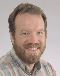
David Beltonمشاهده پروفایل
مدرس ارشد
- Laser Scanning
- Photogrammetry
- Remote Sensing
- +۵ مورد دیگر
Dr. David Belton is a Senior Lecturer in the School of Earth and Planetary Sciences at Curtin University, within the Faculty of Science and Engineering. He also holds a portfolio role in the Office of the Provost. His expertise lies in laser scanning (both terrestrial and mobile) and photogrammetry, with a focus on automated processing, feature extraction, and applications in mining, heritage conservation, and structural monitoring. Dr. Belton holds a BCSc, BSc (First Class Honours), and a PhD from Curtin University. His teaching responsibilities include coordinating and lecturing in Cartographical Statistics and Integrated Surveying, alongside previous roles in Mine Surveying and Mine Survey Project courses. He actively supervises PhD, MPhil, and Honours students, fostering research excellence in spatial sciences. His research emphasizes practical applications of geospatial technologies, including underwater photogrammetry, pipeline monitoring, and coral reef analysis. Key areas include robust statistical methods for point cloud processing, sensor calibration, and open-source device development for marine surveys. His work bridges theoretical advancements with real-world challenges in environmental monitoring, infrastructure assessment, and cultural heritage preservation. Publications span high-impact journals like Corall Reefs , ISPRS Journal of Photogrammetry , and IEEE Transactions , reflecting contributions to geomatics, remote sensing, and computer vision. His research often addresses interdisciplinary challenges, such as UAV-based ecological monitoring and automated 3D model reconstruction from laser scanning data. Dr. Belton collaborates widely, contributing to projects like the Sydney-Kormoran wreck analysis and heritage documentation of Pilbara rock art. His work underscores innovative solutions for spatial data challenges across environmental, engineering, and archaeological domains.