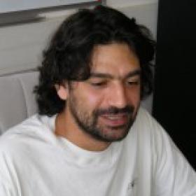
Gabriele Facciolo is a Professor at the Image Processing Group within ENS Paris-Saclay. His research focuses on advanced image processing techniques, computer vision, and remote sensing applications, with an emphasis on satellite imagery analysis. He is an active member of the ELLIS society, contributing to interdisciplinary research in computational imaging and geospatial technologies. His work bridges theoretical advancements and practical applications, including video restoration, super-resolution techniques, methane plume detection, and large-scale dataset development for environmental monitoring. Recent contributions highlight innovations in Gaussian splatting for Earth observation, GPU-accelerated stereo pipelines, and efficient annotation methods. His research often addresses challenges in low-latency systems, multispectral data fusion, and automated environmental monitoring. Key publications include breakthroughs in satellite image processing, methane detection algorithms, and novel datasets for shadow and visibility estimation. His methodologies are widely recognized for their impact on geospatial analysis and real-world applications in environmental science and industrial monitoring.
Dray Stéphane is a Senior Research Scientist (CNRS DR2) at Université Claude Bernard Lyon 1, affiliated with the Laboratoire de Biométrie et Biologie Evolutive (LBBE, UMR 5558). His research focuses on statistical ecology, combining multivariate analysis, spatial statistics, and computational tools to address ecological questions. Key areas include community ecology, population dynamics, and the impact of biotic/abiotic factors on species distributions. Dr. Dray holds a PhD in Biometry (2003) and a Habilitation (2016) from Université Lyon 1. He has extensive postdoctoral experience, including a stint at Université de Montréal. His work bridges statistics and ecology, with notable contributions to software development (e.g., ade4 , adespatial ), which are widely used for ecological data analysis. His research emphasizes innovative statistical methods for analyzing ecological networks, spatial patterns, and species interactions. Recent work explores applications in camera trap data analysis, phylogenetic comparative methods, and the calibration of deep learning models for wildlife monitoring. Education: Habilitation, Université Lyon 1 (2016) PhD in Biometry, Université Lyon 1 (2003) MSc/BSc in Biometry, Université Lyon 1 (1997–1999) Labs/Teams: Laboratoire de Biométrie et Biologie Evolutive (LBBE), part of the Institut des Sciences de l'Évolution de Lyon (ISE-Lyon).
Shengkai Zhang is an active researcher with 26 publications and 444 citations spanning engineering, computer science, and environmental disciplines. His work demonstrates strong interdisciplinary collaboration through co-authorship with researchers like Kezhong Liu and Mozi Chen across multiple high-impact venues including IEEE conferences, arXiv, and specialized journals. His research interests center on Machine Learning applications in maritime systems , with significant contributions to Large Language Model integration for ship navigation, wireless sensing for bridge officer monitoring, and sensor fusion techniques. Additional expertise spans robotics perception (visual-inertial systems, mmWave radar enhancement), environmental modeling (urban energy systems, climate studies), and biomedical applications of traditional medicine. Recent work shows increasing focus on AI foundation models and their security implications. Zhang's publication trajectory reveals consistent output with accelerating impact since 2023, featuring 15+ papers in 2024 alone. His research clusters around three core themes: Maritime AI Systems (LLM navigation, track association, watchkeeping monitoring) Advanced Sensing Technologies (mmWave radar, Wi-Fi sensing, GNSS fusion) Environmental & Biomedical Applications (urban energy modeling, gut microbiome studies) These areas demonstrate both technical depth in signal processing/computer vision and practical focus on real-world engineering challenges.
Emmanuel Alby is a Lecturer in the Civil Engineering and Topography Department at the University of Strasbourg, affiliated with INSA Strasbourg. He is a Researcher in the ICUBE Research Unit's TRIO Team and a member of the PAGE team. His work focuses on integrating geomatics technologies such as photogrammetry, laser scanning, and 3D modeling for archaeological and cultural heritage documentation. Research Interests: Alby's research emphasizes digital documentation of archaeological sites, 3D modeling of heritage structures, and the development of low-cost solutions for artifact and site recording. His work bridges traditional archaeological methods with cutting-edge technologies like UAV imagery, point cloud processing, and semantic segmentation for heritage preservation. Key Contributions: Alby has pioneered methodologies for combining photogrammetry and laser scanning data to create comprehensive 3D models of sites such as the Bronze Age cave "Les Fraux" and the Monastery of Saint Hilarion in Gaza. He has also developed open-source tools for real-time 3D visualization and semantic analysis of archaeological data. Articles Trends: His publications highlight advancements in 3D reconstruction techniques, artifact identification algorithms, and the application of machine learning to architectural heritage. Recent work includes real-time smartphone-based depth mapping and long-term monitoring of excavation sites in Jordan and France. Labs/Teams: Active in ICUBE's TRIO and PAGE teams, Alby collaborates on projects involving heritage preservation, archaeological surveying, and interdisciplinary geomatics applications.
Vincent NGUYEN serves as a Lecturer at the University of Orléans, France, affiliated with the Laboratory of Fundamental Computer Science (LIFO). His academic profile centers on interdisciplinary applications of artificial intelligence across medical and earth sciences domains. His research program integrates machine learning with real-world problem solving, specializing in computer vision techniques for medical imaging and geospatial analysis. Key methodological emphases include attention mechanisms, multiple instance learning, and graph-based modeling approaches. Current projects demonstrate strong translational focus in pulmonary nodule detection and mineral prospectivity mapping. Recent publications (2023-2025) reveal concentrated activity in memory-efficient neural architectures and cross-domain AI applications. The 2025 works advance continual learning frameworks and geospatial prediction systems, while the 2023 publication optimizes medical diagnostics through CT image analysis. Scientific awards: None documented in source materials. Advising and grants: No student supervision or funding information disclosed in available records. Labs and teams: Core member of LIFO (Laboratory of Fundamental Computer Science), contributing to its artificial intelligence research axis within the University of Orléans' scientific ecosystem.
Guillaume Bourmaud is an Associate Professor at the University of Bordeaux , affiliated with the Bordeaux Institute of Technology and the Signal and Image Processing department. He is a member of the MOTIVE research team within the IMS Bordeaux laboratory. Research Interests : His work focuses on Signal processing and image matching algorithms Computer vision and Transformer-based architectures Statistical learning for geospatial and atmospheric data SLAM (Simultaneous Localization and Mapping) with probabilistic models Publications Trends : Recent work spans computer vision (2024), geospatial navigation (2023), and atmospheric measurement techniques (2022), with emphasis on kriging, Gaussian processes, and feature correspondence evaluation.
Filip Biljecki is an Assistant Professor at the National University of Singapore, jointly appointed in the Department of Architecture (College of Design and Engineering) and the Department of Real Estate (NUS Business School). He founded and leads the NUS Urban Analytics Lab, which serves as a research hub for urban data science and geospatial AI applications. His work bridges architecture, geomatics, and data science to create smarter, more sustainable urban environments. Dr. Biljecki earned his PhD in 3D GIS from Delft University of Technology with highest honors (top 5%) and completed his MSc in Geomatics at the same institution. His educational background in geospatial science forms the foundation for his innovative research in urban analytics. His research focuses on leveraging emerging urban data sources, particularly street view imagery and other visual data, to advance 3D city modeling, urban digital twins, and GeoAI applications. He investigates spatial data quality, crowdsourcing through platforms like OpenStreetMap, and develops methods to assess urban form and human perception of built environments. His work integrates computer vision, machine learning, and geospatial analysis to address pressing urban challenges related to sustainability, comfort, and equity. Analysis of his recent publications reveals a strong trend toward integrating AI with urban analytics, with particular emphasis on using street view imagery to understand urban environments. His work spans from technical aspects of 3D modeling and digital twins to human-centered applications assessing walkability, thermal comfort, and visual perception. A significant portion of his research addresses sustainability challenges through carbon analysis, urban heat island mitigation, and sustainable urban design. Presidential Young Professorship (NUS), 2020 Top 2% scientists worldwide (Stanford University), 2021 Multiple teaching excellence awards (2021-2025) Best paper awards at 3D GeoInfo (2017, 2023) EuroSDR award for best PhD thesis related to GIS in Europe, 2017 Dr. Biljecki actively supervises PhD students and research fellows through his Urban Analytics Lab, with research supported by various grants and collaborations. He serves as Associate Editor for Computers, Environment and Urban Systems and holds editorial positions with several other leading journals in geography and urban studies. His work bridges academia and practice through collaborations with industry and government agencies focused on urban development. As founder of the NUS Urban Analytics Lab, he leads a vibrant research team exploring the intersection of cities and AI. He also chairs the 3D Information Management Domain Working Group at the Open Geospatial Consortium and serves as Chair of WG IV/1 at the International Society for Photogrammetry and Remote Sensing. His leadership extends to the Future Cities Lab Global at the Singapore-ETH Centre where he serves as Principal Investigator.
Myriam Servières is a Professor of Computer Science at Centrale Nantes, where she has taught since 2006. She currently serves as Director of AAU-CRENAU and Deputy Director of the AAU Laboratory. Her academic journey includes a PhD in Applied Computer Science from the University of Nantes (2002-2005) and an engineering diploma from École Centrale de Nantes (1999-2002). Her research explores the intersection of digital technology and urban environments, with key interests in: Geolocation : Developing advanced positioning systems for urban navigation Augmented/Virtual Reality : Creating multisensory urban simulations 3D Modeling : Reconstructing and analyzing urban spaces Citizen Sensing : Engaging communities in environmental monitoring Her recent publications demonstrate strong focus on VR-based urban perception analysis, pedestrian navigation systems, and geospatial data processing. Work frequently appears in premier journals like ISPRS and IEEE Transactions . She leads significant initiatives including the IRSTV 'Urban Tomography' research axis and the '3D geospatial data' prospective action. Her teaching spans core computer science courses and specialized programs in digital cities. At AAU-CRENAU, she directs research on computational urban analysis, collaborating across disciplines to develop new methods for understanding and designing urban spaces through digital mediation.
Thomas Leduc is an Associate Professor at Nantes Université, affiliated with the École Nationale Supérieure d'Architecture de Nantes and the UMR AAU CNRS 1563 research unit. He has been a key figure in urban climate and geospatial research, serving as Director of the CRENAU research team (2015-2019) and Deputy Director of UMR AAU (2014-2019). Currently, he remains an active researcher and member of the Council of UMR CNRS 1563 through 2025, while also contributing to the Scientific Council of École de Design Nantes Atlantique and serving on the Doctoral School Council SIS. Professor Leduc's research focuses on the intersection of urban climate science and geospatial analysis, with particular emphasis on urban thermal comfort, pedestrian mobility, and visibility analysis in urban environments. His work combines advanced GIS methodologies with practical urban planning applications, developing innovative approaches to measuring and modeling urban microclimates. He has made significant contributions to understanding how urban form affects thermal comfort and has developed specialized techniques for analyzing urban visibility using isovists and wavelet transforms. His recent publications (2022-2025) demonstrate a strong research trajectory in urban climate modeling, with a focus on practical applications for climate adaptation. The publications reveal a consistent pattern of interdisciplinary collaboration, particularly with researchers specializing in environmental science, urban design, and computer vision. His work increasingly integrates mobile measurement techniques with geospatial frameworks to provide more nuanced understandings of urban microclimates at pedestrian level. Active participant in multiple research projects including Coolscapes, ResilientGAIA, and Lunne Coordinator of the Urbaclim research action of the GDR MAGIS Organizer of significant scientific events including SCAN'18 and Vu-pas-vu-2017 Co-supervisor of numerous doctoral students working at the intersection of urban climate and geospatial analysis Professor Leduc's research group maintains strong connections with both academic and professional communities, regularly collaborating with urban planners, architects, and environmental scientists to translate research findings into practical urban design strategies. His work on urban cooling strategies and thermal comfort has direct relevance to cities facing increasing heat stress due to climate change.
Vincent Tourre is an Associate Professor in the Department of Computer Science at Centrale Nantes, affiliated with the CRENAU Research Team (UMR CNRS 6051), a joint unit involving CNRS, Université Grenoble Alpes, and multiple architecture schools. His academic career spans urban data visualization, morphological analysis of urban spaces, and natural lighting simulation. His research interests focus on Urban Data Visualization , Morphological Analysis of Urban Spaces , and Virtual Reality Applications for urban environments. Recent work examines 360° image perception, urban soundscapes classification, and immersive geospatial data visualization. Tourre's publications demonstrate consistent output in top venues including ISPRS Annals, International Journal of Geographical Information Science, and the Journal of the Acoustical Society of America. Tourre's 15 most recent articles reveal a strong trajectory in interdisciplinary urban computing , with growing emphasis on machine learning applications for urban data analysis (particularly in acoustics and visual perception) since 2020. His work increasingly integrates virtual reality with multi-sensor urban monitoring systems. As course leader at Centrale Nantes, Tourre teaches urban data analysis, scientific visualization, and knowledge representation. His research training contributions include doctoral supervision and development of the CORAULIS VR Platform for immersive urban studies. The CRENAU team's collaborative structure provides access to extensive urban datasets and interdisciplinary expertise across architecture, computer science, and environmental studies.
Nicolas Verstaevel is an Associate Professor at the University of Toulouse Capitole and researcher at the Toulouse Institute of Computer Science Research (IRIT), where he contributes to the SMAC (Cooperative Multi-Agent Systems) team. He holds a PhD in Artificial Intelligence and an HDR (Habilitation à Diriger des Recherches). His career includes international experience as an Associate Research Fellow at the University of Wollongong, Australia, and industrial R&D roles at Capgemini. His research explores complex systems through: Agent-based modeling and simulation frameworks Machine learning applications in urban environments IoT-enabled smart city infrastructure Pedestrian dynamics and crowd behavior analysis Real-time traffic monitoring systems He leads projects funded by ANR and EU programs, focusing on high-density crowd simulations and sustainable urban mobility. His publications demonstrate strong emphasis on multi-agent systems, sensor data fusion, and scalable simulation architectures. Key lab affiliations: Cooperative Multi-Agent Systems (SMAC) at IRIT: https://www.irit.fr/-Equipe-SMAC-