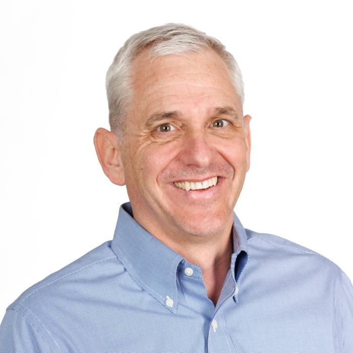
Dr. Dennis Buckmaster is a Professor in Agricultural & Biological Engineering at Purdue University, serving as Dean's Fellow for Digital Agriculture. He holds a B.S. from Purdue University and M.S./Ph.D. from Michigan State University. His research focuses on digital agriculture, machine systems engineering, and data science applications in farming. He co-coordinates the Agricultural Systems Management program and teaches courses like Computing Technology with Applications and Ag Tech and Innovation. He leads the Open Ag Technology and Systems Center (OATS Center), advancing open-source solutions for agriculture through platforms like ISOBlue and OADA. His work integrates IoT, robotics, and machine learning to optimize crop production, livestock management, and farm decision-making. He has authored over 150 publications on precision agriculture technologies. Professional memberships include American Society of Agricultural and Biological Engineers and Fluid Power Society. He emphasizes data interoperability, edge computing, and bridging engineering with agricultural practices through collaborative frameworks like LATTICE and Meta Ag.
Professor Luke Prendergast is the Deputy Dean of the School of Computing, Engineering & Mathematical Sciences (SCEMS) at La Trobe University (LTU) and holds a Professorship in the Department of Mathematics and Statistics. He previously served as Head of Department (2014–2020) and led LTU's Statistics Consulting Platform. His research focuses on robust statistics, meta-analysis, dimension reduction, and applied statistics, leading the DRAMA research group. Collaborations span fields like endocrinology, disability studies, and respiratory health. He actively contributes to research grants, including projects on Prader-Willi syndrome and exercise for disability populations. Professor Prendergast's recent work emphasizes statistical software development (e.g., the rquest package) and applications in biostatistics, such as metabolomics analysis and health intervention fidelity. His articles address topics like quantile-based hypothesis testing, geospatial accessibility for disability care, and motivational interviewing efficacy. Professional roles include NHMRC grant review panels, editorial boards for Nutrients and Respirology , and leadership in the Statistical Society of Australia (SSA Vic). His teaching includes courses in meta-analysis, linear models, and data-based critical thinking. Grants funded projects on exercise programs for cerebral palsy populations and community-university partnerships for disability inclusion. Luke's work bridges statistical theory with real-world health challenges, emphasizing robust methodologies and interdisciplinary collaboration.
Filip Biljecki is an Assistant Professor jointly appointed at the Department of Architecture within the College of Design and Engineering and the Department of Real Estate at the NUS Business School, National University of Singapore. He is the founder and principal investigator of the NUS Urban Analytics Lab and was awarded the prestigious NUS Presidential Young Professorship in 2020. With over 150 peer-reviewed publications, his research bridges geomatic engineering, geospatial technologies, and urban data science to advance digital twins and data-driven urban planning. Dr. Biljecki's educational background includes: PhD in 3D GIS (cum laude), Delft University of Technology, Netherlands (2017) MSc in Geomatics, Delft University of Technology, Netherlands (2010) BSc in Geodesy and Geoinformatics, University of Zagreb, Croatia (2008) His research interests focus on emerging urban data sources, particularly urban imagery, and their application in 3D city modeling, digital twins, and GeoAI. He explores how crowdsourcing and open science can inform cutting-edge techniques for urban sensing and analytics at city-scale. His work significantly contributes to establishing smart cities through innovative methods that integrate recent advancements in computer science, geomatics, and urban data science. Analysis of his recent publications reveals a strong focus on street view imagery applications for urban analytics, digital twin development, and geospatial AI. His research spans multiple domains including urban morphology, environmental assessment, public health applications, and urban comfort analysis. The interdisciplinary nature of his work is evident in collaborations with researchers from diverse fields, producing impactful studies that address complex urban challenges through innovative methodological approaches. His notable scientific achievements include: Annual Teaching Excellence Award (ATEA), 2025 College Educator Award AY2023/2024, 2025 Urban Informatics Paper of the Year Award, 2023 Top 2% scientists worldwide (Stanford University), 2021 Presidential Young Professorship (NUS), 2020 As an educator, Dr. Biljecki has supervised dozens of students leading to publications in leading journals and placements at top universities and organizations. He has delivered talks at over 120 universities and organizations worldwide including MIT, Stanford, Harvard, and ETH Zurich. His research is supported through various grants and affiliations including his role as Principal Investigator at the Future Cities Lab Global at the Singapore-ETH Centre. The NUS Urban Analytics Lab, which he established, brings together scholars from diverse disciplines to drive research on making cities smarter and more data-driven. The lab has developed innovative tools like ZenSVI for street view imagery analysis and has produced influential research on urban digital twins, urban morphology, and GeoAI applications. Through his leadership, the lab continues to pioneer methods that advance data-driven urban planning and smart city development.
Shashi Shekhar is a Professor at the University of Minnesota, holding the distinguished titles of McKnight Distinguished University Professor and Distinguished University Teaching Professor. He serves as the ADC/CSE Chair and Director of the AI-LEAF Institute within the Department of Computer Science at the College of Science and Engineering. His research interests span multiple areas of spatial computing including spatial data science, spatial data mining, spatial databases, Geo-AI, and Geographic Information Systems (GIS). His work has focused on developing scalable algorithms for eco-routing, evacuation route planning, and spatial pattern mining. He has made significant contributions to the field through his Spatial Databases textbook, the Encyclopedia of GIS which has seen over 192,918 downloads in 2017, and a spatial computing book for professionals. His research group has produced numerous PhD graduates dating back to 1993 through 2023. Analysis of his recent publications reveals a strong focus on applying spatial computing to critical societal challenges including climate change mitigation through the AI-LEAF Institute, pandemic response through mobility data analysis, and sustainable transportation through eco-routing algorithms. His work bridges theoretical advances in spatial data science with practical applications in urban planning, emergency management, and environmental sustainability. Distinguished McKnight University Professor Distinguished University Teaching Professor UCGIS Education Award (2015) Graduate Education Award (2015) President of University Consortium for GIS (2017-2018) Computing Research Association Board Member (2016-2019) Professor Shekhar has advised over 30 PhD students since 1993, with his most recent graduate in 2023. He has secured significant research funding including a $20 million AI Institute grant focused on climate-smart agriculture and forestry. His Spatial Computing Research Group maintains active collaborations with government agencies and industry partners. The group has developed practical applications featured in media outlets including FoxTV coverage of evacuation route planning algorithms. Current research directions include applying AI techniques to address climate challenges through the AI-LEAF Institute and advancing spatial data science for polar regions through NSF-funded initiatives.
Robert Likamwa is an Associate Professor at Arizona State University, affiliated with the School of Arts, Media and Engineering and the School of Electrical, Computer and Energy Engineering. His research focuses on the intersection of mobile computing, augmented reality, and sensor design through Meteor Studio. Ph.D., Rice University M.S., Rice University B.S., Rice University His work spans three core research arcs: (i) advanced visual capture systems, (ii) hybrid virtual-physical immersion through sensory augmentation, and (iii) data-driven frameworks for AR/VR storytelling. He explores mobile operating systems, low-power architectures, computational imaging, and holographic computing. Recent publications analyze multi-resolution visual sensing, geospatial cross-virtuality collaboration, planetary data visualization, spatial audio optimization, and multi-sensory virtual environments. His 2013 paper on energy-proportional image sensors received the Best Paper Award at ACM MobiSys. Best Paper Award, ACM MobiSys 2013 LiKamWa advises graduate students through research and thesis courses and leads grants related to mobile vision systems, haptic interfaces, and energy-efficient sensor design. He directs Meteor Studio, a research group focused on immersive technology innovation.
Prof. Dr.-Ing. Werner Lang serves as Vice President for Sustainable Transformation and holds the Chair of Energy Efficient and Sustainable Design and Building (ENPB) at the Technical University of Munich (TUM), within the TUM School of Engineering and Design. Previously, he was Professor of Sustainable Building and Director of the Center for Sustainable Development at the University of Texas School of Architecture in Austin (2008-2010). Lang also directs the Oskar von Miller Forum and is a partner at Lang Hugger Rampp GmbH Architekten in Munich. Lang's research focuses on developing strategies for buildings with positive environmental footprints through regenerative energy systems, renewable materials, and closed material cycles. His work emphasizes comprehensive life cycle analysis considering ecological, economic, and social aspects. Current research areas include climate-resilient urban neighborhoods, circular economy in construction, and sustainable building materials. The ENPB institute conducts numerous research projects such as Building Climate-Municipal, CircularFTmehrRAUM, and Urban Green Infrastructure. Lang's publications reveal a strong trend toward life cycle assessment, multi-criteria decision-making, and computational approaches for sustainable building design. His recent work integrates machine learning with building performance analysis and focuses on practical implementation of circular economy principles in urban contexts, with increasing emphasis on quantifying environmental benefits of urban green infrastructure. TUM Sustainability Award 2022 Doce et Delecta (Second Prize for Best Teaching), 2019 Bayerischer Energiepreis 2014 International Building Skin Tech Award (2008) Promotionspreis der TUM (2000) Lang leads the Institute of Energy-Efficient and Sustainable Design and Building with numerous research grants including projects like Building.Lab+, NAWAREUM, and ECO+. His team includes researchers working on topics ranging from urban mining to life cycle assessment tools. The institute maintains several products and startups including MoMeBo, Bilanzlabor, and EnergyML that translate research into practical applications for the building industry.
Dr. Samuel Cheng is an Associate Professor at the Gallogly College of Engineering , University of Oklahoma , specializing in Electrical and Computer Engineering . He holds a Ph.D. in Electrical Engineering from Texas A&M University (2004), preceded by M.S. and M.Phil. degrees from the University of Hawaii and Hong Kong University of Science and Technology. Education: B.S. (University of Hong Kong, 1995), M.Phil. (HKUST, 1997), M.S. (University of Hawaii, 2000), Ph.D. (Texas A&M, 2004) Professional Experience: Senior Research Engineer at Advanced Digital Imaging Research (2004-2005), prior internships at Microsoft Asia and Panasonic Technologies His research focuses on Information Theory , Signal and Image Processing , and Pattern Recognition , with applications in remote sensing, urbanization analysis, and disaster monitoring. His publications span topics including urban impervious surface mapping , nighttime light analysis , and machine learning for environmental data . His work often integrates multi-source datasets (e.g., Landsat, LiDAR, social media) for spatiotemporal modeling. Technical Expertise: Spectral unmixing, machine learning, thermal remote sensing, GIS integration Key Applications: Power outage detection, vegetation-crime correlation, PM2.5 estimation, smart meter data fusion Dr. Cheng holds three US patents in digital watermarking and is affiliated with IEEE, Sigma Xi, and AAAS. His recent articles demonstrate a trend toward leveraging AI for remote sensing challenges and analyzing urbanization impacts on ecosystems.
Prof. Dr. Fabian Gieseke is a Professor and Chair of Machine Learning and Data Engineering at the University of Münster. He holds a PhD in Computer Science from Carl von Ossietzky University of Oldenburg and a dual degree in Mathematics and Computer Science from the University of Münster. His research focuses on Machine Learning, High-Performance Computing, and their applications in Geosciences, Smart Cities, and Astrophysics. Education: PhD in Computer Science (2012), Carl von Ossietzky University of Oldenburg University studies in Mathematics and Computer Science (2006–2011), University of Münster Research Interests: Data Mining and Machine Learning High-Performance Computing & Distributed Systems Deep Learning Applications in Environmental Science and Astrophysics Geospatial Data Analysis using Satellite Imagery Publications Trends: His recent work emphasizes large-scale environmental monitoring via deep learning, including canopy height estimation, forest biomass prediction, and national-scale tree counting. He also explores interactive systems for geospatial data retrieval and optimization of machine learning models for resource-constrained environments. Advising & Grants: Supervised over 30 theses on topics like satellite image analysis, deep learning on microcontrollers, and data marketplaces for smart grids. Active in securing grants for interdisciplinary projects combining AI with Earth observation. Labs/Teams: Leads the Machine Learning and Data Engineering group at the University of Münster, focusing on scalable AI solutions for real-world challenges in science and industry.
Ben Seiyon Lee is an Assistant Professor in the Department of Statistics at George Mason University's College of Science. His work bridges computational statistics, climate modeling, and environmental risk assessment. Education: PhD in Statistics, Pennsylvania State University (2020) Lee specializes in computational methods for high-dimensional spatiotemporal data and uncertainty quantification in climate models. His research explores climate change impacts on extreme hydrological events, wildfire emissions, and medical decision-making. Recent publications focus on Bayesian spatiotemporal frameworks for extreme precipitation analysis, zero-inflated spatial models, and multisector uncertainty quantification. His work addresses challenges in flood risk assessment, agricultural yield projections, and healthcare compliance metrics.
Daniel Kifer is a Professor in the Computer Science and Engineering department at Pennsylvania State University, with affiliations to the Huck Institutes of the Life Sciences. His work bridges computer science, privacy-preserving machine learning, and geoscience applications. With over 10,000 citations and a high h-index, he focuses on methods to unify theoretical and applied research. Research Interests: Differential Privacy, Privacy-Preserving Machine Learning, Physics-Informed Neural Networks, Landslide Prediction, and Formal Verification of Privacy Systems. Recent projects include grants from the National Science Foundation: SaTC: CORE: Small (2024): privacy-preserving user data embedding in machine learning pipelines. SaTC: CORE: Medium (2017-2023): formal methods for differential privacy and accuracy optimization. His research outputs span domains like geoscience, database systems, and policy analysis, emphasizing precision and scalability of privacy-preserving algorithms.
Mohsen Lesani is an Associate Professor in the Computer Science and Engineering Department at the University of California, Santa Cruz's Baskin School of Engineering. His research focuses on reliability and security of software systems, particularly concurrent and distributed systems, with recent emphasis on secure replicated systems and distributed machine learning. Dr. Lesani received his PhD from UCLA, MS in artificial intelligence from Sharif University of Technology, and BS in software engineering from University of Tehran. He was previously a postdoc at MIT. His educational background provides a strong foundation for his interdisciplinary research spanning programming languages, distributed systems, and security. His research interests center on creating reliable and secure distributed systems. Current projects include resilient and secure distributed systems, heterogeneous and reconfigurable secure distributed systems, automatic analysis and synthesis of replicated objects, verification of distributed systems, data analytics, secure exchange across blockchains, machine learning for performance models, domain-specific languages and type systems, and automatic fence insertion for concurrent systems. His work bridges theoretical foundations with practical implementations to address real-world challenges in distributed computing. Lesani's research has been recognized with several prestigious awards including the NSF CAREER award in 2020 and DARPA YFA award in 2022. His work has also received the SIGPLAN Research Highlight in 2019, a distinguished paper award at OOPSLA 2018, and a best paper award at ISSRE 2015. These accolades reflect the impact and quality of his contributions to the field. He actively mentors PhD students in the Safe and Secure Software (S3) lab, including Xiao Li, Eric Chan, Javad Saber-Latibari, and Tejas Mane. His research has been supported by multiple NSF grants, demonstrating sustained funding for his innovative work. Lesani serves on program committees for major conferences including POPL, PLDI, OOPSLA, and DISC, contributing to the academic community. Lesani leads the Safe and Secure Software (S3) lab at UC Santa Cruz, where his team works on cutting-edge research in distributed systems, programming languages, and security. The lab fosters a collaborative environment where theoretical insights are translated into practical systems that address real-world challenges in reliability and security of distributed applications.
Ryan Engstrom is a Professor and Director of Data Science in the Department of Geography at George Washington University (GW). He is affiliated with the Columbian College of Arts and Sciences and holds a Ph.D. from the joint program at San Diego State University and UC Santa Barbara. His research focuses on Remote Sensing, GIS applications, Climate Change impacts, Arctic environments, and Population Estimation, with an emphasis on poverty mapping and urban deprivation analysis. Engstrom has led major initiatives such as YouthMappers and IDEAMAPS, leveraging geospatial data and satellite imagery to address global development challenges. His work includes developing methodologies for georeferencing historical imagery, estimating non-monetary poverty, and mapping population density in regions like Sri Lanka and Ghana. He has published extensively in Remote Sensing , World Bank Economic Review , and Global Change Biology , among others. Key research trends in his publications involve integrating satellite-derived features with machine learning to model urban poverty, climate-driven land-use changes in Arctic regions, and applications of open-source geospatial tools for international development. Engstrom collaborates globally, contributing to projects like the World Bank’s welfare tracking in disaster-affected regions.
Dr. Saeed Gazor is a full Professor in the Department of Electrical and Computer Engineering at Queen's University. He holds a cross-appointment in the Department of Mathematics and Statistics. His research focuses on signal processing applications in electrical energy systems, communications, and medical imaging. He has supervised postdoctoral fellows Babak Ghaffari and Yaser Esmaeili Salehani. Professional affiliations include Senior Member IEEE and membership in the Institution of Engineering and Technology. Education: PhD (1994) in Signal and Image Processing from Télécom ParisTech; M.Sc. (1989) and B.Sc. (1987) from Isfahan University of Technology with highest honors. Academic roles include former Assistant Professor at Isfahan University of Technology (1995–1998) and research associate at University of Toronto (1999). Research interests span detection theory, smart energy systems, hyperspectral imaging, and medical signal processing. Notable contributions include innovations in radar signal processing, sparse signal reconstruction, and adaptive filtering. Active in academic service, including editorial roles in IEEE journals. Awards: Professional Engineer designation from Professional Engineers Ontario. Over 200 peer-reviewed publications with recent focus on AI-driven hyperspectral analysis, robust beamforming, and energy-efficient communication systems. Labs/Teams: Leads signal processing research initiatives at Queen's, collaborating on projects involving smart energy grids, distributed radar networks, and biomedical signal analysis. Current work emphasizes integrating deep learning with traditional signal processing techniques.
Michela Bertolotto is a Professor in the School of Computer Science at University College Dublin (UCD). Her research focuses on spatio-temporal data modeling, GIScience, and applications of geospatial technologies in fields like urban planning and health informatics. She leads a research group and has supervised 19 PhD and 8 MSc students. Her work includes innovations in LiDAR-based flood risk visualization, semantic web quality assurance, and open-source spatial data analysis. Bertolotto has held roles including College Lecturer at UCD (2000–2006) and postdoctoral research positions at the University of Maine and University of Genoa. Education: BSc and PhD in Computer Science from the University of Genoa (1993, 1998). Professional achievements include over 100 publications, 24 grants (e.g., Science Foundation Ireland-funded Urban ARK project), and editorial roles at journals like the International Journal of Geographical Information Science. Awards include the UCD President's Research Award (2001) and NATO Postdoc Fellowship (1998–1999). Research interests span map personalization, volunteered geographic information (VGI), and geospatial data quality. Her lab develops tools like the LAMSkyCam (low-cost sky imaging system) and dynamic flood risk viewers. She chairs international conferences and serves on program committees for GIScience events.
Prof. Nikos Mamoulis is a Professor at the Department of Computer Science & Engineering, University of Ioannina, and a Lead Researcher at Archimedes Research Unit, ATHENA RC. He holds a PhD from Hong Kong University of Science and Technology (HKUST) and a Diploma from the University of Patras. His research focuses on spatial data management, big data analytics, data privacy, and uncertain data systems. Education : Ph.D., Computer Science, Hong Kong University of Science and Technology (2000) 5-year Diploma, Computer Engineering and Informatics, University of Patras (1995) Research Interests : Complex data management (spatial, spatio-temporal, time-series, text, graphs), big data analysis, privacy preservation, and uncertain data systems. He develops scalable algorithms and systems for modern data management challenges, with applications in transportation, social networks, and geospatial analytics. Projects & Grants : MESA: In-memory Spatial Analytics Made Scalable (HFRI-funded, PI) MORE: Real-time Energy Data Management (H2020, Senior Researcher) Smart City Bus Platform (ERDF-funded, PI/Coordinator) Awards : Outstanding Young Researcher Award (2008-2009, HKU) Best Paper Award at SSTD 2015 Test of Time Award at MDM 2022 Labs & Collaborations : Leads the Archimedes Research Unit at ATHENA RC, collaborating with institutions like HKUST and Uppsala University on spatial and big data systems. Active in organizing top-tier conferences like SIGMOD, EDBT, and ICDE.