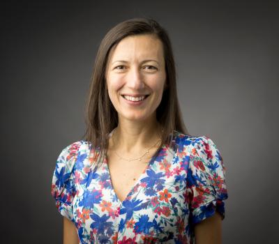
Dr. Alister Smith is a Reader (Associate Professor) in Geotechnics at Loughborough University, where he directs the £1M National Engineered Slope Simulator (NESS) – the world’s first climate-controlled facility testing clay slope deterioration. His £6.7M research portfolio addresses geotechnical infrastructure resilience under climate change. Innovations include acoustic emission (AE) landslide early warning systems deployed across five continents, with the Community Slope SAFE project recognized in REF2021. Current work includes the RAINDROP doctoral training cluster on infrastructure prognosis and the £4.9M EPSRC ACHILLES programme on climate impacts. Awards: Philip Leverhulme Prize, ICE Thomas Telford Premium (twice), and Hawley Award for Engineering Innovation. He serves on the Lilly Fellows Program Board and edits for the International Journal of Christianity and Education.
Jon Miller is a Research Associate Professor in the Department of Civil, Environmental and Ocean Engineering at Stevens Institute of Technology. He holds dual roles as Director of the NJ Coastal Protection Technical Assistance Service and NJ Sea Grant Coastal Processes Specialist. Miller earned a B.E. in Civil Engineering from Stevens (1999), followed by M.S. and Ph.D. in Coastal Engineering from the University of Florida (2001, 2004). His research focuses on coastal hazard mitigation, nature-based solutions, and numerical modeling of coastal systems. Education: - Ph.D. Coastal Engineering, University of Florida (2004) - M.S. Coastal Engineering, University of Florida (2001) - B.E. Civil Engineering, Stevens Institute of Technology (1999) Research Interests: Miller's work emphasizes coastal resilience through innovative engineering approaches. Key areas include: - Wave attenuation mechanisms of natural/nature-based features - Climate change impacts on coastal erosion - Living shoreline design and implementation - Sediment management strategies for inlets and beaches - Dune system vulnerability analysis Grants & Awards: - $1M+ funding from NOAA, NSF, and state agencies - 2024 ASCE Educator of the Year Award - 2023 Robert G. Dean Coastal Award - Over 20+ technical reports guiding coastal policy Professional Leadership: - Editorial roles in Shore & Beach and Journal of Coastal Research - Leadership in NJ Coastal Resilience Collaborative - Advisor for 3 Technogenesis Summer Scholars Labs & Projects: - Principal Investigator for SEECPRS disaster response system - Co-developed NJ Living Shorelines Engineering Guidelines - Conducts fieldwork on Hudson River shoreline restoration
Brett Sanders is a Professor in the Department of Civil and Environmental Engineering at the Samueli School of Engineering, University of California, Irvine. His research focuses on developing innovative algorithms for flow and transport in river and coastal systems and integrating information technologies to create more accurate and efficient simulation tools for flood hazard assessment. His primary research interests include: Flooding and erosion hazards, particularly coastal flooding and urban flooding Surface water quality Low impact development impacts on hydrology Dam-break flooding Aerial and terrestrial lidar scanning Geographical information systems High performance computing for simulation tools Social dimensions of flood risk and adaptation behaviors Dr. Sanders' recent publications (2024-2025) reveal a comprehensive research program addressing both technical and social aspects of flood risk. His work spans computational hydrodynamics, flood hazard mapping, infrastructure vulnerability assessment, and the socioeconomic dimensions of flood risk. He has made significant contributions to understanding multi-grid modeling of urban flooding, post-fire flood hazards, satellite-based monitoring of land motion, and social inequalities in flood exposure. His research demonstrates how flood dynamics are more complex than simple bath-tub filling models suggest, with important implications for urban planning and climate adaptation. Dr. Sanders has received recognition as a Chancellor's Professor at UC Irvine, indicating distinguished scholarly achievement. His educational background includes: Ph.D. in Civil Engineering from the University of Michigan (1997) M.S. in Civil Engineering from the University of Michigan (1994) B.S. in Civil Engineering from the University of California, Berkeley (1993)
Dr. Karim El-Basyouny is a Killam Laureate Professor and City of Edmonton Urban Traffic Safety Research Chair at the University of Alberta's Faculty of Engineering, where he serves as Associate Dean (Research Infrastructure and Innovation) in the Civil and Environmental Engineering Department. A licensed Professional Engineer in Alberta, he holds advanced degrees in Transportation Engineering from the University of British Columbia and has dedicated his career to advancing road safety through data-driven management frameworks. His academic credentials include: Doctor of Philosophy, Civil Engineering, University of British Columbia, 2011 Engineering Management Sub-specialization, Civil Engineering, University of British Columbia, 2010 Master of Applied Science, Civil Engineering, University of British Columbia, 2006 Bachelor's degree (ABET Equivalent), Civil & Environmental Engineering, United Arab Emirates University, 2003 El-Basyouny's research pioneers the integration of remote sensing, machine learning, and statistical modeling to enhance transportation safety. His work develops automated tools for infrastructure digitization, collision prediction, and speed management, treating safety as a systemic product requiring management frameworks. Key contributions include LiDAR-based road feature extraction, network-level safety evaluations, and frameworks for vision-zero outcomes that address both human-driven and autonomous vehicle contexts. His recent publications demonstrate a cohesive research trajectory centered on leveraging point cloud data and computational intelligence for safety management. Over 15 major publications since 2021 focus on automated infrastructure assessment (light pole detection, clear zone mapping, vertical clearance evaluation), weather-impact modeling, and enforcement resource optimization. This body of work bridges transportation engineering with computer vision and operations research to create scalable safety solutions. His scientific contributions have been recognized with prestigious honors including: 2024 Killam Annual Professorship Award 2024 Road Safety Achievement Award from TAC 2023 Donald Stanley Award for environmental engineering 2022 Faculty of Engineering Graduate Teaching Award 2021 Daniel B. Fambro Student Paper Award As an academic leader, El-Basyouny actively mentors graduate students and secures significant research funding through his endowed chair position. He currently recruits fully-funded PhD and postdoctoral candidates specializing in remote sensing applications, machine learning, and geomatics for road digitization projects. His research group collaborates with national safety committees and municipal agencies to translate findings into policy, while he serves on editorial boards for Transportation Research Record and Analytic Methods in Accident Research. The research group operates at the intersection of transportation engineering and computational science, developing automated frameworks that merge sensor technologies with data processing tools. Current projects focus on semantic segmentation of 3D point clouds, safety implications of infrastructure digitization, and machine learning applications for road feature extraction in both urban and rural environments.
Matej Varga is a Scientific Assistant and Postdoctoral Researcher at ETH Zurich's Department of Civil, Environmental and Geomatic Engineering, working in the Geosensors and Engineering Geodesy group under Prof. Andreas Wieser since 2021. His research spans geometrical geodesy, physical geodesy, and satellite geodesy, with applications in both theoretical and practical domains. Dr. Varga's research interests focus on spatial, temporal and spectral analysis of geodetic data, with particular expertise in geodetic reference systems and frames, gravity and geomagnetic field modeling at all temporal and spatial scales, and multi-GNSS multi-frequency positioning and monitoring. His work integrates geometrical and physical aspects of geodesy to address complex Earth observation challenges, particularly in infrastructure monitoring and geophysical applications. His recent publications demonstrate a strong trend toward high-precision geodetic applications for major scientific infrastructure, most notably the Future Circular Collider project, alongside important contributions to earthquake impact analysis, geomagnetic network development, and gravity field modeling. His research bridges traditional geodetic methods with modern computational approaches, including machine learning applications for point cloud registration. Dr. Varga is actively involved in the GSEG research group at ETH Zurich, contributing to the development of geodetic infrastructure and reference systems. His work has practical applications in infrastructure monitoring, earthquake analysis, and scientific projects requiring extreme geodetic precision.
Pascale Biron is a Professor in the Department of Geography, Urban Planning and Environment at Concordia University, Montreal. She holds a Ph.D. in Geography from Université de Montréal (1995) and has been with Concordia since 1998. Her research focuses on river dynamics, stream restoration for fish habitat, flood modeling, and climate change impacts. She specializes in hydrogeomorphology, river management in agricultural watersheds, and numerical modeling of fluvial processes. Research Interests: Her work includes river restoration strategies, flood risk assessment using LiDAR technology, and the 'river freedom' concept promoting ecosystem resilience. She collaborates closely with government agencies to translate research into practical river management policies. Professional Affiliations: Canadian Geomorphology Research Group, Canadian Association of Geographers, American Geophysical Union, GRIL (Limnology Research Group), and RIISQ (Quebec Flood Risk Network). Publications & Research: Recent studies address global salmonid biomass patterns, fluvial hazard detection via machine learning, and large-scale flood modeling. She supervises 19 graduate students in Ph.D./M.Sc. programs in Geography and Environmental Studies, focusing on topics like river confluence hydraulics and agricultural stream restoration. Grants & Funding: Active projects include river dynamics in fish habitats, flood modeling for road infrastructure vulnerability, and computational fluid dynamics simulations of river flows. She also leads research on societal dimensions of river restoration and policy frameworks for flood resilience.
Filip Biljecki is an Assistant Professor jointly appointed at the Department of Architecture within the College of Design and Engineering and the Department of Real Estate at the NUS Business School, National University of Singapore. He is the founder and principal investigator of the NUS Urban Analytics Lab and was awarded the prestigious NUS Presidential Young Professorship in 2020. With over 150 peer-reviewed publications, his research bridges geomatic engineering, geospatial technologies, and urban data science to advance digital twins and data-driven urban planning. Dr. Biljecki's educational background includes: PhD in 3D GIS (cum laude), Delft University of Technology, Netherlands (2017) MSc in Geomatics, Delft University of Technology, Netherlands (2010) BSc in Geodesy and Geoinformatics, University of Zagreb, Croatia (2008) His research interests focus on emerging urban data sources, particularly urban imagery, and their application in 3D city modeling, digital twins, and GeoAI. He explores how crowdsourcing and open science can inform cutting-edge techniques for urban sensing and analytics at city-scale. His work significantly contributes to establishing smart cities through innovative methods that integrate recent advancements in computer science, geomatics, and urban data science. Analysis of his recent publications reveals a strong focus on street view imagery applications for urban analytics, digital twin development, and geospatial AI. His research spans multiple domains including urban morphology, environmental assessment, public health applications, and urban comfort analysis. The interdisciplinary nature of his work is evident in collaborations with researchers from diverse fields, producing impactful studies that address complex urban challenges through innovative methodological approaches. His notable scientific achievements include: Annual Teaching Excellence Award (ATEA), 2025 College Educator Award AY2023/2024, 2025 Urban Informatics Paper of the Year Award, 2023 Top 2% scientists worldwide (Stanford University), 2021 Presidential Young Professorship (NUS), 2020 As an educator, Dr. Biljecki has supervised dozens of students leading to publications in leading journals and placements at top universities and organizations. He has delivered talks at over 120 universities and organizations worldwide including MIT, Stanford, Harvard, and ETH Zurich. His research is supported through various grants and affiliations including his role as Principal Investigator at the Future Cities Lab Global at the Singapore-ETH Centre. The NUS Urban Analytics Lab, which he established, brings together scholars from diverse disciplines to drive research on making cities smarter and more data-driven. The lab has developed innovative tools like ZenSVI for street view imagery analysis and has produced influential research on urban digital twins, urban morphology, and GeoAI applications. Through his leadership, the lab continues to pioneer methods that advance data-driven urban planning and smart city development.
Dr. Giulia Celentano is a Senior Scientific Assistant and Humanitarian Research Fellow at ETH Zurich's Department of Civil, Environmental and Geomatic Engineering (D-BAUG), affiliated with the Institute of Construction and Infrastructure Management (IBI). She holds a PhD in Sustainable Construction from ETH Zurich and has academic roles including lecturer in courses at D-BAUG and D-ARCH, as well as visiting professorships at Politecnico di Milano and ETSAM in Madrid. Her research focuses on humanitarian engineering, post-disaster reconstruction, and sustainable construction in conflict-affected and informal urban settings. She leads projects with organizations like the ICRC, UN-HABITAT, and UNHCR, emphasizing field-based, impact-oriented strategies. Education includes a Bachelor's and Master's in Architecture from Politecnico di Milano, a short course in Shelter and Settlements from IFRC/Oxford Brookes, and guest research at MIT ReAct. Current initiatives include coordinating the MOOC on Regenerative Materials (launching 2025) and developing tools like the ETH-ICRC Sustainable Construction Tool. Her work spans case studies in the MENA region, Sub-Saharan Africa, and Southeast Asia, addressing challenges in informal settlements and resilient health infrastructure.
Somayeh Dodge is an Associate Professor of Spatial Data Science in the Department of Geography at the University of California, Santa Barbara (UCSB). She leads the MOVE Lab and serves as Co-Associate Director of the UCSB Center for Spatial Studies and Data Science. Her research focuses on computational movement analysis, spatiotemporal data science, and the application of these tools to study human and ecological systems. She holds editorial roles in major journals including Journal of Spatial Information Science and Geographical Analysis. Education: PhD in GIScience (University of Zurich, 2011), MS in GIS Engineering (K.N.Toosi University of Technology, 2005), and BS in Geomatics Engineering (2003). Postdoctoral work at The Ohio State University and University of Zurich. Prior faculty positions include University of Minnesota (2016–2019) and University of Colorado, Colorado Springs (2013–2016). Research interests include wildfire impact analysis, mobility patterns during disasters, environmental vulnerability modeling, and geovisualization techniques. Her NSF CAREER project explores movement responses to environmental disruptions. Teaching focuses on GIScience, movement analytics, and spatial modeling courses. Awards: 2021 NSF CAREER Award and 2022 AAG Emerging Scholar Award. Active in editorial boards for multiple journals and serves on the Board of Directors for the University Consortium for Geographic Information Science (UCGIS). Advising: Supervises 7 graduate students in mobility analytics and environmental modeling. Labs/Teams: MOVE Lab (https://move.geog.ucsb.edu/) focuses on computational movement ecology and human mobility studies.
Dr. David Burton is a Professor in the Department of Plant, Food, and Environmental Sciences at Dalhousie University's Faculty of Agriculture. He serves as Director of the Centre for Sustainable Soil Management and leads initiatives in soil health, greenhouse gas emissions, and sustainable agricultural practices. His teaching spans undergraduate and graduate courses in soil science, nutrient management, and climate change. Research focuses on microbial metabolism in soil, nitrogen cycling, and the environmental impacts of agricultural practices. He co-founded the Atlantic Soil Health Lab and manages the Greenhouse Gas Analysis Lab. Key affiliations include the Canadian Society of Soil Science (Fellow), Soil Conservation Council of Canada, and Fertilizer Canada's 4R Research Network. Recent work emphasizes soil's role in climate resilience, including presentations on regenerative farming and soil carbon sequestration. He collaborates with government and industry to develop climate-smart soil management policies and tools for nitrogen management optimization. Awards: Fellow of the Canadian Society of Soil Science Labs: Centre for Sustainable Soil Management, Greenhouse Gas Analysis Lab, Atlantic Soil Health Lab Grants: NSERC CREATE Climate Smart Soils
Christopher Storie is a Professor of Geography at the University of Winnipeg, specializing in GIS, Remote Sensing, and Urban Geography. He holds an office in Lockhart Hall (5L03) and teaches courses such as Introduction to GIS, Remote Sensing, and Urbanization in the Developing World. His research focuses on Deep Learning applications for automated land use/land cover mapping, informal settlement mapping, and urban-rural fringe detection. Key research interests include leveraging neural networks for geospatial analysis, urban dynamics in regions like Mexico City, and collaborative international fieldwork. He has contributed to over 20 peer-reviewed articles since 2000, emphasizing satellite imagery analysis and environmental monitoring. His work bridges technical geospatial methods with socio-environmental challenges in urban and developing regions.
John McDonald is a Professor in the Department of Computer Science at Maynooth University, where he has held a faculty position since 2001. He is affiliated with the Maynooth University Hamilton Institute and the Assisted Living and Learning Institute (ALL). His research focuses on computer vision, robotics, and AI, emphasizing spatial perception and autonomous systems. He has contributed to areas such as visual SLAM, intelligent vehicle systems, and digital holography, with funding from SFI, EU, and other agencies. Currently, he is a Funded Investigator in Lero (SFI Research Centre for Software) and collaborates on the SFI Blended Autonomy Vehicles Spoke. Key research themes include simultaneous localization and mapping (SLAM), robotic navigation, 3D reconstruction, and applications in autonomous driving. His work integrates cutting-edge techniques in computer vision and machine learning to address challenges in spatial intelligence and perception. Publications highlight advancements in dense mapping, fisheye camera systems, and geospatial analysis. He has held visiting roles at MIT’s CSAIL and the National Centre for Geocomputation. His contributions span academic journals, conferences, and technical reports, reflecting a strong emphasis on both theoretical and applied robotics research. John McDonald has supervised numerous research projects and contributed to initiatives like the John and Pat Hume Doctoral Scholarships. His work bridges academia and industry, with a focus on real-world applications of autonomous systems and AI-driven robotics.
Lars-Olof Johansson is a Senior Lecturer at Halmstad University's School of Information Technology, specializing in Informatics. His research focuses on digital service innovation from a learning perspective, emphasizing collaboration between diverse stakeholders and knowledge exchange in innovation processes. He is actively involved in the LeaDS research program (Learning in a Digitalized Society) and teaches in the bachelor's program 'Digital Business Development' and the master's program 'Digital Learning'. His work bridges educational methodologies and technological innovation, particularly in fostering environments where interdisciplinary learning drives successful digital service creation. Notably recognized as an 'Excellent Teacher in Informatics,' he integrates practical experience with academic rigor, contributing to both scholarly discourse and pedagogical advancements. Key projects include SESMA (2019-2021), exploring sustainable mobility solutions, and ongoing collaborations in boundary practices for ICT innovation. His publications span topics like knowledgeability in digital service innovation, ethics in autonomous systems, and collaborative learning frameworks. His awards highlight his pedagogical impact, while his research addresses systemic challenges in innovation through interdisciplinary approaches.
Dr. Yelda Turkan is an Associate Professor in the School of Civil and Construction Engineering at Oregon State University, where she leads research in automation, computer vision, and machine learning for sustainable infrastructure. She holds a PhD from the University of Waterloo and dual BS degrees in Civil Engineering and Geomatics Engineering from Istanbul Technical University. Her work focuses on leveraging lidar, digital twins, and BIM to improve construction operations and decision-making in the built environment. She has secured over $4M in grants from NSF, FHWA, and other agencies, and currently leads the NSF Convergence Accelerator-funded 'Deep Reality' project for AI-driven infrastructure management. Education: Ph.D., Civil Engineering, University of Waterloo, 2012 M.S., Engineering Informatics & Remote Sensing, Istanbul Technical University, 2006 B.S., Civil Engineering (double major in Geomatics Engineering), Istanbul Technical University, 2005/2003 Professional Roles: Vice President, International Association for Automation and Robotics in Construction (IAARC) Chair, ASCE Computing Division Education Committee Associate Editor, ASCE OPEN Journal Her research emphasizes automation in construction quality control, infrastructure inspection via drones and lidar, and immersive education tools using VR/AR. Recent projects include automated curb ramp compliance analysis, wildfire impact modeling, and digital twin development for timber structures. She has published over 80 peer-reviewed articles and actively promotes computing integration in civil engineering education and professional practice.
Dieu Tien Bui is a Full Professor in the Department of Business and IT at the University of South-Eastern Norway (USN) School of Business. His research focuses on Geospatial Artificial Intelligence Machine Learning GIS and Remote Sensing Natural Hazard Modeling Environmental Problems (landslides, floods, soil salinity, biomass) . He has contributed to over 15 recent publications in journals like Science of the Total Environment , Remote Sensing , and Geomorphology , emphasizing hybrid AI models for landslide and flood susceptibility. His work spans Vietnam, India, China, and Iran with applications in climate change adaptation and disaster management. Scientific Awards: Global Highly Cited Researcher PhD Supervision: He has supervised 8 PhD students at institutions including USN, NTNU, and Vietnamese universities.