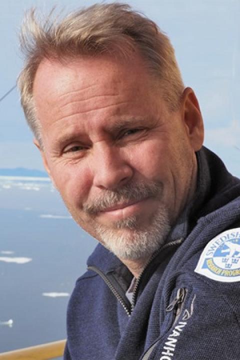
Martin Jakobsson is Professor of Marine Geology and Geophysics and Head of the Department of Geological Sciences at Stockholm University, with an affiliate Research Professor appointment at the Center for Coastal and Ocean Mapping (CCOM), University of New Hampshire. Education: Ph.D. in Geological Sciences, Stockholm University (2000). Thesis: "Mapping the Arctic Ocean: Bathymetry and Pleistocene Paleoceanography." His research spans Arctic Ocean glacial history, West Antarctic Ice Sheet dynamics, submarine glacial landforms, and acoustic geophysical seafloor mapping. With over one year of cumulative ship time, he has served as Co-Chief Scientist on eight international ocean expeditions, advancing methodologies in marine geophysical data acquisition and paleoenvironmental reconstruction. Honors: Academy Fellow of the Royal Swedish Academy of Sciences (2004-2009), funded by Knut and Alice Wallenberg Foundation Member of Royal Swedish Academy of Sciences (Class V for Geoscience, 2012) His research program is sustained through major fellowships including the Wallenberg Academy Fellowship, supporting extensive field campaigns in polar regions. As department head and Academy Vice President, he shapes institutional strategy while maintaining active oceanographic fieldwork. He leads multidisciplinary research teams conducting international expeditions, integrating geophysical mapping with paleoclimate analysis to investigate ice-sheet history and seafloor processes.
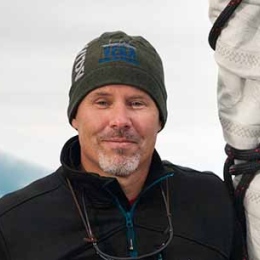
Frank Corsetti is a Professor of Earth Sciences at the University of Southern California (USC), leading the Corsetti Lab. His research focuses on the co-evolution of Earth and its biosphere, particularly during extreme events like the 'Snowball Earth' glaciation and mass extinctions. He holds a Ph.D. in Geological Sciences from UC Santa Barbara (1998) and a B.S. in Geology from UC Davis (1989). Research Interests: Corsetti studies geobiological processes such as stromatolite formation, microbial carbonate systems, and the environmental impacts of mass extinctions. His lab investigates biosignatures, diagenetic processes, and astrobiological applications. Current projects include the end-Triassic mass extinction and microbial interactions in extreme environments. Advising & Grants: He mentors a team of PhD students (including Reena Joubert, Alison Cribb, and others) and has secured funding from NASA for projects like stromatolite carbonate formation studies. His work bridges paleontology, geochemistry, and microbiology, contributing to understanding Earth’s long-term climate and life history. Labs/Teams: The Corsetti Lab at USC explores stromatolites, microbial mats, and ancient Earth systems. Collaborations involve institutions like JPL and international universities.
Martin Jakobsson is a Professor of Marine Geology and Geophysics at Stockholm University's Department of Geological Sciences. His career spans international research expeditions and leadership roles, including Dean of Earth Science (2021) and Head of Department (2012-2018). A key member of the Marine Geology group, he studies Arctic and Antarctic glacial history through sediment analysis and seafloor mapping. PhD from Stockholm University (2000) Academy Fellow, Royal Swedish Academy of Sciences (2004-2009) Professor II position at University Centre of Svalbard (2011-) His research focuses on marine geological archives to reconstruct glacial cycles, ice-ocean interactions, and bathymetric mapping. As GEBCO Vice-Chair (2013-2020), he led initiatives for global seabed mapping through the Seabed 2030 project. Recent publications reveal expertise in: Arctic Ocean paleocirculation Methane release from thawing permafrost Ice sheet sensitivity to oceanic warming High-resolution bathymetric analysis Scientific recognition includes: Election to Royal Swedish Academy of Sciences (2012) 1st Vice President, Royal Swedish Academy of Sciences (2016-2019) Membership in Norwegian Scientific Academy for Polar Research (2016) He leads international collaborations on polar research vessels, with over a year of cumulative ship time and multiple Co-Chief Scientist roles on Arctic expeditions.
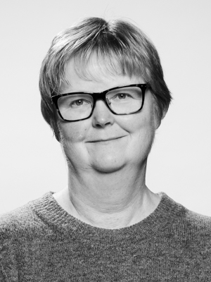
Carol Smith is an Associate Professor in the Department of Soil & Physical Sciences at Lincoln University, New Zealand, where she serves as Head of Department since 2017. She has been an elected academic staff member of the Lincoln University Council from 2018-2022. Dr. Smith holds a PhD from the University of Aberdeen, an MSc from the University of Reading, and a BSc(Hons) from the University of Portsmouth, forming the foundation of her expertise in soil science and physical geography. Her research spans both fundamental and applied aspects of pedology. On the fundamental side, she investigates Quaternary pedology and paleoenvironmental reconstruction using loess stratigraphy, geomorphology, and micromorphology, which provides critical data for verifying future climate change predictive models. Applied research focuses on sustainable use of recycled organic matter and rehabilitation of degraded soils. She collaborates internationally on multidisciplinary projects involving paleoclimate reconstruction, paleoliquefaction, Antarctic soils, and viticulture. Dr. Smith is passionate about teaching and science communication, employing experiential learning methods to develop practical field skills in soil science through 'soil judging competitions' in New Zealand and Australia. Her research addresses UN Sustainable Development Goals including Life on Land (15), Climate Action (13), and Quality Education (4). Among her notable recognitions are the Norman H Taylor Memorial award 2020 from the New Zealand Society of Soil Science for outstanding contributions to soil science in New Zealand and Fellowship in the Royal Geographical Society, London. She serves as Associate Editor of Natural Sciences Education and was previously editor of Quaternary Australasia. Dr. Smith has supervised numerous graduate students through research-based supervision, with completed projects covering diverse topics from soil patterns in Southland to Antarctic soil ecology. She teaches advanced courses in field research, soil science, and physical landscapes, and has developed innovative approaches to teaching during the pandemic, including virtual field trips.
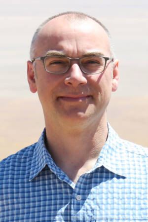
Peter K. Kitanidis is a Professor in the Department of Civil and Environmental Engineering and the Institute for Computational and Mathematical Engineering at Stanford University . His research focuses on groundwater flow , hydrologic forecasting , and stochastic inverse modeling , with applications to pollutant remediation and CO₂ storage monitoring . Education : Diploma, National Technical University of Athens (1974) M.S., MIT (1976) Ph.D., MIT (1978) Research Interests : Groundwater modeling and contaminant transport Hydraulic tomography and aquifer characterization Stochastic methods for uncertainty quantification Bioremediation and enhanced in-situ pollutant decay Dilution and mixing processes in heterogeneous media Real-time river flow forecasting Scientific Awards : L.G. Straub Award (1979) W.L. Huber Research Prize (1994) ISI Highly Cited Researcher (2001) AGU Hydrologic Sciences Award (2011) ASCE Pioneers in Groundwater Lecturer (2011) Advising and Grants : Advised 20+ PhD and MS students (1978–2018) Principal investigator on NSF, EPA, and DOE-funded projects Developed software for groundwater data analysis and CO₂ monitoring Contributed to bioremediation protocols and hydraulic tomography algorithms Labs and Teams : Kitanidis Laboratory for groundwater crisis solutions Collaborated with Oak Ridge National Laboratory and Stanford Hydrogeology Group Mentored postdocs (2000–2017) in reactive transport and inverse modeling
Ares J. Rosakis is the Theodore von Kármán Professor of Aeronautics and Mechanical Engineering at the California Institute of Technology (Caltech), where he served as Chair of the Division of Engineering and Applied Science from 2009-2015 and previously as Director of the Graduate Aerospace Laboratories (GALCIT). He has held numerous prestigious visiting professorships including at Nanyang Technological University, Northwestern University, Columbia University, Oxford University, and École Normale Supérieure in Paris. Rosakis earned his B.A. and M.A. in Engineering Science from Oxford University in 1978, followed by his Sc.M. (1980) and Ph.D. (1982) in Engineering (Solid Mechanics) from Brown University. He joined Caltech as an Assistant Professor in 1982, was promoted to Associate Professor in 1988, and to full Professor in 1993. In 2004, he was named the Theodore von Kármán Professor, one of Caltech's most distinguished named chairs. Rosakis is globally recognized as the foremost expert in dynamic failure mechanics of solid materials. His pioneering contributions span the dynamic failure of metals, composites, and interfaces. He invented Coherent Gradient Sensing (CGS) interferometry, a novel optical method sensitive to gradients of optical path differences that has been widely adopted in fracture mechanics and thin film stress measurements. His research encompasses dynamic shear-dominated rupture of heterogeneous materials, rupture mechanics of crustal earthquakes (where he experimentally discovered 'intersonic' or 'supershear' ruptures), and reliability of thin films and in-situ wafer level metrology. His work bridges engineering science, materials mechanics, and geophysics with remarkable interdisciplinary impact. His recent publications demonstrate a strong focus on earthquake mechanics and laboratory simulations of seismic events, particularly supershear earthquake ruptures. The research connects fundamental fracture mechanics with real-world geophysical phenomena, revealing how laboratory-scale experiments can illuminate the physics of large-scale earthquakes. His work has established critical links between theoretical models, experimental observations, and geological field evidence. Rosakis has received numerous prestigious awards including: 2024 Foreign Member of the Royal Society, UK 2023 Honorary PhD from National Technical University of Athens 2023 Honorary Degree of Doctor of Engineering from University of Illinois 2021 Zdeněk P. Bažant Medal for Failure and Damage Prevention 2018 Timoshenko Medal from ASME 2016 Elected to the National Academy of Sciences 2011 Elected to the National Academy of Engineering Throughout his distinguished career at Caltech, Rosakis has mentored numerous graduate students and postdoctoral researchers, many of whom have become leaders in their fields. His research has been continuously supported by major grants from the National Science Foundation, Department of Energy, and other federal agencies, focusing on dynamic fracture, earthquake mechanics, and advanced optical measurement techniques. He has served on numerous editorial boards and advisory committees for major scientific organizations. At Caltech, Rosakis leads research in the Graduate Aerospace Laboratories (GALCIT), where he has established world-class experimental facilities for studying dynamic fracture and earthquake mechanics. His laboratory features high-speed imaging systems capable of millions of frames per second, infrared diagnostics for temperature field measurements, and specialized equipment for simulating earthquake ruptures at laboratory scale. His research group combines experimental, theoretical, and computational approaches to address fundamental questions in solid mechanics and their applications to geophysics and materials engineering.
Dr. Alain Bonneville is a Lab Fellow and Geophysicist at Pacific Northwest National Laboratory (PNNL) and holds a Courtesy Professor appointment at Oregon State University's College of Earth, Ocean, and Atmospheric Sciences. With extensive experience in geological storage of CO2, geothermal energy, and geophysical monitoring techniques, Dr. Bonneville leads diverse research projects that bridge fundamental science and practical applications for energy and environmental challenges. Dr. Bonneville's educational background includes: PhD in Geophysics from the University of Montpellier, France MS in Petroleum Geophysics from IFP-School, Paris, France BS in Geology from the University of Lyon, France Dr. Bonneville's research spans several critical areas in Earth sciences and energy systems. His work on geothermal energy focuses on super-hot enhanced geothermal systems (EGS), site characterization, monitoring, and stimulation fluids. In geological CO2 storage, he investigates project management, site characterization, numerical modeling, and monitoring methods using potential fields and remote sensing. His expertise in geophysical methods includes heat flow measurements, gravity surveys, muon tomography development for borehole deployment, and remote sensing applications. Additional research areas encompass marine heat flow instrumentation development, thermal monitoring of active volcanoes, and intraplate volcanism studies in the Indian and Pacific Oceans. Dr. Bonneville has received significant recognition for his contributions to science, including: Membership in the Washington State Academy of Sciences Lab Fellow position at Pacific Northwest National Laboratory Executive Committee membership on the U.S. National Risk Assessment Partnership Scientific Committee membership at IFP-Energies Nouvelles, France He also holds two U.S. patents related to electrophilic acid gas-reactive fluids for enhanced fracturing and recovery of energy producing materials. Throughout his career, Dr. Bonneville has led significant research initiatives, including the PNNL Carbon Sequestration Initiative (2009-2013) and the European Marie Curie Research Training Network on Greenhouse Gas Removal (GRASP), which involved 14 academic and industrial institutions across 7 countries and supported 35 PhD students and post-docs. His work on the FutureGen 2.0 project demonstrates his leadership in large-scale carbon storage site characterization and monitoring program design. Dr. Bonneville maintains active collaborations with research teams at PNNL's Environmental Molecular Sciences Laboratory and works closely with Oregon State University's geoscience researchers. His laboratory work focuses on developing novel instrumentation for geophysical monitoring, particularly in the areas of muon tomography for subsurface characterization and thermal monitoring systems for geothermal and carbon storage applications.
Anne H Schistad Solberg is a Professor in the Department of Informatics at the University of Oslo's Faculty of Mathematics and Natural Sciences. She leads research in digital signal processing and image analysis, with a focus on machine learning applications across multiple domains. As co-director of SFI Visual Intelligence, she oversees research on interpretable deep learning models, uncertainty quantification, contextual learning, and self-supervised learning approaches. Her research spans medical imaging (particularly cardiovascular ultrasound), environmental monitoring using satellite imagery, and seabed mapping with sonar technology. Professor Solberg's work demonstrates a consistent trajectory from foundational signal processing techniques to cutting-edge deep learning applications. Her recent publications show increasing specialization in medical image analysis, particularly in echocardiography enhancement and cardiac structure segmentation, while maintaining strong contributions to remote sensing and geophysical applications. She teaches several popular courses including IN2070, IN3310, and IN5400 (Machine Learning for Image Analysis), which is noted as the most popular master's/PhD course on deep learning at the University of Oslo. Professor Solberg serves as principal investigator for the Intelligent Cardiovascular Ultrasound Scanner (INCUS) project, collaborating with GE Vingmed Ultrasound to develop AI-enhanced cardiac imaging systems that improve diagnostic accuracy and productivity in echocardiography. Co-director of SFI Visual Intelligence research center Principal Investigator for the INCUS project (Intelligent Cardiovascular Ultrasound Scanner) Member of the Digital Signal Processing and Image Analysis (DSB) research group Member of the Strategic Research Initiative: Multimodal Medical Imaging and Image Analysis (MEDIMA) Her research group develops algorithms that address real-world challenges in medical diagnostics and environmental monitoring, with a particular emphasis on making deep learning models more interpretable and reliable for critical applications. The INCUS project, funded through User-driven Research-based Innovation (BIA), aims to reduce the time wasted during cardiac ultrasound examinations by implementing intelligent algorithms that learn from expert users and historical data.
Scott McDougall is an Associate Professor in the Department of Earth, Ocean & Atmospheric Sciences at the University of British Columbia (UBC). He specializes in geohazards, particularly landslides and related risks, with a focus on improving risk assessment and mitigation strategies. His work integrates field data, statistical analysis, numerical modeling, and laboratory experiments to understand landslide dynamics. Education: PhD in Geological Engineering, UBC (2006) BASc in Civil Engineering, University of Toronto (1998) Research Interests: Landslide mobility and runout modeling Tailings dam breaches and their impacts Risk evaluation frameworks for geohazards Shoreline erosion and landslide-generated waves Applications of machine learning in hazard prediction Key Contributions: Development of the UBC Geohazards Research Team to advance landslide risk reduction Leadership in the CanBreach project to improve tailings dam breach analysis Pioneering probabilistic runout prediction models for rock avalanches and debris flows Awards: Engineering Geology Best Paper Award 2024 CDA Published Paper Award Advising & Grants: Supervised over 15 graduate students and postdoctoral fellows Active industry collaborations with mining and engineering firms Funded by NSERC, Mitacs, and industry partnerships Labs & Teams: UBC Geohazards Research Team CanBreach Collaborative Research and Development Project
Iain Stewart is Professor of Geoscience Communication at the University of Plymouth, holding the UNESCO Chair in Geoscience and Society. He directs research at the Sustainable Earth Institute and serves as Communications Lead for the UKRI Tomorrow's Cities initiative targeting disaster risk reduction in urban environments. His research bridges Earth science and societal concerns through three key areas: 1) Geoscience communication strategies for complex issues like climate change and energy, 2) Cultural responses to geohazards using film and gaming technologies, and 3) Public perceptions of geological resources and subsurface environments. His work applies cognitive and social science frameworks to geoscience communication challenges. Stewart maintains an extensive public engagement profile through BBC television documentaries including 'Earth: The Power of the Planet' and as science consultant for 'Seven Worlds, One Planet'. He serves as President of the Royal Scottish Geographical Society and Devon Wildlife Trust while advocating for geoscience education globally. His research has been recognized with numerous international awards including an MBE and honors from the Geological Society of America and American Geophysical Union.
Robert Likamwa is an Associate Professor at Arizona State University, affiliated with the School of Arts, Media and Engineering and the School of Electrical, Computer and Energy Engineering. His research focuses on the intersection of mobile computing, augmented reality, and sensor design through Meteor Studio. Ph.D., Rice University M.S., Rice University B.S., Rice University His work spans three core research arcs: (i) advanced visual capture systems, (ii) hybrid virtual-physical immersion through sensory augmentation, and (iii) data-driven frameworks for AR/VR storytelling. He explores mobile operating systems, low-power architectures, computational imaging, and holographic computing. Recent publications analyze multi-resolution visual sensing, geospatial cross-virtuality collaboration, planetary data visualization, spatial audio optimization, and multi-sensory virtual environments. His 2013 paper on energy-proportional image sensors received the Best Paper Award at ACM MobiSys. Best Paper Award, ACM MobiSys 2013 LiKamWa advises graduate students through research and thesis courses and leads grants related to mobile vision systems, haptic interfaces, and energy-efficient sensor design. He directs Meteor Studio, a research group focused on immersive technology innovation.
Dr. Moritz Ziegler is a geomechanics researcher affiliated with the Technical University of Munich (TUM) and the Assistant Professorship of Geothermal Technologies . He previously worked at GFZ Potsdam (2017–2023) and earned his PhD in Geophysics from the University of Potsdam (2014–2017). His research focuses on geomechanical numerical modeling , uncertainty quantification , and 3D stress field analysis , with applications to geothermal energy, seismic hazard, and rock mechanics. Education: Bachelor of Science in Geosciences (2008–2011), Freie Universität Berlin Master of Science in Geophysics (2011–2014), University of Potsdam PhD in Geophysics (2014–2017), University of Potsdam & GFZ Potsdam His work integrates advanced computational methods ( Altair Hypermesh , Dassault Systèmes Abaqus , Python , Matlab ) to address complex geomechanical problems. Recent publications analyze stress gradients in the North Alpine Foreland Basin, fault-stress interactions, and physics-based machine learning in geomechanics. He has contributed to software development (DOuGLAS v1.0) and calibration tools (FAST Calibration v2.4). Scientific awards or honors are not explicitly mentioned in the provided text. However, his research has been published in leading journals such as Geophysical Journal International , Solid Earth , and Pure and Applied Geophysics .
James Scoates is a Professor in the Department of Earth, Ocean & Atmospheric Sciences at the University of British Columbia (UBC), affiliated with the Faculty of Science. His research focuses on magmatic processes, including the origin and evolution of silicate magmas, geochemical and isotopic studies of layered intrusions and anorthosite suites, and the formation of magmatic ore deposits. He has held positions at UBC since 2002, following roles at Université Libre de Bruxelles (1995-2001). Education: B.Sc. (Honours), 1987, Queen's University at Kingston, Canada Ph.D., 1994, University of Wyoming, USA Research Interests: His work spans igneous petrology, geochronology, and mineral deposit geology. Key areas include physical volcanology of Large Igneous Provinces (LIPs), the geochemical evolution of magma plumbing systems in layered intrusions like the Skaergaard and Bushveld Complexes, and the application of isotopic techniques to trace mantle sources. He also investigates convergent margin Ni-Cu-PGE deposits and their tectonic contexts. Awards: Faculty Teaching Award, 2021 (EOAS-UBC) Killam Teaching Award, 2018 (UBC) Young Scientist Award, 2001 (Mineralogical Association of Canada) Teaching & Leadership: Dr. Scoates teaches courses in mineralogy, geochemistry, mineral deposits, and field geology. He has led initiatives to innovate geoscience education through virtual field experiences and peer-learning strategies. He chairs the MAGNET NSERC CREATE program and serves on the Pacific Centre for Isotopic and Geochemical Research (PCIGR) steering committee. Key Projects: Investigating the geochemical evolution of Hawaiian plumes and mantle heterogeneity. Studying magma storage and differentiation in the Muskox intrusion (Mackenzie LIP). Developing geochronological frameworks for layered intrusions like the Stillwater Complex.
Hyuck Jin Park is a Full Professor in the Department of Energy Resources and Geosystems Engineering at Sejong University, South Korea, where he has been teaching and conducting research since 2003. With a Ph.D. in Engineering Geology from Purdue University, his expertise spans geotechnical engineering, landslide analysis, and geospatial technologies. Professor Park has built a distinguished career in landslide hazard assessment, combining traditional geotechnical approaches with modern machine learning techniques to improve prediction accuracy and risk management. His educational background includes: B.S. in Geology from Yonsei University (1990) M.S. in Geophysics from Yonsei University (1993) Ph.D. in Engineering Geology from Purdue University (2011) Professor Park's research focuses on the spatial and temporal probability of landslide occurrence, utilizing fuzzy logic, probabilistic analysis, GIS, Monte Carlo simulation, and machine learning for landslide hazard assessment. His work integrates physically based models with statistical approaches to better understand landslide mechanisms and improve prediction capabilities. He has made significant contributions to the development of methodologies that account for geological uncertainties in hazard assessment, with applications ranging from rock slope stability to rainfall-induced shallow landslides. His recent publications demonstrate a clear trend toward integrating explainable artificial intelligence with traditional geotechnical approaches for natural hazard assessment. Professor Park's work increasingly focuses on making machine learning models transparent and interpretable while maintaining high predictive accuracy. The research spans multiple hazard types including landslides, earthquakes, and floods, with a growing emphasis on climate change impacts and data-scarce environments. With an h-index of 28 and over 3,421 citations, Professor Park has established himself as a leading researcher in his field. His work has been published in high-impact journals including Engineering Geology, Landslides, and Catena, reflecting the significance and quality of his contributions to geotechnical engineering and natural hazard assessment. Professor Park has mentored numerous researchers through collaborative projects and has secured funding for his innovative work in landslide prediction and hazard assessment. His research has involved significant international collaboration, particularly with researchers from Malaysia, Australia, and Yemen, addressing landslide and flood risks in diverse geographical contexts. He leads research activities within the Department of Geoinformation Engineering at Sejong University and has contributed to the development of specialized tools like DEWS (Distance, Elevation, Watershed, and Slope unit) for landslide early warning systems.
David Wettergreen is a Research Professor at the Robotics Institute within Carnegie Mellon University's School of Computer Science , where he has been a faculty member since 2000. He directs the PhD Program in Robotics and holds a courtesy appointment in Mechanical Engineering. His research focuses on robotic exploration systems for extreme environments, spanning planetary surfaces, underwater caves, and terrestrial deserts. Key areas include autonomous navigation , science autonomy , multi-modal perception , and resource-cognizant planning . Field validation drives his work, with deployments in the Atacama Desert, Antarctic volcanoes, and lunar analog sites. Co-founder of Mesh Robotics LLC for off-road autonomy Former Research Fellow at Australian National University Former National Research Council Research Associate at NASA Ames Research Center His 15 most recent publications (2023-2025) demonstrate expertise in autonomous path planning , machine learning applications , terrain modeling , and science-driven exploration . Collaborations span planetary science, environmental monitoring, and space systems engineering. He has advised 17 PhD and 33 MS students , many of whom now work in space exploration or field robotics, and teaches courses in Robotics Systems Engineering . Current projects include the MoonRanger lunar micro-rover and technologies for autonomous resource mapping .