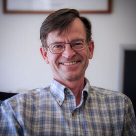
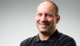
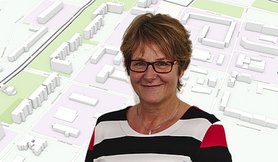
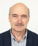
Jamie McCallum is the Radio Telescope Array Operations Manager at the School of Natural Sciences, Physics, University of Tasmania. He plays a key role in the AuScope VLBI project, which collaborates with Geoscience Australia to advance global geodetic measurements using radio telescopes. Role : Operations Manager for Australian VLBI array Collaborations : Geoscience Australia, International VLBI Service for Geodesy and Astrometry (IVS) Research Interests include: Geodetic applications of VLBI Radiotelescope calibration Earth orientation parameter determination Space ties between GNSS, SLR, and VLBI Southern hemisphere observational strategies High-resolution radio interferometry Research Output Trends show a focus on: Improving geodetic precision to millimeter levels Developing mixed-mode and dynamic VLBI scheduling Analyzing interstellar scintillation effects Aligning celestial and terrestrial reference frames Tracking black hole binary systems Supervision includes: Primary supervisor for Chin Chuan Lim's doctoral research (2018-2023) on dynamic VLBI operations Funded Projects totaling over $9 million from Geoscience Australia and Department of Industry initiatives to support: AuScope VLBI array operations (2013-2028) Yarragadee telescope safety protocols (2025) Global geodetic reference frame development
Kirsti Lysaker serves as an Assistant Professor in the Department of Civil Engineering and Environmental Sciences at Western Norway University of Applied Sciences (HVL). Her academic work focuses on geomatics, with expertise spanning land surveying, geodesy, laserscanning, photogrammetry, satellite positioning, and related fields. Dr. Lysaker holds leadership responsibilities as the Leader of Education and research committee of Geoforum, the organization for geomatics in Norway. Her educational background includes an MSc (siv.ing) in Mapping Sciences (geomatics) from the Norwegian University of Life Sciences (1990-1995), Geophysics studies at UiB (2000/01), and specialized pedagogical training including Pedagogy for Higher Education (15 SP, 2012/13) and e-pedagogy (10 ECTS, 2015). Her research focuses on the registration and deformation analysis of 3D datasets and geodetic measurements. She is affiliated with the Geomatics research group, which is part of the Technology group of focus area Property design and spatial planning. Her teaching portfolio includes courses such as Land Surveying, Geomatics, Mathematics for Surveyors, BIM, Geo-informatics, and Systems Thinking and Innovation for Engineers. Upcoming courses she will teach include Cadastral law and process (Fall 2025), Engineering Surveying (Spring 2026), Land surveying basic course (Spring 2026), Introduction to Remote Sensing (Spring 2026), and Bachelor Thesis - Land Administration and Surveying (Spring 2026). Dr. Lysaker demonstrates strong didactic competence in e-learning, blended learning, problem-based learning, and lifelong learning approaches, which informs her teaching methodology across various engineering disciplines.
Ann Chen is an Associate Professor in the Department of Aerospace Engineering and Engineering Mechanics at The University of Texas at Austin, with a courtesy appointment in the Department of Geological Sciences. She leads the Radar Interferometry Group at the Center for Space Research, focusing on advancing InSAR techniques for earth system science applications. Her research addresses critical issues such as natural and induced seismicity, groundwater resource monitoring, natural disaster assessment, and permafrost hydrology and carbon storage dynamics. Her work integrates satellite-based remote sensing with geophysical modeling to study subsurface deformation patterns linked to human activities (e.g., fluid injection) and environmental processes. Collaborations span academic and industrial sectors, emphasizing scalable InSAR solutions for large-scale basins like the Permian Basin and Delaware Basin. Her affiliations include dual roles at the Cockrell School of Engineering and Jackson School of Geosciences, fostering interdisciplinary research. Ann has developed innovative methods for InSAR data processing, including interferogram subset analysis and GNSS calibration strategies to enhance monitoring in challenging environments. Her contributions have advanced applications in coastal subsidence risk assessment, Arctic permafrost dynamics, and aquifer system characterization. Her teaching includes graduate-level courses in geophysical imaging systems, computational methods, and numerical methods in geosciences. She actively mentors researchers in radar interferometry, geohazard monitoring, and environmental geophysics.
Thomas Herring is Professor of Geophysics and Chair of the Program in Geophysics at MIT's Department of Earth, Atmospheric and Planetary Sciences (EAPS), where he has served since 1989 after six years as a Harvard research scientist. His pioneering work in millimeter-precision geodetic methods using GPS, VLBI, and InSAR addresses critical Earth surface deformation problems globally. Education: Bachelor's and Master's in Surveying, University of Queensland PhD in Earth and Planetary Sciences, MIT (1983) His research integrates geodesy with geophysics to study transient deformation after earthquakes, Earth rotation variations, and structural responses of skyscrapers (>350m) to seismic/thermal stresses. He develops advanced GNSS data processing techniques and investigates low-cost multi-GNSS systems ($700 units) as alternatives to expensive equipment (> $20K), while analyzing atmospheric impacts on positioning accuracy and non-steady deformation from earthquake stress buildup. Recent publications (2016-2018) demonstrate his focus on scalable geodetic solutions for plate boundary observatories and structural monitoring, revealing trends toward democratizing high-precision instrumentation through affordable technology while expanding applications to planetary interiors and natural hazards. Scientific Awards: Macelwane Medal, American Geophysical Union (1991) Bomford Prize, International Association of Geodesy (1995) Vening-Meinesz Medal, European Geophysical Union (2007) Fellow, American Association for the Advancement of Science (2013) Fellow, American Geophysical Union Fellow, International Association of Geodesy Fellow, European Geosciences Union Herring leads major geodetic initiatives including the GAMIT/GLOBK software suite and Plate Boundary Observatory networks, with administrative support from Joshua Kastorf and financial management by Christine Maglio. His work directly informs NASA advisory panels and international geodetic standards committees. His laboratory focuses on real-time GNSS data processing for earthquake response systems and structural health monitoring of tall buildings, utilizing both global networks and experimental low-cost sensor arrays to advance geophysical measurement capabilities.
Robert Kingdon is an Associate Teaching Professor and Chair in the Department of Geodesy and Geomatics Engineering at the University of New Brunswick (UNB) in Fredericton. He holds a PhD and is a Professional Engineer (P.Eng.). His research focuses on advanced geodetic techniques including geoid modeling, gravity field analysis, orthometric height systems, and satellite gravimetry. Key areas of expertise include rigorous geoid computation using the Stokes-Helmert method, topographical density modeling, and precision geodetic positioning in marine environments. Professor Kingdon has contributed to global and regional geoid models such as the UNB_TopoDens series and the GCR-RSH-2020 for Costa Rica. His work emphasizes the physical rigor of height systems, advocating for orthometric heights compatible with geoid models. He has developed the GEOWAPP geospatial web application for surveying education and explored innovative PPK techniques in challenging environments. No scientific awards are explicitly mentioned in the provided materials. His research spans over two decades, with publications addressing theoretical geodetic principles alongside practical applications in terrestrial and airborne gravity data processing.
Professor Szabolcs Rózsa serves as Dean of the Faculty of Civil Engineering and Head of the Department of Geodesy and Surveying at Budapest University of Technology and Economics . He coordinates the Geoinformatics Engineering MSc specialization and contributes to doctoral council activities. His research focuses on GNSS applications in Earth sciences, atmospheric monitoring, and structural engineering. Research Fields: GNSS Meteorology, Geodynamics, Sensor Fusion for Autonomous Vehicles, Structural Health Monitoring Projects: GeoSES (cross-border geohazard monitoring), INTRO (troposphere model integrity), TROPSY (tropospheric effects for navigation), COST ES1206 (GNSS tropospheric products for climate studies) His scientific publications cover tropospheric delay modeling, GNSS-based water vapor estimation, geodetic deformation analysis, and low-cost sensor applications. He has contributed to autonomous vehicle localization in urban environments and developed GNSS stream gauge techniques for hydrological monitoring. Awards: IAG Fellow (2007) Pro Scientia Golden Award (1999) Szádeczky-Kardoss Elemér Award (2012, 1999) Minister's Certificate of Recognition (2019) As a DSc (2023) and habilitation holder (2015), he advises students on topics like positioning in dynamic environments . His leadership roles in the Hungarian Academy of Sciences and international geodetic organizations further highlight his impact.
Prof. Dr.-Ing. Christian Clemen is a faculty member at the Faculty of Spatial Information at HTW Dresden. He specializes in BIM-GIS interoperability , 3D modeling , and digital twin technologies, with a focus on standardization and practical implementation. Active in ISO/TC 59/SC 13/JWG 14 (BIM-GIS) and chairs the DVW AK3 'BIM' (2023–2026). Leads projects like VideoBIM , ClimaLiftControl , and BIM4HEI (ERASMUS+/EU). Develops open-source tools such as IfcTerrain for BIM-GIS data conversion. His research explores topological analysis , point cloud registration , and automated construction monitoring . Recent publications address BIM standardization , terrain modeling , and collaborative workflows . He supervises PhD students like Enrico Romanschek and has mentored graduates such as Tim Kaiser. Teaching includes modules like 3D Modeling , Coordinate Reference Systems , and Building Information Modeling (BIM) across geomatics and green tech programs. He serves as an External Examiner at TU Dublin and contributes to Leitfaden Geodäsie und BIM (Version 3.0).
Ines Schwarzbach serves as a Lecturer for Geoinformatics at the Dresden University of Applied Sciences within the Faculty of Spatial Information. She holds the position of Appointee for the laboratory of geoinformatics and for data processing, overseeing technical operations and educational resources in this specialized field. Her academic background includes a Diplom-Ingenieur (Dipl.-Ing.) degree, indicating completion of an advanced engineering program equivalent to a Master's degree in the German higher education system. This qualification forms the foundation for her technical expertise in geospatial technologies and systems. In her research, Schwarzbach focuses on practical applications of geospatial technologies with particular emphasis on: Development and implementation of GIS applications for diverse domains Spatial data management systems and database architectures Web-based geospatial services and interoperability standards Historical map georeferencing and digitization techniques Multimedia presentation of spatial-temporal relationships Evaluation and testing of geoportal software systems Integration of geospatial technologies with archaeological and cultural heritage documentation Her publication record demonstrates a consistent research trajectory from 2002 to 2020, showing evolution from foundational work on Web Map Servers to more sophisticated applications integrating GIS with historical documentation, archaeology, and multimedia presentation systems. A notable pattern in her work is the strong emphasis on practical implementation, educational aspects, and testing methodologies for geospatial technologies. Schwarzbach has secured and contributed to numerous research projects with external partners including: Dresden City Museums - Technical Collections (historical maps georeferencing project, 2018-2019) Technische Sammlungen Dresden (Camera City Dresden project, 2014-2017) Staatliche Kunstsammlungen Dresden (Modernism network exhibition visualization, 2012) MairDumont (SVG visualization methods for cartographic data, 2012) BTU Cottbus (CISAR archaeological information system development, 2007-2012) Saxon State Chancellery (eGovernment initiatives for geospatial services, 2006-2007) As Appointee for the laboratory of geoinformatics, she oversees the technical infrastructure for geospatial computing at the university, ensuring students have access to current technologies and methodologies. Her teaching portfolio includes core courses such as Application Development for Geomatics, GIS Applications, Spatial Data Management, and Geographic Information Systems across multiple degree programs in Geoinformatics and related fields.
Børje Andreas Forssell is a Professor in the Department of Electronic Systems within the Faculty of Information Technology and Electrical Engineering at the Norwegian University of Science and Technology (NTNU). His primary research focuses on satellite navigation systems, GPS/GNSS technology, and radio navigation with special emphasis on high-latitude applications. His work spans theoretical foundations, practical implementation, and safety considerations in navigation systems. Forssell's research interests include Satellite Navigation Systems, GPS/GNSS Technology, Radio Navigation, Indoor Positioning, Navigation Safety, and High-Latitude Navigation. His work addresses critical challenges in navigation technology, particularly in Arctic regions where satellite coverage presents unique difficulties. He has investigated error sources in satellite navigation, jamming susceptibility, and indoor positioning performance under various environmental conditions. His publication portfolio shows consistent contributions since the 1970s, with 15 recent publications spanning from 2002 to 2021. These works demonstrate a clear evolution from traditional radio navigation systems like LORAN-C toward modern satellite-based positioning technologies. The publications reveal strong interdisciplinary connections between electrical engineering, navigation safety, and practical implementation challenges. His research shows particular attention to real-world applications in aviation, maritime contexts, and urban environments. Forssell has been actively involved in academic dissemination through numerous lectures at international conferences including the European Navigation Conference, GNSS symposiums, and specialized workshops on satellite navigation. His outreach extends to media appearances and contributions to reference works like Store Norske Leksikon. His academic leadership is evident in his extensive publication record including two authoritative books on Radionavigation Systems (1991 with Prentice-Hall and 2008 with Artech House), numerous journal articles, and technical reports. His work has significantly contributed to understanding navigation system vulnerabilities, high-latitude performance characteristics, and the integration of emerging technologies in positioning systems.
Marco Viccaro is a Full Professor of Geochemistry and Volcanology (GEO/08) at the University of Catania, Department of Biological, Geological and Environmental Sciences. He serves as President of the Master's Degree Program in Geophysical Sciences (2020-2024) and Delegate for Research at the Department of Biological, Geological and Environmental Sciences. Additionally, he is associated with research activities at the National Institute of Geophysics and Volcanology – Catania Section, Etnean Observatory since April 2016, and is a member of the National Commission for Forecasting and Prevention of Major Hazards for the Volcanic Risk Sector since September 2023. His educational background includes: Bachelor's Degree in Geological Sciences (Mineral-Petrographic-Geochemical-Volcanological Major) from the University of Genoa (2003, 110/110 cum laude) PhD in Petrography and Petrology from the University of Catania (2007) Professor Viccaro's research focuses on magmatic processes in volcanic systems across various geodynamic settings. His work emphasizes compositional and textural microanalysis of mineral phases to develop models of feeding systems in numerous volcanic systems worldwide and to determine possible magma storage levels. His research has provided insights into volcanic processes and their temporal scales. He is involved in multidisciplinary collaborations including: Studies on the role of active tectonics in volcanic processes through volcanic-stratigraphic/structural surveys Multidisciplinary studies on intratelluric fluid dynamics through geophysical signal analysis Research and development for geothermal resource capture and sustainable use Study of magmatic rock materials used in significant architectural constructions and ceramic artifact pastes Analysis of his recent publications reveals a strong focus on understanding volcanic plumbing systems, particularly at Mt. Etna, Stromboli, and other Mediterranean volcanic centers. His work increasingly integrates multi-parameter approaches combining petrological, geochemical, and geophysical data to unravel eruption dynamics, magma storage, and ascent processes. There's also a growing emphasis on applied geothermal research, reflecting his leadership in spin-off company EarTherm srl focused on renewable energy, particularly low-enthalpy geothermal resources. Among his scientific recognitions: Recipient of the prestigious "Angelo Bianchi Award 2011" by SIMP Merit certificate from UnionCamere of the Sicilian Region for activities of the innovative startup EarTherm srl Professor Viccaro has been instrumental in securing and managing numerous research projects including PON, PNRR, PRIN, INGV-DPC, and University Research Programs. He has supervised over 100 bachelor's and master's theses and mentored 7 PhD students. His editorial roles include Associate Editor for several international journals including "Geosciences," "Journal of Chemistry," and "Scientific Reports." As President of the Italian Volcanology Association since January 2021, he plays a significant role in the national volcanological community. He leads the spin-off company EarTherm srl, which operates in the renewable energy sector with particular reference to low-enthalpy geothermal energy. His research group at the University of Catania collaborates extensively with the National Institute of Geophysics and Volcanology (INGV) and participates in international research networks, contributing to both fundamental volcanological research and practical applications for volcanic hazard assessment and geothermal energy development.
Juraj Papčo is a researcher at the Slovak University of Technology in Bratislava, affiliated with both the Department of Global Geodesy and Geoinformatics at the Faculty of Civil Engineering and the Department of Theoretical Geodesy. His work spans multiple institutions through collaborations with the European Space Agency, German Aerospace Center, and various international universities. Dr. Papčo's research focuses on advanced geodetic techniques, particularly satellite radar interferometry (InSAR) for monitoring ground deformations. His expertise encompasses Global Geodesy, Physical Geodesy, Satellite Navigation Systems, Gravimetry, and Geodynamics. He has made significant contributions to applying these methods for infrastructure monitoring, archaeological prospection, and environmental applications. His publication record shows consistent productivity since the early 2000s, with notable recent work on deformation-induced topographic effects in gravity measurements (2019) and multi-temporal InSAR techniques for structural health monitoring (2014). His research demonstrates a strong trend toward practical applications of geodetic science in solving real-world problems across diverse domains. Dr. Papčo has led multiple significant research projects including ESA Earth Observation Principal Investigator Project EOPI-9981 and DLR project LAN 1583. His international collaborations span Europe, Africa, and Asia, demonstrating the global relevance of his work in satellite-based deformation monitoring. As an educator, he teaches Global Geodesy, Geodynamics, and GIS in Building Sciences, while supervising practical exercises in Remote Sensing, Gravimetry, and field techniques. His research group operates the InSAR.space platform, supporting advanced deformation monitoring applications using satellite radar technology.
Prof. Ján Hefty serves as Professor and Head of the Department of Global Geodesy and Geoinformatics at the Faculty of Civil Engineering, Slovak University of Technology in Bratislava, a position he has held since 2003. With continuous affiliation since 1975, he progressed from Observatory Assistant to full Professor in 2006 following his inaugural lecture on permanent GNSS monitoring for geodesy and geodynamics. His academic credentials include a Candidate of Sciences (PhD equivalent) in Geodesy and Cartography obtained in 1985 with research on Earth dynamics using astronomical measurements, followed by habilitation in 1995 leading to Associate Professorship. His scholarly journey reflects deep specialization in geodetic methodologies and Earth system science. Prof. Hefty's research spans geodetic astronomy (1975-2000), Earth rotation analysis (1980-1995), and modern geodynamics using GNSS since 1991. His current work focuses on high-frequency GPS analysis for seismic displacement detection, Central European geokinematic modeling, and troposphere/ionosphere studies. He established Slovakia's first permanent GPS station in Modra-Piesk and directs the Local Analytical Center of the European Permanent Network. His 110+ publications reveal evolving trends from optical astrometry to cutting-edge GNSS applications, with recent work emphasizing real-time geodesy for natural hazard monitoring and reference frame densification in Central Europe. The research consistently bridges theoretical geodesy with practical geodynamic applications. Prof. Hefty has co-led 25 research and grant projects including the Central European Regional Geodynamics Project (CERGOP) and European Permanent Network initiatives. His international collaborations include five research stays at the Paris Observatory's International Earth Rotation Service, focusing on astrometric Earth rotation determination and VLBI applications. He oversees critical geodetic infrastructure including the Modra-Piesk GPS station and Central European data analysis center, which continuously process observations from regional networks. His team's work supports reference frame realization, crustal deformation monitoring, and the integration of geodetic data with geophysical models across Central Europe.
Laky Piroska serves as an Associate Professor at the Department of General and Higher Geodesy within the Faculty of Civil Engineering at Budapest University of Technology and Economics. Her academic career demonstrates a strong integration of mathematical theory with practical geodetic applications. Her educational background includes: PhD in Earth Sciences (2008) with dissertation on 'Coordinate transformation using computer algebra system and artificial neural networks' Certified Surveying and Geoinformatics Engineer (2003) Dr. Laky's research focuses on the intersection of geodesy, remote sensing, and computational mathematics. She has developed expertise in LiDAR data processing, particularly in waveform analysis and classification. Her work with neural networks for coordinate transformations represents an innovative approach to traditional geodetic problems. She has also made significant contributions to geomathematics, applying algebraic methods to solve complex geodetic equations. Her publication record reveals a consistent research trajectory focused on computational methods in geodesy. From her early work on coordinate transformations with neural networks to her more recent contributions on LiDAR data processing, she has maintained a focus on bridging theoretical mathematics with practical geospatial applications. Her co-authorship of the book 'Algebraic Geodesy and Geoinformatics' demonstrates her commitment to advancing methodological approaches in the field. Dr. Laky's scientific contributions have been recognized with numerous prestigious awards: Dr Korányi Imre Scholarship for research at The Ohio State University (2009-2010) Hungarian State Eötvös Scholarship for research at University of Stuttgart (2006-2007) Best Paper Award at International Symposium on Modern technologies in geodesy (2004) National TDK conference 1st prize (2003) Multiple Faculty TDK conference 1st prizes at BME (2001-2003) She has secured competitive research funding through various scholarship programs that supported her international collaborations. Her work with colleagues from The Ohio State University and University of Stuttgart demonstrates her ability to attract research partnerships with leading institutions. While specific grant details are not provided in the available information, her scholarship history indicates a strong track record in research funding acquisition. Dr. Laky is actively engaged with the international geodetic community through her memberships in the Hungarian Geodetic, Cartographic and Remote Sensing Society (MFTTT), the American Society for Photogrammetry and Remote Sensing (ASPRS), and former membership in the MTA Geomathematical Committee. Her international collaborations, particularly with institutions in the USA and Germany, highlight her global academic presence and contribution to advancing geodetic science.
Dr. Takács Bence Géza serves as an Associate Professor at the Department of Geodesy and Surveying within the Faculty of Civil Engineering at Budapest University of Technology and Economics (BME). With over two decades of academic engagement, he maintains active roles in teaching core surveying courses, supervising student research projects (TDK), and leading departmental field practice programs. His institutional responsibilities include serving as the department's TDK coordinator and field practice course supervisor, while maintaining professional affiliations with the Hungarian Academy of Sciences, Hungarian Chamber of Engineers, and Hungarian Society of Surveying. Education: PhD in Earth Sciences, Budapest University of Technology and Economics (2005) MSc Land Surveyor and Geomatics Engineer, Budapest University of Technology and Economics (1999) Dr. Takács specializes in Global Navigation Satellite Systems (GNSS) and Engineering Geodesy with particular expertise in Safety of Life applications, Performance Based Navigation procedures, and infrastructure monitoring systems. His research bridges theoretical geodesy with practical civil engineering challenges, focusing on bridge load testing, road infrastructure quality control, and modernization of cadastral systems through point cloud technologies. Recent work demonstrates strong emphasis on ionospheric modeling for GNSS integrity, EGNOS network deployment, and open-source solutions for coordinate transformations, reflecting his commitment to advancing both academic knowledge and industry standards in geospatial engineering. Analysis of his publication record (2014-2021) reveals a clear trajectory toward practical implementation of geodetic techniques in critical infrastructure projects. His work consistently addresses safety-critical applications in aviation navigation (PBN4HU, BEYOND projects), structural monitoring of bridges (Rákóczi Bridge, Komárom Bridge), and modernization of land registry systems. The integration of machine learning for ionosphere modeling and open-source GIS development highlights his innovative approach to solving complex geospatial problems across civil engineering and transportation domains. Scientific Awards: Academy of Sciences Youth Award (2004) Award for consultation of student research projects, BME (2007) Rector's Award (2021) Hazay Prize (2021) Dr. Takács actively supervises student research through TDK programs and coordinates comprehensive surveying field practice courses. His research leadership spans major projects including PBN4HU (implementing Performance Based Navigation at Hungarian airports), BEYOND (building EGNSS capacity across multimodal domains), and EDCN (operating EGNOS monitoring stations). These initiatives demonstrate significant grant acquisition capabilities with direct applications to aviation safety, road infrastructure monitoring, and national geodetic infrastructure. His work bridges academic research with practical industry implementations through collaborations with the Paksi Nuclear Power Plant, Budapest Metro, and Hungarian road construction authorities. As a key member of the Committee on Geodesy and Geoinformatics at the Hungarian Academy of Sciences and serving on multiple certification committees for the Hungarian Chamber of Engineers, Dr. Takács shapes national standards for geospatial practice. His departmental leadership in surveying field courses and TDK supervision creates pipelines for next-generation geospatial professionals, while his professional qualifications as a certified designer (GD-T) and expert (GD-Sz) in land surveying ensure industry relevance of academic training.
De Viron Olivier is a Professor at La Rochelle University , associated with the DPL team. His research focuses on Geodesy , Climate System , and Data Analysis , with emphasis on geodetic data accuracy, source separation in mixed datasets, and climate dynamics' impact on geodetic observations. Research Interests : Geodetic data precision assessment Climate-induced signal separation in geodetic datasets Atmospheric and oceanic loading effects on Earth rotation Nonlinear coastal hydrodynamic modeling Earth's core variability studies via magnetic/gravity data Recent Publications highlight expertise in coastal engineering , climate-ocean mass interactions , hydrological connectivity , and Earth rotation dynamics . His work integrates GNSS , GRACE satellite , and superconducting gravimeter data across interdisciplinary teams. Affiliations : La Rochelle University Reference Institute: INSU (Institut National des Sciences de l'Univers) Research Section: CNU 35 (National Council for Universities - Earth, Planetary, and Environmental Sciences) Contact: olivier.de_viron@univ-lr.fr | Tel: +33(0)5 46 50 76 34