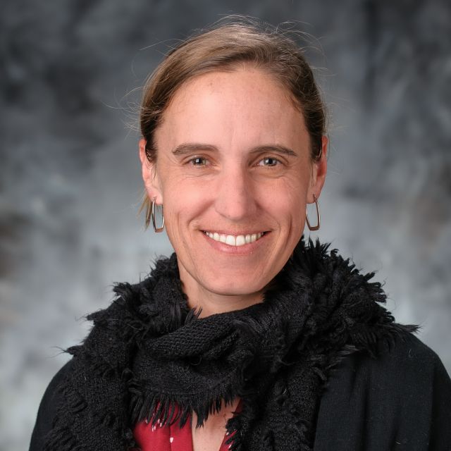
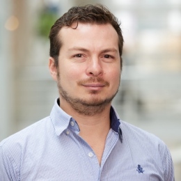
Zahra Gharineiat is an Associate Professor at the University of Southern Queensland , affiliated with the School of Surveying and Built Environment . She has over 8 years of tertiary teaching experience and 11 years of administrative responsibilities. Bachelor of Surveying (BSurv), University of Tabriz Master of Engineering Management (MEngMgt), University of Melbourne PhD, University of Newcastle Research Interests : Zahra specializes in Geomatic Engineering and Machine Learning , with a focus on applications like Unmanned Aerial Vehicles (UAVs) , LiDAR , Digital Twins , and Remote Sensing . Her work spans Earth Science Observations , Satellite altimetry , and Geodetic data capturing , integrating Computational Modelling and Geoinformatics for innovative solutions. Professional Affiliations : She is a member of the Surveying and Spatial Sciences Institute (SSSI) and the International Union of Geodesy and Geophysics (IUGG) . Her research affiliations include the Centre for Future Materials (CFM) , Institute for Advanced Engineering and Space Sciences (IAESS) , and Centre for Astrophysics (CA) .
Kristin Morell is an Associate Professor in the Department of Earth Science at the University of California, Santa Barbara. Her research focuses on active tectonic regions, particularly subduction zones, integrating field observations, geochronology, and remote sensing techniques. Key areas of investigation include subduction zone dynamics, earthquake hazards, and landscape evolution in regions such as Alaska, Central America, Chile, Cascadia, and the Himalayas. She advises graduate students, including Josh Love, and maintains an active research lab dedicated to advancing understanding of tectonic processes and geohazards. Recent field studies have explored the Alaska subduction zone, Cascadia, and Costa Rica, with a focus on faulting mechanisms and long-term uplift patterns. Her work highlights the interplay between tectonic forces and surface processes, emphasizing the importance of integrated observational networks like SZ4D for hazard assessment. She is currently offering graduate student opportunities for Fall 2025, focusing on paleoseismology and tectonic geomorphology in these regions. Notable contributions include studies on forearc deformation, subduction obliquity effects, and the energy budget of subduction zones. Her research spans both theoretical and applied aspects, with implications for seismic hazard mitigation and geological risk management.
Femke Vossepoel is a Professor of Earth System Simulation at the Delft University of Technology 's Faculty of Civil Engineering & Geosciences. She leads a research group focused on data assimilation in geosciences, integrating observations with dynamic Earth-system models to address challenges in urban heat islands, subsidence, and seismic hazard forecasting. Her interdisciplinary background spans oceanography, petroleum engineering, and climate resilience. Research Focus Earthquake occurrence estimation using advanced filtering algorithms Subsidence due to subsurface fluid extraction Climate resilience applications in urban environments AI-enhanced data assimilation for CO2 storage optimization Her work bridges geoscience and computational methods, with key roles in EU's Destination Earth initiative and the UrbanAIR consortium. She received funding from the Dutch Research Council (NWO), Delphi Consortium, and Petrobras for her innovative projects.
Scott DeWolf is a Research Associate Professor in the Department of Environmental Engineering and Earth Sciences at Clemson University, specializing in optical fiber sensor systems for geophysical applications. With over $6M in funding, his work includes permanent subsurface strain monitoring for CO 2 injection and reservoir characterization. Education: Ph.D. in Oceanography (Applied Ocean Science) from UC San Diego (2014), M.S. in Earth Sciences (Geophysics) from UC San Diego (2009), and dual B.S. degrees in Physics and Mathematics from University of Wisconsin River Falls (2007). His research focuses on: High-resolution borehole strain measurements using ruggedized optical fiber CO 2 subsurface storage monitoring Shallow-deep reservoir correlation through strain tensor analysis Subsidence mapping in deltaic environments Nonlinear wave spectroscopy for wellbore damage detection Geophysical instrument development for field deployments Recent publications highlight advancements in: Bayesian inversion of strain tensor data Shallow geologic carbon storage Coherence microwave photonic interferometry Subsidence dynamics in Bangladesh Scientific Awards: Best Poster (2013, European Workshop on Optical Fibre Sensors) Ronald E. McNair Scholar (2005) Sigma Pi Sigma Honor Society (2005) Scott contributes to the HydroMechanics research group and has developed electromagnetic and fiber optic instruments for subsurface monitoring since joining Clemson in 2014.
Nathalie Abadie is a Researcher at the Geographic Information Science and Technology Laboratory (LaSTIG) within the National School of Geographic Sciences at the University of Paris-East. She leads research in geographic information science with a focus on knowledge capture, geohistorical data, and semantic web technologies. Her work bridges historical geography, digital humanities, and artificial intelligence. Her research interests include structured data matching with geographic reference datasets, creation of geohistorical knowledge graphs, and knowledge acquisition for geographic data. She develops methodologies for spatial named entity linking, multimodal image matching, and historical data integration, particularly applied to urban evolution studies of Paris from 1789-1950. Dr. Abadie's recent publications demonstrate trends in geohistorical knowledge graph construction, historical document analysis, and real-time geolocation applications. Her work increasingly integrates machine learning with traditional GIS techniques to address challenges in historical data processing and disaster response. She actively advises PhD students including Solenn Tual, Charly Bernard, and Helen Mair Rawsthorne, and has led major research projects such as SoDuCo (Study of Urban Spatial Structures Evolution) and Mezanno (Collaborative Annotation Tools). Her grants include CNRS-funded initiatives in digital humanities and geospatial AI. Dr. Abadie co-leads the STRUDEL research team and directs multiple national working groups including the CNRS GDR MAGIS commission on Geohistorical Knowledge Graphs. She organizes major conferences including the French Knowledge Engineering Conference and workshops on Digital Humanities and Artificial Intelligence.
Dr. Timothy C. Bartholomaus serves as Associate Professor in the Department of Earth and Spatial Sciences within the College of Science at the University of Idaho. Leading the Glacier Dynamics Group in Moscow, ID, his research integrates seismology and geophysics to investigate glacier dynamics, ice-ocean interactions, and sea level rise projections. His work spans field sites in Alaska, Greenland, Antarctica, and Svalbard with emphasis on subglacial hydrology, iceberg calving mechanisms, and rapid ice loss processes. His educational background includes: PhD in Geophysics (2013), University of Alaska Fairbanks MS in Geological Sciences (2007), University of Colorado Boulder AB in Earth Sciences (2002), Dartmouth College Bartholomaus' research focuses on the fundamental processes driving glacier acceleration and mass loss. His group employs seismic monitoring to map subglacial water systems, revealing how conduit branching and pressure gradients control ice flow. Seminal work demonstrated that changes in subglacial water storage—not total throughput—govern glacier velocity, overturning prior assumptions. Current projects examine glacier surges through enthalpy-based modeling, ice mélange impacts on fjord stratification, and calving style differentiation using terminus change time series. Analysis of his recent publications reveals strong emphasis on interdisciplinary approaches combining seismology, hydrology, and remote sensing. Key trends include seismic mapping of subglacial hydrology during surge cycles, quantification of submarine melt effects on calving, and development of applied ice sheet modeling frameworks for policy relevance. His work increasingly addresses societal implications through sea level rise projections and community engagement initiatives. As principal investigator, Bartholomaus has secured funding from the National Science Foundation and the University of Alaska Fairbanks Center for Global Change. His Glacier Dynamics Group mentors graduate students through field campaigns in Alaska and Greenland, with recent graduates including Dr. Chris Miele (PhD dissertation: 'Shearing shelves, mathematical modeling, and fracture factories'). The group actively participates in major workshops including the Future of Greenland Ice Sheet Science (FOGSS) and Northwest Glaciologists meetings. The Glacier Dynamics Group operates through collaborative networks including the International Glaciological Society and multi-institutional projects like the 2023 FOGSS workshop hosted at UI. Field operations span the St. Elias Range, Greenland fjords, and Antarctic ice shelves, utilizing seismic arrays, GPS monitoring, and oceanographic sensors to capture ice-ocean interactions at process scales.
Pierre-Yves Gilliéron is a Senior Scientific Collaborator and Section Assistant at École polytechnique fédérale de Lausanne (EPFL), affiliated with the School of Architecture, Civil and Environmental Engineering (ENAC) and the Environmental Engineering Sciences (SIE) section. He serves as Deputy Director of the SIE section since 2018 and is a Lecturer in satellite positioning and geomatics. His work spans teaching, research, and academic administration, including managing bachelor’s and master’s study plans, mobility programs, and internships. His research interests are centered on Geomatics, Intelligent Transportation Systems (ITS), GNSS (satellite navigation), Geographic Information Systems, and road and transport standardization . He has extensive expertise in mobile mapping, precise road geometry, pedestrian navigation, and the integration of GNSS in transport systems. His work also explores big data, crowdsourcing, and the quality of traffic information in modern mobility contexts. His recent publications reflect a strong focus on positioning performance, integrity, and reliability in ITS, particularly for autonomous and safer driving. He has led and contributed to major European research initiatives like the COST TU1302 SaPPART Action, emphasizing the role of high-quality positioning in future transport systems. His work bridges technical research with practical applications in road safety, urban mobility, and infrastructure management. Scientific Affiliations and Service: Deputy Director, SIE Section, EPFL Member, Swiss Institute of Navigation (ION-CH) Member, Swiss Geodetic Commission (SCNAT/SGK) Member, VSS Expert Commissions Member, its-ch Committee Professional affiliations: IGSO, geosuisse, SSPIT Former member, ENAC Faculty Council (2004–2010) Member, SIE Teaching Committee He has supervised students such as D. Moreau and has been instrumental in developing educational resources, including a MOOC on geomatics available on Coursera. His research is supported by collaborations with institutions like IFSTTAR and industry partners, focusing on real-time data capture, navigation system enhancement, and the management of scientific projects and networks. Laboratories and Research Groups: Formerly affiliated with the Topometry Laboratory (TOPO) at EPFL Involved in the NEARCTIS project (Network of Excellence for Cooperative Traffic Management)
Laramie Potts is an Associate Professor at the School of Applied Engineering and Technology, New Jersey Institute of Technology (NJIT). His research focuses on geomatics engineering, geophysics, and space weather modeling, with notable contributions to satellite geopotential studies and educational innovations in geospatial technologies. He has secured seven federal grants including an NSF I-Corps project on AI-driven reality capture data and a multi-year study on equatorial ionospheric anomalies. Key research areas include crustal thickness analysis, gravity anomaly mapping, and GPS applications in infrastructure monitoring. His educational work emphasizes competency-based curricula for 4IR readiness and DEI frameworks in geospatial education. Over 28 publications span geospatial systems, structural monitoring, and pedagogical strategies, with a Scopus h-index of 30 and 10+ citations on major works like drainage management systems and dam deformation assessments. Grants: $1.2M+ in NSF funding for projects like AI-generated labeled maps (2023-2024) and ionospheric wavelet modeling (2004-2010) Expertise: Integrating geomatics with engineering education through reality capture technologies and LMS systems Recognition: Cited 17x for geodetic dam deformation studies and 9x for drainage information systems Led collaborative projects with NASA and international teams, advancing both technical innovation and educational equity in engineering disciplines.
Professor Linlin Ge is a distinguished academic specializing in remote sensing and earth observation at the University of New South Wales (UNSW), Sydney, Australia. He holds a position in the School of Civil and Environmental Engineering and has been studying earth observation techniques since 1985. His work has significant applications in natural disaster monitoring, land subsidence measurement, and integrating radar and optical remote sensing with GPS and GIS systems. Professor Ge's educational background includes a PhD in GPS and remote sensing from UNSW, an MSc in Crustal Deformation from the Institute of Seismology, and a BEng (1st Hons and University Medal) in Optical Engineering from the Wuhan Technical University of Surveying and Mapping. He was also a postdoctoral research fellow in the Meteorological Research Institute of the Japan Meteorological Agency sponsored by the Science and Technology Agency of Japan during 1997-1998. His research interests focus on using digital images to map the Earth's surface, combining remote sensing with GPS and GIS to produce cost-effective and reliable maps, and integrating radar and optical remote sensing with GPS and GIS to measure subtle surface changes with minimal latency. Professor Ge's work aims to make remote sensing more timely, accurate, affordable, and widely applicable across various disciplines. His recent publications demonstrate a strong focus on advanced remote sensing techniques, particularly in the areas of hyperspectral image classification, landslide monitoring, earthquake damage assessment, and land subsidence analysis. His research increasingly incorporates deep learning and AI approaches while maintaining strong applications in natural disaster monitoring and management. Major Awards: JK Barrie Award for Overall Excellence (2008 Asia-Pacific Spatial Excellence Awards) NSW Scientist of the Year 2009 (Physics, Earth Sciences, Chemistry and Astronomy) UNSW Inventor of the Year finalist (2010) Australian Research Council Postdoctoral Fellowship (2002-2004) Professor Ge has supervised 25 graduated students and currently has 5 students in his lab. His research is supported by multiple grants including ARC Discovery grants, Australian Space Research Program funding, and various government and industry partnerships focused on SAR formation flying, subsidence monitoring, flood mapping, and carbon capture safeguarding. His work with satellite missions such as Envisat, ALOS, COSMO-SkyMed, Radarsat-2 and ALOS-2 demonstrates his leadership in practical applications of remote sensing technology.
Silvia Katsarska-Filipova is an Associate Professor at the Department of Photogrammetry and Cartography within the Faculty of Geodesy at the University of Architecture, Civil Engineering and Geodesy (UACEG) in Sofia, Bulgaria. She holds a Doctor of Science degree in Photogrammetry and Remote Sensing Methods (2014) and a Master of Science in Geodesy from the same institution (1995-2000). Currently, she teaches courses including Unmanned Aerial Photogrammetry and Transformation and Interpretation of Space Images, and conducts exercises in Digital Photogrammetry, Close-range Photogrammetry and Laser Scanning. Doctor of Science in Photogrammetry and Remote Sensing Methods (2014) Master of Science in Geodesy, University of Architecture, Civil Engineering and Geodesy (1995-2000) Dr. Katsarska-Filipova's research focuses on digital photogrammetry, image processing, 3D modeling of surfaces and volumetric bodies, methods for obtaining and analyzing geospatial information, unmanned aerial systems for image capture and processing, applications of remote sensing, and GIS. Her work bridges theoretical advancements with practical applications in cultural heritage documentation, environmental monitoring, and urban planning. She has developed expertise in using drone technology for precise geospatial measurements and analysis, particularly for volume computations in quarries and other applications. Her recent publications (2022-2024) demonstrate a strong focus on integrating photogrammetry with remote sensing for diverse applications including urban heat island analysis, forest fire monitoring, water body assessment, and photovoltaic park efficiency evaluation. She has increasingly incorporated digital twin technology and multi-sensor approaches in her research, showing a progression from traditional photogrammetric techniques to more integrated, technology-driven solutions that combine close-range photogrammetry, laser scanning, and satellite imagery. Her work frequently involves practical applications in environmental monitoring and cultural heritage preservation. Dr. Katsarska-Filipova has supervised numerous diploma students on topics ranging from photogrammetric documentation of architectural heritage to analysis of burned territories using satellite imagery. She has served as Quality Manager for her department since 2017 and has participated in multiple research projects including 'Information platform for research and monitoring of the environment' (2018-2019), 'Use of multispectral and thermal images in analysis and assessment of energy efficiency' (2021-2022), 'Creation of 3D models of architectural objects based on hybrid technology for laser scanning' (2022-2023), and 'Digital geodetic twins in UACEG' (2023-2024). She is a member of the Union of Geodesists and Land Surveyors in Bulgaria and has received positive assessment from the Commission for the Attestation of the Academic Staff at the Faculty of Geodesy of UACEG (375.9 points) dated January 7, 2020. Her research has been widely cited internationally, particularly her 2016 work on volume computation of stockpiles using UAV measurements, which has become a reference in the field of drone-based surveying applications.
Marco Viccaro is a Full Professor of Geochemistry and Volcanology (GEO/08) at the University of Catania, Department of Biological, Geological and Environmental Sciences. He serves as President of the Master's Degree Program in Geophysical Sciences (2020-2024) and Delegate for Research at the Department of Biological, Geological and Environmental Sciences. Additionally, he is associated with research activities at the National Institute of Geophysics and Volcanology – Catania Section, Etnean Observatory since April 2016, and is a member of the National Commission for Forecasting and Prevention of Major Hazards for the Volcanic Risk Sector since September 2023. His educational background includes: Bachelor's Degree in Geological Sciences (Mineral-Petrographic-Geochemical-Volcanological Major) from the University of Genoa (2003, 110/110 cum laude) PhD in Petrography and Petrology from the University of Catania (2007) Professor Viccaro's research focuses on magmatic processes in volcanic systems across various geodynamic settings. His work emphasizes compositional and textural microanalysis of mineral phases to develop models of feeding systems in numerous volcanic systems worldwide and to determine possible magma storage levels. His research has provided insights into volcanic processes and their temporal scales. He is involved in multidisciplinary collaborations including: Studies on the role of active tectonics in volcanic processes through volcanic-stratigraphic/structural surveys Multidisciplinary studies on intratelluric fluid dynamics through geophysical signal analysis Research and development for geothermal resource capture and sustainable use Study of magmatic rock materials used in significant architectural constructions and ceramic artifact pastes Analysis of his recent publications reveals a strong focus on understanding volcanic plumbing systems, particularly at Mt. Etna, Stromboli, and other Mediterranean volcanic centers. His work increasingly integrates multi-parameter approaches combining petrological, geochemical, and geophysical data to unravel eruption dynamics, magma storage, and ascent processes. There's also a growing emphasis on applied geothermal research, reflecting his leadership in spin-off company EarTherm srl focused on renewable energy, particularly low-enthalpy geothermal resources. Among his scientific recognitions: Recipient of the prestigious "Angelo Bianchi Award 2011" by SIMP Merit certificate from UnionCamere of the Sicilian Region for activities of the innovative startup EarTherm srl Professor Viccaro has been instrumental in securing and managing numerous research projects including PON, PNRR, PRIN, INGV-DPC, and University Research Programs. He has supervised over 100 bachelor's and master's theses and mentored 7 PhD students. His editorial roles include Associate Editor for several international journals including "Geosciences," "Journal of Chemistry," and "Scientific Reports." As President of the Italian Volcanology Association since January 2021, he plays a significant role in the national volcanological community. He leads the spin-off company EarTherm srl, which operates in the renewable energy sector with particular reference to low-enthalpy geothermal energy. His research group at the University of Catania collaborates extensively with the National Institute of Geophysics and Volcanology (INGV) and participates in international research networks, contributing to both fundamental volcanological research and practical applications for volcanic hazard assessment and geothermal energy development.
Dr. TUCHBAND Tamás is an Assistant Professor at the Department of Geodesy and Surveying, Faculty of Civil Engineering, Budapest University of Technology and Economics (BME). He teaches courses such as Structural Geodesy and Surveying, with a focus on high-accuracy GPS positioning and atmospheric modeling. PhD in Earth Sciences (2015) MSc in Land Surveying and Geomatics Engineering (2008) His research emphasizes tropospheric and ionospheric models in GNSS applications, including precise point positioning and water vapor estimation. Recent work explores EGNOS calibration and motion capture systems for geodetic precision. Scientific awards include the #építő250 Scholarship . He serves as Secretary of the Youth and Education Section at the Hungarian Society of Surveying, Mapping and Remote Sensing.
Mohammad Bagherbandi is a Professor at the University of Gävle , specializing in Geomatics and Applied Geodesy within the Department of Computer Science and the Built Environment . He has been affiliated with the university since 2012 and maintains a concurrent role as a Senior Researcher (Associate Professor) at KTH Royal Institute of Technology , where he worked as a postdoctoral researcher for two years post-PhD (2011) in Physical Geodesy and Earth's Interior Modeling . Research Areas : Precision positioning, Earth observation, infrastructure monitoring, gravity field modeling, environmental monitoring (climate change, ice melt, sea-level changes) Key Methods : Geodetic, remote sensing, GNSS/IMU integration, GNSS reflectometry, InSAR His recent work emphasizes interdisciplinary links between geodesy and geophysics , particularly in quantifying land uplift from glacial isostatic adjustment (via GRACE/GRACE-FO), deformation monitoring in urban/railway systems, and integrating geodetic data with wireless sensors. Projects include: Roof network in the air (2019–2022) - Swedish Transport Administration Satellite monitoring of railways (2020–2021) - Traffic Agency Spatial Data Innovation (2018–2021) - Swedish Agency for Economic and Regional Growth 3D mapping accuracy (2018–2020) - Lars E. Lundberg's Foundation Subsidence monitoring in urban regions (2019–2020) - SWECO/J. Gust. Richert Foundation He contributes to GNSS signal applications for detecting sea-level variations and tidal frequencies, alongside theoretical advancements in geoid/quasigeoid modeling and relativistic geodesy. His research spans planetary height systems (e.g., Mars/Lunar geodesy) and geophysical stress modeling in regions like Fennoscandia and the Tibetan Plateau.
Francisco J. Peña is a postdoctoral researcher working jointly at the Department of Physical Geography of Stockholm University and the Division of Software and Computer System (SCS) of KTH Royal Institute of Technology in Sweden. He is also a member of the Distributed Computing at KTH (DC@KTH) research group. Peña received his PhD from University College Cork in June 2019 and previously held a postdoctoral position at University College Dublin (2018-2020). His academic journey reflects a strong foundation in computational methods applied to geospatial analysis. His research program bridges artificial intelligence and environmental monitoring, with particular expertise in applying deep learning techniques to remote sensing data. Peña's work in computer vision and natural language processing contributes to innovative approaches for analyzing geospatial information, with applications in hydrological monitoring and wetland conservation. His interdisciplinary approach combines computer science methodologies with physical geography challenges. Peña is actively engaged with the Hydrogeodesy Lab, which specializes in using geodetic methods to measure hydrological quantities that conventional monitoring systems cannot capture. This research has significant implications for water resource management and climate change adaptation. His current DeepWetlands project represents a cutting-edge application of machine learning to monitor water extent changes in wetlands through integration of satellite imagery, radar data, and other space-based sensors. This work addresses critical environmental monitoring needs with advanced computational techniques.