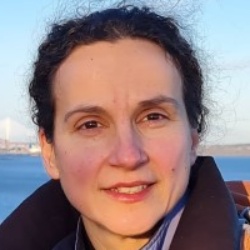
Lisa Grant Ludwig is a Professor in the Department of Population Health and Disease Prevention at the University of California, Irvine (UCI). She is a nationally recognized expert in earthquake science, focusing on translating geophysical research into policy for disaster risk reduction. Her work bridges seismology, public health, and policy implementation. PhD in Geology with Geophysics minor (Caltech) MS in Environmental Engineering Science (Caltech) BS in Applied Environmental Earth Science (Stanford) Dr. Ludwig's research centers on earthquake dynamics, particularly along the San Andreas Fault, advancing disaster resilience through innovative nowcasting techniques using AI and machine learning. Her publications demonstrate expertise in seismic hazard modeling, geodetic imaging, and community preparedness studies. Recent publications highlight AI-enhanced earthquake prediction (QuakeGPT), temporal-spatial nowcasting models, and applications of geodetic data for crustal deformation analysis. These works integrate machine learning with traditional seismological methods to improve hazard forecasting. President of Seismological Society of America NASA 2012 Software of the Year Medal Featured on Science magazine cover Congressional Testimony provider Active Federal Advisory Committee member Her interdisciplinary approach combines geophysics, public health policy, and computational science. Current projects focus on earthquake nowcasting, fault zone analysis, and developing accessible geospatial tools like GeoGateway for disaster response.
Prof. Dr.-Ing. Jörg Blankenbach holds the Chair of Construction Informatics and Geoinformation Systems at RWTH Aachen University's Geodetic Institute. His research focuses on the integration of digital technologies in civil engineering and geospatial systems. Current affiliations include: Chair of Construction Informatics and Geoinformation Systems, RWTH Aachen University Geodetic Institute, RWTH Aachen University Research interests span digital construction management, geospatial data modeling, BIM-GIS integration, and smart infrastructure systems.
Prof. Hansjörg Kutterer is a Professor and Dean at the KIT-Department of Civil Engineering, Geo and Environmental Sciences at Karlsruhe Institute of Technology (KIT). His primary affiliation is with KIT's Department of Civil Engineering, Geo and Environmental Sciences. He leads geodetic research initiatives focusing on Earth observation systems, atmospheric modeling, and geophysical data analysis. His research emphasizes advanced applications of GNSS, InSAR, and satellite gravimetry for monitoring climate-related phenomena such as water vapor dynamics, terrestrial water storage changes, and ground motion patterns. Key projects include developing machine learning-enhanced models for tropospheric delay corrections and integrated water vapor estimation in the Upper Rhine Graben region. Prof. Kutterer actively contributes to international geodetic frameworks like the Global Geodetic Observing System (GGOS), particularly through DA-CH regional collaborations. His work bridges geodetic methodologies with interdisciplinary challenges in climate science and environmental engineering. He oversees departmental operations as Dean, fostering innovation in geospatial education and infrastructure. His technical expertise spans geodetic deformation analysis, statistical robust estimation, and the integration of geophysical models with observational data.
Summer Rupper is a Professor at the School of Environment, Society & Sustainability at the University of Utah, where she has held her position since July 2019. Her research focuses on understanding the interactions between climate, glaciers, and water resources, with particular emphasis on high mountain regions including High Mountain Asia, the Himalayas, and polar regions. She leads multiple research projects examining glacier dynamics, hydrological processes, and climate change impacts on water security for downstream populations. BS in Geology from Brigham Young University (2001) MS in Geology from University of Washington (2004) PhD in Earth and Space Sciences from University of Washington (2007) Professor Rupper's research spans physical geography, environmental geoscience, and climate change science, with specific expertise in glaciology, hydrology, and atmospheric sciences. Her work integrates field measurements, remote sensing, and numerical modeling to understand glacier dynamics, snow processes, and water resource availability in mountainous regions. She has particular expertise in High Mountain Asia, where glaciers provide critical water resources for over a billion people. Her research addresses fundamental questions about glacier response to climate change, hydrological partitioning, and the implications for water security in vulnerable regions. Her recent publications demonstrate a consistent focus on understanding glacier dynamics, hydrological processes, and climate interactions in mountainous regions. The work spans multiple methodologies including remote sensing analysis, numerical modeling, statistical approaches, and field-based measurements. Key themes include glacier melt contributions to river systems, precipitation patterns in complex terrain, snow density modeling, and the impacts of climate change on water resources in High Mountain Asia and polar regions. Her research often integrates multiple data sources and approaches to address complex questions about cryospheric processes and their societal implications. Superior Research Award (2024, CSBS, University of Utah) G.K. Gilbert Award for Excellence in Geomorphic Research (2022) Outstanding Utah Higher Education Science Teacher (2021) Top Researcher Award, Celebrate U showcase (2017) Antarctic Service Medal (2010, USAF) Professor Rupper actively mentors graduate students through thesis research courses at both the PhD and Master's levels, as well as individual projects. She has secured significant research funding from multiple federal agencies including NSF, NASA, and USAID, with current projects examining climatic controls on Antarctic ice sheets, glacier dynamics in High Mountain Asia, and historical glacier changes. Her collaborative work extends across international boundaries, working with scientists in Pakistan, Bhutan, and other regions to address shared water security challenges. She also engages in community outreach through workshops with school districts and science teacher associations to communicate climate science to broader audiences. Professor Rupper participates in multiple collaborative research teams including the NASA High Mountain Asia Team (HiMAT), where she contributes expertise in glacier dynamics and hydrology. She serves on several scientific committees including the NSF Ice Core Facility Sample Allocation Committee and the American Geophysical Union Cryosphere Section Fellows Committee. Her research often involves interdisciplinary teams combining expertise in glaciology, hydrology, remote sensing, and climate modeling to address complex questions about mountain water systems under changing climate conditions.
Jaap Zevenbergen is a Full Professor at the University of Twente's Faculty of ITC, specializing in Land Administration and Geo-Information Management. He holds a PhD from Delft University of Technology (2002) and degrees in Geodetic Engineering (Delft) and Law (Leiden University). His research focuses on international land governance, digital transformation of property institutions, and pro-poor land tools, with projects in Africa, Southeast Asia, and Eastern Europe. He has contributed to UN Habitat initiatives and World Bank programs, emphasizing sustainable development goals (SDGs 1, 11, 13). Key roles: Theme leader at TU Delft's OTB Institute (2003–2010), Portfolio Manager for MSc Land Administration at ITC. Teaching: MSc programs in Land Administration, GIMA, and International Land Management. Research interests include: Land Administration Domain Model (LADM) implementation, legal-technical integration in geo-ICT systems, and post-disaster/post-conflict land governance. He has authored/co-authored over 340 publications and edited books like Real Property Transactions . Notable achievement: Co-winner of the 2018 FIG-Survey Review Prize for land policy analysis. Current projects explore 3D cadastral systems, UAV applications in land registration, and ethical geospatial practices. He advises on land reforms in Greece and Egypt and collaborates with institutions like UN Habitat and the World Bank.
Ramon Arrowsmith is a Professor at Arizona State University's School of Earth and Space Exploration (SESE). His research focuses on earthquake geology, tectonic geomorphology, and active faulting, with a particular emphasis on leveraging high-resolution topography through initiatives like OpenTopography. He has over 35 years of experience in paleoseismology, geomorphic mapping, and fault zone analysis. Arrowsmith has held administrative roles such as Deputy Director of SESE and associate directorships in graduate studies and geological sciences departments. His work integrates remote sensing, lidar technology, and robotics to address geological hazards and landscape evolution. Key projects include the QUAKES mission for topographic data collection and the development of low-cost seismic tools like ShakeBot. His research spans global regions, including the San Andreas Fault, Pamir-Tien Shan collision zone, and volcanic fields in Arizona and Mexico. Arrowsmith's recent publications highlight advancements in fault slip modeling, seismic hazard assessment, and open-access geospatial data platforms. His contributions to education include courses on field geology and computational methods in earth sciences. Collaborations with international teams and interdisciplinary projects underscore his commitment to advancing geoscience through innovation and accessibility.
Walter Szeliga is a Professor and Department Chair at Central Washington University. He holds a Ph.D. from the University of Colorado (2010). His research focuses on seismology, GPS, and InSAR technologies, with emphasis on earthquake early warning systems, crustal deformation monitoring, and natural hazards mitigation. Dr. Szeliga leads efforts in integrating real-time geodetic data streams for disaster response and has contributed to the development of ShakeAlert® systems. His work spans global geophysical networks, ionospheric perturbations, and paleotsunami studies. Key research interests include: Real-time GNSS applications for seismic monitoring Crustal deformation analysis using InSAR and GPS Earthquake source characterization through multi-method approaches Historical seismotectonic reconstructions Disaster forecasting and early warning system optimization Recent studies highlight advancements in trapping atmospheric lee waves detection via GNSS, volcanic plume dynamics during the 2022 Tonga eruption, and long-term paleotsunami records in Chile. His work bridges geophysical instrumentation with computational modeling to address critical questions in tectonic processes and hazard assessment. Scientific contributions include 50+ peer-reviewed articles on topics ranging from Cascadia subduction zone dynamics to global navigation satellite system innovations. His research has implications for civil infrastructure resilience, space weather impacts, and international geohazard collaboration frameworks.
Kyle Bradley is a research-focused academic affiliated with the College of Engineering at Cornell University, specifically within the Department of Earth and Atmospheric Sciences. His work centers on active tectonics, earthquake geology, and geodetic modeling, with extensive fieldwork and satellite-based analysis in Southeast Asia, particularly Indonesia and Myanmar. University: Cornell University School: College of Engineering Department: Department of Earth and Atmospheric Sciences Academic Rank: Research Professor His research interests lie primarily in understanding the mechanics of active fault systems, subduction zones, and their associated hazards. He investigates how tectonic and volcanic processes interact, particularly in regions like the Flores Thrust and Sumatran Fault Zone. His methodologies include GPS and InSAR geodesy, photogrammetry, drone-based mapping, and seismic source modeling to constrain fault geometries, slip rates, and rupture behaviors. The trends in his recent publications indicate a strong emphasis on interdisciplinary geophysics, combining structural geology, seismology, and geochemistry to assess seismic and tsunami hazards. His work often integrates high-resolution geospatial data with field observations to develop models of crustal deformation and earthquake cycles. Although no formal scientific awards are listed in the provided content, his consistent publication record in high-impact journals reflects significant scholarly contributions. There is no mention of formal grant funding, but his research scope suggests involvement in federally or institutionally supported projects. Kyle Bradley has not listed any students in the provided information, but his role as a research professor implies potential mentorship of graduate students and postdoctoral researchers. His work contributes to understanding earthquake triggering mechanisms, such as the role of wet rice cultivation in landslides during the 2018 Palu earthquake, demonstrating applied relevance to disaster risk reduction. He is actively involved in developing regional tectonic models using dense GNSS networks, focal mechanism catalogs, and bathymetric data. His research teams likely include collaborators from international institutions, particularly in Indonesia and Southeast Asia, given the geographic focus of his studies. Labs or research groups associated with his work may utilize geospatial analysis, satellite remote sensing, and computational modeling of tectonic processes.
Dr. Erik Linstead is an Associate Professor and Senior Associate Dean at Chapman University, affiliated with the Fowler School of Engineering, School of Pharmacy, and George L. Argyros College of Business and Economics. His expertise spans Machine Learning, GPU Programming, Autism Spectrum Disorder, Assistive Technologies, Predictive Analytics, and Virtual Reality. Education: Bachelor of Science, Chapman University Master of Science, Stanford University Ph.D., University of California, Irvine Dr. Linstead's research integrates machine learning with diverse domains, including autism treatment, environmental monitoring, and software engineering. His recent publications focus on coral reef health, land surface temperature trends, and embedded machine learning systems. His scholarly work includes collaborations in remote sensing, medical informatics, and neurodiversity support. Articles highlight his interdisciplinary approach, applying AI to ecological challenges (e.g., Red Sea coral reefs, Nile Basin droughts) and human-centered technologies (e.g., VR therapy for autism, medication adherence analysis).
Dr. Stella Pytharouli is a Senior Lecturer in Civil and Environmental Engineering at the University of Strathclyde. With over 20 years of expertise in structural and ground deformation monitoring/analysis, her research focuses on subsurface characterization and slope instability early warning systems through microseismic monitoring, geodetic technologies, and machine learning integration. MEng (2002) - University of Patras MSc (2004) - University of Patras PhD (2007) - University of Patras Her research combines advanced signal processing with geodetic monitoring (terrestrial/aerial) to develop AI-driven solutions for UK landslide sites. Key areas include: Microseismic monitoring of weak seismic events Geometric and kinematic analysis of ground deformations Integration of geotechnical data with machine learning Climate change impact on slope stability Low-cost sensor development for environmental monitoring Recent publications highlight her work on AI-based seismic classification models, tiltmeter applications, and 3D reconstruction techniques. Her group includes 4 PhD students and 1 postdoc. Scientific recognitions include: Geophysical Research Letters front cover selection (2011) EOS Research Spotlight (2019) Lampadarios Prize from Academy of Athens (2009) TOPCON Award for young researchers (2008) As Director of Postgraduate Research (2020-present), she supervises PhD students and teaches land surveying modules. Current projects address slope stability analysis, climate change correlations, and seismic data automation.
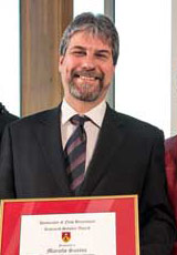
Marcelo Santos is a Professor in the Department of Geodesy and Geomatics Engineering at the University of New Brunswick (UNB), where he has been a faculty member since 2000. He holds a PhD in Geodesy (1995, UNB), M.Sc. in Geophysics (1990, Rio de Janeiro National Observatory), and B.Sc.E. in Cartographic Engineering (1982, Rio de Janeiro State University). His academic career includes roles such as Head of the Department (2012–2017) and international leadership in organizations like the International Association of Geodesy (IAG), where he served as President of Commission 4 (2015–2019) and Senior National Delegate of Canada (2007–2011). Research interests focus on Space and Physical Geodesy, GNSS navigation, and atmospheric delay modeling. His work emphasizes rigorous height systems, geoid determination, and integration of geodetic techniques with numerical weather models. Key contributions include the development of UNB’s atmospheric delay models and the Stokes-Helmert geoid computation methodology. Professional activities include chairing IAG commissions, directing UNB’s Space Geodesy Laboratory (1996–1999), and advising on geodetic infrastructure projects in Brazil and Canada. His publications span over 150 peer-reviewed articles, covering topics like tropospheric modeling, geoid determination, and GNSS applications in environmental monitoring. Led research grants include projects on global topographical density models and climate applications of GNSS-derived tropospheric parameters. Collaborations involve institutions like NASA, ESA, and Brazil’s IBGE. Current projects focus on enhancing geoid models and improving vertical datum systems for precision geomatics applications.
Prof. Dr. Jonathan Bedford is a leading researcher in physical geodesy at Ruhr-Universität Bochum's Institute of Geology, Mineralogy and Geophysics. Previously, he worked at the German Research Centre for Geosciences (GFZ) in Potsdam and the Free University of Berlin. His research focuses on subduction zone dynamics, coseismic/postseismic deformation, and machine learning applications in geophysics. University of Leeds (BSc Geosciences) Colorado School of Mines (MS Geosciences) Free University of Berlin (PhD 2015) His work spans: Subduction zone mechanics and earthquake cycles Viscoelastic relaxation and afterslip modeling Machine learning for earthquake prediction Geodetic data analysis with GPS and InSAR Fault interaction and seismic hazard assessment Power-law rheology in crustal deformation Research trends from his publications show emphasis on: Pre-earthquake deformation patterns (wobbling, gradual unlocking) Postseismic processes (afterslip, viscoelastic relaxation, poroelasticity) Integration of geodetic and seismic data Physics-based and data-driven earthquake analog models Notable collaborations include GFZ Potsdam, Free University of Berlin, and Chilean institutions. His work combines numerical modeling with observational data to understand megathrust earthquake mechanisms and improve seismic hazard assessments.
Eric Kirby is an Adjunct Research Professor in the Department of Earth, Marine, and Environmental Sciences at the University of North Carolina at Chapel Hill, within the College of Arts and Sciences. He is actively engaged in tectonics and geomorphology research, leading the Tectonics and Geomorphology Lab. Education: Ph.D., Massachusetts Institute of Technology (2001) M.S., University of New Mexico (1994) B.A., Hamilton College (1992) Dr. Kirby's research centers on the interplay between tectonics, climate, and erosion in shaping mountainous landscapes. His work spans active mountain belts globally, with a focus on the Tibetan Plateau, convergent margins, and active fault systems. He investigates landscape responses to rock uplift, mantle flow, and hydrological processes, integrating field observations with geochronology and geophysical data. His recent publications reveal a strong trend in Quaternary tectonics, paleoseismology, fluvial geomorphology, and climate-tectonics coupling. Key themes include fault slip rate quantification, paleolake evolution, river terrace formation, and transient landscape responses to base-level changes, primarily in high-elevation and tectonically active regions. Scientific Awards: No awards listed in the provided text. Dr. Kirby actively mentors graduate students and collaborates on funded research projects involving landscape evolution, critical zone dynamics, and tectonic geomorphology. His work is supported by publications in top-tier journals and collaborations with leading institutions. He advises several students, including W.M. Rittase, Q. Su, N. West, and X. Shi, who appear as first authors on joint publications. He leads the Tectonics and Geomorphology Lab , which conducts research on active tectonics, surface processes, and landscape evolution using field mapping, remote sensing, and numerical modeling techniques.
Michele Cooke is an Associate Professor at the University of Massachusetts Amherst , affiliated with the School of Earth and Sustainability. Her research focuses on mechanical modeling of fault systems, particularly in Southern California, and she leads initiatives for disability equity in geosciences. Contact: cooke@umass.edu | (413) 577-3142 | Morrill 3 230, 611 N Pleasant St, Amherst, MA Research Interests: Active faulting and work minimization in fault evolution Integration of analog experiments (sandbox/claybox) with numerical models Disability equity in geosciences (e.g., The Mind Hears mentoring forum) Subduction zone hazards and energy budgets Earthquake early warning accessibility for deaf communities Education: Ph.D., Stanford University
Dr. Armin Agha Karimi is a Lecturer in the School of Surveying and Built Environment at the University of Southern Queensland. He holds a BSc in Civil Engineering from Tabriz University, an MSc from Middle East Technical University (METU), and a PhD from the University of Newcastle. His research focuses on spatial data integration, cadastral systems modernization, environmental monitoring using remote sensing, and sea level variability analysis. Key research interests include 3D cadastral boundaries in BIM environments, digital twin applications in built environments, and the impact of hydrological loading on land motion. He has contributed to studies on erosion hotspot mapping in Queensland and the implications of coal seam gas activities on land subsidence. His work on Baltic Sea sea level dynamics and Australian coastal projections has advanced understanding of climate-driven environmental changes. Dr. Karimi is affiliated with the Centre for Sustainable Agricultural Systems and actively publishes on geomatics, climate science, and legal aspects of digital surveying. His recent articles highlight innovations in VR-ready survey data transformation and the legal challenges of electronic cadastral plans.