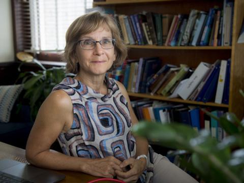
Domniki Asimaki is a Professor of Mechanical and Civil Engineering at the California Institute of Technology (Caltech), part of the Division of Engineering and Applied Science. Her research focuses on geotechnical engineering, computational mechanics, and structural dynamics, with an emphasis on understanding ground motion effects on natural and engineered systems such as dams, tunnels, and urban infrastructure. She holds a Dipl. from the National Technical University of Athens (1998), an M.S. (2000) and Ph.D. (2004) from MIT, joining Caltech in 2014. Key research interests include soil dynamics, wave propagation, regional ground deformation, and soil-foundation-structure interaction. She has pioneered data-driven approaches to integrate numerical simulations with field observations for resilient infrastructure design. Notable achievements include developing the open-source Seismo-VLAB software for seismic analysis and receiving prestigious awards like the Bodossaki Award of Scientific Excellence and the Geotechnical Earthquake Engineering Award. Her work addresses seismic hazards at urban and regional scales, with recent studies on the 2023 Türkiye earthquake, the 2019 Ridgecrest earthquake, and Kathmandu Basin dynamics. She leads initiatives to enhance ground motion prediction, landslide hazard assessment, and infrastructure resilience through advanced modeling and AI-driven methods. Education: Dipl., National Technical University of Athens, 1998 M.S., Massachusetts Institute of Technology, 2000 Ph.D., Massachusetts Institute of Technology, 2004 Awards: Bodossaki Award of Scientific Excellence Geotechnical Earthquake Engineering Award Labs/Teams: Leads research groups focusing on seismic hazard modeling, open-source software development, and geotechnical data assimilation techniques.
Professor Ana Ferreira is a leading seismologist at University College London, focusing on deep Earth structure and earthquake source processes. Her research integrates seismic and geodetic data to understand planetary dynamics from the surface to the lowermost mantle. Her work includes pioneering seismic tomography, such as the SGLOBE-rani 3D anisotropy model, and earthquake source analysis using InSAR and normal mode data. She leads the Seismological Laboratory and teaches Seismology II and Field Geophysics. Recent projects include the UPFLOW experiment, which deployed 49 ocean bottom seismometers in the Atlantic, and studies on Greenland ice sheet evolution and Tonga volcanic eruptions. Her EU-funded research emphasizes multidisciplinary data integration and numerical modeling. Key article trends cover mantle anisotropy, global tomography, earthquake source inversion, cosmology-inspired machine learning, and ocean bottom seismology applications in geodynamics and cryospheric processes.
Jerry X. Mitrovica is the Frank B. Baird, Jr. Professor of Science at Harvard University, leading the Mitrovica Group. His research focuses on Earth’s geodynamic response to environmental changes, with a central theme of sea-level variability across timescales. He holds a Ph.D. from the University of Toronto, where he previously served as the J. Tuzo Wilson Professor in Physics and directed the Canadian Institute for Advanced Research’s Earth Systems Evolution Program. His work integrates theoretical, numerical, and observational approaches to study ice sheet dynamics, mantle structure, and geodetic signals of climate change. Key research areas include modern ice sheet collapse impacts, glacial isostatic adjustment, and the interplay between Earth’s rotation and ice mass redistribution. Mitrovica’s group emphasizes interdisciplinary collaboration, with members from geophysics, mathematics, archaeology, and the humanities. Notable awards include the Arthur L. Day Medal, W.S Jardetsky Medal, and A.E.H. Love Medal. His lab has pioneered methods to infer Antarctic mantle viscosity from GPS data and reconcile paleo-sea-level records with dynamic topography corrections. Current projects include probing mantle structure via sea-level measurements and investigating human migration routes via sea-level fingerprints. Academic advising includes Natasha Valencic (Ph.D. student). The group actively advocates for diversity in academia and integrates activism into its mission, supporting graduate unions and marginalized communities in science.
Eric Hetland is an Associate Professor in the Department of Earth and Environmental Sciences at the University of Michigan. His research focuses on geophysical natural hazards, particularly earthquake dynamics from a geodetic perspective. He investigates fault loading processes during interseismic and postseismic periods, and collaborates on modeling volcanic eruption conditions with Prof. Becky Lange. His work integrates machine learning methods into geodetic data analysis, addressing climate studies and hazard vulnerability. Applied mathematics and computational science are central to his interdisciplinary approach. Education: PhD in Geophysics from MIT (2006), MA in Geology from SUNY Binghamton (2000), BS in Physics from UC Santa Cruz (1996) Research Interests: Seismology, Geodesy, Crustal Deformation, Geodynamics, Magmatism and Volcanism Lab/Teams: Active collaborations with interdisciplinary teams, leveraging geodetic and computational tools His recent publications emphasize coseismic slip distribution modeling, Bayesian stress inversion, and transient strain analysis using advanced statistical methods. He has no listed scientific awards but maintains an active research program funded through collaborative grants. Advising focuses on graduate student training in geophysical hazards and computational geophysics.
Sylvain Barbot is an Associate Professor of Earth Sciences at the University of Southern California (USC) Dornsife College of Letters, Arts and Sciences. His research focuses on understanding the physics of fault systems, earthquake mechanics, and tectonic processes. He holds a Ph.D. in Earth Sciences from Scripps Institution of Oceanography, University of California San Diego (2009), followed by postdoctoral training. His work integrates field observations, geodetic data analysis, and numerical modeling to study fault dynamics, frictional processes, and deformation in Earth's crust and upper mantle. Research interests include: Fault slip stability and earthquake nucleation Thermomechanical behavior of fault zones Seismic cycle modeling in subduction zones and continental margins Interactions between tectonic deformation and climate Remote sensing applications in geohazard assessment Recent studies analyze rupture segmentation, asthenosphere flow modulation during earthquake cycles, and the structural controls on seismic hazards. His computational tools, such as the Motorcycle numerical method, advance simulations of multi-fault systems. He has contributed to understanding the 2014 Iquique, 2023 Kahramanmaraş, and 2022 Kaikōura earthquakes through geodetic and mechanical analyses. No scientific awards were explicitly mentioned in the provided texts. He advises no listed students but collaborates on large-scale geodynamic projects. His work interfaces with international initiatives like the SEAS community code verification exercises for earthquake simulations.
Prof. Dr.-Ing. Annette Eicker is a Professor of Geodesy and Adjustment Calculations at the HafenCity University Hamburg (HCU), where she has been serving since 2016. Prior to her current position, she was an Academic Councillor at the Institute of Geodesy and Geoinformation at the University of Bonn (2014-2016), and has held visiting research positions at NASA's Jet Propulsion Laboratory in Pasadena, USA (2015) and the University of Rennes 1 in France (2014). Her research focuses on satellite gravimetry, particularly utilizing GRACE (Gravity Recovery and Climate Experiment) and GRACE-FO (Follow-On) mission data to monitor terrestrial water storage, study climate-related mass changes, and develop advanced methods for gravity field recovery. Her work bridges geodesy, hydrology, and climate science, with significant contributions to understanding global water cycle dynamics and developing next-generation gravity missions like MAGIC (Mass-change And Geosciences International Constellation). Analysis of her recent publications reveals a strong emphasis on improving the accuracy and applications of satellite gravity data for hydrological monitoring, with increasing focus on next-generation missions and daily gravity field solutions. Her research spans from fundamental method development (e.g., GROOPS software toolkit) to practical applications for water resource management and climate change monitoring. Prof. Eicker's work demonstrates leadership in the field of satellite gravimetry, with numerous publications in high-impact journals addressing critical challenges in Earth observation and climate monitoring. Though specific awards aren't mentioned in the provided materials, her extensive publication record and leadership in major projects like MAGIC indicate significant recognition within the geodetic and hydrological communities. Her research has strong implications for understanding climate change impacts on water resources, with applications in drought monitoring, flood risk assessment, and sustainable water management. She maintains active collaborations with international institutions including NASA's Jet Propulsion Laboratory and has contributed to major initiatives like the GlobalCDA Project, which integrates geodetic and remote sensing data with hydrological models.
Lisa Grant Ludwig is a Professor in the Department of Population Health and Disease Prevention at the University of California, Irvine (UCI). She is a nationally recognized expert in earthquake science, focusing on translating geophysical research into policy for disaster risk reduction. Her work bridges seismology, public health, and policy implementation. PhD in Geology with Geophysics minor (Caltech) MS in Environmental Engineering Science (Caltech) BS in Applied Environmental Earth Science (Stanford) Dr. Ludwig's research centers on earthquake dynamics, particularly along the San Andreas Fault, advancing disaster resilience through innovative nowcasting techniques using AI and machine learning. Her publications demonstrate expertise in seismic hazard modeling, geodetic imaging, and community preparedness studies. Recent publications highlight AI-enhanced earthquake prediction (QuakeGPT), temporal-spatial nowcasting models, and applications of geodetic data for crustal deformation analysis. These works integrate machine learning with traditional seismological methods to improve hazard forecasting. President of Seismological Society of America NASA 2012 Software of the Year Medal Featured on Science magazine cover Congressional Testimony provider Active Federal Advisory Committee member Her interdisciplinary approach combines geophysics, public health policy, and computational science. Current projects focus on earthquake nowcasting, fault zone analysis, and developing accessible geospatial tools like GeoGateway for disaster response.
Ramon Arrowsmith is a Professor at Arizona State University's School of Earth and Space Exploration (SESE). His research focuses on earthquake geology, tectonic geomorphology, and active faulting, with a particular emphasis on leveraging high-resolution topography through initiatives like OpenTopography. He has over 35 years of experience in paleoseismology, geomorphic mapping, and fault zone analysis. Arrowsmith has held administrative roles such as Deputy Director of SESE and associate directorships in graduate studies and geological sciences departments. His work integrates remote sensing, lidar technology, and robotics to address geological hazards and landscape evolution. Key projects include the QUAKES mission for topographic data collection and the development of low-cost seismic tools like ShakeBot. His research spans global regions, including the San Andreas Fault, Pamir-Tien Shan collision zone, and volcanic fields in Arizona and Mexico. Arrowsmith's recent publications highlight advancements in fault slip modeling, seismic hazard assessment, and open-access geospatial data platforms. His contributions to education include courses on field geology and computational methods in earth sciences. Collaborations with international teams and interdisciplinary projects underscore his commitment to advancing geoscience through innovation and accessibility.
Walter Szeliga is a Professor and Department Chair at Central Washington University. He holds a Ph.D. from the University of Colorado (2010). His research focuses on seismology, GPS, and InSAR technologies, with emphasis on earthquake early warning systems, crustal deformation monitoring, and natural hazards mitigation. Dr. Szeliga leads efforts in integrating real-time geodetic data streams for disaster response and has contributed to the development of ShakeAlert® systems. His work spans global geophysical networks, ionospheric perturbations, and paleotsunami studies. Key research interests include: Real-time GNSS applications for seismic monitoring Crustal deformation analysis using InSAR and GPS Earthquake source characterization through multi-method approaches Historical seismotectonic reconstructions Disaster forecasting and early warning system optimization Recent studies highlight advancements in trapping atmospheric lee waves detection via GNSS, volcanic plume dynamics during the 2022 Tonga eruption, and long-term paleotsunami records in Chile. His work bridges geophysical instrumentation with computational modeling to address critical questions in tectonic processes and hazard assessment. Scientific contributions include 50+ peer-reviewed articles on topics ranging from Cascadia subduction zone dynamics to global navigation satellite system innovations. His research has implications for civil infrastructure resilience, space weather impacts, and international geohazard collaboration frameworks.
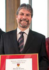
Marcelo Santos is a Professor in the Department of Geodesy and Geomatics Engineering at the University of New Brunswick (UNB), where he has been a faculty member since 2000. He holds a PhD in Geodesy (1995, UNB), M.Sc. in Geophysics (1990, Rio de Janeiro National Observatory), and B.Sc.E. in Cartographic Engineering (1982, Rio de Janeiro State University). His academic career includes roles such as Head of the Department (2012–2017) and international leadership in organizations like the International Association of Geodesy (IAG), where he served as President of Commission 4 (2015–2019) and Senior National Delegate of Canada (2007–2011). Research interests focus on Space and Physical Geodesy, GNSS navigation, and atmospheric delay modeling. His work emphasizes rigorous height systems, geoid determination, and integration of geodetic techniques with numerical weather models. Key contributions include the development of UNB’s atmospheric delay models and the Stokes-Helmert geoid computation methodology. Professional activities include chairing IAG commissions, directing UNB’s Space Geodesy Laboratory (1996–1999), and advising on geodetic infrastructure projects in Brazil and Canada. His publications span over 150 peer-reviewed articles, covering topics like tropospheric modeling, geoid determination, and GNSS applications in environmental monitoring. Led research grants include projects on global topographical density models and climate applications of GNSS-derived tropospheric parameters. Collaborations involve institutions like NASA, ESA, and Brazil’s IBGE. Current projects focus on enhancing geoid models and improving vertical datum systems for precision geomatics applications.
Summer Rupper is a Professor at the School of Environment, Society & Sustainability at the University of Utah, where she has held her position since July 2019. Her research focuses on understanding the interactions between climate, glaciers, and water resources, with particular emphasis on high mountain regions including High Mountain Asia, the Himalayas, and polar regions. She leads multiple research projects examining glacier dynamics, hydrological processes, and climate change impacts on water security for downstream populations. BS in Geology from Brigham Young University (2001) MS in Geology from University of Washington (2004) PhD in Earth and Space Sciences from University of Washington (2007) Professor Rupper's research spans physical geography, environmental geoscience, and climate change science, with specific expertise in glaciology, hydrology, and atmospheric sciences. Her work integrates field measurements, remote sensing, and numerical modeling to understand glacier dynamics, snow processes, and water resource availability in mountainous regions. She has particular expertise in High Mountain Asia, where glaciers provide critical water resources for over a billion people. Her research addresses fundamental questions about glacier response to climate change, hydrological partitioning, and the implications for water security in vulnerable regions. Her recent publications demonstrate a consistent focus on understanding glacier dynamics, hydrological processes, and climate interactions in mountainous regions. The work spans multiple methodologies including remote sensing analysis, numerical modeling, statistical approaches, and field-based measurements. Key themes include glacier melt contributions to river systems, precipitation patterns in complex terrain, snow density modeling, and the impacts of climate change on water resources in High Mountain Asia and polar regions. Her research often integrates multiple data sources and approaches to address complex questions about cryospheric processes and their societal implications. Superior Research Award (2024, CSBS, University of Utah) G.K. Gilbert Award for Excellence in Geomorphic Research (2022) Outstanding Utah Higher Education Science Teacher (2021) Top Researcher Award, Celebrate U showcase (2017) Antarctic Service Medal (2010, USAF) Professor Rupper actively mentors graduate students through thesis research courses at both the PhD and Master's levels, as well as individual projects. She has secured significant research funding from multiple federal agencies including NSF, NASA, and USAID, with current projects examining climatic controls on Antarctic ice sheets, glacier dynamics in High Mountain Asia, and historical glacier changes. Her collaborative work extends across international boundaries, working with scientists in Pakistan, Bhutan, and other regions to address shared water security challenges. She also engages in community outreach through workshops with school districts and science teacher associations to communicate climate science to broader audiences. Professor Rupper participates in multiple collaborative research teams including the NASA High Mountain Asia Team (HiMAT), where she contributes expertise in glacier dynamics and hydrology. She serves on several scientific committees including the NSF Ice Core Facility Sample Allocation Committee and the American Geophysical Union Cryosphere Section Fellows Committee. Her research often involves interdisciplinary teams combining expertise in glaciology, hydrology, remote sensing, and climate modeling to address complex questions about mountain water systems under changing climate conditions.
Dr. Armin Agha Karimi is a Lecturer in the School of Surveying and Built Environment at the University of Southern Queensland. He holds a BSc in Civil Engineering from Tabriz University, an MSc from Middle East Technical University (METU), and a PhD from the University of Newcastle. His research focuses on spatial data integration, cadastral systems modernization, environmental monitoring using remote sensing, and sea level variability analysis. Key research interests include 3D cadastral boundaries in BIM environments, digital twin applications in built environments, and the impact of hydrological loading on land motion. He has contributed to studies on erosion hotspot mapping in Queensland and the implications of coal seam gas activities on land subsidence. His work on Baltic Sea sea level dynamics and Australian coastal projections has advanced understanding of climate-driven environmental changes. Dr. Karimi is affiliated with the Centre for Sustainable Agricultural Systems and actively publishes on geomatics, climate science, and legal aspects of digital surveying. His recent articles highlight innovations in VR-ready survey data transformation and the legal challenges of electronic cadastral plans.
Dr. Ian Walker is a Professor in the Department of Geography at the University of California, Santa Barbara (UCSB). He specializes in physical geography and geomorphology, with expertise in sediment transport, coastal and aeolian processes, environmental fluid dynamics, and dune ecosystem restoration. He holds a B.Sc. in Geography and Environmental Science from the University of Toronto and a Ph.D. in Geography from the University of Guelph, Canada. Prior to UCSB, he served as faculty at Arizona State University and the University of Victoria (Canada). His research focuses on coastal and desert environments, employing field and lab methods such as terrestrial laser scanning (TLS), unmanned aerial systems (UAS), wind tunnel simulations, and computational fluid dynamics (CFD). Key projects include dust emissions mitigation at Oceano Dunes (collaborating with California Department of Parks) and invasive plant removal studies in Humboldt Bay. He has secured over $6M in research funding and advised over 40 students/post-docs. Education: B.Sc. (University of Toronto), Ph.D. (University of Guelph) Editorial Roles: Earth Surface Processes & Landforms , Annals of the American Association of Geographers , Journal of Coastal Research Professional Affiliations: Member of NASEM Scientific Advisory Panel for Owens Valley Dust Studies His articles emphasize coastal morphodynamics, restoration strategies, and climate change impacts. Notable work includes comparing UAS/TLS methods for geomorphic change detection and modeling airflow over dunes using CFD. He teaches courses on physical geography, geomorphology, and remote sensing. Grants and partnerships include collaborations with US Fish & Wildlife Service, NOAA, and state agencies. His lab focuses on integrating geospatial technologies with field experiments to address coastal sustainability challenges.
Mick Filmer is a Senior Lecturer at Curtin University's School of Earth and Planetary Sciences (EPS) within the Faculty of Science and Engineering. He serves as Curtin's representative on the Land Surveyors Licensing Board of Western Australia and holds a PhD (Curtin University) and a Bachelor of Geoinformatics and Surveying (University of South Australia). His research focuses on InSAR technology, vertical land motion, height systems, and coastal sea surface topography, with over 30 peer-reviewed publications since 2007. Teaching responsibilities include Survey Law Ethics Practice, Cadastral Surveying, and Applied Geodetic Surveying. Research contributions span geodetic datum development (e.g., AUSGeoid09), InSAR deformation analysis, and land subsidence monitoring in the Perth Basin and Latrobe Valley. He collaborates with organizations like the International Association of Geodesy and European Geosciences Union. Key projects include evaluating Australia’s AUSHYDROID vertical datum model (2024), integrating InSAR with terrestrial reference frames (2021), and analyzing ocean tide signals in coastal zones (2023). His work bridges geodesy, remote sensing, and hydrogeology, addressing challenges in vertical land motion monitoring and geodetic infrastructure planning.
Cynthia J. Ebinger is a Professor and holder of the Marshall-Heape Chair in Geology at the Department of Earth and Environmental Sciences, Tulane University. She specializes in earthquake seismology, active tectonics, and crustal dynamics, with applications to volcanic hazards and hominin evolution paleoenvironments. Education: Ph.D. from MIT/Woods Hole Oceanographic Joint Program (1988), M.S. from MIT (1986), B.S. from Duke University (1982). Current research includes magma-fault interactions in the Taupo Volcanic Zone (New Zealand), tectonic controls on Lake Kivu rifting (DRC/Rwanda), and lithospheric structure of the Turkana Depression (Kenya/Ethiopia). Her work integrates seismic, geodetic, and potential field methods to study rift systems and mantle plume dynamics. Recent projects focus on dike intrusion mechanics, fault reactivation risks, and critical zone imaging for archaeology. She maintains a field network of seismometers and GPS systems for real-time deformation monitoring. Scientific awards include the Jefferson Science Fellowship. She leads the GATR (Geophysics and Active Tectonics Research) Group, which operates advanced geophysical equipment and computational resources for seismic data analysis.