Prof. Srdjan Capkun is a Full Professor in the Department of Computer Science at ETH Zurich and Director of the Zurich Information Security and Privacy Center (ZISC). He holds a Dipl.Ing. from the University of Split (1998) and a Ph.D. from EPFL (2004). His research focuses on system and network security, including wireless security (e.g., secure positioning), trusted computing, blockchain technologies, and privacy-preserving systems. He co-founded 3db Access (acquired by Infineon) and Sound-Proof, addressing secure distance measurement and authentication. Notable achievements include an ERC Consolidator Grant (2016), ACM Fellowship, and IEEE Fellowship. Education: Dipl.Ing., Electrical Engineering / Computer Science, University of Split, 1998 Ph.D., Communication Systems, EPFL, 2004 Research Interests: Wireless security (e.g., UWB, GNSS, cellular) Trusted execution environments (TEEs) Blockchain and cryptocurrency systems Privacy-preserving technologies Awards & Grants: ERC Consolidator Grant (2016) ACM Fellow and IEEE Fellow Leadership of ZISC Advising & Labs: Leads the System Security Group at ETH Zurich Guided postdoctoral researchers and graduate students in security and privacy Companies: 3db Access (secure distance measurement) Futurae (online authentication)
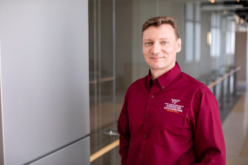
Dr. Mathieu Joerger is an Associate Professor in the Aerospace & Ocean Engineering Department at Virginia Tech, leading the Assured Vehicle Autonomy (AVA) Lab. He holds a Ph.D. (2009), M.S. (2002), and Diplôme d’Ingénieur (2002) from Illinois Institute of Technology and INSA Strasbourg. His research focuses on navigation safety, multi-constellation GNSS, and autonomous system integrity. He serves as Technical Editor for IEEE Transactions on Aerospace and Electronic Systems and co-leads the CARNATIONS initiative for resilient PNT systems. Notable awards include the ION Early Achievement Award (2015) and Bradford W. Parkinson Award (2009). Research interests include GNSS augmentation, LiDAR/IMU integration, and safety quantification for autonomous vehicles. His lab collaborates with industry/government on projects like CAAMS and develops methods to detect GNSS interference using UAS. Key publications address integrity monitoring in SLAM, particle filtering, and Kalman filter applications. Education: Ph.D. Mechanical & Aerospace Engineering, Illinois Tech (2009); M.S. Mechanical Engineering, Illinois Tech (2002); Diplôme d’Ingénieur, INSA Strasbourg (2002). Awards: ION Early Achievement Award, Outstanding NAVIGATION Reviewer, Bradford W. Parkinson Award. Professional Roles: Senior Editor for IEEE Transactions, ARAIM Standards Contributor, CARNATIONS Co-Director. Advises multiple PhD/Master’s students and oversees lab activities involving 20+ researchers. Projects include R-PNT systems, UAS-based RFI localization, and automotive GNSS safety. Active in international conferences like ION GNSS+ and AIAA forums.
Dimitra Psychogiou is a Full Professor of Microwave Engineering at University College Cork and Principal Investigator at Tyndall National Institute's CONNECT Centre in Cork, Ireland. She leads the Advanced RF Technology Group, driving innovation in reconfigurable RF systems for next-generation wireless networks. Her academic credentials include: Dipl.-Eng. in Electrical and Computer Engineering, University of Patras (2008) Ph.D. in Electrical Engineering, ETH Zurich (2013) Prof. Psychogiou's research pioneers reconfigurable microwave filters , non-reciprocal RF components , and additive manufacturing for antenna systems . Her work bridges theoretical microwave engineering with practical implementations in 5G/6G front-ends, emphasizing sustainability through hyperflexible filtering architectures that reduce hardware complexity and energy consumption. Key innovations include acoustic-wave resonator filters and 3D-printed RF components enabling unprecedented miniaturization. Analysis of her 2022-2025 publications reveals a strategic shift toward multifunctional RF integration , where filtering coexists with isolation, amplification, and switching in single modules. This trend addresses critical industry needs for compact, software-defined radio front-ends in satellite communications and IoT networks, with increasing emphasis on reflectionless topologies and spatiotemporal modulation techniques. Her scientific recognition includes: 2023 MTT-S Outstanding Young Engineer Award 2021 Roberto Sorrentino Prize 2021 SFI Research Professorship 2020 NSF CAREER Award 2020 URSI Young Scientist Award UC Boulder Junior Faculty Research Award Prof. Psychogiou actively shapes her field through leadership roles as Chair of IEEE MTT-13 Committee and Secretary of USNC-URSI Commission D, while serving as Associate Editor for IEEE MWCL and IJMWT. Her group collaborates extensively with semiconductor foundries and wireless infrastructure companies to transition lab innovations to commercial applications. The Advanced RF Technology Group operates state-of-the-art facilities for GaAs MMIC prototyping, 3D-printed RF component fabrication, and full-wave electromagnetic characterization, supporting Ireland's strategic position in European telecommunications research.
Dr. Jianguo Wang is a Professor in the Department of Earth and Space Science Engineering at York University's Lassonde School of Engineering. He has been a faculty member since 2006 and is a founding member of the Lassonde School. With over 35 years of academic and industrial experience, he specializes in multisensor integration, GNSS technology, and precision engineering surveying. He holds a Dr.-Ing. in Geomatics Engineering from Universität der Bundeswehr München, Germany, alongside Bachelor’s and Master’s degrees from Wuhan Technical University of Surveying and Mapping (WTUSM). His research focuses on advanced data processing methodologies, including Kalman filtering, error analysis, and LiDAR systems. He has authored/co-authored over 60 publications, including textbooks like Error Theory and Foundation of Surveying Adjustment and Foundation of Geodesy . He is a Fellow of Engineers Canada and licensed as a Professional Engineer in Ontario. Education: Dr.-Ing., Geomatics Engineering, Universität der Bundeswehr München (Germany) M.Sc., Surveying Engineering, Wuhan Technical University of Surveying and Mapping B.Sc., Surveying Engineering, Wuhan Technical University of Surveying and Mapping Dr. Wang teaches courses such as Advanced Optimization and Applications , GNSS , and Global Geophysics and Geodesy . He leads the Earth Observation Laboratory (PSE 432), focusing on multisensor integration for navigation and positioning. His work explores innovative solutions for sensor calibration, data fusion, and geospatial applications. Grants & Labs: Active in lab-based research with collaborators like Baoxin Hu, his laboratory integrates GNSS, IMUs, LiDAR, and cameras for precision navigation. His recent work addresses challenges in sensor error calibration, LiDAR point cloud accuracy, and Kalman filter enhancements.
Jan Skaloud serves as an Adjunct Professor at École Polytechnique Fédérale de Lausanne (EPFL), affiliated with the School of Architecture, Civil and Environmental Engineering (ENAC). He holds positions across multiple departments including SSIE (Institute of Earth Surface Dynamics), EDCE (Doctoral Program in Environmental Sciences and Engineering), and leads the Earth Sensing and Observation (ESO) Lab. His office is located at GC C2 397 in the EPFL campus in Lausanne, Switzerland. Dr. Skaloud's research expertise spans satellite positioning, inertial and integrated navigation systems, sensor orientation and calibration, attitude determination, mobile mapping, airborne laser scanning, and Kalman filtering techniques. His work bridges theoretical development with practical applications in UAV navigation, photogrammetry, and remote sensing. He teaches across three EPFL sections and two faculties, demonstrating his interdisciplinary approach to education. His publication record shows consistent contributions to the field, with recent work (2023-2025) focusing on vehicle dynamic model-based navigation for various UAV platforms, including delta-wing and fixed-wing drones. His research demonstrates a clear trajectory toward increasingly sophisticated navigation systems that integrate aerodynamic modeling with traditional sensor fusion approaches. This trend reflects the growing importance of model-based navigation in achieving higher precision and autonomy in UAV operations. 2021: Samuel Gamble Award for career contribution in photogrammetry & sensing (ISPRS) 2020: U.V. Helava Award for best paper in ISPRS Journal (2016-2019) 2017: Best Demo Award at IEEE International Workshop on Metrology & Aerospace 2014: Hansa Luftbild Award for best paper in PFG journal 2012: Karl Kraus Medal for best textbook in Photogrammetry 2009: GNSS Leader to Watch Innovation Award (GPS World) Dr. Skaloud has supervised numerous PhD students whose work focuses on advanced navigation systems, sensor calibration, and UAV applications. His research has received funding for projects involving direct georeferencing, mobile mapping systems, and UAV-based search and rescue operations. The ESO lab he directs serves as a hub for cutting-edge research in Earth observation technologies. The Earth Sensing and Observation Lab under Dr. Skaloud's direction brings together researchers working on navigation systems, sensor integration, and data processing techniques for geospatial applications. The lab maintains strong connections with industry partners and international research organizations, facilitating technology transfer and collaborative research projects.
Prof. Jaume Sanz Subirana is a Tenure Full Professor of Mathematics at the Universitat Politècnica de Catalunya (UPC), BarcelonaTECH, and a Senior GNSS Scientific Researcher. He has been affiliated with the Department of Mathematics since 1983. His primary research focuses on GNSS data processing algorithms, ionospheric sounding, and high-accuracy navigation systems like WARTK and Fast-PPP. He co-founded the spin-off company gAGE-NAV S.L. in 2009 and served on the European Space Agency's GNSS Scientific Advisory Group (2018-2022). Prof. Sanz Subirana holds a Physics degree (1982) and a PhD in Galactic Dynamics (1987) from the Universitat de Barcelona. He has authored over 100 peer-reviewed papers (50+ in top JCR journals), 200 conference works, five books (including ESA-commissioned volumes), and holds four patents. His work has earned four best paper awards and UPC's Merit Recognition for teaching excellence. His research group, gAGE/UPC, specializes in GNSS navigation algorithms, ionospheric monitoring, and SBAS/GBAS systems. Key contributions include ionospheric gradient monitoring, real-time kinematic positioning, and mitigation of space weather effects on navigation signals.
Matej Varga is a Scientific Assistant and Postdoctoral Researcher at ETH Zurich's Department of Civil, Environmental and Geomatic Engineering, working in the Geosensors and Engineering Geodesy group under Prof. Andreas Wieser since 2021. His research spans geometrical geodesy, physical geodesy, and satellite geodesy, with applications in both theoretical and practical domains. Dr. Varga's research interests focus on spatial, temporal and spectral analysis of geodetic data, with particular expertise in geodetic reference systems and frames, gravity and geomagnetic field modeling at all temporal and spatial scales, and multi-GNSS multi-frequency positioning and monitoring. His work integrates geometrical and physical aspects of geodesy to address complex Earth observation challenges, particularly in infrastructure monitoring and geophysical applications. His recent publications demonstrate a strong trend toward high-precision geodetic applications for major scientific infrastructure, most notably the Future Circular Collider project, alongside important contributions to earthquake impact analysis, geomagnetic network development, and gravity field modeling. His research bridges traditional geodetic methods with modern computational approaches, including machine learning applications for point cloud registration. Dr. Varga is actively involved in the GSEG research group at ETH Zurich, contributing to the development of geodetic infrastructure and reference systems. His work has practical applications in infrastructure monitoring, earthquake analysis, and scientific projects requiring extreme geodetic precision.
Jiro Katto is a Professor at Waseda University's School of Fundamental Science and Engineering, where he has been conducting research and teaching since 1999. He received his Ph.D. from the University of Tokyo and has established himself as a leading researcher in multimedia signal processing and computer networks. His academic journey includes positions as Associate Professor (1999-2004), Professor (2004-present), and Director at NEDO (2004-2008), along with research experience at NEC C&C Laboratories (1992-1999) and a Visiting Scholar position at Princeton University (1996-1997). Professor Katto's research interests focus on Multimedia Signal Processing and Computer Networks, with particular expertise in video compression, 5G network performance, and learned image compression techniques. His work bridges theoretical advancements with practical implementations, as evidenced by his extensive publications in top-tier conferences and journals. His research group has made significant contributions to point cloud compression, latency compensation in remote systems, and hardware-accelerated video encoding for UHD streaming. His publication record is impressive, with 276 papers cited 3,323 times in Scopus and 6,169 times in Google Scholar, reflecting his substantial impact in the field. His recent work shows a strong trend toward applying deep learning techniques to traditional signal processing problems, particularly in the areas of image and video compression, where his team has developed novel approaches to improve compression efficiency while reducing computational complexity. Electric Telecommunications Promotion Foundation Telecommunications System Technology Award (2023) Takayanagi Kenjiro Foundation Takayanagi Kenjiro Achievement Award (2020) Institute of Image Information and Television Engineers Fellow (2020) Institute of Electronics, Information and Communication Engineers Fellow (2015) IEICE Communications Society Activity Contribution Award (2006) IEICE Academic Encouragement Award (1995) SPIE VCIP 1991, Best Student Paper Award (1991) Professor Katto has served on numerous prestigious committees including IEEE ComSoC Tech News Editorial Board, IEEE Technical Program Committees for major conferences (Globecom, ICC, ICIP), and editorial boards for several academic journals. His leadership in the academic community extends to chairing conferences like IWAIT 2011 and serving as Editor-in-Chief for journals in his field. His research has practical applications in commercial 5G networks, video streaming services, and remote monitoring systems, demonstrating the real-world impact of his work.
Cathryn Mitchell is a Professor of Radio Science and Royal Society Industry Fellow at the University of Bath, specializing in ionospheric physics, position, navigation, and timing (PNT). She leads research in the Space & Telecoms Research Group (STAR), focusing on radio propagation, data assimilation, and space weather impacts on communication systems. Her work bridges theoretical, computational, and experimental approaches, with applications in satellite navigation, climate monitoring, and defense sectors. Her research interests include ionospheric tomography, HF communications, and the development of robust PNT systems. Mitchell collaborates extensively with industry partners like Spirent Communications on future navigation technologies and space weather resilience. She has held roles such as Academic Director of the Doctoral College and contributes to interdisciplinary projects like the DRIIVE initiative exploring ionospheric variability with EISCAT-3D radar. Recent work emphasizes ionospheric effects during geomagnetic storms (e.g., the 2024 Gannon Storm) and cooperative autonomous systems under communication constraints. Her projects are funded by the Royal Society, Natural Environment Research Council (NERC), and ESA, addressing challenges in space weather forecasting and PNT system reliability. Awards: Royal Society Industry Fellow (2022–present) Key Projects: Royal Society Industry Fellowship on Future PNT Technologies DRIVERS (DRIIVE): Ionospheric Variability Studies EISCAT-3D FINESSE: Ionospheric Structuring Analysis Mitchell’s lab, STAR, integrates academic and industrial partnerships to advance space weather applications and sustainable navigation systems, contributing to UN Sustainable Development Goals related to climate action and innovation.
Prof. Dr.-Ing. habil. Michael Meurer is a Universitätsprofessor (University Professor) at RWTH Aachen University, holding the Chair of Navigation with a joint appointment at the German Aerospace Center (DLR). His work focuses on satellite navigation, particularly GNSS (Global Navigation Satellite Systems), with applications in low Earth orbit (LEO), safety-critical systems, and autonomous driving. Research Interests GNSS signal integrity and error analysis LEO-based augmentation systems Multi-antenna positioning techniques Spatial signal processing Navigation for autonomous systems Publications highlight his contributions to GNSS error modeling, spoofer detection, and resilient positioning systems. Recent work emphasizes LEO constellations, distributed antenna architectures, and signal integrity monitoring. Contact Email: michael.meurer@nav.rwth-aachen.de Address: Mies-van-der-Rohe-Str. 15, 52074 Aachen Phone: +49 8153 28 3065 Teaching includes courses on satellite navigation, safety-critical navigation systems, and multisensorial navigation architectures.
Dr. Chee Kiat Seow is an Associate Professor at the University of Glasgow's School of Computing Science. He holds a PhD from Nanyang Technological University (NTU) and an MSc from the National University of Singapore (NUS). His research focuses on cyber-physical security, wireless communication localization, and IoT systems leveraging AI/ML. He has led projects valued in the millions, winning awards like the IEEE Best Student Paper and National Instruments Engineering Impact Awards. Education: PhD (NTU), MSc (NUS) Research: Specializes in UWB positioning, spoofing detection, and IoT integration with 5G/GNSS. Teaching: Courses include Big Data, Software Engineering, and Data Analytics. His recent work addresses NLOS mitigation in indoor localization and cyber-physical security threats. Over 63 publications span journals like IEEE Transactions and conferences such as IPIN and WF-IoT. Supervised 6+ PhD/MSc students on topics like autonomous robotics and AI-driven localization. Grants: Includes $853K for 5G-X Smart Building projects and $797K for GNSS signal authentication. Awards: IEEE PIERS Best Student Paper (2019), NI Engineering Impact Awards (2015-2016). He advises on IoT and cybersecurity for organizations like ARTC and National Instruments. Active in IEEE Signal Processing and Computer Society.
René Jr Landry is a full Professor in the Department of Electrical Engineering at École de technologie supérieure (ETS), Université du Québec, specializing in Global Navigation Satellite Systems (GNSS), avionics, and wireless communication technologies. His academic journey includes a B.Ing. from Polytechnique Montréal, M.Sc. from University of Surrey (UK), and Ph.D. from SupAréo in Toulouse. He maintains active research leadership through two key laboratories: LASSENA (Laboratory of Space Technologies, Embedded Systems, Navigation and Avionics) and LACIME (Communications and Microelectronic Integration Laboratory). His research spans critical aerospace navigation domains including GNSS signal processing, inertial navigation systems, software-defined radio for avionics, radio frequency interference mitigation, and indoor positioning technologies. Landry's work addresses real-world challenges in satellite navigation robustness, precision positioning in urban/denied environments, and next-generation avionic system security. His current projects focus on blockchain-enhanced IoT security, AI-driven GNSS disruption analysis, and adaptive RF front-ends for multi-band avionics applications. Analysis of his recent publications reveals strong emphasis on resilient positioning systems through multi-constellation integration (particularly Iridium-NEXT), blockchain applications for navigation security, and explainable AI techniques for GNSS signal quality assessment. His work increasingly bridges traditional navigation engineering with cutting-edge security and machine learning paradigms. 2014 Prix d'excellence du c.a. pour les services à la collectivité Landry has supervised over 100 graduate students across doctoral, master's, and research projects since 2005, with current supervision extending through Summer 2025. His research funding supports multiple industry partnerships focused on avionics certification, software-defined radio implementations, and next-generation navigation systems. The LASSENA laboratory under his leadership develops certified avionic products from open-source SDR platforms and advances multi-sensor fusion techniques for challenging navigation environments. His research infrastructure includes specialized facilities for GNSS signal simulation, avionics hardware testing, and multi-sensor integration. Current work emphasizes flight-tested validation of RF front-end technologies, blockchain-secured navigation data, and real-time interference mitigation systems for aviation applications.
Robert Piche is a Professor at the Computing Sciences Mathematics Research Centre, specializing in advanced signal processing, positioning systems, and sensor fusion. He holds a Doctor of Science (Technology) and Master of Science from the University of Waterloo, Canada (1986 and 1982, respectively). His research focuses on Kalman filters, Global Positioning Systems (GPS), particle filters, and indoor positioning technologies. He has contributed extensively to fields like satellite orbit prediction, non-line-of-sight (NLoS) positioning, and machine learning applications in biomechanics and robotics. Dr. Piche has authored over 230 publications and received recognition through an invitation/ranking in a 2014 competition. He actively participates in academic activities, including conference presentations and peer-review roles. His work bridges theoretical advancements and practical applications, with contributions to autonomous systems, sensor data analysis, and wearable technology. Collaborations span international institutions, reflecting his global impact in engineering and computer science disciplines.
Dr. Penina Axelrad is a University of Colorado Distinguished Professor and Joseph T. Negler Professor of Aerospace Engineering Sciences at the University of Colorado Boulder. She has held academic roles since 1992, serving as Department Chair from 2012–2017. A member of the National Academy of Engineering since 2019, her research focuses on GNSS technology, satellite navigation, and remote sensing applications. She has authored over 223 publications and secured $17.5M in research grants. Education: Ph.D., Aeronautics and Astronautics, Stanford University, 1991 S.M., Aeronautical and Astronautical Engineering, MIT, 1986 S.B., Aeronautical Engineering (Avionics Option), MIT, 1985 Research Interests: Global Navigation Satellite Systems (GNSS), multipath mitigation, GNSS reflectometry, orbital dynamics, and quantum sensing for Earth science. Her work bridges astrodynamics, satellite navigation, and environmental monitoring. Awards: Member, National Academy of Engineering (2019) Women In Aerospace Educator Award (2016) Institute of Navigation Samuel Burka Award (2012) AIAA Summerfield Book Award (2011) Advising & Grants: Advised numerous students (no names listed) and led major grants including NASA Quantum Pathways Institute and Sentinel-6 orbit determination projects. Active in Institute of Navigation leadership roles. Labs/Teams: Colorado Center for Astrodynamics Research (CCAR), Quantum Pathways Institute, and collaborative efforts on CubeSat atomic clock experiments.
Patrick Henkel is a Professor at the Technical University of Munich (TUM) affiliated with the TUM School of Engineering and Design and the Chair of Communication and Navigation. He holds a professorship in Satellite Geodesy under Prof. Hugentobler. His research focuses on advanced positioning technologies, including Global Navigation Satellite Systems (GNSS), autonomous systems, and sensor fusion. He develops algorithms for precise positioning in challenging environments such as urban areas, alpine regions, and indoor spaces. His work also extends to environmental applications, such as snow hydrology and climate monitoring using GNSS signals. Henkel’s contributions include innovations in real-time kinematic (RTK) positioning, UAV navigation, and multi-sensor integration for robotics and autonomous vehicles. His research is supported by collaborations with industry and academic partners, addressing both theoretical and applied challenges in geodesy and navigation. Henkel leads projects on GNSS signal processing, satellite-based environmental monitoring, and autonomous driving technologies. He has contributed to the Galileo HAS service and developed methodologies for snow water equivalent estimation using multi-frequency GNSS signals. His expertise spans hardware-software co-design for navigation systems and algorithm optimization for high-precision positioning in dynamic environments. He actively publishes in top-tier journals and conferences, with a focus on advancing the reliability and accuracy of navigation systems across various domains. His advising and grants include funding for projects on sensor fusion, UAV-based measurements, and satellite receiver development. He collaborates with teams at TUM’s Navigation Lab and the Professur für Satellitengeodäsie, contributing to both academic and industrial applications. His work on low-bandwidth RTK dissemination and laser-tracker verified UAV positioning highlights his commitment to bridging theoretical advancements with real-world implementation.