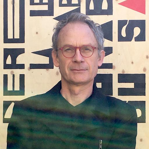
Ryan Galt is a Professor in the Department of Community & Regional Development at the University of California, Davis. His research focuses on the governance of agrifood systems, political ecology, and the intersection of agriculture, environment, and society across scales. He holds a Ph.D. (2006) and M.S. (2001) in Geography from the University of Wisconsin, Madison, and a B.A. (1999) in Geography from UC Berkeley. Key research themes include: (1) pesticide use and regulation in global food systems, (2) community-based food systems like CSA models, (3) wildfire resilience in agricultural landscapes, and (4) agroecological transitions in the Corn Belt. He emphasizes participatory methodologies and critical pedagogy in sustainability education. Recent work explores pandemic impacts on direct-market farmers, pesticide trade inequities, and institutional pathways for agricultural diversification. His publications span 30 years of addressing systemic challenges in food systems through interdisciplinary approaches.
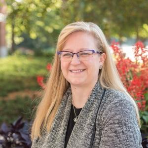
Federica Burini is a Full Professor of Geography at the Department of Foreign Languages, Literatures and Cultures of the University of Bergamo . She serves as Scientific Coordinator of the Imago Mundi Lab, member of the Center for Territorial Studies, and Scientific Director of OrobieLab. Her academic career spans participatory processes, collaborative mapping, and sustainable territorial regeneration. Full Professor of Geography Imago Mundi Lab Coordinator Center for Territorial Studies member OrobieLab Scientific Director Research Focus : Federica specializes in participatory geography through collaborative mapping techniques for environmental governance in both rural and urban contexts. Her work emphasizes sustainable development in Sub-Saharan Africa and European mountainous regions, with particular attention to landscape valorization via participatory processes and responsible tourism. Key projects include digital co-mapping initiatives for community engagement and territorial regeneration. Participatory mapping tools Sustainable tourism frameworks Mountainous area development Rural community empowerment Digital geospatial applications Landscape perception studies Publications : Recent works explore digital collaborative mapping tools (2024), industrial heritage interpretation for slow tourism (2024), and water resource-driven community regeneration (2024). Earlier contributions examine pandemic impacts on tourism (2020) and participatory cartography methodologies (2016). Her research consistently bridges geographical theory with practical territorial governance solutions.
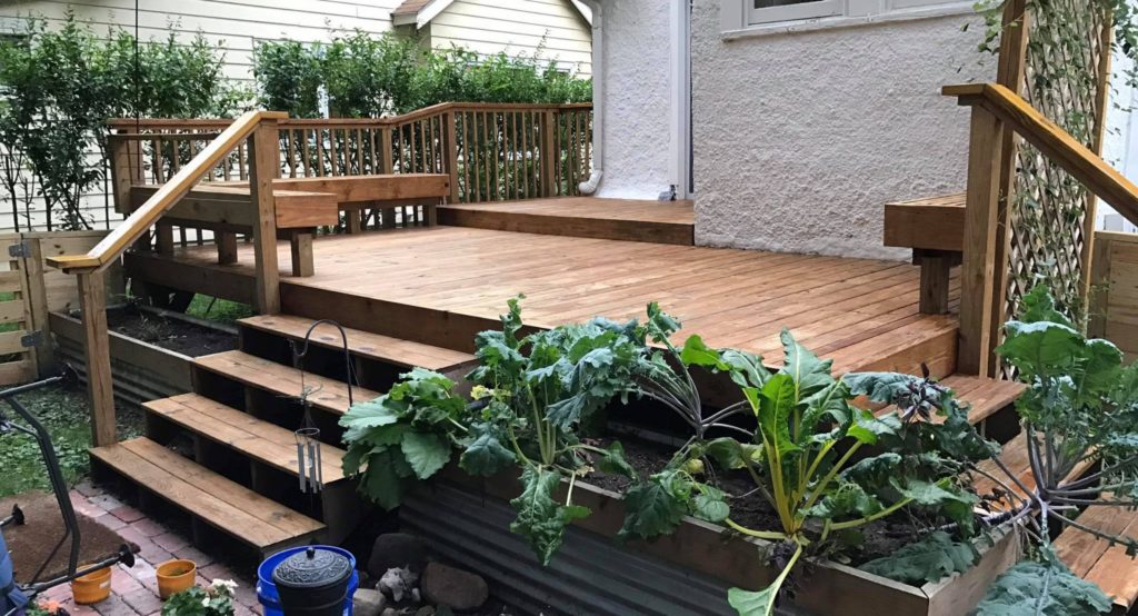
Keenan Gibbons is a Lecturer in Environment Sustainability and Development at the University of Michigan’s School of Environment, Art, and Society. A licensed landscape architect and urban design professional based in Detroit, he specializes in sustainable green infrastructure, parks, streetscapes, and innovative stormwater management strategies. With expertise in digital media, parametric modeling, and FAA-certified drone operations, he conducts research on urban heat island effects supported by the Landscape Architecture Foundation. Education Master of Landscape Architecture, Ball State University Bachelor of Science in Horticulture, Michigan State University His research interests integrate environmental sustainability with urban design , focusing on climate resilience through drone-based thermal imaging and low-impact construction . Publications highlight his work on UAV thermal disparity visualization and community-driven urban regeneration , including notable projects like Riverside Park Detroit . He received the LAF Deb Mitchell Research Grant for his heat wave visualization toolkit. Keenan’s projects include concrete-free construction for fences, decks, and planters, emphasizing reclaimed materials and DIY innovation . His work has been featured in CNN , The Weather Channel , and professional journals like MiASLA SITES . As an educator, he bridges environmental theory with hands-on design practice , often involving community stakeholders in his projects.
Jeffrey A. Lee is a Professor in the Department of Geosciences at Texas Tech University, specializing in aeolian geomorphology and environmental processes. With academic appointments since 1988, his work focuses on wind-driven sediment transport and dune dynamics across multiple continents. Education: B.A. in Geography (1979), University of California, Los Angeles M.A. in Geography (1984), University of California, Los Angeles Ph.D. in Geography (1990), Arizona State University Research interests center on aeolian processes, particularly dust emission dynamics and wind erosion patterns. His work examines temporal trends in blowing dust across Texas and the American Southwest, while also investigating long-term shifts in wind climate patterns. Professor Lee teaches foundational physical geography courses including Global Environmental Science and advanced topics in arid land geomorphology. Recent publications demonstrate interdisciplinary focus across aeolian geomorphology, environmental monitoring, and climate science. Key themes include dust source characterization using satellite data, drought legacy effects on erosion, and historical analysis of environmental disasters like the Dust Bowl. Contact: jeff.lee@ttu.edu | 213 Holden Hall, Texas Tech University | (806) 834-8228
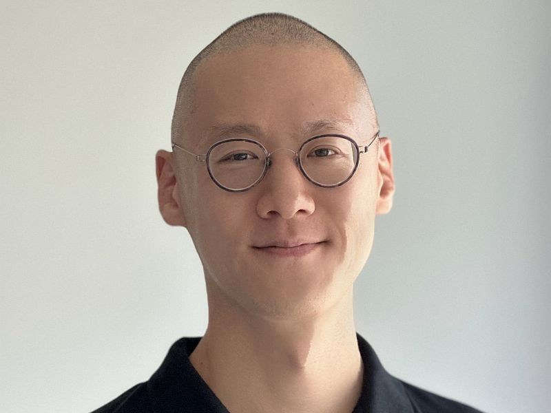
Dr. Bon Woo Koo is an Assistant Professor at the School of Urban and Regional Planning , Toronto Metropolitan University. His expertise lies in geospatial urban analytics, walkability, and GIS applications, focusing on urban design for public health equity and innovative data science tools. He holds a PhD in City & Regional Planning from Georgia Institute of Technology, a Master’s in Landscape Architecture from Seoul National University, and a Bachelor’s in Interior Design from Kookmin University. Education: PhD in City and Regional Planning, Georgia Institute of Technology Master of Landscape Architecture, Seoul National University Bachelor of Interior Design, Kookmin University Research Interests: Dr. Koo investigates urban environments’ impact on health and well-being, equity in environmental amenities (e.g., tree canopies), and advanced GIS techniques. He develops automated audit methods for walkability and explores spatial modeling for urban sustainability. His work bridges data science with policy, contributing to CDC health surveillance and smart city initiatives. Publications: His research appears in journals like Landscape and Urban Planning , Environment and Behavior , and Health and Place , with a focus on walkability audits, urban tree equity, and audio-based pedestrian sensing. Recent work addresses post-pandemic mental health and broadband equity strategies. Professional Engagement: He has advised the CDC’s technical panel on leveraging big data for health policy, presented at conferences like the Association of Collegiate Schools of Planning, and collaborated with institutions like Universitas Gadjah Mada and the Atlanta Regional Commission.
Prof. Dr. Bernd Möller is a faculty member at Europa-Universität Flensburg, specializing in sustainable energy systems management for developing countries. His research focuses on renewable energy integration, spatial analysis, and environmental planning, leveraging GIS tools for energy system transformation. Current position: Professor at Department Energy and Environmental Management Alumni of Flensburg University of Applied Sciences and Aalborg University (PhD in Energy Planning) Research interests encompass wind/solar/biomass systems, energy atlas development, and climate-resilient infrastructure. His work bridges technology, economics, and spatial planning in renewable transitions. Publications highlight trends in offshore wind modeling, biomass logistics, district heating expansion, and GIS-driven energy solutions. Key themes include decarbonization, resource constraints, and regional energy equity. Teaching involves applied GIS science, energy planning frameworks, and development cooperation. He leads the PhD program in Energy and Environmental Management for Developing Countries.
Dr. Yuhan Jiang is an Assistant Professor in the Department of Built Environment at North Carolina A&T State University's College of Science and Technology. He serves as the Founding Director of the HUD Center of Excellence for Innovation in Affordable Housing and Sustainable Communities (CIAHSC). Dr. Jiang leads a multidisciplinary research team focused on integrating robotics, artificial intelligence, and Building Information Modeling in construction operations and infrastructure management. Ph.D. in Civil Engineering from Marquette University M.M. in Construction Management from Guangzhou University Additional Construction Management degree from Guangzhou University Dr. Jiang's research primarily focuses on artificial intelligence applications in architecture, engineering, construction, and operations (AECO). His work integrates robotics and remote sensing for data collection, computer vision and machine learning for data processing, and BIM, GIS, and AR/VR for data visualization. His research enables more efficient construction operations, building inspection, and infrastructure management. Additionally, he has extensive experience in community redevelopment planning and complex systems simulation, including investigating urban village formation mechanisms. Analysis of Dr. Jiang's recent publications reveals a strong focus on applying drone technology, computer vision, and deep learning to construction and infrastructure challenges. His work spans multiple domains including façade modeling, pavement evaluation, sidewalk inspection, earthwork calculation, and 3D reconstruction. A consistent theme across his research is the development of automated systems that improve efficiency, accuracy, and safety in construction and infrastructure management through AI and robotics. N.C. A&T and CoST Junior Faculty Teaching Excellence Award 2024-25 N.C. A&T and CoST Rookie Researcher of the Year Award 2024 ASCE Journal of Architectural Engineering Best Paper Award 2022 ASCE CI & CRC Joint Conference Best Paper Award 2024 AAAS HBCU Making and Innovation Showcase 1st Place 2024 CoST SciTech Week Innovation Challenge awards (2023-2025) N.C. A&T Provost's Faculty Fellow (2023 & 2024) Dr. Jiang has successfully secured over $4.5 million in research funding as PI or Co-PI, including a $2.5 million HUD Center of Excellence grant. He has mentored students who won 1st and 3rd place in the 2023 & 2024 Sci-Tech Week Innovation Challenge competitions and 1st place at the 2024 AAAS HBCU Making and Innovation Showcase. His funded projects span AI-driven BIM education tools, smart farming with robotics, drone-based façade modeling, and digital twin applications for infrastructure management. As Founding Director of the HUD Center of Excellence for Innovation in Affordable Housing and Sustainable Communities (CIAHSC), Dr. Jiang leads a multidisciplinary team focused on innovative approaches to affordable housing and sustainable community development. His lab work integrates drone technology, computer vision, and AI to create practical solutions for real-world construction and infrastructure challenges.
Peter Long is a Senior Lecturer in Ecology and Conservation at the University of Oxford Brookes, School of Biological and Medical Sciences . His research integrates satellite remote sensing, environmental modeling, and biodiversity assessment to address ecological and conservation challenges at landscape and global scales. Key research themes include: Developing algorithms for satellite data analysis Quantifying biodiversity and ecosystem services Building web-based ecological assessment tools Studying climate-agriculture interactions Assessing deforestation drivers in Madagascar Recent publications (2023–2025) focus on regenerative agriculture carbon impacts , Madagascar deforestation policy , and climate-induced habitat changes . He specializes in GIS, high-performance computing, and stakeholder engagement for environmental monitoring. Collaborations span Guatemala , Madagascar , and Europe , with tools like LEFT (web-based ecological value estimator) and BioTIME 2.0 (biodiversity time series database).
Nicolò Dell'Unto serves as Professor of Archaeology at Lund University's Department of Archaeology and Ancient History within the Faculty of Humanities and Theology. His research pioneers digital methodologies for archaeological analysis, specializing in 3D visualization, spatial technology, and virtual reality applications that transform how we perceive and investigate the past. Based at Helgonavägen 3 in Lund (Room LUX:A122), he directs the Digital Archaeology Laboratory (DARKLab) and oversees undergraduate/postgraduate digital archaeology programs. His educational background includes: Archaeology studies at University of Rome, La Sapienza PhD in Technology and Management of Cultural Heritage from IMT Lucca, Italy Postdoctoral fellowship at University of California Merced Dell'Unto's research focuses on how laser scanners, photogrammetry, GIS, and virtual reality technologies fundamentally reshape archaeological practice. His work bridges technical innovation with theoretical frameworks in landscape archaeology, emphasizing practical field applications while addressing methodological challenges in data interpretation. Key themes include digital documentation standards, 3D data management, and the cognitive impact of visualization tools on archaeological reasoning. His publication trends reveal a shift toward AI integration in archaeological data interpretation, infrastructure development for 3D data sharing, and cross-disciplinary collaborations examining Mediterranean connectivity. Recent works emphasize practical frameworks for implementing digital tools in fieldwork while addressing sustainability challenges in digital heritage preservation. Award highlights: Einar Hansen Prize for Humanities (2017) Royal Physiographic Society of Lund election (2024) Best Paper Award (2014) Highly Cited Research recognition (2017) Dell'Unto supervises PhD and master's students while leading major projects including RE-OSTRAKON (3D artifact scanning), TETRARCHs (data reuse), and AIR (Archaeological Interactive Report). His DARKLab serves as Sweden's national infrastructure for digital archaeology, collaborating with institutions like University of Oslo's Museum of Cultural History where he holds a visiting professorship since 2019. He actively shapes digital archaeology policy as Domain Specialist for Swedish National Data Service, Board Member for Statens historiska museer, and Open Science Champion at Lund University, driving national standards for archaeological data management and open science practices.
Sébastien Caquard is a Professor in the Department of Geography, Planning and Environment at Concordia University, Montréal (Tiohtià:ke). His research bridges Cartography and Oral History , focusing on mapping stories to explore relationships between places, narratives, memories, and maps. Founder and Director of the Geomedia Lab , leading development of the open-source Atlascine mapping application Principal Investigator for projects like (Re)tracer la mémoire cartographique (SSHRC 2023-28) and Enhancing Atlascine Mapping Platform (CANARIE 2018-23) Co-applicant for Indigenous Stewardship of Environment and Alternative Development (INSTEAD 2020-26) Key Research Areas : Story Mapping & Narrative Cartography Geoweb & Digital Humanities Oral History & Memory Studies Decolonial & Indigenous Cartography GIS & Environmental Impact Assessment Interactive Atlases & Emotional Mapping Recent Collaborations : Co-organized exhibitions and workshops on Rwandan life stories, Indigenous cartographies, and mapping difficult narratives with institutions like the Centre for Oral History and Digital Storytelling (COHDS) and international conferences.
Mengqiu Cao is a Lecturer in Urban Systems Predictive Analytics and Machine Learning at the University College London (UCL) within the Bartlett School of Environment, Energy and Resources . He integrates academia and industry expertise to advance interdisciplinary research at the intersection of transport analysis and urban studies. Research Focus : Sustainable transport, urban mobility, logistics, social equity, and low carbon transitions. Teaching : Coordinates modules on climate sciences, data-driven consumer behavior analysis, and transport policy. Awards : Holds fellowships with the Royal Geographical Society, Royal Statistical Society, and Royal Society of Arts. Publications : Recent works examine green space impacts on mobility, equitable EV charging access, dockless bike-sharing patterns, and 15-minute city frameworks.
Robert Berry is a Senior Lecturer at the Faculty of Computing, Engineering and Science at the University of South Wales. He holds a PhD in Geographical Information Systems, an MSc in GIS, and a BSc in Geography. His research focuses on geocomputation, integrating AI, NLP, and GIS to address geospatial challenges, with recent work in accessibility modeling and 3D landscape visualization. He is affiliated with the GIS Research Centre and WISERD, an interdisciplinary social science institute. Dr. Berry teaches modules in computing and information systems, including big data analytics, GIS, and project management. He has supervised numerous MSc and PhD students and contributed to over 50 research outputs, including peer-reviewed articles, conference papers, and technical reports. His expertise spans FOSS tools, programming (R, Python), and cloud computing for geospatial applications. Key projects include the 'People, Places and the Public Sphere' initiative (2024–2027) and evaluations of agricultural risk management policies. He has collaborated with UK government agencies, local authorities, and third-sector organizations on projects involving environmental planning, flood management, and cultural heritage preservation. Dr. Berry is a Fellow of the Royal Geographical Society and actively engages in advancing participatory technologies for environmental decision-making. His work emphasizes enhancing public participation through digital tools and addressing socio-economic challenges via geospatial analysis.
Athanasios Vionis is an Associate Professor in Byzantine Archaeology and Art at the University of Cyprus (UCY), where he has served since 2009. He previously held roles including Director of the Archaeology Research Unit (2020–2024) and was a postdoctoral researcher at the Catholic University of Leuven (2007–2008). His academic journey includes a PhD in Medieval and Post-Medieval Aegean Archaeology from Leiden University (2005) and a BA in Ancient History and Archaeology from Durham University (1997). Current Position: Associate Professor, Department of History and Archaeology, UCY Previous Roles: Lecturer (2009–2013), Assistant Professor (2013–2018) Research focuses on landscape archaeology, spatial analysis of built and sacred landscapes, and the application of digital technologies (e.g., GIS). He studies Byzantine, Medieval, and Ottoman ceramics, as well as daily life and nutrition through material remains. His work includes the monograph A Crusader, Ottoman and Early Modern Aegean Archaeology (2012) and co-edited volumes on topics like sacred landscapes and glaze technology. He leads the ArtLandS Lab (Artefact and Landscape Studies Laboratory), established at UCY in 2010, which conducts field research in Cyprus and Greece. Key projects include the Settled and Sacred Landscapes of Cyprus (2014–present), funded by the EU and Cyprus Research Foundation. He coordinates international initiatives like the Unlocking Sacred Landscapes network (2014–present) and has collaborated with institutions such as the Cyprus Institute and Trinity College Dublin. His awards include UNESCO prizes for cultural documentaries and Marie Curie fellowships. Teaching spans undergraduate and postgraduate programs, including “Land and Underwater Field Archaeology” and “Medieval Archaeology.”
Carlos Cámara-Menoyo is a Senior Research Software Engineer at the University of Warwick's Centre for Interdisciplinary Methodologies, where he bridges technical expertise with urban research. He holds a PhD in Information and Knowledge Society from the Universitat Oberta de Catalunya (2018), awarded the IND+I Science Prize. His academic roles include Lecturer at Universidad San Jorge and Associate Lecturer at Oxford Brookes University and Universitat Oberta de Catalunya. Education : PhD in Information and Knowledge Society (2018), Universitat Oberta de Catalunya MSc in Information and Knowledge Society (2012), Universitat Oberta de Catalunya MSc Architecture (2004), Universitat Politècnica de Catalunya Research Interests : Urban Studies, Open Science, Spatial Justice, Data Visualization, and Urban Commons. His work explores commodifications between cities, technology, and society, focusing on equitable urban development and participatory methods. Articles : His recent work addresses the Food-Water-Energy Nexus, participatory urban governance, and inclusive GIS applications. Key themes include sustainability transformations and co-design processes. Awards : IND+I Science Prize (2018), Cum Laude PhD distinction. Advising & Grants : Supervised Master’s theses on urban commons and co-production. Active in collaborative projects like Zaragoza Accesible and the Creating Interfaces initiative. Labs & Teams : Leads research software engineering efforts at CIM, promoting open science and reproducible workflows.
Danielle Willkens is an Associate Professor at Georgia Institute of Technology's School of Architecture , where she combines design, research, and education to engage diverse audiences with architectural history. Her work spans design/build projects , heritage documentation , and transatlantic architectural studies , with a focus on digital preservation and sustainable tourism . Education: Ph.D. in Architectural History & Theory, University College London (2015) Graduate Certificate in Historic Preservation, SCAD (2011) M.Arch, University of Virginia (2008) M.Phil in History of Art & Architecture, University of Cambridge (2006) BS in Architecture + Architectural History, University of Virginia (2004) Her research interests integrate terrestrial laser scanning (TLS) , UAV photogrammetry , and heritage BIM to document sites like the Edmund Pettus Bridge and Rosenwald Schools . Recent projects include digital reconstructions of Civil Rights Movement landmarks and transatlantic architectural networks between Thomas Jefferson and Sir John Soane. Scientific awards highlight her contributions: 2015 SAH H. Allen Brooks Travelling Fellow 2017-2018 AIAS/ACSA New Faculty Teaching Award 2021 AIAS Educator Honor Award American Philosophical Society Franklin Research Grant She leads funded interdisciplinary projects such as the $50,000 NPS grant for the Edmund Pettus Bridge and $750,000 NPS Rosenwald School rehabilitation , collaborating with Auburn University and the National Center for Preservation Training.