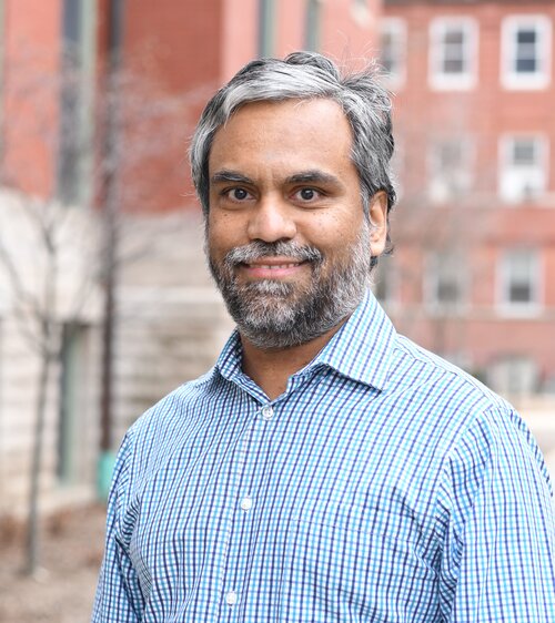
Derek T. Robinson is an Associate Professor at the University of Waterloo's Department of Geography and Environmental Management , specializing in land-use science, agent-based modeling, and geospatial analysis. His work integrates GIS, ecological models, and human decision-making to assess impacts of land policies on ecosystem services and human well-being. Research Interests : Land-use/cover change and carbon cycle dynamics Agent-based modeling of socio-ecological systems Exurban land management and fragmentation Ecosystem service quantification Land policy scenario analysis Teaching : Courses in spatial analysis, advanced GIS, and land-use-carbon interactions. His lab utilizes cutting-edge tools like ArcGIS, NetLogo, and UAV systems (e.g., Aeryon SkyRanger) for fieldwork and modeling.
Dr. Veysel Gümüş is an Associate Professor at Harran University's Faculty of Engineering, Department of Civil Engineering, where he has been since 2014. His research focuses on turbulence modeling, computational fluid dynamics, hydrological drought analysis, and time-series trend analysis. Licence (2003), Master's (2006), and Doctorate (2014) in Civil Engineering from Harran and Çukurova Universities. His research interests span hydrological drought , computational fluid dynamics , climate trend analysis , and GIS applications in hydrology . His recent work emphasizes drought risk assessment, wind speed trends, and fluid flow simulations using AI techniques. Publications since 2023 highlight his expertise in Mann-Kendall tests , copula-based drought analysis , and CMIP6 climate projections across Turkey and Morocco. He has supervised over 15 graduate theses and served as an editor/hakem for 10+ journals, including ASCE and Theoretical and Applied Climatology.
Kristian Sevdari is a Postdoctoral Researcher at the Department of Wind and Energy Systems, Technical University of Denmark (DTU). He was born in Kucove, Albania, in 1995, and holds a B.Sc in electrical engineering from the Polytechnic University of Tirana (2016), an M.Sc from UiT Norges arktiske universitet, Norway (2020), and a Ph.D. from DTU (February 2024). Since 2020, he has been working at DTU on multiple projects including Solar-Move, AHEAD, FLOW, EV4EU, ACDC, and FUSE. His research focuses on renewable energy integration and electric vehicle grid integration, with specific expertise in vehicle-to-grid systems, power system dynamics and stability, prosumers and flexible demand, wind power integration, and smart grid technologies. His work contributes to UN Sustainable Development Goals related to sustainable energy and climate action. Dr. Sevdari's recent publications demonstrate a strong trend toward solving practical challenges in EV-grid integration, with emphasis on bidirectional charging technologies, harmonics analysis, battery second-life applications, and smart charging strategies for residential and urban environments. His research bridges theoretical control approaches with experimental validation across multiple European contexts. Best paper award at 2024 IEEE Transportation Electrification Conference & Expo Best paper award of the IEEE PES ISGT-Europe 2021 conference As a supervisor, he has guided multiple Master's theses on topics including telematics integration for EV cost reduction, open charge point protocol implementation, vehicle-to-grid testing, and compatibility testing for EV ecosystems. He is actively involved in the IEEE PES Task Force on electric vehicle grid integration and IEA Task 53, and is the founder of IEEE REST conferences, Qendra SUSALB, and EkoVolt.
Minh Hoai Nguyen is an Assistant Professor in the Department of Computer Science at Stony Brook University. He received his PhD in Robotics from Carnegie Mellon University and a Bachelor of Engineering from the University of New South Wales. Prior to Stony Brook, he was a post-doctoral research fellow at Oxford University and a Kurti Junior Research Fellow at Brasenose College. Education: PhD in Robotics, Carnegie Mellon University Bachelor of Engineering, University of New South Wales His research focuses on computer vision , machine learning , and time series analysis , particularly in developing algorithms for human action recognition , gesture detection , and expression analysis in video data. Applications include video surveillance , human-computer interaction , and medical diagnosis of behavioral disorders . His work integrates computer vision for video processing, time series analysis for modeling human behavior, and machine learning for training complex algorithms. Notable awards include: CVPR 2012 best student paper award Winner of PASCAL VOC 2012 Challenge for Human Action Recognition He teaches courses such as Video Analysis (CSE 594) and Introduction to Robotics (CSE 525) .
Karen Joyce is an Associate Professor at James Cook University (JCU) with expertise in remote sensing and environmental monitoring. She holds a PhD in Geographical Sciences from the University of Queensland (2005). Her work focuses on developing remote sensing tools for applications in marine, coastal, and savanna ecosystems. Notable contributions include advancing drone technology for coral reef mapping, mangrove phenology modeling, and disaster management integration. She co-founded She Maps, a social enterprise promoting women in STEM through drone education, and GeoNadir, emphasizing geospatial innovation. Education: PhD in Geographical Sciences (University of Queensland, 2005) Key Roles: Co-Founder of She Maps and GeoNadir Former Geomatic Engineering Officer in the Australian Army Her research interests center on optimizing remote sensing models to quantify Earth observation data, with applications in coral reef health, mangrove ecosystems, and invasive species management. Recent projects include She Flies Drone Camps to build STEM confidence in girls and hyperspectral drone technology for bathymetric mapping. Her publications emphasize drone-based data acquisition, spectral analysis for coral cover, and automated image processing using tools like Google Earth Engine. Despite no listed academic awards, her work has significant practical impact in conservation and disaster preparedness. Key grants include projects like 'Is satellite technology telling the truth? Perspectives from a coral reef' (2015–2017) and 'Developing hyperspectral drone technology' (2016–2017). She collaborates extensively with institutions like the Australian Army, New Zealand conservation agencies, and Kakadu National Park researchers.
Dr. Chunyuan Diao is an Associate Professor in the Department of Geography & Geographic Information Science at the University of Illinois at Urbana-Champaign (UIUC), part of the College of Liberal Arts & Sciences. He serves as Director of Graduate Studies and leads the Remote Sensing Space-Time Innovation (RSSI) Lab. His research focuses on computational remote sensing, ecosystem dynamics, and geospatial data science, integrating satellite imagery, AI, and high-performance computing to study climate change impacts, agriculture, and biodiversity. Dr. Diao has received prestigious awards including the 2024 AAG Fellowship and the NSF CAREER Award. He teaches courses such as GGIS 477 (Intro to Remote Sensing) and GGIS 489 (Programming for GIS). His lab actively mentors students in advanced remote sensing techniques, with notable alumni like Zijun (now a tenure-track professor at UNC Wilmington) and Chishan (Frontera Computational Science Fellow). Key research themes include multi-scale land surface phenology, intelligent agriculture, and invasive species monitoring. The RSSI Lab collaborates on large-scale projects like CropSight, leveraging street view and satellite data for crop monitoring. Dr. Diao’s work bridges remote sensing with field observations to address global environmental challenges.
Jonathan L. Goodall is a Professor of Civil and Environmental Engineering and Director of the Link Lab at the University of Virginia. His research focuses on hydroinformatics, urban hydrology, and flood modeling, leveraging data science and cyber-physical systems to enhance resilience in coastal urban environments. He leads efforts in reproducible environmental modeling through integration of platforms like HydroShare, emphasizing open science and computational workflows. His work includes advancing machine learning techniques for real-time flood forecasting, integrating IoT and sensor networks for smart city applications, and assessing climate change impacts on coastal communities. Notable contributions involve developing surrogate models for flood prediction in Norfolk, VA, and studying compound flooding effects using hydrodynamic modeling paired with crowdsourced data. Collaborations span universities, national labs, and agencies like CUAHSI, focusing on environmental data interoperability and infrastructure resilience. Goodall’s research often addresses socio-technical challenges in urban flood management, combining engineering solutions with community engagement strategies. His lab explores reinforcement learning for real-time stormwater control, IoT education initiatives, and geospatial tools for flood vulnerability analysis. Projects frequently involve interdisciplinary teams and emphasize reproducibility through containerized environments and metadata standards.
Stephen Brooks is a Professor in the Faculty of Computer Science at Dalhousie University, actively contributing to research and education in computer graphics, visualization, and human-computer interaction. He is affiliated with the Human-Computer Interaction, Visualization & Graphics research cluster and currently supervises multiple graduate students on diverse projects. PhD in Computer Science, University of Cambridge (2004) MSc in Computer Science, University of British Columbia (2000) BSc, Brock University (1998) His research focuses on computer graphics and visualization, particularly non-photorealistic rendering, image editing, 3D geospatial systems, ocean visualization, and real-time rendering of natural phenomena. He has also worked in sound synthesis and motion editing. His recent publications show a strong emphasis on visual analytics, network flow visualization, and ocean science applications. His work spans interdisciplinary domains including environmental science, genomics, cybersecurity, and digital art. He has developed visualization tools for ocean science under a major CFREF-funded initiative and created novel methods for rendering stained glass, mixed media art, rivers, and ocean surfaces. His research integrates perception, automation, and user interaction to enhance visual analysis. Notable scientific contributions include work on tone mapping optimization, uncertainty visualization using chromatic aberration, semantic object clouds, and hybrid 2D/3D GIS. His publications appear in top venues such as IEEE TVCG, ACM Transactions, and SIGGRAPH. NSERC Discovery Grants Canada First Research Excellence Fund (CFREF) NSERC CREATE Mitacs Accelerate and Globalink CFI New Opportunities Grant Cyber Security Research and Development Grant He has supervised numerous PhD, Master’s, and undergraduate students in areas including ocean visualization, tone mapping, network security, VR, and geospatial analytics. He teaches courses in Game Design, Visualization, Computer Animation, and Network Computing, emphasizing project-based and interdisciplinary learning. He leads research in visual analytics for network data (FloVis), ocean science, and mixed reality collaboration. His lab develops interactive systems for data exploration in domains ranging from marine biology to cybersecurity. Future work includes expanding ocean-first climate visualization and enhancing mixed presence collaboration in immersive environments.
Professor Yngve Karl Frøyen works at the Department of Architecture and Planning, Faculty of Architecture and Design, Norwegian University of Science and Technology (NTNU). With expertise in sustainable transport solutions, urban spatial modeling, and GIS applications for planning, he has taught and supervised urban and regional planning topics since 2010. His work spans multiple master programs and involves improving transport modeling tools for walking, transit, and bicycling modes. Research Focus: Sustainable urban transport (walking, bicycling, public transit), urban density, GIS methods, land use-transport interactions, and urban logistics. Teaching: Courses in GIS methods, land use-transport integration, regional planning, and master thesis supervision. Publications: 15+ works on transport modeling, urban density impacts, bicycle infrastructure, and planning methodology. Outreach: Regularly presents at conferences and seminars on topics like urban logistics, walking modeling, and transport policy. His academic career spans from 1981 civil engineer graduation to current professorship, with prior roles at Norwegian Institute of Urban and Regional Research (NIBR) and SINTEF. He combines technical GIS proficiency with policy-oriented planning expertise.
Tae J. Kwon is an Associate Professor in the Department of Civil and Environmental Engineering at the University of Alberta . His research spans Winter Transportation Engineering , Intelligent Transportation Systems (ITS) , Traffic Optimization , and Geospatial Information Science . Developed LoRWIS , a web-based decision support system for road weather sensor optimization Recipient of multiple awards including ITS Canada Excellence in Research and Development Award (2024) , KOFST Scientist of the Year (2024) , and Early Career Research Award (University of Alberta, 3 times) Active in professional committees like the TRB Surface Transportation Weather Research Group (2016–present) Research Highlights : Winter Road Maintenance : Advanced geostatistical and deep learning techniques for road condition monitoring Location Optimization : Pioneered models for RWIS sensor placement using hybrid geostatistical methods Intelligent Transportation Systems : Focused on big data applications for traffic safety and connected vehicles Climate Resilience : Integrated ecological vulnerability into fire hazard modeling Scientific Awards : ITS Canada Excellence in Research (2024) KOFST Scientist of the Year (2024) Donald Stanley Best Paper Award (2023) AKCSE Early Achievement Award (2021) University of Alberta Early Career Research Award (2020) Great Supervisor Award (2019) Teaching & Leadership : Teaches courses like CIV E 419 (Transportation Engineering: Highway Planning and Design) and CIV E 612 (Transportation Planning: Methodology and Techniques) Leads the Geospatial Transportation System & Sensing Solutions Lab (GeoTrans) , mentoring PhD students Juan Cuellar and Jiehao Bi Collaborates with agencies including Alberta Transportation , NSERC , and Iowa DOT
Dr. Husam Al-Najjar is a Lecturer at the School of Computer Science within the Faculty of Engineering and Information Technology at the University of Technology Sydney (UTS). He serves as the Course Director for the Bachelor of Information Systems (BIS) program. With expertise in geospatial technology and machine learning, Dr. Al-Najjar focuses on predicting and mitigating natural hazards and environmental issues to contribute to a sustainable digital earth. Dr. Al-Najjar earned his PhD from the University of Technology Sydney. Before joining academia, he worked in project management and has received numerous prestigious awards, scholarships, and grants throughout his career. Dr. Al-Najjar's research primarily centers on the application of machine learning techniques to address complex environmental challenges. His work spans geospatial AI, natural hazard prediction (particularly landslides and bushfires), and sustainable development. He has developed innovative approaches that integrate physical models with machine learning algorithms to improve prediction accuracy in data-scarce environments. His research also extends to remote sensing applications, urban planning, and smart city technologies, with a strong emphasis on practical solutions for real-world problems. Analysis of Dr. Al-Najjar's recent publications reveals a strong focus on applying explainable AI techniques to natural hazard prediction, particularly landslides. His work consistently bridges the gap between theoretical machine learning approaches and practical geospatial applications. He has made significant contributions to integrating physical models with AI, developing methods for handling imbalanced data through generative adversarial networks, and improving feature selection for remote sensing applications in environmental monitoring. Best Paper Award at the ISPRS Geospatial Week in Enschede, the Netherlands As an educator, Dr. Al-Najjar is actively involved in mentoring and teaching. He serves as Course Director for the Bachelor of Information Systems program and teaches courses in GIS, Information Systems, IS development methodologies, Design & Innovation, and Project Management. He welcomes prospective PhD candidates interested in his research areas and emphasizes the importance of detailed research proposals that demonstrate novelty and significance. His teaching philosophy focuses on fostering an engaging and inclusive learning environment that promotes student success and well-being. Dr. Al-Najjar is affiliated with 'The Trustworthy Digital Society' concentration at UTS and serves as a referee and holds editorial roles in respected journals. His work contributes to the development of geospatial AI frameworks that support decision-making in environmental management and disaster preparedness.
Armando Apan is an Honorary Professor at the University of Southern Queensland's School of Surveying and Built Environment. With over 26 years of tertiary teaching experience, he specializes in geospatial technologies and their applications in environmental and agricultural systems. Research interests include remote sensing, GIS, crop stress detection, vegetation mapping, flood monitoring, and land use/cover analysis His work focuses on geospatial data modeling for terrestrial ecosystem observation and climate change response. He has taught courses such as GIS3406 Remote Sensing and GIS1402 Geographic Information Systems. Qualifications: BSc (Phillipines), MSc (Asian IT), PhD (Monash) Languages: English, Tagalog (non-accredited translator) Professional Affiliations Fellow, Surveying and Spatial Science Institute (Australia) Institute for Life Sciences and the Environment (ILSE) Centre for Sustainable Agricultural Systems (CSAS)
Jane Frankenberger is a Professor in the Department of Agricultural & Biological Engineering at Purdue University, specializing in environmental and natural resources engineering. She holds a B.A. in Physics from St. Olaf College, an M.S. in Agricultural Engineering from the University of Minnesota, and a Ph.D. from Cornell University. Her career includes eight years working in Africa (DRC and Senegal) and roles at the U.S. EPA and USDA. Currently, she serves as the Extension Water Quality Coordinator, leading projects on watershed management, drinking water protection, and TMDL compliance. Her research focuses on agricultural drainage, water quality, and climate change adaptation in drained landscapes. She teaches a graduate course on GIS applications and has contributed to over 100 peer-reviewed articles, emphasizing nutrient reduction strategies and drainage management. Education: B.A. Physics, St. Olaf College M.S. Agricultural Engineering, University of Minnesota Ph.D. Agricultural & Biological Engineering, Cornell University Key Roles: Extension Water Quality Coordinator Lead of water quality projects in Indiana Author of extension publications on watershed management Research Interests: Her work addresses watershed management, conservation drainage practices, and climate resilience in agricultural systems. She develops models to assess the effectiveness of conservation practices and integrates geospatial tools for decision-making. Recent studies focus on nitrate dynamics in tile-drained systems and climate change impacts on crop yields. Publications highlight trends in drainage water management, nutrient load reduction, and interdisciplinary approaches to sustainable agriculture. Her work bridges engineering, ecology, and policy to improve water resource management at local and global scales. Grants and collaborations include USDA-NIFA projects on transforming drainage research and international initiatives in Peru and Colombia. She emphasizes stakeholder engagement through workshops and outreach programs to enhance community-driven water management solutions.
Anand Padmanabhan is a Research Associate Professor in the Department of Geography & Geographic Information Science at the University of Illinois at Urbana-Champaign (UIUC), affiliated with the School of Earth, Society & Environment within the College of Liberal Arts & Sciences. He holds a Ph.D. in Computer Science from the University of Iowa, alongside an MS in Computer Science (University of Iowa) and a BE in Computer Engineering (University of Mumbai). His research focuses on advanced cyberinfrastructure, cyberGIS, geospatial data science, and high-performance computing. He leads the spatial algorithms and systems team at the CyberGIS Center for Advanced Digital and Spatial Studies, developing cyberGIS capabilities to leverage advanced computing for geospatial innovation. His work emphasizes scalable geocomputation, cloud-based frameworks, and reproducible research environments, with contributions to tools like CyberGIS-Compute and EasyScienceGateway. Recent publications highlight advancements in science gateway frameworks, middleware systems, and geospatial education platforms. He serves as Online MS Program Adviser and has secured NSF and EPA grants for interdisciplinary projects. His work spans transdisciplinary training programs, urban sensing analytics, and integration of social media with geospatial data.
Dr. Gavin McArdle is an Associate Professor at the University College Dublin (UCD) School of Computer Science, specializing in spatial data analysis and smart cities. He holds academic affiliations with the National Centre for Geocomputation (Maynooth University) and CeADAR (Data Analytics Centre). His research focuses on urban dynamics, geovisual analytics, smart transportation, and remote sensing applications. He has received a College of Science Teaching Excellence Award for his contributions to education. McArdle earned his BSc, PhD, and a Prof Dip in University Teaching & Learning from UCD. His work bridges academia and industry through collaborative grants, including those from Science Foundation Ireland and EU funding. Notable projects include the Dublin Dashboard (urban analytics platform) and DubSim (traffic simulation using digital footprints). His research outputs span over 147 publications, with recent work addressing Airbnb's impact on urban gentrification, sustainable mobility, and environmental monitoring via satellite data. He actively contributes to professional committees, including roles in the UCD Data Protection Impact Assessment Committee and international conferences like Web and Wireless GIS. McArdle coordinates courses such as Research Practicum and Computer Programming II, emphasizing practical research and technical skills. His interdisciplinary approach integrates machine learning, spatial statistics, and urban informatics to address real-world challenges in smart cities and environmental sustainability.