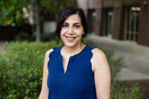
Negin Alemazkoor is an Assistant Professor at the University of Virginia's School of Engineering and Applied Science, specializing in interdisciplinary research on infrastructure resilience. Her work focuses on developing AI-driven methodologies for analyzing interconnected systems like power grids, urban flood models, and transportation networks under uncertainty. Key areas include enhancing grid reliability through multi-fidelity modeling, hurricane evacuation equity analysis, and precision-compression techniques for large-scale data. She co-leads a NSF-funded initiative to democratize AI education in high schools. Her research integrates graph neural networks, physics-informed models, and machine learning to address challenges in energy systems, environmental monitoring, and disaster response. Notable projects include hurricane-induced power outage risk analysis under climate change and precision guarantees for smart-meter data analytics. She emphasizes computational efficiency and multi-fidelity approaches to balance accuracy with resource constraints. Recent contributions span AI applications in flood forecasting, renewable energy integration, and infrastructure cybersecurity. Her NSF grant aims to create inclusive AI curricula, reflecting her commitment to education and societal impact. She is affiliated with UVA Engineering’s research initiatives on resilient systems and data-driven decision-making.
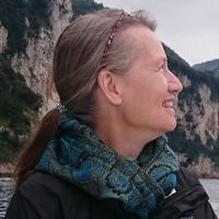
Ulla Mörtberg is a Professor and Docent at KTH Royal Institute of Technology's Digital Futures Faculty, specializing in Sustainable Development, Environmental Science and Engineering. She holds academic roles in the Department of Sustainable Development, Environmental Science and Engineering and is actively involved in interdisciplinary projects such as the EO-AI4GlobalChange initiative and the Embedding AI in geospatial policy tools for clean cooking adoption. Her work bridges geospatial technologies, environmental policy, and sustainable urban planning. Key research focuses include renewable energy planning (wind farms, bioenergy), urban ecosystem services, biodiversity conservation, and geodesign applications. She leads projects addressing climate solutions in Stockholm, such as integrating nature-based solutions into urban compaction strategies and evaluating green infrastructure impacts on urban heat. Her methods emphasize GIS-based decision support systems and multi-criteria analysis for balancing environmental, social, and economic objectives. Recent publications highlight advancements in ecosystem services assessment frameworks, wind energy sustainability, and urban biodiversity dynamics. Notable contributions include spatial optimization models for forest management and policy assessments of Brazil's Forest Code. Her work often involves global case studies but emphasizes regional applications in Sweden and the Stockholm region. Mörtberg collaborates extensively with municipal planners and policymakers, contributing to sustainable development goals through actionable research. Her projects often involve international partnerships and address global challenges such as deforestation in the Amazon and energy transition pathways in Europe.
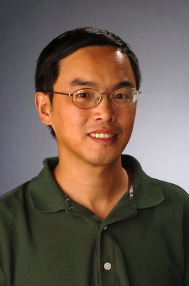
Peng Gao is a Professor in the Department of Geography and the Environment at Syracuse University, affiliated with the Maxwell School of Citizenship and Public Affairs. His work bridges river geomorphology and urban geospatial analysis, leveraging GIS, remote sensing, and UAV technologies to address environmental and social challenges. Education: Ph.D., Physical Geography, State University of New York at Buffalo (2003) M.S., Physical Geography, Lanzhou University (1993) B.S., Solid Mechanics, Lanzhou University (1990) Professor Gao specializes in river morphodynamics—particularly in the Qinghai-Tibet Plateau—and geospatial applications for urban planning. His research examines braided/meandering river systems, peatland hydrology, and how urban built environments influence social inequities and public health outcomes through spatial analysis. His 2020-2024 publications reveal a dual focus: (1) fluvial processes in high-altitude regions (e.g., neck cutoff dynamics, braided river discharge estimation using Landsat), and (2) urban applications (e.g., green building design, lead poisoning exposure mapping). This reflects a strategic integration of field geomorphology with computational geospatial modeling. Professor Gao actively mentors through SOURCE undergraduate research grants and PhD committees. Current funded projects include peatland mapping in the Andean Altiplano, I-81 Viaduct impact analysis in Syracuse, and studies on urban built environments affecting childhood lead poisoning. His work utilizes UAVs for BVLOS operations and collaborates with Syracuse CoE on urban environmental simulations, emphasizing technical innovation in geospatial data acquisition and analysis.
Professor Leif Isaksen is a leading scholar in Digital Humanities and Ancient History at the University of Exeter, holding a chair in the Department of Classics, Ancient History, Religion and Theology. He also serves as Theme Lead for Humanities, Heritage and the Creative Industries at the Institute for Data Science and Artificial Intelligence (IDSAI). With a background in archaeology and a focus on Spatial-temporal representation in humanities Intelligent systems for historical data Digital skills development in arts and humanities , his work bridges classical scholarship and computational innovation. His research includes Pelagios Network projects like Recogito and Peripleo , which revolutionized semantic annotation and geospatial analysis of ancient texts. He directed the Cluny Hill Dig and co-founded initiatives like Hot Source! and DISKAH to democratize digital humanities skills. Key professional roles include: Executive Board Chair of ADHO (2019-2021) Co-Director of Web Science CDT at Southampton Active leadership in CAA, EADH, and ISHMap Scientific honors include fellowships at the Society of Antiquaries of Scotland and former affiliations with the Alan Turing Institute and Society of Antiquaries of London . His work aligns with UN Sustainable Development Goals 9: Industry, Innovation and Infrastructure and 4: Quality Education .
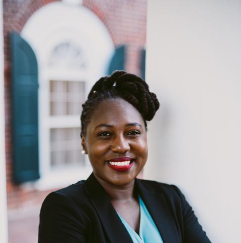
Charity Nyelele is an Assistant Professor in the Environmental Sciences department at the University of Virginia. Her research bridges human well-being and environmental systems, focusing on biodiversity, climate change, and ecosystem services through the lens of environmental justice and equity. Specializes in urban forestry and socio-ecological synthesis Active in climate justice, carbon sequestration, and stormwater management Nyelele's recent work integrates machine learning and social media data to map recreational ecosystem services and optimize tree planting frameworks. She has developed multi-objective decision support tools to address urban ecosystem service trade-offs and leads research in fire-driven ecosystem restoration across Western US forests. She teaches courses on Environmental and Climate Justice , Management of Forest Ecosystems , and co-instructs Politics, Science, and Values . Contact: hbt3mb@virginia.edu
Jessica Roberts is an Assistant Professor in the School of Interactive Computing at Georgia Tech. She holds a PhD in the Learning Sciences and directs the Technology-Integrated Learning Environments (TILEs) Lab. Her work focuses on technology-mediated learning in informal environments like museums and citizen science projects, emphasizing geospatial analysis, data visualization, and accessibility. Prior to academia, she was a middle school teacher. Education: PhD in Learning Sciences (specific institution not listed) Postdoctoral research at Carnegie Mellon University's Human-Computer Interaction Institute Postdoctoral work at Northwestern University's Tidal Lab Research Interests: Dr. Roberts explores how interactive technologies can foster inclusive, socially meaningful learning experiences. Her projects include: Data sonification systems for visually impaired audiences AI literacy frameworks for K-12 classrooms Citizen science platforms that democratize environmental data exploration Embodied interaction designs to enhance public engagement with scientific data Article Trends: Recent work highlights innovations in AI education, climate data visualization, and accessibility technologies. Over half of her 2023-2025 publications address data sonification systems for marginalized audiences or AI literacy challenges in K-12 contexts. Awards: Brook Byers Institute for Sustainable Systems Faculty Fellow Advising & Grants: Leads the TILEs Lab, which collaborates with institutions like the Field Museum of Natural History. Projects have been exhibited at major science museums, indicating significant external partnerships. Labs/Teams: Director of the TILEs Lab, affiliated with GVU Center at Georgia Tech. Collaborates with interdisciplinary teams across education, computer science, and environmental science domains.
Benedetta Giovanola is a Full Professor at the University of Macerata (UniMC) in the Department of Political Sciences, Communication and International Relations. She holds the Jean Monnet Chair 'Ethics for Inclusive Digital Europe' (funded by the EU) and is a Visiting Professor at Tufts University, USA. She also serves as Adjunct Professor of 'Economic Philosophy and Business Ethics' at the Catholic University of Milan. Her roles include Director of the postgraduate course on 'Digital Ethics, Law, Technologies' and member of the executive board of the 'Cybersecurity, Cyber Risk and Data Protection' program, both jointly run with the Polytechnic University of Marche. Current roles: Jean Monnet Chair, Full Professor, Visiting Professor at Tufts, Adjunct Professor at Catholic University Milan. Leadership: Founder of GAIA (AI Ethics and Governance spin-off), Principal Investigator (PI) in EU-funded projects like EthicAI4CARE and REINITIALISE. Professional memberships: Member of the executive board of SIFM (Italian Association for Moral Philosophy), past Deputy Rector at UniMC (2016-2022). Research focuses on digital ethics, AI ethics, media ethics, public ethics, social and global justice. She leads projects such as ENDE (European Network on Digitalization and E-Governance) and publishes extensively on AI ethics in healthcare, cultural heritage, and business contexts. Her work emphasizes ethical frameworks for trustworthy AI and fairness in algorithmic systems. Awards and recognition include the Jean Monnet Chair, and her research has been featured in journals like AI & Society, Computer Vision and Image Understanding, and IEEE Transactions on Technology and Society. She also contributes to policy initiatives and ethical guidelines for emerging technologies.
Peter K. Bol is the Charles H. Carswell Professor of East Asian Languages and Civilizations at Harvard University. His research focuses on China's cultural elites from the 7th to 17th centuries, geospatial analysis, and digital humanities projects including the China Historical Geographic Information Systems (CHGIS) and China Biographical Database (CBDB). His research interests include: Intellectual transitions in Tang and Sung China Neo-Confucianism and its historical context Geospatial analysis in historical research Biographical database development Digital approaches to Chinese history Bol has led significant university-wide initiatives including the establishment of Harvard's Center for Geographic Analysis in 2005 and has served as Vice Provost (2013-2018) overseeing HarvardX, the Harvard Initiative in Learning and Teaching, and online learning research.
Prof. Pia Fricker is an Associate Professor and Vice Head of the Department of Architecture at Aalto University's School of Arts, Design and Architecture in Finland. She holds the Professorship of Computational Methodologies in Landscape Architecture and Urbanism, directing the Urban Studies and Planning Programme. Her research integrates urban design, landscape architecture, and digital design culture, focusing on data-driven methods, immersive environments, and adaptive urban development. Collaborations include ETH Zurich, Singapore University of Technology and Design, and Hafencity University Hamburg. Key projects include the Metaversity and Future Smart Cities initiatives. Fricker has led over 80 publications and exhibitions globally, including at the Venice Biennale and National Design Centre Singapore. She is an editorial board member for the Journal of Digital Landscape Architecture and peer reviewer for multiple journals. Awards include the Digital Landscape Architecture Award (2018) and DLA Scientific Merit Award (2021). Her teaching emphasizes computational pedagogy and digital innovation in design education. Education: PhD in Architecture (ETH Zurich, 2021) Postgraduate in Didactics (ETH Zurich, 2011) MAS in Computer Aided Architectural Design (ETH Zurich, 2003) MSc Arch in Urban Design & Landscape Architecture (Technical University of Karlsruhe, 2001) Research Interests: Computational design, parametric modeling, mixed reality, climate-adaptive ecosystems, generative AI, and sustainable urban development. Her work bridges emerging technologies with ecological and urban challenges, emphasizing interdisciplinary collaboration. Grants & Projects: Metaversity (2023–2025, Principal Investigator) Future Smart Cities Sasakawa (2023–2024, Principal Investigator) ABRA (2020–2023, Project Member) Awards: DLA Awards (2018, 2021) DLA Review Committee Awards (2020–2022) Exhibition Recognitions (Venice Biennale, National Design Centre Singapore) Labs/Teams: Leads the Urban Studies and Planning Programme and collaborates with interdisciplinary teams on projects like the RAILCORRIDOR Singapore initiative. Active in digital twin development and AI-driven design tools.
Prof. Liqiu Meng serves as Chair of Cartography and Visual Analytics at the Technical University of Munich (TUM). He specializes in advanced geospatial research, digital cartography, and human-technology collaboration frameworks. Current Faculty at TUM Chair of Cartography and Visual Analytics Research Focus: His work bridges cartographic theory with cutting-edge technology, covering topics like 3D urban modeling, AI ethics visualization, geovisual analytics, and spatiotemporal data interpretation. Urban Morphology Analysis AI Ethics Cartography Geovisual Analytics 3D City Data Integration Location-Based Service Design Publications: Recent works (2025-2024) demonstrate expertise in explainable AI for urban analysis, multi-agent systems for geospatial interaction, and advanced spatial modeling techniques. Contact: liqiu.meng@tum.de | contact.lfk@ed.tum.de
Dr. Gaël Kermarrec is a researcher at the Boundary Layer Meteorology Group , part of the Institute of Meteorology and Climatology within the Faculty of Mathematics and Physics at Leibniz University Hannover . His work focuses on atmospheric turbulence, GNSS applications, and remote sensing for environmental monitoring. Boundary layer meteorology Turbulence theory GNSS signal processing Terrestrial laser scanning Climate change impacts Geodetic time series analysis His research integrates advanced mathematical models like LR B-splines and Matérn covariance with large eddy simulations to study: Atmospheric turbulence effects on optical/GNSS signals Hydrospheric mass loading Deformation analysis of terrain/port infrastructure Climatic sea-level changes Machine learning for remote sensing The 15 most recent articles (2025-2023) demonstrate his focus on: GNSS-based turbulence detection AI-enhanced climate mapping Advanced surface approximation techniques Multi-sensor data fusion Stochastic modeling of geodetic observations Environmental impacts on optical measurements He has developed tools like the Klimascanner QGIS plugin for urban climate resilience and contributes to: Understanding atmospheric scale lengths Improving TLS/GNSS deformation monitoring Analyzing hydrospheric changes Wavefront modeling Ionospheric corrections
Ngoc Thanh Nguyen is a Full Professor at Wroclaw University of Science and Technology where he serves as Head of the Department of Applied Informatics. He holds the prestigious title of Professor granted by the President of Poland and has been recognized as a Distinguished Scientist of ACM since 2009. He serves as Editor-in-Chief of both the Journal of Information and Telecommunication (JIT) and the Vietnam Journal of Computer Science (VJCS), and chairs the IEEE SMC Technical Committee on Computational Collective Intelligence. His research spans computational collective intelligence, knowledge integration, data mining, social media analysis, and sentiment analysis. Professor Nguyen has pioneered significant methodologies in spatial data clustering within network space, inter-sequence pattern mining, and graph neural network applications. His work bridges theoretical computer science with practical applications in intelligent information systems, demonstrating particular expertise in handling complex spatial and sequential data structures. His research has evolved from foundational pattern mining techniques to sophisticated neural network approaches for geospatial and social data analysis. The analysis of his recent publications reveals a strong focus on spatial data analysis in network environments, with significant contributions to clustering algorithms, graph neural networks, and pattern mining. His work consistently addresses efficiency challenges in data processing while expanding into emerging areas like Vietnamese language processing and topological data analysis. The research demonstrates a clear trajectory from traditional data mining techniques toward more sophisticated AI-driven approaches that incorporate spatial relationships and network topologies. Distinguished Scientist of ACM (2009) ACM Distinguished Speaker (2009-2013) IEEE Distinguished Visitor (2009-2013) Title of Professor granted by the President of Poland Professor Nguyen has supervised over 20 PhD students to completion and currently mentors several ongoing doctoral candidates. His academic leadership extends to founding two major conference series: the Asian Conference on Intelligent Information and Database Systems (ACIIDS) and the International Conference on Computational Collective Intelligence (ICCCI), which have become significant venues in their respective fields. His collaborative network spans multiple institutions, particularly with Yeungnam University as evidenced by several co-supervised PhD projects. As founder and chair of the IEEE SMC Technical Committee on Computational Collective Intelligence, he leads an international community of researchers advancing this specialized field. His departmental leadership at Wroclaw University of Science and Technology positions him at the center of applied informatics research and education in Poland, with particular emphasis on computational intelligence applications.
Mila N. Koeva is a Vice Dean Research and senior Associate Professor at the University of Twente's Faculty of Geo-Information Science and Earth Observation (ITC), Department of Urban and Regional Planning and Geo-Information Management. Her research focuses on 3D modeling and Digital Twins for land management and urban planning, integrating geospatial technologies, UAV data, and AI/ML methods. PhD in architectural photogrammetry MSc in Engineering (Geodesy) Research Themes: Digital Twinning for urban ecosystems AI-driven cadastral boundary extraction 3D modeling with LiDAR and satellite data Global partnerships in Rwanda, Kenya, and Ethiopia Interoperability standards for local digital twins Scientific Contributions: Geospatial World Innovation Award 2021 Copernicus Masters Competition (3rd place 2016) Editorial roles in Photogrammetric Records and MDPI journals Keynote speaker at 3D GeoInfo, GI Forum, and FIG events Her educational impact includes developing courses, lecturing, and supervising students whose work has received top awards in The Netherlands and international competitions.
Anton Rozhkov is an Industry Assistant Professor and Director of the M.S. in Applied Urban Science and Informatics Program at the Center for Urban Science and Progress (CUSP) at New York University (NYU) Tandon School of Engineering. His work focuses on applying geospatial tools, modeling techniques, and data science to address complex challenges in urban environments, with particular emphasis on infrastructure planning and city design. Dr. Rozhkov earned his Ph.D. in Urban Planning and Policy from the University of Illinois Chicago, where his research centered on decentralized and renewable energy systems in urban contexts through a complex systems approach. Prior to his doctoral studies, he received an M.S./B.S. in Engineering in Land Cadaster from the State University of Land Use Planning in Moscow, Russia, and worked as a senior specialist in the Russian power grid sector with "Rosseti" Group of Companies. His research interests span the application of complex systems, data science, and spatial analytics to solve urban challenges, particularly focusing on how data-driven policies and new technologies can transform infrastructure planning and city design. Dr. Rozhkov employs methods including causal loop diagrams, system dynamics, and agent-based modeling to understand how decentralized energy systems interact with existing power grids and contribute to sustainable urban development. He has published extensively on urban transportation, energy systems, and census data analysis, with a notable focus on Chicago's urban landscape and Illinois state initiatives. Dr. Rozhkov has been actively involved in several significant research projects including an empirical investigation into affordable transit-oriented development in California sponsored by the California State University Transportation Consortium, the Sustainable Urban-Regional Modeling Network project funded by the Illinois Innovation Network, and the Census 2020 Map-The-Count project with the Illinois Department of Human Services which developed predictive models for census response rates and a GIS platform for reporting outreach activities. Ph.D. in Urban Planning and Policy, University of Illinois Chicago M.S./B.S. in Engineering in Land Cadaster, State University of Land Use Planning (Moscow, Russia) His teaching portfolio includes courses on geographic information systems (GIS), advanced spatial analysis, decision modeling, and machine learning for cities. Dr. Rozhkov emphasizes not just understanding urban trends but exploring the "why" behind these trends to develop sustainable solutions. His recent publications (2020-2025) demonstrate a consistent research trajectory examining the complex interrelationships between urban infrastructure systems, particularly focusing on energy, transportation, and spatial patterns through sophisticated analytical methods. Outside of his academic work, Dr. Rozhkov is passionate about urban and landscape photography, traveling, running, snowboarding, and playing guitar. He was born and raised in Balashikha, a city in the Moscow suburbs in Russia, and maintains a gallery of his photographic work from various global locations.
Dr. C. Rhett Jackson serves as the Associate Dean of Academic Affairs and holds the John Porter Stevens Distinguished Professorship in Water Resources at the University of Georgia's Warnell School of Forestry and Natural Resources. His research focuses on the impacts of land use (forestry, agriculture, urbanization) on water quality and aquatic habitats, with particular emphasis on riparian vegetation, stream temperatures, and hydrological processes. He leads trans-disciplinary projects involving collaborators from environmental engineering, ecology, and geology. Education: PhD in Hydrology (University of Washington), MSE and BSE in Environmental Engineering (Duke University). Affiliations: Institute for Resilient Infrastructure Studies (IRIS), River Basin Center, and Coweeta LTER. Research interests include interflow dynamics, nitrogen cycling in mountain catchments, and the effectiveness of best management practices for nonpoint source pollution. He has authored over 100 peer-reviewed articles and has been recognized for his contributions to environmental science through the Distinguished Professor title. Key labs/centers: Water Resources Area, IRIS, and Coweeta LTER. His work bridges basic hydrologic science with applied water resource management, addressing both rural and urban challenges such as bioenergy crop impacts, karst groundwater interactions, and urban stream restoration.