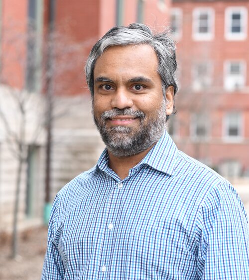
Anand Padmanabhan is a Research Associate Professor in the Department of Geography & Geographic Information Science at the University of Illinois at Urbana-Champaign (UIUC), affiliated with the School of Earth, Society & Environment within the College of Liberal Arts & Sciences. He holds a Ph.D. in Computer Science from the University of Iowa, alongside an MS in Computer Science (University of Iowa) and a BE in Computer Engineering (University of Mumbai). His research focuses on advanced cyberinfrastructure, cyberGIS, geospatial data science, and high-performance computing. He leads the spatial algorithms and systems team at the CyberGIS Center for Advanced Digital and Spatial Studies, developing cyberGIS capabilities to leverage advanced computing for geospatial innovation. His work emphasizes scalable geocomputation, cloud-based frameworks, and reproducible research environments, with contributions to tools like CyberGIS-Compute and EasyScienceGateway. Recent publications highlight advancements in science gateway frameworks, middleware systems, and geospatial education platforms. He serves as Online MS Program Adviser and has secured NSF and EPA grants for interdisciplinary projects. His work spans transdisciplinary training programs, urban sensing analytics, and integration of social media with geospatial data.
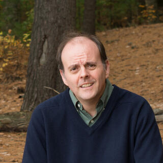
Dr. Gavin McArdle is an Associate Professor at the University College Dublin (UCD) School of Computer Science, specializing in spatial data analysis and smart cities. He holds academic affiliations with the National Centre for Geocomputation (Maynooth University) and CeADAR (Data Analytics Centre). His research focuses on urban dynamics, geovisual analytics, smart transportation, and remote sensing applications. He has received a College of Science Teaching Excellence Award for his contributions to education. McArdle earned his BSc, PhD, and a Prof Dip in University Teaching & Learning from UCD. His work bridges academia and industry through collaborative grants, including those from Science Foundation Ireland and EU funding. Notable projects include the Dublin Dashboard (urban analytics platform) and DubSim (traffic simulation using digital footprints). His research outputs span over 147 publications, with recent work addressing Airbnb's impact on urban gentrification, sustainable mobility, and environmental monitoring via satellite data. He actively contributes to professional committees, including roles in the UCD Data Protection Impact Assessment Committee and international conferences like Web and Wireless GIS. McArdle coordinates courses such as Research Practicum and Computer Programming II, emphasizing practical research and technical skills. His interdisciplinary approach integrates machine learning, spatial statistics, and urban informatics to address real-world challenges in smart cities and environmental sustainability.
Fernando Camelli is an Associate Professor in the Physics & Astronomy Department at George Mason University, holding dual roles as Instructional Faculty and Faculty. His research focuses on computational fluid dynamics (CFD), urban environmental modeling, and high-performance computing. He specializes in simulating complex fluid flows in urban environments, subway systems, and industrial applications, with particular emphasis on turbulence modeling, fluid-structure interaction, and GPU-accelerated algorithms. Key research areas include: CFD for urban airflow and contamination dispersion Meshless and immersed boundary methods Integration of geographic information systems (GIS) with CFD Large-scale simulations using parallel computing His work addresses practical challenges such as subway ventilation optimization, emergency contaminant dispersion prediction, and urban infrastructure design. Recent studies emphasize scalability improvements for fluid-structure interaction simulations and GPU-based code modernization.
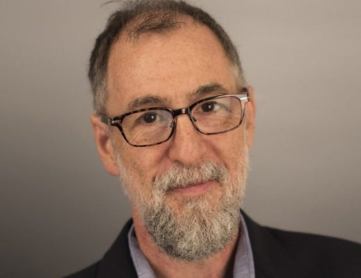
Federica Burini is a Full Professor of Geography at the Department of Foreign Languages, Literatures and Cultures of the University of Bergamo . She serves as Scientific Coordinator of the Imago Mundi Lab, member of the Center for Territorial Studies, and Scientific Director of OrobieLab. Her academic career spans participatory processes, collaborative mapping, and sustainable territorial regeneration. Full Professor of Geography Imago Mundi Lab Coordinator Center for Territorial Studies member OrobieLab Scientific Director Research Focus : Federica specializes in participatory geography through collaborative mapping techniques for environmental governance in both rural and urban contexts. Her work emphasizes sustainable development in Sub-Saharan Africa and European mountainous regions, with particular attention to landscape valorization via participatory processes and responsible tourism. Key projects include digital co-mapping initiatives for community engagement and territorial regeneration. Participatory mapping tools Sustainable tourism frameworks Mountainous area development Rural community empowerment Digital geospatial applications Landscape perception studies Publications : Recent works explore digital collaborative mapping tools (2024), industrial heritage interpretation for slow tourism (2024), and water resource-driven community regeneration (2024). Earlier contributions examine pandemic impacts on tourism (2020) and participatory cartography methodologies (2016). Her research consistently bridges geographical theory with practical territorial governance solutions.
Lucy Bastin is a Professor in the School of Computer Science and Digital Technologies at Aston University, part of the College of Engineering and Physical Sciences. She holds academic roles since 2003, including leadership in the Digital Observatory for Protected Areas (DOPA) project at the European Commission. Her research focuses on biodiversity informatics, remote sensing, and citizen science, with applications in conservation planning and sustainable development. She advises PhD students on topics like GIS, remote sensing, and citizen observatories. Education: BSc Zoology (University of Nottingham), MSc GIS (University of Leicester), PhD in Spatial Population Ecology (University of Birmingham). She also holds a Postgraduate Certificate in Teaching and Learning in Higher Education. Research Interests: Essential Biodiversity Variables, metadata standards for citizen science, uncertainty in conservation models, disease mapping (e.g., MRSA), and environmental policy support. She developed the DOPA toolkit for protected area monitoring and co-authored the Bari Manifesto for biodiversity variables. Key Projects: DOPA Explorer 2.0, FLIERS EU project, EuroGEOSS initiatives Recent Awards: Midlands Women in Tech Finalist (2021), Best Paper Award (2018) Teaching: Software Engineering, Professional Ethics in Computing, GIS modules Labs/Teams: Part of the Computer Science Research Group and Aston Centre for Artificial Intelligence Research and Application. Collaborates with global partners on initiatives like BIOPAMA and the Green Deal Data Space.
Dr. Hamid Rabiei is an Assistant Professor in Geography at the School of History and Geography, Dublin City University. He holds a PhD in Spatial Planning and Urban Development from Politecnico di Milano, Italy. His research focuses on sustainable development, spatial inequalities, climate change, and remote sensing/GIS applications. He has secured prestigious grants like the Marie Skłodowska-Curie Fellowship and published extensively in top-tier journals such as Habitat International and Applied Geography . His work bridges engineering, social science, and data science to address global challenges like environmental degradation and urbanization patterns. Key research interests include smart cities, spatial composite indicators, gentrification, and social vulnerability to natural hazards. He has contributed to developing novel models like the Adaptive Inverse Distance Weighting (AIDW) for population estimation and the Ordered Geographically Weighted Averaging (OGWA) for composite indicators. Recent work includes spatial analysis of internal migration impacts in Iran, Afghan immigrant segregation in Tehran, and ensemble modeling of extreme temperatures. He serves on editorial boards of academic journals in environmental studies and urban planning. His research emphasizes policy relevance, collaborating with decision-makers to translate findings into actionable strategies. Publications span 2023-2025, reflecting interdisciplinary approaches to urban sustainability, disaster risk, and big data applications. Grants and fellowships highlight his international recognition, particularly in integrating geospatial techniques with socioeconomic analysis.
Paul Cohen is a Professor of Computer Science at the University of Pittsburgh's School of Computing and Information (SCI), where he also directs the Modeling and Managing Complicated Systems Institute (MOMACS). Previously, he served as the founding Dean of SCI from 2017 to 2020. Before joining Pitt, he was a Program Manager at DARPA (2013–2017), leading initiatives like Big Mechanism and Communicating with Computers. Earlier roles include founding director of the University of Arizona’s School of Information: Science, Technology and Arts (SISTA), and professor at the University of Southern California’s Information Sciences Institute and the University of Massachusetts. Education: PhD in Computer Science and Psychology (Stanford University), MS in Psychology (UCLA), BS in Psychology (UC San Diego). Research Interests: Focuses on artificial intelligence, machine learning, natural language processing, and modeling complex systems like cell signaling pathways and socio-environmental interactions. His work emphasizes explainable AI, human-computer communication, and interdisciplinary problem-solving. Key Contributions: Authored Empirical Methods for Artificial Intelligence and over 200 peer-reviewed articles. His research spans robotics, education technology (e.g., the AnimalWatch tutoring system), and collaborative analysis tools like COLAB. He has won a Telly Award for his video on systemic challenges and a Best Paper award for spatial language learning frameworks. Awards & Recognition: Elected Fellow of the AAAI, recipient of the Telly Award, and winner of the Best Paper Award at the IEEE Conference on Development and Learning. Leadership & Outreach: Advocates for polymathy in education to address global challenges. His work includes developing curricula for complex systems thinking and promoting diversity in STEM through initiatives like AnimalWatch.
Dr. Indratmo is an Associate Professor and Chair of the Department of Computer Science at MacEwan University. He holds a PhD from the University of Saskatchewan, an M.Sc. from the University of Manitoba, and a B.Eng. from Petra Christian University. His research focuses on information visualization, human-computer interaction, and social computing, with a particular emphasis on developing tools for analyzing social media data. He has contributed to projects like a visual analytical tool for sentiment analysis in Edmonton's traffic-related social media data and studies on multimedia content effectiveness in communication strategies. Indratmo teaches a range of computer science courses, emphasizing student engagement through transparent pedagogical practices. His work bridges technical innovation with social impact, aiming to enhance communication strategies for organizations through data-driven insights. He has published extensively in journals like Big Data Research and Visual Informatics , and his research spans topics from educational visualization tools to smart mirror applications and geospatial heritage systems. Outside academia, he enjoys outdoor activities in the Canadian Rockies. Notable collaborations include work on stacked bar chart efficacy, web-based course registration models, and exploratory browsing frameworks. His research portfolio demonstrates a commitment to both theoretical advancement and practical applications in computing.
Wenwen Li is a Professor at Arizona State University (ASU), holding roles as Director of the CyberInfrastructure and Computation Intelligence (CICI) Lab and Research Director at the Spatial Analysis Research Center (SPARC). She specializes in geographic information science, cyberinfrastructure, and geospatial big data. Her work focuses on developing intelligent cyberinfrastructure for environmental and urban studies, leveraging AI and semantic technologies. Li's research has been supported by NSF, USGS, and Google.org, among others. Education: Ph.D. in Earth System and Geoinformation Science (George Mason University, 2010), M.S. in Signal and Information Processing (Chinese Academy of Sciences, 2007), and B.S. in Computer Science (Beijing Normal University, 2004). Research Interests : Cyberinfrastructure, spatial-temporal data mining, semantic interoperability, GeoAI applications in climate science, and urban studies. Her lab, CICI, pioneers projects like the Arctic Permafrost Thaw analysis and disaster response systems. Awards : 2023 AAG and UCGIS Fellowships, 2021 NSF Mid-Career Award, 2015 NSF CAREER Award, and the 2024 Greg Leptoukh Lecture Award (AGU). She chairs AAG's Cyberinfrastructure Specialty Group and serves on editorial boards of key journals. Grants & Service : Leads NSF-funded projects on GeoAI, climate modeling, and Arctic science. Active in AAG leadership roles and global initiatives like the Polar Cyberinfrastructure Portal. Recruits Ph.D. students in Geography and Computer Science. Labs & Teams : Directs the CICI Lab, advancing interdisciplinary GeoAI research and training. Collaborates with global partners on environmental and computational geography projects.
Isabella Di Lenardo is a Lecturer and Scientist at the Digital Humanities Institute (DHI) at École Polytechnique Fédérale de Lausanne (EPFL), where she also serves as the coordinator of the EPFL Time Machine Unit and the European Local Time Machines. She holds affiliations across multiple departments, including DHI-GE, SAR-ENS, SHS-ENS, and EDDH-ENS, reflecting her interdisciplinary role in teaching and research. Her educational background includes a PhD in Theories and Art History, with postdoctoral and faculty experience at institutions such as INHA (Paris), EPFL, and IUAV (Venice). Her research spans Digital Humanities, Art History, Urban History, and GIS , with a focus on digital urban reconstruction, historical cadastres, and AI applications in cultural heritage. She employs advanced computational methods including machine learning, 4D modeling, and semantic segmentation to analyze historical maps, cadastral records, and art archives. Her work bridges humanities scholarship with computer science, particularly in reconstructing urban evolution and analyzing visual patterns. The recent publications reveal a consistent trend in AI-powered historical data analysis , especially in processing non-standardized historical documents, reconstructing urban spaces, and developing open-source tools for digital heritage. Her work frequently involves large-scale datasets from Venice, Lausanne, Paris, and Jerusalem, demonstrating a transnational and interdisciplinary approach. She has contributed to significant collaborative projects such as the Venice Time Machine , Parcels of Venice , and Time Machine Organization , often acting as a principal investigator or project leader. Her role involves coordinating diverse teams of researchers, engineers, and cultural institutions. Scientific contributions include: Development of the Morphograph tool for visual pattern recognition in art archives Automatic vectorization and analysis of Napoleonic cadastres Creation of 4D models for historical cities AI-driven text and pattern extraction from historical maps Building discovery engines for digital art history She actively teaches ex cathedra courses in Digital Urban History and Art History at EPFL and internationally. Her work in grants and projects emphasizes open data, reproducibility, and interdisciplinary collaboration. She has led research funded by organizations supporting digital heritage innovation. She is a key member of the Digital Humanities Laboratory at EPFL and the Time Machine Organization , where she fosters collaboration between computer scientists, historians, and cultural institutions. Her work in the Replica Project and ARCHiVe center highlights her leadership in digitizing and making accessible large art historical archives.
Farah Kamw is an Assistant Professor in the Department of Computer Science at Wayne State University. With a PhD in Computer Science (2019) from Kent State University, her expertise spans 18 years of software development, academic teaching, and research in information visualization and database management. Education : PhD (Kent State), MSc (University of Zakho), BSc (University of Baghdad) Her research focuses on Information Visualization and Visual Analytics of spatial-temporal data, particularly through 8 publications (2013-2021) addressing urban mobility patterns, trajectory analysis, and geospatial data integration. She has developed several open-source visual analytics tools including TrajAnalytics and SparseTrajAnalytics, applying both document and graph database techniques. Farah teaches core Computer Science courses such as Algorithm Design , Programming Languages , and Database Systems . Her technical skills include Python, C++, Java, SQL, NoSQL databases, and GIS technologies.
Dr. Tamas Mona is a Postdoctoral Research Associate in the Department of Plant Sciences at the University of Cambridge , affiliated with the Epidemiology and Modelling Group . His work focuses on environmental suitability models for large-scale epidemiological forecasting, particularly in wheat rust outbreaks across Africa, the Middle East, and Asia. Collaborations include the UK Met Office, CIMMYT, and institutions in Ethiopia, Kenya, Bangladesh, and Nepal. PhD in Environmental Sciences (2019), Eötvös Loránd University MSc in Meteorology (2013), Eötvös Loránd University BSc in Physics with Meteorology (2011), Eötvös Loránd University Research interests integrate meteorological applications with epidemiological models to predict crop disease outbreaks. Key projects involve tracking transmission pathways for stem rust pathogens and analyzing how irrigation creates green bridges for intercontinental pathogen spread. Publications emphasize environmental science and computational epidemiology . Current collaborations span Sub-Saharan Africa (EIAR, ATI, KARLO) and South Asia (BWMRI, NARC) through initiatives like the Global Food Security IRC . Modeling frameworks developed by Mona contribute to policy advisory systems for emerging pest threats, aligning with DEFRA and UK government strategies.
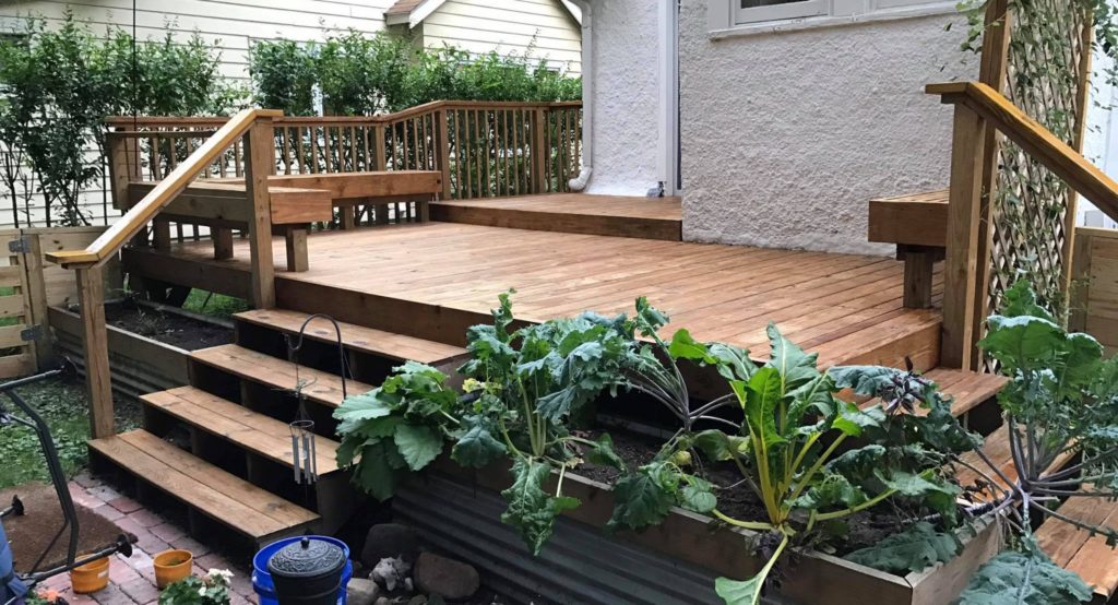
Keenan Gibbons is a Lecturer in Environment Sustainability and Development at the University of Michigan’s School of Environment, Art, and Society. A licensed landscape architect and urban design professional based in Detroit, he specializes in sustainable green infrastructure, parks, streetscapes, and innovative stormwater management strategies. With expertise in digital media, parametric modeling, and FAA-certified drone operations, he conducts research on urban heat island effects supported by the Landscape Architecture Foundation. Education Master of Landscape Architecture, Ball State University Bachelor of Science in Horticulture, Michigan State University His research interests integrate environmental sustainability with urban design , focusing on climate resilience through drone-based thermal imaging and low-impact construction . Publications highlight his work on UAV thermal disparity visualization and community-driven urban regeneration , including notable projects like Riverside Park Detroit . He received the LAF Deb Mitchell Research Grant for his heat wave visualization toolkit. Keenan’s projects include concrete-free construction for fences, decks, and planters, emphasizing reclaimed materials and DIY innovation . His work has been featured in CNN , The Weather Channel , and professional journals like MiASLA SITES . As an educator, he bridges environmental theory with hands-on design practice , often involving community stakeholders in his projects.
Lisa Grant Ludwig is a Professor in the Department of Population Health and Disease Prevention at the University of California, Irvine (UCI). She is a nationally recognized expert in earthquake science, focusing on translating geophysical research into policy for disaster risk reduction. Her work bridges seismology, public health, and policy implementation. PhD in Geology with Geophysics minor (Caltech) MS in Environmental Engineering Science (Caltech) BS in Applied Environmental Earth Science (Stanford) Dr. Ludwig's research centers on earthquake dynamics, particularly along the San Andreas Fault, advancing disaster resilience through innovative nowcasting techniques using AI and machine learning. Her publications demonstrate expertise in seismic hazard modeling, geodetic imaging, and community preparedness studies. Recent publications highlight AI-enhanced earthquake prediction (QuakeGPT), temporal-spatial nowcasting models, and applications of geodetic data for crustal deformation analysis. These works integrate machine learning with traditional seismological methods to improve hazard forecasting. President of Seismological Society of America NASA 2012 Software of the Year Medal Featured on Science magazine cover Congressional Testimony provider Active Federal Advisory Committee member Her interdisciplinary approach combines geophysics, public health policy, and computational science. Current projects focus on earthquake nowcasting, fault zone analysis, and developing accessible geospatial tools like GeoGateway for disaster response.
Prof. Dr.-Ing. Jörg Blankenbach holds the Chair of Construction Informatics and Geoinformation Systems at RWTH Aachen University's Geodetic Institute. His research focuses on the integration of digital technologies in civil engineering and geospatial systems. Current affiliations include: Chair of Construction Informatics and Geoinformation Systems, RWTH Aachen University Geodetic Institute, RWTH Aachen University Research interests span digital construction management, geospatial data modeling, BIM-GIS integration, and smart infrastructure systems.