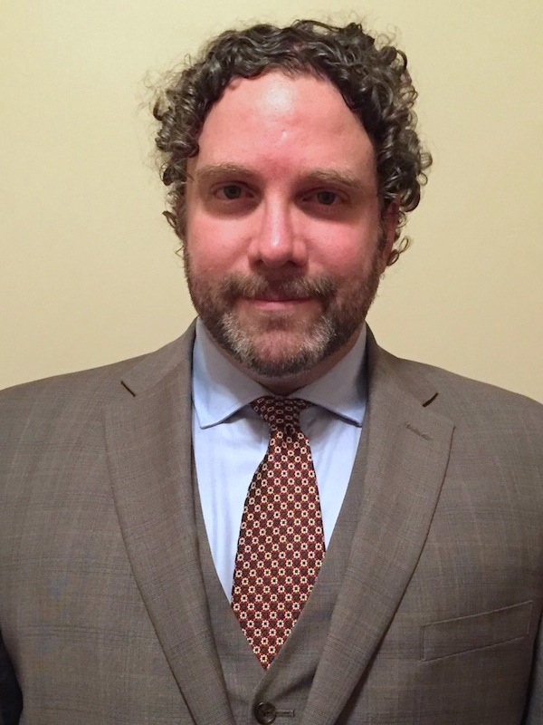
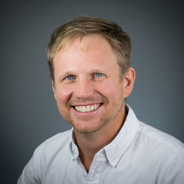
Dr. Frank Heitmuller is an Associate Professor at the University of Southern Mississippi, affiliated with the Department of Geology and Geography within the College of Arts and Sciences. His research focuses on fluvial and coastal geomorphology, sedimentology, and hydrology, particularly along the northern Gulf Coast. He collaborates across disciplines to address ecosystem dynamics and land-use policies. He holds a PhD (2009), MA (2002), and BS (1998) from the University of Texas at Austin and Florida State University, respectively. His teaching includes courses like Physical Geology, Geomorphology, and Hydrology. Research interests include river dynamics, sediment transport, coastal ecosystems, and the interplay between abiotic factors and environmental policies. His work emphasizes fluvial systems in Texas and Louisiana, with studies on flood impacts, channel adjustments, and sedimentologic processes. Publications span topics such as flood sedimentation, lithologic controls on river channels, and policy-related sediment transport modeling. He is affiliated with organizations like the Geological Society of America and Association of Environmental and Engineering Geologists. Languages: English (native), Spanish (limited working). His expertise includes environmental science and soils.
Dr. Anthony Filippi is an Associate Professor and Director of Graduate Programs at Texas A&M University. His research focuses on remote sensing, geographic information systems (GIS), and machine learning applied to aquatic and terrestrial environments. He leads the Fluvial-GEOS Lab, studying riverine/floodplain systems using remote sensing and GIS technologies. Educational Background: Ph.D. in Geography, University of South Carolina (2003) M.S. in Geography, University of South Carolina B.A. in Geography, Kansas State University Research Interests: Imaging spectroscopy, hyperspectral remote sensing of rivers and coastal oceans, GIS-based modeling, data fusion, aquatic optics, and machine learning. His work addresses coastal ocean bathymetry estimation, floodplain dynamics, and applications in environmental monitoring, including hazardous waste site tracking and agricultural studies. Recent Research Trends: Recent publications highlight advancements in UAS-based image analysis, LSTM networks for floodplain classification, and environmental policy impacts on forest resources. His work integrates machine learning with remote sensing to improve ecological and geomorphological understanding. Labs/Teams: Director of the Fluvial-GEOS Lab, focusing on remote sensing and GIS applications in riverine environments.
Juha Järvelä is a Staff Scientist at the Department of Built Environment , Aalto University, and a member of the Aalto Environmental Hydraulics Lab . His research focuses on environmental hydraulics, particularly on Hydraulics of environmental channels Modeling of vegetated flows Environmentally sound hydraulic engineering Järvelä's research spans fluid dynamics in river systems, with an emphasis on vegetation-flow-sediment interactions. Key areas include flow resistance in flexible and rigid vegetation, hydrodynamic modeling of floodplains, and nature-based solutions for water management. His recent publications investigate Blockage effects of woody vegetation Longitudinal dispersion in patchy vegetation Two-stage channel performance in agricultural settings Hydrodynamic characterization of natural-like plants Järvelä has received notable scientific recognition, including 2014 : Outstanding Reviewer Award from the American Geophysical Union for Water Resources Research 2005 : Doctoral Dissertation Award from the Oskari Vilamo Foundation Contact: juha.jarvela@aalto.fi | Phone: +358505626727 | Postal: Tietotie 1 E, 02150 Espoo, Finland
Pascale Biron is a Professor in the Department of Geography, Urban Planning and Environment at Concordia University, Montreal. She holds a Ph.D. in Geography from Université de Montréal (1995) and has been with Concordia since 1998. Her research focuses on river dynamics, stream restoration for fish habitat, flood modeling, and climate change impacts. She specializes in hydrogeomorphology, river management in agricultural watersheds, and numerical modeling of fluvial processes. Research Interests: Her work includes river restoration strategies, flood risk assessment using LiDAR technology, and the 'river freedom' concept promoting ecosystem resilience. She collaborates closely with government agencies to translate research into practical river management policies. Professional Affiliations: Canadian Geomorphology Research Group, Canadian Association of Geographers, American Geophysical Union, GRIL (Limnology Research Group), and RIISQ (Quebec Flood Risk Network). Publications & Research: Recent studies address global salmonid biomass patterns, fluvial hazard detection via machine learning, and large-scale flood modeling. She supervises 19 graduate students in Ph.D./M.Sc. programs in Geography and Environmental Studies, focusing on topics like river confluence hydraulics and agricultural stream restoration. Grants & Funding: Active projects include river dynamics in fish habitats, flood modeling for road infrastructure vulnerability, and computational fluid dynamics simulations of river flows. She also leads research on societal dimensions of river restoration and policy frameworks for flood resilience.
Ben Seiyon Lee is an Assistant Professor in the Department of Statistics at George Mason University's College of Science. His work bridges computational statistics, climate modeling, and environmental risk assessment. Education: PhD in Statistics, Pennsylvania State University (2020) Lee specializes in computational methods for high-dimensional spatiotemporal data and uncertainty quantification in climate models. His research explores climate change impacts on extreme hydrological events, wildfire emissions, and medical decision-making. Recent publications focus on Bayesian spatiotemporal frameworks for extreme precipitation analysis, zero-inflated spatial models, and multisector uncertainty quantification. His work addresses challenges in flood risk assessment, agricultural yield projections, and healthcare compliance metrics.
Giuliano Di Baldassarre is a Professor of Hydrology and Environmental Analysis at the Department of Earth Sciences, Uppsala University , Sweden. He serves as Head of Division for LUVAL (Air, Water and Landscape Sciences) and directs the Centre of Natural Hazards and Disaster Science (CNDS) (2016–2025). His work bridges water, environment, and society through interdisciplinary methods , focusing on disaster risk reduction, climate adaptation, and sustainable development. Education : Details not explicitly provided in the text. His research examines feedbacks between human activities and hydrological processes , including floods, droughts, and reservoir management . Key themes include social-ecological systems , inequalities in water crises , and policy implications of hydrological extremes . He has pioneered sociohydrology and human-water system modeling . Recent articles highlight global drought-flood interactions , urban water inequality , climate service maladaptation , and sociohydrological modeling . His work spans Nature Sustainability , Science Advances , and Hydrological Sciences Journal . Scientific Awards : International Hydrology Prize (Volker Medal) Plinius Medal (EGU) Witherspoon Lecture Award (AGU) European Research Council Consolidator Grant He led Panta Rhei - Everything Flows (2013–2022), IAHS’s global initiative on water-society interactions. Current efforts include transdisciplinary praxis and climate risk reduction frameworks .
Ross Meentemeyer is a Professor and Director of the Center for Geospatial Analytics at North Carolina State University, affiliated with the Department of Forestry and Environmental Resources in the College of Natural Resources. He holds a Ph.D. in Geography from the University of North Carolina, Chapel Hill (2000) and a B.S. in Geography from the University of Georgia (1993). His research focuses on geospatial analytics, ecological forecasting, biological invasions, and forest health, with a strong emphasis on integrating geospatial data and modeling to address environmental challenges. Dr. Meentemeyer's work includes developing decision-support tools for pest management, climate adaptation, and land-use planning. Notable projects involve forecasting invasive species spread via international trade, creating open-source geospatial platforms, and modeling floodplain development risks. He collaborates extensively with federal agencies like USDA, DOI, and NPS to translate research into practical solutions. His grants include multi-million dollar NSF and USDA-funded initiatives addressing plant disease pandemics, agricultural pest threats, and geospatial infrastructure development. Key outcomes include the PAdb system for pandemic prediction and the FUTURES model for urbanization forecasting. He also leads efforts to enhance stakeholder engagement through participatory modeling tools like Tangible Landscape. Research contributions span 20+ years, with over 100 peer-reviewed articles on topics like viewscape modeling, river water dynamics, and wildfire-epidemic interactions. His work bridges ecological and social sciences, emphasizing actionable solutions for sustainable land management and climate resilience.
Athena Nghiem is an Assistant Professor at the University of Wisconsin-Madison, starting Fall 2024, specializing in biogeochemistry and hydrology. She currently holds an ETH Postdoctoral Fellowship at ETH Zürich, focusing on redox processes in groundwater systems. Education: PhD in Earth and Environmental Sciences from Columbia University, BA in Geophysics and Statistics from UC Berkeley Research interests: Environmental variability in hydrology, redox processes, groundwater contamination, data science in environmental research, and reactive transport modeling Her research combines traditional laboratory/field methods with data science to study trace element cycling, particularly arsenic release in aquifers. Recent work includes quantifying sulfate reduction's role in arsenic contamination and evaluating mitigation strategies. Notable awards: ETH Postdoctoral Fellowship (2022-2024), NSF Graduate Research Fellowship (2018-2021), and multiple academic honors during her UC Berkeley BA studies. Current advisees at UW-Madison: Juyong Bak, Savannah Finley, Logan Goulette. She actively encourages applications from diverse backgrounds for future lab positions.
Dr. Pascale Biron is a Professor in the Department of Geography, Planning and Environment at Concordia University, Montreal. Her research focuses on river dynamics, stream restoration, flood modeling, and climate change impacts. She has been at Concordia since 1998 and holds professional affiliations with key organizations like the Canadian Geomorphology Research Group and the American Geophysical Union. Education: PhD from Université de Montréal and Leeds University (fluvial geomorphology) Research Interests Her work integrates fluvial geomorphology, computational fluid dynamics, and societal aspects of river management. Key themes include: River restoration for fish habitat Floodplain modeling using LiDAR Climate adaptation strategies Socio-hydrological dimensions of restoration Hydrodynamic processes at river confluences Recent Research Trends Recent publications emphasize global salmonid habitat analysis, machine learning for fluvial hazard detection, and the socio-environmental impacts of urban flooding. Her work bridges technical hydrology with policy-relevant solutions for sustainable water management. Grants & Advising Supervises over 15 graduate students (PhD/MSc) in topics ranging from flood modeling to bioengineering. Active in collaborative projects like the 'Freedom Space for Rivers' initiative and large-scale floodplain mapping. Labs & Teams Member of GRIL (Limnology Research Group) and RIISQ (Quebec Flood Network), contributing to interdisciplinary water security research.
Prof. Dr. Virginia Ruiz-Villanueva is a Professor and leader of the Geomorphology Unit at the Institute of Geography, University of Bern. Her research focuses on river processes, particularly large wood dynamics, flood hazards, and sediment transport in mountainous regions. She holds a prominent role in international collaborations, addressing climate change impacts and river management challenges. Key areas of expertise include geomorphology, environmental hazards, and interdisciplinary approaches to understanding river systems. Her work integrates field observations, numerical modeling, and remote sensing to study processes such as large wood accumulation in rivers, flood risk assessment, and the influence of human activities on hydrological systems. She has contributed to projects across Europe, South America, and the Western United States, emphasizing practical applications for disaster risk reduction and sustainable river management. Recent research highlights include exploring historical changes in mountain river hydrodynamics, quantifying large wood supply in Swiss catchments, and analyzing cascading hazards in Chilean river systems. Her publications frequently appear in high-impact journals such as Earth Surface Processes and Landforms and Science of the Total Environment .
Professor Dörthe Tetzlaff is a leading figure in ecohydrology, serving as Head of Department (A1) Ecohydrology at the Leibniz Institute of Freshwater Ecology and Inland Fisheries (IGB) and as Full Professor of Ecohydrology at Humboldt-Universität zu Berlin, Faculty of Mathematics and Natural Sciences, Geography Department. She also holds an Honorary Professorship at the University of Aberdeen, Scotland. Her work bridges theoretical hydrology with practical applications for water security and environmental management. Professor Tetzlaff's research focuses on ecohydrological processes, particularly using stable water isotopes to understand water cycling, catchment functioning, and landscape connectivity. Her work spans from pristine natural systems to complex urban environments, with particular emphasis on drought resilience, water security, and nature-based solutions. She has pioneered tracer-aided modeling approaches to quantify water storage, fluxes, and ages across the soil-plant-atmosphere continuum. Her publication record shows a clear trend toward increasingly sophisticated integration of multi-tracer approaches with ecohydrological modeling, with recent work focusing on urban systems, drought impacts, and nature-based solutions. The publications demonstrate expertise across hydrology, biogeochemistry, and ecological applications, with strong methodological development in isotope hydrology and modeling techniques. Polubarinova-Kochina Hydrologic Sciences Mid-Career Award of the American Geophysical Union AGU (2024) Water Resource Prize of the Rüdiger Kurt Bode Foundation (2024) Member of the Berlin-Brandenburg Academy of Sciences and Humanities (2023) Fellow of The European Academy of Sciences (2022) Fellow of the Geological Society of America GSA (2020) Professor Tetzlaff actively supervises numerous PhD students and postdoctoral researchers, with her group focusing on cutting-edge ecohydrological research. She leads multiple significant research projects including WETSCAPES2.0, ECCO, ISO-SCALE, and BiNatUr, which address critical questions about water security, climate change impacts, and nature-based solutions in urban environments. Her work is supported by substantial funding from various national and international sources. She leads the Ecohydrology research group at both IGB and Humboldt-Universität zu Berlin, which employs an integrative approach combining field measurements, isotope techniques, and advanced modeling to understand water dynamics across diverse landscapes. The group collaborates extensively with international partners across Europe, North America, and Asia, contributing to global understanding of hydrological processes.
Paola Passalacqua is a Professor of Environmental and Water Resources Engineering and Earth and Planetary Sciences at the University of Texas at Austin, holding the L.B. (Preach) Meaders Professorship in Engineering. She leads research at the intersection of water resources engineering, geomorphology, and hydrology, focusing on river networks, coastal restoration, and remote sensing applications. Her work addresses delta dynamics, floodplain connectivity, and community resilience to compound hazards. Dr. Passalacqua earned a PhD in Civil Engineering (2009) and MS in Water Resources from the University of Minnesota, and dual MS/BS in Environmental Engineering from the University of Genoa (2002). Her technical expertise includes hydrological connectivity, network theory, and morphodynamic modeling using LiDAR and satellite data. Research interests emphasize river delta structure/dynamics, floodplain sedimentation, and translating science into community adaptation strategies. She co-developed tools like GeoFlood for large-scale flood mapping and the pyDeltaRCM numerical delta model. Her interdisciplinary approach integrates socio-technical vulnerability analysis with environmental systems. Awards include the endowed Meaders Professorship. Current projects involve coastal Alaska infrastructure resilience, SWOT satellite data applications, and delta sustainability in the Anthropocene. She leads the Passalacqua Research Group, engaging in citizen science through initiatives like UTBiome.
Rich Walker is an Assistant Professor in the Department of Biology, Geology, and Environmental Science at the University of Tennessee at Chattanooga (UTC). His research focuses on freshwater ecosystems, particularly understanding how stressors affect stream biodiversity and ecological processes. He leads the Freshwater Ecology and Conservation Lab, emphasizing interdisciplinary approaches to environmental challenges. Education: PhD in Ecology (University of Wyoming, 2019), MS in Biology (University of Central Arkansas, 2011), and BS in Environmental Science (University of Central Arkansas, 2008). Research interests include freshwater salinization, non-perennial stream dynamics, and fisheries conservation. His work bridges basic and applied questions, such as how climate change and human activities alter water quality and habitat availability. Recent studies explore predictive modeling of conductivity in the Chesapeake Bay watershed and biogeochemical responses in intermittent streams. Publications span Environmental Science & Technology Water , Nature Water , and Science of the Total Environment . His 2024 studies address conductivity trends and non-perennial stream management. Key findings include global gaps in salinization research and crayfish population dynamics under climate variability. Service roles include membership in UTC’s Curriculum Committee, Izaak Walton League’s Save Our Streams, and the Hartman Nature Reserve Board. Teaching covers ecology, limnology, and fisheries management.
Peng Gao is a Professor in the Department of Geography and the Environment at Syracuse University, affiliated with the Maxwell School of Citizenship and Public Affairs. His work bridges river geomorphology and urban geospatial analysis, leveraging GIS, remote sensing, and UAV technologies to address environmental and social challenges. Education: Ph.D., Physical Geography, State University of New York at Buffalo (2003) M.S., Physical Geography, Lanzhou University (1993) B.S., Solid Mechanics, Lanzhou University (1990) Professor Gao specializes in river morphodynamics—particularly in the Qinghai-Tibet Plateau—and geospatial applications for urban planning. His research examines braided/meandering river systems, peatland hydrology, and how urban built environments influence social inequities and public health outcomes through spatial analysis. His 2020-2024 publications reveal a dual focus: (1) fluvial processes in high-altitude regions (e.g., neck cutoff dynamics, braided river discharge estimation using Landsat), and (2) urban applications (e.g., green building design, lead poisoning exposure mapping). This reflects a strategic integration of field geomorphology with computational geospatial modeling. Professor Gao actively mentors through SOURCE undergraduate research grants and PhD committees. Current funded projects include peatland mapping in the Andean Altiplano, I-81 Viaduct impact analysis in Syracuse, and studies on urban built environments affecting childhood lead poisoning. His work utilizes UAVs for BVLOS operations and collaborates with Syracuse CoE on urban environmental simulations, emphasizing technical innovation in geospatial data acquisition and analysis.
Prof. Rajiv Sinha is a Professor in the Department of Earth Sciences at Indian Institute of Technology Kanpur . With a PhD from the University of Cambridge (1992), his career spans over two decades at IITK, including roles as Head of Department since 2014. Education: PhD (University of Cambridge, 1992), M.Tech (University of Roorkee, 1987), B.Sc (Patna University, 1983) Key Affiliations: Member of International Association of Sedimentologists, SEPM, Quaternary Research Association, and Indian Professional Societies Research Focus: Specializing in river science , Prof. Sinha investigates fluvial geomorphology , sedimentology , and natural hazards like Kosi floods . His work integrates remote sensing and GIS for climate change and paleoclimate reconstruction , notably studying the Ganga river system and its anthropogenic impacts . Scientific Leadership: His publications (2013-2017) reveal: Anthropocene river systems (2016) Indus Civilization paleohydrology (2017) Kosi megafan dynamics (2015) Monsoon evolution (2010, 2014) Groundwater management (2016) Awards & Recognitions: Pandit Girish Ranjan Chair Professorship (2013) National Mineral Award (2002) Alexander von Humboldt Fellowship (2000) UGC Research Fellowship (1988) University Gold Medal (1987) Collaborative Network: Partners include University of Durham , Imperial College London , and Institute du Physique de Globe, Paris . Currently leading Ganga River Basin Management studies and river science initiatives at IITK.