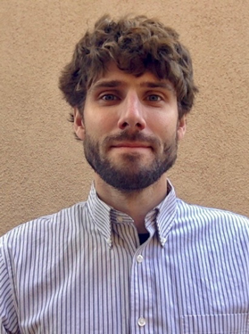
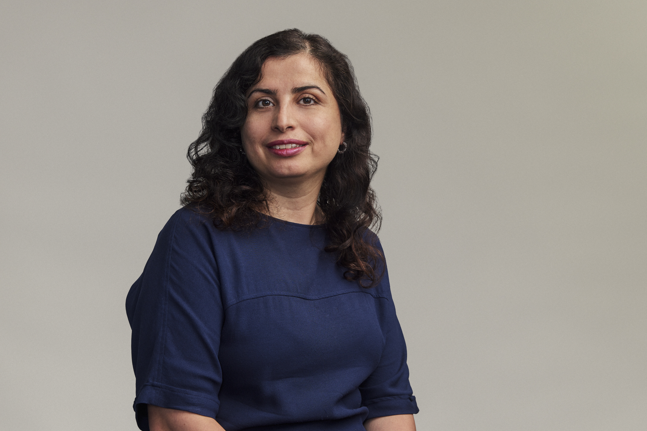
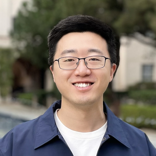
Dr. Maren Boese is a Senior Research Scientist at the Swiss Seismological Service (SED) and Seismology and Geodynamics (SEG) groups at ETH Zurich. Her expertise spans seismology, earthquake early warning systems, and planetary seismology. She leads projects like the CISN ShakeAlert system for California and contributed to NASA's InSight mission to Mars. She earned her Ph.D. from Karlsruhe Institute of Technology (2006) and a Master's from Kiel University (2002). Research Focus: Real-time seismic event detection, finite-fault rupture analysis, ground-motion simulation, and Marsquake seismology. Key contributions include developing the FinDer algorithm for the ShakeAlert system and advancing early warning methodologies in Central America and Switzerland. Awards: 2011: Outstanding Publication Award (Luxembourg National Research Fund) 2010: Ausgewählter Ort im Land der Ideen (BMBF Project EWS Transport) 2006: European IST Prize (Early Warning for Strong Earthquakes) Grants & Leadership: Led the CISN ShakeAlert team (2009–2014), managed the German CRC 461 project, and coordinated international collaborations like the InSight Marsquake Service. Labs/Teams: Swiss Seismological Service (ETH Zurich), NASA InSight Mission, and the CHEAP smartphone network project in Chile.
Scott Staniewicz is a researcher at the University of Texas at Austin in the Department of Aerospace Engineering and Engineering Mechanics. His work focuses on geophysical applications of computer vision and remote sensing, particularly using Interferometric Synthetic Aperture Radar (InSAR) to detect surface deformation and tropospheric noise features. Academic Affiliation: University of Texas at Austin Research Focus: Surface deformation analysis, InSAR data processing, tropospheric noise mitigation Email: scott.stanie@utexas.edu Staniewicz's research employs computer vision techniques like Laplacian of Gaussian (LoG) filtering to identify spatially coherent deformation features (e.g., subsidence/uplift in oil-producing regions). His methods integrate noise spectrum estimation from real data and simulations to distinguish true deformation signals from atmospheric artifacts. Recent work includes software development for automated InSAR analysis and large-scale studies of anthropogenic deformation in the Permian Basin. He has contributed to open-source tools such as Blobsar (2025a) and Troposim (2025b) for deformation detection, and collaborated on studies analyzing seismic sequences (Skoumal et al., 2020), tropospheric delay corrections (Li et al., 2019; Yang et al., 2024), and statewide seismic networks (Savvaidis et al., 2019). His publications demonstrate expertise in combining computer vision with geophysical data analysis.
Brandon Schmandt is a Professor in the Department of Earth and Planetary Sciences at the University of New Mexico. His research focuses on geophysics, seismology, tectonics, structural geology, and volcanology. He holds a Ph.D. from the University of Oregon (2011). His research group specializes in seismic imaging methods to study subsurface structures related to tectonic and magmatic processes. They analyze seismic data from both fieldwork and public archives, with applications to earthquake mechanics, magma storage, and explosion discrimination. Recent work emphasizes continental magmatic systems, induced seismicity in the Raton Basin, and Yellowstone's magmatic architecture. Collaborative projects include seismic array deployments and machine learning applications for signal analysis. No scientific awards are explicitly listed in the provided texts. His advising includes undergraduate and graduate students such as Wilgus, Stairs, and Maguire. No specific grants or labs are mentioned beyond his departmental affiliation.
Dr. Mojgan A. Jadidi serves as Associate Professor in the Teaching Stream and Director of Common Engineering & BSc Science within the Department of Civil Engineering at York University's Lassonde School of Engineering. A Professional Engineer (P.Eng) and founder of the GeoVA Lab, she leads research at the intersection of geospatial analytics, digital infrastructure, and innovative engineering education aligned with UN Sustainable Development Goals. Education: PhD in Geomatics, Université Laval (2014) MSc in Earthquake and Seismology Engineering, ROSE Center (Italy) & Université Joseph Fourier (France) BSc in Civil-Survey Engineering, Iranian University of Science and Technology Research Focus: Her pioneering work in Geospatial Visual Analytics spans 2D/3D environments, Building Information Modeling (BIM) and 3D GIS integration, and Spatial Quantum Computing applications for smart cities. She develops Infrastructure Digital Twins using sensor data fusion while revolutionizing engineering education through gamification and augmented/virtual reality pedagogies that transform complex spatial concepts into immersive learning experiences. Research Trends: Recent publications (2021-2023) demonstrate convergent innovation across three domains: (1) Building energy optimization through BIM-graph analytics, (2) Transportation safety via AI-driven situational awareness, and (3) Educational technology using VR sandboxes and visual-verbal comics. These works consistently integrate quantum computing principles and UN SDG frameworks to solve urban sustainability challenges. Scientific Recognition: ASEE Zone III Best Paper Award (2023) ASEE Saint Lawrence Best Research Paper & Poster (2022) 3D GeoInfo Conference Best Paper (2018) NSERC Postdoctoral Fellowship (2016) ESRI Student Award (2011) Erasmus Mundus Scholarship (2006) Research Leadership: As Associate Director of York's ESRI Center of Excellence, she manages multi-source funding from NSERC, Mitacs, and York University internal grants. Her professional service spans global organizations including ISPRS Commission IV (Secretary), IEEE Women in Engineering (Member), PEO Etobicoke (Chair), and buildingSMART Canada (Committee Member), driving standards for BIM and digital twin implementation in urban infrastructure. Lab Innovation: The GeoVA Lab develops cutting-edge tools including the TopoSurvey Game for immersive surveying education, PAN-Lassonde XR Sandbox for virtual lab experiences, and quantum computing frameworks for bike-sharing optimization, establishing new paradigms in spatial data interaction and engineering pedagogy.
Zachary E. Ross is a Professor of Geophysics at the California Institute of Technology (Caltech) and holds the William H. Hurt Scholar distinction since 2021. His research integrates machine learning, computational mathematics, and seismology to analyze earthquakes and fault zones using large seismic datasets. Education B.S., University of California, Davis (2009) M.S., California Polytechnic State University, San Luis Obispo (2011) Ph.D., University of Southern California (2016) His research focuses on high-resolution imaging of fault zones, understanding earthquake sequences in space and time, and applying artificial intelligence to seismic data analysis. He develops scalable algorithms for waveform inversion, ground-motion synthesis, and real-time seismic monitoring. Recent publications highlight his work on neural operators for wave propagation, AI-driven seismicity analysis, and induced earthquake dynamics. He teaches advanced courses including Ge 264 – Machine Learning in Geophysics and Ge 271 – Dynamics of Seismicity . Scientific Awards William H. Hurt Scholar (2021–present)
William Newman is a Professor in the Department of Earth, Planetary, and Space Sciences at the University of California, Los Angeles (UCLA), currently on sabbatical at the Institute for Advanced Study in Princeton. His primary academic home resides within UCLA's geoscience and planetary science division. His educational credentials include: B.Sc. (Hon.) in Physics from the University of Alberta, Canada (1971) M.Sc. in Physics from the University of Alberta, Canada (1972) M.S. in Astronomy and Space Science from Cornell University (1975) Ph.D. in Astronomy and Space Science from Cornell University (1979) Professor Newman applies theoretical physics and applied mathematics to solve critical real-world problems across multiple disciplines. His research spans statistical techniques for climate change assessment, earthquake hazard modeling, solar system evolution (including collision risks from trans-Jovian bodies), astrophysical jet dynamics, and pattern emergence in complex systems. This interdisciplinary work bridges geophysics, planetary science, and astrophysics through rigorous mathematical frameworks. His publication record (2024-2016) reveals three dominant research thrusts: (1) Semiconductor electron emission physics (GaAs nanotips, photoemission sources), (2) Solar system dynamics and celestial mechanics (N-body simulations, impact hazards), and (3) Complex systems analysis (earthquake patterns, statistical record-breaking events). These intersect physics, earth sciences, and computational mathematics through shared methodologies in statistical modeling and nonlinear dynamics. At UCLA, Newman developed innovative courses including a natural disasters undergraduate GE course (satisfying diversity requirements) and graduate-level planetary atmospheres and continuum mechanics curricula. His academic contributions include over 100 refereed papers and graduate textbooks published by Princeton and Cambridge University Presses, focusing on mathematical methods for geophysics and space physics.
Domniki Asimaki is a Professor of Mechanical and Civil Engineering at the California Institute of Technology (Caltech), part of the Division of Engineering and Applied Science. Her research focuses on geotechnical engineering, computational mechanics, and structural dynamics, with an emphasis on understanding ground motion effects on natural and engineered systems such as dams, tunnels, and urban infrastructure. She holds a Dipl. from the National Technical University of Athens (1998), an M.S. (2000) and Ph.D. (2004) from MIT, joining Caltech in 2014. Key research interests include soil dynamics, wave propagation, regional ground deformation, and soil-foundation-structure interaction. She has pioneered data-driven approaches to integrate numerical simulations with field observations for resilient infrastructure design. Notable achievements include developing the open-source Seismo-VLAB software for seismic analysis and receiving prestigious awards like the Bodossaki Award of Scientific Excellence and the Geotechnical Earthquake Engineering Award. Her work addresses seismic hazards at urban and regional scales, with recent studies on the 2023 Türkiye earthquake, the 2019 Ridgecrest earthquake, and Kathmandu Basin dynamics. She leads initiatives to enhance ground motion prediction, landslide hazard assessment, and infrastructure resilience through advanced modeling and AI-driven methods. Education: Dipl., National Technical University of Athens, 1998 M.S., Massachusetts Institute of Technology, 2000 Ph.D., Massachusetts Institute of Technology, 2004 Awards: Bodossaki Award of Scientific Excellence Geotechnical Earthquake Engineering Award Labs/Teams: Leads research groups focusing on seismic hazard modeling, open-source software development, and geotechnical data assimilation techniques.
Professor Meghan S. Miller is an academic at the Australian National University (ANU), serving as a Professor in the Research School of Earth Sciences, specializing in Geophysics. She holds an ARC Future Fellowship, focusing on advancing Distributed Acoustic Sensing (DAS) technology for seismic imaging. Her research emphasizes observational seismology, particularly at critical tectonic plate boundaries such as subduction zones and continental collision zones. Education: Ph.D. in Geophysics from ANU (2006), M.Eng. from Cornell University (2000), M.S. from Columbia University (1999), and B.A. from Whittier College (1997). Research interests include seismic imaging of Earth’s structure, dynamics of subduction zones, and the application of novel techniques like DAS for high-resolution subsurface imaging. She has led projects such as the Southwest Australia Seismic Network (SWAN) and the SISSLE experiment in New Zealand. Key achievements include over 100 peer-reviewed publications, supervising numerous graduate students, and leading international collaborations in Indonesia, Alaska, and Morocco. Awards include the ARC Future Fellowship (2022–2026). Labs/Teams: Active in the AuScope Earth Imaging Program and collaborates with institutions like Geoscience Australia and Macquarie University.
Jiaxuan Li is an Assistant Professor of Geophysics in the Department of Earth and Atmospheric Sciences at the University of Houston's College of Natural Sciences and Mathematics. His research focuses on developing fiber-optic sensing technologies for seismic monitoring across diverse geological environments including volcanic, crustal, and glacial settings. Dr. Li's educational background includes a Ph.D. in Geophysics from the University of Houston (2015-2020) and a B.S. in Geophysics from Peking University (2011-2015). He previously held a postdoctoral position at Caltech Seismolab under Prof. Zhongwen Zhan. His research program centers on distributed acoustic sensing (DAS) applications, with major contributions in volcanic eruption forecasting through minute-scale magma migration imaging, earthquake rupture dynamics via high-frequency fault asperity analysis, and subsurface characterization for carbon sequestration and geothermal energy. Recent work demonstrates DAS capabilities as dense geodetic arrays for real-time volcanic monitoring systems deployed in Iceland through collaborations with the Icelandic Met Office and Reykjavik University. Analysis of Dr. Li's publication record reveals a strong emphasis on operationalizing fiber-optic networks for geophysical monitoring, with significant advancements in eruption early warning systems, earthquake source characterization, and subsurface imaging techniques. His work bridges fundamental seismological research with practical hazard mitigation applications. Dr. Li actively mentors graduate students and recently welcomed postdoc Dr. Tianfan Yan to his research team. His lab operates real-time DAS streaming systems for volcanic eruption monitoring in Iceland, developed through international collaborations involving the University of Houston, Caltech, Ljósleiðarann, and Reykjavik University. Current research directions include expanding DAS applications for carbon sequestration verification and deep geothermal reservoir characterization.
Professor Ana Ferreira is a leading seismologist at University College London, focusing on deep Earth structure and earthquake source processes. Her research integrates seismic and geodetic data to understand planetary dynamics from the surface to the lowermost mantle. Her work includes pioneering seismic tomography, such as the SGLOBE-rani 3D anisotropy model, and earthquake source analysis using InSAR and normal mode data. She leads the Seismological Laboratory and teaches Seismology II and Field Geophysics. Recent projects include the UPFLOW experiment, which deployed 49 ocean bottom seismometers in the Atlantic, and studies on Greenland ice sheet evolution and Tonga volcanic eruptions. Her EU-funded research emphasizes multidisciplinary data integration and numerical modeling. Key article trends cover mantle anisotropy, global tomography, earthquake source inversion, cosmology-inspired machine learning, and ocean bottom seismology applications in geodynamics and cryospheric processes.
Prof. Dr.-Ing. Annette Eicker is a Professor of Geodesy and Adjustment Calculations at the HafenCity University Hamburg (HCU), where she has been serving since 2016. Prior to her current position, she was an Academic Councillor at the Institute of Geodesy and Geoinformation at the University of Bonn (2014-2016), and has held visiting research positions at NASA's Jet Propulsion Laboratory in Pasadena, USA (2015) and the University of Rennes 1 in France (2014). Her research focuses on satellite gravimetry, particularly utilizing GRACE (Gravity Recovery and Climate Experiment) and GRACE-FO (Follow-On) mission data to monitor terrestrial water storage, study climate-related mass changes, and develop advanced methods for gravity field recovery. Her work bridges geodesy, hydrology, and climate science, with significant contributions to understanding global water cycle dynamics and developing next-generation gravity missions like MAGIC (Mass-change And Geosciences International Constellation). Analysis of her recent publications reveals a strong emphasis on improving the accuracy and applications of satellite gravity data for hydrological monitoring, with increasing focus on next-generation missions and daily gravity field solutions. Her research spans from fundamental method development (e.g., GROOPS software toolkit) to practical applications for water resource management and climate change monitoring. Prof. Eicker's work demonstrates leadership in the field of satellite gravimetry, with numerous publications in high-impact journals addressing critical challenges in Earth observation and climate monitoring. Though specific awards aren't mentioned in the provided materials, her extensive publication record and leadership in major projects like MAGIC indicate significant recognition within the geodetic and hydrological communities. Her research has strong implications for understanding climate change impacts on water resources, with applications in drought monitoring, flood risk assessment, and sustainable water management. She maintains active collaborations with international institutions including NASA's Jet Propulsion Laboratory and has contributed to major initiatives like the GlobalCDA Project, which integrates geodetic and remote sensing data with hydrological models.
Brandon Shuck is an Assistant Professor in the Department of Geology & Geophysics at Louisiana State University (LSU), part of the College of Science. His research focuses on solid-earth geophysics, particularly tectonic processes within plate boundaries and mature tectonic settings. He uses active-source seismic reflection and wide-angle ocean-bottom seismometer data to image subsurface lithospheric architecture and integrate interdisciplinary datasets including bathymetry, borehole logs, and geodynamic models. Education: Ph.D. in Geological Sciences (2021) from the University of Texas at Austin; B.S. in Geology (Petroleum Emphasis) and Mathematics (2015) from Western Colorado University. Previously served as a Postdoctoral Fellow at Lamont-Doherty Earth Observatory, Columbia University (2021–2024). Research Interests: Tectonic evolution of the lithosphere at plate boundaries, feedbacks between lithospheric stress and fluid-rock interactions, geologic hazards related to subduction zones, and mantle dynamics during continental breakup. Active projects include studies of subduction initiation in the Tyrrhenian Sea, megathrust fault segmentation in Cascadia, and water content in the Cocos Plate offshore Mexico. Current opportunities include an NSF-funded PhD position (starting Fall 2025) investigating mantle dynamics during early Atlantic seafloor spreading, involving seismic data acquisition on the R/V Langseth. His group emphasizes collaborative, interdisciplinary approaches combining seismic imaging, field geology, and modeling. Awards: None explicitly listed, though his work has been supported through NSF funding and institutional grants. Lab/Team: Directs the LSU Solid-Earth Geophysics Research Group, which integrates geophysical data analysis with field observations to address tectonic questions at multiple scales.
Dr. Dibakar Ghosal is an Associate Professor in the Department of Earth Sciences at the Indian Institute of Technology Kanpur (IIT Kanpur). He leads the Crustal Imaging Laboratory (CIL) which is equipped with state-of-the-art seismic data acquisition setup and processing software for both land and marine seismic datasets. His research spans exploration seismology, tectonic studies, and algorithm development for subsurface imaging across diverse geological settings. Dr. Ghosal's educational background includes: PhD in Geophysics (2008-2013) from Institut de Physique du Globe de Paris (IPGP), France M.Sc. in Geophysics (2004-2006) from Indian Institute of Technology Kharagpur, India B.Sc. in Geology, Mathematics and Physics (2001-2004) from Jadavpur University, India His research focuses on three major themes: (1) Tectonic studies across Himalaya, Sumatra-Andaman, and Bay of Bengal using high-resolution seismic datasets; (2) Development of algorithms for petrophysical parameter estimation of hydrocarbon and ore reserves; and (3) Ambient Noise and earthquake data analysis. His work integrates field data acquisition, computational modeling, and advanced algorithm development to address fundamental questions in Earth sciences, with particular emphasis on crustal architecture and resource exploration. His recent publications demonstrate expertise in crustal imaging techniques, tectonic analysis of subduction zones, and algorithm development for seismic data processing. The research spans diverse geographical regions including the Himalayas, Sumatra-Andaman region, Bay of Bengal, and Southern Indian Ocean, with applications to hydrocarbon exploration, tectonic studies, and crustal architecture analysis. Dr. Ghosal has received several prestigious fellowships and awards: 2023: Scientific High Level Visiting Fellowship (SSHN) from French Institute in India (IFI) 2022: INSA visiting scientist fellowship 2019: Visiting Faculty at IPG Paris, France 2019: Visiting Faculty at NTU Singapore 2014-2015: Postdoctoral fellowship, Geocentrum, Uppsala University, Sweden 2008-2012: PhD fellowship, IPG Paris, France Dr. Ghosal actively mentors students and has supervised numerous PhD, MTech, and BS-MS students. His research is supported by multiple sponsored projects from DST-SERB, MoES, ONGC, and other funding agencies. He has successfully completed projects on topics including seismic imaging of the Himalayan foothills, gas hydrate reservoir modeling, and petrophysical property estimation. He leads the Crustal Imaging Laboratory (CIL) at IIT Kanpur, which conducts field work across various regions of India including the Himalayas and offshore areas. The laboratory is equipped with RAUs, 3C Tromino sensors, seismic thumpers, and advanced processing servers. He collaborates with national institutions including NIO Goa, IISER Pune, and NGRI, as well as international institutions such as IPG Paris, Uppsala University, and Texas A&M University.
Annakaisa Korja serves as Head of Department and Research Director at the Department of Geosciences and Geography, Faculty of Science, University of Helsinki, while also holding a Docent title in Tectonics. She is affiliated with the Helsinki Institute of Sustainability Science (HELSUS) and supervises the Doctoral Programme in Geosciences. Her leadership extends to multiple major research initiatives including EPOS Finland, where she serves as Principal Investigator. Her educational background includes a Docent qualification in Tectonics from the University of Helsinki (2003) and a Specialist qualification in Management from Liikemiesten kauppaopisto (2010). Prior to her current position, she held research roles at the Geological Survey of Finland, Geological Survey of Canada, and Geological Survey of Sweden. Korja's research centers on geophysics and seismology, with particular expertise in seismic hazard analysis, induced seismicity related to geothermal energy, tectonic evolution of the Fennoscandian Shield, and deep crustal structures. Her work bridges fundamental Earth science with practical applications in energy development and risk management, especially regarding nuclear power plant safety and urban geothermal projects. Her recent publications reveal strong trends in seismic hazard modeling for Northern Europe, moment tensor analysis of induced earthquakes, and the tectonic evolution of Precambrian terrains. She has led significant updates to the Fennoscandian earthquake catalogue and developed 3D velocity models for the Helsinki region. Suomen Leijonan 1. luokan Ritarimerkki SL R1 (Order of the Lion of Finland, First Class) - 2021 As supervisor for the Doctoral Programme in Geosciences and direct thesis advisor (including Tino Mellin's 2022 Bachelor's thesis), Korja mentors the next generation of Earth scientists. Her extensive grant portfolio includes EPOS Finland (Research Council of Finland infrastructure project), ELY-keskuksen tuki (Ministry funding until 2030), and multiple international collaborations. She actively serves on the Research Council of Finland Scientific Council for Natural Sciences and Engineering (2025-2027). Korja manages the Institute of Seismology's EPOS Finland coordination office and leads the OBF seismic network. Her research group collaborates extensively across Nordic countries and Europe, particularly on seismic hazard assessment projects involving nuclear facilities and urban geothermal development.
Eric Hetland is an Associate Professor in the Department of Earth and Environmental Sciences at the University of Michigan. His research focuses on geophysical natural hazards, particularly earthquake dynamics from a geodetic perspective. He investigates fault loading processes during interseismic and postseismic periods, and collaborates on modeling volcanic eruption conditions with Prof. Becky Lange. His work integrates machine learning methods into geodetic data analysis, addressing climate studies and hazard vulnerability. Applied mathematics and computational science are central to his interdisciplinary approach. Education: PhD in Geophysics from MIT (2006), MA in Geology from SUNY Binghamton (2000), BS in Physics from UC Santa Cruz (1996) Research Interests: Seismology, Geodesy, Crustal Deformation, Geodynamics, Magmatism and Volcanism Lab/Teams: Active collaborations with interdisciplinary teams, leveraging geodetic and computational tools His recent publications emphasize coseismic slip distribution modeling, Bayesian stress inversion, and transient strain analysis using advanced statistical methods. He has no listed scientific awards but maintains an active research program funded through collaborative grants. Advising focuses on graduate student training in geophysical hazards and computational geophysics.