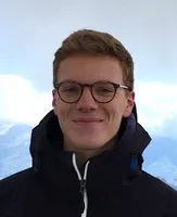
Meeyoung Cha is a Professor at KAIST and Scientific Director of the Max Planck Institute for Security and Privacy (MPI-SP) in Bochum, Germany. Her research focuses on Data Science for Humanity, encompassing computational social science, misinformation dynamics, and human-machine interaction. She holds a PhD in Computer Science from KAIST (2008) and previously served as Chief Investigator at the Institute for Basic Science and Visiting Professor at Facebook. Her work addresses societal challenges such as poverty mapping, fraud detection, and AI ethics. Key achievements include best paper awards and recognition like the Hong Jin-Ki Creator Award (2024) and Test-of-Time Awards (ACM IMC 2022, AAAI ICWSM 2020). Research interests span AI ethics, social media analysis, and interdisciplinary applications of machine learning. Notable projects include modeling climate risks via satellite imagery and analyzing chatbot interactions' societal impacts. She leads the MPI-SP's Data Science for Humanity Group, mentoring over 20 students across PhD and postdoc programs. Education: PhD in Computer Science (KAIST, 2008) Affiliations: MPI-SP (Germany), KAIST Key Awards: Hong Jin-Ki Creator Award, Korean Young Information Scientist Award, Test-of-Time Awards Her publications bridge computational methods with societal issues, including climate modeling, protein engineering, and algorithmic fairness. Current projects explore geospatial AI for economic development and ethical AI design frameworks.
Prof. Roland Pail is a full Professor of Astronomical and Physical Geodesy at the Technical University of Munich (TUM). He leads the Chair of Astronomical and Physical Geodesy, part of the TUM School of Engineering and Design. His research focuses on physical and numerical geodesy, global/regional gravity field modeling, and satellite gravity missions like GOCE, GRACE, and future initiatives like MAGIC. He has held leadership roles, including President of IAG Commission 2 (2015–2019) and Vice Dean of TUM's Department of Aerospace and Geodesy. Pail earned his doctorate (sub auspiciis praesidentis) from TU Graz (1999) and habilitation in 2002. He is a Fellow of the International Association of Geodesy and has received numerous awards for his contributions to geodesy. His work integrates satellite data with geophysical modeling to monitor mass transport processes (e.g., ocean circulation, ice melt) and Earth's interior dynamics. He collaborates internationally on missions such as the DFG Research Training Group UPLIFT and the MAGIC constellation. Key publications include gravity field models (e.g., XGM2016, GOCO06s) and studies on future mission design, stochastic modeling, and climate monitoring. Pail’s scientific awards include the IAG Fellowship (2011), Young Authors Award (2006), and the Allmer-Löschner Prize (2000). His research also addresses quantum sensor applications in satellite gravimetry and the development of next-generation gravity field retrieval techniques.
Dr. Folkert Boersma is a Professor at Wageningen University and Research specializing in atmospheric science and satellite remote sensing. He leads significant international research projects focusing on air pollution monitoring, wildfire impacts, and climate change analysis using advanced satellite instrumentation. His research interests span atmospheric chemistry, environmental monitoring, and climate data analysis, with particular expertise in nitrogen dioxide (NO 2 ) measurements, carbon cycle analysis, and wildfire monitoring. Dr. Boersma's work integrates satellite data with ground-based measurements and computer models to understand complex environmental processes. His recent publications demonstrate a strong focus on improving the accuracy of satellite-based atmospheric measurements, with particular emphasis on TROPOMI observations. His research has advanced our understanding of urban and industrial emissions, ship pollution patterns, wildfire impacts, and carbon uptake dynamics. Dr. Boersma collaborates extensively with international partners including KNMI, SRON, and various European universities. INFLAMES project funding (5-year, nearly €18 million) Dr. Boersma actively supervises PhD students including Juliette Anema, Christoph Riess, Auke Visser, and Felipe Cifuentes, whose research focuses on satellite-based environmental monitoring. His work has significant implications for air quality management, climate policy development, and environmental protection strategies worldwide.
Jan Cermak is Professor and acting Director of the Institute of Meteorology and Climate Research - Atmospheric Trace Gases and Remote Sensing (IMK-ASF) at Karlsruhe Institute of Technology (KIT). His research focuses on atmospheric science with specialization in fog dynamics, aerosol-cloud interactions, and satellite remote sensing applications. His primary research interests include Atmospheric Science, Meteorology, Remote Sensing, Aerosol-Cloud Interactions, Fog and Low Stratus Dynamics, Satellite Meteorology, and Machine Learning Applications. He employs geostationary satellite data and explainable machine learning to investigate fog life cycles, particularly in the Namib Desert and Po Valley, examining how aerosols influence cloud formation and dissipation processes. His work bridges observational meteorology with computational techniques for environmental monitoring. Recent publications (2023-2025) reveal a concentrated research trajectory on fog life cycle analysis using multi-sensor approaches, with significant emphasis on aerosol impacts in polluted regions and arid environments. Key methodological trends include explainable AI for cloud fraction adjustment analysis and high-resolution satellite-based air quality estimation, demonstrating strong interdisciplinary integration of atmospheric physics and data science. Scientific Awards: No awards were documented in the provided source material. Advising and Grants: Source documentation contains no information regarding student supervision, research grants, or funding sources. His leadership role as acting director of IMK-ASF suggests administrative responsibilities within the institute's research framework. Labs and Teams: Cermak leads the Atmospheric Trace Gases and Remote Sensing (IMK-ASF) group at KIT, conducting field campaigns including NaFoLiCA (Namib Fog Life Cycle Analysis) and FAIRARI (Fog and Aerosol Interaction Research Italy). The team specializes in satellite data analysis combined with ground-based observations to study fog dynamics in extreme environments.
Yubao Liu is a Professor at Sun Yat-sen University's School of Data and Computer Science, Department of Computer Science, with a prolific research career spanning over two decades in computer science. His work demonstrates significant contributions to database systems, data mining, and spatio-temporal analysis. Professor Liu's research interests focus on Data Mining , Database Systems , Traffic Flow Prediction , and Graph Neural Networks . His recent work has concentrated on developing advanced techniques for large-scale traffic flow prediction, crowd flow analysis, and spatio-temporal modeling using deep learning approaches. His research bridges theoretical computer science with practical applications in transportation systems and urban computing. Liu's publication record shows consistent high-impact contributions, with recent work emphasizing graph-based neural network architectures for traffic forecasting problems. His research demonstrates a clear evolution from foundational database work to cutting-edge applications of deep learning in transportation and social network analysis. Professor Liu has collaborated extensively with researchers including Weiyang Kong, Kaiqi Wu, Sen Zhang, Genan Dai, and Youming Ge, indicating a strong research group focused on spatio-temporal data analysis and deep learning applications. His academic advising is evident through publications where his students appear as first authors, suggesting an active mentorship role in training the next generation of computer scientists specializing in data-intensive applications.
Prof. Dr. Jian Peng is a W3 Professor for Hydrology and Remote Sensing at the University of Leipzig and Head of the Remote Sensing Department at the Helmholtz Centre for Environmental Research (UFZ) since January 2020. He holds a joint appointment between these institutions and serves as Editor-in-Chief of the Geoscience Data Journal for the Royal Meteorological Society. His academic career spans prestigious institutions including the University of Oxford, University of Munich, and the Max Planck Institute for Meteorology. Education: Postgraduate Certificate in Teaching and Learning in Higher Education, University of Oxford (2018-2020) PhD in Earth Science, Max Planck Institute for Meteorology (2010-2013) Professor Peng's research focuses on the intersection of hydrology, remote sensing, and climate science. His work centers on the quantitative extraction of land surface parameters from remote sensing data, assimilation of this data into climate and land surface models, understanding land-atmosphere interactions, and quantifying climate change impacts on water resources. He has particular expertise in estimating high-resolution land surface water and energy fluxes from satellite observations and investigating hydrological and climatic extremes. His research employs both process-based modeling and data-driven approaches to address critical questions in Earth system science. Professor Peng's recent publications (2021-2025) demonstrate a strong focus on soil moisture monitoring, drought assessment, climate extremes, and land-atmosphere interactions. His work increasingly integrates multi-source satellite data with advanced modeling techniques to produce high-resolution environmental datasets. A significant portion of his research addresses the impacts of climate change on water resources and agricultural systems, with particular attention to regional studies in China and global applications. His collaborative approach is evident in the extensive co-authorship networks spanning multiple continents and disciplines. Scientific Awards and Recognition: 2019 Remote Sensing Young Investigator Award, MDPI Featured as 'promising future leader in climate science' by the World Climate Research Programme (WCRP) Professor Peng leads an active research group within the Remote Sensing Department at UFZ, supervising PhD candidates through programs like MoDEV and mentoring early-career researchers. His team has secured funding from major organizations including the EU and the German Research Foundation (DFG). The group maintains strong international collaborations, particularly with institutions in China, the UK, and the US. Current research directions include developing high-resolution environmental monitoring systems, improving drought prediction capabilities, and understanding the complex interactions between climate change, water resources, and ecosystem functioning. Professor Peng's research group, part of the Remote Sensing Department at UFZ, includes researchers such as Daniel Doktor, Almudena García-García, Maximilian Lange, Anne Reichmuth, Andreas Schmidt, Elisabeth Rahmsdorf, Mohammad Hajeb, and Xueying Li. The department is embedded within UFZ's broader research framework focusing on 'Smart Models / Monitoring' and contributes to multiple interdisciplinary research units including Ecosystems of the Future, Water Resources and Environment, and Compound Environmental Risks. The team operates within the Remote Sensing Center for Earth System Research (RSC4Earth), which facilitates cutting-edge Earth observation research.
Prof. Dr. Uwe Rascher is the Head of the Shoot Dynamics group at the Institute of Bio- and Geosciences (IBG) , Plant Sciences (IBG-2) within the Jülich Research Centre . His research bridges biophysical processes in photosynthesis with remote sensing applications. Research Focus: Spatiotemporal dynamics of photosynthesis Non-destructive physiological monitoring Solar-induced chlorophyll fluorescence (SIF) for ecosystem analysis Drought and stress response in crops Machine learning for agricultural decision support Integration of leaf-to-canopy scale observations Scientific Trends: Analysis of SIF for photosynthesis quantification, development of hyperspectral imaging systems, cross-scale stress detection (drought, heat), machine learning applications in plant phenotyping, and climate research collaborations. Technical Contributions: Development of HyScreen, FloX, and FluoMap systems for field spectroscopy, UAV-based sensor validation, and standardized ground measurement networks. His work emphasizes sensor fusion, light distribution models, and fractal geometry for fluorescence downscaling.
Dr. Jing Wei is an Assistant Research Scientist affiliated with the Earth System Science Interdisciplinary Center (ESSIC) and the Department of Atmospheric and Oceanic Science at the University of Maryland, College Park. She also holds appointments at NASA Goddard Space Flight Center and the Cooperative Institute for Satellite Earth System Studies (CISESS). Her research focuses on air quality monitoring through satellite remote sensing, big data analytics, and artificial intelligence applications. Dr. Wei specializes in atmospheric aerosols, particulate matter (PM) and chemical composition, and trace gases, utilizing satellite remote sensing, big data, and AI to assess the impacts of air pollution and extreme weather on the environment, health, and climate. Her work has resulted in the development of high-resolution air pollutant datasets for China (CHAP), the United States (USHAP), and globally (GHAP), which have been widely used in over 350 applied publications. Her research has produced over 100 SCI papers as (co-)first or corresponding author in leading journals including Nature Communications and The Lancet Planetary Health, with 7 ESI Hot papers (Top AGU James R. Holton Award (2022) Remote Sensing Young Investigator Award (2023) Stanford University List of the World's Top 2% Scientists since 2021 Top 0.1% highly cited authors in Atmospheric Sciences Dr. Wei serves as Editor of Earth System Science Data and Associate Editor of Journal of Geophysical Research: Atmospheres. She has secured research funding from NASA Earth Sciences and other organizations. Her work has been featured in major media outlets including CBS News, Yahoo News, US News, and The Hill.
Heike Kalesse-Los serves as a W1 (Tenure Track) Professor for Arctic Climate Change at the University of Leipzig since April 2018. She is affiliated with the Institute of Meteorology and specializes in atmospheric remote sensing research with a strong focus on Arctic climate systems. Leipzig University, Institute of Meteorology (2018-present) Leibniz Institute for Tropospheric Research (2015-2018) McGill University, Montreal (2011-2014) Education: Doctorate, Johannes Gutenberg University, Mainz (2006-2010) Diploma in Meteorology, University of Leipzig (2000-2006) Professor Kalesse-Los's research centers on remote sensing of the Arctic climate system , with particular expertise in analysis of Doppler spectra from cloud radar devices and development of atmospheric retrieval algorithms . Her work integrates multiple remote sensing instruments to investigate cloud microphysics, dynamics, and radiation interactions. She also conducts research at the atmosphere-biosphere interface , focusing on flying insect retrievals and precipitation shadowing effects. A significant portion of her recent work applies machine learning techniques to improve short-term power forecasts for renewable energy systems, particularly wind and photovoltaic applications. Her recent publications (2019-2022) demonstrate a strong methodological focus on applying artificial neural networks to cloud radar data analysis . These works address critical challenges in cloud physics including riming prediction, cloud liquid detection, and identification of cloud droplets beyond lidar attenuation. The research consistently bridges atmospheric science with advanced computational techniques, establishing new methodologies for atmospheric retrieval using radar Doppler spectra. Research Funding: TRR 172/B07: Influence of water channels in sea ice and polynyas on Arctic cloud properties (DFG, 2020-2023) PICNICC: Polarimetry influenced by CCN and INP in Cyprus and Chile (DFG, 2018-2023) CORSIPP: Characterization of orographically influenced frosting and secondary ice production (DFG, 2023-2026) PV-WOV: Improving photovoltaic performance forecasts (EU ESF, 2022-2025) Professor Kalesse-Los leads multiple collaborative research projects funded by the German Research Foundation and European Union, focusing on Arctic climate processes and renewable energy applications. Her work involves extensive collaboration with researchers across atmospheric physics, climate science, and machine learning domains. She maintains active research partnerships with institutions in Germany and internationally, including previous affiliations with McGill University in Canada. Her research group operates within the Arctic Climate Change research unit at Leipzig University, working with advanced remote sensing instrumentation including cloud radar systems and microwave radiometers. The team participates in international field campaigns focused on Arctic atmospheric processes and contributes to major collaborative research centers including the SFB Transregio 172: Arctic Amplification.
Marloes Penning de Vries is an Assistant Professor at the University of Twente's Faculty of Geo-information and Remote Sensing, specializing in satellite-based environmental monitoring. Her research bridges remote sensing technology with critical Earth system processes. Her research interests focus on Remote Sensing , Hydrology , and Environmental Health , with particular expertise in satellite applications for water cycle monitoring, air quality assessment, and climate-related health impacts. Her work integrates multi-sensor satellite data to address challenges in water resources management and atmospheric composition. Analysis of her publication record reveals strong thematic continuity in satellite geophysics and environmental monitoring , with increasing emphasis on interdisciplinary applications connecting hydrology, atmospheric science, and public health. Recent work demonstrates sophisticated integration of GRACE satellite data with traditional hydrological models and expanding applications in geohealth frameworks. Her professional trajectory shows progression from atmospheric chemistry foundations to broader Earth system science applications, maintaining consistent methodological expertise in satellite data processing while expanding into water resources and health applications.
Dr. Zhao-Cheng Zeng is an Assistant Professor at Peking University's School of Earth and Space Sciences since March 2022. His academic career spans multiple prestigious institutions including the University of California, Los Angeles and the California Institute of Technology, where he served in research roles from 2017 to 2022. His educational background includes a PhD in Earth System Science from the Chinese University of Hong Kong (2013-2016), a Master's in Atmospheric Remote Sensing from the Institute of Remote Sensing and Digital Earth, Chinese Academy of Sciences (2010-2013), and a Bachelor's in Geology from Sun Yat-sen University (2006-2010). Dr. Zeng's research focuses on the development of theories and algorithms in two fundamental areas of remote sensing: radiative transfer and inverse modeling/retrieval . His work primarily addresses atmospheric composition monitoring, greenhouse gas emissions tracking, and air quality assessment using satellite observations. His expertise spans multiple areas including Remote Sensing, Atmospheric Physics, and Radiative Transfer, with particular emphasis on monitoring greenhouse gases like carbon dioxide, methane, and ammonia using various satellite platforms including FengYun series, OCO-2, and GOSAT. The trend in his recent publications shows increasing focus on geostationary satellite observations that enable monitoring of diurnal variations in atmospheric constituents, representing a significant advancement over traditional polar-orbiting satellite observations. His contributions to the field have been recognized with several prestigious awards, including the Richard M. Goody Award (2023), the Global Scholarship Program for Research Excellent from the Chinese University of Hong Kong (2014), the President Award of the Chinese Academy of Sciences (2013), and the Excellent Dissertation Award from Sun Yat-sen University (2010). Dr. Zeng serves on the Editorial Board of Atmospheric Measurement Techniques, a journal published by Copernicus Publications on behalf of the European Geosciences Union. His research has resulted in 106 publications with over 21,552 reads and 1,769 citations, demonstrating significant impact in the atmospheric science community. His work often involves collaborations with institutions worldwide, including NASA's Jet Propulsion Laboratory and European research organizations. His current research activities focus on utilizing geostationary satellite observations for monitoring diurnal variations of atmospheric constituents, developing advanced retrieval algorithms for greenhouse gases in the presence of aerosols, and analyzing spatial-temporal patterns of emissions from anthropogenic sources and natural events like wildfires.
Junhong Lee is a Research Fellow at the Max Planck Institute for Meteorology (MPI-M) in Hamburg, Germany, specializing in land-atmosphere interactions within storm-resolving Earth System Models. His work investigates how soil moisture conditions influence precipitation triggering and carbon cycle dynamics in high-resolution climate simulations. His academic background includes: Ph.D. and M.S. in Atmospheric Sciences from Yonsei University, Korea (2012-2019), with thesis on "The Representations of Vegetation for Surface Wind in the WRF Model" B.S. in Atmospheric Sciences and B.S. in Earth Science Education from Kongju National University, Korea (2008-2012), with thesis on "Analysis of Arctic and Antarctic Sea-Ice Concentration Variation Retrieved from Aqua/AMSER-E" Lee's research centers on improving boundary-layer processes and land-surface representations in climate models. He has implemented critical model components including the 3D Smagorinsky turbulence scheme in ICON's Sapphire configuration and the roughness sublayer scheme in WRF. His work bridges observational data with high-resolution modeling to advance understanding of land-atmosphere feedback mechanisms, particularly in storm-resolving frameworks where traditional parameterizations break down. Analysis of his 12 publications (2015-2023) reveals consistent focus on boundary-layer meteorology, model development, and land-surface interactions. His recent work emphasizes kilometer-scale Earth System Modeling (ICON-Sapphire), vegetation-atmosphere coupling, and innovative parameterizations for surface-layer processes. Key trends include integration of observational data into models, evaluation of model physics across scales, and exploration of land-surface feedbacks in extreme weather contexts. Lee actively contributes to MPI-M's modeling infrastructure including the ICON Earth System Model and participates in collaborative projects like nextGEMS and WarmWorld. His research leverages the institute's observational assets such as the Barbados Cloud Observatory and HALO research aircraft, though no specific lab leadership or student advising is documented. The institute's structure—particularly the Climate Physics and Climate Dynamics departments—provides the framework for his storm-resolving model development work.
Dr. Moritz Makowski is a Researcher at the Technical University of Munich , affiliated with the Professorship for Environmental Sensors and Modeling . His work focuses on urban greenhouse gas (GHG) transport modeling , inverse modeling , and sensor network evaluation , leveraging computational fluid dynamics (CFD) and Lagrangian Particle Dispersion Models (LPDMs). Key Research Areas : Atmospheric modeling, GHG monitoring, sensor networks, inverse modeling, urban climate studies, methane emission quantification Scientific Contributions : Moritz has co-authored 15 recent publications (2022–2025) on topics like high-density CO2 sensor networks, satellite data validation, and LPDM-based source localization. His work includes developing open-source software tools Pyra and EM27/SUN pipelines for automating GHG measurements. Collaborations : Active participant in the ICOS Cities and MUCCnet projects, contributing to urban emission assessments in Munich and Hamburg. Collaborates with international teams on FTIR spectrometer networks and OCO-2 satellite data comparisons.
Steffen Schön is a Professor at the Institute of Geodesy, Leibniz University Hannover, affiliated with the Faculty of Civil Engineering and Geodetic Science. His roles include Dean of Studies for Geodesy and Geoinformatics, and Speaker of the DFG Research Training Group GRK2159 (i.c.sens). He is also a liaison professor for the Studienstiftung des deutschen Volkes. Schön’s research focuses on GNSS technology, atomic clocks, collaborative positioning, antenna calibration, quantum inertial navigation, and satellite gravity missions. He leads projects in the QuantumFrontiers and CRC 1464 TerraQ initiatives. His research explores antenna phase center corrections, multipath mitigation, and hybrid sensor systems combining classical and quantum accelerometers. Recent work includes evaluating quantum sensors for space navigation and improving GNSS integrity in urban environments. He has collaborated globally through programs like the IGS Antenna Ring Campaign and contributes to 5G NR positioning research. Publications span antenna calibration methodologies, inertial navigation improvements, and applications of GNSS in autonomous systems. His work addresses challenges in frequency transfer, tropospheric parameter retrieval, and resilient timekeeping for technical infrastructure. Schön’s research integrates geodetic, aerospace, and quantum physics domains, emphasizing practical applications for navigation and environmental monitoring.
Dr. Omar Regaieg is a researcher at the University of Bonn's Department of Geography within the GIUB Department. He is affiliated with the RG Malenovsky research group, focusing on remote sensing and radiative transfer modeling. His work emphasizes 3D vegetation canopy analysis, solar-induced chlorophyll fluorescence, and satellite image inversion using the DART and DART-Lux models. He contributes to advancing techniques for environmental monitoring, forest ecology, and urban studies through high-resolution remote sensing applications. Contact: oregaieg@uni-bonn.de . Research Interests: Dr. Regaieg's research integrates remote sensing technologies with radiative transfer models to study vegetation dynamics, atmospheric interactions, and land surface processes. Key areas include optimizing satellite data acquisition for forest canopies, calibrating 3D models with UAV and Sentinel data, and simulating thermal and solar-induced fluorescence emissions. His work bridges theoretical modeling and practical applications in environmental science and urban planning. Recent Research Trends: His articles from 2022–2025 highlight advancements in DART model applications, such as improving satellite image correction, simulating fire scenes, and enhancing 3D radiative transfer simulations for diverse environments. The research emphasizes interdisciplinary approaches to address challenges in climate modeling, crop monitoring, and disaster management. Affiliations & Location: Office 1.026 at Meckenheimer Allee 166, Bonn. Phone: +49 228 73-9705. He collaborates actively within the RG Malenovsky team and contributes to the Department of Geography's academic and applied research initiatives.