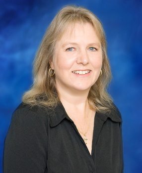
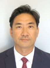
Zahra Gharineiat is an Associate Professor at the University of Southern Queensland , affiliated with the School of Surveying and Built Environment . She has over 8 years of tertiary teaching experience and 11 years of administrative responsibilities. Bachelor of Surveying (BSurv), University of Tabriz Master of Engineering Management (MEngMgt), University of Melbourne PhD, University of Newcastle Research Interests : Zahra specializes in Geomatic Engineering and Machine Learning , with a focus on applications like Unmanned Aerial Vehicles (UAVs) , LiDAR , Digital Twins , and Remote Sensing . Her work spans Earth Science Observations , Satellite altimetry , and Geodetic data capturing , integrating Computational Modelling and Geoinformatics for innovative solutions. Professional Affiliations : She is a member of the Surveying and Spatial Sciences Institute (SSSI) and the International Union of Geodesy and Geophysics (IUGG) . Her research affiliations include the Centre for Future Materials (CFM) , Institute for Advanced Engineering and Space Sciences (IAESS) , and Centre for Astrophysics (CA) .
Prof. Matt Pritchard is a Professor in Earth & Atmospheric Sciences at Cornell University, based at Snee Hall. His research focuses on volcanology, geodesy, and remote sensing, with a particular emphasis on using satellite data to monitor volcanic activity, deformation, and glacial interactions. He leads studies on global volcanic systems, including Indonesia's Semeru and Raung volcanoes, Chile's Cordón Caulle, and Bolivia's Uturuncu, applying techniques like InSAR, SAR, and thermal imaging. Key research interests include volcanic eruption dynamics, magma-hydrothermal systems, and the integration of multi-sensor datasets. He has contributed to developing tools like Hotspotter for automated volcanic thermal feature detection and has explored planetary volcanism (e.g., Venus). His work bridges geophysics, glaciology, and computational methods, addressing both Earth and extraterrestrial systems. Prof. Pritchard has received recognition such as the William Bowie Lecture (2022, 2023). His projects often involve international collaborations, including the CEOS Volcano Demonstrator initiative and the EarthDEM/ArcitcDEM projects. He also engages in geothermal energy research and seismic monitoring in Ithaca, NY.
David Al-Attar is a Professor at the University of Cambridge's Department of Earth Sciences, actively involved in theoretical and computational geophysics research. He serves as a supervisor within the Cambridge NERC Doctoral Landscape Awards (Training Partnerships) program, particularly in the CREATES initiative focusing on climate and environmental science. Education: While specific educational details aren't provided in the text, his extensive publication record and professorial position at Cambridge indicate advanced training in geophysics and applied mathematics. Research Interests: Professor Al-Attar's work spans several interconnected areas within geophysics. His primary focus includes theoretical and computational problems in geophysics, with particular emphasis on continuum mechanics as applied to Earth systems. He develops new physical and mathematical theories for understanding Earth processes, including rigorous function space methods for inverse problems and uncertainty quantification. His sea level change research aims to constrain ice sheet evolution during the last glacial period to better understand modern contributions to sea level rise. Additionally, he investigates solid Earth dynamics including seismic free oscillations, body tides, and Earth rotation, contributing to our understanding of deep Earth structure and mantle dynamics. Research Themes: His publications demonstrate expertise in adjoint methods, glacial isostatic adjustment, mantle viscosity, planetary seismology, and computational methods for geophysical problems. Recent work emphasizes 3-D Earth modeling, sensitivity analysis, and the integration of satellite observations with theoretical models. Current Projects: Potential projects for students include inverse problems related to deglacial sea level change with focus on uncertainty quantification, modern sea level monitoring using satellite data, and solid Earth dynamics particularly regarding outer core viscosity in tidal and rotational dynamics. Contact: He can be reached at da380@cam.ac.uk for research inquiries and collaboration opportunities.
Karl Ulrich Schreiber is an Adjunct Professor at the Department of Physics and Astronomy, University of Canterbury, New Zealand, and an apl. Professor at the Institute for Astronomical and Physical Geodesy at the Technical University of Munich (TUM). He is a scientist at the Geodetic Observatory Wettzell, jointly operated by TUM and the Bundesamt für Kartographie und Geodäsie (BKG). His work bridges fundamental physics and geodetic applications, with leadership roles in major international projects including ESA’s MAGIC/Science, QSG4EMT, and Baltic+ Theme 5, as well as DFG Research Units NEROGRAV and UPLIFT. His research focuses on Space Geodesy , Satellite and Lunar Laser Ranging , and Ring Laser Technology . He has pioneered the use of large ring laser gyroscopes for measuring Earth's rotation, polar motion, and seismic rotations. His work enables high-precision monitoring of geophysical phenomena such as Earth tides, Chandler wobble, and rotational ground motions from earthquakes. He is a key contributor to multi-technique co-location studies (VLBI, SLR, GNSS) and time transfer experiments, advancing the Global Geodetic Observing System (GGOS). His recent publications show a strong trend in developing and applying large-scale ring laser arrays (e.g., ROMY) for geophysical sensing, photon-counting laser ranging for space debris and satellite tracking, and optical timing systems for synchronization across geodetic networks. These efforts span disciplines including geodesy, seismology, quantum optics, and fundamental physics. Scientific contributions include: Development of the Wettzell Large Ring Laser (G-ring) for continuous Earth rotation monitoring. First direct measurements of Earth's diurnal polar motion and Chandler wobble using ring lasers. Pioneering work in rotational seismology, validating ring laser data against seismic arrays. Contributions to lunar laser ranging and its role in reference frame realization. Leadership in ESA and DFG projects advancing space geodesy and inertial sensing. He advises doctoral and master’s students within the DFG Research Training Group UPLIFT and collaborates with international institutions on instrumentation and data analysis. His lab at Wettzell hosts advanced laser ranging and ring laser systems, serving as a fundamental geodetic observatory. Future work includes enhancing clock ties for global geodesy, expanding multi-component rotation sensing, and advancing space-based geodetic technologies.
Taylor Perron is the Cecil and Ida Green Professor of Earth, Atmospheric and Planetary Sciences at Massachusetts Institute of Technology (MIT), where he also serves as the EAPS Undergraduate Officer. His research program at MIT spans multiple interdisciplinary areas within Earth and planetary sciences, with strong connections to the MIT-WHOI Joint Program in Oceanography/Applied Ocean Science and Engineering. Dr. Perron's academic background includes an AB in Earth and Planetary Sciences and Archaeology from Harvard University (1999) and a PhD from the University of California, Berkeley (2006), followed by postdoctoral work at Harvard. His leadership roles at MIT have included serving as chair of the Program in Geology, Geochemistry, and Geobiology, and as Associate Department Head for Education. His research focuses on three interconnected areas: Landscape Evolution, Planetary Surfaces, and the Human Landscape. Within Landscape Evolution, he investigates dynamic river networks, climate-landscape interactions, grain-scale sediment transport mechanics, and the connections between landscape evolution and biological diversification. His Planetary Surfaces research examines river systems on Mars and Titan, using spacecraft data to understand extraterrestrial hydrological processes. The Human Landscape component explores archaeological applications of geomorphology, particularly in the Amazon basin. Analysis of his recent publications reveals a strong emphasis on comparative planetary hydrology, with significant work on Earth, Mars, and Titan. His research increasingly integrates field observations, mathematical modeling, and remote sensing to address questions about landscape evolution across different planetary environments and timescales, with growing attention to anthropogenic impacts on Earth's surface processes. Scientific Awards & Honors: MacArthur Fellowship (2021) James B. Macelwane Medal, American Geophysical Union (2014) Fellow, American Geophysical Union (2014) Editorial Committee Member, Annual Review of Earth & Planetary Sciences (2017-present) Dr. Perron has established a productive research group that collaborates across disciplines and institutions, including significant partnerships with WHOI, NASA missions, and archaeological teams. His work bridges fundamental questions about planetary evolution with practical implications for understanding climate change impacts on Earth's surface systems.
Dr. Penina Axelrad is a University of Colorado Distinguished Professor and Joseph T. Negler Professor of Aerospace Engineering Sciences at the University of Colorado Boulder. She has held academic roles since 1992, serving as Department Chair from 2012–2017. A member of the National Academy of Engineering since 2019, her research focuses on GNSS technology, satellite navigation, and remote sensing applications. She has authored over 223 publications and secured $17.5M in research grants. Education: Ph.D., Aeronautics and Astronautics, Stanford University, 1991 S.M., Aeronautical and Astronautical Engineering, MIT, 1986 S.B., Aeronautical Engineering (Avionics Option), MIT, 1985 Research Interests: Global Navigation Satellite Systems (GNSS), multipath mitigation, GNSS reflectometry, orbital dynamics, and quantum sensing for Earth science. Her work bridges astrodynamics, satellite navigation, and environmental monitoring. Awards: Member, National Academy of Engineering (2019) Women In Aerospace Educator Award (2016) Institute of Navigation Samuel Burka Award (2012) AIAA Summerfield Book Award (2011) Advising & Grants: Advised numerous students (no names listed) and led major grants including NASA Quantum Pathways Institute and Sentinel-6 orbit determination projects. Active in Institute of Navigation leadership roles. Labs/Teams: Colorado Center for Astrodynamics Research (CCAR), Quantum Pathways Institute, and collaborative efforts on CubeSat atomic clock experiments.
Keith D. Koper is a Professor in the Department of Geology & Geophysics at the University of Utah and serves as Director of the University of Utah Seismograph Stations (UUSS). He is also the editor-in-chief of The Seismic Record . His work integrates academic research with operational seismic monitoring and public safety initiatives across Utah and the Intermountain West. Education: PhD in Geophysics, Washington University, 1998 BA in Math, Geology, and ISP, Northwestern University, 1993 Dr. Koper's research focuses on array seismology, forensic seismology, deep Earth structure (especially the inner core), earthquake rupture imaging, ambient seismic noise, and seismic hazards in the Intermountain West, including mining-induced and urban earthquakes. His work combines observational seismology with advanced signal processing and machine learning techniques to improve detection, discrimination, and imaging capabilities. He has led or contributed to major projects involving the Wasatch Front, Yellowstone, and regional seismic networks. His recent research emphasizes machine learning for earthquake detection, high-resolution relocation of aftershock sequences (e.g., Magna 2020, Bluffdale 2019), microseism generation in lakes, and fine-scale imaging of the Earth's inner core using seismic reflections. His studies often involve interdisciplinary collaboration, particularly with mining engineering and geodesy. Dr. Koper's research has been consistently funded by federal and state agencies, including the National Science Foundation (NSF), U.S. Geological Survey (USGS), Department of Energy (DOE), Air Force Research Laboratory (AFRL), and the Utah Department of Public Safety. His publications reflect a strong trend toward integrating computational methods with traditional seismological analysis to tackle complex problems in both natural and induced seismicity. Scientific Service and Leadership: Editor-in-Chief, The Seismic Record Director, University of Utah Seismograph Stations Secretary, U.S. Air Force Seismic Review Panel Former Chair and Vice-Chair, Utah Seismic Safety Commission Dr. Koper mentors graduate students in seismology and geophysics, including recent advisees Sean Hutchings and Alysha Armstrong. His research group actively engages in both fundamental and applied seismological research, with strong ties to national labs such as Sandia. The group is involved in deploying portable seismic arrays, analyzing large datasets, and developing new algorithms for event detection and classification. The University of Utah Seismograph Stations, under his leadership, plays a critical role in monitoring seismicity in Utah and Yellowstone, producing real-time earthquake information, ShakeMaps, and public outreach materials. The station also contributes to national and international efforts in nuclear test monitoring and volcanic hazard assessment.
Patrick Henkel is a Professor at the Technical University of Munich (TUM) affiliated with the TUM School of Engineering and Design and the Chair of Communication and Navigation. He holds a professorship in Satellite Geodesy under Prof. Hugentobler. His research focuses on advanced positioning technologies, including Global Navigation Satellite Systems (GNSS), autonomous systems, and sensor fusion. He develops algorithms for precise positioning in challenging environments such as urban areas, alpine regions, and indoor spaces. His work also extends to environmental applications, such as snow hydrology and climate monitoring using GNSS signals. Henkel’s contributions include innovations in real-time kinematic (RTK) positioning, UAV navigation, and multi-sensor integration for robotics and autonomous vehicles. His research is supported by collaborations with industry and academic partners, addressing both theoretical and applied challenges in geodesy and navigation. Henkel leads projects on GNSS signal processing, satellite-based environmental monitoring, and autonomous driving technologies. He has contributed to the Galileo HAS service and developed methodologies for snow water equivalent estimation using multi-frequency GNSS signals. His expertise spans hardware-software co-design for navigation systems and algorithm optimization for high-precision positioning in dynamic environments. He actively publishes in top-tier journals and conferences, with a focus on advancing the reliability and accuracy of navigation systems across various domains. His advising and grants include funding for projects on sensor fusion, UAV-based measurements, and satellite receiver development. He collaborates with teams at TUM’s Navigation Lab and the Professur für Satellitengeodäsie, contributing to both academic and industrial applications. His work on low-bandwidth RTK dissemination and laser-tracker verified UAV positioning highlights his commitment to bridging theoretical advancements with real-world implementation.
Sophie Nowicki is an Empire Innovation Professor at the University at Buffalo's RENEW Institute, Department of Earth Sciences within the College of Arts and Sciences. She serves as Director of the Center for Geological and Climate Hazards. Her research focuses on ice sheet and sea level dynamics, using a combination of applied mathematics, remote sensing observations, and numerical modeling to understand how ice sheets interact with the global climate system. Empire Innovation Professor, University at Buffalo Director, Center for Geological and Climate Hazards Member of UB RENEW Institute Department of Earth Sciences, College of Arts and Sciences Dr. Nowicki's research interests center on glaciology, ice-sheet modeling, climate modeling, and sea level change. She studies how ice sheets interact with the global climate system and affect sea level change using a spectrum of models from idealized to large-scale continental ice sheet models. Her work is integral to climate models that provide forcing for ice sheet models, particularly through the Ice Sheet Model Intercomparison Project for CMIP6 (ISMIP6). She teaches courses including Introduction to Computational Earth Science, Environmental Remote Sensing, and various graduate research courses. Her recent publications reveal a strong focus on Antarctic and Greenland ice sheet modeling, sea level rise projections, and the development of advanced modeling frameworks. The research spans from fundamental glaciological processes to large-scale climate impacts, with a particular emphasis on quantifying uncertainties in ice sheet contributions to sea level rise. Her work frequently appears in top journals including Nature, The Cryosphere, and Geophysical Research Letters, and she has made significant contributions to the IPCC Sixth Assessment Report. Empire Innovation Professor recognition Lead contributor to IPCC AR6 Working Group I Principal Investigator for ISMIP6 (Ice Sheet Model Intercomparison Project) Dr. Nowicki actively mentors graduate students and postdoctoral researchers, with current advisees working on various aspects of ice sheet dynamics and sea level change. Her research is supported by multiple grants from NASA, NSF, and other agencies focused on improving our understanding and projections of ice sheet behavior in a warming climate. She leads the development of critical tools like the Cryosphere Model Comparison Tool (CmCt) and has been instrumental in establishing community standards for ice sheet modeling. She is involved with several research groups and initiatives including the Ice Sheet & Sea Level Lab at UB, which focuses on understanding how ice sheets will evolve in a warming world and what this means for future sea levels. Her team combines observational data with sophisticated modeling approaches to address key questions about ice-ocean and ice-atmosphere interactions that drive ice sheet changes.
Professor Walter Timo de Vries is a faculty member at the Technical University of Munich (TUM) , holding the Chair of Land Management and Land Development within the Department of Aerospace and Geodesy, TUM School of Engineering and Design . His research focuses on intelligent and responsible land management , urban and rural development , spatial justice , and the development of a Human Geodesy framework. A graduate of TU Delft (1988) and Rotterdam (PhD), he has led international projects across Asia, Africa, and South America. At TUM, he directs the Master's and PhD Programs in Land Management , serves as Dean of Geodesy , and leads TUM.Africa . Member of the German Geodetic Commission Member of the Bavarian Academy for Rural Development Academic Coordinator of TUM SEED Center Research Interests span responsible land governance , land tenure security , land consolidation , and geospatial methods for sustainable development. His recent work examines the Water-Energy-Food Nexus and digital twins in collaborative planning. He has supervised over 20 PhD and Master’s students on topics like spatial justice , nomic pastoral tenure , and smart land use . Publications address blockchain in land administration , spatial inequalities , and land policy reforms across global contexts.
Frederik J. Simons is a Professor of Geosciences and Associate Chair of the Department of Geosciences at Princeton University. He holds affiliations with the Program in Applied & Computational Mathematics, High Meadows Environmental Institute, and Andlinger Center for Energy and the Environment. His research focuses on global geophysics, seismology, and geodesy, emphasizing the lithosphere's physical properties through seismic tomography and spectral analysis. Simons developed methods for oceanic instrumentation, including the EarthScope-Oceans consortium, and pioneered wavelet-based signal processing for seismology. His work integrates computational inverse methods and statistical techniques, with a commitment to reproducible research. Education: PhD in Geophysics (MIT), M.Sc. in Geology (KU Leuven, Belgium). Previous roles include Lecturer at University College London and Hess Postdoctoral Fellow at Princeton. Research interests span seismic tomography, lithospheric mechanics, and planetary science, with notable contributions to mantle structure imaging and earthquake early warning systems. Awards include the Vladimir Keilis-Borok Medal (2022). Simons advises graduate students and mentors researchers in computational geoscience. His teaching emphasizes clarity and engagement, blending theoretical foundations with hands-on applications.
Mick Filmer is a Senior Lecturer at Curtin University's School of Earth and Planetary Sciences (EPS) within the Faculty of Science and Engineering. He serves as Curtin's representative on the Land Surveyors Licensing Board of Western Australia and holds a PhD (Curtin University) and a Bachelor of Geoinformatics and Surveying (University of South Australia). His research focuses on InSAR technology, vertical land motion, height systems, and coastal sea surface topography, with over 30 peer-reviewed publications since 2007. Teaching responsibilities include Survey Law Ethics Practice, Cadastral Surveying, and Applied Geodetic Surveying. Research contributions span geodetic datum development (e.g., AUSGeoid09), InSAR deformation analysis, and land subsidence monitoring in the Perth Basin and Latrobe Valley. He collaborates with organizations like the International Association of Geodesy and European Geosciences Union. Key projects include evaluating Australia’s AUSHYDROID vertical datum model (2024), integrating InSAR with terrestrial reference frames (2021), and analyzing ocean tide signals in coastal zones (2023). His work bridges geodesy, remote sensing, and hydrogeology, addressing challenges in vertical land motion monitoring and geodetic infrastructure planning.
Eric Hetland is an Associate Professor in the Department of Earth and Environmental Sciences at the University of Michigan. His research focuses on geophysical natural hazards, particularly earthquake dynamics from a geodetic perspective. He investigates fault loading processes during interseismic and postseismic periods, and collaborates on modeling volcanic eruption conditions with Prof. Becky Lange. His work integrates machine learning methods into geodetic data analysis, addressing climate studies and hazard vulnerability. Applied mathematics and computational science are central to his interdisciplinary approach. Education: PhD in Geophysics from MIT (2006), MA in Geology from SUNY Binghamton (2000), BS in Physics from UC Santa Cruz (1996) Research Interests: Seismology, Geodesy, Crustal Deformation, Geodynamics, Magmatism and Volcanism Lab/Teams: Active collaborations with interdisciplinary teams, leveraging geodetic and computational tools His recent publications emphasize coseismic slip distribution modeling, Bayesian stress inversion, and transient strain analysis using advanced statistical methods. He has no listed scientific awards but maintains an active research program funded through collaborative grants. Advising focuses on graduate student training in geophysical hazards and computational geophysics.
Lisa Grant Ludwig is a Professor in the Department of Population Health and Disease Prevention at the University of California, Irvine (UCI). She is a nationally recognized expert in earthquake science, focusing on translating geophysical research into policy for disaster risk reduction. Her work bridges seismology, public health, and policy implementation. PhD in Geology with Geophysics minor (Caltech) MS in Environmental Engineering Science (Caltech) BS in Applied Environmental Earth Science (Stanford) Dr. Ludwig's research centers on earthquake dynamics, particularly along the San Andreas Fault, advancing disaster resilience through innovative nowcasting techniques using AI and machine learning. Her publications demonstrate expertise in seismic hazard modeling, geodetic imaging, and community preparedness studies. Recent publications highlight AI-enhanced earthquake prediction (QuakeGPT), temporal-spatial nowcasting models, and applications of geodetic data for crustal deformation analysis. These works integrate machine learning with traditional seismological methods to improve hazard forecasting. President of Seismological Society of America NASA 2012 Software of the Year Medal Featured on Science magazine cover Congressional Testimony provider Active Federal Advisory Committee member Her interdisciplinary approach combines geophysics, public health policy, and computational science. Current projects focus on earthquake nowcasting, fault zone analysis, and developing accessible geospatial tools like GeoGateway for disaster response.
Dr. Jae Sung Kim is an Assistant Professor in the Department of Civil, Environmental, and Geospatial Engineering at Michigan Technological University (MTU). He holds a PhD in Geomatics from Purdue University and teaches courses in photogrammetry, UAV mapping, and geospatial technology. His research focuses on geospatial technologies, including remote sensing, GIS, and their applications in agriculture, environmental science, and planetary studies. PhD: Geomatics, Purdue University MSCE: Civil Engineering, Purdue University ME: Civil Engineering, Korea University BE: Civil Engineering, Korea University Dr. Kim’s research interests span photogrammetry, remote sensing, geodesy, and geospatial cyberinfrastructure. He develops tools for agricultural water management (FARMs system) and landslide analysis. His work often utilizes open-source geospatial technologies and integrates historical aerial photography with modern GIS systems. His recent publications include studies on volcanic lava flow modeling (2025), winter vegetation detection via remote sensing (2024), and automated orthorectification of archival aerial photos (2022). These reflect his expertise in combining traditional geospatial methods with cutting-edge technologies. Dr. Kim serves as an Associate Editor for the Journal of Applied Remote Sensing and Assistant Director of the Photogrammetric Applications Division at ASPRS. He has also contributed to watershed delineation tools and web-based water monitoring systems using open-source frameworks.